U-105 - 2nd War Patrol
Translation by Jerry Mason with help from Andi Forster
Departed |
Date |
Arrived |
Date |
Days at Sea |
Lorient |
22 February 1941 |
Lorient |
13 June 1941 |
112 |
| Click the icon to download a KMZ file displaying the U-boat track, significant events and locations for this patrol. You must have Google Earth loaded on your computer to view this file. Download Google Earth here |
| Note: from 26 March to 12 June time in this KTB is entered in GMT (except for radio messages which are entered in German Legal Time - DSZ = GMT +2) |
Ships Hit |
||||||
Date |
KTB Time |
Position |
Ship |
Tons |
Nationality |
Convoy |
8 Mar 41 |
03.41 |
17°57'N,
21°30'W |
HARMODIUS |
5,229 |
British |
SL-67 |
18 Mar 41
|
03.00 |
16°27'N,
21°09'W |
MEDJERDA |
4,380 |
British |
SL-68 |
19 Mar 41
|
00.24 - 00.29 |
18°16'N,
21°26'W |
MANDALIKA |
7,750 |
Netherlands |
SL-68 |
21 Mar 41 |
00.46 |
20°03'N,
25°51'W |
CLAN OGILVY |
5,802 |
British |
SL-68 |
21 Mar 41
|
00.47 |
20°03'N,
25°51'W |
BENWYVIS |
5,920 |
British |
SL-68 |
21 Mar 41
|
21.59 |
20°51'N,
24°57'W |
JHELUM |
4,038 |
British |
SL-68 |
5 Apr 41 |
03.38 |
1°03'N,
26°09'W |
ENA DE LARRINAGA |
5,200 |
British |
|
6 May 41
|
10.52 |
6°20'N,
27°45'W |
OAKDENE |
4,255 |
British |
OG-59 |
13 May 41
|
07.48 |
1°21'N,
20°39'W |
BENVRACKIE |
6,434 |
British |
OB-312 |
15 May 41 |
20.29 |
4°21'N,
18°39'W |
BENVENUE |
5,920 |
British |
OB-314 |
16 May 41
|
05.48 - 08.10 |
5°03'N,
19°03'W |
RODNEY STAR |
11,803 |
British |
|
1 Jun 41
|
00.22 - 00.52 |
13°03'N,
27°15'W |
SCOTTISH MONARCH |
4,719 |
British |
OB-319 |
Total = 71,450 |
||||||
| Note: The positions in the table above and in the Google Earth patrol summary are derived from the KTB and in many cases do not match those set forth in authoritative references such as Jürgen Rohwer, Axis Submarine Successes of World War Two or the Uboat.net website. The goal here is to present the picture relative to the U-boat and not the absolute position that the ship was attacked or sank. | ||||||
| This KTB uses the depth notation "depth T = xx meters" Under this scheme, the actual depth was twice the depth given after T = so for example, if the KTB entry read "depth T = 50 meters, the actual depth was 100 meters. This was intended to hide the actual depth for security purposes. This notation was used from about January 1940 to December 1941. In these KTBs, depths written without using "T =", for example "dived to depth 35 meters" were not so disguised. |
| K r i e g s t a g e b u c h | ||||||||||||||
| ========================= | ||||||||||||||
| of | ||||||||||||||
| U n t e r s e e b o o t e s "U 105" | ||||||||||||||
| =============================== | ||||||||||||||
| 2nd Patrol. | ||||||||||||||
|
||||||||||||||
| Kommandant: Kapitänleutnant S c h e w e . | ||||||||||||||
| Distribution: | 2 x O.K.M. Skl. U. | |||||||||||||
| 1 x B.d.U. Op. | ||||||||||||||
| 1 x B.d.U. Org. | ||||||||||||||
| 1 x 2. U.-Flottille | ||||||||||||||
| 1 x Boot (Original copy) | ||||||||||||||
| 26.6.41 Drafted | ||||||||||||||
| © U-boat Archive 2023 - all rights reserved | ||||||||||||||
 |
Click the flag to view the above page from the original German KTB |
- 1 - |
|||||
| 1941 | |||||
| 01.02.41 | U-boat Base Lorient | ||||
| 02.02.41 | |||||
| to | Shipyard Lorient | Shipyard period in Lorient. | |||
| 18.02.41 | |||||
| 18.02.41 | Un-docked. Shifted to U-boat Base. | ||||
| 14.00 | Departed for sea trial and trim test. | ||||
| 17.30 | Made fast U-boat Base. | ||||
| 19.02.41 | Outfitting. | ||||
| 21.02.41 | |||||
| 17.15 | Cast off for final trim test. | ||||
| 18.52 | Made fast U-boat Base. | ||||
| |
|||||
| 22.02.41 | |||||
| 13.05 | Lorient | Cast off Lorient. Departed on 2nd patrol. | |||
| 14.50 | Released from escort. | ||||
| 16.00 | BF 6172 | ||||
| W 4, Sea 3, 5/10, Vis. moderate, 984 mb, +11°C | |||||
| 17.01 | Aircraft sighted to port bearing 210°T, range 2000 meters on southerly course. Probably Ju 88. | ||||
| 18.54 | Test dive. Deep dive test. Reached depth T 50 meters. [actual depth 100 meters] Boat is tight. | ||||
| 20.00 | BF 5534 | ||||
| 20.48 | Surfaced, continued transit. | ||||
| 22.30 | Passed 2 fishing vessels. | ||||
| 24.00 | BF 5552 | ||||
| W 4-5, Sea 4, 4/10, Vis. medium, 992 mb, +11°C | |||||
| |
|||||
| 23.02.41 | |||||
| 04.00 | BF 4548 | ||||
| W 4-5, Sea 4, 6/10, Vis. medium, 996 mb, +11°C | |||||
| 08.00 | BF 5499 | ||||
| W 4-5 Sea 5, 7/10, Vis. medium, 1004 mb, +12°C | |||||
| 09.02 | Crash dive for training. Test dive. | ||||
| 09.44 | Surfaced. | ||||
| 12.00 | BF 5729 | Day's run: Surfaced = 120.1 nm | |||
| W 2-3, Sea 3-4, 6/10, Vis. medium, 1007 mb, +13°C | Submerged 8.2 nm = 128.3 nm | ||||
| 16.00 | BF 5771 | ||||
| WSW 3, light W-Swell, 10/10, Vis. bad, 1004 mb, +11°C | |||||
| 20.00 | BF 8143 | ||||
| WSW 2, light W-Swell, 10/10, Vis. bad, 1002 mb, +11.5°C | |||||
|
Sun and Moon Data 22.02.41 |
| Sun and Moon Data 23.02.41 |
- 2 - |
|||||
| continued | |||||
| 23.02.41 | |||||
| 21.23 | Incoming Radio Message 2057/23/196: Own former Norwegian tanker "JASPIS" under French flag, French crew 20 February departed Casablanca for Bordeaux. B.d.U. | ||||
| 24.00 | BF 7397 | ||||
| WSW 1-2, W-Swell, 5/10, Vis. moderate, 1002 mb, +12°C | |||||
| |
|||||
| 24.02.41 | |||||
| 04.00 | BF 7648 | ||||
| SSW 1, Sea 1, light Swell, 3/10, Vis. moderate, 1000 mb, +13°C | |||||
| 07.27 | Outgoing Short Signal: Position BF 78. U-105. | ||||
| Short Signal was not confirmed. | |||||
| 07.30 | Lighthouse Cape Villano in sight. | ||||
| 08.00 | BF 7829 | ||||
| SW 4, Sea 4, 6/10, Vis. moderate, 1008 mb, +12°C | |||||
| 09.05 | Crash dive for training. Test dive. | ||||
| Propulsion system check on the port engine. A bearing had to be tightened. | |||||
| 12.00 | BF 7857 | Day's run: Surfaced = 262.0 nm | |||
| Submerged 8.8 nm = 270.8 nm | |||||
| 13.20 | Surfaced. | ||||
| 14.00 | BF 7881 | ||||
| SW 2-3, Sea 3, W-Swell, Vis. bad, rain, 10/10, 1009 mb | |||||
| 14.27 | BF 7884 | Steamer in sight abeam to starboard, vessel steers northerly course, distance from the Spanish coast about 10 nm, ran at 14-15 knots. Maneuvered ahead. | |||
| 16.00 | BF 7859 | ||||
| SW 2-3, Sea 3, 10/10, Vis. bad, rain showers, 1019 mb, +13°C | |||||
| 16.15 | Steamer came to course 60°. | ||||
| 16.22 | Broke off maneuver ahead, because in my opinion the steamer steers for a northern Spain or French harbor. | ||||
| Continued transit to the south. | |||||
| 17.47 | Incoming Radio Message 1402/24/130: Spanish steamer "ASAKA" proceeds at 15 knots within a 15 nm strip along the Spanish coast for Bilbao. Arrives about 25 February 09.00 hours. B.d.U. | ||||
| (Radio Message was first received on the first repeat because of bad reception on the original transmission). | |||||
| 20.00 | CG 2229 | ||||
| SW 3-4, Sea 4, 10/10, Vis. 1-2 nm, 1009 mb, +13°C | |||||
| 21.06 | Outgoing Short Signal: Position CG 22. U-105. | ||||
| 21.28 | Incoming Radio Message 2118/24/138: Confirmation. | ||||
| 24.00 | CG 2315 | ||||
| SW 4, Sea 4, 10/10, Vis. bad 1-2 nm, rain, 1010 mb, +13°C | |||||
| |
|||||
|
Sun and Moon Data 23.02.41 |
| Sun and Moon Data 24.02.41 |
- 3 - |
|||||
| 25.02.41 | |||||
| 04.00 | CG 2575 | ||||
| SSW 2-3, Sea 3, 10/10, Vis. bad, rain, 1009 mb, +14°C | |||||
| 08.00 | CG 2793 | ||||
| SSW 2-3, Sea 3, 10/10, Vis. bad, rain, 1008 mb, +13°C | |||||
| 09.18 | Crash dive for training. Test dive, replaced fuel valve. | ||||
| 10.13 | Surfaced. | ||||
| 12.00 | CG 5167 | Day's run: Surfaced = 253.4 nm | |||
| SSW 5, Sea 5, 10/10, Vis. moderate, 1009 mb | Submerged 5.8 nm = 259.2 nm | ||||
| 16.00 | CG 5425 | ||||
| W 3-4, Sea 4, 2/10, Vis. good, 1011 mb, +14.5°C | (Sudden weather change abeam Cape da Roca) | ||||
| 20.00 | CG 5724 | ||||
| W 1, Sea 2, Vis. good, 1014 mb, +15°C | |||||
| 24.00 | CG 5777 | ||||
| SW 2-3, Swell, 4/10, Vis. good, 1015 mb, +15°C | |||||
| |
|||||
| 26.02.41 | |||||
| 04.00 | CG 7398 | ||||
| SW 1, Sea 1, 9/10, Vis. medium, 1017 mb, +16°C | |||||
| 08.00 | CG 7689 | ||||
| SW 1, Sea 1, 3/10, Vis. medium, 1017 mb, +15°C | |||||
| 08.49 | Crash dive for training. Test dive. Propulsion system check. | ||||
| 10.34 | Surfaced. | ||||
| 12.00 | S 2-3, Sea 1, 10/10, Vis. good, 1019 mb | Day's run: Surfaced = 314.4 nm | |||
| Submerged 5.7 nm = 320.1 nm | |||||
| 13.00 | Clocks changed to M.G.Z. [mittlere Greenwich-Zeit = G.M.T.] (except for the Radio Room clock). | ||||
| 16.00 | DJ 1173 | ||||
| S 2-3, Sea 2, 9/10, Vis. good, 1017 mb, +16°C | |||||
| 20.00 | DJ 1474 | ||||
| S 1, Sea 1-2, 5/10, Vis. good, 1018 mb | |||||
| 22.00 | Vessel with set lights sighted bearing 160°T. Maneuvered ahead and closed. Vessels carries Spanish markings and is about 1500-2000 GRT. Course of the vessel: Canary Spanish coast. | ||||
| 22.52 | Incoming Officer-Only Radio Message 2226/26/113: | ||||
| "CORIENTES" is the first anchored ship on entering Las Palmas. | |||||
| 24.00 | DJ 1714 | ||||
| SSW 1-2, Sea 2, 5/10, Vis. medium, 1018 mb, +16°C | |||||
| |
|||||
|
Sun and Moon Data 25.02.41 |
| Sun and Moon Data 26.02.41 |
- 4 - |
|||||
| 27.02.41 | |||||
| 01.53 | Incoming Officer-Only Radio Message 0110/27/125: | ||||
| Appearance of own heavy warships must be expected north of 30°N, west of 17°W. B.d.U. | |||||
| 04.00 | DJ 1479 | ||||
| SSW 1-2, Sea 2, 6/10, Vis. medium, 1018 mb | Continued transit to the south. | ||||
| 08.00 | DJ 4111 | ||||
| S 1, Sea 1, 2/10, Vis. good, 1019 mb, +17°C | |||||
| 08.26 | Crash dive for training. Test dive. | ||||
| 08.45 | Surfaced. | ||||
| 12.00 | DH 6634 | Day's run: Surfaced = 326.2 nm | |||
| SW 1, Sea 0, 2/10, Vis. good, 1020 mb | Submerged 1.0 nm = 327.2 nm | ||||
| 13.55 | DH 6659 | Smoke cloud sighted ahead. | |||
| Maneuvered ahead. | |||||
| 15.03 | Incoming Officer-Only Radio Message 1418/27/144: North of 33°N, 17°W, south of this latitude do not cross 22°W to the west. Encounter with own heavy warships is also possible east of this line. B.d.U. | ||||
| 15.19 | Crash dive. Closed the steamer. | ||||
| Steamer carries Spanish markings, name of the steamer "MONTE JAVOLON" | |||||
| 16.43 | Incoming Officer-Only Radio Message 1553/27/147: | ||||
| U-105, 106, 124: If necessary to justify supply with an distress situation, immediately report by radio message. | |||||
| B.d.U. | |||||
| 17.37 | Surfaced. Continued transit to the south. | ||||
| 19.55 | DH 6926 | Steamer with set lights sighted bearing 210°T. Closed, steamer carried Spanish markings (steamer of the same type as we sighted the previous night). | |||
| 20.00 | DH 6926 | Course for the - Canary Islands - Spanish coast. | |||
| E 1, Sea 1, 1/10, Vis. good, 1018 mb, +18°C | |||||
| 22.25 | Punta Delgada Lighthouse in sight ahead. | ||||
| 24.00 | DH 6978 | ||||
| No wind, no sea, clear sky Vis. good, 1018 mb, +16°C | |||||
| |
|||||
| 28.02.41 | |||||
| 04.00 | DH 9237 | Off Punta Delgada - Headed for Gran Canaria | |||
| E 1, light Swell, 1/10, Vis. medium, 1018 mb | |||||
| 08.00 | DH 9218 | ||||
| E 1-2, light Swell, 2/10, Vis. good, 1018 mb, +17°C | |||||
| 08.29 | Crash dive for training. Test dive. | ||||
| 10.25 | Surfaced. | ||||
| 12.00 | DH 9217 | Day's run: Surfaced = 217.4 nm | |||
| ENE 1-2, Sea 2, 3/10, Vis. good, 1018 mb, +26.5°C | Submerged 11.7 nm = 229.1 nm | ||||
|
Sun and Moon Data 27.02.41 |
| Sun and Moon Data 28.02.41 |
- 5 - |
|||||
| continued | |||||
| 28.02.41 | |||||
| 16.00 | DH 9214 | ||||
| ENE 1-2, Sea 2, 1/10, Vis. good, 1028 mb | |||||
| 18.30 | Incoming Officer-Only Radio Message 1807/28/183: Radio Message 1418/27/144 containing western limit at longitude 17°W only affects Southern Boats. | ||||
| 19.26 | Lighthouse Isletta in sight. | ||||
| During the day until the beginning of darkness moved back and forth outside of visual range of the island. | |||||
| At the beginning of twilight headed for Las Palmas. | |||||
| 20.00 | DH 9274 | ||||
| ENE 1-2, Sea 1, 5/10, Vis. medium, 1016 mb, +19°C | |||||
| 24.00 | DH 9462 | ||||
| ENE 1-2, Sea 1, 3/10, Vis. medium, 1017 mb, +17°C | |||||
| |
|||||
| 01.03.41 | |||||
| 01.41 | After moonset ran in to Las Palmas. Went alongside CORRIENTES. Preparations for supply were not for this but instead the coming night. | ||||
| 02.00 | Left La Luz [Puerto De La Luz = Las Palmas harbor] | ||||
| 04.00 | DH 9436 | Set off to the north. By day back and forth in position out of sight of the island. According to Operational Orders supply was set for 1 March. Because according to orders favorable time for supply is between 01.00 and 05.00 hours, one had to assume that supply should have been carried out this night. | |||
| NE 2-3, Sea 2, 2/10, Vis. medium, 1015 mb, +18°C | |||||
| 07.10 | Crash dive for training. Test dive. | ||||
| 08.00 | DH 9196 | ||||
| 11.00 | Surfaced. | ||||
| 12.00 | DH 9271 | Day's run: Surfaced = 160.4 nm | |||
| NE 1, Sea 1, 4/10, Vis. good, 1015 mb, +25°C | Submerged 13.9 nm = 174.3 nm | ||||
| 16.00 | DH 9196 | ||||
| NE 1, Sea 0-1, 5/10, Vis. medium, 1015 mb | |||||
| 18.50 | Incoming Officer-Only Radio Message 1815/1/109: To Southern Boats: Culebra [supply at Las Palmas] is to be carried out by U-124 in the evening of 3 March, by U-105 not on 1 March but instead on the evening of 4 March, by U-106 on the evening of 5 March. B.d.U. | ||||
| After receiving this Radio Message Moved off to the west to about 18°W (western edge of the Canary Islands), to possibly catch enemy traffic here. | |||||
| No traffic observed. | |||||
| 20.00 | DH 9196 | ||||
| NE 1, Swell, 4/10, Vis. medium, 1014 mb, +20.5°C | |||||
|
Sun and Moon Data 28.02.41 |
| Sun and Moon Data 01.03.41 |
- 6 - |
|||||
| continued | |||||
| 01.03.41 | |||||
| 20.25 | Incoming Radio Message 1826/1/110: To Southern Boats: | ||||
| 1) Operations area south of 30° expanded to 25°W. | |||||
| 2) Carry out transit from Culebra to 12°N on 21° to 22°W | |||||
| 3) Appearance of own heavy warships is possible in squares DH and DT. B.d.U. | |||||
| 24.00 | DH 9189 | ||||
| NE 1, Sea 1, 0/10, Vis. medium | |||||
| |
|||||
| 02.03.41 | |||||
| 04.00 | DH 9116 | ||||
| NE 1, Sea 1-2, 1/10, Vis. medium, 1014 mb | |||||
| 08.00 | DH 9116 | ||||
| NE 2-3, Sea 1-2, 4/10, Vis. good, 1016 mb, +20°C | |||||
| 08.22 | Crash dive for training. Test dive. | ||||
| 08.44 | Surfaced. | ||||
| 12.00 | DH 6778 | Day's run: Surfaced = 142.9 nm | |||
| ENE 2-3, Sea 2, 5/10, Vis. good, 1018 mb, +22°C | Submerged 1.2 nm = 144.1 nm | ||||
| 16.00 | DH 5969 | ||||
| ENE 3-4, Sea 3, 6/10, Vis. medium, 1019 mb, +21.5°C | |||||
| 20.00 | DH 5959 | ||||
| ENE 3, Sea 3, 4/10, Vis. medium, 1019 mb, +19°C | |||||
| 24.00 | DH 5949 | ||||
| ENE 2-3, Sea 3, 3/10, Vis. medium, 1020 mb, +19°C | |||||
| |
|||||
| 03.03.41 | |||||
| 04.00 | DH 5869 | ||||
| ENE 3-4, Sea 3, 5/10, Vis. good, 1020 mb, +19°C | |||||
| 08.00 | DH 5869 | ||||
| ENE 3-4, Sea 3, 5/10, Vis. good, 1021 mb | |||||
| 08.44 | Crash dive for training. Test dive. | ||||
| 09.15 | Surfaced. | ||||
| 12.00 | DH 5948 | Day's run: Surfaced = 119.5 nm | |||
| ENE 3-4, Sea 3, 5/10, Vis. good, 1023 mb, +22°C | Submerged 1.5 nm = 121.0 nm | ||||
| 16.00 | DH 5958 | ||||
| NE 2-3, Sea 3, 5/10, Vis. good, 1027 mb, +20.5°C | |||||
|
Sun and Moon Data 01.03.41 |
| Sun and Moon Data 02.03.41 | |
| Sun and Moon Data 03.03.41 |
- 7 - |
|||||
| continued | |||||
| 03.03.41 | |||||
| 20.00 | DH 5994 | ||||
| NE 2-3, Sea 3, 3/10, Vis. good, 1022 mb, +19°C | |||||
| 24.00 | DH 9114 | ||||
| NE 2-3, Sea 3, 6/10, Vis. medium, 1022 mb, +19.5°C | |||||
| |
|||||
| 04.03.41 | |||||
| 02.30 | DH 9151 | Punta Roque de Anaga in sight. | |||
| 04.00 | NE 2, Sea 2, 4/10, Vis. medium, 1023 mb, +17°C | ||||
| 04.56 | De Anaga abeam. | ||||
| 08.00 | DH 9183 | ||||
| NE 2-3, 7/10, Vis. good, 1023 mb, +18°C | |||||
| 08.31 | Crash dive for training. Test dive. | ||||
| 09.08 | Surfaced. | ||||
| 12.00 | DH 9199 | Day's run: Surfaced = 144.9 nm | |||
| NE 2, Sea 2, 2/10, Vis. good, 1022 mb, +22°C | Submerged 1.4 nm = 146.3 nm | ||||
| 14.20 | Smoke cloud sighted bearing 100°T. Dived, closed the steamer. Spanish markings and steers for Las Palmas. | ||||
| 16.54 | Surfaced. | ||||
| 20.00 | DH 9435 | ||||
| ENE 2, Sea 2, 3/10, Vis. good, 1022 mb, +19°C | At the beginning of twilight headed for Las Palmas. | ||||
| 24.00 | DH 9463 | ||||
| Sea 1-2, medium Swell | Off Las Palmas | ||||
| |
|||||
| 05.03.41 | |||||
| Ran into La Luz after moonset Made fast alongside CORIENTES | |||||
| Supplied | |||||
| 00.51 | The boat made fast on the starboard side of the CORIENTES. In the prevailing NE-Swell supply was barely possible on the starboard side of the CORIENTES. The boat could not lie on the port side, the lee side of the CORIENTES, because an armed Swede lay between land and the supply steamer. | ||||
| The fuel supply went without difficulties. The boat had 110 cbm on arrival, 180 cbm after supply, so 70 cbm of fuel and 2 cbm of lubricating oil was taken over. While taking over fuel, took food stuffs on board; vegetables, bread and fresh meat for a few days. | |||||
|
Sun and Moon Data 03.03.41 |
| Sun and Moon Data 04.03.41 | |
| Sun and Moon Data 05.03.41 |
- 8 - |
|||||
| continued | |||||
| 05.03.41 | |||||
| 05.15 | Supply ended. Departed La Luz. | ||||
| 06.50 | Trim test. | ||||
| 08.46 | Surfaced. | ||||
| 07.48 | (DSZ Germen Summer time) | Outgoing Short Signal: Completed supply. U-105. | |||
| 08.00 | DH 9493 | ||||
| 08.00 DSZ | Incoming Radio Message 0802/5/114: Confirming Short Signal. | ||||
| After surfacing sighted a steamer on southerly course. Attempted to close submerged. Range was too great. Steamer was not armed. Markings were not recognized. | |||||
| 11.11 | Surfaced. Maneuvered ahead on the surface and held contact until darkness. | ||||
| (Submerged attack was not possible due to Sea State 6-7) | |||||
| Closed in the darkness. | |||||
| Portuguese steamer on course for Cape Verde. | |||||
| 12.00 | DH 9735 | Day's run: Surfaced = 121.8 nm | |||
| ENE 7, Sea 6-7, 1/10, 1020 mb, +19°C | Submerged 26.8 nm = 148.6 nm | ||||
| 14.20 | Passed a small fishing trawler abeam to starboard on northerly course. | ||||
| 16.00 | DU 2223 | ||||
| ENE 4-5, Sea 5, 6/10, Vis. medium, 1018 mb, +21°C | |||||
| 20.00 | DU 2284 | ||||
| NE 4, Sea 4, 9/10, Vis. medium, 1016 mb, +19°C | |||||
| After determining the steamer was Portuguese came to SW course. Continued transit in accordance with Radio Message 1826/1/110 Paragraph 2. | |||||
| 22.52 | Incoming Radio Message 0005/6/136: KR KR to B.d.U.: | ||||
| MGZ | Square DT 3554 heavy units course 200°, low speed. | ||||
| U-124. | |||||
| 24.00 | DU 2432 | ||||
| NE 4, Sea 4. 10/10, Vis. medium, 1016 mb, +20°C | |||||
| |
|||||
| 06.03.41 | |||||
| 01.45 | Incoming Officer-Only Radio Message 0120/6/138: B.d.U. to U-124: To Radio Message 0005/6/136: Possibly own units. | ||||
| DSZ | |||||
| 04.00 | DU 1663 | ||||
| NE 1, Sea 1, 2/10, Vis. good, 1015 mb, +21°C | |||||
| 07.57 | Crash dive for training. Test dive. | ||||
| 08.00 | DU 1648 | ||||
| 08.22 | Surfaced. | ||||
|
Sun and Moon Data 05.03.41 |
| Sun and Moon Data 06.03.41 |
- 9 - |
|||||
| continued | |||||
| 06.03.41 | |||||
| 09.20 | Incoming Radio Message 0846/6/146: In Radio Message 0805/6/145 must mean: U-106 reports completion Culebra. | ||||
| 12.00 | DU 1585 | Day's run: Surfaced = 267.9 nm | |||
| N 1, Sea 1, 4/10, Vis. good, 1015 mb, +24°C | Submerged 1.5 nm = 269.4 nm | ||||
| 16.00 | DU 1726 | ||||
| NE 1-2, Sea 1, 4/10, Vis. good, 1014 mb, +23.5°C | |||||
| 17.45 | Incoming Officer-Only Radio Message 1717/6/159: Position of own battleships 6 March square DT 30. | ||||
| B.d.U. | |||||
| 20.00 | DT 3938 | ||||
| NE 1, Sea 1, Vis. good, 1014 mb, +20°C | |||||
| 24.00 | DT 3995 | ||||
| NNE 1, Sea 1-2, 5/10, Vis. good, 1014 mb, +18.5°C | Transit to the south. | ||||
| |
|||||
| 07.03.41 | |||||
| 04.00 | DT 6338 | ||||
| NE 1, Sea 1, 6/10, Vis. good, 1014 mb, +22°C | |||||
| 06.32 | Passed the Tropic of Cancer. | ||||
| 08.00 | DT 6392 | ||||
| NE 1-2, Sea 1, 10/10, Vis. good, 1014 mb, +20.8°C | |||||
| 08.11 | Crash dive for training. Test dive. | ||||
| 09.16 | Surfaced. | ||||
| 12.00 | DT 6632 | Day's run: Surfaced = 180.3 nm | |||
| NNE 2-3, Sea 3, 9/10, 1015 mb, +24.1°C | Submerged 2.5 nm = 182.8 nm | ||||
| Continued transit to the south. | |||||
| 14.47 | Incoming Radio Message 1430/7/187: Southern Boats: | ||||
| DSZ | With reconnaissance reports concerning convoys report strength and disposition of the escorts. B.d.U. | ||||
| 15.37 | Incoming Officer-Only Radio Message 1448/7/188: | ||||
| DSZ | Own warships report 13.30 hours sighting a convoy of battleship or aircraft carriers. Square DT 90 presumably DT 9919. B.d.U. | ||||
| Headed for the convoy. | |||||
| 16.00 | DT 6668 | ||||
| NNE 2, Sea 2, 7/10, Vis. good, 1013 mb, +24°C | |||||
| 18.30 | Incoming Radio Message 1755/7/190: Southern Boats: | ||||
| DSZ | The reported convoy was located in DT 9922 at 16.50 hours. B.d.U. | ||||
|
Sun and Moon Data 06.03.41 |
| Sun and Moon Data 07.03.41 |
- 10 - |
|||||
| continued | |||||
| 07.03.41 | |||||
| 20.00 | DT 6937 | ||||
| NNE 1-2, Sea 2, 9/10, Vis. medium, 1015 mb, +26°C | |||||
| 20.30 | Incoming Radio Message 1954/7/192: Southern Boats: | ||||
| DSZ | Reported convoy 19.00 hours square DT 9681. B.d.U. | ||||
| 21.33 | Incoming Radio Message 2114/7/194: Southern Boats: | ||||
| DSZ | Contact holder reports 19.47 hours: Convoy steers 340°, 5-7 knots. B.d.U. | ||||
| 21.57 | Incoming Radio Message 2114/7/195: Southern Boats: | ||||
| DSZ | It at convoy Short Signal "Yes" and attack. B.d.U. | ||||
| 22.34 | Incoming Radio Message 2205/7/197: Southern Boats: | ||||
| DSZ | With a favorable opportunity first shoot battleships when perfectly recognized as enemy. B.d.U. | ||||
| 22.56 | Incoming Radio Message 2243/7/199: Southern Boats: | ||||
| DSZ | 21.41 hours convoy course 0°, 5-7 knots. B.d.U. | ||||
| 24.00 | DT 9324 | ||||
| NE 1-2, Sea 1, 6/10, Vis. medium, 1015 mb | Headed for the convoy by the received contact keeper reports. | ||||
| |
|||||
| 08.03.41 | |||||
| 01.25 | DT 9349 | Convoy comes in sight ahead to port at the time expected from the contact keeper reports. | |||
| 03.33 | Incoming Radio Message 0316/8/107: | ||||
| U-124 reports contact on convoy. B.d.U. | |||||
| 03.49 | Outgoing Short Signal: Yes. | ||||
| DSZ | |||||
| 04.18 | Incoming Radio Message 0359/8/108: | ||||
| DSZ | U-105 has contact on convoy. B.d.U. | ||||
| Closed on the port side of the convoy and initiated attack on the port row of the convoy. | |||||
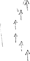
| On closing determined that the vessels in the port row proceeded in echelon. | |||||
| Following formation: | |||||
 |
|||||
|
Sun and Moon Data 07.03.41 |
| Sun and Moon Data 08.03.41 |
- 11 - |
|||||
| continued | |||||
| 08.02.41 | Intended was: | ||||
| To attack the third and steamer following behind. The screen was not seen while closing and is not seen now. Attacked third (the larges of the three forward vessels) steamer. Ran in up to a shooting range of about 400 meters. | |||||
| 03.41 | Multiple shot (bow) Eto, target speed = 7 knots | ||||
| Target angle = 90° | |||||
| Lead angle = 14° | |||||
| Estimated range = 400 meters | |||||
| Actual range = 425 meters = 35 | |||||
| seconds running time | |||||
| Depth = 3 meters | |||||
| Observations: For the multiple shot the size of the steamer was decisive. Both torpedoes hit. | |||||
| 1st forward of the bridge | |||||
| 2nd behind the bridge. | |||||
| From the steamer rockets and star shells were shot in the direction of the boat. Steamer settled deeper on an even keel. Steamer was 10000 GRT and fully loaded. | |||||
| After the shot turned to port to attack the steamer following behind, in so doing at the level of this steamer a destroyer with target angle 0° was sighted. Turned away, took the destroyer astern and attempted to get away on the surface at high speed. | |||||
| The destroyer remained at target angle 0°, came up slowly (suspect only capable of 15 knots). After about 5 minutes the destroyer turned on a searchlight. Illuminated past us on the port side of the boat. The boat was not in the searchlight cone. Continued the attempt to get away on the surface. After the searchlight dazzling the destroyer came about sharply to port and now illuminated in the opposite direction (to the south). A short time after the searchlight illuminated there followed the same searchlight dazzling, the destroyer came about and again took the boat ahead. He detected the boat with the searchlight illumination and immediately began to shoot with artillery. Getting away on the surface is impossible. | |||||
| 03.57 | Crash dive. | ||||
| Shortly before diving in relative bearing 130° a second destroyer with target angle 0° and course for the boat was sighted. After the crash dive, when the boat was at about 30-40 meters, one well-placed series of depth charges. | |||||
| Damage: | |||||
| 1) Forward periscope completely flooded. | |||||
| 2) Leak between the port regulating and reserve fuel oil tank and the regulating tank. | |||||
| 3) Four daughter gyro compass repeaters broken. | |||||
|
Sun and Moon Data 08.03.41 |
- 12 - |
|||||
| continued | |||||
| 08.03.41 | 4) Aft bearing gyrocompass repeater on the bridge failed due to water intake. | ||||
| 04.00 | EJ 3273 center-left edge | 5) Speed measurement system failed. | |||
| NE 1-2, Sea 1, 3/10, Vis. good, 1020 mb, +19.5°C | 6) Speed measurement gear in the conning tower pointer shaft dropped off. | ||||
| 7) Papenberg gauge in the conning tower shattered. | |||||
| 8) Oil and water level glass shattered. | |||||
| 9) Lightbulbs. | |||||
| 10) Cover of the aft Marcks liferaft torn away. | |||||
| [04.00, 08.00 and 12.00 positions are in error] | After that went to depth T = 53 meters. [actual depth 105 meters] A short time later a second series of depth charges. | ||||
| After the second series of depth charges both destroyers carried out a listening pursuit and employed sonar. | |||||
| 04.17 | A third series of depth charges (each series 5-6 depth charges) were no longer well-placed. Destroyers continued their listening pursuit. | ||||
| 08.00 | EJ 3241 center-left edge | Made several attempts to surface during the night. Each time the boat went higher the destroyers accelerated and located. Because the forward periscope is out of service due to the depth charges and nothing is seen in the aft periscope in the darkness and range to the destroyers cannot be determined from the strength of the sound bearings, I decided not to try to surface again in the darkness, but only after lightness is it possible to take an all around sweep in the fixed eye periscope. | |||
| NE 2-3, Sea 2, 4/10, Vis. good, 1020 mb, +20.0°C | |||||
| On the first attempt to surface after dawn a destroyer running off is sighted bearing 100°T, about target angle 180°. | |||||
| On extending the periscope the periscope pennant jumps off the drum and jams. As a result the aft periscope is initially out of service. | |||||
| 12.00 | DT 9794 lower-right corner | Day's run: Surfaced = 161.0 nm | |||
| NE 2, Sea 2, 3/10, Vis. good, 1020 mb, +21°C | Submerged 15.3 nm = 176.3 nm | ||||
| 16.00 | DT 9341 | Sound bearings were fainter and disappeared. | |||
| NE 4, Sea 4, 5/10, Vis. good, 1016 mb, +21°C | |||||
| 16.30 | Surfaced and pursued to the north. | ||||
| 17.35 | Incoming Officer-Only Radio Message 1717/8/128: Southern Boats: | ||||
| Convoy 16.00 hours square DU 4771. Go. Attack. When holding contact, immediately report current observations of the type and strength of the escort. B.d.U. | |||||
| Pursued at GF on plotted course 25°. | |||||
| 18.30 | Incoming Officer-Only Radio Message 1817/8/129: Southern Boats: | ||||
| DSZ | |||||
| 17.47 | Crash dive for training, test dive. | ||||
| 17.56 | Surfaced. | ||||
|
Sun and Moon Data 08.03.41 |
- 13 - |
|||||
| continued | |||||
| 08.03.41 | |||||
| 18.41 | Incoming Radio Message 1825/8/130: To B.d.U. | ||||
| DSZ | In night attack only two destroyers sighted square 6950. | ||||
| U-124. | |||||
| 19.27 | Outgoing Short Signal: Position DT 93. U-105. | ||||
| DSZ | |||||
| 19.01 | Battleship sighted 40° to starboard. Recognition Signals exchanged with SCHARNHORST. SCHARNHORST signals with searchlight Fli, Fli. No aircraft sighted. | ||||
| 20.00 | DT 6949 | Did not send a Radio Message concerning strength and disposition of the escort, because U-124 made the same observation. | |||
| NE 3, Sea 4, 4/10, Vis. good, 1015.5 mb, +19°C | |||||
| Found water in the lubricating oil. | |||||
| Therefore can only run with one engine at LF, as a result it is hopeless to reach the convoy today, so sent Radio Message 2337/8/145. | |||||
| 20.30 | Incoming Radio Message 2006/8/133: To Group West: | ||||
| DSZ | MALAYA and two cruisers square DU 4745. Flottille. | ||||
| 21.17 | Incoming Radio Message 2047/8/137: KR KR to Southern Boats: | ||||
| DSZ | |||||
| 20.00 hours MALAYA and two cruisers square DU 4745. | |||||
| B.d.U. | |||||
| 23.40 | Incoming Officer-Only Radio Message 1039/8/121: (concerning Recognition Signals). | ||||
| DSZ | |||||
| 24.00 | DT 6952 | ||||
| NE 2-3, Sea 3, Vis. good, 1017 mb, +19°C | Convoy can no longer be reached. [under the current circumstances] | ||||
| |
|||||
| 09.03.41 | |||||
| 00.41 | Outgoing Radio Message 2337/8/145: To B.d.U. | ||||
| Water in the lubricating oil, damaged being repaired. Forward periscope flooded due to depth charges. U-105. | |||||
| 02.17 | Engines are operable again. | ||||
| Pursued at 2 x GF. | |||||
| 04.00 | DU 4472 | ||||
| NE 2-3, Sea 3, 4/10, Vis. good, 1016 mb, +18°C | |||||
| 07.50 | Passed the Tropic of Cancer coming from the south. | ||||
| 08.00 | DU 4146 | ||||
| NE 2-3, Sea 3, 4/10, 1014 mb, +18°C | |||||
| 09.27 | Smoke cloud in sight ahead to port. Steamer about 2000-3000 GRT. Course from the Canary Islands to Cape Verde. | ||||
| Because both periscopes are out of service (forward by depth charges aft due to new pennant being installed) and because operation on the convoy seems more important, did not maneuver ahead to attack, instead continued to operate on the convoy. | |||||
| 10.29 | Outgoing Radio Message 1004/9/154: To B.d.U. | ||||
| DSZ | Square DU 4146 no contact. Night of the 8th from convoy a steamer of 10000 GRT. U-105. | ||||
|
Sun and Moon Data 08.03.41 |
| Sun and Moon Data 09.03.41 |
- 14 - |
|||||
| continued | |||||
| 09.03.41 | |||||
| 12.00 | DT 6336 | Day's run: Surfaced = 224.8 nm | |||
| NE 1-2, Sea 2, 10/10, Vis. good, 1018 mb, +21.5°C | Submerged 3.0 nm = 227.8 nm | ||||
| 12.25 | Incoming Radio Message 1135/9/157: | ||||
| DSZ | Only report damage and failures if return transit or limited operation of the boat is necessary and at the same time are specifically requested. B.d.U. | ||||
| 16.00 | DU 1741 | ||||
| NE 1, Sea 2, 7/10, 1016 mb, +23.5°C | |||||
| 19.06 | Crash dive for training, test dive. | ||||
| 19.38 | Surfaced. | ||||
| 20.00 | DU 1712 | ||||
| NE 1, Sea 0-1, 1/10, Vis. good, 1015 mb, +22°C | Found no contact on the convoy. | ||||
| 22.15 | Incoming Radio Message 2050/9/166: To U-105, U-124: | ||||
| DSZ | Report exact torpedo inventory with radio message. B.d.U. | ||||
| 22.32 | Incoming Radio Message 2048/9/164: If up to darkness there is no enemy contact U-105 on 20°W, U-106 on 21°W to the Freetown area. Orders concerning supply to follow. | ||||
| DSZ | |||||
| B.d.U. | |||||
| Because there is no enemy contact began transit to the south. | |||||
| 23.12 | Outgoing Radio Message 2203/9/171: To B.d.U. | ||||
| DSZ | 12 + 4 torpedoes square DU 1712. U-105. | ||||
| 24.00 | DT 3936 | ||||
| W 1-2, Sea 1, 4/10, Vis. good, 1015 mb, +19°C | |||||
| |
|||||
| 10.03.41 | |||||
| 04.00 | DT 3969 | ||||
| NE 1, Sea 1, cloudless, Vis. very good, 1015 mb, +23°C | |||||
| 08.00 | DT 3999 | ||||
| SW 1, Sea 2, 3/10, Vis. medium, 1015 mb, +23°C | |||||
| 08.19 | Crash dive for training. Test dive. | ||||
| 09.37 | Surfaced. | ||||
| 12.00 | DT 6339 | Day's run: Surfaced = 150.9 nm | |||
| SW 2-3, Sea 2, 2/10, Vis. good, 1015 mb, +23°C | Submerged 5.8 nm = 156.7 nm | ||||
| Transit to the south. | |||||
| 16.00 | DT 6393 | ||||
| W 3, Sea 2-3, 5/10, Vis. good, 1015 mb, +23.5°C | |||||
| 20.00 | DT 6636 | ||||
| W 1, Swell 1, 2/10, Vis. good, 1014 mb | |||||
| 24.00 | DT 6693 | ||||
| SW 1, Sea 1-2, 1/10, Vis. good, 1013 mb, +22.2°C | |||||
| |
|||||
|
Sun and Moon Data 09.03.41 |
| Sun and Moon Data 10.03.41 |
- 15 - |
|||||
| 11.03.41 | |||||
| 04.00 | DT 6939 | ||||
| SW 2, Sea 1, 5/10, Vis. good, 1013 mb, +18°C | |||||
| 04.45 | Incoming Radio Message 0420/11/103: | ||||
| DSZ | Because unexplained ETO failures have occurred again on all boats especially with outfitting in the homeland especially careful regulating and examination. B.d.U. | ||||
| 08.00 | DT 6997 | ||||
| WSW 2, Sea 2, 3/10, Vis. good, 1014 mb, +20°C | |||||
| 08.08 | Crash dive for training, test dive. | ||||
| 08.42 | Surfaced. | ||||
| 12.00 | DT 9364 | Day's run: Surfaced = 170.4 nm | |||
| SW 2-3, Sea 2-3, 3/10, Vis. good, 1015 mb, +23°C | Submerged 2.0 nm = 172.4 nm | ||||
| Transit to the south. | |||||
| 16.00 | DT 9631 | ||||
| WSW 3, Sea 3, 3/10, Vis. good, 1015 mb, +25°C | |||||
| 20.00 | DT 9695 | ||||
| WSW 1-2, Sea 2, 2/10, Vis. very good, 1015 mb, +22.5°C | |||||
| 24.00 | DT 9962 | ||||
| W 2, Sea 2, 1/10, Vis. good, 1017 mb, +21.8°C | |||||
| |
|||||
| 12.03.41 | |||||
| 01.54 | Incoming Officer-Only Radio Message 0047/12/126: | ||||
| DSZ | To Southern Boats; | ||||
| Ship 40 shifted operations area to EH. B.d.U. | |||||
| 04.00 | EJ 3332 | ||||
| W 1, Sea 1, 1/10, Vis. good, 1017 mb, +21°C | |||||
| 08.00 | EJ 3386 | ||||
| NW 1-2, Sea 1, medium NW-Swell, 1/10, Vis. good, 1017 mb, +24.6°C | |||||
| 08.12 | Crash dive for training, test dive. | ||||
| 08.59 | Surfaced. | ||||
| 12.00 | EJ 3653 | Day's run: Surfaced = 204.5 nm | |||
| NW 1-2, Sea 1, 1/10, Vis. good, 1019 mb, +24.8°C | Submerged 2.5 nm = 207.0 nm | ||||
| 16.00 | EJ 3931 | ||||
| NW 2-3, Sea 2, 1/10, Vis. good, 1018 mb, +27°C | |||||
|
Sun and Moon Data 11.03.41 |
| Sun and Moon Data 12.03.41 |
- 16 - |
|||||
| continued | |||||
| 12.03.41 | |||||
| 20.00 | EJ 3996 | ||||
| NW 1-2, Sea 2, medium Swell, 3/10, Vis. good, 1018 mb, +23.2°C | |||||
| 24.00 | EJ 6366 | ||||
| NW 2-3, Sea 2, 5/10, Vis, good, 1021 mb, +22.2°C | |||||
| |
|||||
| 13.03.41 | |||||
| 04.00 | EJ 6399 | ||||
| NNE 2, Sea 2, 3/10, Vis. good, 1019 mb, +22.2°C | |||||
| 08.00 | EJ 6662 | ||||
| NNE 2, Sea 3, 3/10, Vis. good, 1020 mb, +24.2°C | |||||
| 08.08 | Crash dive for training. | ||||
| 08.41 | Surfaced. | ||||
| 12.00 | EJ 6695 | Day's run: Surfaced = 171.3 nm | |||
| NNE 3-4, Sea 3, 2/10, Vis. good, 1020 mb, +26.1°C | Submerged 2.0 nm = 173.3 nm | ||||
| Transit to the south. | |||||
| 16.00 | EJ 6935 | ||||
| NNE 3-4, Sea 3, 3/10, Vis. good, 1019 mb, +27.5°C | |||||
| 17.25 | Sighted a steamer bearing 210°T proceeding independently, course 90°. Steers towards the Gambia Lightship. Maneuvered ahead. At sunset was ahead of the steamer. | ||||
| Moonrise at 19.20 hours MGZ. Full moon. Surface attack is not possible for this reason. Decided to attack submerged. | |||||
| 20.00 | EK 4746 | ||||
| NE 3-4, Sea 3, 2/10, Vis. good, 1013 mb, +20°C | |||||
| 20.23 | Dived for submerged attack, steamer came out of the dark horizon and could not be seen in the fixed eye periscope (air search periscope is out of service). | ||||
| Even with the full moon submerged attack with the fixed eye periscope is not possible. Surfaced after the steamer passed by. | |||||
| 24.00 | EK 4764 | Decided to attack submerged in the coming morning. During the night held contact, matched the steamer's speed. | |||
| NE 3-4, Sea 3, 3/10, Vis. very good, 1018 mb, +23.5°C | |||||
| |
|||||
| 14.03.41 | |||||
| 04.00 | EK 4853 | ||||
| NE 3-4, Sea 4, 1/10, Vis. very good, 1018 mb, +23°C | |||||
|
Sun and Moon Data 12.03.41 |
| Sun and Moon Data 13.03.41 | |
| Sun and Moon Data 14.03.41 |
- 17 - |
|||||
| continued | |||||
| 14.03.41 | |||||
| 05.44 | Dived for submerged attack. | ||||
| 07.46 | Multiple shot (bow) ETO. | ||||
| Target speed = 9 knots, target angle = 90°, lead angle = 16°, range 400-500 meters. | |||||
| 1st torpedo depth 2 meters, | |||||
| 2nd torpedo depth 3 meters, | |||||
| Observations: despite shooting data with exactly matched the speed: miss. | |||||
| At the shot heavy Swell and Sea State 4. Shot with the seas. Steamer was about 2500-3000 GRT, was unloaded, lay very high out of the water. Steamer drove dimmed during the night and had a cannon aft. | |||||
| In my opinion the steamer was under shot due to the heavy Sea State. | |||||
| 08.00 | EK 4942 | Did not carry out a further attack, because another maneuver ahead was not possible due to the proximity of the coast. | |||
| The steamer reached the Gambia Lightship about midday. | |||||
| Artillery attack during the night was not possible because the cannon could not be manned in the prevailing Sea State. Reloaded submerged. | |||||
| 11.09 | Surfaced. | ||||
| 12.00 | EK 4865 | Day's run: Surfaced = 179.5 nm | |||
| NE 3-4, Sea 4, cloudless, Vis. good, 1019 mb, +26.5°C | Submerged 19.6 nm = 199.1 nm | ||||
| Continued transit to the south. | |||||
| 13.23 | Incoming Officer-Only Radio Message 0756/14/194: | ||||
| DSZ | The presence of the cruiser SCHEER and tanker NORDMARK must be expected in the area around Point Rot. B.d.U. | ||||
| 13.30 | Incoming Radio Message 0754/14/193: | ||||
| Attack areas off Freetown: | |||||
| U-105 south of, U-106 north of a line Cape Sierra Leone in 55°. According to unconfirmed reports ships often wait within 200-meter line at night, on which heavy cruisers patrol. Both boats remain off Freetown until about 21 March and supply about 25 March at Point Rot. More to follow. B.d.U. | |||||
| 16.00 | EK 4871 | ||||
| NNE 3-4, Sea 3, cloudless, Vis. good, 1019 mb, +24.8°C | |||||
| 19.56 | Incoming Officer-Only Radio Message 1850/14/109: | ||||
| DSZ | To Southern Boats: | ||||
| Ship 41 is about 9000 GRT. Bow has Meier form, cruiser stern. From forward: cargo mast, mast, cargo mast, smokestack, cargo mast, mast, cargo mast. Expect missing cargo masts. B.d.U. | |||||
|
Sun and Moon Data 14.03.41 |
- 18 - |
|||||
| continued | |||||
| 14.03.41 | |||||
| 20.00 | EK 7158 | ||||
| NNE 2, Sea 1-2, cloudless, Vis. good, 1019 mb | |||||
| 24.00 | EK 7456 | ||||
| NNW 1, Sea 1, cloudless, Vis. good, 1019 mb, +22°C | |||||
| |
|||||
| 15.03.41 | |||||
| 04.00 | EK 7738 | ||||
| NNE 2, Sea 2, cloudless, Vis. good, 1019 mb, +24.5°C | |||||
| 08.00 | ET 1211 | ||||
| NE 1-2, Sea 1-2, light Swell, 1018 mb, +25.5°C | |||||
| 08.13 | Crash dive for training. Test dive. | ||||
| Propulsion system checks, in so doing determined that the thrust bolts had to be retightened. | |||||
| 10.07 | Surfaced. | ||||
| 12.00 | ET 1246 | Day's run: Surfaced = 231.6 nm | |||
| NE 3, Sea 2, cloudless, Vis. good, 1018 mb, +26.5°C | Submerged 5.2 nm = 237.3 nm | ||||
| 14.41 | Incoming Radio Message 1419/15: | ||||
| DSZ | To B.d.U.: | ||||
| Convoy EK 7728 westerly course. U-106. | |||||
| Radio Message was not heard by Control Station. Headed for the convoy by plotting. Port diesel is still out of service. (Thrust bolts and cylinder heads tightened.) Proceeded at highest diesel-electric speed (10 knots against the sea). Position on receiving Radio Message 1419/15 about 100 nm from the reported position of the convoy. | |||||
| Diesel is in service about 16.00 hours. | |||||
| Highest speed of advance 14 knots due to temperature. | |||||
| 16.00 | ET 1162 | ||||
| NE 3-4, Sea 3, cloudless, Vis. good, 1016 mb, +24.5°C | |||||
| 16.02 | Incoming Radio Message 1536/15/130: | ||||
| DSZ | To Southern Boats. | ||||
| 2 patrol vessels have passed Punta Delgada for Freetown. | |||||
| 17.05 | Starboard diesel out of service. Valve cone broken. Went to highest diesel-electric speed (10 knots). | ||||
| Diesel is in service again about 19.30 hours. | |||||
| At 380 RPM (highest RPM that could be maintained due to temperature = 13 knots). | |||||
| 20.00 | ET 1162 | ||||
| N 2, Sea 1-2, cloudless, Vis. good, 1014 mb, +24°C | |||||
|
Sun and Moon Data 14.03.41 |
| Sun and Moon Data 15.03.41 |
- 19 - |
|||||
| continued | |||||
| 15.03.41 | |||||
| 21.40 | Incoming Radio Message 2110/15/139: | ||||
| To B.d.U.: | |||||
| Convoy square EK 7473 upper-left, northerly course, 2 destroyers. U-106. | |||||
| Plotted. Headed for the convoy. Because in the first Radio Message a westerly course was given, I am now already west of the convoy. | |||||
| 23.32 | Incoming Radio Message 2323/15/141: | ||||
| DSZ | U-106 keep going, U-105 close. B.d.U. | ||||
| 00.14 | Incoming Radio Signal 2356/15/143: | ||||
| DSZ | Convoy in sight. EK 7443, enemy steers 0°, 7 knots. U-106. | ||||
| 24.00 | EK 7715 | ||||
| NE 3, Sea 3, cloudless, Vis. good, medium Swell, 1017 mb | |||||
| 00.29 | Incoming Officer-Only Radio Message 2324/15/144: | ||||
| To Southern Boats: | |||||
| Ship 41 shifted meeting point due to weather conditions to 3°N, 31°W square ER 89. | |||||
| |
|||||
| 16.03.41 | |||||
| 03.30 | Incoming Radio Signal 0307/16/148: | ||||
| Square 7421 course 30°, escort positioned ahead of the convoy. U-106. | |||||
| 04.00 | EK 7419 | ||||
| N 3, Sea 3, cloudless, Vis. good, 1018 mb | |||||
| 06.58 | Incoming Radio Signal 0640/16/154: | ||||
| DSZ | Square 7158, enemy steers northerly course. U-106. | ||||
| 08.00 | EK 7154 | ||||
| N 2-3, Sea 4, cloudless, Vis. good, 1016 mb | |||||
| 08.55 | Intended to carry out test dive. On slowing the diesels from GF to HF several steamers came in sight head to port. U-106-convoy. Range about 6000 meters. Because the bridge was wet from being at GF, the vessels were not seen before. On the starboard side of the steamers a destroyer run at high speed on the opposite course. Behind the last steamer the destroyer probably turned to starboard, however from the boat it seemed that he turned to port and | ||||
|
Sun and Moon Data 15.03.41 |
| Sun and Moon Data 16.03.41 |
- 20 - |
|||||
| continued | |||||
| 16.03.41 | |||||
| 08.55 | approached the boat at high speed. For this reason . . . | ||||
| 09.00 | Crash dive. | ||||
| During the night while running at high speed against the sea, speed was reduced hourly to LF to at least once an hour have a reasonable all around sweep. The bridge of these boats is very wet. | |||||
| After diving, in or outside the boat once again sounds arise, which were heard for the first time after the depth charge attack on 8 March. It is a very loud sound, as if highly compressed air escaped to the outside. Probably during the depth charge attack on 8 March the bulkhead between the regulating and reserve fuel oil tank and the regulating tank was torn and the air flows out of the regulating tank into the regulating and reserve fuel oil tank. | |||||
| 10.44 | Surfaced, Pursued. | ||||
| 12.00 | EK 7128 | Day's run: Surfaced = 256.4 nm | |||
| N 3, Sea 2-3, cloudless, Vis. good, 1016 mb, +24°C | Submerged 7.5 nm = 263.9 nm | ||||
| 15.37 | Incoming Radio Signal 1056/16/162: | ||||
| DSZ | Square 4722, enemy steers NW-course. U-106. | ||||
| 16.00 | EK 4746 | ||||
| NNE 2, Sea 2, 2/10, Vis. good, 1016 mb, +23.5°C | |||||
| 16.15 | Incoming Radio Signal 1546/16/170: | ||||
| DSZ | To B.d.U. | ||||
| Convoy located square EJ 6993 NW-course, with it today MALAYA and two further destroyers. U-106. | |||||
| Headed for the convoy. | |||||
| 18.38 | Incoming Radio Message 1825/16/172: | ||||
| DSZ | To U-105, 106: | ||||
| Attack, keep going. B.d.U. | |||||
| 18.52 | Incoming Radio message 1829/16/174: | ||||
| DSZ | To U-105. | ||||
| Report by Yes or No of you are in contact with the convoy. B.d.U. | |||||
| 19.30 | EJ 6952 | Contact on convoy. | |||
| 17.37 | Outgoing Short Signal: No. U-105. | ||||
| (Was not confirmed) | |||||
| 20.00 | EJ 6928 | ||||
| NNE 1-2, Sea 2, 2/10, Vis. good, 1017 mb, +22°C | |||||
| 21.41 | Outgoing Short Signal: Yes. U-105. | ||||
| DSZ | Held contact, convoy steered NW-course. | ||||
|
Sun and Moon Data 16.03.41 |
- 21 - |
|||||
| continued | |||||
| 16.03.41 | |||||
| 22.17 | Incoming Radio Message 2207/16/184: | ||||
| DSZ | U-105 reports by Short Signal Yes. B.d.U. | ||||
| 22.35 | Incoming Radio Message 2226/16/185: | ||||
| DSZ | Southern Boats attack. U-105 come in as contact keeper if U-106 has no contact. B.d.U. | ||||
| At the break of day the convoy changes course to 0°. Maneuvered ahead and intended to advance into the convoy from ahead and attack. | |||||
| During dawn the convoy took up the following formation: | |||||
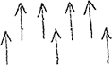 |
|||||
| Vessels were so close to one another that breaking in from ahead was not possible. Moved off ahead of the convoy to port and intended to attack the port outer row. During the attack (shortly before moonrise): | |||||
| 2333 | Incoming Radio Message 2305/16/187: | ||||
| DSZ | To B.d.U. | ||||
| Forced off, Position EJ 6934. U-106. | |||||
| Did not attack. | |||||
| (1. due to moonrise | |||||
| 2. to bring up U-106.) | |||||
| Stepped in as contact keeper in accordance with Radio Message 2226/16/186. | |||||
| 24.00 | EJ 6687 | ||||
| NNE 2, Sea 2, 2/10, Vis. good, 1017 mb, +21.5°C | |||||
| 00.20 | Outgoing Radio Message 2354/16/190: | ||||
| DSZ | B.d.U. | ||||
| Convoy square EJ 6925, course 0°. U-105. | |||||
| |
|||||
| 17.03.41 | |||||
| 02.17 | Incoming Short Signal: Request bearing signals from contact keeper. U-106. | ||||
| DSZ | |||||
| 03.15 | Outgoing bearing signals: square EJ 6684. | ||||
| 03.30 | Incoming Radio Message 0304/17/192: | ||||
| DSZ | U-106 requests by Short Signal 0214 bearing signals from contact keeper. U-105 send bearing signals. B.d.U. | ||||
|
Sun and Moon Data 16.03.41 |
| Sun and Moon Data 17.03.41 |
- 22 - |
|||||
| continued | |||||
| 17.03.41 | |||||
| 03.45 | Outgoing bearing signals: square EJ 6681. | ||||
| DSZ | |||||
| 04.20 | Outgoing bearing signals: square EJ 6681 | ||||
| DSZ | |||||
| 04.48 | Outgoing Radio Signal 0430/17/195: | ||||
| DSZ | The position of the convoy is square 6657, enemy steers 340°, speed 7 knots. U-105 | ||||
| 04.55 | Outgoing bearing signals: square EJ 6649. | ||||
| DSZ | |||||
| 05.22 | Outgoing bearing signals: square EJ 6649. | ||||
| DSZ | |||||
| 05.48 | Outgoing bearing signals: square EJ 6645. | ||||
| 04.00 | EJ 6645 | ||||
| NNE 2-3, 3/10, Vis. good, 1017 mb | |||||
| 06.23 | Outgoing bearing signals: square EJ 6645. | ||||
| DSZ | |||||
| 07.17 | Incoming Radio Message 0713/17/198: | ||||
| DSZ | Have contact with reported enemy warships. U-106. | ||||
| During the night held contact west of the convoy and sent bearing signals. | |||||
| Attack was not possible due to the moon. | |||||
| During the night evaded several times before the flank screening destroyer. | |||||
| In the morning twilight a destroyer was sent far out on the port side of the convoy (sweeper). Because the boat was positioned on the western horizon, avoided this destroyer by moving off. Later again closed in and held contact on the port side of the convoy. | |||||
| 08.00 | EJ 6538 | ||||
| NNE 4, Sea 4, 3/10, Vis. good, 1017 mb | |||||
| 09.15 | U-106 came in sight bearing 110°T. Went in hailing distance. Exchanged observations up to now on the convoy. | ||||
| Intended submerged attack by day was not possible due to the Sea State and the Swell. Decided to attack on the surface at night. | |||||
| Held contact. | |||||
| 12.00 | EJ 6295 | Day's run: Surfaced = 201.4 nm | |||
| NNE 4, Sea 4, heavy Swell, Vis. good, 2/10, 1017 mb, +22°C | Submerged 0 nm = 201.4 nm | ||||
| Around midday the horizon where the convoy was located became hazy. As a result contact holding was very difficult. | |||||
| 14.55 | A steamer (probably an auxiliary cruiser) moved off to port, | ||||
|
Sun and Moon Data 17.03.41 |
- 23 - |
|||||
| continued | |||||
| 17.03.41 | |||||
| 14.55 | muzzle fire was observed several times. At the same time a destroyer behind the convoy sets off to port at high speed. At first attempted to get free of this destroyer by moving off. It did not work. The destroyer probably saw the boat now and ran towards the boat at target angle 0°. | ||||
| 15.45 | Crash dive. | ||||
| Up to 17.00 hours was held submerged by the destroyer. | |||||
| 16.00 | EJ 6282 | Surfaced. | |||
| 17.15 | Convoy is no longer in sight. | ||||
| Pursued. | |||||
| 16.27 | Incoming Officer-Only Radio Message 1522/17/109: | ||||
| DSZ | To Southern Boats: | ||||
| Japanese transport JASKA leaves Bilbao 17 March via CF 59 and EH 36. Do not hinder. B.d.U. | |||||
| 16.50 | Incoming Radio Message 1607/17/110 | ||||
| DSZ | " " " 1609/17/111: | ||||
| Watch for filler Radio Messages as test transmissions of a new Very Long Wavelength transmitter on 19750 meters | |||||
| Today from 20.30 hours to 21.30 hours. | |||||
| Tomorrow from 00.00-01.00 hours, 07.30-08.30 hours and 12.00-13.00 hours. | |||||
| After completion of testing report U-106, U-45 and U-110 by Short Signal, average receiving strength. | |||||
| WXY = better then Nauen | |||||
| WYA - as good as Nauen | |||||
| WZG - worse than Nauen. B.d.U. | |||||
| (Report is in Enclosure) | |||||
| 20.00 | EJ 6227 | ||||
| NE 2-3, Sea 2, 3/10, Vis. good, 1017 mb, +21°C | |||||
| 21.15 | Outgoing Short Signal: Request bearing signals from contact keeper. U-105. | ||||
| DSZ | |||||
| 22.26 | Outgoing Radio Message 2209/17/119: | ||||
| DSZ | Have lost contact. U-105. | ||||
| Bearing signals from U-106 are too faint to take a bearing. | |||||
| No contact | |||||
| 22.43 | Incoming Radio Message 2217/17/120: | ||||
| DSZ | U-105, U-106: As soon as situation allows, report fuel inventory and position. B.d.U. | ||||
| 22.55 | Incoming Radio Message 2247/17/122: | ||||
| DSZ | Square EJ 3896. U-106 | ||||
|
Sun and Moon Data 17.03.41 |
- 24 - |
|||||
| continued | |||||
| 17.03.41 | |||||
| 24.00 | EJ 3875 | ||||
| NE 2, Sea 2, 2/10, Vis. good. 1017 mb, +20°C | |||||
| |
|||||
| 18.03.41 | |||||
| 00.19 | Incoming Radio Message 2358/17/124: | ||||
| DSZ | Square 3892, enemy steers 40°. U-106. | ||||
| Plotted: Came to course 54°. | |||||
| 00.54 | Outgoing Short Signal: | ||||
| DSZ | Request bearing signals from contact keeper. U-105. | ||||
| Despite U-106 sending bearing signals, gave this Short Signal once more, to point out to U-106 that his bearing signals were received poorly. | |||||
| 03.22 | Incoming Radio Message 0213/18/129: | ||||
| DSZ | Have lost contact on the reported enemy warships, Square 3869. U-106. | ||||
| 04.15 | Incoming Radio Message 0324/18/130: | ||||
| DSZ | To B.d.U. | ||||
| 130 cbm, 2 independent steamers 14316 GRT from the convoy 3 of about 21000 GRT. Still 7 + 4 torpedoes. Position square EJ 38. U-106. | |||||
| 02.25 | EJ 3856 | Shadow sighted bearing 345°T. Distance 3 nm. Maneuvered ahead. | |||
| Despite the bright moon decided to attack on the surface, (stern torpedoes) because the forward periscope is out of service. | |||||
| 03.00 | Attack on the steamer. | ||||
| Single shot (stern) Eto. | |||||
| Target speed = 5 knots, target angle = 90°, lead angle = 6°, depth = 3 meters, range = 1500 meters, range at shot 1620 meters = 108 seconds. | |||||
| Observation: after 108 seconds the steamer was hit in the center and broke apart immediately. Steamer sank after 20-30 seconds. | |||||
| Steamer ran at 5 knots and steered 280°. Probably a steamer which was forced from the convoy by the attack of U-106. Steamer was fully loaded, name unknown. Estimated at 6000 GRT. | |||||
| After the attack attempted to get contact on the convoy. | |||||
| 07.23 | Outgoing Radio Message 0700/18/132: | ||||
| DSZ | To B.d.U.: | ||||
| 110 cbm, square EJ 3852 center. U-105. | |||||
| 08.00 | EJ 3587 | ||||
| NE 2, Sea 2, 2/10, Vis. good, 1017 mb, +20°C | |||||
| 08.49 | Crash dive for training. | ||||
| 09.06 | Surfaced. | ||||
|
Sun and Moon Data 17.03.41 |
| Sun and Moon Data 18.03.41 |
- 25 - |
|||||
| continued | |||||
| 18.03.41 | |||||
| 09.06 | Attempted to gain contact on the convoy on various courses. | ||||
| 12.00 | EJ 3519 | Day's run: Surfaced = 193.2 nm | |||
| NE 2-3, Sea 2, 2/10, Vis. good, 1018 mb, +22.5°C | Submerged 5.7 nm = 198.9 nm | ||||
| 16.00 | EJ 3282 | ||||
| NE 3, Sea 2, 3/10, Vis. good, 1018 mb, +21.5°C | |||||
| 20.00 | EJ 3216 | ||||
| NE 3, Sea 3, 5/10, Vis. good, 1020 mb, +20.5°C | |||||
| 22.30 | Incoming Radio Message 2119/18/154: | ||||
| DSZ | U-105, U-106: | ||||
| If there is no contact, transit to the south, orders for supply follow. B.d.U. | |||||
| 20.45 | Came to southerly course. | ||||
| 23.39 | EJ 3254 | Convoy in sight ahead to port, steers 310°, runs at 7 knots. | |||
| 24.00 | EJ 3254 | ||||
| NE 2, Sea 2, 3/10, Vis. good, medium Swell, 1020 mb, +20°C | |||||
| |
|||||
| 19.03.41 | |||||
| 02.48 | Outgoing Radio Message 0240/19/160: | ||||
| DSZ | Enemy convoy in sight, square 3254, course 310°. U-105. | ||||
| On coming in sight we were about abeam the center of the starboard row of the convoy. Closed on this side, maneuvered ahead of the convoy and entered the convoy between the center and starboard rows. | |||||
| Formation of the convoy was approximately as follows: | |||||
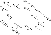 |
|||||
| Spacing between the first two steamers was approximately 500-600 meters. Slowed and dropped back very close to the first steamer of the starboard outer row on the enemy course into the convoy. | |||||
| Attack on the second steamer of the center row: | |||||
| 00.24 | Multiple shot (bow) 2 Etos. | ||||
|
Sun and Moon Data 18.03.41 |
| Sun and Moon Data 19.03.41 |
- 26 - |
|||||
| continued | |||||
| 19.03.41 | |||||
| 00.24 | Target speed = 7 knots, target angle = 90°, lead angle = 13°, both torpedoes depth 3 meters, range estimated = 1500 meters, for the first shot 1750 meters = 117 seconds. | ||||
| Range for the second shot 1720 = 119 seconds. | |||||
| Observations: both torpedoes hit. | |||||
| Steamer sank. Name unknown. Steamer was fully loaded, size 8000 GRT. | |||||
| Size of the steamer was decisive for the multiple shot. | |||||
| Directly after the first two shots (multiple shot), attacked the third steamer of the center row. | |||||
| Miss on this steamer, target angle estimated too great. | |||||
| 00.25 | Single shot (bow) Eto. | ||||
| Target speed = 7 knots, target angle = 90°, lead angle = 13°, depth 3 meters, range estimated = 1500 | |||||
| Observations: no observations. Miss on the attacked steamer. In the boat however after about 2 minutes 30 seconds after firing of the third torpedo pistol impact and detonation heard. | |||||
| During the attack on the third steamer of the center row a destroyer was sighted running down on the port side of the center row on the opposite course of the convoy. | |||||
| After the second attack turned away and attacked the third steamer of the starboard outer row from the port side. | |||||
| During the attack on this steamer it was observed that white and red multiple stars were shot from towards the ships on the port side of the center row. It was accepted that the destroyer seen previously fired these stars. | |||||
| 00.29 | Single shot (bow) Ato | ||||
| Target speed = 7 knots, target angle = 90°, lead angle = 13°, estimated range = 600 meters running time 49 seconds = 1000 meters depth = 3 meters. | |||||
| Observations: After 49 seconds hit center. Steamer sheered out to starboard. Remained lying stopped. Set out boats and shot a few briefly illuminating Star Shells [presumably flares]. Steamer sank. | |||||
| 00.40 | Received on the 600-meter wavelength: | ||||
| SSS SSS SSS 1816 n 2126 w | |||||
| 1816 n 2126 w | |||||
| torpedoed mandalika torpedoed mandalika A 0040. | |||||
| Following was repeated afterwards from a land station: | |||||
| adicac torpedoed 0101 zvpu- zsc 1, | |||||
| SSS SSS SSS | |||||
| xs 29 18r 18n 21 26w mandalika torpedoed 0040 torpedoed 0101 | |||||
| zvpu - zsc 0117 zsv -ar- | |||||
| Did not find the name of the steamer in | |||||
|
Sun and Moon Data 19.03.41 |
- 27 - |
|||||
| continued | |||||
| 19.03.41 | |||||
| 00.40 | the books at hand. | ||||
| Estimated at 6000 GRT. Steamer was fully loaded. | |||||
| After the attack went out of the convoy ahead of the bow of the attacked steamer, in so doing sighted a destroyer astern approaching the boat. Evaded the destroyer by running off, in so doing lost the convoy. | |||||
| Pursued. | |||||
| 03.29 | Outgoing Radio Message 0306/19/162: | ||||
| DSZ | Have attacked, was forced off. U-105. | ||||
| 03.50 | Incoming Radio Message 0341/19/163: | ||||
| DSZ | Attack, keep going. B.d.U. | ||||
| 01.56 | Starboard engine out of service (oil piping, exhaust gas turbine). Port diesel-electric at highest possible speed setting. | ||||
| 04.00 | EJ 3855 | ||||
| NE 1-2, Sea 1, 3/10, Vis. good, 1020 mb, +19.2°C | |||||
| 04.25 | Starboard diesel in service again. | ||||
| 06.32 | In the twilight the convoy is in sight again. As it gets brighter a destroyer was sighted about 70° to port at a distance of 5000-6000 meters, which apparently had been stationed far to port ahead of the convoy. | ||||
| Avoiding on the surface was not possible. | |||||
| 07.20 | Dived. | ||||
| 08.00 | EJ 3241 | Destroyer ran off towards the convoy. Attack on the destroyer was not possible, due to great range. After the destroyer passed out of sight surfaced. | |||
| NE 2-3, Sea 2, 4/10, Vis. good, 1020 mb, +20°C | |||||
| 12.00 | DT 9794 | No contact on the convoy. | |||
| NE 2, Sea 2, 3/10, Vis. good, 1020 mb, +21°C | |||||
| 16.00 | DT 9799 | ||||
| NE 1-2, Sea 2, 2/10, 1020 mb, +21.5°C | |||||
| 21.05 | 12.00 hours Day's run: | Outgoing Radio Signal 1400/19/197: | |||
| DSZ | Surfaced = 234.1 nm | Have lost contact on the convoy. Square 9794. U-105. | |||
| 22.31 | Submerged 3.3 nm | Incoming Radio Message 2153/19/195: | |||
| DSZ | = 237.4 nm | Square 8696, enemy steers course 290°. U-106. | |||
| 22.42 | Incoming Radio Message 2155/19/193 | ||||
| DSZ | To U-105, 106: | ||||
| 20.00 | DT 9871 | Attack, keep going. Supply Culebra may be ordered. B.d.U. | |||
| NE 1-2, Sea 2, 2/10, Vis. medium, 1020 mb, +20.0°C | |||||
| 23.32 | Incoming Radio Message 1602/19/182: | ||||
| DSZ | B.d.U. | ||||
| Convoy with MALAYA square DT 9751, northerly course. | |||||
| U-106. | |||||
| Pursued. | |||||
| 24.00 | DT 8935 | ||||
| NE 1-2, Sea 2, 7/10, Vis. medium, 1020 mb | |||||
| |
|||||
|
Sun and Moon Data 19.03.41 |
- 28 - |
|||||
| 20.03.41 | |||||
| 04.00 | DT 8569 | ||||
| NE 1-2, Sea 2, 9/10, Vis. good, 1020 mb | |||||
| 04.24 | Incoming Radio Signal 0406/20/200: | ||||
| DSZ | Square 8644, enemy steers NW-course. U-106. | ||||
| Still no contact on the convoy. | |||||
| 07.16 | DT 8515 | Abaft of 10° to port to abeam smoke clouds in sight. | |||
| Contact on the convoy. | |||||
| Initially assumed that it was another convoy because it steered a SW-course. Held contact and attempted to maneuver ahead. | |||||
| Because today the ever-present hand-wide haze layer is missing on the horizon, the smoke clouds of the convoy are very easy to see. | |||||
| 08.00 | DT 8555 | ||||
| NE 1-2, Sea 2, 8/10, Vis. very good, 1020 mb | |||||
| 10.18 | DT 8546 | Incoming Radio Message 1004/20/104: | |||
| DSZ | Square 8546. enemy steers westerly course. U-106. | ||||
| 12.00 | DT 8454 | Day's run: Surfaced = 236.6 nm | |||
| NE 1-2, Sea 2, 1/10, Vis. very good, 1020 mb, +22.2°C | Submerged 15.5 nm = 252.1 nm | ||||
| 14.15 | Am positioned ahead of the convoy. Convoy came to NW-course, as a result I am behind the convoy again. | ||||
| 16.18 | Incoming Radio Signal 1608/20/113: | ||||
| DSZ | Square 8494, enemy steers SW-course. U-106. | ||||
| 16.00 | DT 8722 | ||||
| NE 1-2, Sea 1, 2/10, Vis. very good, 1020 mb, +23.8°C | |||||
| 18.29 | Incoming Radio Signal 1811/20: | ||||
| Square 8447, enemy steers NW-course. U-106. | |||||
| Radio Signal was not repeated by the Control Station. | |||||
| 20.00 | DT 7657 | ||||
| NE 1-2, Sea 1, 3/10, Vis. very good, 1020 mb | |||||
| 22.20 | Lost contact on the convoy (very bright west horizon, while the convoy was to the east). | ||||
| 22.24 | Incoming Officer-Only Radio Message 2135/20/122: | ||||
| DSZ | To Southern Boats: | ||||
| Ship 10 operates in square ES 10 to ER 20. Own heavy warships are no longer in the operations area. | |||||
| U-105, U-106 attack. B.d.U. | |||||
| 00.46 | Outgoing Short Signal: | ||||
| DSZ | Request bearing signals from contact keeper. U-105 | ||||
| Pursued. | |||||
|
Sun and Moon Data 20.03.41 |
- 29 - |
|||||
| continued | |||||
| 20.03.41 | |||||
| 00.50 | Outgoing Radio Message 2358/20/127: | ||||
| DSZ | Have lost contact. U-105. | ||||
| 01.24 | Incoming Radio Message 0112/21/128: | ||||
| DSZ | Confirming Short Signal from U-105. Request bearing signal from contact keeper. B.d.U. | ||||
| Bearing signals were not heard from U-106. (U-106 was at the convoy attacking). U-106 had not sent bearing signals. | |||||
| 23.28 | Convoy in sight again ahead to port on NE-course. | ||||
| 24.00 | DT 7629 | ||||
| NE 1-2, Sea 2, 3/10, Vis. medium, 1020 mb, +20°C | |||||
| |
|||||
| 21.03.41 | |||||
| Ran past ahead of the convoy and took position on the dark horizon. | |||||
| Attack on the port outer row. | |||||
| 02.05 | Incoming Radio Signal 0158/21/129: | ||||
| DSZ | Square DT 7646, enemy steers NE-course. U-106. | ||||
| Attack initiated on the 2nd steamer of the port outer row. Range was getting too great. Initiated attack on the third steamer of the same row. | |||||
| 00.46 | Single shot (bow) Eto. | ||||
| Target speed = 5 knots, target angle = 90°, lead angle = 9.5°, depth = 3 meters, range estimated 800 meters. Range (running time) 84 seconds - 1260 meters. | |||||
| Observations: Torpedo hit aft of the level of the after mast. Steamer was immediately down by the stern after the hit, set out boats and sank. | |||||
| On the 600-meter wavelength received: | |||||
| clan ogilvy torpedoed ar | |||||
| clan ogilvy torpedoed ar | |||||
| clan ogilvy (name of the steamer) ar golf sk. | |||||
| Estimated size 6000 GRT. Documents at hand 5800 GRT. | |||||
| Steamer was fully loaded. | |||||
| Turned to port to get behind attacked steamer in this row (confusing formation of steamers). | |||||
| Maneuvered ahead parallel to the convoy and then attacked the 2nd steamer of the port outer row. | |||||
| 00.47 | Single shot (bow) Eto. | ||||
| Target speed = 5 knots, target angle = 90°, lead angle = 9.5°, depth = 3 meters, range estimated = 1000 meters. Running time 229 seconds = 3500 meters. | |||||
| Observations: Miss on the attacked steamer. Incorrect target angle (target angle was greater then 90°) after 229 seconds detonation and explosion column on one of the steamers proceeding in the inner row. Hit forward of the bridge. Steamer was | |||||
|
Sun and Moon Data 20.03.41 |
| Sun and Moon Data 21.03.41 |
- 30 - |
|||||
| continued | |||||
| 20.03.41 | [typo 21.03.41] | ||||
| 00.47 | down by the bow, was fully loaded. Name unknown, estimated at 7000 GRT. | ||||
| After this shot turned away to port. | |||||
| Intended to maneuver ahead parallel to the convoy and, because we are out of torpedoes forward, attack with a stern torpedo on the 1st steamer of the convoy. | |||||
| While running ahead a detonation was observed on the just hit steamer. Directly thereafter from the center row a star shell fan which lay in the direction of the boat. | |||||
| 1st fan lay to starboard, therefore attempted to turn away to port. | |||||
| 2nd fan was added to the left of the first. | |||||
| Now the boat is detected. | |||||
| 00.56 | Dived. | ||||
| Star shell fans were well-placed. Star shells illuminated a very long time and were obviously shot by a warship. | |||||
| If the boat was shot at with artillery could not be determined. | |||||
| Submerged the sinking of the steamer was heard (boiler explosion, breaking of bulkheads). | |||||
| |
|||||
| 21.03.41 | |||||
| 01.36 | Surfaced. | ||||
| By diving contact on the convoy was lost. | |||||
| Pursued. | |||||
| 05.48 | Outgoing Radio Message 0538/21/130: | ||||
| DSZ | Have attacked, lost contact. U-105. | ||||
| 04.00 | DT 7623 | ||||
| NE 1-2, Sea 2, 2/10, Vis. medium, 1020 mb, +20°C | |||||
| 07.06 | Incoming Radio Signal 0702/21/131: | ||||
| DSZ | Enemy gathers in square 7664. U-106. | ||||
| Headed for square 7664, in the process did not find the convoy. | |||||
| 08.00 | DT 7652 | In the morning in the vicinity of the shooting location sighted a large oil slick and several life boats. | |||
| NE 1-2, Sea 2, 6/10, Vis. medium, 1020 mb | |||||
| Again pursued to the north. | |||||
| 10.50 | Outgoing Radio Message 1024/21/135: | ||||
| DSZ | To B.d.U. | ||||
| From convoy "Oe" "Oe" 5 steamers totaling about 33000 GRT. Still 3 stern and 4 torpedoes, 80 cbm. Square 7625. | |||||
| U-105. | |||||
|
Sun and Moon Data 21.03.41 |
- 31 - |
|||||
| continued | |||||
| 21.03.41 | |||||
| 10.33 | Incoming Radio Message 1007/21: | ||||
| DSZ | Square [DT] 8419, enemy steers NE-course. U-106. | ||||
| (was not heard by Control) | |||||
| Plotted. | |||||
| 10.05 | Steamer in sight to port, steers a very strong zigzag course and runs at high speed. General course the steamer is towards the convoy. Steamer is probably a straggler and drives on changing courses up to 90° to each side. On the basis of his high speed and course changes a maneuver ahead is hopeless. | ||||
| 12.00 | DT 7394 | ||||
| NE 1-2, Sea 1, 2/10, Vis. good | |||||
| Day's run: | |||||
| Surfaced = 297.9 nm | |||||
| Submerged 2.5 nm | |||||
| = 300.4 nm | |||||
| 16.00 | DT 8187 | Broke off pursuit because I absolutely want to have contact on the convoy before the beginning of twilight. | |||
| NE 2-3, Sea 2, 2/10, Vis. good, 1020 mb, +22°C | |||||
| 13.32 | Incoming Radio Message 1226/21/138: | ||||
| DSZ | U-105 report by Short Signal Yes or No if today's reported tonnage number included the success reported on 9 March. | ||||
| B.d.U. | |||||
| 13.45 | Outgoing Short Signal: No. U-105. | ||||
| DSZ | |||||
| 14.51 | Incoming Radio Message 1424/21/140: | ||||
| DSZ | U-105 reports by Short Signal No. B.d.U. | ||||
| 16.45 | Smoke clouds in sight ahead. | ||||
| Again contact on the convoy. Convoy steers NE-course. | |||||
| Over the convoy an aircraft as escort. | |||||
| 17.00 | Aircraft flies towards the boat. | ||||
| Dived. | |||||
| 17.58 | Surfaced. The convoy is still in sight. | ||||
| Aircraft at the convoy. | |||||
| 18.30 | Aircraft flies towards the boat a second time. | ||||
| Dived. 2 small aircraft bombs far from the boat. | |||||
| 20.00 | DT 8157 | Surfaced. Held contact after surfacing. On closing the convoy at 21.24 hours 2 vessels were directly ahead of the boat, probably 2 steamers straggling from the convoy. | |||
| NE 2, Sea 2, 2/10, Vis. medium, 1020 mb, +21.5°C | |||||
| Attack on the forward steamer (by the appearance probably the steamer for which the maneuver ahead during the day failed.). | |||||
| 21.59 | Single shot (stern) Eto (shot at the front) | ||||
| Target speed = 8 knots, target angle = 90°, lead angle = 15.5°, depth 3 meters. Estimated range = 400 meters. Running time 39 seconds = 600 meters. | |||||
| Observations: hit amidships. Steamer turned away to port shortly before the shot. Enormous detonation and high explosion column, | |||||
|
Sun and Moon Data 21.03.41 |
- 32 - |
|||||
| continued | |||||
| 21.03.41 | |||||
| 21.59 | Steamer remained lying stopped, set out boats and after the shot lay deeper on an even keel. Steamer did not sink further, therefore after an hour a coup de grâce. Steamer sank slowly on an even keel. | ||||
| 23.30 | The steamer sank. | ||||
| At the shooting location a large oil slick. Steamer was a modern ship with a raked bow and cruiser stern and a canted smokestack. Steamer was fully loaded, name unknown. Estimated at 8000 GRT. | |||||
| During the attack on this steamer the second was lost. Probably was already seen by it before the attack because he attempted to warn the first steamer by Morse lamp. After the sinking of the first steamer attempted to find the second steamer again. | |||||
| Did not succeed. | |||||
| During this attack contact on the convoy was lost. | |||||
| Pursued. | |||||
| 01.31 | Incoming Radio Signal 0111/22/156: | ||||
| DSZ | Square 5788, enemy steers N-course. U-106. | ||||
| 24.00 | DT 8151 | ||||
| NNE 2-3, Sea 2, 5/10, low cloud deck, 1020 mb, +20°C | |||||
| |
|||||
| 22.03.41 | |||||
| 02.50 | Outgoing Radio Message 0227/22/158: | ||||
| DSZ | To B.d.U. | ||||
| Steamer straggling from convoy about 8000 GRT. 1 stern + 4 torpedoes. 72 cbm. DT 8154. U-105. | |||||
| No contact on convoy. | |||||
| 04.00 | DT 5781 | ||||
| NNE 2-3, Sea 2, Vis. medium, 1021 mb, +19°C | |||||
| 08.00 | DT 5479 | ||||
| NE 1-2, Sea 2-3, 3/10, Vis. medium, 1022 mb | |||||
| 10.34 | Incoming Officer-Only Radio Message 0943/22/164: | ||||
| DSZ | To U-105, 106: | ||||
| Well done. If weather conditions allow download torpedoes and keep going. Otherwise set off at economical speed to ER 89. With Short Signal Yes or No report if downloading. With Short Signal report XYZ if failure of supply in ER 89 return to Culebra at economical speed is not ensured. | |||||
| B.d.U. | |||||
| Downloading is not possible due to weather. | |||||
| 09.10 | Began transit to the south. | ||||
|
Sun and Moon Data 21.03.41 |
| Sun and Moon Data 22.03.41 |
- 33 - |
|||||
| continued | |||||
| 22.03.41 | |||||
| 12.22 | Outgoing Short Signal. No. U-105. | ||||
| DSZ | |||||
| 12.47 | Incoming Radio Message 1237/22/167: | ||||
| DSZ | Confirming the Short Signal from U-105 No. B.d.U. | ||||
| 10.20 | U-106 in sight. Went within hailing range. | ||||
| 12.00 | DT 5478 | Day's run: Surfaced = 182.9 nm | |||
| NE 2-3, Sea 2-3, 2/10, Vis. good, 1024 mb, +24.8°C | Submerged 8.9 nm = 191.8 nm | ||||
| 16.00 | DT 4939 | ||||
| NE 2-3, Sea 2-3, 2/10, Vis. good, 1024 mb, +23.2°C | |||||
| 20.00 | DT 4992 | ||||
| NE 2, Sea 2, 3/10, Vis. good, 1024 mb, +21.8°C | |||||
| 21.54 | Incoming Officer-Only Radio Message 2119/22/184: | ||||
| DSZ | U-105, 106, supply anticipated 29 March at 3°N, 31°W from NORDMARK and Ship 41. B.d.U. | ||||
| 24.00 | DT 7329 | ||||
| NE 1-2, Sea 1, 1/10, Vis. good, 1025 mb, +21.4°C | |||||
| |
|||||
| 23.03.41 | |||||
| 04.00 | DT 7381 | ||||
| NE 2, Sea 1-2, 6/10, Vis. good, 1025 mb, +22°C | |||||
| 08.00 | DT 7616 | ||||
| NE 1-2, Sea 1-2, 9/10, Vis. good, 1025 mb, +22°C | |||||
| 12.00 | DT 7645 | Day's run: Surfaced = 142.5 nm | |||
| NE 2, Sea 2, 7/10, Vis. medium, 1026 mb, +22.8°C | Submerged 0.0 nm = 142.5 nm | ||||
| In transit to the south to the supply point. | |||||
| 14.57 | DT 6774 | Steamer in sight ahead to starboard. Steers N-course, runs at high speed. Steers strongly zigzagging course. Maneuvered ahead. | |||
| 16.00 | DT 7672 | ||||
| NE 2-3, Sea 2-3, 8/10, Vis. medium, 1026 mb, +22°C | |||||
| 16.40 | Steamer passes out of sight. | ||||
| 16.47 | Dived. Sound bearing from steamer. | ||||
| 17.13 | Surfaced. | ||||
| 17.39 | Steamer in sight again. Maneuvered ahead. No speed advantage. | ||||
| 18.25 | On the 600-meter wavelength received: | ||||
| ssssooo sss | |||||
| 1959 n 2627 w malancia missed by torpedo. | |||||
| (Initially assumed that we were seen by the steamer | |||||
|
Sun and Moon Data 22.03.41 |
| Sun and Moon Data 23.03.41 |
- 34 - |
|||||
| continued | |||||
| 23.03.41 | |||||
| 18.25 | and that it had sent this message. However, it turned out that U-106 had fired a miss at MALANCHA. The position given by MALANCHA is about 30 nm west of our position). | ||||
| 18.30 | Lost contact on the steamer. | ||||
| 18.31 | Dived. | ||||
| Sound bearing from the steamer. | |||||
| Pursued. | |||||
| Did not gain contact on the steamer. | |||||
| Dived several times while following the steamer. Sound bearings were always fainter. The steamer probably steered a straight course during the night. | |||||
| 20.00 | DT 7643 | ||||
| NE 3, Sea 3, 4/10, Vis. good, 1024 mb | |||||
| Up to 03.29 hours pursued at highest possible speed setting (14 knots). Gained no contact. Steamer must have run at 15-16 knots. | |||||
| 24.00 | DT 7293 | ||||
| NE 1-2, Sea 2, 7/10, Vis. medium, 1022 mb, +21°C | Pursuit broken off because catching up with the steamer is hopeless. Size of the steamer estimated at about 8000 GRT. | ||||
| |
|||||
| 24.03.41 | |||||
| 03.29 | Continued transit to the south to the supply point. | ||||
| 04.00 | DT 7328 | ||||
| NE 2, Sea 2, 6/10, medium Swell, 1022 mb, +21.4°C | |||||
| 08.00 | DT 7285 | ||||
| NE 2-3, Sea 2, 5/10, Vis. good, 1022 mb, +23°C | |||||
| 12.00 | DT 7561 | Day's run: Surfaced = 170.4 nm | |||
| NE 3, Sea 3, 6/10, Vis. medium, 1022 mb, +24°C | Submerged 8.6 nm = 179.0 nm | ||||
| In transit to the supply point. | |||||
| 16.00 | DT 7576 | ||||
| NE 3, Sea 3, 1/10, Vis. good, 1021 mb, +24°C | |||||
| 20.00 | DT 7818 | ||||
| NE 3, Sea 3, 4/10, Vis. medium, 1020 mb, +23°C | |||||
| 20.38 | Crash dive for training. Test dive. | ||||
| 21.16 | Surfaced. | ||||
| 24.00 | DT 7871 | ||||
| NE 2, Sea 2, 3/10, 1021 mb, +21°C | |||||
| |
|||||
| 25.03.41 | |||||
| 04.00 | |||||
|
Sun and Moon Data 23.03.41 |
| Sun and Moon Data 24.03.41 | |
| Sun and Moon Data 25.03.41 |
- 35 - |
|||||
| continued | |||||
| 25.03.41 | |||||
| 04.00 | EJ 1133 | ||||
| NE 2, Sea 1-2, 1/10, Vis. medium, 1020.5 mb, +20.5°C | |||||
| 08.00 | EJ 1156 | ||||
| NE 2, Sea 1-2, 3/10, 1020 mb, +22°C | |||||
| 12.00 | EJ 1188 | Day's run: Surfaced = 144.7 nm | |||
| NE 3-4, Sea 3-4, 1/10, Vis. good, 1021 mb, +24.2°C | Submerged 4.2 nm = 148.9 nm | ||||
| In transit to the supply point. | |||||
| A few wreck parts sighted abeam to port. | |||||
| 15.30 | EJ 1428 | ||||
| 16.00 | EJ 1451 | ||||
| NE 3-4, Sea 3-4, 3/10, Vis. good, 1021 mb, +24°C | |||||
| 20.00 | EJ 1476 | ||||
| NE 3, Sea 3, 4/10, Vis. good, 1020 mb | |||||
| 24.00 | EJ 1717 | ||||
| NE 2, Sea 2-3, 2/10, Vis. medium, 1021 mb, +22.8°C | |||||
| |
|||||
| 26.03.41 | |||||
| 04.00 | EH 3993 | ||||
| NE 2, Sea 2, 10/10, Vis. good, 1019 mb, +22°C | |||||
| 08.00 | EH 6337 | ||||
| NE 2-3, Sea 2, 7/10, Vis. good, 1019 mb | |||||
| 08.32 | Crash dive for training. Test dive. | ||||
| 10.01 | Surfaced. | ||||
| 13.08 | Incoming Officer-Only Radio Message 1043/26/178: | ||||
| DSZ | To Southern Boats: | ||||
| Own prize probably "BRITANIA" was released on 25 March in square ES 5160. B.d.U. | |||||
| 12.00 | EH 6359 | Day's run: Surfaced = 148.7 nm | |||
| Submerged 4.5 nm = 153.2 nm | |||||
| 16.00 | EH 6622 | ||||
| NE 2, Sea 2, 4/10, Vis. medium, 1018 mb, +26.2°C | |||||
| 20.00 | EH 6657 | ||||
| NE 2, Sea 2, 4/10, 1018 mb, +23.6°C | |||||
| 24.00 | EH 6921 | ||||
| NE 2-3, Sea 2, 3/10, Vis. medium, 1019 mb, +23.6°C | |||||
| |
|||||
| 27.03.41 | |||||
| 04.00 | EH 2969 | ||||
| NE 1-2, Sea 1-2, 3/10, Vis. good, 1018 mb | |||||
| 08.00 | EH 9313 | ||||
| NE 1-2, Sea 1-2, Vis. medium, 1017 mb | |||||
| 11.15 | Incoming Officer-Only Radio Message 0929/27/105: | ||||
| DSZ | To U-105, 106: | ||||
|
Sun and Moon Data 25.03.41 |
| Sun and Moon Data 26.03.41 | |
| Sun and Moon Data 27.03.41 |
- 36 - |
|||||
| continued | |||||
| 27.03.41 | |||||
| 11.15 | NORDMARK and Ship 41 [Kormoran] are located in square ER 89 on 29 March. Lead Supply Ship 41distribute torpedoes equally. B.d.U. | ||||
| DSZ | |||||
| 12.00 | EH 9347 | Day's run: Surfaced = 160.0 nm | |||
| NNE 3, Sea 3, 7/10, Vis. bad, 1019 mb, +22.8°C | Submerged 1.2 nm = 161.2 nm | ||||
| In transit to supply point. | |||||
| 16.00 | EH 9566 | ||||
| NE 3, Sea 3, 6/10, Vis. medium, 1018 mb, +26.8°C | |||||
| 20.00 | EH 9837 | ||||
| NNE 2, Sea 2, 4/10, Vis. medium, 1016 mb, +26°C | |||||
| 24.00 | ER 3225 | ||||
| NNE 1-2, Sea 2, 7/10, Swell, Vis. medium, 1016 mb, +25°C | |||||
| |
|||||
| 28.03.41 | |||||
| 04.00 | ER 3513 | ||||
| NNE 1, Sea 1, 3/10, Vis. medium, 1016 mb, +25°C | |||||
| 08.00 | ER 3577 | ||||
| NNE 1-2, Sea 1, 6/10, Vis. medium. 1014 mb, +25°C | |||||
| 12.00 | ER 3769 | Day's run: Surfaced = 293.0 nm | |||
| NNE 1-2, Sea 1-2, 6/10, Vis. medium, 1015 mb, +27°C | Submerged 0.0 nm = 293.0 nm | ||||
| 16.00 | ER 6191 | In transit to the supply point. | |||
| NNE 1-2, Sea 1, 9/10, Vis. medium, 1014 mb, +27°C | |||||
| 20.00 | ER 6456 | ||||
| NNE 1-2, Sea 1-2, 6/10, Vis. medium, 1013 mb, +26.8°C | |||||
| 24.00 | ER 6751 | ||||
| NNE 1, Sea 1, 6/10, Vis. bad, 1016 mb, +26°C | |||||
| |
|||||
|
Sun and Moon Data 27.03.41 |
| Sun and Moon Data 28.03.41 |
- 37 - |
|||||
| 29.03.41 | |||||
| 04.00 | ER 9118 | ||||
| NNE 2, Sea 1, 3/10, Vis. good, 1014 mb, +22.8°C | |||||
| 08.00 | ER 8636 | ||||
| NNE 3, Sea 3, 10/10, Vis. good, 1014 mb, +27.4°C | |||||
| 12.00 | ER 8697 | Day's run: Surfaced = 277.5 nm | |||
| ESE 2, Sea 2, 9/10, Vis. good, 1015 mb, +27.8°C | Submerged 0.0 nm = 277.5 nm | ||||
| In transit to the supply point. | |||||
| After 23 March in transit to the south to the supply place no traffic observed. | |||||
| 12.28 | Ahead 30° to port Ship 41 in sight. Recognition Signals exchanged with Ship 41. Due to weather proceeded to the south. | ||||
| 16.00 | ER 8929 | ||||
| ESE 1-2, Sea 2, 10/10, Vis. good, 1015 mb, +27.8°C | |||||
| 16.21 | Stopped. Began supply. | ||||
| 20.00 | ESE 2, Sea 2, 10/10, Vis. medium, 1013 mb, +28.8°C, wind calm | ||||
| 24.00 | Square | Over night stopped at Ship 41. | |||
| 4/10, Vis. good, 1015 mb | |||||
| |
|||||
| 30.03.41 | |||||
| 04.00 | Square | ||||
| SE 1, Sea 1, 6/10, Vis. medium, light Swell, 1014 mb, +26°C | |||||
| 07.28 | ER 8911 | ||||
| (celestial fix) | |||||
| SE 1, Sea 1, 6/10, Vis. medium, light Swell, 1014 mb | |||||
| 12.00 | NNE 1-2, 8/10, Vis. medium, 1016 mb, +28°C | Took over torpedoes. | |||
| Day's run: Surfaced = 27.5 nm | |||||
| Submerged 0.0 nm = 27.5 nm | |||||
| 16.00 | NE 1, Sea 1-2, 9/10, Vis. good, 1016 mb, +29°C | ||||
| 20.00 | Square | ||||
| NE 1-2, Sea 1-2, 9/10, Vis. good, 1015 mb, +28.8°C | 12 torpedoes taken over. With the 13th torpedo transfer broken off because the transfer gear (crane) collapsed. During the night stopped at Ship 41. | ||||
| |
|||||
|
Sun and Moon Data 29.03.41 |
| Sun and Moon Data 30.03.41 |
- 38 - |
|||||
| 31.03.41 | |||||
| 04.00 | SE 2-3, Sea 2-3, 10/10, medium Swell, Vis. bad, 1016 mb | ||||
| 08.00 | SE 2-3, Sea 2, 10/10, Vis. medium, 1016 mb, +26.7°C | ||||
| 12.00 | NE 2, Sea 2-3, 10/10, Vis. medium, 1016 mb, +28°C | Continued supply. | |||
| Day's run: Surfaced = 9.0 nm | |||||
| Submerged - nm = 9.0 nm | |||||
| 13th torpedo taken over. | |||||
| 14.00 | ER 8558 | ||||
| (celestial fix) | |||||
| 16.00 | ENE 2-3, Sea 2-3, 9/10, Vis. medium, 1016 mb, +28.6°C | ||||
| 20.00 | ENE 2, Sea 1-2, 7/10, Vis. good, 1016 mb, +28°C | ||||
| 21.45 - 00.33 | Transit to the south with Ship 41 during the night. | ||||
| 00.33 - 08.30 | Transit to the east with Ship 41. | ||||
| 24.00 | ER 8829 | ||||
| SE 2, Sea 2, 2/10, Vis. medium, 1016 mb, +27.8°C | |||||
| |
|||||
| 01.04.41 | |||||
| 04.00 | ER 8942 | ||||
| SE 2-3, Sea 2, 1/10, Vis. medium, 1015 mb, +28°C | |||||
| 08.00 | ER 8961 | ||||
| ENE 1-2, Sea 2, 9/10, Vis. good, 1015 mb, +28°C | |||||
| 08.30 | Stopped. | ||||
| Took over fuel oil, drinking water, provisions. | |||||
| 12.00 | ENE 2, Sea 2, 7/10, Vis. good, 1015 mb, +29°C | Day's run: Surfaced = 111 nm | |||
| 16.00 | ENE 2, Sea 2, 7/10, Vis. good, 1015 mb, +29°C | ||||
| 18.00 | When casting off the towing connection the manila line and take over hose were rendered inoperable. | ||||
| Until morning stopped at Ship 41. | |||||
| 20.00 | NE 2, Sea 2, 5/10, Vis. medium, 1015 mb, +28.5°C | ||||
|
Sun and Moon Data 31.03.41 |
| Sun and Moon Data 01.04.41 |
- 39 - |
|||||
| continued | |||||
| 01.04.41 | |||||
| 24.00 | NE 1-2, Sea 1-2, 10/10, Vis. medium, 1016 mb, +27.6°C | ||||
| |
|||||
| 02.04.41 | |||||
| 04.00 | NE 1-2, Sea 1, 6/10, Vis. good, 1016 mb, +28°C | ||||
| 08.00 | NE 1-2, Sea 1-2, 7/10, Vis. good, 1015 mb, +28.4°C | At lightness transfer gear was ready and was delivered to Ship 41. | |||
| Taken over were: | |||||
| 13 torpedoes, of these 6 Etos and 4 Atos into the bow room. | |||||
| 3 Atos in the stern room | |||||
| Fuel oil: 117 cbm, | |||||
| Lubricating oil: 3.5 cbm | |||||
| Fresh water: 8 cbm | |||||
| Provisions: for 4 weeks. | |||||
| 10.57 | Test dive. | ||||
| 11.07 | Surfaced. | ||||
| 11.14 | Crash dive for training. | ||||
| 11.17 | Surfaced. | ||||
| 11.32 | Left Ship 41. Began transit to the east. | ||||
| 12.00 | ER 8991 | Day's run: Surfaced = 5.0 nm | |||
| NE 2-3, Sea 2-3, 10/10, Vis. good, 1016 mb, +28.5°C | Submerged 0.0 nm = 5.0 nm | ||||
| 16.00 | ER 9776 | ||||
| NE 2-3, Sea 2-3, 10/10, Vis. good, 1016 mb, +28°C | |||||
| 20.00 | ER 9795 | ||||
| NE 2, Sea 2-3, 8/10, Vis. medium, 1014 mb, +28°C | |||||
| 24.00 | ER 9875 | ||||
| NE 1-2, Sea 1-2, 9/10, Vis. good, 1016 mb, +28°C | |||||
| |
|||||
| 03.04.41 | |||||
| 03.06 | Outgoing Short Signal: Have completed supply. U-105. | ||||
| DSZ | |||||
| 03.31 | Incoming Radio Message 0317/3/103: Short Signal from U-105 concerning completion of the task was understood. | ||||
| DSZ | |||||
| B.d.U. | |||||
| 04.00 | ER 9885 | ||||
| NE 2, Sea 2, 6/10, Vis. medium, 1015 mb, +28°C | |||||
| 08.00 | ER 9898 | ||||
| NE 2-3, Sea 2, 1014 mb, +28.4°C | |||||
|
Sun and Moon Data 01.04.41 |
| Sun and Moon Data 02.04.41 | |
| Sun and Moon Data 03.04.41 |
- 40 - |
|||||
| continued | |||||
| 03.04.41 | |||||
| 08.36 | Crash dive for training. Test dive. | ||||
| 08.54 | Surfaced. | ||||
| 12.00 | ER 9979 | Transit to the east. | |||
| NE 3, Sea 3, 4/10, Vis. good, 1016 mb, +29.5°C | Day's run: Surfaced = 154.7 nm | ||||
| Submerged 1.1 nm = 155.8 nm | |||||
| 16.00 | ER 9997 | ||||
| NE 3, Sea 3-4, 5/10, Vis. good, 1017 mb, +29.5°C | |||||
| 20.00 | FC 3333 | ||||
| NE 2, Sea 1-2, 2/10, Vis. good, 1014 mb, +28.6°C | |||||
| 22.55 | Incoming Radio Message 2203/3/126: To Southern Boats: | ||||
| DSZ | Head for the Freetown area from the southwest, U-124 pass by in the vicinity of Sterbo Island, where a collection point for steamers is suspected, then occupy attack areas: east of 20°W. U-124 strip at the level of ET 29 south of 8°30'N. U-105, 106 north therefrom, for this a strip at the level of square ET 25. Mines suspected in ET 3810. | ||||
| B.d.U. | |||||
| 24.00 | FD 1113 | ||||
| NE 1-2, Sea 1, 6/10, Vis. medium, 1014 mb, +28.5°C | |||||
| 00.56 | Outgoing Officer-Only Radio Message 2354/3/133: | ||||
| DSZ | To B.d.U. and S.K.L.: | ||||
| Prize CANADOLITE 25 March from ES 89. Arriving at the Gironde about 15 April has no sea or air Recognition Signals. Ship 41. U-105. | |||||
| (Radio Message was sent for Ship 41) | |||||
| |
|||||
| 04.04.41 | |||||
| 04.00 | FD 1123 | ||||
| NE 2, Sea 1-2, 3/10, Vis. medium, 1014 mb, +29°C | |||||
| 08.00 | FD 1211 | ||||
| NNE 1, Sea 1, 2/10, Vis. good, 1014 mb | |||||
| 09.02 | Crash dive for training. Test dive. | ||||
| 09.30 | Surfaced. | ||||
| 12.00 | FD 1221 | Day's run: Surfaced = 121.7 nm | |||
| NE 2, Sea 2, 9/10, Vis. good, 1014 mb, +30.8°C | Submerged 1.3 nm = 123 nm | ||||
| Transit to the east. | |||||
| 16.00 | FD 1231 | ||||
| NE 1-2, Sea 1, 7/10, Vis. good, 1014 mb, +30.8°C | |||||
| 17.08 | Course change to the south, to 172°. | ||||
|
Sun and Moon Data 03.04.41 |
| Sun and Moon Data 04.04.41 |
- 41 - |
|||||
| continued | |||||
| 04.04.41 | |||||
| 17.18 | FD 1234 | A smoke cloud in sigh astern to port. Maneuvered ahead, it is too late to attack submerged. Despite the bright moonshine a submerged attack is not possible because the forward periscope is out of service. | |||
| Decided to attack on the surface. Held contact until moonset. | |||||
| 20.00 | FD 1266 | ||||
| NE 1, 4/10, Vis. good, 1015 mb, +29.6°C | |||||
| 24.00 | FD 1296 | ||||
| NE 1, Sea 1, Vis. changing, 1017 mb, +29°C | |||||
| |
|||||
| 05.04.41 | After moonset began to close. | ||||
| 03.38 | FD 1644 | Single shot (bow) Ato, target speed = 8 knots | |||
| target angle = 90° | |||||
| lead angle = 11 | |||||
| depth = 2 meters | |||||
| range estimated = 600 meters | |||||
| running time 18 seconds = 360 meters | |||||
| Observations: Steamer steered 170° and ran at 8 knots. Because the steamer was underestimated and was not fully loaded, a depth of 2 meters was set. 18 seconds after the shot hit about 10 meters aft. Due to the low shooting range and the shallow set depth a very heavy detonation was heard. Very high explosion cloud. Steamer set out boats and settled deeper on an even keel, then slowly filled and finally sank after 60 minutes. | |||||
| 03.54 | On the 600-meter wavelength received: | ||||
| SSS de lr 25 Nord 26r 00w ena de larrinaga torpedoed. | |||||
| 03.56 | SSS SSS SSS, 1 r 25 nord 26 r 00w, | ||||
| ena de larrinaga torpedoed | |||||
| 04.00 | FD 1644 | SSS SSS SSS lr 25 nord 26r 00w | |||
| NE 1, long Swell, 4/10, Vis. good, +28°C | ena de larrinaga torpedoed ar. | ||||
| 04.39 | Steamer sank. | ||||
| Own position lay at 200°T 25 nm from the position given by the steamer on 600-meters. | |||||
| After the sinking of the steamer moved off on course 170°. | |||||
| 08.00 | FD 1914 | Came to northerly course. | |||
| NE 1, Sea 1, 2/10, Vis. good, light Swell, 1014 mb, +27.5°C | |||||
| 11.31 | Sighted 2 lifeboats with set sails, probably from the steamer | ||||
|
Sun and Moon Data 04.04.41 |
| Sun and Moon Data 05.04.41 |
- 42 - |
|||||
| continued | |||||
| 05.04.41 | sunk during the night. | ||||
| Avoided to port. | |||||
| 12.00 | FD 1596 | Day's run: Surfaced = 162.5 nm | |||
| NE 1, Sea 1, 4/10, Vis. good, 1014 mb, +30.5°C | Submerged 1.8 nm = 164.3 nm | ||||
| 16.00 | FD 1565 | ||||
| NE 1, Sea 1, 4/10, Vis. good, 1014 mb, +28°C | |||||
| 16.30 | Incoming Officer-Only Radio Message 1505/5/177: | ||||
| [BF 15 - a disguised square] | To U-106, 105: For patrol to to square BF 15 take over fuel, provisions and charts on 9 April from NORDMARK in square ER 89 center. Strive for completion of take over before 10 April. U-124 no limitations to attack area off Freetown. B.d.U. | ||||
| Transit into Freetown operations area not continued, until 6 April will operate in squares ES 80 and FD 10. | |||||
| 20.00 | FD 1531 | ||||
| NE 1, Sea 1, 6/10, Vis. good, 1014 mb, +27.5°C | |||||
| 24.00 | FD 1292 | ||||
| NE 1, Sea 1, 6/10, 1014 mb, +27°C | |||||
| |
|||||
| 06.04.41 | |||||
| 04.00 | FD 1345 | ||||
| NE 1, Sea 1, 9/10, Vis. bad, 1014 mb, +27°C | |||||
| 08.39 | Crash dive for training. Test dive. | ||||
| 12.00 | ES 7994 | Day's run: Surfaced = 137.3 nm | |||
| ENE 1, Sea 1, 8/10, Vis. good, 1014 mb, +27.5°C | Submerged 0.8 nm = 138.1 nm | ||||
| 16.00 | ES 8742 | ||||
| NE 1, 10/10, Vis. medium, 1014 mb, +27.5°C | |||||
| 20.00 | ES 8489 | ||||
| SW 1, Sea 1, +27.5°C, 10/10, Vis. bad, 1015 mb | |||||
| 24.00 | ES 8467 | ||||
| ENE 1, Sea 1, 4/10, Vis. bad, 1015 mb, +26°C | Began transit to supply point. | ||||
| |
|||||
|
Sun and Moon Data 05.04.41 |
| Sun and Moon Data 06.04.41 |
- 43 - |
|||||
| 07.04.41 | |||||
| 04.28 | Incoming Officer-Only Radio Message 1348/7/134: | ||||
| DSZ | To Southern Boats: Operations are for U-boats is expanded to south of 30°N to 30°W except for the area west of a line 20°N, 60°W to 5°N, 24°W, to 20°S, 24°W. U-107 report traffic situation and continue transit in accordance with operations order Paragraph IV b however cross 25°W to the west first from 10 April | ||||
| 2.) U-103 transit between 17 and 24°W. Tanker "RUDOLF ALBRECHT" is located in the vicinity of NORDMARK. Superstructure from forward to aft: Mast bridge, gap, mast, smokestack, cargo mast. In square ER als suspect steamer TANNENFELS and prize "BRITISH ADVOCATE". B.d.U. | |||||
| 04.00 | ES 8457 | ||||
| NE 1-2, Sea 1, 10/10, Vis. bad, 1015 mb, +26°C | |||||
| 08.00 | ES 7692 | ||||
| NE 1, Sea 1-2, 6/10, Vis. medium, 1015 mb, +26°C | |||||
| 08.41 | Crash dive for training. Test dive. | ||||
| 12.00 | ES 7673 | Day's run: Surfaced = 185.0 nm | |||
| NNW 2, Sea 1, 9/10, Vis. good, 1014 mb, +30°C | Submerged 0.9 nm = 185.9 nm | ||||
| Continued transit to the west. | |||||
| 16.55 | Incoming Officer-Only Radio Message 1541/7/136: To U-105, 106: From NORDMARK receive encoding material for Foreign Waters. Orders for special radio circuit to follow. B.d.U. | ||||
| DSZ | |||||
| 16.00 | ES 7585 | ||||
| NNW 3, Sea 3, 6/10, Vis. medium, 1014 mb, +29°C | |||||
| 20.00 | ES 7477 | ||||
| NNE 2, Sea 1, 9/10, Vis. good, 1014 mb, +27.8°C | |||||
| 24.00 | ER 9922 | ||||
| NNE 2, Sea 1, 3/10, Vis. good, 1014 mb, +27°C | |||||
| |
|||||
| 08.04.41 | |||||
| 04.00 | ER 9833 | ||||
| NNE 1-2, 10/10, Vis. good, 1014 mb, +27°C | |||||
| 08.00 | ER 9579 | ||||
| NNE 2, Sea 1-2, 4/10, Vis. good, 1014 mb, +27°C | |||||
| 12.00 | ER 9719 | Day's run: Surfaced = 248.5 nm | |||
| NW 2-3, Sea 2, 3/10, Vis. good, 1014 mb, +35°C | Submerged - nm | ||||
| Continued transit to supply point. | |||||
|
Sun and Moon Data 07.04.41 |
| Sun and Moon Data 08.04.41 |
- 44 - |
|||||
| continued | |||||
| 08.04.41 | |||||
| 14.07 | Mastheads ahead 30° to port. | ||||
| Closed: NORDMARK. | |||||
| 15.05 | Established towing connection and supplied from NORDMARK. | ||||
| 16.00 | NW 2, Sea 1, 4/10, Vis. good, 1014 mb, +21.9°C | ||||
| 20.00 | N 1, Sea 1, 10/10, Vis. good, 1014 mb, +28°C | During the night in tow from NORDMARK. | |||
| 24.00 | Square | ||||
| N 1, Sea 1, 10/10, Vis. good, 1014 mb, +27.5°C | |||||
| |
|||||
| 09.04.41 | |||||
| 04.00 | N 2, Sea 1, 10/10, Vis. good, 1014 mb, +26.5°C | ||||
| 08.00 | ER 8952 | ||||
| NNE 2, Sea 1, 8/10, Vis. medium, 1015 mb, +28.1°C | |||||
| 08.30 | Adjacent course 72°. | ||||
| W of NORDMARK. | |||||
| 1 steamer abeam to port. Slipped the tow line. Steamer sighted bearing 340°T, 25 kilometers away. | |||||
| Slipped the towing connection. Moved off. Steamer was not attacked because: | |||||
| 1.) Was unloading a torpedo from the over deck canister below. | |||||
| 2.) Am within the American Neutrality Zone. | |||||
| 3.) Outside the operations area for U-boats. | |||||
| 12.00 | Square | Day's run: Surfaced = 44.2 nm | |||
| NNE 2-3, Sea 2, 10/10, Vis. good, 1016 mb, +31.5°C | Submerged - nm = 44.2 nm | ||||
| Stopped at NORDMARK. Supplied from NORDMARK were: | |||||
| Fuel oil = 36 cbm | |||||
| Lubricating oil = 560 liters | |||||
| Fresh water = 2.8 cbm | |||||
| Provisions for 3 weeks | |||||
| 1 over deck torpedo taken below. | |||||
| 16.47 | Incoming Radio Message 1620/9/185: To Southern Boats: | ||||
| DSZ | To Radio Message 1347/7/134 and 1533/7/135: | ||||
| Named steamer has no Recognition Signals. B.d.U. | |||||
| After supply waited at NORDMARK until U-106 had completed supply. | |||||
| 16.00 | ENE 2-3, Sea 2, 9/10, Vis. good, 1016 mb, +30.5°C | ||||
|
Sun and Moon Data 08.04.41 |
| Sun and Moon Data 09.04.41 |
- 45 - |
|||||
| continued | |||||
| 09.04.41 | |||||
| 16.00 | ENE 2-3, Sea 2, 9/10, Vis. good, 1016 mb, +30.5°C | ||||
| 20.00 | ER 8925 | ||||
| NE 1, Sea 1, 6/10, Vis. good, 1015 mb, +29°C | |||||
| 20.30 | Began transit to the south with U-106 | ||||
| Completion of supply not reported due to transmitter failure. | |||||
| 24.00 | ER 8954 | ||||
| Wind calm, Sea 0-1, 9/10, Vis. good, 1014 mb, +28°C | |||||
| |
|||||
| 10.04.41 | |||||
| 04.00 | ER 8979 | ||||
| Wind calm, Sea 1, 8/10, Vis. medium, 1014 mb, +27.5°C | |||||
| 08.00 | FC 2344 | ||||
| Wind calm, Sea 1, 5/10, Vis. medium, 1015 mb, +29°C | |||||
| 12.00 | FC 2611 | Day's run: Surfaced = 99.0 nm | |||
| SE 1, Sea 1, 6/10, Vis. good, 1015 mb, +33.5°C | Submerged - nm = 99 nm | ||||
| Continued transit to the south together with U-106. | |||||
| 16.00 | FC 2645 | ||||
| SE 1, Sea 1, 6/10, Vis. good, 1015 mb, +31.2°C | |||||
| 19.37 | Incoming Radio Message 1857/10/116: U-105, U-106: | ||||
| DSZ | By Short Signal Yes of No report if encoding material for Foreign Waters is on board. Boats will be used for special task. Further orders to follow. B.d.U. | ||||
| Because the transmitter is still not in service U-106 reported for U-105 (See Radio Message 2032/10/125). | |||||
| 20.00 | FC 2677 | ||||
| SE 1, Sea 1, 4/10, Vis. good, 1014 mb, +29°C | |||||
| 21.18 | Incoming Radio Message 2032/10/125: To B.d.U. | ||||
| DSZ | Both boats Yes "Schewe" transmitter out of service, Proceeding together. Position square FC 26. | ||||
| Oesten. | |||||
| 24.00 | FC 2943 | ||||
| SE 1, Sea 1, 1/10, Vis. good, 1014 mb, +28°C | |||||
| |
|||||
| 11.04.41 | |||||
| 01.20 | Incoming Radio Message 0004/11/126 | ||||
| 01.35 | 0051/11/127 | ||||
| 02.28 | 0012/11/129 | ||||
| DSZ | 0208/11/130: U-105, 106: | ||||
| Special task Circuit from 12 April 00.00 hours MGZ | |||||
| 1.) Boats occupy receiving side on wavelength | |||||
|
Sun and Moon Data 09.04.41 |
| Sun and Moon Data 10.04.41 | |
| Sun and Moon Data 11.04.41 |
- 46 - |
|||||
| continued | |||||
| 11.04.41 | |||||
| remote service Norddeich in accordance with War Order 201a Enclosure 2 at the following Program Times: 02.00, 05.00, 09.00, 20.00, 23.00 hours MGZ once each hour. Radio Message for the boats are sent in the first 15 minutes and repeated in the next 2 Program Times. U-boat Very Low Frequency Wavelengths Atlantic at the following Program Times: 06.00, 12.00, 14.00, 16.00, 18.00, 22.00 hours MGZ | |||||
| 2) Short Wave Radio Messages are decrypted and repeated on Very Low Frequency Program Times on U-boat Short Wave Atlantic. | |||||
| 3) Radio Messages for the boats are numbered consecutively in the text. | |||||
| 4) Boats place messages via Norddeich or on other wavelengths in accordance with War Order 201a. On U-boat Circuit if there are no other communications. | |||||
| 5) Outside of Program Times under 1, U-boat Circuit occupied to gain experience. | |||||
| 6) On coming into effect Special Circuits use MGZ. | |||||
| 7) Encoding means Foreign Waters. | |||||
| B.d.U. | |||||
| 03.06 | Passed the Equator coming from the north. | ||||
| 04.00 | FC 2984 | ||||
| SE 1, Sea 1, 1/10, Vis. good, 1014 mb, +28°C | |||||
| 08.00 | FC 5316 | Equator Ceremony. | |||
| 3/10, Vis. good, SE 1, Sea 1, 1013 mb, +29°C | |||||
| 12.00 | FC 5357 | Day's run: Surfaced = 137.0 nm | |||
| SE 2, Sea 2, 3/10, Vis. good, 1013 mb | Submerged - nm = 137.0 nm | ||||
| Proceeded to the south together with U-106. | |||||
| 12.00 | Incoming Radio Message 1114/11/134: | ||||
| DSZ | 1155/11/135: To U-105, U-106: | ||||
| 12.30 | Supplemental to Message Orders: | ||||
| DSZ | 1) Radio Message task to Norddeich first 1 minute after the Norddeich transmitter switches off. | ||||
| 2) While acknowledging Short Signals to still disguise Radio Messages the use of call signs by Norddeich is pointed out. | |||||
| 3) Time groups on Norddeich wavelengths in MGZ, on U-boat Short Wave and Very Low Frequency in German Summer Time. Times in Radio Messages are in MGZ. | |||||
| B.d.U. | |||||
| 12.50 | Incoming Radio Message 1215/11/136: | ||||
| DSZ | From 12 April, on the U-boat Circuit Radio Messages [encoded with] Foreign Waters are only for U-105, 106. | ||||
| B.d.U. | |||||
| 16.00 | FC 5354 | ||||
| SE 1, Sea 1, 5/10, Vis. good, 1013 mb, +37°C | |||||
|
Sun and Moon Data 11.04.41 |
- 47 - |
|||||
| continued | |||||
| 11.04.41 | |||||
| 20.00 | FC 5587 | ||||
| SE 1-2, Sea 1-2, 4/10, Vis. good, 1013 mb, +30°C | |||||
| 24.00 | FC 5651 | ||||
| SE 1-2, Sea 1-2, 3/10, Vis. good, 1013 mb, +29.5°C | |||||
| |
|||||
| 12.04.41 | |||||
| 04.00 | FC 5684 | ||||
| SE 1-2, Sea 1-2, 7/10, Vis. good, 1013 mb, +28°C | |||||
| 08.00 | FC 5951 | ||||
| SE 1-2, Sea 1-2, 4/10, Vis. good, 1013 mb, +29°C | |||||
| 08.41 | Test dive. | ||||
| 12.00 | FC 5984 | Day's run: Surfaced = 130.1 nm | |||
| SE 3, Sea 2-3, 4/10, Vis. good, 1013 mb, +28°C | Submerged 1.7 nm = 131.8 nm | ||||
| Continued transit to the south with U-106. | |||||
| 14.25 | Incoming Radio Message Foreign Waters No. 1 | ||||
| MGZ | 1524/12/165: U-105 report by Short Signal YZA if transmitter failure is finally repaired. B.d.U. | ||||
| 16.00 | FC 8345 | ||||
| SE 2-3, Sea 2, 5/10, Vis. good, 1013 mb, +30.9°C | |||||
| 19.57 | Outgoing Short Signal: Transmitter repaired. U-105. | ||||
| 20.00 | FC 8612 | ||||
| SE 2, Sea 2, 3/10, Vis. good, 1013 mb, +30.1°C | |||||
| 23.04 | Incoming Radio Message Foreign Waters No. 2/2215/12. | ||||
| MGZ | U-105 reported by Short Signal that the transmitter failure was repaired. Message No. 2. B.d.U. | ||||
| 24.00 | FC 8593 | ||||
| SE 1-2, Sea 1-2, 2/10, Vis. good, 1013 mb, +29°C | |||||
| |
|||||
| 13.04.41 | |||||
| 04.00 | FC 8863 | ||||
| SE 2, Sea 1-2, 2/10, Vis. good, 1014 mb, +29°C | |||||
| 08.00 | FK 1231 | ||||
| SE 2, Sea 1-2, 3/10, Vis. good, 1014 mb, +29°C | |||||
| 11.20 | Incoming Radio Message Foreign Waters No. 3/1010/13/186 | ||||
| MGZ | To U-105, 106: | ||||
| No. 3. Await further orders in square FK. Remain unnoticed. B.d.U. | |||||
| 12.00 | FK 1267 | Day's run: Surfaced = 194 nm | |||
| SE 4,, Sea 3-4, 7/10, Vis. good, 1015 mb, +36.8°C | |||||
| 16.00 | FK 1297 | ||||
| 20.00 | FK 1552 | ||||
| SE 2, Sea 2, 2/10, Vis. good, 1013 mb, +29°C | |||||
|
Sun and Moon Data 11.04.41 |
| Sun and Moon Data 12.04.41 | |
| Sun and Moon Data 13.04.41 |
- 48 - |
|||||
| continued | |||||
| 13.04.41 | |||||
| 24.00 | FK 1582 | ||||
| SE 1-2, Sea 1-2, 4/10, Vis. good, 1013 mb, +28.7°C | Continued transit to the south. | ||||
| |
|||||
| 14.04.41 | |||||
| 04.00 | FK 1822 | ||||
| SE 2, Sea 1-2, 7/10, Vis. good, 1013 mb, +28°C | |||||
| 08.00 | FK 1854 | ||||
| SE 2, Sea 2, 10/10, Vis. good, 1013 mb, +27.8°C | |||||
| 12.00 | FK 1880 | Day's run: Surfaced = 111.5 nm | |||
| SE 3-4, Sea 3-4, 2/10, Vis. good, 1014 mb, +30.2°C | Submerged - nm = 111.5 nm | ||||
| 14.00 | FK 4220 | 1 steamer sighted ahead 30° to starboard. | |||
| 14.01 | Dived. | ||||
| Closed the steamer submerged, to get as close as possible to him. Steamer steers a straight course 330-340° and is loaded. (3 masts, (mast, bridge, mast, smokestack, mast) distance between forward mast and center mast less than between the center mast and aft mast.) If the steamer carried a flag and markings could not be determined, because the distance was too great. Probably a Dutch steamer of the POELAU-BRAS class. | |||||
| No attack because attack is not permitted (Boat should remain unnoticed and in the neutral zone.). | |||||
| 15.30 | Surfaced. | ||||
| Continued transit to the south. | |||||
| 16.00 | FK 1880 | ||||
| SW 2-3, Sea 2-3, 5/10, Vis. good, 1015 mb, +31°C | |||||
| 20.00 | FK 4240 | ||||
| ESE 2, Sea 1-2, Vis. good, 2/10, 1015 mb, +28.6°C | |||||
| 21.16 | Incoming Officer-Only Radio Message 2300/14/134: | ||||
| 21.30 | 2253/14/133: | ||||
| MGZ | Message No. 4 to U-105, U-106: | ||||
| U-105 return transit in operations area west of Freetown. East of 24°W attack free in accordance with War Order. Reach this area on the shortest route then transit to ET. | |||||
| U-106 carries out special task off Rio about 27 April. Operate in FD or FL east of 24°W at own discretion according to fuel and time. Report intention with Yes or No. Supply at the beginning of May at Point Rot intended. However, return transit to "Culebra" must remain possible for both boats. B.d.U. | |||||
|
Sun and Moon Data 13.04.41 |
| Sun and Moon Data 14.04.41 |
- 49 - |
|||||
| continued | |||||
| 14.04.41 | |||||
| 23.52 | Began transit to the east. | ||||
| 24.00 | FK 4510 | ||||
| Sea 2, 4/10, Vis. good, 1017 mb, +28.6°C | |||||
| |
|||||
| 15.04.41 | |||||
| 04.00 | FK 4520 | ||||
| SE 3, Sea 2, 3/10, 1017 mb, +28.5°C | |||||
| 08.00 | FK 4530 | ||||
| SE 3, Sea 3, 2/10, 1018 mb, +29°C | |||||
| 08.28 | Incoming Radio Message 0941/15/145: To Southern Boats: | ||||
| MGZ | You are reminded of Operations Order Paragraph V 10. | ||||
| B.d.U. | |||||
| 10.40 | Detached from U-106. | ||||
| 12.00 | FK 4610 | Day's run: Surfaced = 104.0 nm | |||
| E 3-4, Sea 3, 2/10, Vis. good, 1018 mb, +31.6°C | Submerged 2.1 nm = 106.1 nm | ||||
| Transit to the east. | |||||
| 16.00 | FK 4620 | ||||
| ESE 3-4, Sea 3-4, 5/10, Vis. good, 1015 mb, +30°C | |||||
| 20.00 | FK 5440 | ||||
| ESE 2-3, Sea 2-3, 3/10, Vis. good, 1017 mb, +25°C | |||||
| 24.00 | FK 5460 | ||||
| SE 3, Sea 3, 9/10, Vis. bad, rain showers, 1017 mb, +28°C | |||||
| |
|||||
| 16.04.41 | |||||
| 04.00 | FK 5520 | ||||
| ESE 3-4, Sea 3, 7/10, 1016 mb, +27.9°C | |||||
| 08.00 | FK 5530 | ||||
| ESE 3-4, Sea 3-4, 8/10, 1016 mb, +25.3°C | |||||
| 10.25 | Crash dive for training. Test dive. | ||||
| 10.49 | Surfaced. | ||||
| 11.52 | Incoming Radio Message 1238/16/177: | ||||
| Enemy reports are also to be sent and as far as possible continued, if several single steamers are sighted at the same time and the boat itself can probably attack them all. Neighboring boats may also operate without operational orders. B.d.U. | |||||
| 12.00 | FK 5610 | Day's run: Surfaced = 165.0 nm | |||
| ESE 2-3, Sea 4, 3/10, Vis. good, 1016 mb, +26°C | Submerged 1.1 nm = 166.1 nm | ||||
| Transit to the east. | |||||
| 16.00 | FK 5630 | ||||
| SE 3-4, Sea 3-4, 3/10, Vis. good, 1015 mb, +31°C | |||||
|
Sun and Moon Data 14.04.41 |
| Sun and Moon Data 15.04.41 | |
| Sun and Moon Data 16.04.41 |
- 50 - |
|||||
| continued | |||||
| 16.04.41 | |||||
| 20.00 | FK 6170 | ||||
| ESE 3-4, Sea 3-4, 2/10, Vis. good, 1015 mb, +28.9°C | |||||
| 24.00 | FK 6180 | ||||
| ESE 3-4, Sea 3-4, 1015 mb, +27.5°C | |||||
| |
|||||
| 17.04.41 | |||||
| 04.00 | FK 6190 | ||||
| SE 3, Sea 3, 4/10, Vis. good, 1016 mb | |||||
| 08.00 | FK 6280 | ||||
| SE 3-4, Sea 4, 4/10, Vis. good, 1017 mb, +26°C | |||||
| 12.00 | FK 6290 | Day's run: Surfaced = 158.0 nm | |||
| SE 4-5, Sea 4, 4/10, Vis. medium, 1017 mb, +30.1°C | Submerged - nm = 158.0 nm | ||||
| Transit to the east. | |||||
| 16.00 | FK 6350 | ||||
| ESE 3, Sea 3-4, 6/10, Vis. good, 1016 mb, +29.8°C | |||||
| 20.00 | FL 4140 | ||||
| SE 3-4, Sea 3-4, 3/10, Vis. good, 1016 mb, +29°C | |||||
| 24.00 | FL 4160 | ||||
| ESE 1-2, Sea 2, 8/10, Vis. medium, 1018 mb, +27°C | |||||
| |
|||||
| 18.04.41 | |||||
| 04.00 | FL 4210 | ||||
| ESE 2-3, Sea 2, 8/10, Vis. medium, 1018 mb. +26°C | |||||
| 04.38 | Crossed 24°W coming from the west. | ||||
| 08.00 | FL 4220 | Course change to 10°. | |||
| E 2, Sea 2, 9/10, Vis. medium, 1018 mb, +24.2°C | |||||
| 12.00 | FL 1834 | Day's run: Surfaced = 183.9 nm | |||
| ESE 2-3, Sea 2, 3/10, Vis. good, 1018 mb, +24.2°C | Submerged - nm = 183.9 nm | ||||
| Transit to the north. | |||||
| 12.19 | Incoming Radio Message 1021/18/136: Stand by for test transmissions of the Very Low Frequency transmitter on 14.250 meters = 21.05 Khz. From 19 April midday to morning 20 April at the following times: 12.00, 15.00, 18.00, 21.00. 24.00, 08.00. 10.00 hours each half hour. Report concerning Volume and possibly also receiving depth after return. B.d.U. | ||||
| 16.00 | FL 1565 | ||||
| ESE 2, Sea 2, 2/10, 1017 mb, +29.2°C | |||||
| 16.18 | |||||
|
Sun and Moon Data 16.04.41 |
| Sun and Moon Data 17.04.41 | |
| Sun and Moon Data 18.04.41 |
- 51 - |
|||||
| continued | |||||
| 18.04.41 | |||||
| 16.18 | Incoming Radio Message 1527/18/1408: To inform Leadership about the traffic situation boats are to report sinking a ship every time by Short Signal vvv if the situation does not allow a detailed message. B.d.U. | ||||
| 20.00 | FL 1295 | ||||
| ESE 2, Sea 2, 2/10, Vis. good, 1017 mb, +26.4°C | |||||
| 24.00 | FL 1236 | ||||
| ESE 1-2, Sea 2, 1/10, Vis. medium, 1017 mb, +26°C | |||||
| |
|||||
| 19.04.41 | |||||
| 04.00 | FD 8944 | ||||
| ESE 1-2, Sea 1-2, 1/10, Vis. good, 1017 mb, +27.2°C | |||||
| 08.00 | FD 8678 | ||||
| SE 1, Sea 1, 2/10, Vis. good, 1017 mb, +27.8°C | |||||
| 12.00 | FD 8619 | Day's run: Surfaced = 214.6 nm | |||
| ESE 1-2, Sea 1, 3/10, Vis. good, 1018 mb, +29°C | Submerged 1.6 nm = 216.2 nm | ||||
| Transit to the north. | |||||
| 12.41 | Test dive. Crash dive for training. | ||||
| At the same time tried in accordance with Radio Message 1021/18/136. | |||||
| 12.43 | Dived. | ||||
| 13.21 | Surfaced. | ||||
| 16.00 | FD 8357 | ||||
| ESE 1-2, Sea 1, 3/10, Vis. good, 1017 mb, +29.6°C | |||||
| 20.00 | FD 8313 | ||||
| NE 2, Sea 1-2, 7/10, Vis. good, 1017 mb, +27.5°C | |||||
| 24.00 | FD 5946 | ||||
| NE 2, Sea 1, 8/10, Vis. good, 1017 mb, +27.1°C | |||||
| |
|||||
| 20.04.41 | |||||
| 04.00 | FD 5684 | ||||
| NE 1, Sea 1, 6/10, 1017 mb, +27°C | |||||
| 08.00 | FD 5625 | ||||
| NE 1, Sea 1, 7/10, Vis. good, 1017 mb, +27°C | |||||
| 10.03 | Crash dive for training. Test dive. | ||||
| 10.22 | Surfaced. | ||||
| 12.00 | FD 5359 | Day's run: Surfaced = 194.3 nm | |||
| Wind calm, 4/10, Sea 1, 1015 mb, +28.9°C | Submerged 3.2 nm = 197.5 nm | ||||
| Transit to the north. | |||||
|
Sun and Moon Data 18.04.41 |
| Sun and Moon Data 19.04.41 | |
| Sun and Moon Data 20.04.41 |
- 52 - |
|||||
| continued | |||||
| 20.04.41 | |||||
| 12.00 | Up to now no traffic observed. | ||||
| 16.00 | FD 5334 | ||||
| ENE 1, Sea 1, 8/10, Vis. good, 1017 mb, +32.5°C | |||||
| 16.13 | Came to course 40°. Headed towards Freetown from the southwest. | ||||
| 20.00 | FD 2969 | ||||
| NE 1-2, Sea 1, 3/10, 1015 mb, +27.8°C | |||||
| 24.00 | FD 3743 | ||||
| SE 1, Sea 1, 3/10, 1017 mb, +27.5°C | |||||
| |
|||||
| 21.04.41 | |||||
| 04.00 | FD 3497 | ||||
| ESE 1, 5/10, Vis. bad, 1016 mb, +27°C | |||||
| 08.00 | FD 3466 | ||||
| ESE 1-2, Sea 1, 4/10, 1015 mb, +29°C | |||||
| 12.00 | FD 3287 | Day's run: Surfaced = 180.0 nm | |||
| SE 1, Sea 1, 4/10, Vis. good, 1014 mb, +28.5°C | Submerged 0.0 nm = 180.0 nm | ||||
| Headed to Freetown from the southwest. No traffic. | |||||
| 16.00 | FD 3269 | ||||
| ESE 1, Sea 1, 5/10, Vis. good, 1012 mb, +31°C | |||||
| 18.52 | Crash dive for training. Test dive. | ||||
| 20.00 | FD 3316 | ||||
| ESE 2-3, Sea 2, 8/10, Vis. good, 1014 mb, +29.3°C | |||||
| 23.36 | Incoming Officer-Only Radio Message 2144/21/132: | ||||
| 23.00 | 2142/21/131: | ||||
| DSZ | To Southern Boats: | ||||
| From now observe American Neutrality Zone south of 20°N only to a distance of 300 nm from the coast. B.d.U. | |||||
| 2335 | Outgoing Short Signal: No traffic. U-105. | ||||
| DSZ | (Sent with the emergency transmitter because the main transmitter is out of service again.) | ||||
| 00.56 | Outgoing Short Signal: Position ES 99. U-105. | ||||
| DSZ | (Position Short Signal was not confirmed.) | ||||
| 00.41 | Incoming Radio Message 0020/22/136: From U-105 Short Signal no traffic was received with Volume 3-4. B.d.U. | ||||
| DSZ | |||||
| 24.00 | ES 9983 | ||||
| ENE 1, Sea 1, 5/10, 1014 mb | |||||
| |
|||||
| 22.04.41 | |||||
| 04.00 | ES 9939 | ||||
| ENE 1, Sea 0-1, 4/10, Vis. good, 1014 mb, +29.1°C | |||||
|
Sun and Moon Data 20.04.41 |
| Sun and Moon Data 21.04.41 | |
| Sun and Moon Data 22.04.41 |
- 53 - |
|||||
| continued | |||||
| 22.04.41 | |||||
| 08.00 | ET 7478 | ||||
| Wind calm, 9/10, Vis. low, rain, 1014 mb, +26.5°C | |||||
| 12.00 | ET 7449 | Day's run: Surfaced = 170.2 nm | |||
| SE 2, Sea 0-1, 5/10, Vis. good, 1015 mb, +29°C | Submerged 1.2 nm = 171.4 nm | ||||
| Headed to Freetown from the SW. No traffic. | |||||
| 16.00 | ET 7424 | ||||
| NE 1. Sea 0, 10/10, Vis. good, 1015 mb, +31°C | |||||
| 19.05 | Crash dive for training. Test dive. | ||||
| 19.28 | Surfaced. | ||||
| 20.00 | ET 7197 | ||||
| WNW 1, Sea 1, 6/10, Vis. medium, 1015 mb, +27.5°C | |||||
| 23.08 | Outgoing Short Signal: Position ET 71. U-105 | ||||
| DSZ | (Sent with the emergency transmitter.) | ||||
| 00.18 | Incoming Radio Message 2353/22/164: U-105 reports by Short Signal his position in ET 71. B.d.U. | ||||
| DSZ | |||||
| 24.00 | ET 7271 | ||||
| NNW 1-2, Sea 1, 3/10, Vis. medium, 1015 mb | |||||
| |
|||||
| 23.04.41 | |||||
| 04.00 | ET 7254 | ||||
| NE 1, 5/10, Vis. good, 1015 mb, +27°C | |||||
| 08.00 | ET 7311 | ||||
| NNE 1, Sea 1, 6/10, Vis. good, 1015 mb, +27°C | |||||
| 09.08 | Crash dive for training. Test dive. | ||||
| 09.41 | Surfaced. | ||||
| 12.00 | ET 4981 | Day's run: Surfaced = 136.1 nm | |||
| N 1-2, Sea 1, 8/10, Vis. medium, 1015 mb, +35°C | Submerged 2.9 nm = 139.0 nm | ||||
| Headed to Freetown from the southwest. No traffic. | |||||
| 16.00 | ET 4953 | ||||
| N 1, Sea 0, 8/10, 1013 mb, +32°C | |||||
| 20.00 | ET 4699 | ||||
| N 1, Sea 1, 9/10, Vis. good, 1014 mb, +27°C | |||||
| 24.00 | ET 5449 | ||||
| N 1, Sea 1, cloudless, Vis. good, 1015 mb, +27°C | |||||
| |
|||||
| 24.04.41 | |||||
| 04.00 | ET 5429 | ||||
| N 1, Sea 1, cloudless, Vis. good, 1015 mb, +27°C | |||||
|
Sun and Moon Data 22.04.41 |
| Sun and Moon Data 23.04.41 | |
| Sun and Moon Data 24.04.41 |
- 54 - |
|||||
| continued | |||||
| 24.04.41 | |||||
| 07.23 | Crash dive for training. Test dive. | ||||
| 08.00 | ET 5199 | ||||
| 8.16 | Surfaced. | ||||
| 12.00 | ET 5279 | Day's run: Surfaced = 141.3 nm | |||
| NW 1-2, Sea 1, 1/10, Vis. good, 1015 mb, +29.8 | Submerged 4.0 nm = 145.3 nm | ||||
| No traffic | |||||
| Will operate in area: ET 27, 28, 29, 37, 61, 53, 52, 51, 55, 56, 64 until 30 April. | |||||
| 16.00 | ET 5246 | ||||
| NW 2, Sea 1-2, 4/10, Vis. good, 1015 mb, +29.5°C | |||||
| 20.00 | ET 2879 | ||||
| NW 1-2, Sea 1, 2/10, Vis. good, 1015 mb, +26.7°C | |||||
| 24.00 | ET 2846 | ||||
| NW 1-2, Sea 1, cloudless, Vis. medium, 1015 mb, +26°C | |||||
| |
|||||
| 25.04.41 | |||||
| 03.45 | Incoming Radio Message 0926/24/109: | ||||
| DSZ | To U-103, U-105: | ||||
| Operate on traffic coming to Freetown from the southwest. | |||||
| B.d.U. | |||||
| 04.00 | ET 2864 | ||||
| NW 1, Sea 1, 1/10, Vis. medium, 1015 mb, +27°C | |||||
| 08.00 | ET 2945 | ||||
| NW 1-2, Sea 1, 8/10, Vis. good, 1015 mb, +29.4°C | |||||
| 12.00 | ET 2984 | Day's run: Surfaced = 137.2 nm | |||
| Wind calm, 3/10, Vis. good, 1015 mb, +36°C | Submerged 2.6 nm = 139.8 nm | ||||
| Operating in area ET on traffic running in to Freetown from the SW. | |||||
| 16.00 | ET 5334 | ||||
| Wind calm, 6/10, Vis. good, 1015 mb, +35°C | |||||
| 20.00 | ET 6142 | ||||
| Wind calm, 2/10, Vis. good, 1015 mb, +27.5°C | |||||
| 24.00 | ET 3779 | ||||
| NNW 1, Sea 1, 9/10, 1015 mb, +27.5°C | |||||
| |
|||||
|
Sun and Moon Data 24.04.41 |
| Sun and Moon Data 25.04.41 |
- 55 - |
|||||
| 26.04.41 | |||||
| 04.00 | ET 2996 | ||||
| NW 1, Sea 1, 2/10, Vis. good, 1015 mb, +27°C | |||||
| 08.00 | ET 5351 | ||||
| NNW 1, Sea 1, 4/10, Vis. good, 1015 mb, +27.5°C | |||||
| 12.00 | ET 5293 | Day's run: Surfaced = 181.5 nm | |||
| NNW 1, Sea 1, 2/10, Vis. good, 1015 mb, +33°C | Operating in area ET on traffic running in to Freetown from the SW. | ||||
| No traffic. | |||||
| 12.47 | Incoming Officer-Only Radio Message 1132/26/165: | ||||
| DSZ | U-38 occupy ET 10 and 20 as attack area. Focal point on traffic running out of Freetown. | ||||
| 16.00 | ET 5289 | ||||
| NW 1-2, Sea 1-2, 10/10, Vis. good, 1014 mb, +29.5°C | |||||
| 18.50 | Crash dive for training. Test dive. | ||||
| 19.09 | Surfaced. | ||||
| 20.00 | ET 5377 | ||||
| Wind calm, 10/10, Vis. medium, 1013 mb, +27.2°C | |||||
| 23.03 | Outgoing Short Signal: No traffic. U-105. | ||||
| DSZ | (Short Signal was not confirmed.) | ||||
| 24.00 | ET 5388 | ||||
| 6/10, Vis. bad, NW 1, Sea 1, 1014 mb, +27.8°C | |||||
| |
|||||
| 27.04.41 | |||||
| 02.15 | Outgoing Short Signal: No traffic. U-105. | ||||
| DSZ | |||||
| 02.40 | Incoming Radio Message 0229/27/184: U-105 reported by Short Signal no traffic. B.d.U. | ||||
| DSZ | |||||
| 04.00 | ET 5377 | ||||
| NNW 1, Sea 1, 9/10, Vis. good, 1014 mb, +28.2°C | |||||
| 06.37 | Crash dive for training. Test dive. | ||||
| 07.33 | Surfaced. | ||||
| 08.00 | ET 5289 | ||||
| NNW 1, Sea 1, 2/10, Vis. good, 1014 mb, +28.6°C | |||||
| 12.40 | Incoming Radio Message 1155/27/194: All | ||||
| DSZ | From 28 April 1941 at 00.00 German Legal Time applies in all radio traffic. Deviations are to be particularly marked. | ||||
| B.d.U. | |||||
| 12.00 | ET 5275 | Day's run: Surfaced = 139.2 nm | |||
| NW 1, Sea 1, 8/10, Vis. good, 1017 mb, +34°C | Submerged 3.8 nm = 143.0 nm | ||||
|
Sun and Moon Data 26.04.41 |
| Sun and Moon Data 27.04.41 |
- 56 - |
|||||
| continued | |||||
| 27.04.41 | |||||
| 12.00 | Operating in area ET on traffic running in to Freetown from the SW. | ||||
| 16.00 | ET 5165 | ||||
| NNE 0-1, Sea 1, 5/10, Vis. good, 1014 mb, +36°C | |||||
| 20.00 | ET 2787 | ||||
| W 1, Sea 1, cloudless, Vis. good, 1014 mb, +28°C | |||||
| 23.29 | Incoming Radio Message 2232/27/109: Southern Boats: | ||||
| DSZ | For the time being no further traffic reports will be given. | ||||
| B.d.U. | |||||
| 00.48 | Incoming Radio Message 0026/28/112: | ||||
| DSZ | English U-boat Warning at 22.06 for ET 65. B.d.U. | ||||
| Own position at the time was ET 51. The position given in the U-boat Warning must have been form U-103. | |||||
| 24.00 | ET 2789 | ||||
| WNW 0-1, Sea 1, 2/10, Vis. medium, 1014 mb, +27°C | |||||
| |
|||||
| 28.04.41 | |||||
| 04.00 | ET 5136 | ||||
| NW 1, Sea 1, 2/10, Vis. good, 1014 mb, +27.6°C | |||||
| 08.00 | ET 5246 | ||||
| NW 1, Sea 0, 4/10, Vis. good, 1014 mb, +28°C | |||||
| 09.58 | Crash dive for training. Test dive. | ||||
| 10.29 | Surfaced. | ||||
| 12.00 | ET 5286 | Day's run: Surfaced = 136.7 nm | |||
| NW 0-1, Sea 0, 2/10, Vis. good, 1015 mb, +34°C | Submerged 1.6 nm = 138.3 nm | ||||
| Operating in area ET on traffic running in to Freetown from the southwest. | |||||
| 16.00 | ET 5535 | ||||
| NE 0-1, Sea 0-1, 3/10, Vis. good, 1015 mb, +39°C | |||||
| 20.00 | ET 5645 | ||||
| N 1, Sea 0-1, 1/10, Vis. medium, 1014 mb, +29.8°C | |||||
| 24.00 | ET 5685 | ||||
| NE 1, Sea 0-1, 3/10, Vis. medium, 1014 mb, +29°C | |||||
| |
|||||
|
Sun and Moon Data 27.04.41 |
| Sun and Moon Data 28.04.41 |
- 57 - |
|||||
| 29.04.41 | |||||
| 04.00 | ET 5696 | ||||
| NW 1, Sea 1, cloudless, 1014 mb, +29.2°C | |||||
| 07.23 | Crash dive for training. | ||||
| 08.55 | Surfaced. | ||||
| 08.00 | ET 5669 | ||||
| 12.00 | ET 5657 | Day's run: Surfaced = 141.7 nm | |||
| NE 1, Sea 1, 10/10, Vis. good, 1015 mb, +27.6°C | Submerged 4.6 nm = 146.3 nm | ||||
| Operating in area ET on traffic running in to Freetown from the southwest. | |||||
| 16.00 | ET 5615 | ||||
| NE, Sea 0, 10/10, Vis. medium, 1013 mb, +31.3°C | |||||
| 21.40 | Incoming Radio Message 2103/29/171: To U-105, U-103: | ||||
| DSZ | Supply about 3 May in square ER intended. Details to follow. B.d.U. | ||||
| 20.00 | ET 5371 | ||||
| NW 0-1, Sea 0, 9/10, Vis. medium, 1012 mb, +28.5°C | |||||
| 24.00 | ET 5262 | ||||
| NW 1, Sea 0, 4/10, Vis. bad, 1015 mb, +28°C | |||||
| |
|||||
| 30.04.41 | |||||
| 04.00 | ET 5227 | ||||
| NW 1, Sea 1, 4/10, Vis. bad, 1015 mb, +28.2°C | |||||
| 08.00 | ET 5139 | ||||
| W 0-1, Sea 0-1, 9/10, Vis. medium, 1015 mb, +28.2°C | |||||
| 11.04 | Incoming Officer-Only Radio Message 0938/30/192: | ||||
| MGZ | U-107 and U-105 supply fuel and provisions on 3 May from "NORDMARK" at 7°N 31°W. Afterwards warfare west of Freetown. U-105 thereafter no further supply. Calculate so that return transit to "Lorient" is possible without supply. | ||||
| B.d.U. | |||||
| 12.00 | ET 5128 | Day's run: Surfaced = 144.0 nm | |||
| NW 1-2, Sea 0, 4/10, Vis. good, 1015 mb, +36.8°C | Submerged - nm = 144.0 nm | ||||
| Began transit to supply point. Since 5 April except for the steamer sighted on 14 April within the American protective zone nothing further seen. | |||||
| 16.00 | ET 4361 | ||||
| NW 1-2, Sea 1-2, 4/10, Vis. good, 1014 mb, +31°C | |||||
| 20.00 | ET 4262 | ||||
| NW 1, Sea 0, cloudless, Vis. good, 1013 mb, +27°C | |||||
| 24.00 | ET 4164 | ||||
| NW 1, Sea 1, 6/10, Vis. medium, 1014 mb, +26°C | |||||
| |
|||||
|
Sun and Moon Data 29.04.41 |
| Sun and Moon Data 30.04.41 |
- 58 - |
|||||
| 01.05.41 | |||||
| 04.00 | ES 6365 | ||||
| NNW 2, Sea 1-2, cloudless, Vis. good, 1014 mb, +26°C | |||||
| 08.00 | ES 6264 | ||||
| NE 2, Sea 2, 4/10, Vis. good, 1014 mb, +26°C | |||||
| 12.00 | ES 6164 | Day's run: Surfaced = 307.5 nm | |||
| NNE 1-2, Sea 2, 2/10, Vis. good, 1015 mb, +36°C | Submerged - nm = 307.5 nm | ||||
| In transit to the supply point. | |||||
| 16.00 | ES 5358 | ||||
| NE 2, Sea 2, cloudless, Vis. good, 1015 mb, +33.5°C | |||||
| 20.00 | ES 5268 | ||||
| NE 3, Sea 2-3, 2/10, Vis. good, 1014 mb, +27°C | |||||
| 20.18 | Crash dive for training. Test dive. | ||||
| 20.31 | Surfaced. | ||||
| 24.00 | ES 5167 | ||||
| NE 3, Sea 3, cloudless, Vis. good, 1014 mb, +26°C | |||||
| |
|||||
| 02.05.41 | |||||
| 04.00 | ES 4392 | ||||
| NE 2-3, Sea 2-3, 3/10, Vis. medium, 1014 mb, +26°C | |||||
| 08.00 | ES 4317 | ||||
| NNE 1, Sea 1-2, 4/10, Vis. good, 1014 mb, +27°C | |||||
| 12.00 | ES 4241 | Day's run: Surfaced = 313.9 nm | |||
| NE 2-3, 3/10, Vis. good, 1015 mb, +30°C | Submerged 0.6 nm = 314.5 nm | ||||
| In transit to the supply point. | |||||
| 16.00 | ES 4144 | ||||
| NE 3, Sea 2-3, 6/10, Vis. good, 1015 mb, +31.8°C | |||||
| 22.48 | Incoming Officer-Only Radio Message 2150/2/166: U-105. U-107 supply of torpedoes from EGERLAND on 9 May at Point Rot. Remaining Southern Boats with orders to supply in square ER expect the same time period. B.d.U. | ||||
| DSZ | |||||
| 20.00 | ES 6348 | ||||
| NE 3, Sea 3, 6/10, Vis. good, 1015 mb, +27°C | |||||
|
Sun and Moon Data 01.05.41 |
| Sun and Moon Data 02.05.41 |
- 59 - |
|||||
| continued | |||||
| 02.05.41 | |||||
| 24.00 | ER 6273 | ||||
| NE 3, Sea 3, 3/10, Vis. good, 1017 mb, +27°C | |||||
| |
|||||
| 03.05.41 | |||||
| 04.00 | ER 6173 | ||||
| NE 2, Sea 1-2, 2/10, Vis. medium, 1017 mb, +26°C | |||||
| 05.03 | Starboard diesel out of service (an intake valve being replaced). Highest speed setting: | ||||
| Diesel-electric 10 knots. | |||||
| 06.08 | At the supply point. | ||||
| Latitude 7°N | |||||
| Longitude 31°W | |||||
| A shadow sighted bearing 180°T. | |||||
| Initially thought it was NORDMARK. It was later recognized that it was not NORDMARK. | |||||
| Because the steamer was detected in the immediate vicinity of the supply point and outside the operations area for U-boats west of 30°W and it is not clear to me if it is an own steamer I decided not to attack. | |||||
| 08.00 | ER 5397 | Initially held contact, to see if the steamer crosses 30°W west to east, then attack. | |||
| NE 2, Sea 2, 5/10, Vis. good, 1017 mb, +26.9°C | |||||
| Maneuvered ahead and dove ahead of the steamer, to see if it is possible to determine its name, if enemy. Not possible, | |||||
|
Sun and Moon Data 02.05.41 |
| Sun and Moon Data 03.05.41 |
- 60 - |
|||||
| continued | |||||
| 03.05.41 | |||||
| because the highest speed setting (starboard diesel out of service) amounts to 10 knots. | |||||
| 12.00 | ER 5663 | Day's run: Surfaced = 280.3 nm | |||
| NE 3-4, Sea 3-4, 4/10, +28.5°C | Submerged - nm = 280.3 nm | ||||
| Steamer steers 170° and runs at 9 knots. | |||||
| 14.52 | Broke off holding contact and headed for the supply point. | ||||
|
Sun and Moon Data 03.05.41 |
- 61 - |
|||||
| continued | |||||
| 03.05.41 | |||||
| 16.00 | ER 5696 | ||||
| NNE 3, Sea 3-4, 7/10, Vis. good, 1017 mb, +30°C | |||||
| 17.06 | Starboard diesel in service again. Went to GF. Headed for the supply point. | ||||
| 20.00 | ER 5631 | ||||
| NNE 3-4, Sea 4, 3/10, Vis. good, 1017 mb, +26.6°C | |||||
| 20.20 | Steamer sighted bearing 240°T. Recognition Signals exchanged. Steamer is NORDMARK. During the night lay in the vicinity of NORDMARK. | ||||
| 24.00 | ER 5388 | ||||
| NNE 2, Sea 2, 1/10, Vis. good, 1017 mb | |||||
| |
|||||
| 04.05.41 | |||||
| 04.00 | ER 5380 | ||||
| NNE 2-3, Sea 3, 5/10, Vis. good, 1017 mb, +25.6°C | |||||
| 08.00 | ER 5380 | ||||
| NE 2, Sea 2, 4/10, Vis. good, 1017 mb, +25.6°C | |||||
| 09.00 | Began supply: | ||||
| Fuel oil: 107 cbm | |||||
| Lubricating oil: 1.8 cbm | |||||
| Drinking water: 8 cbm | |||||
| Provisions for 5 weeks. | |||||
| 12.00 | ER 5370 | Day's run: Surfaced = 93.3 nm | |||
| NE 2-3, Sea 2-3, 4/10, Vis. good, 1016 mb, +32.5°C | Submerged 0.0 nm = 93.3 nm | ||||
| 16.00 | ER 5370 | ||||
| NE 2-3, 4/10, Vis. good, 1016 mb, +32.5°C | |||||
| 17.21 DSZ | Incoming Officer-Only Radio Message 1629/4/115: | ||||
| To U-105: After supply on 3 May, take over torpedoes on 9 May no further supply intended. B.d.U. | |||||
| 20.00 | ER 5370 | ||||
| NE 3, Sea 2-3, 6/10, Vis. good, 1017 mb | |||||
| 20.42 | Began transit to the east. | ||||
| 24.00 | ER 5386 | ||||
| NE 3, Sea 3, 10/10, Vis. good, 1018 mb, +26.5°C | |||||
| |
|||||
| 05.05.41 | |||||
| 00.10 | Test dive. | ||||
| 00.20 | Surfaced. | ||||
| 03.05 DSZ | Outgoing Radio Message" Have completed supply. U-105. | ||||
| 04.20 DSZ | Incoming Radio Message 0348/5/130: U-105 has completed supply. B.d.U. | ||||
| 04.00 | ER 6174 | ||||
| NE 1-2, Sea 1-2, 5/10, Vis. medium, 1018 mb, +26.5°C | |||||
| 08.00 | ER 6184 | ||||
| NE 1, Sea 1-2, 4/10, Vis. medium, 1018 mb, +26.5°C | |||||
|
Sun and Moon Data 03.05.41 |
| Sun and Moon Data 04.05.41 | |
| Sun and Moon Data 05.05.41 |
- 62 - |
|||||
| continued | |||||
| 05.05.41 | |||||
| 12.00 | ER 6195 | Day's run: Surfaced = 84.5 nm | |||
| NE 2-3, Sea 3, 7/10, Vis. good, 1018 mb, +31°C | Submerged 0.9 nm = 85.4 nm | ||||
| Continued transit to operations area. | |||||
| 16.00 | ER 6276 | ||||
| NE 2-3, Sea 2-3, 3/10, Vis. good, 1018 mb, +38°C | |||||
| 20.00 | ER 627x | ||||
| NNE 2-3, 9/10, Vis. good, 1018 mb, +27°C | |||||
| 22.30 DSZ | Incoming Radio Message 2141/5/152: | ||||
| "EGERLAND" is the former "NORTH AMERICA" 8788 GRT, 12 knots, normal bow, cruise stern. From forward to aft: | |||||
| Mast, bridge, cargo mast, mast, smokestack, armed, expect camouflage. B.d.U. | |||||
| 23.06 DSZ | Outgoing Radio Message 2248/5/156: | ||||
| To B.d.U.: 5 April FD 16 ENA DE LARRINAGA. Freetown no traffic. 14 + 3 torpedoes, square ER 62. | |||||
| U-105. | |||||
| 24.00 | ER 6375 | ||||
| NE 2, Sea 2, 7/10, Vis. good, 1028 mb, +26.7°C | |||||
| |
|||||
| 06.05.41 | |||||
| 04.00 | ER 6386 | ||||
| NNE 1-2, Sea 1-2, 9/10, Vis. good, 1017 mb, +26.3°C | |||||
| 07.05 | ER 6396 | Own course 90°. | |||
| Ahead 20° to port a shadow. Maneuvered ahead. | |||||
| 08.00 | ER 6399 | ||||
| NNE 1, Sea 1, 5/10, Vis. good, 1016 mb, +26.2°C | |||||
| 10.36 | Ahead of the steamer. Steamer steers 170° and runs at 9 knots. | ||||
| 10.39 | Crash dive. | ||||
| 10.52 | ES 4449 | Single shot (bow) Eto. | |||
| Target speed 9 knots, target angle 86°, lead angle 17°, depth 3 meters, range estimated = 600 meters | |||||
| Running time 30 seconds = 450 meters. | |||||
| Observations: | |||||
| Detonation after 30 seconds. Steamer was hit aft 30 meters. Steamer stopped and set out boats, takes a strong list to port. Steamer sank over the stern post. Was armed with a cannon astern, Name (read): "OAKDENE", 4300 GRT. Steamer was loaded. | |||||
| 12.00 | ES 4466 | Day's run: Surfaced = 160.0 nm | |||
| Submerged 4.2 nm = 164.2 nm | |||||
| 13.33 | Surfaced. | ||||
| 2 lifeboats and several rafts bearing 185°T, fully occupied. Moved off to the north. | |||||
| 10.30 DSZ | Incoming Radio Message 0951/6/169: To U-105: No torpedo supply. As attack area occupy west of Freetown. | ||||
| B.d.U. | |||||
| 15.47 DSZ | Incoming Radio Message 1521/6/175: Unknown steamer | ||||
|
Sun and Moon Data 05.05.41 |
| Sun and Moon Data 06.05.41 |
- 63 - |
|||||
| continued | |||||
| 06.05.41 | |||||
| gave 02.00 hours sos in EJ 7380. U-boat warning given for ET 28. | |||||
| 16.00 | ES 4416 | ||||
| NNE 1-2, Sea 1-2, 7/10, Vis. good, 1014 mb, +30°C | |||||
| 20.00 | ES 4173 | ||||
| NNE 2, Sea 2, 5/10, Vis. medium, 1015 mb, +26°C | |||||
| 22.34 DSZ | Outgoing Radio Message 2203/6/186: | ||||
| To B.d.U.: Today square ES 4449 "OAKDENE". U-105. | |||||
| 01.40 DSZ | Incoming Radio Message 0112/7/189: At 04.00 the Admiralty gave a U-boat Warning for ES 44. B.d.U. | ||||
| Sinking location for OAKDENE. | |||||
| 24.00 | ES 4118 | ||||
| NNE 1-2, Sea 1, cloudless. Vis. good, 1016 mb, +25.2°C | |||||
| |
|||||
| 07.05.41 | |||||
| 00.15 | Came to northeast course. | ||||
| 04.00 | ES 1788 | ||||
| NE 1, Sea 1, cloudless, Vis. good, 1016 mb, +25.2°C | |||||
| 09.28 DSZ | Incoming Radio Message 0822/7/194: On 6 May at 11.00 hours an Italian U-boat sighted an aircraft carrier, heavy cruiser and a steamer on course 260° in square EJ 9980. | ||||
| B.d.U. | |||||
| 08.00 | ES 1796 | ||||
| NNE 1-2, Sea 1, 2/10, Vis. good, 1016 mb, +25°C | |||||
| 12.00 | ES 1849 | Day's run: Surfaced = 135.5 nm | |||
| NE 2-3, Sea 2-3, 1/10, Vis. good, 1016 mb, +36°C | Submerged 5.0 nm = 140.5 nm | ||||
| Continued transit to the northeast. | |||||
| 16.00 | ES 1852 | ||||
| NE 2, Sea 1-2, 3/10, Vis. good, 1017 mb, +30.2°C | |||||
| 20.00 | ES 1832 | ||||
| NE 2, Sea 2-3, 8/10, Vis. medium, 1017 mb, +26°C | |||||
| 20.02 | On the 600-meter wavelength received: | ||||
| cq cq de kubl sen searching for crew of gzdz anybody know if they have been found? de kubl v mtd r | |||||
| osg -- crew of OAKDEDE all save. | |||||
| [translation into German] | To all from kubl (OHIOAN = American steamer): | ||||
| On the search for the crew od gzdz (OAKDENE). Have they been found? mtd osg | |||||
| 24.00 | ES 1675 | Crew of the OAKDENE is saved. | |||
| NE 1-2, Sea 1, 3/10, Vis. good, 1017 mb, +25.5°C | |||||
| |
|||||
|
Sun and Moon Data 06.05.41 |
| Sun and Moon Data 07.05.41 |
- 64 - |
|||||
| 08.05.41 | |||||
| 07.00 | Received on the 600-meter wavelength: | ||||
| vpu de kubl. crew of OAKDENE all save. -ar- | |||||
| 04.00 | ES 1658 | ||||
| NE 1-2, Sea 2, 10/10, Vis. good, 1017 mb, +24.8°C | |||||
05.01 |
ES 1656 | Own course 50°. In 40°T a steamer with set position lights, steers 200°. Closed. Steamer carries Spanish flag and markings. Nothing suspicious seen. Turned away, moved off to the north. Steamer passed out of sight astern to port. | |||
| 06.20 | |||||
| 07.32 | ES 1629 | Masthead sighted ahead 40° to port. | |||
| Maneuvered ahead. | |||||
| 08.00 | ES 1661 | ||||
| NE 1-2, 10/10, Vis. medium, 1017 mb, +25.5°C | |||||
| 09.21 | Ahead of the steamer. | ||||
| Crash dive. Dived to attack. General course of the steamer is 130°. Steamer zigzags regularly 80° to each side. | |||||
| 10.12 | ES 1663 | Multiple shot (bow) Eto. Target speed = 10 knots, target angle = 80°, lead angle = 19°, both torpedoes depth 3 meters, range (estimated) = 800 meters. | |||
| Observations: On approach recognized that the steamer ran at more than 10 knots. Therefore multiple shot. Missed. First torpedo broached briefly and then did not run (determined in the listening gear). Torpedo failure. | |||||
| Moved off submerged. | |||||
| 11.28 | Surfaced, maneuvered ahead. | ||||
| 13.56 DSZ | Incoming Radio Message 1235/8/129: | ||||
| Southern Boats: Ordered supply is only by night, do not carry out by day. B.d.U. | |||||
| 12.00 | ES 2444 | Day's run: Surfaced = 139.6 nm | |||
| NE 1-2, 10/10, Vis. good, 1017 mb, +29°C | Submerged 8.3 nm = 147.9 nm | ||||
| 16.00 | ES 2499 | ||||
| NE 2, Sea 2, 5/10, Vis. good, 1017 mb, +29°C | Nothing more happened by day. | ||||
| 20.00 | ES 2867 | At the beginning of darkness am ahead of the steamer. | |||
| NE 1-2, Sea 1-2, 10/10, Vis. moderate, 1016 mb, +26.8°C | Held contact. | ||||
| 21.51 | To Action Stations. Attempted to close the steamer to attack out of a rain cloud (on the surface). Attack had to be broken off because clouds no longer covered the moon. Intend to attack the steamer during this night on the surface if an opportunity is provided (Clouds covering the moon). Otherwise attack after moonset. | ||||
| Moonset on 9 May of 04.06 hours. Full moon is on 11 May. | |||||
| 24.00 | ES 5319 | ||||
| NNE 1-2, 1/10, Vis. good, 1016 mb, +25°C | |||||
| |
|||||
|
Sun and Moon Data 08.05.41 |
- 65 - |
|||||
| 09.05.41 | |||||
| 04.00 | ES 5369 | ||||
| NNE 1-2, Sea 1-2, 7/10, Vis. good, 1016 mb, +25°C | |||||
| 05.10 | Attack. Multiple shot (bow) Ato. | ||||
| Target speed = 14 knots, target angle = 85°, lead angle = 20°, both torpedoes depth 3 meters, range (estimated) = 14.00 meters. | |||||
| 06.02 | ES 6174 | Observations: General course of the steamer is still 130°. Zigzag 80° to each side. Miss due to incorrect setting of enemy speed on the lead angle calculator. Ordered was 12 knots, set was 14 knots. | |||
| A further attack on the surface is not possible because the dawn is breaking. It is too bright! | |||||
| First attack was at the the beginning of morning twilight, so the range was too great. | |||||
| Initially moved off on the surface, the when it was to bright | |||||
| 06.42 | Dived. | ||||
| 07.09 | Surfaced. | ||||
| Maneuvered ahead on the port side of the steamer. | |||||
| 08.00 | ES 6179 | ||||
| NE 1, Sea 1, 3/10, Vis. good, 1016 mb, +24.5°C | |||||
| 10.51 | Incoming Radio Message 1002/9/152: | ||||
| Southern Boats: Torpedoes from EGERLAND lay a long time without maintenance. After taking over must perform extensive maintenance. Receive written instructions for this from EGERLAND. B.d.U. | |||||
| 12.00 | ES 6542 | Day's run: Surfaced = 283.5 nm | |||
| NE 1, Sea 1, 8/10, Vis. good, 1016 mb, +30°C | Submerged 1.2 nm = 284.7 nm | ||||
| While maneuvering ahead. | |||||
| 16.00 | ES 6835 | In the course of the afternoon the steamer changed his general course from 130° to 170° and zigzagged 40° to each side. | |||
| NE 1, Sea 2, 7/10, Vis. good, 1016 mb, +28.9°C | |||||
| 19.00 | Am ahead of the steamer. | ||||
| 19.35 | It is too late for a submerged attack. | ||||
| Dived to attack, steamer was not seen in the periscope (night targeting scope out of service from depth charges). | |||||
| 20.00 | ES 6899 | ||||
| 20.39 | Surfaced. | ||||
| Again held contact on the steamer. Surface attack is not possible because of the moon. Decided on submerged day attack. | |||||
| 24.00 | ES 9267 | ||||
| NE 0-1, Sea 1, 8/10, 1016 mb, +26°C | |||||
| |
|||||
| 10.05.41 | |||||
| 04.00 | ES 9565 | During the night contact was lost on the steamer in a rain cloud. Attempted to gain contact again. No further contact. | |||
| NE 1, Sea 1, 8/10, Vis. medium, 1016 mb, +27.2°C | |||||
| 06.44 | ES 9599 | Own course 170°. ahead 30° to starboard a burning tanker, lifeboats in the vicinity, torpedo detonation observed on the steamer. (Coup de grâce). | |||
|
Sun and Moon Data 09.05.41 |
| Sun and Moon Data 10.05.41 |
- 66 - |
|||||
| continued | |||||
| 10.05.41 | |||||
| 08.00 | ES 9911 | Attempted to gain contact on the steamer again with large legs. | |||
| SE 1, 8/10, Vis. medium, 1016 mb, rainy, +26°C | |||||
| 10.31 | Dived to listen. | ||||
| No sound bearings. | |||||
| 10.44 | Surfaced. Continued attempting to gain contact. | ||||
| 12.00 | ES 9971 | Day's run: Surfaced = 325.2 nm | |||
| SE 1-2, Sea 1-2, 10/10, Vis. medium, 1016 mb, +28.5°C | Submerged 5.0 nm = 330.2 nm | ||||
| 14.42 | Broke off the search for the steamer because it it pointless. Moved off on course 350° (the same route the steamer took to the south). | ||||
| 16.00 | FD 3315 | ||||
| SE 2-3, Sea 2, 10/10, Vis. medium, rain shower, 1016 mb, +28°C | |||||
| 20.00 | ES 9947 | ||||
| SE 1, Sea 1-2, 10/10, Vis. medium, 1016 mb, +27°C | |||||
| 24.00 | ES 9911 | ||||
| SE 1, Sea 1-2, 10/10, Vis. good, 1016 mb, +28°C | |||||
| |
|||||
| 11.05.41 | |||||
| 04.00 | ES 9566 | ||||
| SE 1, Sea 1, 10/10, Vis. good, 1016 mb, +27.2°C | |||||
| 08.00 | ES 9298 | ||||
| SE 1, Sea 1, 10/10, Vis. good, 1016 mb, +27.2°C | |||||
| 12.00 | ES 9237 | Day's run: Surfaced = 195.0 nm | |||
| SE 1-2, Sea 1, 4/10, Vis. good, 1016 mb, +30°C | Submerged 0.0 nm = 195.0 nm | ||||
| Transit to the north along the route the steamer ran to the south. | |||||
| 16.00 | ES 6883 | ||||
| NNE 1, Sea 1, 9/10, Vis. good, 1016 mb, +33°C | |||||
| 20.00 | ES 6825 | ||||
| NE 1, Sea 1, 9/10, Vis. good, 1016 mb, +29°C | |||||
| 22.08 | ES 6585 | Own course 350°. Ahead to starboard a steamer sighted, general course of the steamer 170°. Proceeds zigzagging. | |||
| Zigzags 40° to each side. Surface night attack is not possible due to the moon, because the moon has not set. Maneuvered ahead and decided on a submerged attack. | |||||
| 24.00 | ES 6825 | ||||
| NNE 1-2, Sea 1-2, 4/10, 1016 mb, +28°C | |||||
| |
|||||
| 12.05.41 | |||||
| 04.00 | ES 6897 | ||||
| NE 1-2, Sea 1-2, 1/10, Vis. good, 1016 mb, +26°C | |||||
| 06.34 | Dived for submerged attack. From zigzagging of the steamer the range at the shot was too great (steamer zigzagged suddenly 2 times to the same side) | ||||
|
Sun and Moon Data 10.05.41 |
| Sun and Moon Data 11.05.41 | |
| Sun and Moon Data 12.05.41 |
- 67 - |
|||||
| continued | |||||
| 12.05.41 | |||||
| gave up the attack. | |||||
| 08.00 | ES 9264 | ||||
| 09.08 | Surfaced, pursued, maneuvered ahead. | ||||
| 12.00 | ES 9611 | Day's run: Surfaced = 198.8 nm | |||
| SE 2, Sea 2, 4/10, Vis. moderate, rain showers, 1016 mb, +32°C | Submerged 10.0 nm = 208.8 nm | ||||
| 16.00 | ES 9671 | Ahead of the steamer in twilight. | |||
| SE 1-2, Sea 1-2, 7/10, Vis. moderate, 1016 mb, rain showers, +26.9°C | Too late to attack submerged. | ||||
| 20.00 | ES 9866 | Surface attack before moonrise. Moon rises at 19.45 hours. | |||
| SE 2, Sea 2, 10/10, Vis. medium, 1016 mb, +28°C | |||||
| 20.30 | ES 9866 | Single shot (bow) Ato. | |||
| Target speed = 10 knots, target angle = 88°, lead angle = 14°, depth 3 meters, range (estimated) = 600 meters. | |||||
| Observations: Miss. Torpedo failure possible, because no running track seen. | |||||
| New attack. | |||||
| 20.54 | ES 9869 | Single shot (bow) Eto. | |||
| Target speed = 9 knots, target angle = 94°, lead angle = 17°, depth 3 meters, range (estimated) = 800 meters. | |||||
| Observations: Miss. Although with other Etos the running track was seen when shooting at night, here no running track was observed. Torpedo failure is also possible here. | |||||
| 24.00 | ES 9977 | The steamer was sunk the following day with the same shooting data. A further attack is not possible because the moon had risen in the mean time. Intend a submerged attack by day. | |||
| SSE 2, Sea 2, 5/10, Vis. good, 1016 mb, +27°C | |||||
| |
|||||
| 13.05.41 | |||||
| 04.00 | FD 3372 | ||||
| SE 2, Sea 2, 4/10, Vis. good, 1016 mb, +27.9°C | |||||
| 06.50 | Dived to attack submerged. | ||||
| 07.48 | FD 3615 | Multiple shot (bow) Eto. | |||
| Target speed = 9 knots, target angle = 90°, lead angle = 17°, both torpedoes depth 3 meters, range (estimated) = 400 meters, running time of the torpedoes 19 seconds = 285 meters. | |||||
| Observations: Decided on a multiple shot because the first shot on 8 May at 10.12 hours was certainly a torpedo failure. | |||||
| Both torpedoes hit aft 50 meters. Steamer quickly went down by the stern and took a strong list to port. Steamer set out boats. Steamer sank after 4 minutes. | |||||
| 07.50 | Surfaced. | ||||
| In the vicinity of the sinking location a fully occupied boat with 35-40 men, mostly Chinese. The boat is in very bad condition, no sail, leaks heavily, 2 men continually scoop warer from the boat. One boat is capsized. Several crew are on pieces of wreckage. | |||||
|
Sun and Moon Data 12.05.41 |
| Sun and Moon Data 13.05.41 |
- 68 - |
|||||
| continued | |||||
| 13.05.41 | |||||
| Several pieces of wreckage float at the sinking location and part of the cargo: aircraft parts from English sport aircraft "Gypsy Moth", paper, wallpaper, tobacco pipes, canisters with paint or oil. Went in the vicinity of the lifeboats and determined the name: "BENVRACKI" 6435 GRT. Steamer was armed with a cannon aft. | |||||
| 11.00 | Moved off to the north, on the route that the steamer steered to the south. | ||||
| 12.00 | FD 3378 | Day's run: Surfaced = 193.7 nm | |||
| SE 2, Sea 2, 8/10, Vis. good, 1016 mb, +31.5°C | Submerged 3.4 nm = 197.1 nm | ||||
| 11.30 DSZ | Incoming Radio Message 1005/13/138: | ||||
| To Southern Boats: Reports in accordance with Operations Order Paragraph V. A 10 are only to be made on outbound and return transit to the operations area west of Freetown. | |||||
| B.d.U. | |||||
| 16.00 | FD 3342 | ||||
| SE 1, Sea 1, 2/10, Vis. good, 1016 mb, +35°C | |||||
| 18.00 | Prepared to download torpedoes. | ||||
| Downloaded the 3 Atos still at hand into the bow room from the over deck. | |||||
| Starboard center over deck canister leaked. As a result the torpedo was unusable. When regulating determined that the circle needle bearing was oxidized as a result of the water entry (too high water pressure while diving) and a perfect run of the torpedo was not certain. Suspect the starboard center over deck torpedo canister leaked due to damage on 8 March. | |||||
| 20.00 | ES 9869 | ||||
| SE 1, Sea 0, 4/10, 1016 mb, +23°C | |||||
| 24.00 | ES 9838 | ||||
| SE 1, Sea 0, 1/10, Vis. medium, 1016 mb, +28.2°C | |||||
| |
|||||
| 14.05.41 | |||||
| 04.00 | ES 9592 | ||||
| SE 1, Sea 0-1, 1/10, Vis. good, 1016 mb, +27.6°C | |||||
| 08.00 | ES 9531 | ||||
| SE 1, Sea 0-1, 3/10, Vis. good, 1016 mb, +32°C | |||||
| 12.00 | ES 9291 | Day's run: Surfaced = 165.5 nm | |||
| Cloudless, Sea 0, long Swell, 1017 mb, +36.8°C | Continued transit to the north. | ||||
| 16.00 | ES 9237 | ||||
| Sea 0, cloudless, long Swell, 1017 mb, +38°C | |||||
| 18.47 DSZ | Incoming Officer-Only Radio Message 1742/14/118: | ||||
| To Southern Boats: English course instructions from 8 May run: via 21°N 19°30'W, 11°30N 19°30'W, 9°30N 15°10'W to Freetown. B.d.U. | |||||
| 20.00 | ES 6893 | ||||
| NE 1, Sea 0, 3/10, Vis. good, 1016 mb, +28°C | |||||
|
Sun and Moon Data 13.05.41 |
| Sun and Moon Data 14.05.41 |
- 69 - |
|||||
| continued | |||||
| 14.05.41 | |||||
| 20.20 | Crash dive for training. Test dive. | ||||
| 20.45 | Surfaced. | ||||
| 24.00 | ES 6838 | ||||
| 8/10, Sea 0, Vis. bad, 1016 mb, +28.8°C | |||||
| |
|||||
| 15.05.41 | |||||
| 04.00 | ES 6589 | ||||
| NE 1-2, Sea 1, 10/10, Vis. bad, 1016 mb, +28°C | |||||
| 05.18 | ES 6585 | A shadow astern 40° to port. Shadow recognized as a steamer. Maneuvered ahead, in the course of this it was no longer possible to do so due to daybreak. | |||
| 06.39 | Dived. | ||||
| 07.32 | Surfaced. Maneuvered ahead. General course of the steamer 130°. Steamer zigzags 40° to each side. | ||||
| 08.00 | ES 6836 | ||||
| SE 0-1, 2/10, Vis. good, 1015 mb, +27°C | |||||
| 12.00 | ES 6965 | Day's run: Surfaced = 152.0 nm | |||
| SE 1, Sea 1, 5/10, Vis. good, 1015 mb | Submerged 3.8 nm = 155.8 nm | ||||
| Maneuvering ahead on the port side of the steamer. | |||||
| 16.00 | ET 7126 | Ahead of the steamer on his easterly zigzag. | |||
| SE 1-2, Sea 2, 8/10, rain showers, 1015 mb, +34°C | Too late for day attack. Decided on a night attack. | ||||
| 20.00 | ET 7276 | ||||
| SE 2, Sea 2, 5/10, Vis. medium, 1014 mb, +29°C | |||||
| 20.29 | ET 7284 | Single shot (bow) Ato. | |||
| SE 2 | Target speed = 11 knots, target angle = 92°, lead angle = 15.5°, depth 3 meters, range (estimated) = 500 meters. | ||||
| Running time of the torpedo 33 seconds = 660 meters. | |||||
| Observations: After 33 seconds hit aft 30 meters. Immediately after the detonation the steamer gives 3 short blasts of his siren, was then down by the stern. Sets out boats and transmits on the 600-meter wavelength: | |||||
| sss sss sss | |||||
| 4 r 27 n 18 r 25 w benvenue torpedoed 20.30 GMT 15 ar. | |||||
| 20.48 | Steamer sank by the stern post. Steamer was fully loaded, Name "BENVENUE" 5920 GRT. | ||||
| 21.00 | Moved off to the north. | ||||
| 21.41 | Lifeboats burn magnesium flares. | ||||
| During the attack on the steamer rudder failure. Rudder jammed hard to starboard. | |||||
| 24.00 | ET 7246 | ||||
| SE 2, Sea 2, 5/10, Vis. bad, 1014 mb, +29°C | |||||
| |
|||||
| 16.05.41 | |||||
| 04.00 | ET 7139 | ||||
| W 3, Sea 2-3, 9/10, Vis. medium, 1014 mb, +29°C | |||||
| 04.50 | ET 7135 | Shadow sighted ahead 20° to port. Shadow is recognized as a steamer. General course of the steamer 60°, strong zigzags. Despite the morning twilight decided to attack | |||
|
Sun and Moon Data 14.05.41 |
| Sun and Moon Data 15.05.41 | |
| Sun and Moon Data 16.05.41 |
- 70 - |
|||||
| continued | |||||
| 16.05.41 | on the surface because the boat is positioned on the favorable horizon in a rain cloud.. | ||||
| 05.48 | ET 7133 | Multiple shot (bow) Ato. | |||
| Target speed = 12 knots, target angle = 90°, lead angle = 17°, depth 3 meters, range (estimated) = 1000 meters, running time of the torpedo 96 seconds = 1920 meters. | |||||
| Observation: after 96 seconds hit aft 20 meters. Steamer stopped and set out boats. | |||||
| 05.57 | Steamer transmitted on the 600-meter wavelength: | ||||
| +++SSS SSS SSS rpt SSS SSS SS RODNEY STAR abandony ship 0805 cp cp de vpu vpu ß qtg ß vpu vpu ar vpu | sss sss sss | ||||
| 05 r 03 n 19 r 02 w | |||||
| rodney star torpedoed rpt | |||||
| cq cq de vpu vpu ß qtg ß vpu vpu vpu ar vpu +++ | |||||
| 06.20 | Not determined if steamer is sinking. Decided on a surface coup de grâce. | ||||
| Single shot (stern) Ato. Hit forward 20 meters. | |||||
| 06.40 | Dived. | ||||
| Steamer observed still not sinking. | |||||
| 07.46 | A further coup de grâce: Single shot stern Ato. Hit center. Steamer breaks at the smokestack and does not sink further. | ||||
| 07.52 | Surfaced. | ||||
| 08.00 | ET 7133 | Cannon ready. Shot holes in the hull forward and aft at the level of the waterline. Later only in the waterline in the aftership. | |||
| 08.10 | |||||
| 09.35 | Steamer fills through the shot holes in the aftership. Steamer sank over the stern post. | ||||
| In the vicinity of the sinking location float oil barrels, filled lard barrels and numerous cubical crates (edge length about 30 cm) containing butter. | |||||
| Name of the steamer "RODNEY STAR" 11900 GRT. (refrigerator ship) fully loaded. | |||||
| Steamer was armed: on the stern a 10-12 cm cannon, above on the stern superstructure a cannon about 4 cm. On the bridge several machine guns. | |||||
| Shortly before the sinking of the steamer (09.30 hours) a barrel burst, by which the barrel was torn open. 113 shots were fired, of these 91 explosive ammunition, 22 incendiary ammunition. | |||||
| Some of the cannon crew were wounded: | |||||
| Fähnrich z.S. Feddersen: | |||||
| Medium sized splinter in the right upper arm and lower leg musculature as well as a pea sized splinter in the right lower abdomen. Probably in the abdominal cavity, Feddersen was immediately operated on by the Doctor. Shot path was followed into the abdominal cavity. Tissues not not shot through, no bullet holes in the superficial intestinal loops. | |||||
|
Sun and Moon Data 16.05.41 |
- 71 - |
|||||
| continued | |||||
| 16.05.41 | |||||
| An examination of the lower intestines was not made because the special instrument was lacking and sterile work could not be ensured despite the best preparations. | |||||
| Hand over to EGERLAND is necessary because there under favorable conditions an erupting peritonitis, which occurs if intestinal contents escape from injured deeper intestinal loops, can be treated.. | |||||
| Bootsmann Wagner: | |||||
| Tear in the right eardrum. | |||||
| Matr.Gefr. Otten Wilhelm: | |||||
| Tear in the right eardrum. | |||||
| Bootsmaat d.R. Behrens: | |||||
| Bleeding in the right eardrum without a tear. | |||||
| St.Ob.Steuermann Ibelshäuser: | |||||
| Likely pinhead size splinter in the right temporal bone area. | |||||
| Masch.Gefr. Möller: | |||||
| Several small splinters in the right and left back of the knee. | |||||
| Barrel burst is probably attributable to ammunition, because in this period there were barrel bursts and barrel bulging on different boats. Barrel burst took place with a explosive shell. | |||||
| After sinking of the steamer moved off on a northerly course. | |||||
| 12.00 | ET 4792 | Day's run: Surfaced = 217.5 nm | |||
| SW 3-4, Sea 2-3, 10/10, Vis. bad, rain, 1016 mb, +29.5°C | Submerged 3.5 nm = 221.0 nm | ||||
| 16.00 | ET 4751 | ||||
| SW 4-5, Sea 3-4, 8/10, Vis. medium, rain, 1016 mb, +26.2°C | |||||
| 20.00 | ES 6963 | ||||
| S 2, Sea 2, 6/10, Vis. good, 1017 mb, +29°C | |||||
| 22.58 | Outgoing Radio Message 2213/16/178: To B.d.U. | ||||
| DSZ | Square FD 36 BENVRAKI. | ||||
| Square ET 72 BENVENUE. | |||||
| Square ET 47 RODNEY STAR. | |||||
| 100 cbm, 2 stern torpedoes. U-105. | |||||
| 23.34 | Outgoing Radio Message 2206/16/179: To B.d.U. | ||||
| DSZ | Fähnrich Feddersen abdominal injury from barrel burst. Handover to EGERLAND is necessary. U-105. | ||||
|
Sun and Moon Data 16.05.41 |
- 72 - |
|||||
| continued | |||||
| 16.05.41 | |||||
| 24.00 | ES 6919 | ||||
| SE 2-3, Sea 2-3, 8/10, Vis. medium, 1018 mb, +28.5°C | |||||
| |
|||||
| 17.05.41 | |||||
| 02.30 | Incoming Radio Message 0146/17/181: To U-105: | ||||
| DSZ | Go to EGERLAND at Point Rot. More to follow. B.d.U. | ||||
| 00.34 | ES 6917 | A steamer with set lights in sight ahead to port. | |||
| 04.00 | ES 6815 | Closed. | |||
| SE 3, Sea 2-3, 10/10, Vis. bad, 1018 mb, +27.5°C | Steamer carried French markings with flag (marking outlined in yellow) | ||||
| Name: "LIEUTENANT DE LA TOUR" | |||||
| 08.00 | ES 6712 | Steamer steers northerly course. | |||
| NW 2, Sea 3-4, 7/10, Vis. medium, 1017 mb, +27°C | Nothing suspicious seen. | ||||
| 10.56 | Incoming Radio Message 1014/17/187: U-105 | ||||
| EGERLANG located 19 May at Point Rot. After handing over the patient carry out supply, as far as return transit to Lorient with some reserve makes necessary. Torpedoes only as far as necessary to fill all tubes. | |||||
| Afterwards delayed return transit between 20 and 24°W. At supply give precedence to U-69. B.d.U. | |||||
| 12.00 | ES 5688 | Day's run: Surfaced = 270.5 nm | |||
| NW 1, Sea 2, 7/10, Vis. good, 1017 mb, +35.2°C | Submerged - nm = 270.5 nm | ||||
| Heading for supply point. | |||||
| 16.00 | ES 5586 | ||||
| NW 1-2, Sea 1-2, 3/10, 1014 mb, +35°C | |||||
| 20.00 | ES 5491 | ||||
| NW 2, Sea 2, 8/10, Vis. medium, 1017 mb, +29C | |||||
| 21.10 | Incoming Officer-Only Radio Message 2044/17/101: To B.d.U. | ||||
| DSZ | Carry out supply in square ER 8230. Point Rot vacated due to weather and enemy traffic. EGERLAND still has 6 Atos. | ||||
| U-103. | |||||
| 24.00 | ES 4656 | ||||
| NW 2, Sea 2, 4/10, Vis. medium, 1017 mb, +26.4°C | |||||
| |
|||||
| 18.05.41 | |||||
| 04.00 | ES 4561 | ||||
| NW 1, Sea 1, 5/10, Vis. medium, 1017 mb, +27°C | |||||
|
Sun and Moon Data 16.05.41 |
| Sun and Moon Data 17.05.41 | |
| Sun and Moon Data 18.05.41 |
- 73 - |
|||||
| continued | |||||
| 18.05.41 | |||||
| 08.00 | ES 4429 | ||||
| N 1, Sea 1, 3/10, Vis. medium, 1018 mb, +26°C | |||||
| 12.14 | Incoming Radio Message 1114/18/117: | ||||
| DSZ | |||||
| 13.13 | Incoming Radio Message 1153/18/119: To Southern Boats: | ||||
| DSZ | Aim is to detect convoy traffic to England. Occupy the following attack areas. | ||||
| U-107 north of a line Cape Sierra Leone in 100°T. | |||||
| U-103 south of this line. | |||||
| Both boats east of 20°W. | |||||
| U-38 area ET 10 and ES 30. | |||||
| U-106 area EJ 70 and 80 and 90. | |||||
| U-105 area EJ 40 and 50 and 60 and EK 40. | |||||
| Schewe and Oesten take part at your own discretion on return transit to Lorient, possibly even before exhaustion supplies and report that by Short Signal. B.d.U. | |||||
| 12.00 | ER 6634 | Day's run: Surfaced = 311.5 nm | |||
| N 2-3, Sea 2, 1/10, Vis. good, 1019 mb, +34°C | Submerged - nm = 311.5 nm | ||||
| In transit to the supply point. | |||||
| 16.00 | ER 6646 | ||||
| 20.00 | ER 6562 | ||||
| NNE 2-3, Sea 2, 3/10, Vis. good, 1019 mb, +29°C | |||||
| 20.29 | Crash dive for training. Test dive. | ||||
| 20.49 | Surfaced. | ||||
| 24.00 | ER 6527 | ||||
| NNE 2, Sea 2, 2/10, Vis. medium, 1019 mb, +27.8°C | |||||
| |
|||||
| 19.05.41 | |||||
| 04.00 | ER 6436 | ||||
| N 1, Sea 1, 3/10, Vis. medium, 1018 mb, +27°C | |||||
| 07.47 | ER 6177 | U-69 sighted bearing 15°T. Recognition Signals exchanged. | |||
| 08.00 | ER 5399 | ||||
| NNE 2, Sea 2, 3/10, Vis. good, 1018 mb, +28°C | |||||
| 08.23 | EGERLAND in sight astern 30° to starboard. Recognition Signals exchanged. Closed EGERLAND. | ||||
| During supply of U-69 provisions were taken over. Torpedo transfer not possible due to unfavorable weather. | |||||
| 12.00 | ER 5390 | Stopped at EGERLAND. | |||
| Day's run: Surfaced = 160.0 nm | |||||
| Submerged 1.0 nm = 161.0 nm | |||||
|
Sun and Moon Data 18.05.41 |
| Sun and Moon Data 19.05.41 |
- 74 - |
|||||
| continued | |||||
| 19.05.41 | |||||
| 16.00 | ER 5390 | ||||
| NE 2, Sea 2, 3/10, Vis. good, 1018 mb, +30°C | |||||
| 20.00 | ER 5390 | ||||
| NE 2-3, Sea 2-3, 6/10, Vis. good, 1018 mb, +29°C | |||||
| 24.00 | ER 5390 | ||||
| NE 2, Sea 2, 2/10, Vis. medium, 1018 mb, +27.2°C | |||||
| |
|||||
| 20.05.41 | |||||
| 04.00 | ER 5390 | ||||
| NE 2, Sea 2, 5/10, Vis. medium, 1018 mb, +27°C | |||||
| 08.00 | ER 5390 | ||||
| NE 3, Sea 3, 9/10, Vis. medium, 1018 mb, +27°C | |||||
| 09.00 | Torpedo take over is not possible due to Sea State. Proceeded south with EGERLAND. | ||||
| 12.00 | ER 5681 | Day's run: Surfaced = 44 nm | |||
| NE 2, Sea 2, 1/10, Vis. good, 1018 mb, +33°C | Submerged - nm = 44 nm | ||||
| 16.00 | ER 5896 | ||||
| NNE 2, Sea 2, 4/10, Vis. good, 1018 mb, +37.8°C | |||||
| 17.41 | ER 8233 | Stopped. | |||
| Weather is favorable for torpedo take over. Prepared the take over gear. | |||||
| 19.05 | Began to take over torpedoes. Take over goes smoothly until the third torpedo when the transfer winch was not working properly. Torpedo was transferred into the boat with block and tackle. | ||||
| Broke off torpedo take over. Took over lubricating oil. | |||||
| 20.00 | ER 8233 | ||||
| NE 1-2, Sea 1-2, 10/10, Vis. medium, 1018 mb, +29.5°C | |||||
| Fuel oil take over is not possible in the night because of bad visibility and rain. Towing connection cannot be established. | |||||
| 24.00 | ER 8233 | ||||
| NE 1, Sea 1 | |||||
| |
|||||
| 21.05.41 | |||||
| 04.00 | ER 5890 | ||||
| NW 3, Sea 2-3, 10/10, Vis. bad, 1018 mb, +25°C | |||||
|
Sun and Moon Data 19.05.41 |
| Sun and Moon Data 20.05.41 | |
| Sun and Moon Data 21.05.41 |
- 75 - |
|||||
| continued | |||||
| 21.05.41 | |||||
| 08.00 | ER 5890 | ||||
| SW 1-2, Sea 1-2, 6/10, Vis. good, 1019 mb, +25.6°C | |||||
| 08.30 | Established towing connection. | ||||
| Drinking water and fuel oil were taken over. | |||||
| Taken over were: | |||||
| Fuel oil: 100 cbm | |||||
| Lubricating oil: 2.4 cbm | |||||
| Drinking water: 6.0 cbm | |||||
| Provisions for 2 weeks. | |||||
| 12.00 | ER 5890 | Day's run: Surfaced = 78.0 nm | |||
| SSW 1-2, Sea 1-2, 8/10, Vis. good, 1018 mb, +32°C | Submerged - nm = 78.0 nm | ||||
| 14.00 | Supply ended. Towing connection disestablished. | ||||
| 4th torpedo taken over in the afternoon after the winch was repaired. | |||||
| 16.00 | ER 5896 | ||||
| Sea 1, 4/10, Vis. good, 1018 mb, +33.5°C | |||||
| 16.55 | Began transit into operations area. | ||||
| 20.00 | ER 5949 | ||||
| NE 1, Sea 1, 4/10, Vis. good, 1018 mb, +30°C | |||||
| 20.28 | Test dive. | ||||
| 20.47 | Surfaced. | ||||
| 24.00 | ER 5961 | ||||
| NE 1-2, Sea 1, 10/10, Vis. bad, 1018 mb, +26°C | |||||
| 00.37 | Outgoing Short Signal: Supply completed. U-105. | ||||
| DSZ | |||||
| 01.37 | Incoming Radio Message 0106/22/118: | ||||
| DSZ | Report concerning completion of supply received from U-105. | ||||
| |
|||||
| 22.05.41 | |||||
| 04.00 | ER 6718 | ||||
| NE 2, Sea 2, 10/10, Vis. bad, 1018 mb, +26°C | |||||
| 08.00 | ER 6733 | ||||
| NE 1-2, Sea 1-2, Sea 1-2, 6/10, Vis. medium, 1018 mb, +27°C | |||||
|
Sun and Moon Data 21.05.41 |
| Sun and Moon Data 22.05.41 |
- 76 - |
|||||
| continued | |||||
| 22.05.41 | |||||
| 12.00 | ER 6587 | Day's run: Surfaced = 138.5 nm | |||
| NE 2-3, Sea 2, 6/10, Vis. good, 1018 mb, +35.5°C | Submerged 0.6 nm = 139.1 nm | ||||
| In transit to the operations area. | |||||
| 16.00 | ER 6592 | ||||
| NNE 2, Sea 1-2, 1018 mb, Vis. good, +45°C [typo 35] | |||||
| 19.17 | Crash dive for training. | ||||
| 19.28 | Surfaced. | ||||
| 20.00 | ER 6657 | ||||
| NE 1, Sea 1, 3/10, Vis. good, 1017 mb, +30°C | |||||
| 24.00 | ER 6663 | ||||
| NE 1, Sea 1, cloudless, Vis. medium, 1017 mb, +27°C | |||||
| |
|||||
| 23.05.41 | |||||
| 04.00 | ES 4412 | ||||
| NE 1-2, Sea 1, 1/10, Vis. medium, 1017 mb, +26.8°C | |||||
| 08.00 | ES 4179 | ||||
| NE 1-2, 3/10, Vis. good, 1018 mb, +27°C | |||||
| 12.00 | ES 4157 | Day's run: Surfaced = 143.8 nm | |||
| NNE 1-2, Sea 1-2, 1/10, Vis. good, 1018 mb, +35°C | Submerged 0.7 nm = 144.5 nm | ||||
| In transit to the operations area. No traffic. | |||||
| 16.00 | ES 4129 | ||||
| NE 1-2, Sea 1-2, 4/10, Vis. good, 1018 mb, +31.4°C | |||||
| 19.23 | Crash dive for training. Test dive. | ||||
| 19.33 | Surfaced. | ||||
| 20.00 | ES 1797 | ||||
| NE 1-2, Sea 1-2, 1/10, Vis. good, 1018 mb, +28.9°C | |||||
| 24.00 | ES 1842 | ||||
| NE 1-2, Sea 1-2, 2/10, Vis. medium, 1017 mb, +26.5°C | |||||
| |
|||||
| 24.05.41 | |||||
| 04.00 | ES 1578 | ||||
| NE 1-2, Sea 1, 9/10, Vis. medium, 1017 mb, +25.4°C | |||||
| 08.00 | ES 1545 | ||||
| NNE 1-2, Sea 1-2, 8/10, Vis. moderate, 1017 mb, +25.4°C | |||||
|
Sun and Moon Data 22.05.41 |
| Sun and Moon Data 23.05.41 | |
| Sun and Moon Data 24.05.41 |
- 77 - |
|||||
| continued | |||||
| 24.05.41 | |||||
| 12.00 | ES 1511 | Day's run: Surfaced = 148.4 nm | |||
| NNE 1-2, Sea 1-2, 7/10, Vis. medium, 1017 mb, +38.4°C | Submerged 0.6 nm = 149.0 nm | ||||
| In transit to the operations area. | |||||
| 16.00 | ES 1131 | ||||
| NE 1-2, Sea 1-2, 6/10, Vis. good, 1017 mb, +31°C | |||||
| 19.11 | Crash dive for training. Test dive. | ||||
| 19.23 | Surfaced. | ||||
| 20.00 | EJ 7777 | ||||
| NNE 1-2, Sea 1-2, 10/10, Vis. medium, 1017 mb, +26°C | |||||
| 24.00 | EH 9965 | ||||
| NE 1-2, Sea 1-2, 10/10, Vis. medium, 1017 mb, +25.5°C | |||||
| |
|||||
| 25.05.41 | |||||
| 04.00 | EH 9689 | ||||
| NNE 1-2, Sea 1-2, 10/10, Vis. medium, 1017 mb, +25°C | |||||
| 06.51 | Incoming Radio Message 0522/25/124: To U-105: | ||||
| DSZ | On the award of the Knight's Cross to the Kommandant congratulations and thanks and recognition for the excellence of the crew. Oberbefehlshaber. | ||||
| Supplement from B.d.U. | |||||
| Well done. Tenacity paid off. B.d.U. | |||||
| 08.00 | EH 9651 | ||||
| NE 2, Sea 2, 7/10, Vis. medium-good, 1017 mb, +26.4°C | |||||
| 12.00 | EH 9381 | Day's run: Surfaced = 224.5 nm | |||
| NE 2, Sea 2-3, 9/10, Vis. medium-good, 1019 mb, +29.5°C | Submerged 0.6 nm = 225.1 nm | ||||
| Headed for the operations area in long legs. | |||||
| No traffic. | |||||
| 16.00 | EH 9331 | ||||
| NNE 2, Sea 2, 2/10, Vis. medium-good, 1019 mb, +31°C | |||||
| 17.30 | Reached the operations area. | ||||
| In transit to the operations area engines overhauled (Cooling water pumps). | |||||
| 20.00 | EJ 4749 | ||||
| NE 2, Sea 2-3, 9/10, Vis. medium, 1019 mb, +26.2°C | |||||
| 24.00 | EJ 4729 | ||||
| NNE 2, Sea 2-3, 10/10, Vis. bad, 1019 mb, +25.5°C | |||||
| |
|||||
|
Sun and Moon Data 24.05.41 |
| Sun and Moon Data 25.05.41 |
- 78 - |
|||||
| 26.05.41 | |||||
| 04.00 | EJ 4811 | ||||
| NE 2, Sea 2, 10/10, Vis. medium, 1019 mb, +25.2°C | |||||
| 08.00 | EJ 4581 | ||||
| NE 2-3, Sea 2-3, 4/10, 1024 mb, +24.8°C | |||||
| 12.00 | EJ 4562 | Day's run: Surfaced = 184.5 nm | |||
| NNE 1-2, Sea 1, 10/10, Vis. good, 1019 mb, +25°C | Submerged - nm = 184.5 nm | ||||
| Operating in area EJ 40, 50, 60 and EK 40. | |||||
| 16.00 | EJ 4615 | ||||
| NE 2, Sea 1, 10/10, Vis. medium, 1019 mb, +28.8°C | |||||
| 19.13 | Crash dive for training. Test dive. | ||||
| 19.34 | Surfaced. | ||||
| 20.00 | EJ 4652 | ||||
| NE 1-2, Sea 2, 4/10, Vis. good, 1019 mb, +25°C | |||||
| 24.00 | EJ 4669 | ||||
| NE 2-3, Sea 2-3, cloudless, Vis. medium, 1015 mb, +25.8°C | |||||
| |
|||||
| 27.05.41 | |||||
| 04.00 | EJ 5476 | ||||
| NE 1-2, Sea 1-2, cloudless, Vis. good, 1019 mb, +25.5°C | |||||
| 08.00 | EJ 5731 | ||||
| NE 1, Sea 1, 1/10, Vis. medium, 1019 mb, +25°C | |||||
| 12.00 | EJ 5815 | Day's run: Surfaced = 133.0 nm | |||
| NNE 3-4, Sea 3, 4/10, Vis. bad, 1019 mb, +34°C | Submerged 1.1 nm = 134.1 nm | ||||
| Operating in area EJ 40, 50, 60 and EK 40. | |||||
| 16.00 | EJ 5825 | ||||
| NNE 3, Sea 3, cloudless, Vis. good, 1019 mb, +34.5°C | |||||
| 19.51 | Crash dive for training. Test dive. | ||||
| 20.00 | EJ 5836 | ||||
| 20.01 | Surfaced. | ||||
| 20.55 | Incoming Radio Message 2009/27/121: To Southern Boats: | ||||
| DSZ | New attack areas: | ||||
| U-103 and U-38 south of the line Freetown in 40°T. | |||||
| U-107 and UA north therefrom. | |||||
| U-105 and U-106 no limitations to attack area. | |||||
| All boats remain north of 5°N, east of 30°W, south of 5°N remain east of 25°W | |||||
|
Sun and Moon Data 26.05.41 |
| Sun and Moon Data 27.05.41 |
- 79 - |
|||||
| continued | |||||
| 27.05.41 | |||||
| 20.55 | Intentions were: proceed east of Cape Verde to the north, then head for Sao Vicente, to meet traffic stated to be there in accordance with traffic Officer-Only Radio Message 2052/19/149. | ||||
| 24.00 | EJ 5924 | ||||
| NE 3, Sea 3, 5/10, Vis. medium, 1019 mb, +24°C | |||||
| |
|||||
| 28.05.41 | |||||
| 04.00 | EJ 5934 | ||||
| NNE 2, Sea 2-3, 3/10, Vis. medium, 1019 mb, +24°C | |||||
| 08.00 | EJ 6743 | ||||
| NNE 3, Sea 3, 4/10, Vis. medium, 1018 mb, +24°C | |||||
| 12.00 | EJ 6729 | Day's run: Surfaced = 133.0 nm | |||
| NNE 2, Sea 3, 7/10, Vis. medium, 1019 mb, +28°C | Submerged 0.5 nm = 133.5 nm | ||||
| Operating in area EJ 40, 50, 60 and EK 40. No traffic. | |||||
| 15.42 | Incoming Radio Message 1554/28/152: U-105, 106, 107: | ||||
| DSZ | [St. Vincent = São Vicente] | English steamers have frequently received instructions to stop at St. Vincent - Cape Verde Islands. B.d.U. | |||
| Decided to operate in the area west of the Cape Verde Islands, there to meet traffic coming from the south for Sao Vicente. | |||||
| 17.43 | Incoming Radio Message 1651/28/155: Southern Boats: | ||||
| DSZ | Spanish motor sailer DELFIN is underway with Italian supplies from Las Palmas to Cape Verde Islands. Deployment of 2 additional sailing vessels is intended. | ||||
| B.d.U. | |||||
| 16.00 | EJ 6497 | ||||
| NNE 4, Sea 4, 9/10, Vis. good, 1019 mb, +27°C | |||||
| 20.00 | EJ 6475 | ||||
| NNE 3, Sea 2-3, 7/10, Vis. medium, 1020 mb, +26°C | |||||
| 24.00 | EJ 5681 | ||||
| NNE 3, Sea 2-3, 4/10, Vis. medium, 1020 mb, +25.2°C | |||||
| |
|||||
| 29.05.41 | |||||
| 03.18 | Received on the 600-meter wavelength: | ||||
| DSZ | SSS SSS 16r 5on 25r 10w | ||||
| torpedoed torpedoes de | |||||
| cs cs torpedoed k k | |||||
| Can only be from U-106, who is south of the island. | |||||
| Thereupon decided, not to head for Sao Vicente | |||||
|
Sun and Moon Data 27.05.41 |
| Sun and Moon Data 28.05.41 | |
| Sun and Moon Data 29.05.41 |
- 80 - |
|||||
| continued | |||||
| 29.05.41 | |||||
| instead to operate west of the Cape Verde Islands up to 30°W. | |||||
| 04.00 | EJ 5593 | ||||
| NE 2, 3/10, Vis. good, 1020 mb, +23.2°C | |||||
| 08.00 | EJ 5582 | ||||
| NE 2, Sea 1-2, 10/10, Vis. good, 1020 mb, +24°C | |||||
| 12.00 | EJ 5547 | Day's run: Surfaced = 170.0 nm | |||
| N 3, Sea 3, 8/10, Vis. good, 1020 mb, +29.4°C | Submerged - nm = 170.0 nm | ||||
| 16.00 | EJ 5492 | ||||
| NE 3, Sea 2-3, 4/10, Vis. good, 1020 mb, +32°C | |||||
| 15.57 | Incoming Radio Message 1428/29/181: To Southern Boats: | ||||
| DSZ | For Southern Boats the following Radio Messages are important: 121, 152, 155, for replenishment Serial Nos. 158, 167 to 173. M.F.S. B.d.U. | ||||
| 20.00 | EJ 5473 | ||||
| NE 2-3, Sea 2, 6/10, Vis. good, 1020 mb, +24.9°C | |||||
| 20.35 | Crash dive for training. Test dive. | ||||
| 24.00 | EJ 4692 | ||||
| NE 2-3, Sea 2-3, 5/10, Vis. medium, 1020 mb, +24.8°C | |||||
| |
|||||
| 30.05.41 | |||||
| 04.00 | EJ 4681 | ||||
| ENE 1-2, Sea 1-2, 7/10, Vis. good, 1020 mb, +24°C | |||||
| 08.00 | EJ 4593 | ||||
| N 2, Sea 2, Vis. good, 10/10, 1020 mb, +25.5°C | |||||
| 12.00 | EJ 4582 | Day's run: Surfaced = 136.01 nm | |||
| NE 2-3, Sea 2-3, 8/10, Vis. good, 1020 mb, +32°C | Submerged 0.5 nm = 136.5 nm | ||||
| Operating in area EJ 40, 50, 60 and EK 40. No traffic. | |||||
| 16.00 | EJ 4541 | ||||
| NNE 2, Sea 2-3, 9/10, Vis. good, 1020 mb, +32.5°C | |||||
| 19.43 | Crash dive for training. Test dive. | ||||
| 20.00 | EJ 4481 | ||||
| NE 2-3, Sea 2-3, 4/10, Vis. good, 4/10, 1020 mb, +25.5°C | |||||
| 24.00 | EH 6668 | ||||
| NNE 1-2, Sea 1-2, 9/10, Vis. good, 1020 mb, +25°C | |||||
| |
|||||
|
Sun and Moon Data 29.05.41 |
| Sun and Moon Data 30.05.41 |
- 81 - |
|||||
| 31.05.41 | |||||
| 04.00 | EH 6657 | ||||
| NE 2, Sea 2, 9/10, Vis. medium, 1020 mb, +24.9°C | |||||
| 07.00 | EH 6647 | A steamer came in sight in the dawn bearing 255°T. Attempted to move off on the surface and maneuver ahead. Did not work, because it got bright very quickly. | |||
| 07.12 | Crash dive. | ||||
| 08.00 | EH 6672 | Moved off submerged. | |||
| 08.57 | Surfaced. | ||||
| Maneuvered ahead. Steamer steers about 140° and zigzags about 50° to each side irregularly. | |||||
| 12.00 | EH 6697 | Day's run: Surfaced = 170.0 nm | |||
| NE 2-3, Sea 2-3, 10/10, Vis. good, 1020 mb, +26°C | Submerged 6.0 nm = 176.0 nm | ||||
| 14.20 | Ahead of the steamer. | ||||
| 14.22 | Dived to attack. | ||||
| 15.35 | EJ 4741 | Multiple shot (bow) Ato. | |||
| Target speed = 10 knots | |||||
| Target angle = 90° | |||||
| Lead angle = 14° | |||||
| Depth = 3 meters both torpedoes | |||||
| Range estimated = 800 meters. | |||||
| Because the steamer zigzagged twice to the same side during the attack, the range became 800 meters. Miss unexplained. | |||||
| 16.00 | EJ 4617 | ||||
| 16.26 | Surfaced. | ||||
| Maneuvered ahead. | |||||
| 20.00 | EJ 4782 | ||||
| NNE 2-3, Sea 3, 4/10, Vis. good, 1021 mb, +25°C | |||||
| 21.00 | Attacked the steamer, because at this moment the moon is covered by clouds. | ||||
| 21.10 | Attack broken off because the moon broke through and it is too bright on the surface. | ||||
| Held contact ahead of the steamer and decided to attack after moonset. | |||||
| 24.00 | FJ 7134 | ||||
| NNE 2-3, Sea 2-3, 4/10, Vis. good, 1021 mb, +24.5°C | |||||
| |
|||||
| 01.06.41 | |||||
| 00.06 | Attack on the steamer. A bow attack was intended. During the attack shortly before the shot the steamer turned to starboard and the range was too low. Turned away hard to starboard and made a stern shot. | ||||
|
Sun and Moon Data 31.05.41 |
| Sun and Moon Data 01.06.41 |
- 82 - |
|||||
| continued | |||||
| 01.06.41 | |||||
| 00.22 | EJ 7135 | Single shot (stern) Ato: | |||
| Target speed =11.5 knots | |||||
| Target angle = 53° | |||||
| Lead angle = 13.5° | |||||
| Depth = 3 meters | |||||
| Range estimated = 600 meters | |||||
| Running time 34 seconds = 680 meters | |||||
| Observation: after 34 seconds hit very far forward (before the forward mast). Steamer stopped set out boats. | |||||
| Not determined if it is sinking. | |||||
| Decided on coup de grâce. | |||||
| 00.36 | Coup de grâce from tube 3 (Ato). | ||||
| Running track is seen very well. Torpedo hit about in the center of the steamer. | |||||
| Probably a pistol failure of Combat Pistol No. 6417. | |||||
| 00.52 | Coup de grâce from tube 4 (Ato). | ||||
| After 31 seconds hit at the forward edge of the bridge. | |||||
| After this hit the steamer settled slowly forward. | |||||
| Settling forward continues to increase. | |||||
| 02.20 | Steamer is strongly down by the bow, obviously just about to sink. | ||||
| A huge explosion, large black explosion cloud. After this dissipated, the steamer had sunk. Steamer did not transmit. | |||||
| Went in the vicinity of the lifeboats and determined the name of the steamer. According to statements of the lifeboat crew the steamer was the English steamer "SCOTTISH MONARCH" = 4719 GRT. Steamer was over estimated, because it was a flush decker. Steamer was very long and very broad. It carried 8430 tons. | |||||
| Moved off on a northerly course. | |||||
| 04.00 | EJ 4789 | ||||
| NNE 2, Sea 2, 9/10, Vis. good, 1022 mb, +24°C | |||||
| 08.00 | EH 6966 | ||||
| NNE 2-3, Sea 2-3, 9/10, Vis. medium, 1021 mb, +24.5°C | |||||
| 12.00 | EH 6916 | Day's run: Surfaced = 220.5 nm | |||
| NE 1-2, Sea 1-2, 8/10, Vis. good, 1021 mb, +31.4°C | Submerged 8.0 nm = 228.5 nm | ||||
| No traffic | |||||
| 16.00 | EH 6595 | ||||
| NE 3, Sea 3, 4/10, Vis. good, 1021 mb, +31°C | |||||
| 19.51 | Crash dive for training. Test dive. | ||||
| 20.00 | EH 6565 | ||||
| 20.10 | Surfaced. | ||||
|
Sun and Moon Data 01.06.41 |
- 83 - |
|||||
| continued | |||||
| 01.06.41 | |||||
| 24.00 | EH 6531 | ||||
| NE 3, Sea 3, 10/10, Vis. good, 1022 mb, +24.4°C | |||||
| |
|||||
| 02.06.41 | |||||
| 04.00 | EH 6291 | ||||
| NE 2, Sea 2, 10/10, Vis. medium, 1021 mb, +24.4°C | |||||
| 08.00 | EH 3237 | ||||
| NE 2, Sea 2, 10/10, Vis. good, 1021 mb, +23.5°C | |||||
| 11.36 | Incoming Officer-Only Radio Message 1027/2/192: | ||||
| To Southern Boats: | |||||
| Admiralty gave all ships instructions not to go to Cape Verde because U-boats operate there. B.d.U. | |||||
| 12.00 | EH 3894 | Day's run: Surfaced = 134.5 nm | |||
| NE 2-3, Sea 2-3, 5/10, Vis. good, 1021 mb, +29.5°C | Submerged 1.0 nm = 135.5 nm | ||||
| No traffic. | |||||
| 16.00 | EH 3894 | ||||
| NE 3, Sea 3, 4/10, Vis. good, 1021 mb, +30°C | |||||
| 20.00 | EH 3824 | ||||
| NE 2-3, Sea 3, 6/10, 1021 mb, +25.2°C | |||||
| 20.14 | Crash dive for training. Test dive. | ||||
| 20.35 | Surfaced. | ||||
| 23.55 | [typo Outging] | Incoming Radio Message 2324/2/109: To B.d.U. | |||
| DSZ | Square EJ 71 SCOTTISH MONARCH. Return transit. | ||||
| U-105. | |||||
| 24.00 | EH 3558 | ||||
| NE 0-1, Sea 0-1, 10/10, Vis. good, 1021 mb, +24°C | |||||
| |
|||||
| 03.06.41 | |||||
| 04.00 | EH 3525 | ||||
| NE 1-2, Sea 1-2, 10/10, Vis. medium, 1021 mb, +24°C | |||||
| 08.00 | EH 3291 | ||||
| NE 2-3, Sea 2-3, 10/10, Vis. medium, 1021 mb, +24.4°C | |||||
| 12.00 | EH 3361 | Day's run: Surfaced = 173.0 nm | |||
| NE 2-3, Sea 2-3, 2/10, Vis. good, 1022 mb, +25.4°C | Submerged 1.0 nm = 174.0 nm | ||||
| No traffic. | |||||
| 16.00 | EJ 1126 | ||||
| NE 2-3, Sea 2-3, 1/10, 1022 mb, +27.1°C | |||||
| 20.00 | DT 7888 | ||||
| NNE 2, Sea 2-3, 4/10, Vis. good, 1022 mb, +23.5°C | |||||
|
Sun and Moon Data 01.06.41 |
| Sun and Moon Data 02.06.41 | |
| Sun and Moon Data 03.06.41 |
- 84 - |
|||||
| continued | |||||
| 03.06.41 | |||||
| 20.07 | Crash dive for training. Test dive. | ||||
| 20.23 | Surfaced. | ||||
| 24.00 | DT 7886 | ||||
| NE 2, Sea 2, 3/10, Vis. medium, 1022 mb, +23°C | |||||
| |
|||||
| 04.06.41 | |||||
| 04.00 | DT 7947 | ||||
| NE 2, Sea 2, 9/10, Vis. good, 1024 mb, +22.5°C | |||||
| 08.00 | DT 7955 | ||||
| NE 2, Sea 2-3, 2/10, Vis. good, 1025 mb, +23°C | |||||
| 12.00 | DT 8719 | Day's run: Surfaced = 194.3 nm | |||
| NE 3, Sea 2-3, 1/10, Vis. good, 1025 mb, +27°C | Submerged 0.7 nm = 195.0 nm | ||||
| No traffic. | |||||
| 16.00 | DT 8577 | ||||
| NE 3-4, Sea 3-4, 5/10, Vis. good, 1025 mb, +27.6°C | |||||
| 20.00 | DT 8583 | ||||
| NE 3-4, Sea 3-4, 4/10, Vis. good, 1025 mb, +23°C | |||||
| 20.41 | Crash dive for training. Test dive. | ||||
| 20.53 | Surfaced. | ||||
| 24.00 | DT 8539 | ||||
| NE 4, Sea 4, 3/10, Vis. good, 1025 mb, +22.2°C | |||||
| |
|||||
| 05.06.41 | |||||
| 04.00 | DT 8387 | ||||
| NE 3, Sea 3-4, 4/10, Vis. good, 1025 mb, +22.1°C | |||||
| 06.10 | Passed the Tropic of Cancer coming from the south. | ||||
| 08.00 | DT 8369 | ||||
| NE 4, Sea 3, 3/10, 1025 mb, +22°C | |||||
| 12.00 | DT 9111 | No traffic. Day's run: Surfaced = 165.0 nm | |||
| NE 3, Sea 3-4, 4/10, Vis. good, 1025 mb, +33.5°C | Submerged 0.5 nm | ||||
| 165.0 nm | |||||
| 15.40 | Incoming Radio Message 1353/5/176: | ||||
| DSZ | Operation on Greenland Circuit was added on 6 June at 00.00 hours. | ||||
| rpt ko. B.d.U. | |||||
| (Circuit was monitored from 6 June at 00.00 hours.) | |||||
| 16.00 | DT 6749 | ||||
| NE 3, Sea 3-4, 5/10, Vis. good, 1025 mb, +28°C | |||||
|
Sun and Moon Data 03.06.41 |
| Sun and Moon Data 04.06.41 | |
| Sun and Moon Data 05.06.41 |
- 85 - |
|||||
| continued | |||||
| 05.06.41 | |||||
| 20.00 | DT 6722 | ||||
| NE 3, Sea 3, 8/10, Vis. medium, 1026 mb, +23.4°C | |||||
| 24.00 | DT 6452 | ||||
| NNE 3, Sea 3, 9/10, Vis. good, 1026 mb, +22.2°C | |||||
| |
|||||
| 06.06.41 | |||||
| 04.00 | DT 6194 | ||||
| NE 4, Sea 4, 8/10, Vis. good, 1026 mb, +21.2°C | |||||
| 08.00 | DT 6217 | ||||
| NE 3, Sea 3, 9/10, Vis. medium, 1027 mb, +21.4°C | |||||
| 08.48 | Crash dive for training. Test dive. | ||||
| 09.10 | Surfaced. | ||||
| 12.00 | DT 3875 | Day's run: Surfaced = 187.4 nm | |||
| NNE 2-3, Sea 3, 9/10, 1027 mb | Submerged 1.1 nm = 188.5 nm | ||||
| No traffic | |||||
| 16.00 | DT 3851 | ||||
| NE 3-4, Sea 3, 3/10, Vis. good, 1029 mb, +27.5°C | |||||
| 20.00 | DT 3583 | ||||
| NE 2-3, Sea 2-3, 2/10, Vis. good, 1029 mb, +25°C | |||||
| 24.00 | DT 3523 | ||||
| NE 4, Sea 2-3, 6/10, Vis. good, 1029 mb, +21°C | |||||
| |
|||||
| 07.06.41 | |||||
| 04.00 | DT 3265 | ||||
| NE 2, Sea 2, 7/10, Vis. good, 1029 mb, +21.2°C | |||||
| 08.00 | DH 7976 | ||||
| NNE 2, Sea 2, 6/10, Vis. good, 1029 mb, +22.2°C | |||||
| 11.29 | Incoming Radio Message 1046/7/122: To U-105: | ||||
| DSZ | Italian U-boat reports 08.00 hours convoy square DH 3441, course 250°, speed 8 knots. B.d.U. | ||||
| Plot shows: | |||||
| Course 1°T, range 309 nm. | |||||
| Headed for intercept point. | |||||
| 09.47 | Crash dive for training. Test dive. | ||||
| 10.31 | Surfaced. | ||||
| 12.00 | DH 7927 | Day's run: Surfaced = 202.6 nm | |||
| NNE 2, Sea 2, 1/10, Vis. good, 1029 mb, +25.5°C | Submerged 1.1 nm = 203.7 nm | ||||
| Headed for the reported convoy according to the plot. | |||||
| 16.00 | DH 7627 | ||||
| N 1-2, Sea 1-2, 3/10, Vis. very good, 1029 mb, +33°C | |||||
|
Sun and Moon Data 05.06.41 |
| Sun and Moon Data 06.06.41 | |
| Sun and Moon Data 07.06.41 |
- 86 - |
|||||
| continued | |||||
| 07.06.41 | |||||
| 20.00 | DH 7352 | ||||
| NNW 1-2, Sea 1-2, 2/10, Vis. very good, 1028 mb, +22.3°C | |||||
| 24.00 | DH 4927 | ||||
| NW 1, Sea 1, 1/10, Vis. good, 1027 mb, +22.8°C | |||||
| |
|||||
| 08.06.41 | |||||
| 04.00 | DH 4651 | ||||
| NW 1-2, Sea 1, 10/10, Vis. good, 1024 mb, +22.5°C | |||||
| 08.00 | DH 4354 | ||||
| NW 1, Sea 1, 10/10, Vis. good, 1026 mb, +23°C | |||||
| 10.26 | Reached meeting point with convoy according to the plot. |
||||
| Because there are no further contact keeper reports are received, pursued on the course of the convoy (250°). | |||||
| 12.00 | DH 1976 | Day's run: Surfaced = 319.5 nm | |||
| WNW 1-2, Sea 1-2, 9/10, Vis. good, long NW-Swell, 1026 mb, +28.2°C | Pursuing the convoy. | ||||
| 14.00 | Pursuit was unsuccessful. | ||||
| Came to opposite course and ran back at 9 knots. | |||||
| Since the reconnaissance report from the Italian U-boat on 7 June 11.29 hours DSZ no further contact keeper reports were received. Therefore broke off the search for the reported convoy. | |||||
| Continued to run on the opposite course of the convoy (70°). | |||||
| 16.00 | DH 1974 | ||||
| SW 1-2, Sea 1, 8/10, Vis. good, 1025 mb, +29.5°C | |||||
| 20.00 | DH 1959 | ||||
| WNW 2-3, Sea 2, 10/10, Vis. moderate, 1025 mb, +22°C | |||||
| 20.12 | Crash dive for training. | ||||
| 20.23 | Surfaced. | ||||
| 24.00 | DH 2714 | ||||
| NNW 1-2, Sea 1-2, 4/10, Vis. good, 1026 mb | |||||
| |
|||||
| 09.06.41 | |||||
| 04.00 | DH 2457 | ||||
| NW 1, Sea 1, 2/10, Vis. good, 1025 mb, +21°C | |||||
|
Sun and Moon Data 07.06.41 |
| Sun and Moon Data 08.06.41 | |
| Sun and Moon Data 09.06.41 |
- 87 - |
|||||
| continued | |||||
| 09.06.41 | |||||
| 08.00 | DH 2436 | ||||
| NW 1-2, Sea 1-2, 10/10, Vis. good, 1025 mb, +22.4°C | |||||
| 10.05 | Crash dive for training. Test dive. | ||||
| 10.20 | Surfaced. | ||||
| 12.00 | DH 2272 | Day's run: Surfaced = 223.4 nm | |||
| NW 2, Sea 2-3, 3/10, Vis. good, 1025 mb, +27°C | Submerged 1.1 nm = 224.5 nm | ||||
| 16.00 | DH 2225 | ||||
| NNW 1, Sea 1, 2/10, Vis. good, 1025 mb, +25°C | |||||
| 20.00 | CF 9768 | ||||
| NW 1, Sea 1, 2/10, Vis. good, 1025 mb, +21°C | |||||
| 22.23 | Outgoing Radio Message 2219/9/192: | ||||
| DSZ | New entry route unknown. U-105. | ||||
| 23.38 | CF 9815 | Several shadows sighted ahead 30° to starboard. Recognized as enemy formation. | |||
| 1 battleship, | |||||
| 1 aircraft carrier (ARC ROYAL), | |||||
| 1 cruiser, | |||||
| 6 destroyers. | |||||
| Formation steered SW-course, makes zigzags and runs at 19-20 knots. | |||||
| Attempt to reach shooting position to attack the formation. Not possible due to high speed. | |||||
| 03.04 | Outgoing Radio Message 0138/10/196: | ||||
| DSZ | Enemy in sight square CF 9815 | ||||
| 1 aircraft carrier, | |||||
| 1 battleship, | |||||
| 24.00 | CF 9814 | 1 cruiser, | |||
| NW 1, Sea 1, 3/10, Vis. good, 1025 mb, +20C | 6 destroyers. | ||||
| SW course, high speed. Enemy passed out of sight. U-105 | |||||
| Later recognized that the cruiser was an aircraft carrier of the HERMES class. | |||||
| |
|||||
| 10.06.41 | |||||
| 00.50 | Continued return transit. | ||||
| 04.00 | CF 9552 | ||||
| NW 1-2, Sea 1-2, 4/10, Vis. good, 1025 mb, +19°C | |||||
| 08.00 | CF 9371 | ||||
| NNW 1, Sea 1, 10/10, Vis. good, 1025 mb, +25°C | |||||
| 12.00 | CF 6989 | ||||
|
Sun and Moon Data 09.06.41 |
| Sun and Moon Data 10.06.41 |
- 88 - |
|||||
| continued | |||||
| 10.06.41 | |||||
| 12.00 | NNW 1, Sea 1, 10/10, Vis. good, 1026 mb, +24.6°C | Day's run: Surfaced = 262.0 nm | |||
| Submerged - nm = 262.0 nm | |||||
| 13.48 | Crash dive for training. Test dive. | ||||
| 13.57 | Surfaced. | ||||
| 16.00 | CG 4717 | ||||
| NW 1, Sea 1, 10/10, Vis. bad, 1027 mb, +22°C | On return transit. | ||||
| 20.00 | CG 7459 | ||||
| NW 1, Sea 10/10, fog, 1027 mb, +19°C | |||||
| 24.00 | CG 4273 | ||||
| W 1, Sea 1, 10/10, fog, 1027 mb, +19.2°C | |||||
| |
|||||
| 11.06.41 | |||||
| 04.00 | CG 1898 | ||||
| NNW 1, Sea 0-1, 10/10, Vis. good, 1027 mb, +18.5°C | |||||
| 08.00 | CG 1924 | ||||
| NW 1-2, Sea 1, 10/10, Vis. moderate, 1025 mb, +20°C | |||||
| 12.00 | BF 2412 | Day's run: Surfaced = 327.5 nm | |||
| WSW 2, Sea 1, 10/10, 1025 mb, +23°C | Submerged 0.7 nm = 328.2 nm | ||||
| On return transit. | |||||
| 13.20 | Crash dive for training. Test dive. | ||||
| 13.45 | Surfaced. | ||||
| 16.00 | CG 2156 | ||||
| NW 2, Sea 1, 10/10, Vis. bad, 1024 mb, +19.2°C | |||||
| 19.26 | Incoming Radio Message 1824/11/139: | ||||
| DSZ | Boats returning to Lorient and do not have War Order 484 of 29 April: Point Luzi II square BF 6173 center-right is headed to from 1st to 7th and 15th to 22nd of each month via square 6474 square 6458 lower-left, square 6187 upper-right. From Luzi II enter with escort north of Isle Groix via old Point 4, 5, 7. B.d.U. | ||||
| 20.00 | BF 7872 | ||||
| SW 2-3, Sea 2-3, 10/10, fog, 1024 mb, +17.6°C | |||||
| 24.00 | BF 7911 | ||||
| SW 2-3, Sea 2-3, 10/10, heavy dog, 1024 mb, +17°C | |||||
| |
|||||
|
Sun and Moon Data 10.06.41 |
| Sun and Moon Data 11.06.41 |
- 89 - |
|||||
| 12.06.41 | |||||
| 04.00 | BF 7665 | ||||
| SW 2, Sea 2, 10/10, Vis. good, 1024 mb, +17°C | |||||
| 08.00 | BF 8176 | ||||
| WSW 3, Sea 3, 10/10, fog, 1024 mb | |||||
| 11.08 | Crash dive for training. Test dive. | ||||
| 11.53 | Surfaced. | ||||
| 12.00 | BF 8243 | Day's run: Surfaced = 297.4 nm | |||
| W 3, Sea 3, 9/10, Vis. good, 1024 mb | Submerged 2.3 nm = 300.0 nm | ||||
| 16.00 | BF 5798 | ||||
| W 3, Sea 3, 10/10, Vis. medium, 1025 mb, +17°C | |||||
| 20.00 | BF 5838 | ||||
| WSW 2-3, Sea 2-3, 10/10, Vis. medium, 1025 mb, +15°C | |||||
| 20.26 | Several fishing vessels ahead 30° to port. | ||||
| 21.38 | Reached Point Cäsar. | ||||
| 24.00 | Clocks advanced 2 hours (DSZ) | ||||
| |
|||||
| 13.06.41 | |||||
| 04.00 | BF 6455 | ||||
| NNW 2-3, Sea 2-3, 1/10, Vis. good, 1025 mb, +15°C | |||||
| 08.00 | Point Luzi II | Point Luzi II | |||
| 08.30 | Taken in convoy. | ||||
| 10.45 | Lorient | Made fast alongside "ISERE" Lorient. | |||
| Day's run: Surfaced = 294.0 nm | |||||
| Submerged - nm | |||||
| = 294.0 nm | |||||
| Total day's run: Surfaced = 19986.9 nm | |||||
| Submerged 319.1 nm | |||||
| Total = 20306.0 nm | |||||
| ========== | |||||
| |
|||||
| Kapitänleutnant | |||||
|
Sun and Moon Data 12.06.41 |
| Sun and Moon Data 13.06.41 |
Comments of the B.d.U. |
|||
A good, very successful patrol. The excellent work together with U-106 at the convoy deserves special mention. Otherwise nothing to note on execution. |
|||
Signed in draft: Dönitz. |
|||
For the Befehlshabers der Unterseeboote |
|||
The Chief of the Operations Department. |
|||
|
|||

|
Click the icons to view the associated records |
|||||
 |
Return to the U-boat KTB page | ||||