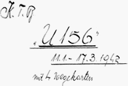
U-156 - 2nd War Patrol
Translation by Jerry Mason with the help of Andi Forster
Departed |
Date |
Arrived |
Date |
Days at Sea |
Lorient |
19 January 1942 |
Lorient |
17 March 1942 |
58 |
| Click the icon to download a KMZ file displaying the U-boat track, significant events and locations for this patrol. You must have Google Earth loaded on your computer to view this file. Download Google Earth here |
Ships Hit |
||||||
Date |
KTB Time |
Position |
Ship |
Tons |
Nationality |
Convoy |
16 Feb 42
|
08.01 |
12°25'N, 69°55'W |
PEDERNALES (damaged)
|
4,317
|
British
|
|
16 Feb 42 |
08.03 |
12°25'N, 69°55'W |
ORANJESTAD |
2,396 |
British |
|
16 Feb 42 |
09.16 - 09.30 |
12°30'N, 70°00'W |
ARKANSAS (damaged) |
6,452 |
American |
|
20 Feb 42 |
11.31- 12.00 |
14°39'N, 62°33'W |
DELPLATA |
5,127 |
American |
|
25 Feb 42 |
02.19 - 06.21 |
17°33'N, 66°57'W |
LA CARRIERE |
5,685 |
British |
|
27 Feb 42 |
10.35 |
19°50'N, 69°40'W |
MACGREGOR |
2,498 |
British |
ON-60 |
28 Feb 42 |
11.17 |
17°33'N, 66°57'W |
OREGON |
7,017 |
American |
|
Total = 33,492 |
||||||
| Note: The positions in the table above and in the Google Earth patrol summary are derived from the KTB and in many cases do not match those set forth in authoritative references such as Jürgen Rohwer, Axis Submarine Successes of World War Two or the Uboat.net website. The goal here is to present the picture relative to the U-boat and not the absolute position that the ship was attacked or sank. | ||||||
 |
|||||
 |
|||||
 |
|||||
| © U-boat Archive 2023 - all rights reserved | |||||
 |
Click the flag to view the above page from the original German KTB |
- 1 - |
|||||||||||||||||
| |
|||||||||||||||||
| |
|||||||||||||||||
|
|||||||||||||||||
| Beginning: 11 January 1942. | |||||||||||||||||
| Ending: 17 March 1942. | |||||||||||||||||
| Kommandant: | Kapitänleutnant Hartenstein. | ||||||||||||||||
:
|
|||||||||||||||||
| Produced 25.03.42 2.Ufl. 5x | |||||||||||||||||
| created | |||||||||||||||||
| |
|||||||||||||||||
|
- 2 - |
|||||
| 11.01.42 | |||||
| to | Lorient | Upkeep and armament. | |||
| 18.01.42 | |||||
| |
|||||
| 19.01.42 | Lorient | Departed. | |||
| Followed a sperrbrecher to Point L with "U-67" and "U-502". | |||||
| Continued without escort to Rosabella and Cedernwald. | |||||
| 20.00 | BF 6184 | Mission per Operations Order 51: | |||
| WNW 2, Sea 1, Vis. 2-3 nm, hazy | Surprise, simultaneous attack on the traffic directly off the West Indian Islands Aruba and Curacao, Codeword: Neuland. Attack 5 hours before sunrise. | ||||
| To 50°W normal attack instructions, west of 50° only against battleships and aircraft carriers. | |||||
| |
|||||
| 20.01.42 | |||||
| 00.00 | BF 6458 | ||||
| NW 3, Sea 2, Vis. 3-4 nm, overcast | |||||
| 02.03 | Point Tanne | Heading for BF 71. Speed HF. | |||
| 04.00 | BF 5598 | ||||
| NW 3-4, Sea 3, Vis. 3-4, 1/3 overcast | |||||
| 04.10 | BF 5598 | Two white lights bearing 340°T, range 2 nm and 252°T, range 4 nm. Probably fishing vessels. | |||
| 08.00 | BF 5824 | ||||
| NW 4, Sea 3, overcast, mist, Vis. 4-5 nm, WNW-Swell 3 | |||||
| 09.00 | BF 5818 | Morning navigation fix: 46°14'N, 5°16.6'W. | |||
| 09.06 | BF 5818 | Dived to proceed submerged per orders. | |||
| 12.00 | BF 5841 | Day's run: Surfaced = 155.6 nm | |||
| Submerged = 6.2 nm = 161.8 nm. | |||||
| 16.00 | BF 5766 | ||||
| 19.58 | BF 5765 | Surfaced to proceed on the surface. 253°, HF. | |||
| 20.00 | BF 5763 | Evening navigation fix: 46°01'N, 5°48'W. | |||
| WNW 1-2, Sea 1, light overcast, Vis. 8 nm | Corrected ship's position after fix: 6.2 nm, 160°. | ||||
| |
|||||
| 21.01.42 | Bay of Biscay | ||||
| 00.00 | BF 5772 | ||||
| NWbyW 1, Sea 1-2, lightly cloudy, rain showers, Vis. 3-4 nm, dark | |||||
| 04.00 | BF 8112 | ||||
|
Sun and Moon Data 19.01.42 |
| Sun and Moon Data 20.01.42 | |
| Sun and Moon Data 21.01.42 |
- 3 - |
|||||
| continued | |||||
| 21.01.42 | |||||
| 08.00 | BF 7319 | ||||
| SW 1-2, Sea 1, nearly overcast, SW-Swell 2, Vis. 5 nm, light rain | |||||
| 09.00 | BF 7341 | Morning navigation fix: 45°15.6'N | |||
| 9° 01'W. | |||||
| 09.31 | BF 7263 | Dived to proceed submerged. 253°, LF | |||
| 12.00 | BF 7256 | Day's run: Surfaced = 149.2 nm | |||
| Submerged = 35.0 nm = 184.2 nm. | |||||
| 16.00 | BF 7254 | ||||
| S 5, Sea 4, nearly overcast, S-Swell 2, Vis, 10 nm | |||||
| 20.00 | BF 7248 lower edge | ||||
| 20.13 | BF 7248 | Surfaced to proceed on the surface. | |||
| S 1, Sea 1, cross Swell, overcast, Vis. 8 nm | |||||
| |
|||||
| 22.01.42 | 140 nm Northwest of Finisterre | ||||
| 00.00 | BF 7182 | ||||
| E 1, Sea 0-1, W-Swell 1-2, lightly cloudy, Vis. 6 nm | |||||
| 02.00 | BF 7176 | On course 231° heading for a point 40 nm southeast of Santa Maria (Azores). | |||
| 04.00 | BE 9633 right edge | ||||
| 08.00 | BE 9655 | ||||
| NE 2, Sea 1-2, nearly overcast, NNE-Swell 3, Vis. 3 nm | |||||
| 09.35 | BE 9681 | Morning navigation fix: 44° 4.5'N | |||
| 12° 23.0'W. | |||||
| 12.00 | BE 9912 | Day's run: Surfaced = 144.4 nm | |||
| NNE 2, Sea 2, N-Swell 2, cloudy and overcast, Vis. 14 nm | Submerged = 24.6 nm = 169 nm. | ||||
| Continued on one Diesel 2 x LF (250 RPM). | |||||
| 16.00 | BE 9862 right edge | ||||
| NbyE 3, Sea 2, N-Swell 3, Vis. 12 nm, 5/10 overcast | |||||
| 16.48 | Navigation fix: 43° 22'N, 13° 16'W. | ||||
| 20.00 | BE 9883 | ||||
| N 1, Sea 1, nearly overcast, N-Swell 2, Vis. 8 nm | |||||
| 21.45 | Short Signal: delivered on Coastal Circuit: | ||||
| My position is quadrant BE 98. "U-156". | |||||
| (Was understood and confirmed.) | |||||
| |
|||||
| 23.01.42 | West of Vigo | ||||
| 00.00 | CG 1132 | ||||
| NW 1-2, Sea 1-2, lightly cloudy, NbyW-Swell 2, Vis. 5 nm, dark | |||||
|
Sun and Moon Data 21.01.42 |
| Sun and Moon Data 22.01.42 | |
| Sun and Moon Data 23.01.42 |
- 4 - |
|||||
| continued | |||||
| 23.01.42 | |||||
| 04.00 | CG 1152 | ||||
| NbyW 2-3, Sea 2, overcast, N-Swell 2, Vis. 3 nm | |||||
| 08.00 | CG 1172 | ||||
| NNW 1, Sea 1, partial overcast, Vis. 4 nm | |||||
| 09.57 | CF 3396 | Crash dive for training. | |||
| 10.06 | Surfaced. Continued transit. Switched to Ireland Circuit. | ||||
| 12.00 | CF 339x [probably CF 3397] | Day's run: Surfaced = 160.1 nm | |||
| Submerged = 0.4 nm = 160.5 nm. | |||||
| 15.15 | CF 3628 | Noon Latitude 41° 45.9N | |||
| 16.00 | CF 3627 | Navigation fix: 41° 43'N | |||
| WNW 2-3, Sea 2, NW-Swell 3, Vis. 12 nm, overcast | 15 °50'W. | ||||
| 20.00 | CF 3569 right edge | ||||
| W 1, Sea 1, nearly overcast, Vis. 8 nm, WNW-Swell 2 | |||||
| |
|||||
| 24.01.42 | |||||
| 00.00 | CF 3589 | ||||
| W 1-2, Sea 1-2, lightly cloudy, Vis. 6 nm, bright moon | |||||
| 04.00 | CF 3818 | ||||
| WNW 2-3, Sea 3, WNW-Swell 3, Vis. 5 nm, lightly cloudy | |||||
| 08.00 | CF 3768 | ||||
| W 2, Sea 3, partial overcast | |||||
| 12.00 | CF 3787 | Day's run: 171.5 nm. | |||
| W 3, Sea 3, nearly overcast, Vis. 12 nm, WNW-Swell 3 | |||||
| 16.00 | CF 5339 | ||||
| WbyN 3, Sea 2, overcast, Vis. 12 nm, WNW-Swell 3 | |||||
| 19.05 | CF 5356 lower edge | Crash dive for training. | |||
| 19.15 | Surfaced. Continued at economical speed, 1 Diesel 2 x LF. | ||||
| 20.00 | CF 5358 right edge | ||||
| WNW 2, Sea 2, overcast, Vis. 8 nm | |||||
| |
|||||
| 25.01.42 | |||||
| 00.00 | CF 5378 | ||||
| W 2, Sea 2, overcast, Vis. 4 nm, bright night | |||||
| 04.00 | CF 5535 | ||||
| WbyN 3-4, Sea 2, WNW-Swell 3, light haze, Vis. 3 nm | |||||
| 08.00 | CF 5555 | ||||
| W 2, Sea 2, overcast, Vis. 3 nm | |||||
| 12.00 | CF 5575 | Day's run: Surfaced = 160.4 nm | |||
| WbyS 2, Sea 2, WbyN-Swell 2, Vis. 12 nm, overcast | Submerged = 0.6 nm = 161.0 nm. | ||||
|
Sun and Moon Data 23.01.42 |
| Sun and Moon Data 24.01.42 | |
| Sun and Moon Data 25.01.42 |
- 5 - |
|||||
| continued | |||||
| 25.01.42 | |||||
| 16.00 | CF 5734 | ||||
| W 2-3, Sea 2, WNW-Swell 2-3, overcast, Vis. 12 nm | |||||
| 20.00 | CF 5754 | ||||
| SWbyW 1, Sea 1, overcast, Vis. 6 nm, NWbyW-Swell 2 | |||||
| |
|||||
| 26.01.42 | |||||
| 00.00 | CF 5771 | ||||
| WbyS 1, Sea 1, overcast, Vis. 4 nm | |||||
| 04.00 | CF 7323 | ||||
| WSW 1, Sea 2, overcast, dark, Vis. 3 nm | |||||
| 08.00 | CF 7343 | ||||
| SW 1, Sea 1, overcast, Vis. 3 nm, very dark | |||||
| 12.00 | CF 7293 | Day's run: Surfaced 162 nm. | |||
| SW 1, Sea 1, overcast, Vis. 12 nm, W-Swell 2 | |||||
| 12.40 | CF 7292 | Crash dive for training. | |||
| 13.18 | Surfaced. Continued transit. | ||||
| 16.00 | CF 7582 lower-right | ||||
| SW 2, Sea 1-2, W-Swell 2, overcast | |||||
| 16.18 | CF 7522 | Santa Maria in sight bearing 298°T, distance 52 nm. | |||
| 20.00 | CF 7542 | ||||
| SWbyS 1, Sea 1, overcast, Vis. 8 nm, W-Swell 2 | |||||
| 20.20 | CF 7544 | Navigation fix by running fix. | |||
| 22.45 | 35° 59'N | On passing 25° W headed on course 248° on the Great Circle route between Antigua and Guadeloupe (Lesser Antilles), because I suspect there is less traffic here than in the Anegada Passage, therefore with the covert advance, less time required for avoidance and diving maneuvers. | |||
| 25° 00'W | |||||
| |
|||||
| 27.01.42 | |||||
| 00.00 | CE 9683 | ||||
| SSW 1, Sea 1, overcast, Vis. 5 nm | |||||
| 04.00 | CE 9675 | ||||
| SW 2, Sea 1-2, nearly overcast, light haze, Vis. 5 nm | |||||
| 08.00 | CE 9834 | ||||
| 10.10 | CE 9851 | Navigation fix: 35° 22.7'N | |||
| 26° 36'W. | |||||
| 12.00 | CE 9845 | Day's run: Surfaced = 187.8 nm | |||
| Submerged = 2.7 nm = 190.5 nm. | |||||
| Continued transit on 1 Diesel at LF. | |||||
| 16.00 | CE 9768 | Noon fix: 35° 13.9'N | |||
| SbyE 2-3, Sea 2, S-Swell 2, heavily cloudy, Vis. 12 nm | 27° 21.0'W. | ||||
| 19.55 | CE 9785 | Crash dive for training. | |||
| 20.06 | SbyE 2-3, Sea 2, S-Swell 2, cloudy | Surfaced, continued transit. | |||
|
Sun and Moon Data 25.01.42 |
| Sun and Moon Data 26.01.42 | |
| Sun and Moon Data 27.01.42 |
- 6 - |
|||||
| continued | |||||
| 27.01.42 | |||||
| 22.39 | CE 9779 | Incoming radio message: | |||
| "Hartenstein" switch Greenland Circuit on 28 January at 08.00 hours. | |||||
| |
|||||
| 28.01.42 | South of the Azores | ||||
| 00.00 | DG 2311 | ||||
| SE 2, Sea 2, Vis. 6 nm | |||||
| 04.00 | DG 2235 | ||||
| SE 2-3, Sea 2, SSE-Swell 2, Vis. 6 nm | |||||
| 08.00 | DG 2227 | Switched to Greenland Circuit. | |||
| 10.25 | DG 2242 | Morning navigation fix: 34°24.0'N | |||
| 29°25.0'W. | |||||
| 12.00 | DG 2244 | Day's run: Surfaced = 163.04 nm | |||
| SE 2-3, Sea 2-3, Swell 2, Vis. 12 nm, bright | Submerged = 0.96 nm = 164 nm. | ||||
| 16.00 | DG 2167 | ||||
| SE 2, Sea 2-3, Swell 2, Vis. 12 nm, bright | |||||
| 16.11 | DG 2167 | Noon fix: 34° 12.7'N | |||
| 29° 27.0'W. | |||||
| 20.00 | DG 2172 | ||||
| SSE 3, Sea 2-3, SSE-Swell 3, Vis. 12 nm | |||||
| 20.35 | Test dive. | ||||
| 21.05 | DG 2172 | Surfaced. Continued transit on course 245°. | |||
| |
|||||
| 29.01.42 | Central Atlantic | ||||
| 00.00 | DG 2411 | Transit on the Great Circle route is not very successful. The boat is constantly set to the south despite large corrections. | |||
| SSE 2-3, Sea 2, SSE-Swell 2, Vis. 6 nm | |||||
| 04.00 | DG 1653 | ||||
| SSE 2, Sea 1-2, SSE-Swell 2, Vis. 5 nm | |||||
| 08.00 | DG 1658 | ||||
| SSE 2, Sea 1, SSE-Swell 2, Vis 6 nm | |||||
| 12.00 | DG 1595 | Day's run: Surfaced = 142.29 nm | |||
| SSE 1-2, Sea 1, SSE-Swell 1-2, Vis. 12 nm | Submerged = 1.71 nm = 144.0 nm. | ||||
| 16.00 | DG 1822 | ||||
| SSE 1-2, Sea 1-2, SSE-Swell 1-2, Vis. 12 nm | |||||
| 20.00 | DG 1842 | ||||
| SSE 1-2, Sea 1-2, SSE-Swell 2, Vis. 12 nm | |||||
| |
|||||
| 30.01.42 | |||||
| 00.00 | DG 1767 | ||||
| SE 2-3, SSE-Swell 2, Sea 1, Vis. 6 nm | |||||
| 04.00 | DG 1775 | ||||
| SE 2-3, SSE-Swell 2, Sea 2-3, Vis. 5 nm, 2/3 overcast | |||||
|
Sun and Moon Data 27.01.42 |
| Sun and Moon Data 28.01.42 | |
| Sun and Moon Data 29.01.42 | |
| Sun and Moon Data 30.01.42 |
- 7 - |
|||||
| continued | |||||
| 30.01.42 | |||||
| 08.00 | DF 3999 | ||||
| SE 3, Sea 2-3, SSE-Swell 2-3, Vis. 5 nm, overcast | |||||
| 10.30 | DF 6355 | Morning navigation fix: 31° 57.0'N | |||
| 34° 36.0'W. | |||||
| 12.00 | DF 6327 | Day's run: Surfaced = 156 nm. | |||
| SE 3, Sea 3, SSE-Swell 3, Vis. 12 nm, bright | |||||
| 16.00 | DF 6346 | ||||
| SE 3, Sea 3, SSE-Swell 3, Vis. 12 nm, bright | |||||
| 16.34 | Noon Latitude: 31° 41.1'N | ||||
| 19.47 | DF 6268 | ||||
| SE 3, Sea 3, SSE-Swell 3, Vis. 12 nm | Crash dive for training. | ||||
| 20.00 | DF 6268 | ||||
| 20.17 | DF 6268 | Surfaced. Continued transit on the Great Circle route on course 245°. | |||
| SE 3, Sea 2-3, SSE-Swell 3, Vis. 12 nm | |||||
| 22.30 | DF 6291 | Evening navigation fix: 31° 26.0'N, | |||
| SE 3, Sea 2-3, SSE-Swell 3, Vis. 12 nm | 35° 52.0'W. | ||||
| |
|||||
| 31.01.42 | |||||
| 00.00 | DF 6285 | ||||
| SE 2-3, Sea 3, SSE-Swell 3, Vis. 6 nm | |||||
| 06.00 | DF 6513 | ||||
| SE 2-3, Sea 3, SSE-Swell 3, Vis. 6 nm | |||||
| 08.00 | DF 6436 | ||||
| SE 2, Sea 3, SSE-Swell 3, Vis. 6 nm, 1/3 overcast | |||||
| 10.50 | DF 6437 | Morning navigation fix: 30° 52.0'N | |||
| 37° 11.0'W. | |||||
| 12.00 | DF 6453 | Day's run: Surfaced = 140.17 nm | |||
| S 2, Sea 2-3, SSE-Swell 2-3, Vis. 12 nm | Submerged = 1.83 nm = 142 nm. | ||||
| 16.00 | DF 6448 | ||||
| SSW 2, Sea 2-3, SSE-Swell 2-3, Vis. 10 nm, overcast | [hand written] adjacent meridian latitude. | ||||
| 17.00 | DF 6472 | Noon Latitude: 30° 30.2'N | |||
| 20.00 | DF 5696 | ||||
| SSW 2, Sea 3, SSE-Swell 2-3, Vis. 12 nm, overcast | |||||
| |
|||||
| 01.02.42 | |||||
| 00.00 | DF 5931 | ||||
| SSW 2-3, Sea 1-2, Vis. 5 nm, overcast | |||||
| 04.00 | DF 5927 | ||||
| SSW 3, Sea 2, Vis. 5 nm, overcast, rain showers | |||||
| 08.00 | DF 5947 | ||||
| SSW 3, Sea 2-3, Vis. 5 nm, overcast | |||||
|
Sun and Moon Data 30.01.42 |
| Sun and Moon Data 31.01.42 | |
| Sun and Moon Data 01.02.42 |
- 8 - |
|||||
| continued | |||||
| 01.02.42 | |||||
| 10.50 | DF 5892 | Morning navigation fix: 29° 33.0'N | |||
| W 3, Sea 2, Vis. 12 nm, bright, SSW-Swell 2-3 | 39° 35.0'W. | ||||
| 11.30 | DF 5895 | Test dive. | |||
| 11.45 | Surfaced. Continued transit on course 245°. | ||||
| 12.00 | DF 5894 | Day's run: Surfaced = 131.3 nm | |||
| WNW 3, Sea 2, Swell 2, Vis. 12 nm, bright | Submerged = 0.7 nm = 132.0 nm. | ||||
| 16.00 | DF 6473 | ||||
| NNW 2, NW-Swell 3, Sea 2, Vis. 12 nm, bright | |||||
| 20.00 | DF 8221 | ||||
| NNW 2-3, NW-Swell 3, Sea 2-3, Vis. 12 nm | |||||
| 21.00 | DF 8216 | Came to course 242°. | |||
| 23.00 | DF 8163 | Short Signal delivered on Ireland Circuit: | |||
| 29° Latitude - 191 cbm. U-156. | |||||
| Uunderstood by home, but not interpreted. Because the passing report was ordered for 40° W, I believe I have given own location unambiguously. (Quadrant designation would have required an additional group.) | |||||
| 23.30 | DF 8163 | Evening navigation fix: 29° 05.0'N, | |||
| NNW 2-3, NW-Swell 3, Sea 2, Vis. 10 nm, 1/2 overcast | 40° 23.0'W. | ||||
| |
|||||
| 02.02.42 | |||||
| 00.00 | DF 8162 | Short Signal delivered on Norddeich alternate frequency: | |||
| NNW 3, NW-Swell 3, Sea 1-2, Vis. 5 nm | Have reached the prescribed line for delivery of message to control. 191 cbm | ||||
| 04.00 | DF 8182 | U-156. | |||
| NNW 2, Sea 1, lightly cloudy, Vis. 15 nm, NW-Swell 3 | Was not confirmed. | ||||
| 07.10 | Same Short Signal delivered on Ireland Circuit. Copied and confirmed. | ||||
| 08.00 | DF 8178 | ||||
| N 1, Sea 1, lightly cloudy, Vis. 5 nm, NbyW-Swell 4 | |||||
| 11.00 | Morning navigation fix: 28° 22.0'N | ||||
| 41° 34.0'W. | |||||
| 12.00 | DF 7635 | Day's run: Surfaced = 154 nm. | |||
| N 1, Sea 1, lightly overcast, Vis. 10 nm, N-Swell 4 | |||||
| 16.00 | DF 7682 | The gyro compass reads approximately 10° off as a result of failed support and sagging of the gyroscope ball. Error removed by re-torque of the contact screws, exchanging the ball and replacing the supporting fluid. | |||
| NbyE 2, Sea 1, 3/10 overcast, bright, Vis. 12 nm, NbyE-Swell 3 | |||||
| 20.00 | DF 7679 | ||||
| E 1, Sea 1, lightly cloudy, Vis. 12 nm | |||||
| 22.50 | DF 7915 | Evening navigation fix: 27° 35.0'N, | |||
| 42° 42.5'W. | |||||
| |
|||||
|
Sun and Moon Data 01.02.42 |
| Sun and Moon Data 02.02.42 |
- 9 - |
|||||
| 03.02.42 | Central Atlantic | ||||
| 00.00 | DF 7836 | ||||
| ESE 1, Sea 1, lightly cloudy, NbyE-Swell 2-3 | |||||
| 04.00 | DF 7858 | ||||
| ENE 2, Sea 1, cloudy, Vis. 5 nm, bright moonlight | |||||
| 08.00 | DF 7875 | ||||
| EbyS 1, Sea 1, cloudy, Vis. 5 nm, NEbyN-Swell 3 | |||||
| 11.00 | DR 1113 | Morning navigation fix: 26° 31.0'N | |||
| 44° 03.0'W. | |||||
| 11.52 | Crash dive for training. | ||||
| 12.00 | DR 1114 | Day's run: Surfaced = 169.4 nm | |||
| Submerged = 0.6 nm = 170 nm. | |||||
| 12.20 | DR 1114 | Surfaced, continued transit. | |||
| E 1, Sea 1, overcast, Vis. 10 nm, ENE-Swell 2-3 | |||||
| 16.00 | DQ 3337 | ||||
| EbyN 3, Sea 1-2, ENE-Swell 2-3, overcast, Vis. 12 nm, rain showers | |||||
| 20.00 | DQ 3346 | ||||
| EbyN 2, Sea 1, nearly overcast, EbyN-Swell 2, Vis. 12 nm | |||||
| 23.00 | DQ 3288 | Evening navigation fix: 26° 11'N, | |||
| 45° 10'W. | |||||
| |
|||||
| 04.02.42 | |||||
| 00.00 | DQ 3287 | Conducted an analysis of the gyroscope errors; conclusion: irregular gyroscope - error between 1.5 and 9°. As a result, failure of the Great Circle route. | |||
| E 1, Sea 1, partly overcast, Vis. 5 nm | |||||
| 04.00 | DQ 3211 | ||||
| S 2, Sea 1, Vis. 6 nm, nearly overcast | |||||
| 08.00 | DQ 3274 | ||||
| 11.25 | DQ 3423 | Morning navigation fix: 25° 44'N | |||
| 46° 25'W. | |||||
| 12.00 | DO 3422 | Day's run: Surfaced = 141 nm | |||
| SSW 2, Sea 1-2, nearly overcast, Vis. 8 nm | Submerged = 1 nm = 142 nm. | ||||
| 15.00 | Diesel compressor failed. Head and cylinder body for stage 2 and 3 parted. Repair by own means is not possible. | ||||
| 16.00 | DQ 3415 | ||||
| S 2, Sea 2, overcast, Vis. 12 nm, occasional rain | |||||
| 17.00 | Came to course 236°. | ||||
| 18.57 | Radio message received: To Hartenstein, Müller, Rosenstiel. | ||||
| "Neuland 176. Attack areas in accordance with Operations Order Paragraph 10." | |||||
| 20.00 | DQ 2662 | ||||
| SbyW 2, Sea 2, overcast, Vis. 12 nm | |||||
| |
|||||
| 05.02.42 | |||||
| 00.00 | DQ 2681 | ||||
| SbyW 2, Sea 1-2, nearly overcast, Vis. 5 nm, very dark | |||||
|
Sun and Moon Data 03.02.42 |
| Sun and Moon Data 04.02.42 | |
| Sun and Moon Data 05.02.42 |
- 10 - |
|||||
| continued | |||||
| 05.02.42 | |||||
| 00.00 | DQ 2677 | ||||
| SSW 2, Sea 2, overcast | |||||
| 08.00 | DQ 2829 | ||||
| SSW 2-3, Sea 2, overcast, Vis. 5 nm | |||||
| 12.00 | DQ 2848 | Day's run: Surfaced = 141 nm. | |||
| SW 2, Sea 1-2, overcast, Vis. 10 nm | |||||
| 16.00 | DQ 2795 | ||||
| N 3, Sea 2, overcast, Vis. 11 nm | |||||
| 19.58 | DQ 5124 | Dived. | |||
| 20.13 | NbyE 3-4, Sea 2-3, overcast, short Swell, Vis. 10 nm | Surfaced. | |||
| 21.15 | DQ 5142 | Navigation fix: 23° 38'N | |||
| 49° 24'W. | |||||
| Correction 20 nm, 185°. | |||||
| |
|||||
| 06.02.42 | |||||
| 00.00 | DQ 5145 | ||||
| NNE 2-3, Sea 2, overcast, dark | |||||
| 04.00 | DQ 4391 | ||||
| ENE 2, Sea 2, overcast, dust rain | |||||
| 08.00 | DQ 4613 | ||||
| NE 3, Sea 2, overcast, light rain | |||||
| 10.35 | DQ 4617 | Morning navigation fix: 22° 39'N | |||
| 50° 40'W. | |||||
| 12.00 | DQ 4562 | Day's run: Surfaced = 155.1 nm | |||
| Submerged = 0.9 nm = 156 nm. | |||||
| 16.00 | DQ 4581 | ||||
| 20.00 | DQ 4732 | ||||
| NE 4, Sea 3, NNE-Swell 3, overcast, occasional rain, Vis. 8 nm | |
||||
| 07.02.42 | 650 nm Northeast of Guadeloupe | ||||
| 00.00 | DQ 4728 | ||||
| NE 5, Sea 4, overcast, Vis. 8 nm | |||||
| 04.00 | DQ 4747 | ||||
| NE 3, Sea 3, overcast, Vis. 5 nm | |||||
| 08.00 | DP 6997 | ||||
| NE 2, Sea 2, 4/10 overcast, Vis. 5 nm | |||||
| 12.00 | DP 9315 | Day's run: Surfaced = 159 nm. | |||
| NNE 2, Sea 2, lightly cloudy | |||||
| 15.10 | DP 9261 | Navigation fix: 20° 56'N | |||
| 53° 20'W. | |||||
| 16.00 | DP 9256 | ||||
| NNE 2, Sea 2, lightly cloudy, Vis. 12 nm, NbyE-Swell 2 | |||||
| 18.53 - | Crash dive for training. Depth keeping practice including disorders and failures. | ||||
| 20.31 | DP 9257 | ||||
| NNE 2, Sea 1-2, lightly cloudy, Vis. 12 nm | |||||
| 23.55 | DP 9274 | ||||
| Evening navigation fix: 20° 30'N, | |||||
| 54° 03'W. | |||||
| |
|||||
|
Sun and Moon Data 05.02.42 |
| Sun and Moon Data 06.02.42 | |
| Sun and Moon Data 07.02.42 |
- 11 - |
|||||
| 08.02.42 | |||||
| 00.00 | DP 9274 | ||||
| NNE 1, Sea 1, lightly cloudy, Vis. 10 nm | |||||
| 04.00 | DP 9426 | ||||
| NNE 1, Sea 1, partly overcast, Vis. 5 nm, NbyE-Swell 1 | |||||
| 08.00 | DP 9445 | ||||
| NE 1-2, Sea 1, lightly cloudy, Vis. 6 nm, NEbyN-Swell 1 | |||||
| 11.55 | DP 8667 | Morning navigation fix: 19° 45'N | |||
| 55° 13'W. | |||||
| 12.00 | DP 8667 | Day's run: Surfaced = 151.6 nm | |||
| NNE 1, Sea 1, lightly cloudy, Vis. 10 nm | Submerged = 5.4 nm = 157 nm. | ||||
| 16.00 | DP 8667 | ||||
| NNE 1, Sea 1, lightly cloudy, Vis. 12 nm | |||||
| 18.40 | DP 8915 | Dived for steamer bearing 265°T. Steamer course 60°; 5500 GRT, painted olive-gray, cruiser stern, stern artillery, 2 masts, 2 paired loading masts before and aft of the bridge superstructure. No camouflage, topmasts not removed, no flags, no neutral markings, 4 lifeboats swung out. Apparent light zig zagging up to 20° off the general course 60°. Last observed course 80°. | |||
| Not attacked in accordance with Operations Order. | |||||
| 20.46 | DP 8918 | Surfaced. Continued transit. | |||
| NNE 2, Sea 1, lightly cloudy, Vis. 12 nm | |||||
| |
|||||
| 09.02.42 | |||||
| 00.00 | DP 8864 | Evening navigation fix: 18° 57'N, | |||
| NE 1, Sea 1, Vis, 8 nm, lightly cloudy | 56° 02'W. | ||||
| 03.00 | Came to course 244°. | ||||
| 04.00 | DP 8887 | ||||
| E 1, Sea 1, lightly cloudy, Vis. 6 nm | |||||
| 08.00 | EE 2133 | ||||
| E 1, Sea 1, lightly cloudy, Vis. 5 nm | |||||
| 12.00 | EE 2129 | Day's run: Surfaced = 143.2 nm | |||
| E 1, Sea 1, lightly cloudy, Vis. 6 nm | Submerged = 5.8 nm = 149.0 nm. | ||||
| 16.00 | EE 2144 | ||||
| EbyN 1, Sea 1, lightly cloudy, Vis. 12 nm | |||||
| 20.00 | EE 1383 | ||||
| ENE 1-2, Sea 1, 1/10 overcast, Vis. 12 nm | |||||
| 22.06 | Crash dive for training. Exercises for disorders and failures. | ||||
| 23.22 | Surfaced. | ||||
| |
|||||
|
Sun and Moon Data 08.02.42 |
| Sun and Moon Data 09.02.42 |
- 12 - |
|||||
| 10.02.42 | Northwest of Guadeloupe | ||||
| 00.00 | EE 1378 | ||||
| NbyE 3, Sea 1, lightly cloudy, Vis. 8 nm | |||||
| 00.20 | EE 1611 | Evening navigation fix: 17° 37'N, | |||
| 58° 33'W. | |||||
| 02.50 | Came to course 251°. | ||||
| 04.00 | EE 1526 | ||||
| NbyE 2, Sea 1-2, lightly cloudy, Vis. 5 nm | |||||
| 08.00 | EE 1541 | ||||
| ENE 1-2, Sea 1, lightly cloudy, Vis. 6 nm | |||||
| 12.00 | EE 1459 | Morning navigation fix: 17° 05'N | |||
| ENE 3, Sea 1, lightly cloudy, Vis. 8 nm | 59° 49'W. | ||||
| Correction 9.5 nm in 218.8°. | |||||
| Day's run: Surfaced = 162.8 nm | |||||
| Submerged = 3.2 nm = 166.0 nm. | |||||
| 16.00 | EE 1474 | ||||
| NE 2-3, Sea 1, cloudy, Vis. 12 nm | |||||
| 20.00 | ED 3697 | ||||
| NNE 2, Sea 1, lightly cloudy, Vis. 12 nm | |||||
| 21.30 | ED 3922 | Dived for aircraft to the north. Aircraft flies back and forth, probably escort for a steamer. Confirmed by sound bearings moving to the west, to the right and left of the bearing high-speed turbines (destroyer?) heard perfectly. | |||
| Steamer bearing 150°T on course 350°, 5-6000 tons, white-yellow masts, bright yellow funnel with black ring. No flags, no armament identified. Funnel 1-1/2 x bridge, 4 ventilator heads aft of the funnel. The formula: i1i0si1. | |||||
| Apparently Brazilian neutrality markings on the hull. | |||||
| Remained submerged; intention: pass through the Guadeloupe channel at HF in darkness. | |||||
| |
|||||
| 11.02.42 | Guadeloupe Passage | ||||
| 00.31 | ED 3915 | Surfaced. Established ship's position from beacons. Passed through Guadeloupe Passage on the French side. | |||
| NNE 3, Sea 1, cloudy, Vis. 8 nm | |||||
| 04.00 | ED 3852 | ||||
| N 2, Sea 1, Vis. 6 nm, partly overcast | |||||
| 08.00 | ED 3767 | ||||
| NNE 2, Sea 1, lightly overcast, Vis. 6 nm | |||||
| 12.00 | ED 3775 | Day's run: Surfaced = 184.8 nm | |||
| NEbyE 3-4, Sea 2, lightly cloudy, Vis. 8 nm | Submerged = 6.2 nm = 191 nm. | ||||
| Morning navigation fix: 15° 59.1'N | |||||
| 62° 54.8'W. | |||||
| 13.16 | ED 3777 | Dived for steamer bearing 225°T. | |||
| Steamer's course 5. Black hull, white superstructure, yellow masts, black funnel with blue ring, unarmed, no further neutrality markings and name on the bridge are no longer recognizable. 1bisi1i. | |||||
| 15.05 | ED 2999 | Surfaced. Continued transit. | |||
| Note: the "formulas" on this page are the sequence of uprights as set forth in Gröner's Die Handelsflotten der Welt. For the two ships described on this page this is kingpost/mast/kingpost/gap/stack/kingpost/mast and mast/bridge/kingpost/stack/kingpost/mast/kingpost respectively. See the excerpt from Gröner in the Armament note pages in the KTB section. |
|
Sun and Moon Data 10.02.42 |
| Sun and Moon Data 11.02.42 |
- 13 - |
|||||
| continued | |||||
| 11.02.42 | |||||
| 16.00 | ED 5335 | ||||
| ENE 3-4, Sea 2, partly overcast, Vis. 12 nm | |||||
| 20.00 | ED 5328 | ||||
| ENE 3, Sea 2, partly overcast, Vis. 12 nm | |||||
| 23.10 | ED 5341 | Steamer in sight bearing 228°T, course 330°, avoided to the south on the surface. | |||
| |
|||||
| 12.02.42 | Caribbean Sea | ||||
| 00.00 | ED 5265 | ||||
| ENE 3, Sea 1-2, nearly overcast, Vis. 10 nm | |||||
| 01.00 | ED 5267 | Evening navigation fix: 15° 17.6'N, | |||
| 64° 08.2'W. | |||||
| 04.00 | ED 5282 | ||||
| ENE 3, Sea 1-2, partly overcast, Vis. 5 nm | |||||
| 04.45 | ED 5284 | White light bearing 335°T, steamer on course 80°. | |||
| 08.00 | ED 5433 | ||||
| ENE 2, Sea 1, lightly cloudy, Vis. 5 nm | |||||
| 12.00 | ED 5419 | Day's run: Surfaced = 153.7 nm | |||
| EbyN 3, Sea 2, cloudy, Vis. 6 nm | Submerged = 13.3 nm = 167 nm. | ||||
| 12.20 | Morning navigation fix: 14° 38.5'N | ||||
| 65° 35.8'W. | |||||
| 16.00 | ED 4665 | ||||
| ENE 4, Sea 2, lightly cloudy, Vis. 12 nm | |||||
| 20.00 | ED 4679 | ||||
| ENE 3, Sea 2, cloudy, Vis. 12 nm | |||||
| |
|||||
| 13.02.42 | |||||
| 00.00 | ED 4834 | ||||
| ENE 2, Sea 1, cloudy, Vis. 10 nm | |||||
| 01.00 | ED 4828 | Evening navigation fix: 13° 55'N, | |||
| 67° 09'W. | |||||
| 0240 | |||||
Note: the bottom of page 13 (covering the remainder of 13 February) is missing
|
Sun and Moon Data 11.02.42 |
| Sun and Moon Data 12.02.42 | |
| Sun and Moon Data 13.02.42 |
- 14 - |
|||||
| 14.02.42 | Caribbean Sea | ||||
| 00.00 | EC 9348 | ||||
| 01.16 | EC 9347 | Surfaced. Headed for the southeast point of Aruba. Seroe Colorado (Aruba) lighthouse in sight. | |||
| EbyN 5, Sea 4, partly overcast, Vis. 6 nm | |||||
| 04.00 | EC 9289 | ||||
| ENE 4, Sea 3, partly overcast, Vis. 4 nm | |||||
| 05.30 | Colorado-lighthouse abeam 1 nm to starboard, on course 270°. | ||||
| Ran 1 nm off the coast of Nicolas harbor, passed the port entrance 900 meters distant at low speed, explored harbor facilities. In the harbour 4 big tankers, in the roadstead 3 small tankers. Works brightly-illuminated. Arrivals and departures even at night. | |||||
| 06.00 | Ran northwest at LF off shore towards Oranjustad. | ||||
| 06.40 | Off Oranjustad | Off harbor entrance. The habor is not very busy. | |||
| 06.47 | Hooiberg 331°, 5.5 nm | Evaded a guard vessel. | |||
| At 07.00 hours positioned off Oranjustad. The pier is empty. | |||||
| 07.30 | Northwest Point 30°, 3 nm | Departed on westerly course exploring the shipping lanes. | |||
| 08.19 | ENE 4, Sea 3, heavily cloudy, Vis. 5 nm | Steamer in sight bearing 290°T on course 280°. Came to course 105°, headed for Oranjustad. | |||
| 09.30 | Northwest Point 80°, 17 nm | ||||
| 12.00 | Northwest point 52°, 5 nm | Day's run: Surfaced = 112 nm | |||
| ENE 5, Sea 4, partly overcast, Vis. 8 nm | Submerged = 21 nm = 133 nm. | ||||
| 12.21 | Getting light | Dived to observe entrance to Oranjustad, light traffic. | |||
| 12.48 | Northwest Point 44.5°, 4.4 nm | Remained submerged until darkness. | |||
| 23.00 | Tanker in sight bearing 170°T on course 250°, outbound from Nicolas harbour. From the airport 2-4 2-motored aircraft. Lively air traffic through the early morning. | ||||
| |
|||||
| 15.02.42 | Off Aruba | ||||
| 01.50 | Colorado 101°, 11 nm | Surfaced. On course 170° on the shipping route from Maracaibo-Nicholas Harbour. | |||
| ENE 5 nm, Sea 4, nearly overcast, Vis. 6 nm | |||||
| 02.30 | Colorado 90°, 12 nm | Attack on tanker for training. Departed on easterly course. | |||
| 10.00 | Headed for Nicholas Harbor. | ||||
| 12.00 | ENE 5, Sea 4, nearly overcast, Vis. 10 nm | Day's run: Surfaced = 27 nm | |||
| Submerged = 11 nm = 38 nm. | |||||
|
Sun and Moon Data 14.02.42 |
| Sun and Moon Data 15.02.42 |
- 15 - |
||||||||
| continued | ||||||||
| 15.05.42 | ||||||||
| 12.20 | Colorado 32°, 3 nm | Dived to observe the entrance to Nicholas Harbor. Brisk traffic. Harbor is well occupied. Afterwards set off to the west. | ||||||
| 12.40 | Officer-Only radio message received: To Neuland boats: | |||||||
| 1.) Primary task is attack on shipping. | ||||||||
| 2.) After such attacks have been carried out, artillery may be used against land targets from the morning of Neuland day, if there are any favorable opportunities. | ||||||||
| 3.) If no shipping targets are encountered, artillery may be used against land targets from the evening of Neuland day. | ||||||||
| 16.00 | Hooiberg 54°, 9 nm | |||||||
| 18.55 | Hooiberg 72°, 22.5 nm | Surfaced. Proceeding on westerly course. | ||||||
| E 5, Sea 4, lightly cloudy, Vis. 12 nm | ||||||||
| 20.00 | Hooiberg 69°, 27 nm | Came about. Heading for the NW-edge of Aruba at slow speed. | ||||||
| E 5, Sea 4, lightly cloudy, Vis. 12 nm | Modern passenger-freighter 7000 GRT in sight. Making for Nicolas Harbor or Willemstad on course 120°. Evaded several yachtsmen. | |||||||
| |
||||||||
| 16.02.42 | ||||||||
| 00.00 | Hooiberg 72°, 21 nm | |||||||
| EbyN 5, Sea 4, lightly cloudy, Vis. 6 nm | ||||||||
| 04.00 | Hooiberg 82°, 9 nm | |||||||
| 05.00 | " 92°, 7 nm | Heading for Oranjustad on easterly course. | ||||||
| 06.14 | Off Oranjustad. An illuminated tanker is loading. Proceeding to Nicolas Harbour. | |||||||
| 07.35 | Off Nicolas Harbour. Approached 2 anchored tankers at LF. | |||||||
| 08.01 | Colorado 65°, 2 nm | |||||||
| Surface attack - Bow shot on tanker. | ||||||||
|
||||||||
| 08.03 | Surface attack - Bow shot on tanker. | |||||||
|
||||||||
| Came to 300° for artillery attack on refinery and tanks. | ||||||||
| 08.08 | Artillery clear. | |||||||
| 08.11 | Opened fire on land targets. | |||||||
| 08.12 | 10.5: 1st shot barrel burst. 2 seriously injured. 3.7: 16 shots. Shots are not very well-placed at the target, because there is no night sight lighting. | |||||||
|
Sun and Moon Data 15.02.42 |
| Sun and Moon Data 16.02.42 |
- 16 - |
|||||
| continued | |||||
| 16.02.42 | A single short tongue of flame observed on land. Fire discontinued because of slight effect. | ||||
| Headed for Oranjustad at GF. | |||||
| 08.50 | Guard vessel on course Oranjustad-Nicholas Harbour passes 400 meters abeam. Searches with weak searchlight. Turned away. | ||||
| Searchlights also from land. | |||||
| Colorado 99°, 9 nm | |||||
| 08.59 | Proceeding to Oranjustad | ||||
| 09.00 | Matr.Gefr. Büßinger succumbed to his injuries. The II Watch Officer's foot is off. The bleeding has stopped.. | ||||
| 09.16 | Off Oranjustad. Attempt on the tanker at the pier. | ||||
| Surfaced bow shot on tanker. Course at the shot 54°, no detonation, Eto, depth 3 meters, torpedo speed 30 knots, range 600 meters. Reason for failure is uncertain. | |||||
| New approach. | |||||
| 09.30 | Surfaced bow shot on tanker, course at the shot 29°, no detonation, Eto, depth 3 meters, torpedo speed 30 knots, range 600 meters. Reason for failure is uncertain. | ||||
| Came about for stern shot. | |||||
| 09.43 | Surfaced stern shot on tanker, course at the shot 190°, miss, after 1 minute 29.5 detonation on the beach. | ||||
| 09.46 | Crash dive for aircraft, halted. | ||||
| Alarm recanted. Did not dive. Departed to the north to operate by day north of the island against Mona Passage-traffic. | |||||
| Probably none of the big tankers will depart today. It appears advantageous to me to operate on newcomers today. | |||||
| 12.00 | EC 9218 | Day's run: Surfaced = 85 nm | |||
| E 5, Sea 5, lightly cloudy, Vis. 6 nm, E-Swell 3 | Submerged = 28 nm = 113 nm. | ||||
| 12.28 | Radio message delivered: Defence only floodlights, aircraft and a guard vessel. Sank 2 tankers of 3800 tons, 2 misses against tanker at pier. Barrel burst, 2 men serious casualties, including the 2nd Watch Officer. May I call at Martinique to put ashore? 159 cbm. | ||||
| from Hartenstein. | |||||
| (Another boat repeats, Control understood.) | |||||
| 16.00 | EC 9222 | From 12.47 hours on course 60° to a holding position off Martinique. At the same time, off Aruba and Curacao to the north, important shipping lanes searched. Nothing sighted. | |||
| EbyN 4, Sea 3, nearly cloudless, Vis. 12 nm, E-Swell 3-4 | |||||
| 20.00 | EC 6895 | ||||
| EbyN 6, Sea 5, partly overcast, Vis. 12 nm | |||||
| |
|||||
|
Sun and Moon Data 16.02.42 |
- 17 - |
|||||
| 17.02.42 | North of Aruba | ||||
| 00.00 | EC 6972 | ||||
| E 4, Sea 4, nearly overcast, Vis. 6 nm | |||||
| 01.00 | EC 6957 | Evening navigation fix: 13° 25'N 68° 57.2'W | |||
| Funeral service for Mtr.Gefr. Büßinger | |||||
| 03.05 | Radio message received: To Hartenstein. | ||||
| Question concerning delivery of wounded is being looked into. | |||||
| 04.00 | EC 6955 | ||||
| E 4, Sea 4, overcast, rain, Vis. 3 nm | |||||
| 07.20 | Radio message received: To Hartenstein. | ||||
| Head for suggested island. Delivery of wounded approved. Announce when nearby. | |||||
| 08.00 | EC 6958 | ||||
| E 6, Sea 5, nearly overcast, Vis. 4 nm | |||||
| 12.00 | ED 4714 | Day's run: Surfaced 112 nm. | |||
| EbyS 4, Sea 4, cloudy, Vis. 6 nm | |||||
| 12.30 | ED 4714 | Morning navigation fix: 13° 57.5'N 68° 23.5W. | |||
| 13.35 | Test dive. | ||||
| 15.14 | EbyS 4, Sea 3, lightly cloudy, Vis. 12 nm | Surfaced. Continued transit. It is laborious to gain ground against the trade wind. Short steep seas. Struck out on course 60° (20° deviation to the north) after experience during transit trade wind limit lies at 15° N. Detour of 30 nm appears worth it. | |||
| |
|||||
| 18.02.42 | |||||
| 00.00 | ED 4545 | Due to cross sea from 80-120 high fuel consumption. | |||
| 01.50 | ESE 4, Sea 3, lightly cloudy, Vis. 5 nm | Radio message delivered: | |||
| 1.) Air surveillance off Antigua. Heavy independent traffic BB middle and upper-right, usually radiating from Trinidad. | |||||
| 2.) In the operations area lighthouses are extinguished except for Colorado and harbour beacons. Refinery workings were lit up brightly. In the main harbour always 2-4 big tankers. Outbound traffic mostly west north-west, also to the north. Small tankers run in accordance with Gröner loaded at 4 meters draft. Confirmed by hit. The best reception midnight till eight o'clock. | |||||
| 3.) Matr.Gefr. Büßinger died. II. W.O. foot is off. Bleeding stopped. | |||||
| 4.) Heading for Fort de France. 150 cbm. Position BB 94. | |||||
| from Hartenstein. | |||||
| (Was not understood). | |||||
| 04.00 | ED 4528 | ||||
| ENE 4, Sea 3, partly overcast, light rain, Vis. 4 nm | |||||
| 08.00 | ED 4532 | ||||
| ESE 3-4, Sea 3, nearly overcast, Vis. 14 nm | |||||
|
Sun and Moon Data 17.02.42 |
| Sun and Moon Data 18.02.42 |
- 18 - |
|||||
| continued | |||||
| 18.02.42 | |||||
| 12.00 | ED 4375 | Day's run: Surfaced = 89 nm | |||
| EbyN 5-6, Sea 5, nearly overcast, Vis. 6 nm | Submerged = 2 nm = 91 nm. | ||||
| 14.00 | ED 4529 | Morning navigation fix: 14° 42'N | |||
| 67° 04'W. | |||||
| 16.00 | E 5, Sea 5, cloudy and overcast, Vis. 12 nm | ||||
| 18.45 | Came to course 100°. The detour was worth it. Wind in the north, a good wind strength, more calm. | ||||
| 20.00 | ED 4367 | ||||
| EbyS 3-4, Sea 3, partly overcast, Vis. 12 nm | |||||
| |
|||||
| 19.02.42 | |||||
| 00.00 | ED 5147 | Radio message delivered: | |||
| EbyN 3, Sea 5, lightly cloudy, Vis, 10 nm | 1.) Air surveillance off Antigua. Heavy independent traffic Bruno Bruno middle and upper-right, usually radiating from Trinidad. | ||||
| 2.) In the main harbour always two to four big tankers. Outbound traffic mostly west north-west, also to the north. Small tankers run in accordance with Gröner loaded at 4 meters draft. Confirmed by hit. Shelling shore installations with three seven only little effect. The best reception midnight till eight o'clock. | |||||
| 3.) Heading for Fort de France. 147 cbm. Position Bruno Bruno 93. Heavy trade winds. | |||||
| 4.) Matr.Gefr. Büßinger died. II. W.O. foot off. Bleeding stopped. | |||||
| from Hartenstein. | |||||
| 01.00 | ED 5172 | Evening navigation fix: 15° 14.5'N, | |||
| 65° 36.2'W. | |||||
| 04.00 | ED 5185 | ||||
| EbyN 5, Sea 5, cloudy, Vis. 4 nm | |||||
| 08.00 | ED 5198 | ||||
| EbyN 5, Sea 4, lightly cloudy, Vis 4 nm | |||||
| 12.00 | ED 5278 | Day's run: Surfaced = 172 nm. | |||
| E 5, Sea 5, lightly cloudy, | |||||
| Vis. 6 nm | |||||
| 12.15 | ED 5512 upper edge | Morning navigation fix: 14° 57.8'N | |||
| 64° 42.3'W. | |||||
| 13.00 | ED 5513 | Crash dive for training. | |||
| 13.44 | Surfaced. Continued transit to Martinique | ||||
| 16.00 | ED 5522 | ||||
| E 5, Sea 5, lightly cloudy, Vis. 12 nm | |||||
| 16.35 | ED 5523 | Steamer in sight bearing 55°T. Steamer course 150°. Turned away to the south and maneuvered ahead. | |||
| 18.35 | ED 5535 | Dived. To action stations. | |||
| Freighter. 3500 GRT, not loaded, painted olive-grey, no flags, no neutral markings, black cap on funnel, grey ring, white stern, 4 hatches, 1 coal hatch, 2 ventilator heads before the funnel. | |||||
|
Sun and Moon Data 18.02.42 |
| Sun and Moon Data 19.02.42 |
- 19 - |
||||||||
| continued | ||||||||
| 19.02.42 | ||||||||
| 18.35 | Submerged stern shot on freighter. | |||||||
|
||||||||
| Probably under ran. | ||||||||
| Submerged stern shot on freighter. | ||||||||
|
||||||||
| This is now the 3rd missed shot after the first 2 torpedoes hit. The steamer, according to draft, could only be had with a surface runner. Besides, nobody can say with certainty T.V.A. and T.V (Torpedo Experimental Establishment) how deep the torpedo actually runs. | ||||||||
| 20.47 | KD 5539 | Surfaced. Continued transit on course 91° on 1 Diesel at HF. | ||||||
| E 4, Sea 4, lightly cloudy, Vis. 5 nm | ||||||||
| 21.45 | Radio message received: To Hartenstein. | |||||||
| After delivery of wounded, free to maneuver. Operations off area naval quadrant ED 11 and EN 76 and 84 might be favorable. | ||||||||
| 22.10 | Radio message received (Officer-Only) | |||||||
| To Neuland boats: | ||||||||
| USA-ships have received the following instructions: | ||||||||
| 1.) Do not enter or depart from important Caribbean harbours, except during the day. | ||||||||
| 2.) Ships in the Caribbean Sea are instructed to proceed completely darkened. | ||||||||
| |
||||||||
| 20.02.42 | West of Martinique | |||||||
| 00.00 | ED 5619 | |||||||
| E 4, Sea 3-4, lightly cloudy, Vis. 10 nm | ||||||||
| 00.45 | ED 5651 | |||||||
| 04.00 | ED 5653 | Evening navigation fix: 14° 40'N, 63° 41'W | ||||||
| EbyN 3-4, Sea 3, Vis. 5 nm, clear | ||||||||
| 08.00 | ED 6441 | |||||||
| EbyN 4, Sea 3, lightly cloudy, Vis. 4 nm | ||||||||
| 11.31 | ED 6452 | Steamer in sight bearing 170°T, 4000 GRT on course 300°, 4 nm distant, turned to starboard and initiated the attack. | ||||||
| Beginning of dawn | Submerged bowshot on freighter. | |||||||
|
||||||||
| Steamer stopped, fires with stern cannon. Well placed in azimuth, however, short. It is already too light for a surfaced attack. | ||||||||
|
Sun and Moon Data 19.02.42 |
| Sun and Moon Data 20.02.42 |
- 20 - |
||||||||
| continued | ||||||||
| 20.02.42 | ||||||||
| 11.54 | Crash dive for another attack, the steamer does not sink | |||||||
| 12.00 | ED 6453 | Submerged bow shot on freighter. | ||||||
| Day's run: Surfaced = 128.8 nm |
|
|||||||
| Submerged = 7.8 nm | Submerged bow shot on freighter. | |||||||
| = 136.0 nm. |
|
|||||||
| Submerged bow shot on freighter. | ||||||||
|
||||||||
| Submerged stern shot on freighter. | ||||||||
|
||||||||
| Flying boat with steamer. 4 aircraft bombs a great distance off. The steamer occasionally shoots at the periscope, also to the wrong side. | ||||||||
| Continued transit on course 90°. | ||||||||
| 15.49 | EbyN 4, Sea 3, lightly cloudy, Vis. 12 nm | Surfaced. | ||||||
| 15.54 | ED 6451 | Crash dive for approaching flying boat bearing 260°T, continued transit at 40 meters. | ||||||
| 18.00 | Surfaced. | |||||||
| 18.16 | ED 6462 | Crash dive for flying boat bearing 240°T on parallel course. | ||||||
| 21.48 | Surfaced. Continued transit to Fort de France. | |||||||
| 21.51 | ED 6541 | Steamer sighted bearing 90°T, on course 160°, 10 knots, maneuvered ahead. | ||||||
| 22.15 | ED 6517 | Crash dive for flying boat bearing 145°T. [illegible word] approach. This fellow is apparently not easily lost. Continued transit submerged until darkness. | ||||||
| |
||||||||
| 21.02.42 | ||||||||
| 00.00 | ED 6518 | A makeshift chart of Fort de France is produced from the sea handbook, because no coastal chart is aboard. | ||||||
| 01.55 | ED 6519 | Surfaced. Continued transit at HF on course 96°. | ||||||
| E 3-4, Sea 3, lightly cloudy, Vis. 5 nm | Lights of Martinique are in sight directly ahead, bow tubes, 3.7 cm S.K. and 2 cm flak are made ready, because I am not completely sure of the attitude of the Vichy French Colonial authorities. | |||||||
|
Sun and Moon Data 20.02.42 |
| Sun and Moon Data 21.02.42 |
- 21 - |
|||||
| continued | |||||
| 21.02.42 | (Tower coats of arms and radar detection device are removed for secrecy reasons.) | ||||
| Bright moonlit night | |||||
| 03.00 | Headed for Fort de France. | Headed for Fot de France. Beacons is extinguished, buoys apparently removed. Off the entrance set navigation lights, war flag flown from the periscope. | |||
| At the request of the signal facility delivered: | |||||
| "Vaisseau Allemand". | |||||
| "Envoyet un bateau pour uns blesse, s'il vous plait"." | |||||
| ["German vessel". "Send a boat for a casualty, please".] | |||||
| Negotiate in vain with guard vessel coming out (communication problems). | |||||
| He promises to send a boat, however does not. | |||||
| 04.35 | Warship's dinghy with French officers and doctor comes alongside. Very obliging. Hand over II W.O. | ||||
| At the request of the French navigation lights are extinguished (apparently to avoid a sensation). | |||||
| 04.50 | Departed to the west. Intention: First operate on shipping route Trinidad-Anegada Passage. Afterwards shifting to the west on the Trinidad-Mona route. Intend to reload torpedoes during the next night, if necessary under the lee of Guadeloupe. | ||||
| 06.35 | Radio message delivered: From U-156: | ||||
| Delivery went smoothly. The day before yesterday CM 55 empty freighter 2 faulty Etos. Sound firing data. Depth 3 and 2 meters. Yesterday JK 65 2 hits. 3 misses against a stationary freighter 4000 GRT. Sinking not observed because of flying boat. Going to Vienna. 140 cbm. 2 + 4 Torpedoes. | |||||
| 06.40 | ED 6562 | Steamer in sight bearing 180°T on course 300°. Small coastal freighter about 800-1000 tons, bridge at the rear, funnel at the stern. No mast. Allowed to pass because draft is too shallow for a torpedo and 10.5 cm still out of service, 3.7 cm night sight illumination (with onboard means) not yet constructed. | |||
| 08.00 | ED 6564 | ||||
| E 2, Sea 2, lightly cloudy, Vis. 4 nm, E-Swell 2 | |||||
| 10.00 | Proceeding on 1 Diesel at LF on course 340°. | ||||
| 12.00 | ED 6515 | Morning navigation fix: 14° 49.2'N | |||
| E 2, Sea 1, clear sky, Vis. 8 nm | 62° 06'W. | ||||
| Day's run: Surfaced = 126.5 nm | |||||
| Submerged = 37.5 nm = 158 nm. | |||||
| 12.40 | ED 6512 | Crash dive for approaching flying boat bearing 140°T. | |||
| West of Martinique | |||||
| 13.30 | Surfaced. Continued transit on course 340°. | ||||
| 16.00 | ED 6274 | ||||
| EbyN 3, Sea 1-2, Vis. 12 nm | |||||
| 20.00 | ED 6163 | ||||
| E 2, Sea 1, clear sky, Vis. 12 nm | |||||
| |
|||||
|
Sun and Moon Data 21.02.42 |
- 22 - |
|||||
| 22.02.42 | West of Guadeloupe | ||||
| 00.00 | ED 3797 | ||||
| EbyS 1, Sea 1, lightly cloudy, Vis. 8 nm | |||||
| 00.53 | ED 3774 | Came to course 270° for operations on the route Trinidad-Mona Passage. | |||
| 02.00 | 4 Atos loaded from above deck, 2 hours 40 minutes from the beginning of arrangements until 4 Atos were below deck. | ||||
| 04.00 | ED 3776 | Removed about 38 cm of the wrecked barrel of the 10.5 cm with a steel saw. | |||
| EbyS 1, Sea 1, scattered clouds, Vis. 5 nm | |||||
| 08.00 | ED 2995 | ||||
| EbyS 2, Sea 1, lightly cloudy, Vis. 5 nm | |||||
| 12.00 | ED 2975 | Day's run: Surfaced = 154.2 nm | |||
| ESE 2, Sea 1, lightly cloudy, Vis. 6 nm | Submerged = 2.8 nm = 157 nm. | ||||
| 12.10 | ED 2974 | Morning navigation fix: 16° 01'N | |||
| 63° 56.3'W. | |||||
| 12.21 | ED 2974 | Test dive. | |||
| 12.52 | Surfaced. Continued transit on 1 Diesel at LF on course 270°. | ||||
| 16.00 | ED 2886 | ||||
| ESE 3, Sea 2-3, cloudy, Vis. 12 nm | |||||
| 20.00 | ED 2874 | ||||
| ESE 2-3, Sea 1-2, cloudy, Vis. 12 nm | |||||
| 23.30 | Cannon fired. Result: cannon appears to be useful. Rifling unaltered. Recoil from the firing table - moderate. Heavy overbalance of the breech end (approximately 40 kgs). Therefore, very difficult to aim. | ||||
| |
|||||
| 23.02.42 | South of Puerto Rico | ||||
| 00.00 | ED 2785 | ||||
| ESE 1-2, Sea 1, lightly cloudy, Vis. 10 nm | |||||
| 01.00 | ED 2776 | Evening navigation fix: 16° 02.3'N, | |||
| 65° 29'W. | |||||
| 04.00 | ED 1996 | ||||
| ESE 1, Sea 1, partly overcast, Vis. 4 nm | |||||
| 08.00 | ED 1958 | ||||
| E 1, Sea 1, cloudy, Vis. 4 nm | |||||
| 12.00 | ED 1916 | Day's run: Surfaced = 164.7 nm | |||
| EbyN 1, Sea 1, lightly cloudy, Vis. 6 nm | Submerged = 1.3 nm = 166 nm. | ||||
| 12.20 | ED 1916 | Morning navigation fix. | |||
| Came to course 315°. | |||||
| 14.17 | ED 1675 | Crash dive for approaching aircraft bearing 20°T. | |||
| 14.45 | Surfaced. | ||||
| 14.56 | ED 1675 | Crash dive for aircraft bearing 80°T. Parallel course. | |||
| 15.30 | EbyN 1, Sea 1, cloudy, Vis. 12 nm | Surfaced | |||
| 20.00 | ED 1564 | ||||
| EbyN 1, Sea 1, cloudy and overcast, Vis. 12 nm | |||||
|
Sun and Moon Data 22.02.42 |
| Sun and Moon Data 23.02.42 |
- 23 - |
||||||||
| continued | ||||||||
| 23.02.42 | ||||||||
| 23.30 | ED 1524 | A steamer in sight bearing 35°T on course 120°. Steamer zig zags heavily. Aircraft escort. | ||||||
| Came to opposite course, maneuvered ahead. | ||||||||
| |
||||||||
| 24.02.42 | ||||||||
| 00.00 | ED 1527 | |||||||
| E 2, Sea 2, partly overcast, Vis. 8 nm | ||||||||
| 00.10 | ED 1527 | Crash dive for escorting aircraft. | ||||||
| 00.25 | Surfaced. Again forced to submerge. | |||||||
| 01.30 | Continued to maneuver ahead on the surface. Steamer runs at high speed (12 knots), zigzags 50°, sometimes on opposite course. | |||||||
| 05.00 | ED 1619 | |||||||
| 06.30 | ED 1675 | |||||||
| 07.00 | EbyS 2, Sea 2, cloudy, Vis. 5 nm | After moonset approached repeatedly. Steamer outmaneuvers every time, it is believed that the boat was detected with listening gear. | ||||||
| Settled in the wake, to take a propeller shot. | ||||||||
| Surfaced - bowshot on steamer target angle | ||||||||
|
||||||||
| Attack broken off, proceeding on course 300°, for Mona. | ||||||||
| 12.00 | ED 1555 | Day's run: Surfaced = 220.4 nm | ||||||
| SE 2, Sea 1-2, lightly cloudy, Vis. 6 nm | Submerged = 6.6 nm = 227.0 nm. | |||||||
| 12.20 | ED 1551 | |||||||
| 16.00 | ED 1512 | |||||||
| SE 2-3, Sea 2, Vis. 12 nm | ||||||||
| 17.34 | ED 1274 | Crash dive for aircraft bearing 330°T. | ||||||
| 18.00 | Surfaced. Continued transit. | |||||||
| 18.19 | ED 1274 | Two tankers bearing 310°T stacked one behind the other on a southerly course. The first a shuttle type Aruba, the other a big tanker, estimated 9000 GRT. Slight clipper stem, wide funnel, stern mast directly ahead of the engine room bulkhead. | ||||||
| Speed determined to be 12.5-13 knots as we maneuvered ahead. | ||||||||
| 20.00 | ED 11.99 | Performance of the diesels is very gratifying: Speed setting 2 x GF = 17 knots can be held against Sea 3 and tropical coolant temperatures hour after hour. | ||||||
| SE 3-4, Sea 3, lightly cloudy, Vis. 12 nm | ||||||||
| 22.00 | ED 1541 | |
||||||
|
Sun and Moon Data 23.02.42 |
| Sun and Moon Data 24.02.42 |
- 24 - |
|||||||||
| 25.02.42 | |||||||||
| 00.00 | ED 1584 | ||||||||
| EbyS 2, Sea 2, partly overcast, Vis. 6 nm | |||||||||
| 01.38 | ED 1825 | Dove when ahead of the tanker at target angle 0°, because surface attack is not possible in the bright moonlight. Estimated range at diving 4 nm. Initiated attack. | |||||||
| bright moon | |||||||||
| 02.18 | Submerged-bowshot on tanker. | ||||||||
|
|||||||||
| 02.19 | Submerged-bowshot on tanker. | ||||||||
|
|||||||||
| Subsequently determined the first hit struck amidships. Running time 1 minute 43 seconds. | |||||||||
| Tanker stopped, lights on deck, blew steam off, settles a little deeper . . . . . and after about ten minutes gets underway again, course 350° for Ponce, speed 9 knots. | |||||||||
| 02.50 | News account of 25.02.42: | ||||||||
| "DEL PLATA" sunk in the Caribbean Sea | |||||||||
| Lisbon: The U.S.A. steam freighter "DEL PLATA" (5127 GRT) was sunk last Friday in the eastern part of the Caribbean Sea. This fact only became known, when a warship landed 52 men of the crew of the sunken freighter in a harbour of the Antilles. They were sighted by a of U.S.A. aircraft. The "DEL PLATA " was the property of the Mississippi Steamship Company, New Orleans, and provided service between New Orleans and Buenos Aires. | |||||||||
| [handwritten note] Added to the account 20 February. | |||||||||
| 03.00 | ED 1831 | Surfaced in the wake, eased off to starboard and maneuvered ahead. | |||||||
| E 3, bright moon | |||||||||
| 05.19 | ED 1559 | Dived 4 nm ahead of the tanker. Initiated attack. | |||||||
| Starry night, partly overcast | Submerged bow shot on tanker | ||||||||
|
|||||||||
| Submerged bow shot on tanker | |||||||||
|
|||||||||
| Both missed. After 40 seconds running time fiery glow at the stern: joy is premature. He is shooting with the cannon at the supposed end of the torpedo tracks, turned away hard. | |||||||||
| Surfaced astern of the steamer, began to maneuver ahead. Intend to attack on the surface at moonset. | |||||||||
| 06.21 | ED 1534 | Surface - bow shot on tanker. (last torpedo) | |||||||
|
|||||||||
|
Sun and Moon Data 25.02.42 |
- 25 - |
||||||
| continued | ||||||
| 25.02.42 | ||||||
|
||||||
| Tanker sinks quickly, stern is out of the water, lifeboats are launched. Foredeck sinks away. Tanker goes vertical and sinks 2 minutes after hit. | ||||||
| All torpedoes expended. | ||||||
| Lights of Puerto Rico in sight. | ||||||
| Continued transit to Mona. | ||||||
| 11.30 | ED 1271 | Mona in sight, came to course 355°. | ||||
| 12.00 | Mona Island 274°, 16.3 nm | Day's run: Surfaced = 227.4 nm | ||||
| SE 3, Sea 2, cloudy, Vis. 5 nm | Submerged = 5.6 nm = 233 nm. | |||||
| 14.21 | ED 1139 | Dived for Motor freighter, 2000 GRT, aircraft escort, bearing 25°T on course SSW. | ||||
| Remained submerged for the rest of the day due to continuous air traffic (apparently on the Havana-San Juan Puerto Rico route) and proximity to land. | ||||||
| |
||||||
| 26.02.42 | ||||||
| 00.00 | DO 7879 | |||||
| 00.55 | Point Borinquen 128°, 1 nm | Back and forth in the north part of the Mona Passage. | ||||
| S 2-3, Sea 1, clear, Vis. 6 nm | ||||||
| 04.00 | S 2, Sea 1, lightly cloudy, Vis. 4 nm | |||||
| 07.00 | Eliminated after heaviness of the 10.5-cm barrel by unscrewing and welding 2 trim weights. Manufactured night sight lighting for 3.7 SK with on board means. | |||||
| Came to northerly course. | ||||||
| 07.22 | Point Borinquen 94°, 19 nm | |||||
| 12.00 | DO 7844 | Day's run: Surfaced = 77 nm | ||||
| NNE 3, Sea 2, overcast, light rain, Vis. 5 nm, N-Swell 3 | Submerged = 24 nm = 101 nm. | |||||
| 13.00 | Fired 10.5 cm. Cannon is ready for action. | |||||
| 13.17 | DO 7817 | Aircraft in the northeast, course NNW. Remained on the surface. | ||||
| 14.13 | DO 7763 | Intend to search tonight off Puerto Rico the roadsteads of Aguadilla and Arecibo, as well as the coastal route to the north of Puerto Rico to San Juan for the use of artillery. | ||||
| Suppose traffic on both roadsteads, because of the railway lines on the chart. | ||||||
| 14.58 | DO 7841 | Crash dive for aircraft bearing 50°T, course W. | ||||
| 15.57 | Surfaced. | |||||
|
Sun and Moon Data 25.02.42 |
| Sun and Moon Data 26.02.42 |
- 26 - |
|||||||
| continued | |||||||
| 26.02.42 | |||||||
| 15.59 | DO 7817 | Aircraft bearing 250°T, course SE. Showed our stern, continued on. | |||||
| 18.30 | DO 7816 | Steamer in sight course 290°. Bird in hand. Trailed. | |||||
| N 2-3, Sea 1, overcast, Vis. 10 nm, N-Swell 4 | Contact maintained. Maneuvered ahead. Intention: attack with artillery after sunset. Fails, because of a bank of thick black clouds in the west. Continuous contact maintained, intention: attack after moonset. | ||||||
| |
|||||||
| 27.02.42 | |||||||
| 00.00 | DO 7617 | ||||||
| N 2, Sea 1, nearly overcast, Vis. 6 nm | |||||||
| 04.00 | DO 7711 | ||||||
| NbyE 1, Sea 1, cloudy, moonshine, light swell | |||||||
|
|||||||
| This is somewhat of a disappointment: At 1800 meters he no longer fit in the UZO. | |||||||
| 08.00 | E Samana 173°, 23.8 nm | ||||||
| 10.35 | Approached enemy freighter from an acute angle. At range 1600 meters turned to run. Opened fire with all weapons. | ||||||
| After moonset medium dark night, weak wind, nearly calm swell | Steamer transmits on the 600 meter wave: "sss gbnd box 23 wat 0802." | ||||||
| Interfered with own transmitter. | |||||||
| Fires once from stern artillery. Soon burning amidships. Bombardment continued from 1200-600 meters. Size estimated to be at least 2500 GRT, likely more. | |||||||
| Lists a bit to starboard, burns from the stern. | |||||||
| Expended: 92 shots 10.5 cm | |||||||
| 112 " 3.7 cm | |||||||
| [handwritten] | Southern Silverbank | Observed 25-30% hits. | |||||
| 11.30 | Beginning of dawn | From the dark NW-Horizon a vessel shoots at long range with a cannon, it can not be recognized. Do not intend to enter into an artillery duel with a vessel that is probably prepared in daylight. | |||||
| 11.40 | Because our target seems to be sinking with certainty, bombardment ceased and ran off to the northwest on false courses. | ||||||
|
Sun and Moon Data 26.02.42 |
| Sun and Moon Data 27.02.42 |
- 27 - |
|||||
| continued | |||||
| 27.02.42 | |||||
| 12.00 | E Samana 144°, 32 nm | Day's run: Surfaced = 185 nm | |||
| NNE 1, Sea 1, lightly cloudy, Vis. 8 nm | Submerged = 3.3 nm = 189 nm. | ||||
| 12.30 | Morning navigation fix: 19° 56'N, 69° 23'N | ||||
| 14.00 | West of Navidad Bank | Came to course 120° to search on the shipping lanes to the north of the Mona Passage. Should nothing more be found, I intend to search off the north coast of Puerto Rico to San Juan as planned for yesterday. | |||
| 16.00 | E Samana 215°, 32.5 nm | ||||
| 20.00 | DO 7721 | ||||
| NNE 1, Sea 1, cloudy and overcast, Vis. 12 nm | |||||
| 22.50 | DO 7763 | Steamer in sight bearing 165°T, on course 355°. | |||
| Crash dive for aircraft bearing 210°T. | |||||
| |
|||||
| 28.02.42 | |||||
| 00.00 | DO 7763 | Let tanker pass at 800 meters range. Size 4500 GRT. Formula 1n1s. Funnel olive-grey with a marking in the form of coat of arms shaped badge painted over the olive-grey background. Aft of the funnel 4 ventilator heads. Flag set but could not make out as it was dirty. No neutral markings. Loaded. Could not make out armament with certainty. On the stern perhaps a small cannon, 5 cm. Zigzags 30° about course 355°. | |||
| 01.20 | DO 7817 | Surfaced astern of tanker. Began to maneuver ahead. | |||
| SSE 2, Sea 1, lightly cloudy, Vis. 5 nm, moonshine, SSE-Swell 2 | |||||
| 04.00 | DO 7496 | ||||
| 08.00 | DO 7532 | ||||
| 11.17 | DO 7192 | Approached to 1000 meters. Opened fire. 2 shots hit the bridge. No counter fire. Continued bombardment from 900-400 meters. Did not notice the steamer was still moving at 6 knots with hard port rudder. Therefore in trying to get closer a light collision. Forward starboard diving plane inoperative, light minor damage to the forecastle. | |||
| Balance weight 10.5 cm flew off after 140 shots. Firing continued. Recoil reaches allowable maximum. Continued firing. Expended: 58 shots 10.5 cms, 304 shots 3.7 cm and 101 shots 2 cm. Approximately 25-30 hits of 10.5 cm and 200 hits 3.7 cm observed. Tanker burns brightly amidships. 10.5 cms and 3.7 cm ammunition exhausted. Later sinking assured. | |||||
|
Sun and Moon Data 27.02.42 |
| Sun and Moon Data 28.02.42 |
- 28 - |
|||||
| continued | |||||
| 28.02.42 | Ran off to the NE. | ||||
| Steering Great Circle route returning to Lorient. | |||||
| 12.00 | DO 7192 | Day's run: Surfaced = 228.0 nm | |||
| SbyE 2, Sea 1, lightly cloudy, Vis. 6 nm, SSE-Swell 2 | Submerged = 7.0 nm = 235 nm. | ||||
| 15.05 | DO 7219 | Crash dive for training. | |||
| 15.45 | Surfaced. Continued transit on 1 Diesel at HF on course 51°. On board 1300 rounds of 2 cm ammunition. Plan: if a steamer is found during the day on the return transit, maneuver ahead to target angle 0°, dive and visually examine armament, then at target angle 100° surface at 500 meters range, immediately suppress stern artillery with 2 cm, with Varta lamp and if necessary by radio message: Stop and Surrender. Sink with explosive charges. | ||||
| |
|||||
| 01.03.42 | 500 nm South of Bermuda | ||||
| 00.00 | DO 5711 | ||||
| 00.58 | Radio message delivered: (Ireland Circuit) | ||||
| "Linz and Vienna heavy traffic. From Hartenstein. Much air, likely mostly civilian traffic. 25th LA CARRIERE PT 65 sinks after 3 hits, 2 misses. Last 40 cm of the damaged 10.5 sawed off, balance weight welded on. 27th freighter, 2500 GRT, to the north of Haiti with artillery, probably sank. Burning, sinking slowly. 28th tanker, naval quadrant DO 41, burning, riddled. Sinking can be assumed. Out of ammunition. Returning. | |||||
| Naval quadrant DO 49. 101 cbm. Following serial numbers missing . . . . . . . . | |||||
| NNE 2, Sea 2, nearly overcast, Vis. 4 nm | Steamer in sight bearing 120° on southerly course. Showed our stern, departed to the north. I do not intend to attack a steamer whose armament strength I do not know at night with only 2 cm flak. Continued transit. | ||||
| 04.00 | DO 5459 | ||||
| 08.00 | DO 5519 | ||||
| 12.00 | DO 5292 | Day's run: Surfaced = 261.2 nm | |||
| Submerged = 2.8 nm = 264 nm. | |||||
| 12.15 | Morning navigation fix: 23° 25'N, 64° 10'N | ||||
| 16.00 | DO 5342 | ||||
| 20.00 | DO 5322 | ||||
| NEbyN 3, Sea 2, cloudy, overcast, Vis. 12 nm | |||||
| |
|||||
| 02.03.42 | |||||
| 00.00 | DO 2996 | ||||
| NbyE 2-3, Vis. 10 nm, Sea 2, N-Swell 2, heavily cloudy | |||||
| 04.00 | DO 3751 | ||||
| 08.00 | DO 3732 | ||||
| 12.00 | DO 3555 | ||||
|
Sun and Moon Data 28.02.42 |
| Sun and Moon Data 01.03.42 | |
| Sun and Moon Data 02.03.42 |
- 29 - |
|||||
| continued | |||||
| 02.03.42 | |||||
| 12.00 | Day's run: Surfaced = 180 nm | ||||
| 12.10 | Morning navigation fix: 25° 20'N, 61° 40'N | ||||
| 13.42 | DO 3553 | Crash dive for training. | |||
| N 3, Sea 2, NNW-Swell 2-3, lightly cloudy, Vis. 12 nm | |||||
| 14.05 | Surfaced. Continued transit. | ||||
| 15.00 | DO 3536 | ||||
| 20.00 | DO 3318 | ||||
| |
|||||
| 03.03.42 | 500 nm Southeast of Bermuda | ||||
| 00.30 | DP 2115 | Evening navigation fix: 26° 28'N, 60° 15'N | |||
| NE 2, Sea 1, lightly cloudy, Vis. 10 nm | |||||
| 01.30 - | Total lunar eclipse. | ||||
| 03.30 | |||||
| 04.00 | DD 8997 | ||||
| 08.00 | DD 9744 | ||||
| 12.00 | DD 9489 | Day's run: Surfaced = 214.3 nm | |||
| SE 3, Sea 2, NW-Swell 2, cloudy, Vis. 8 nm | Submerged = 0.7 nm = 215 nm. | ||||
| Morning navigation fix: 27° 35'N, 58° 47'N | |||||
13.20 16.00 |
DD 9494 DD 9812 |
Steamer in sight bearing 55°T on course 115°. Turned to the south and maneuvered ahead. Tested 2 cm flak with 20 rounds. Fires perfectly. Explosive ammunition made ready. | |||
| 18.32 | DD 9825 | Dived 11 nm ahead of the steamer. Allowed to overtake. Range 600 meters. Formula 1bis1i. 2 masts forward, 1 astern, 2 kingposts. Camouflage paint. Ventilators forward of the funnel. 4 small ventilators aft of the funnel. On each side large life rafts. 2 anti-aircraft gun platforms, each apparently with 4 cm machine cannon between the smokestack and the after mast. Initially harmless for the planned attack because they are covered. Relatively thin smokestack. Steam whistle astern. Stern artillery 10.5 cm manned by 4 men in uniform. | |||
| SE 4, Sea 4, bright sunshine | |||||
| No, its not right. They can shoot before my anti-aircraft armament is ready. Attack given up. | |||||
| 20.00 | DD 9825 | Surfaced. Continued transit on course 51°. | |||
| |
|||||
| 04.03.42 | |||||
| 00.00 | DD 9595 | Evening navigation fix: 27° 40'N, 57° 10'N | |||
| ESE 4, Sea 3-4, nearly overcast, Vis. 8 nm | |||||
| 04.00 | DD 9645 | ||||
| 08.00 | DD 9626 | ||||
| 11.45 | Morning navigation fix: 28° 48'N, 55° 47'N | ||||
| 12.00 | DE 7171 | Day's run: Surfaced = 211.8 nm | |||
| SEbyE 3-4, Sea 3, nearly overcast, Vis. 10 nm | Submerged = 3.2 nm = 215 nm. | ||||
|
Sun and Moon Data 02.03.42 |
| Sun and Moon Data 03.03.42 | |
| Sun and Moon Data 04.03.42 |
- 30 - |
|||||
| continued | |||||
| 04.03.42 | |||||
| 16.00 | DE 7127 | ||||
| 18.30 | DE 7131 | ||||
| 20.00 | DE 4796 | ||||
| |
|||||
| 05.03.42 | |||||
| 00.00 | DE 4846 | Evening navigation fix: 29° 52'N, 54° 20'N | |||
| SEbyS 4, Sea 3-4, nearly overcast, Vis. 8 nm | |||||
| 04.00 | DE 4834 | ||||
| Occasional rain | |||||
| 08.00 | DE 4671 | ||||
| 12.00 | DE 4652 | Day's run: Surfaced = 192 nm | |||
| SW 3, Sea 2-3, overcast, rain showers | |||||
| 16.00 | DE 4653 | ||||
| NW-Swell 3-4, Vis. 10 nm | |||||
| 18.10 | DE 5178 | Noon fix: 31° 12'N, 52° 02'N | |||
| 20.00 | DE 5181 | ||||
| |
|||||
| 06.03.42 | 600 nm East of Bermuda | ||||
| 00.00 | DE 5162 | Evening navigation fix: 31° 40'N, 51° 16'N | |||
| NW 2, Sea 1, NW-Swell 2-3, Vis. 8 nm | |||||
| 04.00 | DE 5213 | ||||
| lightly cloudy | |||||
| 08.00 | DE 2891 | ||||
| 11.30 | DE 2942 | Morning navigation fix: 32° 35'N, 49° 43'N | |||
| 11.54 | DE 2918 | Crash dive for training. | |||
| 12.00 | DE 2918 | Day's run: Surfaced = 197.7 nm | |||
| Submerged = 0.3 nm = 198 nm. | |||||
| 12.17 | NW 2, Sea 1, NW-Swell 4, clear with light clouds, Vis. 12 nm | Surfaced. | |||
| 16.00 | DE 2689 | ||||
| 20.00 | DE 3471 | ||||
| 23.40 | DE 3452 | Evening navigation fix: 33° 28'N, 48° 07'N | |||
| |
|||||
| 07.03.42 | |||||
| 00.00 | DE 3452 | ||||
| ENE 2, Sea 1, lightly cloudy, Vis. 6 nm | |||||
| 04.00 | DE 3511 | ||||
| 06.56 | DE 3284 | Steamer in sight bearing 330°T with set lights and neutrality markings, course to the Azores. Allowed to pass. | |||
| Half way between Bermuda and the Azores | |||||
| 08.00 | DE 3258 | ||||
| 12.00 | DE 3263 | Day's run: Surfaced = 197.2 nm | |||
| NW 2, Sea 1, NW-Swell 2, nearly overcast | Submerged = 0.8 nm = 198 nm. | ||||
|
Sun and Moon Data 04.03.42 |
| Sun and Moon Data 05.03.42 | |
| Sun and Moon Data 06.03.42 | |
| Sun and Moon Data 07.03.42 |
- 31 - |
|||||
| continued | |||||
| 07.03.42 | |||||
| 12.45 | DF 1177 | Navigation fix: 34° 34'N, 46° 17'N | |||
| 16.00 | CD 7787 | ||||
| 20.00 | CD 7768 | ||||
| |
|||||
| 08.03.42 | |||||
| 00.00 | CD 7819 | ||||
| WSW 4, Sea 3-4, NW-Swell 3-4, nearly overcast, light rain | |||||
| 04.00 | CD 7831 | ||||
| 08.00 | CD 7681 | ||||
| 11.15 | CD 7659 | Morning navigation fix: 36° 04'N, 43° 07'N | |||
| 12.00 | CD 7664 | Day's run: Surfaced = 192 nm | |||
| NW 5-6, Sea 5, NW-Swell 5 | |||||
| 16.00 | CD 8478 | ||||
| Nearly overcast, Vis. 10 nm | |||||
| 20.00 | CD 8197 | ||||
| 23.15 | CD 8271 | Evening navigation fix: 36° 48'N, 41° 24'N | |||
| |
|||||
| 09.03.42 | |||||
| 00.00 | CD 8249 | ||||
| NW 6-7, Sea 6, Swell 5-6 | Proceeding at HF into the sea. | ||||
| 04.00 | CD 8238 | ||||
| cloudy and overcast, Vis. 5 nm | |||||
| 08.00 | CD 5985 | ||||
| Rain showers | |||||
| 12.00 | CD 6745 | Day's run: Surfaced = 233 nm | |||
| 16.00 | CD 6729 | ||||
| NW 8-9, Sea 8, overcast, heavy rain showers, Vis. 8 nm | |||||
| 17.40 | CD 6735 | Navigation fix: 38° 14'N, 38° 01'W | |||
| 20.00 | CD 6579 | ||||
| |
|||||
| 10.03.42 | West of the Azores | ||||
| 00.00 | CD 6645 | ||||
| NW 6, Sea 5, nearly overcast, rain showers | |||||
| 04.00 | CD 6628 | ||||
| 08.00 | CE 4678 | ||||
| 10.30 | CE 4184 | Crash dive for training. | |||
| 17.12 | Surfaced. Continued transit. | ||||
| 12.00 | CE 4182 | Day's run: Surfaced = 211.1 nm | |||
| NWbyN 5, Sea 4, NW-Swell 4 | Submerged = 1.9 nm = 213 nm. | ||||
| 12.40 | CE 4183 | Navigation fix: 39° 33'N, 34° 46'W. | |||
| Nearly overcast, light rain, Vis. 12 nm | |||||
| 16.00 | CE 4244 | ||||
| 20.00 | CE 4225 | ||||
| |
|||||
|
Sun and Moon Data 07.03.42 |
| Sun and Moon Data 08.03.42 | |
| Sun and Moon Data 09.03.42 | |
| Sun and Moon Data 10.03.42 |
- 32 - |
|||||
| 11.03.42 | Northwest of the Azores | ||||
| 00.00 | CE 1977 | ||||
| NW 3, Sea 3, nearly overcast, light rain | |||||
| 04.00 | CE 1968 | ||||
| 08.00 | CE 2726 | ||||
| 10.00 | CE 2578 | Morning navigation fix: 41° 11'N, 30° 32'W. | |||
| 12.00 | CE 2584 | Day's run: Surfaced = 221 nm | |||
| NWbyW 4, Sea 3-4, nearly overcast, Vis. 10 nm | |||||
| 16.00 | CE 2569 | ||||
| NW 4, Sea 3-4, cloudy, Vis. 12 nm | |||||
| 19.40 | Radio message received: | ||||
| Hartenstein on 12 March between 01.00 and 05.00 hours report weather by Weather Short Signal. | |||||
| 20.00 | CE 2652 | ||||
| NW 3-4, Sea 3, nearly overcast, Vis. 12 nm | |||||
| 22.05 | CE 2634 | Evening navigation fix: 41° 53'N, 28° 32'W. | |||
| |
|||||
| 12.03.42 | North of the Azores | ||||
| 00.00 | CE 3178 | ||||
| NW 4, Sea 3-4, cloudy and overcast, W-Swell 2-3, Vis. 3 nm | |||||
| 02.28 | Short Weather Signal delivered on Ireland Circuit | ||||
| Understood. | |||||
| 04.00 | CE 3195 | ||||
| WbyS 3-4, Sea 3, cloudy, light rain, Vis. 4 nm | |||||
| 05.45 | Radio message received: "To Hartenstein: | ||||
| Re-send Short Weather Signal, partially unclear. | |||||
| from B.d.U. Headquarters". | |||||
| 06.28 | Short Weather Signal delivered on Greenland Circuit. Understood. | ||||
| 08.00 | CE 3264 | ||||
| W 3-4, Sea 3, cloudy and overcast, Vis. 5 nm | |||||
| 09.30 | CE 3263 | Morning navigation fix: 42° 36'N, 25° 59'W. | |||
| 12.00 | CE 3319 | Day's run: Surfaced = 236 nm | |||
| W 3-4, Sea 3, cloudy, Vis. 10 nm | |||||
| 16.00 | BE 7778 | ||||
| WSW 3, Sea 2-3, cloudy, Vis. 10 nm | |||||
| 18.58 | Radio message received: Hartenstein switch to Ireland Circuit on 13 March 08.00 hours | ||||
| 20.00 | BE 7785 | ||||
| WSW 3, Sea 2-3, cloudy, occasional rain, Vis. 12 nm | |||||
| 22.00 | BE 7791 | Evening navigation fix: 43° 08'N, 23° 47'W | |||
| |
|||||
|
Sun and Moon Data 11.03.42 |
| Sun and Moon Data 12.03.42 |
- 33 - |
|||||
| 13.03.42 | |||||
| 00.00 | BE 7848 | ||||
| WSW 3, Sea 2-3, nearly cloudy, Vis. 3 nm, occasional rain | |||||
| 04.00 | BE 7838 | ||||
| SWbyW 2, Sea 2, nearly overcast, light rain, Vis. 4 nm | |||||
| 08.00 | BE 7688 | Switched to Ireland Circuit. | |||
| W 1, Sea 1, overcast, rain, Vis. 5 nm | |||||
| 12.00 | BE 8473 | Day's run: Surfaced = 248 nm | |||
| WSW 2, Sea 1-2, overcast, rain, Vis. 0-12 nm | |||||
| 16.00 | BE 8462 | ||||
| SWbyW 2, Sea 2, nearly overcast, Vis. 12, light rain, SW-Swell 2 | |||||
| 20.00 | BE 8521 | ||||
| SWbyW 2, Sea 2, cloudy, Vis. 12 nm | |||||
| 21.20 | BE 8288 | Radio message received: | |||
| Evening navigation fix: 44°46'N | "Return port is Lorient for Rosenstiel, Hartenstein, Wattenberg. | ||||
| 18°02'W | |||||
| Nazaire for Zahn, Pallice for Schulze . . . . | |||||
| Boat is to use Route "Uhunest". | |||||
| |
|||||
| 14.03.42 | 200 nm Northwest of Finisterre | ||||
| 00.00 | BE 8296 | ||||
| SWbyW 2-3, Sea 2-3, cloudy, Vis. 4 nm | |||||
| 04.00 | BE 8359 | ||||
| SbyW 2-3, Sea 2, lightly cloudy, Vis. 4 nm | |||||
| 08.00 | BE 9154 | Morning navigation fix: 45° 12'N, 15° 20'W. | |||
| 12.00 | BE 9139 | Day's run: Surfaced = 243 nm | |||
| SWbyW 4, Sea 3, cloudy and overcast, rain, Vis. 12 nm | |||||
| 16.00 | BE 9226 | ||||
| S 4, Sea 3-4, cloudy, Vis. 12 nm | |||||
| 20.00 | BE 6987 | ||||
| 21.20 | BE 6989 | Evening navigation fix: 45° 40'N, 12° 05'W. | |||
| |
|||||
| 15.03.42 | |||||
| 00.00 | BF 4775 | ||||
| SW 4, Sea 3-4, overcast, Vis. 3 nm | |||||
| 04.00 | BF 4874 | ||||
| SSW 3, Sea 3, overcast, occasional rain, Vis. 3 nm | |||||
| 08.15 | BF 4894 | Morning navigation fix: 45° 47'N, 8° 52'W. | |||
| SSW 3, Sea 3, cloudy, Vis. 6 nm | |||||
| 08.24 | BF 4895 | Dived to proceed submerged. | |||
| 12.00 | BF 4896 | Day's run: Surfaced = 245 nm | |||
| Submerged = 12 nm = 257 nm. | |||||
|
Sun and Moon Data 13.03.42 |
| Sun and Moon Data 14.03.42 | |
| Sun and Moon Data 15.03.42 |
- 34 - |
|||||||||
| continued | |||||||||
| 15.03.42 | Bay of Biscay | ||||||||
| 16.00 | BF 4972 | ||||||||
| 20.00 | BF 4981 | ||||||||
| 20.54 | BF 4982 | Surfaced. Continued transit on course 90°, at 2 x HF. | |||||||
| S 2-3, Sea 2, overcast, light rain, hazy, Vis. 5 nm | |||||||||
| 21.07 | Short Signal delivered on Ireland Circuit: | ||||||||
| "Positioned for entering port in 36 hours." | |||||||||
| (understood and confirmed.) | |||||||||
| Switched to Coastal Circuit. | |||||||||
| 22.35 | White lights bearing 90°T, probably fishing vessels. Moved off to the S from them. | ||||||||
| |
|||||||||
| 16.03.42 | Bay of Biscay | ||||||||
| 08.10 | SE 3, Sea 2-3, nearly overcast, light haze, Vis. 3 nm | Dived. | |||||||
| 20.45 | Surfaced. | ||||||||
| 21.06 | Short Signal delivered: | ||||||||
| "Request Radio Beacon Group 2. | |||||||||
| U-156". | |||||||||
| (understood and confirmed.) | |||||||||
| 21.30 - | |||||||||
| 22.00 | Passed five illuminated fishing steamers near Point UHU. | ||||||||
| |
|||||||||
| 17.03.42 | |||||||||
| Proceeding on Route Uhunest and Rosa. | |||||||||
| 08.20 | Ile de Groix | Trailed a sperrbrecher. | |||||||
| Point L II | Taken in convoy. | ||||||||
| 10.05 | Lorient | Made fast Lorient. | |||||||
| |
|||||||||
| Kplt. and Kmdt. U-156 | |||||||||
| 58 days at sea, 10050 nm. 3 Tankers, 1 Freighter sunk. | |||||||||
| 1 Tanker, 4 Freighters probable, 23632 GRT. | |||||||||
| ====================================== | |||||||||
|
|||||||||
|
Sun and Moon Data 15.03.42 |
| Sun and Moon Data 16.03.42 | |
| Sun and Moon Data 17.03.42 |
- 35 - |
|||||||||||||||||||||||||||||||||||
|
|||||||||||||||||||||||||||||||||||
|
- 36 - |
|||||||||
|
|||||||||
| |
|||||||||
| Kplt. and Kmdt. U-156 | |||||||||
|
| Enclosures to U-156's KTB - click on the text at left to proceed to the document | |
| Chart A | Track chart covering entire war patrol 18 January 1942 to 17 March 1942 |
| Chart B | Track Chart for the period 14-16 February 1942 |
| Chart C | Track Chart for the period 16 January 1942 |
| Chart D | Chart noting sighting of ships and aircraft during the period 10 February to 3 March 1942 |
Commentary of the Befehlshabers der Unterseeboote |
|||||||||
on the Kriegstagebuch of "U-156" from 11 January - 17 March 1942. |
|||||||||
|
|||||||||
|
|||||||||
Signed in draft: D ö n i t z . |
|||||||||
| Validized: | |||||||||
 |
 |
||||||||
| Leutnant zur See and Adjutant | |||||||||
|
Click the icons to view the associated records |
|||||
 |
Return to the U-boat KTB page | ||||