| |
- 1 - |
|
| |
|
|
|
|
|
| |
|
|
|
|
|
| |
|
|
|
|
|
| |
|
|
|
|
|
| |
|
|
|
|
|
| |
|
|
K R I E G S T A G E B U C H - " U 177 " |
|
| |
|
|
xxxxxxxxxxxxxxxxxxxxxxxxxxxxxxxxxxxxxxxxxxxxxxxxx |
|
| |
|
|
|
|
|
| |
|
14.03.42 |
Bremen |
Commissioning. |
|
| |
|
15. - 17.03.42 |
Bremen, commissioning pier |
Took over provisions, remaining boat outfitting and galley. |
|
| |
|
18.03.42 |
Bremen |
Shifted through the lock to the grain traffic facility, outer pier. |
|
| |
|
19. - 29.03.42 |
Bremen, Grain Fac., outer pier |
Training duties. |
|
| |
|
21.03.42 |
Bremen, " " |
Farewell muster of Kmdt.Kptlt. Schulze. |
|
| |
|
30.03.42 |
Bremen |
Dry-docked in Dock 5. |
|
| |
|
31.03.42 |
Bremen |
Un-docked, training duties. |
|
| |
|
19.03. - 18.04.42 |
Bremen |
U.A.K.-Representative on board. Engine and ship construction testing. |
|
| |
|
08.04.42 |
Bremen |
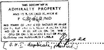
Kapitänleutnant G y s a e took command of " U 177 ". |
| |
|
18.04.42 |
Wesermünde |
Shipyard acceptance cruise with Representatives of the U.A.K., Deschimag and Warship Construction Department. |
|
| |
|
19. - 21.04.42 |
Bremen |
Training duties. |
|
| |
|
22. - 23.04.42 |
North Sea |
Transfer under escort to Kiel. |
|
| |
|
24.04. - 04.05.42 |
Kiel |
U.A.K. testing. |
|
| |
|
24.04.42 |
Kiel |
Dummy torpedo shooting in Arsenal. |
|
| |
|
25.04.42 |
Kiel |
Dummy torpedo shooting, degaussing, radio direction finder calibration. |
|
| |
|
26.04.42 |
Kiel |
Preparations for mine loading gear. |
|
| |
|
27.04.42 |
Kiel |
Mine loading in Arsenal. |
|
| |
|
28.04.42 |
Kiel |
Mine deployment, radio direction finder calibration, balancing the boat. |
|
| |
|
29.04.42 |
Kiel |
Special coordination, pressure dock. |
|
| |
|
30.04.42 |
Kiel |
U.A.K. testing. |
|
| |
|
01.05.42 |
Kiel |
Final trim test. |
|
| |
|
02.05.42 |
Kiel |
Sunday duties. |
|
| |
|
04.05.42 |
Kiel, Kiel Bay |
Test dive, artillery shooting, ruder- and engine maneuvers, anchor maneuvers, testing of the towing mechanism. |
|
| |
|
05.05.42 |
Kiel |
Ready for sea. Transfer speed cruise to Danzig. |
|
| |
|
06.05.42 |
Danzig |
Made fast UAG I. |
|
| |
|
07.05.42 |
Danzig |
Cast off UAG I. Transit to Gotenhafen for the TEK. |
|
| |
|
|
|
|
|
| |
|
|
|
|
|
| |
|
|
|
|
|
| |
|
|
|
|
|
 |
|
|
|
|
|
| |
- 2 - |
|
| |
|
|
|
|
|
| |
|
|
|
|
|
| |
|
|
|
|
|
| |
|
|
|
|
|
| |
|
07.05.42 |
Gotenhafen |
Made fast at TEK, test dive, independent training. |
|
| |
|
08. - 10.05.42 |
Gotenhafen, Eastern Baltic |
TEK testing. |
|
| |
|
11. - 13.05.42 |
U-boat Base Danzig |
Independent training, combat duties. |
|
| |
|
14.05.42 |
Eastern Baltic |
Dive training, independent training. |
|
| |
|
15.05.42 |
Eastern Baltic |
Dive training, independent training. |
|
| |
|
16. - 17.05.42 |
U-boat Base Danzig |
Periscope repairs in the Danziger Werft. |
|
| |
|
18.05.42 |
Danzig |
At Schicau Werft dry-docked to correct damage to hull valves. |
|
| |
|
19.05.42 |
At sea off Hela |
Series testing by UAG I. |
|
| |
|
|
|
Measured mile at various speed settings, anchoring maneuvers, submerged measured mile cruise, fuel measurement. |
|
| |
|
20. - 22.05.42 |
Danzig Bay off Hela |
Type testing. Measured mile and fuel measurement. |
|
| |
|
23. - 24.05.42 |
Danzig, U-boat harbor |
Independent training. |
|
| |
|
25. - 31.05.42 |
Danzig, Hela |
Testing by the Agru-Front, oil trace diving, independent training. |
|
| |
|
01.06.42 |
Danzig, U-boat Harbor |
Independent training. |
|
| |
|
02.06.42 |
Danzig Bay, |
Artillery shooting. |
|
| |
|
03.06.42 |
Neufahrwasser |
Torpedo loading afterwards departed in the Danzig Bay for torpedo shooting. |
|
| |
|
03. - 07.06.42 |
Danzig Bay |
Torpedo shooting with the Schießflottille. |
|
| |
|
08. - 10.06.42 |
Danzig, U-boat Harbor |
Work duties, clearing the baggage from the ship, torpedo loading. |
|
| |
|
10. - 18.06.42 |
Eastern and Central Baltic |
T a c t i c a l T r a i n i n g . |
|
| |
|
19.06.42 |
Gotenhafen |
Torpedo offload, Kmdt. muster. |
|
| |
|
20.06.42 |
Danzig, U-boat Harbor |
Measured mile, transit to Bornholm. |
|
| |
|
21.06.42 |
Bornholm |
Testing by UAG Schall. [sound trials] |
|
| |
|
22. - 23.06.42 |
Kiel Canal, North Sea |
Transit to Bremen. |
|
| |
|
24.06. - 19.08.42 |
Bremen |
Shipyard period, final adjustments. |
|
| |
|
19. - 23.08.42 |
Bremen |
Trim test, sea trial, took over the boat. |
|
| |
|
|
|
|
|
| |
|
|
|
|
|
| |
|
|
|
|
|
| |
|
|
|
|
|
|
|
|
|
|
|
| |
|
|
| |
|
|
|
|
|
| |
|
|
|
|
|
| |
|
|
|
|
|
| |
|
|
|
|
|
| |
|
|
|
|
|
| |
|
|
K R I E G S T A G E B U C H - " U 1 7 7 " . |
|
| |
|
|
======================================== |
|
| |
|
|
|
from 17.9.42 - 22.1.43 |
|
| |
|
17.09.42 |
|
|
|
| |
|
07.00 |
Kiel |
Put to sea. |
|
| |
|
08.00 |
Western Baltic |
|
|
| |
|
|
WSW 2, Sea 3, overcast, rain |
|
|
| |
|
10.00 |
Western Baltic, Point: "Rot 15" |
Taken in convoy: Transit through the Great Belt and Kattegat. |
|
| |
|
11.00 |
|
Switched from wavelength "Nanni Bruno". Switched to U-boat Coastal Circuit: "Karl Otto". |
|
| |
|
12.00 |
Great Belt |
D a y s r u n:  = 54 nm = 54 nm |
|
| |
|
|
WSW 2, Sea 2, Vis. 8 nm, overcast, rain |
|
|
| |
|
16.00 |
Great Belt |
 |
|
| |
|
|
WSW 2, Sea 2, overcast, rain, Vis. 8 nm |
|
| |
|
20.00 |
Great Belt |
|
| |
|
|
WSW 2, Sea 2, overcast, Vis, 8 nm |
|
| |
|
24.00 |
Great Belt |
|
| |
|
|
WNW 2, Sea 3, overcast, rain |
|
| |
|
|
|
|
|
| |
|
18.09.42 |
|
|
|
| |
|
04.00 |
Great Belt |
|
|
| |
|
|
WNW 3, Sea 3, overcast, rain, Vis. 8 nm |
|
|
| |
|
08.00 |
Kattegat |
|
|
| |
|
|
N 2, Sea 2-3, lightly cloudy, Vis. 10 nm |
|
|
| |
|
12.00 |
Kattegat |
D a y s r u n: = 183 nm |
|
| |
|
|
NNW 1, Sea 1-2, clear, Vis. 12 nm |
|
|
| |
|
16.00 |
Kattegat |
|
|
| |
|
|
W 2, Sea 1, clear, Vis. 12 nm |
|
|
| |
|
18.15 |
Kattegat |
Ship's Doctor transferred to steamer "ELMARIFF" to treat a patient with severe middle ear infection. |
|
| |
|
|
W 2, Sea 1-2, Vis. 10 nm |
|
| |
|
18.30 |
Kattegat |
Continued transit. |
|
| |
|
20.00 |
Kattegat, Skagerrak |
|
|
| |
|
|
NNW 2, Sea 2, overcast, Vis. 10 nm |
|
|
| |
|
24.00 |
Skagerrak |
|
| |
|
|
NNW 2, Sea 2-3, overcast, rain, Vis. 4 nm |
|
| |
|
|
  |
|
| |
|
|
|
|
|
| |
|
|
|
|
|
|
|
|
|
|
|
| |
- 2 - |
|
| |
|
|
|
|
|
| |
|
|
|
|
|
| |
|
|
|
|
|
| |
|
|
|
|
|
| |
|
19.09.42 |
|
|
|
| |
|
04.00 |
Skagerrak |
|
|
| |
|
|
W 3, Sea 3, overcast, rain |
|
|
| |
|
06.55 |
Kristiansand South |
Made fast. Took over fuel, water and provisions. |
|
| |
|
08.00 |
Kristiansand South |
|
|
| |
|
|
W 3, overcast |
|
|
| |
|
12.00 |
Kristiansand South |
D a y s r u n: = 143 nm |
|
| |
|
|
W 3, overcast |
|
|
| |
|
13.00 |
Kristiansand South |
Put to sea. Escort by 2 U-boat hunters. |
|
| |
|
16.00 |
AN 3618 |
|
|
| |
|
|
W 2, Sea 2-3, overcast, Vis. 10 nm |
|
|
| |
|
19.30 |
AN 3825 |
Test dive and deep dive to depth A +30 meters. |
|
| |
|
20.00 |
AN 3825 |
|
|
| |
|
20.20 |
AN 3228 |
Surfaced. Continued transit alone. |
|
| |
|
|
W 2, Sea 2-3, overcast |
|
|
| |
|
24.00 |
AN 3198 |
|
|
| |
|
|
W 2, Sea 2, Vis. 5 nm, overcast |
|
|
| |
|
|
|
|
|
| |
|
20.09.42 |
|
|
|
| |
|
04.00 |
AN 3181 |
|
|
| |
|
|
NW 3, Sea 2, overcast, Vis. 4 nm |
|
|
| |
|
07.55 |
AN 4363 |
Passed a drifting mine. |
|
| |
|
08.00 |
AN 4363 |
|
|
| |
|
|
NW 2, Sea 2, light NW-Swell, overcast, Vis. 10 nm |
|
|
| |
|
11.00 |
AN 4332 |
Crash dive for training as test dive. |
|
| |
|
12.00 |
AN 2898 |
|
|
| |
|
|
NNW 1, Sea 1, overcast, Vis. 10-12 nm |
|
|
| |
|
16.00 |
AN 2861 |
|
|
| |
|
|
NNE 1, Sea 1, overcast, Vis. 10-12 nm |
|
|
| |
|
20.00 |
AN 2394 |
|
|
| |
|
|
NE 1, Sea 0-1, overcast, Vis. 10 nm |
|
|
| |
|
23.00 |
|
Radio Message from B.d.U.: |
|
| |
|
|
|
1. Hellriegel, Sturm, Markworth . . . etc. |
|
| |
|
|
|
2. Oelrich, Gysae from 21 September at 08.00 hours "Ireland" Circuit, Essenberg and Liebe "America II" Circuit. |
|
| |
|
24.00 |
AN 2329 |
|
|
| |
|
|
NE 1, Sea 1, overcast, Vis. 4 nm, strong marine phosphorescence |
|
|
| |
|
|
|
 |
|
| |
|
|
|
|
|
|
|
|
|
|
|
| |
- 3 - |
|
| |
|
|
|
|
|
| |
|
|
|
|
|
| |
|
|
|
|
|
| |
|
|
|
|
|
| |
|
21.09.42 |
|
|
|
| |
|
04.00 |
AF 8775 |
|
|
| |
|
|
NE 1, Sea 1, overcast, Vis. 4 nm |
|
|
| |
|
08.00 |
AF 8719 |
Switched to "Ireland" Circuit. |
|
| |
|
|
NE 1, Sea 1, overcast, rain squalls from the NW, Vis. 7 nm |
|
|
| |
|
12.00 |
AF 8474 |
Passed a drifting mine. |
|
| |
|
|
NE 1, Sea 1, overcast, rain, Vis. 5 nm |
D a y s r u n: = 172 nm |
|
| |
|
12.55 |
AF 8474 |
Test dive. |
|
| |
|
13.29 |
AF 8474 |
Surfaced. |
|
| |
|
16.00 |
AF 7663 |
|
|
| |
|
|
NE 1, Sea 1, overcast, Vis. 10 nm |
|
|
| |
|
20.00 |
AF 7395 |
|
|
| |
|
|
NNE 4, Sea 3, overcast, Vis. 4-5 nm |
|
|
| |
|
21.00 |
AF 7395 |
Came to course 310°. |
|
| |
|
24.00 |
AF 7352 |
|
|
| |
|
|
ENE 4, Sea 3, overcast, rain, Vis. 4 nm |
|
|
| |
|
|
|
|
|
| |
|
22.09.42 |
|
|
|
| |
|
03.00 |
AF 7315 |
Came to course 295°. |
|
| |
|
04.00 |
AF 7311 |
|
|
| |
|
|
E 2-3, Sea 3, overcast, Vis. 4-5 nm, strong marine phosphorescence |
|
|
| |
|
08.00 |
AF 4886 |
|
|
| |
|
|
NE 4, Sea 3, overcast, rain, Vis. 5 nm |
|
|
| |
|
12.00 |
AF 4844 |
D a y s r u n: = 189 nm |
|
| |
|
|
E 4-5, Sea 4, overcast, Vis. 10 nm |
 = 2 nm = 2 nm |
|
| |
|
16.00 |
AF 4417 |
Passed a drifting mine. |
|
| |
|
|
NE 5, Sea 5, overcast, Vis. 3 nm |
Came to course 240°. |
|
| |
|
20.00 |
AE 6623 |
|
|
| |
|
|
NE 7-8, Sea 6, overcast, rain, Vis. 5 nm |
|
|
| |
|
24.00 |
AE 6842 |
|
|
| |
|
|
ENE 6, Sea 4, overcast, rain, Vis. 5 nm |
|
|
| |
|
|
|
|
|
| |
|
23.09.42 |
|
|
|
| |
|
04.00 |
AE 6887 |
|
|
| |
|
|
NE 6-7, Sea 5, overcast, rain, Vis. 3-4 nm |
|
|
| |
|
05.45 |
AE 6880 |
Test dive. |
|
| |
|
|
NE 6-7, Sea 7, overcast, rain, Vis. 2-3 nm |
|
|
| |
|
|
|
|
|
| |
|
|
|
|
|
| |
|
|
|
|
|
|
|
|
|
|
|
| |
- 4 - |
|
| |
|
|
|
|
|
| |
|
|
|
|
|
| |
|
|
|
|
|
| |
|
continued |
|
|
|
| |
|
23.09.42 |
|
|
|
| |
|
06.05 |
AE 6880 |
Surfaced. |
|
| |
|
|
|
While blowing the foreship did not come out of the water correctly. Apparently Vent 8 does did not hold tight. While blowing [with engine exhaust] main ballast tank 8 was re-blown with compressed air. Boat holds itself to some extent. The Kommandant went to the control room to discuss the defect with the Chief Engineer and have the emergency vent flap valve closed as a precaution. At suggestion of the Chief Engineer re-diving is intended. |
|
| |
|
|
|
Meanwhile, a heavy cross-sea from behind ran over the bridge, so that large amounts of water could enter through the only ajar conning tower hatch. For safety purposes the control room hatch was closed and all [ballast tanks] were re-blown with compressed air. |
|
| |
|
|
|
According to the statement of the First Watch Officer due to an unexpected overrunning sea from behind, the port forward lookout, Bootsmaat H e n n i n g s Erwin, UO 2700/38 was knocked out [overboard]. Hennings was wearing a safety belt, however probably did not clip in again after surfacing. Rescue attempts were hopeless in the prevailing conditions (very dark night, Sea State 7, drizzle, enemies in the vicinity and delay in notification of the Kommandant). |
|
| |
|
08.00 |
AE 9211 |
|
|
| |
|
|
NE 8-9, Sea 7, overcast, rain squalls, Vis. 2-3 nm |
|
|
| |
|
10.00 |
AE 92 |
Passed a drifting mine. |
|
| |
|
12.00 |
AE 9146 |
D a y s r u n: = 235 nm |
|
| |
|
|
NE 7-8, Sea 7, overcast, rain squalls, Vis. 6-7 nm |
= 2 nm |
|
| |
|
13.3x |
AE 9149 |
A 2-engined land-based aircraft approached from 200°T, low altitude. |
|
| |
|
|
|
Crash dive. While getting inside a bridge watch stander remained hung up on the conning tower hatch by the safety belt. Crash dive was delayed. The first bomb had already fallen when the boat was breaking through the water surface. No failures. A few more aircraft bombs fell far off. |
|
| |
|
|
|
Proceeded submerged at depth A -20 meters. |
|
| |
|
|
|
Until darkness distant detonation of depth charges was heard. After evening twilight surfaced and brought out the Fu.M.B. |
|
| |
|
16.00 |
AE 9172 |
Proceeded submerged. |
|
| |
|
20.00 |
AE 9175 |
|
|
| |
|
21.00 |
AE 9174 |
Surfaced. |
|
| |
|
24.00 |
AE 8325 |
|
|
| |
|
|
NNE 6-7, Sea 6, overcast, Vis. 3-4 nm |
|
|
| |
|
|
|
|
|
| |
|
|
|
|
|
| |
|
|
|
|
|
| |
|
|
|
|
|
|
|
|
|
|
|
| |
- 5 - |
|
| |
|
|
|
|
|
| |
|
|
|
|
|
| |
|
|
|
|
|
| |
|
|
|
|
|
| |
|
24.09.42 |
|
|
|
| |
|
03.50 |
AE 8585 |
Horizontally polarized detection on 1.5 meters. Dived for an hour. |
|
| |
|
|
NW 5, Sea 5, lightly cloudy, Vis. 6 nm |
|
| |
|
04.39 |
AE 8595 |
Surfaced. |
|
| |
|
08.00 |
AE 8842 |
|
|
| |
|
|
NE 5, Sea 5, light overcast, Vis. 7 nm |
|
|
| |
|
08.10 |
AE 8842 |
In the morning twilight a shadow sighted bearing 75°T. Turned away because it was very close. It was a three-masted sailing vessel, The vessel furled his sails away and turned with engines to a sharp target angle. Evaded on the surface. |
|
| |
|
12.00 |
AM 1114 |
D a y s r u n: = 164 nm |
|
| |
|
|
NNE 5, Sea 4, lightly cloudy, Vis. 7 nm |
= 22 nm |
|
| |
|
13.45 |
AL 3236 |
7 land-based aircraft in formations of 4 and 3 sighted on easterly course. Medium altitude, turned away. Aircraft passed out of sight on an easterly course. |
|
| |
|
|
NNE 5, Sea 4, lightly cloudy, Vis. 7 nm |
|
| |
|
16.00 |
AL 3267 |
|
|
| |
|
|
W 2, Sea 3, overcast, Vis. 5-6 nm |
|
|
| |
|
20.00 |
AL 3413 |
|
|
| |
|
|
NW 7, Sea 5, light overcast, Vis. 5-6 nm |
|
|
| |
|
24.00 |
AL 3287 |
|
|
| |
|
|
NW 7, Sea 6, light overcast, Vis. 4-5 nm |
|
|
| |
|
|
|
|
|
| |
|
25.09.42 |
|
|
|
| |
|
04.00 |
AL 3454 |
|
|
| |
|
|
NNW 5, Sea 6, overcast, Vis. 3-4 nm |
|
|
| |
|
08.00 |
AL 3487 |
|
|
| |
|
|
S 3, Sea 2, Swell, Vis. 5 nm |
|
|
| |
|
10.37 |
AL 3542 |
Test dive. |
|
| |
|
10.35 |
AL 3542 |
Surfaced. |
|
| |
|
12.00 |
AL 3641 |
D a y s r u n: = 166 nm |
|
| |
|
|
SW 2-3, long Swell, Vis. 7 nm |
= 1 nm |
|
| |
|
16.00 |
AL 3677 |
|
|
| |
|
|
SW 2-3, Sea 2-3, long Swell, Vis. 7 nm |
|
|
| |
|
20.00 |
AL 3738 |
|
|
| |
|
|
SSW 6-7, Sea 7, long Swell, Vis. 5 nm |
|
|
| |
|
21.36 |
|
Radio Message from B.d.U.: |
|
| |
|
|
|
1. Becker, Lüth, Gysae report weather 26 September between 04.00-07.00 hours. |
|
| |
|
|
|
2. Ibbeken . . . etc. |
|
| |
|
|
|
3. Schacht . . . etc. |
|
| |
|
|
|
|
|
|
|
|
|
|
|
| |
- 6 - |
|
| |
|
|
|
|
|
| |
|
|
|
|
|
| |
|
|
|
|
|
| |
|
continued |
|
|
|
| |
|
25.09.42 |
|
|
|
| |
|
24.00 |
AL 3734 |
|
|
| |
|
|
SSW 2-3, Sea 2-3, overcast, light rain squalls, Vis. 2-4 nm |
|
|
| |
|
|
|
|
|
| |
|
26.09.42 |
|
|
|
| |
|
04.00 |
AL 3929 |
|
|
| |
|
|
SW 3, Sea 1, overcast, rain, Vis. 2-3 nm |
|
|
| |
|
05.21 |
|
Radio Message to B.d.U.: |
|
| |
|
|
|
1. 23 September Bootsmaat Hennings over board. Noon naval square 9194 aircraft bombs. [position in error 9149] |
|
| |
|
|
|
2. Naval square 85 by night horizontally polarized detection 154 cm. |
|
| |
|
|
|
3. With current ballast tank distribution strong tendency to undercut before the sea. |
|
| |
|
|
|
4. SW 3, 1009 mb, +8°C, overcast, naval square 3929. |
|
| |
|
|
|
= Gysae = |
|
| |
|
08.00 |
AL 3985 |
|
|
| |
|
|
SW 3, Sea 3, overcast, rain, Vis. 2-3 nm |
|
|
| |
|
12.00 |
AL 2625 [typo AL 5225] |
D a y s r u n: = 170 nm |
|
| |
|
|
SW 2-3, Sea 2, overcast, Vis. 2-3 nm |
|
|
| |
|
16.00 |
AL 6278 |
|
|
| |
|
|
SW 4, Sea 2-3, overcast, Vis. 5-6 nm |
|
|
| |
|
20.00 |
AL 6540 |
|
|
| |
|
|
NNW 2-3, Sea 3-4, overcast, Vis. 5-6 nm |
|
|
| |
|
21.25 |
AL 6545 |
Shadow in sight 40° to starboard astern (bearing 300°T) out of a fog bank. Turned away to take the steamer astern. After 5 minutes a second vessel in sight and soon afterwards recognized perfectly as a destroyer. |
|
| |
|
|
NW 3-4, Sea 3-4, overcast, Vis. 3-4 nm, fog banks |
|
| |
|
|
|
During twilight maneuvered ahead to attack. The steamer steered about 50°. Steamer zigzagged to 160° and reduced speed. The vessel had an implausibly high superstructure up to the upper edge of the bridge, probably a dummy, to increase the size of the silhouette and to make it more difficult to fix the bow and the target angle, in relation to the ship's size a very thin long smokestack. The destroyer came over to our size. Both vessels stop repeatedly to listen or locate. In the course of this occasionally a flashing red light detected at the bow of the steamer. Radar of the destroyer observed perfectly at 139 cm (horizontally polarized). By radar the destroyer takes us ahead, comes closer. Moved off at high speed . The destroyer loses us. |
|
| |
|
|
|
In the meantime the steamer has zigzagged to a N-course. Maneuvered ahead once again. To starboard the destroyer is again positioned on our side. Attempted to get ahead of the steamer on the other side, |
|
| |
|
|
|
|
|
|
|
|
|
|
|
| |
- 7 - |
|
| |
|
|
|
|
|
| |
|
|
|
|
|
| |
|
|
|
|
|
| |
|
continued |
|
|
|
| |
|
26.09.42 |
|
|
|
| |
|
|
|
While so doing, it [the steamer] deviates to the east to keep us between itself and the destroyer. The destroyer passes out of sight. Then suddenly an unexpected approach from directly ahead (about 300°T) with radar. Because the destroyer is very close, dived to depth A +30 meters. |
|
| |
|
|
|
|
| |
|
|
|
|
| |
|
22.47 |
AL 6545 |
|
| |
|
|
|
The destroyer runs in, however throws no depth charges. Sounds disappeared in southeasterly direction. |
|
| |
|
23.45 |
AL 6545 |
Went to depth A -40 meters. Surfaced. |
|
| |
|
|
|
Came to old course 195°. Both vessels out of sight no detection. |
|
| |
|
23.50 |
AL 6545 |
Two shadows directly ahead. At low speed U-boat hunting group in sight again on northerly course. Moved off on westerly course and low speed, so as not to be detected with listening gear. In the beginning search locating determined repeatedly. |
|
| |
|
24.00 |
AL 6545 |
|
|
| |
|
|
SW 3, Sea 2-3, overcast, fog banks in places, Vis. 4 nm |
|
|
| |
|
|
|
|
|
| |
|
27.09.42 |
|
|
|
| |
|
02.00 |
|
Came to old course 195°. |
|
| |
|
|
|
Believe the entire thing was a U-hunting group, especially since the vessels were practically in the same location for 3.5 hours. |
|
| |
|
04.00 |
AL 6480 |
|
|
| |
|
|
NE 1-6, Sea 1-2, overcast, Vis. 5 nm |
|
|
| |
|
08.00 |
AL 6570 |
|
|
| |
|
|
NW 2, Sea 2, overcast, Vis. 6 nm |
|
|
| |
|
12.00 |
AL 6814 |
D a y s r u n: = 156 nm |
|
| |
|
|
SW 2, Sea 1, overcast, clear, Vis. 6-7 nm |
= 2.5 nm |
|
| |
|
16.00 |
AL 6895 |
|
|
| |
|
|
SSW 3, Sea 3, light overcast, Vis. 6-7 nm |
|
|
| |
|
18.20 |
|
Radio Message to B.d.U.: |
|
| |
|
|
|
1. 26 September 21.30 hours naval square AL 6540 U-boat hunting group from fast independent with high dummy superstructure and destroyer set out laterally. Both with changing course and speed back and forth in position. Steamer zigzagged with attack each time so that the U-boat was between it and the destroyer. This located on 139 cm horizontally polarized and then ran to the fire lee [between the boat and the steamer]. When approaching the steamer a red light occasionally observed. |
|
| |
|
|
|
= Gysae = |
|
| |
|
20.00 |
AL 9134 |
|
|
| |
|
|
WSW 5, Sea 2-3, light overcast, Vis. 8 nm |
|
|
| |
|
20.20 |
AL 9134 |
Test dive. |
|
| |
|
20.40 |
AL 9134 |
Surfaced. |
|
| |
|
|
|
|
|
| |
|
|
|
|
|
| |
|
|
|
|
|
|
|
|
|
|
|
| |
- 8 - |
|
| |
|
|
|
|
|
| |
|
|
|
|
|
| |
|
|
|
|
|
| |
|
continued |
|
|
|
| |
|
27.09.42 |
|
|
|
| |
|
24.00 |
AL 9185 |
|
|
| |
|
|
WSW 5, Sea 2-3, overcast, Vis. 3 nm |
|
|
| |
|
|
|
|
|
| |
|
28.09.42 |
|
|
|
| |
|
04.00 |
AL 9421 |
|
|
| |
|
|
W 7-8, Sea 6, overcast, rain squalls, Vis. 3-4 nm |
|
|
| |
|
08.00 |
AL 9448 |
|
|
| |
|
|
NW 7, Sea 5, overcast, squalls, Vis. 3-4 nm |
|
|
| |
|
12.00 |
AL 9411 |
D a y s r u n: = 171 nm |
|
| |
|
|
WNW 7-8, Sea 6, overcast, Vis. 5-6 nm |
= 1 nm |
|
| |
|
16.00 |
AL 8363 |
|
|
| |
|
|
W 7, Sea 7-8, rain, squalls, Vis. 3-5 nm |
|
|
| |
|
20.00 |
BE 1331 |
|
|
| |
|
|
W 7, Sea 7, overcast-clear, Vis. 6 nm |
|
|
| |
|
21.18 |
|
Radio Message from B.d.U.: |
|
| |
|
|
|
1. Trojer, Friedrichs, Gysae tomorrow between 04.00 - 07.00 hours report weather. |
|
| |
|
|
|
2. Litterscheid . . . etc, |
|
| |
|
|
|
3. Schwandke . . . etc. |
|
| |
|
24.00 |
BE 1350 |
|
|
| |
|
|
NNW 6, Sea 6, overcast, Vis. 3 nm |
|
|
| |
|
|
|
|
|
| |
|
29.09.42 |
|
|
|
| |
|
04.00 |
BE 1387 |
|
|
| |
|
|
NNW 3, Sea 3, Swell, cloudy, Vis. 4-5 nm |
|
|
| |
|
06.22 |
|
Radio Message to B.d.U.: |
|
| |
|
|
|
Short Signal weather report: 50°N, 21°W, rising 1012 mb, +14°C, NW 5-6, overcast, Vis. up to 5 nm, high W-Swell. |
|
| |
|
08.00 |
BE 1642 |
D a y s r u n: = 179 nm |
|
| |
|
|
NNW 2, Sea 3, overcast, Vis. 5 nm |
|
|
| |
|
12.00 |
BE 1580 |
|
|
| |
|
|
NW 3, Sea 4, cloudy, Vis. 8-10 nm |
|
|
| |
|
15.35 |
|
Radio Message from B.d.U.: |
|
| |
|
|
|
Lüth and Gysae proceed via DG 90, EH 90, ES 50, GR 80. All naval squares. |
|
| |
|
16.00 |
BE 4843 |
|
|
| |
|
|
NW 3, Sea 4-5, cloudy, Vis. 7 nm |
|
|
| |
|
18.26 |
BE 4870 |
Test dive. |
|
| |
|
18.47 |
BE 4870 |
Surfaced. |
|
| |
|
|
|
|
|
| |
|
|
|
|
|
| |
|
|
|
|
|
|
|
|
|
|
|
| |
- 9 - |
|
| |
|
|
|
|
|
| |
|
|
|
|
|
| |
|
|
|
|
|
| |
|
continued |
|
|
|
| |
|
29.09.42 |
|
|
|
| |
|
20.00 |
BE 4887 |
|
|
| |
|
|
NNW 5, Sea 3, Swell, overcast, Vis. 4 nm |
|
|
| |
|
24.00 |
BE 4245 |
|
|
| |
|
|
NNW 2, Sea 1, overcast, Vis. 3 nm |
|
|
| |
|
|
|
|
|
| |
|
30.09.42 |
|
|
|
| |
|
04.00 |
BE 4512 |
|
|
| |
|
|
NNW 2, Sea 1-2, overcast, Vis. 3 nm |
|
|
| |
|
08.00 |
BE 4548 |
|
|
| |
|
|
NW 2, Sea 1-2, overcast, Vis. 4 nm |
|
|
| |
|
12.00 |
BE 4811 |
D a y s r u n: = 228 nm |
|
| |
|
|
NNW 2, Sea 1, overcast, Vis. 5 nm |
= 1 nm |
|
| |
|
16.00 |
BE 4872 |
|
|
| |
|
|
NNW 2, Sea 1, overcast, Vis. 5 nm |
|
|
| |
|
20.00 |
BE 7218 |
|
|
| |
|
|
NNW 2, Sea 1, overcast, Vis. 6 nm |
|
|
| |
|
24.00 |
BE 7275 |
|
|
| |
|
|
NNW 1, Sea 1-2, overcast, Vis. 4 nm |
|
|
| |
|
|
|
|
|
| |
|
|
|
|
|
| |
|
|
|
|
|
| |
|
|
|
|
|
| |
|
|
|
|
|
| |
|
|
|
|
|
| |
|
|
|
|
|
| |
|
|
|
|
|
| |
|
|
|
|
|
| |
|
|
|
|
|
| |
|
|
|
|
|
| |
|
|
|
|
|
| |
|
|
|
|
|
|
|
|
|
|
|
| |
- 11 - |
|
| |
|
|
|
|
|
| |
|
|
|
|
|
| |
|
|
|
|
|
| |
|
|
|
|
|
| |
|
01.10.42 |
|
|
|
| |
|
04.00 |
BE 7542 |
|
|
| |
|
|
NNW 2, Sea 1-2, overcast, Vis. 4 nm |
|
|
| |
|
07.00 |
BE 7572 |
Came to course 187. |
|
| |
|
08.00 |
BE 7811 |
|
|
| |
|
|
N 3, Sea 2, overcast, Vis. 5 nm |
|
|
| |
|
12.00 |
BE 7847 |
D a y s r u n: = 182 nm |
|
| |
|
|
NNW 3, Sea 2, overcast, Vis. 5 nm |
|
|
| |
|
16.00 |
CF 1236 |
|
|
| |
|
|
NNW 1-2, Sea 1, cloudy to clear, Vis. 10-12 nm |
|
|
| |
|
17.38 |
CF 1263 |
Crash dive for training, afterwards test dive. |
|
| |
|
17.58 |
CF 1263 |
Surfaced. |
|
| |
|
20.00 |
CF 1293 |
|
|
| |
|
|
NNW 5, Sea 3, Swell, overcast, Vis. 6 nm |
|
|
| |
|
24.00 |
CF 1562 |
|
|
| |
|
|
N 1-2, Sea 1, overcast, Vis. 5 nm |
|
|
| |
|
|
|
|
|
| |
|
02.10.42 |
|
|
|
| |
|
04.00 |
CF 1597 |
|
|
| |
|
|
NE 3, Sea 2, overcast, rain squalls, Vis. 2-5 nm |
|
|
| |
|
08.00 |
CF 1861 |
|
|
| |
|
|
NE 2, Sea 2, overcast, Vis. 3 nm |
|
|
| |
|
12.00 |
CF 4234 |
D a y s r u n: = 195 nm |
|
| |
|
|
NE 3, Sea 2, lightly cloudy, Vis. 10 nm |
= 1 nm |
|
| |
|
16.00 |
CF 4261 |
|
|
| |
|
|
NE 3, Sea 2, lightly cloudy, Vis. 10 nm |
|
|
| |
|
20.00 |
CF 4295 |
|
|
| |
|
|
NNE 3, Sea 2-3, lightly cloudy, Vis. 10 nm |
|
|
| |
|
24.00 |
CF 4526 |
|
|
| |
|
|
NE 3, Sea 2-3, light overcast, Vis. 5-6 nm |
|
|
| |
|
|
|
|
|
| |
|
03.10.42 |
|
|
|
| |
|
04.00 |
CF 4556 |
|
|
| |
|
|
NNE 2, Sea 2, overcast, Vis. 3 nm |
|
|
| |
|
08.00 |
CF 4586 |
|
|
| |
|
|
NNW 2, Sea 1, lightly cloudy, Vis. 7 nm |
|
|
| |
|
12.00 |
CF 4822 |
D a y s r u n: = 104 nm |
|
| |
|
|
NNW 2, Sea 1-2, overcast to clear, |
|
|
| |
|
|
|
|
|
| |
|
|
|
|
|
|
|
|
|
|
|
| |
- 12 - |
|
| |
|
|
|
|
|
| |
|
|
|
|
|
| |
|
|
|
|
|
| |
|
continued |
|
|
|
| |
|
03.10.42 |
|
|
|
| |
|
|
Vis. 10 nm |
|
|
| |
|
16.00 |
CF 4828 |
|
|
| |
|
|
NNW 2, Sea 1-2, overcast to clear, Vis. 10 nm |
|
|
| |
|
20.00 |
CF 4882 |
|
|
| |
|
|
NNW 2, Sea 1, overcast, Vis. 5 nm |
|
|
| |
|
24.00 |
CF 7257 |
|
|
| |
|
|
NNW 1-2, Sea 1, overcast, Vis. 5 nm |
|
|
| |
|
|
|
|
|
| |
|
04.10.42 |
|
|
|
| |
|
04.00 |
CF 7279 |
|
|
| |
|
|
N 1, Sea 0-1, overcast, Vis. 5 nm |
|
|
| |
|
08.00 |
CF 7546 |
|
|
| |
|
|
NE 1, Sea 0-1, overcast, Vis. 6 nm |
|
|
| |
|
11.00 |
CF 7549 |
Went before the sea due to work on the over deck. |
|
| |
|
12.00 |
CF 7572 |
D a y s r u n: = 148 nm |
|
| |
|
|
NE 0-1, Sea 0-1, cloudy, Vis. 8 nm |
|
|
| |
|
13.28 |
CF 7575 |
Test dive. |
|
| |
|
13.35 |
CF 7575 |
Surfaced. |
|
| |
|
16.00 |
CF 7841 |
|
|
| |
|
|
WNW 1, Sea 0-1, overcast to clear, Vis. 8 nm |
|
|
| |
|
20.00 |
CF 7877 |
|
|
| |
|
|
WNW 1, Sea 1, overcast to clear, Vis. 8 nm |
|
|
| |
|
24.00 |
CF 7998 |
|
|
| |
|
|
NNW 1, Sea 0-1, clear, Vis. 6 nm |
|
|
| |
|
|
|
|
|
| |
|
05.10.42 |
|
|
|
| |
|
01.45 |
DG 3268 |
A neutral steamer in sight bearing 154°T with illuminated neutrality markings. Steered westerly course. |
|
| |
|
|
NNW 1, Sea 0-1, clear, Vis. 6 nm |
|
| |
|
04.00 |
DG 3297 |
|
|
| |
|
|
SW 2, Sea 1, clear, Vis. 5-6 nm |
|
|
| |
|
08.00 |
DG 3565 |
|
|
| |
|
|
WNW 3, Sea 1, overcast to clear, Vis. 5 nm |
|
|
| |
|
12.00 |
DG 3826 |
D a y s r u n: = 181 nm |
|
| |
|
|
W 3, Sea 2-3, lightly cloudy, Vis. 10-12 nm |
= 1 nm |
|
| |
|
16.00 |
DG 3883 |
|
|
| |
|
|
W 3, Sea 3, lightly cloudy, rain squalls, Vis. 2-8 nm |
|
|
| |
|
|
|
|
|
| |
|
|
|
|
|
| |
|
|
|
|
|
|
|
|
|
|
|
| |
- 13 - |
|
| |
|
|
|
|
|
| |
|
|
|
|
|
| |
|
|
|
|
|
| |
|
continued |
|
|
|
| |
|
05.10.42 |
|
|
|
| |
|
19.16 |
DG 6225 |
Crash dive for training, afterwards test dive. |
|
| |
|
19.35 |
DG 6225 |
Surfaced. |
|
| |
|
20.00 |
DG 6252 |
|
|
| |
|
|
WNW 3-4, Sea 3, overcast to clear, brief rain squalls, Vis. 2-8 nm |
|
|
| |
|
24.00 |
DG 6287 |
|
|
| |
|
|
N 2, Sea 1, cloudy, Vis. 5 nm |
|
|
| |
|
|
|
|
|
| |
|
06.10.42 |
|
|
|
| |
|
04.00 |
DG 6546 |
|
|
| |
|
|
N 2, Sea 1, cloudy, Vis. 5 nm |
|
|
| |
|
08.00 |
DG 6815 |
|
|
| |
|
|
W 2, Sea 1-2, clear, Vis. 6 nm |
|
|
| |
|
12.00 |
DG 6875 |
D a y s r u n: = 203 nm |
|
| |
|
|
W 2, Sea 1, cloudy, Vis. 10 nm |
= 1 nm |
|
| |
|
16.00 |
DG 9244 |
|
|
| |
|
|
W 2, Sea 2, lightly cloudy, Vis. 10 nm |
|
|
| |
|
20.00 |
DG 9469 |
|
|
| |
|
|
NbyE 1, Sea 1, overcast to clear, Vis. 6 nm |
|
|
| |
|
24.00 |
DG 9638 |
|
|
| |
|
|
NbyE 1, Sea 1-2, overcast to clear, Vis. 5 nm |
|
|
| |
|
|
|
|
|
| |
|
07.10.42 |
|
|
|
| |
|
04.00 |
DG 9735 |
|
|
| |
|
|
N 1, Sea 1, overcast to clear, Vis. 4 nm |
|
|
| |
|
08.00 |
DG 9767 |
|
|
| |
|
|
N 1, Sea 1, clear, Vis. 4 nm |
|
|
| |
|
12.00 |
DT 1267 |
D a y s r u n: = 204 nm |
|
| |
|
|
NbyE 1, Sea 0-1, clear, Vis. 6 nm |
|
|
| |
|
16.00 |
DT 1526 |
|
|
| |
|
|
E 1, Sea 0-1, clear, Vis. 10-12 nm |
|
|
| |
|
17.05 |
DT 1529 |
Crash dive for training, afterwards test dive. |
|
| |
|
17.25 |
DT 1529 |
Surfaced. |
|
| |
|
20.00 |
DT 1582 |
|
|
| |
|
|
E 1, Sea 0-1,m clear, Vis. 10-12 nm |
|
|
| |
|
|
|
|
|
| |
|
|
|
|
|
|
|
|
|
|
|
| |
- 14 - |
|
| |
|
|
|
|
|
| |
|
|
|
|
|
| |
|
|
|
|
|
| |
|
continued |
|
|
|
| |
|
07.10.42 |
|
|
|
| |
|
20.44 |
|
Radio Message from B.d.U.: |
|
| |
|
|
|
1. Rasch, Mengersen . . . etc. |
|
| |
|
|
|
2. On 8 October at 08.00 hours switch Schwartzkopf . . .etc. "Gysae" switch to "Africa" Circuit. |
|
| |
|
|
|
3. "Löwe" . . . etc. |
|
| |
|
24.00 |
DT 1843 |
|
|
| |
|
|
E 1, Sea 0-1, clear, Vis. 5-6 nm |
|
|
| |
|
|
|
|
|
| |
|
08.10.42 |
|
|
|
| |
|
04.00 |
DT 1878 |
|
|
| |
|
|
NW 1, Sea 0-1, clear, Vis. 5-6 nm |
|
|
| |
|
08.00 |
DT 4244 |
Switched to Africa Circuit. |
|
| |
|
|
NE 1, Sea 1, clear, Vis. 10 nm |
|
|
| |
|
12.00 |
DT 4433 |
D a y s r u n: = 193 nm |
|
| |
|
|
NE 1, Sea 1, clear, Vis. 10-12 nm |
= 1 nm |
|
| |
|
16.00 |
DT 4492 |
|
|
| |
|
|
NE 1, Sea 1, clear, Vis. 10-12 nm |
|
|
| |
|
20.00 |
DT 4761 |
|
|
| |
|
|
NE 1, Sea 1, clear, Vis. 10-12 nm |
|
|
| |
|
24.00 |
DT 4788 |
|
|
| |
|
|
NE 1, Sea 1, clear, Vis. 10 nm |
|
|
| |
|
|
|
|
|
| |
|
09.10.42 |
DT 7156 |
|
|
| |
|
04.00 |
E 1-2, Sea 1, clear, Vis. 10 nm |
|
|
| |
|
08.00 |
DT 7421 |
|
|
| |
|
|
ENE 1, Sea 2, lightly cloudy, Vis. 10 nm |
|
|
| |
|
12.00 |
DT 7425 |
D a y s r u n: = 204 nm |
|
| |
|
|
ENE 2, Sea 1, lightly cloudy, Vis. 10 nm |
|
|
| |
|
16.00 |
DT 7741 |
|
|
| |
|
|
ENE 2, Sea 1-2, lightly cloudy, Vis. 10 nm |
|
|
| |
|
17.10 |
DT 7745 |
Crash dive for training. Afterwards test dive. |
|
| |
|
17.23 |
DT 7745 |
Surfaced. |
|
| |
|
20.00 |
DT 7777 |
|
|
| |
|
|
ENE 2, Sea 1, light overcast, Vis. 8-10 nm |
|
|
| |
|
24.00 |
EH 3368 |
|
|
| |
|
|
NNE 1-2, Sea 1, overcast to clear, Vis. 4 nm |
|
|
| |
|
|
|
|
|
| |
|
|
|
|
|
| |
|
|
|
|
|
| |
|
|
|
|
|
| |
|
|
|
|
|
|
|
|
|
|
|
| |
- 15 - |
|
| |
|
|
|
|
|
| |
|
|
|
|
|
| |
|
|
|
|
|
| |
|
continued |
|
|
|
| |
|
10.09.42 |
|
|
|
| |
|
04.00 |
EH 3634 |
|
|
| |
|
|
ENE 2, Sea 1-2, overcast, Vis. 3-4 nm |
|
|
| |
|
08.00 |
EH 3656 |
|
|
| |
|
|
ENE 2, Sea 1-2, heavily cloudy, Vis. 8 nm |
|
|
| |
|
12.00 |
EH 3987 |
D a y s r u n: = 195 nm |
|
| |
|
|
NE 2, Sea 1-2, heavily cloudy, Vis. 8 nm |
= 1 nm |
|
| |
|
16.00 |
EH 3952 |
|
|
| |
|
|
NE 2, Sea 2-3, cloudy, Vis. 10 nm |
|
|
| |
|
19.45 |
EH 6364 |
Mastheads sighted bearing 55°T. Headed for it. It is a warship, forward high lattice mast with fighting top, a low smokestack, aft plain pole or tripod mast. Both masts the same height. It is an American battleship. Enemy steers northwesterly course, runs about 16 knots. Ran along with at the limit of visibility at highest speed, and held contact. |
|
| |
|
|
NE 3, Sea 2-3, heavily cloudy, Vis. 10 nm |
|
| |
|
|
Intention: At darkness close in. Then surprise night attack. |
|
| |
|
21.40 |
NNE 3, Sea 2-3, in the west approaching lightening, strong marine phosphorescence, Vis. 4 nm |
Beginning of twilight. It gets dark very quickly. Angled in. Despite highest speed only get a bit ahead. At times Fu.M.B. brought out. No detection determined. While matching speed from the stern sector determined that the battleship is protected by many escort vessels, among them a long flat vessel. We are now positioned close behind the battleship (target angle 180°). All tubes are ready, to shoot immediately at the next zigzag. There is not enough excess speed for a long maneuver ahead at the limit of visibility. (With full switching [auxiliary diesels powering the electric motors] and AK with open outer tube doors about 16.5 knots). The enemy does not zigzag, attempted a surprise attack moving out of his wake to the side. During this attempt I got a destroyer of the starboard flank screen exactly ahead. Low range. Tried to get around to starboard. Does not work because the destroyer runs parallel and due to marine phosphorescence we leave a trail like a comet. So reduced speed briefly an went to port behind the destroyer back to the battleship. Visibility has so deteriorated due to storm clouds that the battleship can no longer be distinguished at 2000 meters and occasionally passes out of sight. While pursuing broke through behind him without finding him. Afterwards came to the base course of the formation and pursued with full switching and AK. With that the battleship came in sight again 40° to starboard. While closing in we passed the destroyer stationed astern to port |
|
| |
|
|
|
|
|
| |
|
|
|
|
|
|
|
|
|
|
|
| |
- 16 - |
|
| |
|
|
|
|
|
| |
|
|
|
|
|
| |
|
|
|
|
|
| |
|
continued |
|
|
|
| |
|
10.10.42 |
|
|
|
| |
|
|
|
at low range. Destroyer turned after however loses us again. Continued to pursue in the wake of the battleship. Marine phosphorescence is very strong and dazzling at the high speed. |
|
| |
|
|
Intention: Set out to port in-between the battleship and the flat vessel. |
|
| |
|
|
|
Starboard 40°, he destroyer of the starboard screen comes in sight again and runs parallel to me. Unfortunately the battleship still does not zigzag. We are positioned about 10° to port astern of him. Distance 600-800 meters and just wanted to move out to the side, when suddenly the boat was illuminated by the searchlight of the battleship. |
|
| |
|
|
|
|
|
| |
|
11.10.42 |
|
|
|
| |
|
00.55
01.40 |
|
Crash dive! Due to the proximity of the screen went to depth A meters. No further pursuit. Sounds disappeared in a northwesterly direction. Therefore surfaced. Pursuit broke off due to the low speed excess and being noticed. |
|
| |
|
01.45 |
EH 3829 |
Came to southerly course. |
|
| |
|
03.22 |
|
Radio Message to B.d.U.: |
|
| |
|
|
|
01.15 hours naval square EH 3820 American battleship with a destroyer screen, course 330°, 16 knots. After 5 hour hunt shortly before attack detected by searchlight and forced to submerge. Continuing transit. |
|
| |
|
|
|
= Gysae = |
|
| |
|
|
|
|
|
| |
|
04.00 |
EH 3883 |
|
|
| |
|
|
NE 2, Sea 1, overcast, Vis. 3 nm |
|
|
| |
|
08.00 |
EH 6229 |
|
|
| |
|
|
NE 2, Sea 2-3, overcast, Vis. 3 nm |
|
|
| |
|
11.36 |
EH 6280 |
Test dive. |
|
| |
|
12.00 |
EH 6829 [typo 6289] |
D a y s r u n: = 238 nm |
|
| |
|
|
ENE 2, Sea 2, overcast, Vis. 6 nm |
= 1 nm |
|
| |
|
12.02 |
EH 6289 |
Surfaced. |
|
| |
|
16.00 |
EH 6583 |
|
|
| |
|
|
ENE 2, Sea 1, overcast, Vis. 6 nm |
|
|
| |
|
20.00 |
EH 6589 |
|
|
| |
|
|
ENE 2, Sea 2-3, light overcast, Vis. 5 nm |
|
|
| |
|
24.00 |
EH 6251 [incorrect position] |
|
|
| |
|
|
ENE 2-3, Sea 2-3, cloudy, Vis. 3 nm |
|
|
| |
|
|
|
|
|
| |
|
|
|
|
|
| |
|
|
|
|
|
|
|
|
|
|
|
| |
- 17 - |
|
| |
|
|
|
|
|
| |
|
|
|
|
|
| |
|
|
|
|
|
| |
|
|
|
|
|
| |
|
12.10.42 |
|
|
|
| |
|
02.00 |
EH 9229 |
Came to course 140°. |
|
| |
|
04.00 |
EH 9265 |
|
|
| |
|
|
ENE 3, Sea 2, cloudy, Vis. 3-4 nm |
|
|
| |
|
08.00 |
EH 9378 |
|
|
| |
|
|
E 2, Sea 3, cloudy, Vis. 4 nm |
|
|
| |
|
12.00 |
EH 9324 |
D a y s r u n: = 209 nm |
|
| |
|
|
E 3, Sea 2, cloudy, Vis. 6 nm |
|
|
| |
|
16.00 |
EH 9653 |
|
|
| |
|
|
E 3, Sea 2, overcast, Vis. 5-7 nm |
|
|
| |
|
20.00 |
EH 9699 |
|
|
| |
|
|
E 2, Sea 1-2, overcast, rain, Vis. 5-7 nm |
|
|
| |
|
24.00 |
EJ 7727 |
|
|
| |
|
|
E 2, Sea 1-2, overcast, Vis. 4 nm |
|
|
| |
|
|
|
|
|
| |
|
13.10.42 |
|
|
|
| |
|
04.00 |
EJ 8377 |
|
|
| |
|
|
ENE 3, Sea 2, light overcast to cloudy, Summer lightening and thunderstorms, Vis. 3-4 nm |
|
|
| |
|
08.00 |
ES 1218 |
|
|
| |
|
|
E 2, Sea 1, cloudy, Vis. 6 nm |
|
|
| |
|
12.00 |
ES 1282 |
D a y s r u n: = 196 nm |
|
| |
|
|
E 1, Sea 1, lightly cloudy, Vis. 10 nm |
|
|
| |
|
16.00 |
ES 1378 |
|
|
| |
|
|
E 1, Sea 1, cloudy, Vis. 8-10 nm |
|
|
| |
|
20.00 |
ES 1652 |
|
|
| |
|
|
E 1, Sea 1, cloudy, Vis. 8-10 nm |
|
|
| |
|
21.16 |
ES 1656 |
Test dive. |
|
| |
|
22.00 |
|
Surfaced. |
|
| |
|
24.00 |
ES 1995 |
|
|
| |
|
|
SSE 1, Sea 1, cloudy, Vis. 4-5 nm |
|
|
| |
|
|
|
|
|
| |
|
|
|
|
|
|
|
|
|
|
|
| |
- 18 - |
|
| |
|
|
|
|
|
| |
|
|
|
|
|
| |
|
|
|
|
|
| |
|
|
|
|
|
| |
|
14.10.42 |
|
|
|
| |
|
04.00 |
ES 2718 |
|
|
| |
|
|
SSE 1, Sea 1, cloudy, Vis. 4 nm |
|
|
| |
|
08.00 |
ES 2783 |
|
|
| |
|
|
SSE 1, Sea 0-1, light overcast, Vis. 6 nm |
|
|
| |
|
12.00 |
ES 5156 |
D a y s r u n: = 188 nm |
|
| |
|
|
SSE 1, Sea 1, lightly cloudy, Vis. 10-12 nm |
= 1 nm |
|
| |
|
16.00 |
ES 5257 |
|
|
| |
|
|
SSE 1, Sea x, overcast to clear, Vis. 10 nm |
|
|
| |
|
20.00 |
ES 5289 |
|
|
| |
|
|
SSE 1, Sea 0-1, cloudy, Vis. 10 nm |
|
|
| |
|
24.00 |
ES 5644 |
|
|
| |
|
|
SSE 1, Sea 0-1, clear, Vis. 4-5 nm |
|
|
| |
|
|
|
|
|
| |
|
15.10.42 |
|
|
|
| |
|
04.00 |
ES 5687 |
|
|
| |
|
|
SSE 1, Sea 1, overcast to clear, Vis. 6 nm |
|
|
| |
|
08.00 |
ES 5962 |
|
|
| |
|
|
ESE 2, Sea 1, overcast, lightening rain, Vis. 7 nm |
|
|
| |
|
12.00 |
ES 6770 |
D a y s r u n: = 180 nm |
|
| |
|
|
SSE 2, Sea 1, light overcast, squalls, Vis. 10 nm |
|
|
| |
|
16.00 |
ES 6779 |
|
|
| |
|
|
SE 2, Sea 1, overcast, rain, Vis. 5 nm |
|
|
| |
|
20.00 |
ES 9110 |
|
|
| |
|
|
SSE 2, Sea 2, overcast, rain, Vis. 5 nm |
|
|
| |
|
21.10 |
ES 9110 |
Test dive. |
|
| |
|
21.25 |
ES 9110 |
Surfaced. |
|
| |
|
24.00 |
ES 9151 |
|
|
| |
|
|
SSE 2, Sea 1-2, overcast, rain, Vis. 3-4 nm |
|
|
| |
|
|
|
|
|
| |
|
16.10.42 |
|
|
|
| |
|
04.00 |
ES 9156 |
|
|
| |
|
|
SSE 2, Sea 1-2, overcast, rain squalls, Vis. 4 nm |
|
|
| |
|
08.00 |
ES 9191 |
|
|
| |
|
|
SSE 2, Sea 1-2, cloudy, rain squalls, Vis. 4 nm |
|
|
| |
|
|
|
|
|
|
|
|
|
|
|
| |
- 19 - |
|
| |
|
|
|
|
|
| |
|
|
|
|
|
| |
|
|
|
|
|
| |
|
continued |
|
|
|
| |
|
16.10.42 |
|
|
|
| |
|
12.00 |
ES 9199 |
D a y s r u n: = 80 nm |
|
| |
|
|
SbyE 2, Sea 1-2, overcast, sometimes rain squalls, Vis. 10 nm |
= 1 nm |
|
| |
|
16.00 |
ES 9411 |
|
|
| |
|
|
SE 3, Sea 3, overcast, Vis. 10 nm |
|
|
| |
|
20.00 |
ES 9518 |
|
|
| |
|
|
SSE 3, Sea 3, overcast, Vis. 7-8 nm |
|
|
| |
|
24.00 |
ES 9558 |
|
|
| |
|
|
SSE 3, Sea 3, overcast, Vis. 3-4 nm |
|
|
| |
|
|
|
|
|
| |
|
17.10.42 |
|
|
|
| |
|
04.00 |
ES 9832 |
|
|
| |
|
|
SSE 3, Sea 2, overcast, Vis. 3-4 nm |
|
|
| |
|
08.00 |
ES 9945 |
|
|
| |
|
|
SSE 1, Sea 2, overcast, Vis. 7 nm |
|
|
| |
|
12.00 |
ES 9957 |
D a y s r u n: = 119 nm |
|
| |
|
|
SSE 3, Sea 2, clear, Vis. 10-12 nm |
|
|
| |
|
16.00 |
ES 9990 |
|
|
| |
|
|
SSE 3, Sea 2, Vis. 10-12 nm |
|
|
| |
|
20.00 |
FE 1114 |
|
|
| |
|
|
SSE 2, Sea 2, clear, Vis. 10-12 nm |
|
|
| |
|
21.38 |
FE 1100 |
Test dive. |
|
| |
|
22.42 |
FE 1100 |
Surfaced. |
|
| |
|
24.00 |
FE 1154 |
|
|
| |
|
|
SSE 2, Sea 2, clear, Vis. 5 nm |
|
|
| |
|
|
|
|
|
| |
|
18.10.42 |
|
|
|
| |
|
04.00 |
FE 1197 |
|
|
| |
|
|
SSE 2, Sea 1, clear, Vis. 5 nm |
|
|
| |
|
08.00 |
FE 1541 |
|
|
| |
|
|
SSE 2, Sea 1, cloudy, Vis. 7 nm |
|
|
| |
|
12.00 |
FE 1545 |
D a y s r u n: = 128 nm |
|
| |
|
|
SSE 2, Sea 1, clear, Vis. 10-12 nm |
= 1 nm |
|
| |
|
12.55 |
FE 1540 |
Unknown U-boat in sight bearing 140°T. Recognition Signals exchanged. It is U-156 (Korv.Kapt. Hartenstein). |
|
| |
|
13.30 |
|
Experience exchange, as well as taking over various spare parts by rubber boat. |
|
| |
|
|
|
|
|
|
|
|
|
|
|
| |
- 20 - |
|
| |
|
|
|
|
|
| |
|
|
|
|
|
| |
|
|
|
|
|
| |
|
continued |
|
|
|
| |
|
18.10.42 |
|
|
|
| |
|
16.00 |
FE 1580 |
|
|
| |
|
|
SE 2, Sea 1, clear, Vis. 10-12 nm |
|
|
| |
|
16.10 |
FE 1580 |
U-156 out of sight in 330°T. |
|
| |
|
18.46 |
FE 1580 |
Test dive. |
|
| |
|
19.17 |
FE 1580 |
Surfaced. |
|
| |
|
20.00 |
FE 1588 |
|
|
| |
|
|
SE 2, Sea 1, clear, Vis. 10-12 nm |
|
|
| |
|
24.00 |
FE 1837 |
|
|
| |
|
|
SSE 2, Sea 1, clear, Vis. 6 nm |
|
|
| |
|
|
|
|
|
| |
|
19.10.42 |
|
|
|
| |
|
04.00 |
FE 1971 |
|
|
| |
|
|
SE 2, Sea 2, lightly cloudy, Vis. 3-6 nm |
|
|
| |
|
08.00 |
FE 4324 |
|
|
| |
|
|
SE 2, Sea 2, lightly cloudy, Vis. 5 nm |
|
|
| |
|
12.00 |
FE 4367 |
D a y s r u n: = 139 nm |
|
| |
|
|
ESE 3, Sea 2, lightly cloudy, Vis. 5 nm |
= 1 nm |
|
| |
|
16.00 |
FE 5412 |
|
|
| |
|
|
ESE 2, Sea 2, lightly cloudy, Vis. 10 nm |
|
|
| |
|
20.00 |
FE 5180 |
|
|
| |
|
|
ESE 3, Sea 3, lightly cloudy, Vis. 10 nm |
|
|
| |
|
24.00 |
FE 5430 |
|
|
| |
|
|
ESE 2-2, Sea 2-3, lightly cloudy, Vis. 10 nm |
|
|
| |
|
|
|
|
|
| |
|
20.10.42 |
|
|
|
| |
|
04.00 |
FE 5548 |
|
|
| |
|
|
SE 2, Sea 1, lightly cloudy, Vis. 5 nm |
|
|
| |
|
08.00 |
FE 5822 |
|
|
| |
|
|
SSE 2, Sea 1, clear, Vis. 10 nm |
|
|
| |
|
12.00 |
FE 5862 |
D a y s r u n: = 154 nm |
|
| |
|
|
SE 2, Sea 2, clear, Vis. 10-12 nm |
|
|
| |
|
16.00 |
FE 5976 |
|
|
| |
|
|
SSE 3-4, Sea 2-3, clear, Vis. 10-12 nm |
|
|
| |
|
20.00 |
FE 8327 |
|
|
| |
|
|
SSE 3, Sea 2-3, clear, Vis. 10-12 nm |
|
|
| |
|
|
|
|
|
|
|
|
|
|
|
| |
- 21 - |
|
| |
|
|
|
|
|
| |
|
|
|
|
|
| |
|
|
|
|
|
| |
|
continued |
|
|
|
| |
|
20.10.42 |
|
|
|
| |
|
24.00 |
FE 8657 |
|
|
| |
|
|
SSE 2-3, Sea 2, clear, Vis. 6 nm |
|
|
| |
|
|
|
|
|
| |
|
21.10.42 |
|
|
|
| |
|
04.00 |
FE 9448 |
|
|
| |
|
|
SSE 2, Sea 1-2, overcast, Vis. 4-5 nm |
|
|
| |
|
08.00 |
FE 9726 |
|
|
| |
|
|
SSE 2, Sea 1, overcast, Vis. 6 nm |
|
|
| |
|
12.00 |
FE 9723 |
D a y s r u n: = 209 nm |
|
| |
|
|
SSE 2, Sea 1, overcast, Vis. 7-8 nm |
= 0 nm |
|
| |
|
16.00 |
FM 2213 |
|
|
| |
|
|
SE 2, Sea 2-3, light overcast, Vis. 7-8 nm |
|
|
| |
|
20.00 |
FM 2264 |
|
|
| |
|
|
SE 3 Sea 2-3, light overcast, Vis. 8 nm |
|
|
| |
|
20.40 |
FM 2260 |
Test dive. |
|
| |
|
20.55 |
FM 2260 |
Surfaced. |
|
| |
|
24.00 |
FM 2377 |
|
|
| |
|
|
SE 2, Sea 2-3, clear, moonshine, Vis. 5-6 nm |
|
|
| |
|
|
|
|
|
| |
|
22.10.42 |
|
|
|
| |
|
04.00 |
FM 2611 |
|
|
| |
|
|
SE 3, Sea 2-3, overcast, Vis. 4-5 nm |
|
|
| |
|
08.00 |
FM 2655 |
|
|
| |
|
|
SE 3, Sea 2-3, light overcast, Vis. 4-5 nm |
|
|
| |
|
12.00 |
FM 2698 |
D a y s r u n: = 160 nm |
|
| |
|
|
SSE 3, Sea 2, cloudy, Vis. 10 nm |
= 1 nm |
|
| |
|
16.00 |
FM 3742 |
|
|
| |
|
|
SE 3, Sea 2-3, cloudy, Vis. 10 nm |
|
|
| |
|
20.00 |
FM 3782 |
|
|
| |
|
|
SE 3-4, Sea 3, lightly cloudy, Vis. 7-10 nm |
|
|
| |
|
24.00 |
FM 6153 |
|
|
| |
|
|
SE 3-4, Sea 3, clear, Vis. 5-6 nm, moonshine |
|
|
| |
|
|
|
|
|
| |
|
|
|
|
|
|
|
|
|
|
|
| |
- 22 - |
|
| |
|
|
|
|
|
| |
|
|
|
|
|
| |
|
|
|
|
|
| |
|
|
|
|
|
| |
|
23.10.42 |
|
|
|
| |
|
04.00 |
FM 6245 |
|
|
| |
|
|
SE 3-4, Sea 3, cloudy, Vis. 4-5 nm |
|
|
| |
|
08.00 |
FM 6288 |
|
|
| |
|
|
SE 3-4, Sea 3, overcast, Vis. 8 nm |
|
|
| |
|
12.00 |
FM 6562 |
D a y s r u n: = 168 nm |
|
| |
|
|
SE 3, Sea 3, overcast, Vis. 6-7 nm |
|
|
| |
|
16.00 |
FM 6672 |
|
|
| |
|
|
SE 4, Sea 3, overcast, Vis. 7-8 nm |
|
|
| |
|
20.00 |
FM 6926 |
|
|
| |
|
|
SE 4, Sea 3, overcast, Vis. 7-8 nm |
|
|
| |
|
24.00 |
FM 6929 |
|
|
| |
|
|
SE 4, Sea 3, cloudy, Vis. 5 nm |
|
|
| |
|
|
|
|
|
| |
|
24.10.42 |
|
|
|
| |
|
04.00 |
FN 7113 |
|
|
| |
|
|
ESE 3, Sea 3, overcast, Vis. 4-5 nm |
|
|
| |
|
08.00 |
FN 7156 |
|
|
| |
|
|
ESE 3, Sea 3, overcast, Vis. 6-7 nm |
|
|
| |
|
12.00 |
FM 7277 |
D a y s r u n: = 179 nm |
|
| |
|
|
ESE 3, Sea 2, overcast, Vis. 10 nm |
|
|
| |
|
12.20 |
FN 7270 |
Test dive. |
|
| |
|
12.43 |
FN 7270 |
Surfaced. |
|
| |
|
16.00 |
FN 7527 |
|
|
| |
|
|
ESE 3, Sea 2-3, overcast, Vis. 7 nm |
|
|
| |
|
16.25 |
FN 7520 |
Dive to calm the boat for a medical treatment. |
|
| |
|
17.46 |
FN 7520 |
Surfaced. |
|
| |
|
20.00 |
FN 7591 |
|
|
| |
|
|
SE 2, Sea 1, overcast, Vis. 8 nm |
|
|
| |
|
24.00 |
FN 7911 |
|
|
| |
|
|
SE 2, Sea 1, overcast, Vis. 4 nm |
|
|
| |
|
|
|
|
|
| |
|
25.10.42 |
|
|
|
| |
|
04.00 |
FN 7591 [typo 7951?] |
|
|
| |
|
|
ESE 3, Sea 2, overcast, Vis. 2 nm |
|
|
| |
|
|
|
|
|
|
|
|
|
|
|
| |
- 23 - |
|
| |
|
|
|
|
|
| |
|
|
|
|
|
| |
|
|
|
|
|
| |
|
continued |
|
|
|
| |
|
25.10.42 |
|
|
|
| |
|
08.00 |
FN 7990 |
|
|
| |
|
|
ENE 2, Sea 1, overcast, Vis. 5 nm |
|
|
| |
|
12.00 |
FU 1330 |
D a y s r u n: = 160 nm |
|
| |
|
|
E 2, Sea 2, overcast, Vis. 8-10 nm |
= 2 nm |
|
| |
|
16.00 |
FU 1339 |
|
|
| |
|
|
ESE 1-2, Sea 2, overcast, Vis. 8 nm |
|
|
| |
|
20.00 |
FU 2183 |
|
|
| |
|
|
SE 2, Sea 1, overcast, Vis. 8-10 nm |
|
|
| |
|
24.00 |
FU 2435 |
|
|
| |
|
|
SE 2, Sea 2, overcast, Vis. 4 nm |
|
|
| |
|
|
|
|
|
| |
|
26.10.42 |
|
|
|
| |
|
04.00 |
FU 2548 |
|
|
| |
|
|
ESE 1-2, Sea 1, overcast, Vis. 5 nm |
|
|
| |
|
08.00 |
FU 2580 |
|
|
| |
|
|
ESE 3, Sea 3, overcast, Vis. 10 nm |
|
|
| |
|
12.00 |
FU 2862 |
D a y s r u n: = 156 nm |
|
| |
|
|
ESE 2, Sea 2, overcast, Vis. 10 nm |
|
|
| |
|
16.00 |
FU 2972 |
|
|
| |
|
|
ESE 2, Sea 1, overcast, Vis. 8-10 nm |
|
|
| |
|
20.00 |
FU 5322 |
|
|
| |
|
|
ESE 2, Sea 1, overcast, Vis. 8-10 nm |
|
|
| |
|
20.00 |
FU 5322 |
|
|
| |
|
|
ESE 3, Sea 3, overcast, Vis. 8-10 nm |
|
|
| |
|
24.00 |
FU 5365 |
|
|
| |
|
|
ESE 2, Sea 1, overcast, rain, Vis. 3-4 nm |
|
|
| |
|
|
|
|
|
| |
|
27.10.42 |
FU 6178 |
|
|
| |
|
04.00 |
ESE 3, Sea 3, overcast, rain clouds, Vis. 3-4 nm |
|
|
| |
|
08.00 |
FU 6428 |
|
|
| |
|
|
E 3, Sea 3, overcast, squalls, Vis. 7-8 nm |
|
|
| |
|
12.00 |
FU 6493 |
D a y s r u n: = 169 nm |
|
| |
|
|
SE 3-4, Sea 3, cloudy, Vis. 10 nm |
= 0 nm |
|
| |
|
14.34 |
FU 6570 |
Crash dive for training. Afterwards test dive. |
|
| |
|
14.58 |
FU 6570 |
Surfaced. |
|
| |
|
16.00 |
FU 6816 |
|
|
| |
|
|
ESE 3, Sea 3, cloudy to clear, Vis. 10 nm |
|
|
| |
|
|
|
|
|
|
|
|
|
|
|
| |
- 24 - |
|
| |
|
|
|
|
|
| |
|
|
|
|
|
| |
|
|
|
|
|
| |
|
continued |
|
|
|
| |
|
27.10.42 |
|
|
|
| |
|
20.00 |
FU 6859 |
|
|
| |
|
|
SE 3, Sea 3, overcast, rain squalls, Vis. 5-7 nm |
|
|
| |
|
24.00 |
FU 6899 |
|
|
| |
|
|
ESE 2, Sea 2, overcast, Vis. 5-7 nm |
|
|
| |
|
|
|
|
|
| |
|
28.10.42 |
|
|
|
| |
|
04.00 |
FU 9351 |
|
|
| |
|
|
E 3, Sea 2-3, overcast, Vis. 3-4 nm |
|
|
| |
|
08.00 |
FU 9349 |
|
|
| |
|
|
SE 3, Sea 3, overcast, Vis. 4-5 nm |
|
|
| |
|
12.00 |
FV 7417 |
D a y s r u n: = 173 nm |
|
| |
|
|
ESE 3, Sea 3, light overcast, rain squalls, Vis. 10 nm |
= 1 nm |
|
| |
|
16.00 |
FV 7481 |
|
|
| |
|
|
E 4, Sea 3, overcast, Vis. 9-10 nm |
|
|
| |
|
20.00 |
FV 7731 |
|
|
| |
|
|
SE 4, Sea 3, overcast, Vis. 6-8 nm |
|
|
| |
|
24.00 |
FV 7845 |
|
|
| |
|
|
ESE 3, Sea 3, overcast, Vis. 4 nm |
|
|
| |
|
|
|
|
|
| |
|
29.10.42 |
|
|
|
| |
|
04.00 |
FV 7889 |
|
|
| |
|
|
ESE 3, Sea 3, overcast, Vis. 3-4 nm |
|
|
| |
|
08.00 |
GG 2239 |
|
|
| |
|
|
ESE 3, Sea 3, overcast, Vis. 8-10 nm |
|
|
| |
|
12.00 |
GG 2347 |
D a y s r u n: = 160 nm |
|
| |
|
|
SE 3, Sea 2, overcast, Vis. 7-8 nm |
|
|
| |
|
16.00 |
GG 2631 |
|
|
| |
|
|
SE 3, Sea 2, overcast, squall, Vis. 10 nm |
|
|
| |
|
20.00 |
GG 3442 |
|
|
| |
|
|
SE 2, Sea 2-3, breaking up a bit, Vis. 10 nm |
|
|
| |
|
24.00 |
GG 3485 |
|
|
| |
|
|
E 3, Sea 2, overcast, Vis. 4-5 nm |
|
|
| |
|
|
|
|
|
| |
|
|
|
|
|
|
|
|
|
|
|
| |
- 25 - |
|
| |
|
|
|
|
|
| |
|
|
|
|
|
| |
|
|
|
|
|
| |
|
|
|
|
|
| |
|
30.10.42 |
|
|
|
| |
|
04.00 |
GG 3776 |
|
|
| |
|
|
ESE 3, Sea 3, overcast, Vis. 4 nm |
|
|
| |
|
08.00 |
GG 3849 |
|
|
| |
|
|
ESE 2-3, Sea 2-3, overcast, Vis. 8-10 nm |
|
|
| |
|
11.24 |
GG 3880 |
Radio Message from B.d.U.: |
|
| |
|
|
|
To "Gysae" and "Lüth" |
|
| |
|
|
|
Free to maneuver east of the longitude of naval square GR 56 within the entire released area. Operate close off the important harbors according to the defense situation. The sinking reports of "Poske" and "Witte" are called to your attention. |
|
| |
|
12.00 |
GG 3897 |
|
|
| |
|
|
ESE 4, Sea 3, overcast, Vis. 10 nm |
|
|
| |
|
16.00 |
GG 6341 |
|
|
| |
|
|
ESE 3, Sea 3, overcast, Vis. 10 nm |
|
|
| |
|
18.30 |
GG 6380 |
Test dive. |
|
| |
|
18.52 |
GG 6380 |
Surfaced. |
|
| |
|
20.00 |
GG 6385 |
|
|
| |
|
|
ESE 3, Sea 2, overcast, Vis. 3 nm |
|
|
| |
|
24.00 |
GG 6639 |
|
|
| |
|
|
ESE 2, Sea 2, overcast, Vis. 3-4 nm |
|
|
| |
|
|
|
|
|
| |
|
31.10.42 |
|
|
|
| |
|
04.00 |
GH 4449 |
|
|
| |
|
|
ESE 2, Sea 2, overcast, Vis. 3-4 nm |
|
|
| |
|
08.00 |
GH 4731 |
|
|
| |
|
|
ESE 2, Sea 2-3, overcast, Vis. 8-10 nm |
|
|
| |
|
12.00 |
GH 4841 |
D a y s r u n: = 171 nm |
|
| |
|
|
ESE 3, Sea 3, cloudy to clear, Vis. 10-12 nm |
= 1 nm |
|
| |
|
16.00 |
GH 4872 |
|
|
| |
|
|
ESE 2, Sea 2, light overcast, Vis. 10 nm |
|
|
| |
|
20.00 |
GH 7226 |
|
|
| |
|
|
ESE 2, Sea 2, cloudy, Vis. 10 nm |
|
|
| |
|
24.00 |
GH 7269 |
|
|
| |
|
|
ESE 2, Sea 1-2, overcast, Vis. 4-5 nm |
|
|
| |
|
|
|
|
|
| |
|
|
|
|
|
|
|
|
|
|
|
| |
- 27 - |
|
| |
|
|
|
|
|
| |
|
|
|
|
|
| |
|
|
|
|
|
| |
|
|
|
|
|
| |
|
01.11.42 |
|
|
|
| |
|
04.00 |
South Atlantic |
|
|
| |
|
|
GH 7349 |
|
|
| |
|
|
ESE 2, Sea 1, overcast, Vis. 8 nm |
|
|
| |
|
08.00 |
South Atlantic |
|
|
| |
|
|
GH 7385 |
|
|
| |
|
|
ESE 2, Sea 1, overcast, Vis. 8 nm |
|
|
| |
|
12.00 |
South Atlantic |
D a y s r u n: = 126 nm |
|
| |
|
|
GH 7659 |
|
|
| |
|
|
ESE 2, Sea 2, overcast, Vis. 12 nm |
|
|
| |
|
16.00 |
South Atlantic |
|
|
| |
|
|
GH 8484 |
|
|
| |
|
|
SSE 2, Sea 1-2, overcast, Vis. 12 nm |
|
|
| |
|
1x.45 |
GH 8720 |
Test dive. |
|
| |
|
1x.10 |
GH 8720 |
Surfaced. |
|
| |
|
20.00 |
South Atlantic |
|
|
| |
|
|
GH 8737 |
|
|
| |
|
|
SSE 1, Sea 1, overcast, Vis. 10 nm |
|
|
| |
|
24.00 |
South Atlantic |
|
|
| |
|
|
GH 8872 |
|
|
| |
|
|
SSE 1, Sea 1, overcast, Vis. 4 nm |
|
|
| |
|
|
|
|
|
| |
|
02.11.42 |
|
|
|
| |
|
04.00 |
South Atlantic |
|
|
| |
|
|
GQ 3126 |
|
|
| |
|
|
SSE 1, Sea 1, overcast, Vis. 4 nm |
|
|
| |
|
05.34 |
GQ 3130 |
Shortly after morning twilight mastheads in sight bearing 17°T. It a large merchant steamer. Maneuvered ahead for a day attack. |
|
| |
|
|
SSE 1, Sea 1, overcast, Vis. 7-8 nm |
|
| |
|
08.00 |
South Atlantic |
|
|
| |
|
|
GQ 3160 |
|
|
| |
|
|
ESE 1, Sea 1, overcast, Vis. 8 nm |
|
|
| |
|
0x.18 |
GQ 3250 |
Dived for submerged attack. |
|
| |
|
10.22 |
GQ 3265 |
Single shot from tube IV. |
|
| |
|
|
ESE 1-2, Sea 1-2, long Swell, overcast, Vis. 10 nm |
(Shot range = about 300 meters, depth = 4 meters) |
|
| |
|
|
Despite certain data no success. |
|
| |
|
|
Assumption: Due to the low shooting range with the long swell when reaching the target the torpedo has still not steered to the correct depth and went past underneath. (Was later confirmed.) |
|
| |
|
10.26 |
GQ 3265 |
To exhaust all possibilities, tried to shoot the not zigzagging steamer in the propellers from behind (target angle 180°) with tube V (with shot range = 900 meters). No success. Steamer was type "FORT AUKLAND" and loaded. Remained submerged until the steamer was at the limit of visibility. At the same time reloaded tube IV and V. Steamer had slowed and disappeared very slowly. Unexplained distant detonation |
|
| |
|
|
|
|
|
| |
|
|
|
|
|
|
|
|
|
|
|
| |
- 28 - |
|
| |
|
|
|
|
|
| |
|
|
|
|
|
| |
|
|
|
|
|
| |
|
continued |
|
|
|
| |
|
02.11.42 |
|
with other smaller ones. |
|
| |
|
|
Initial assumption: Aircraft bombs. Not confirmed. Also steamer undamaged. Probably the detonation of a torpedo when sinking. |
|
| |
|
11.57 |
GQ 3260 |
Surfaced. |
|
| |
|
|
|
It is too late to maneuver ahead by day because our position is too far astern. Therefore: Hang on and took position in the twilight, and also maneuver ahead. |
|
| |
|
12.00 |
South Atlantic |
D a y s r u n: = 185 nm |
|
| |
|
|
GQ 3260 |
= 7 nm |
|
| |
|
|
ESE 1, Sea 1, clear, Vis. 10-12 nm |
|
|
| |
|
16.00 |
GQ 3610 |
|
|
| |
|
|
ESE 1, Sea 1, Swell, cloudy, Vis. 10-12 nm |
|
|
| |
|
20.00 |
South Atlantic |
|
|
| |
|
|
GQ 3690 |
|
|
| |
|
|
ESE 1, Sea 1, long Swell, strong marine phosphorescence, Vis. 3-4 nm |
|
|
| |
|
21.59 |
GR 1715 |
Surface attack. |
|
| |
|
|
ESE 1, Sea 1, Swell, strong marine phosphorescence, Vis. 3-4 nm |
Two-fan tubes I and IV. |
|
| |
|
|
(Shot range = 480 meters, depth = 2 and 3 meters.) |
|
| |
|
|
1st hit after mast. |
|
| |
|
|
|
2nd hit forward edge of the bridge. |
|
| |
|
|
|
Instantaneous complete detonation of the entire ship with a very strong fiery glow. Wreckage of the ship and the ammunition cargo were lifted about 400 meters high in the detonation cloud. Afterwards splinter rain falls. |
|
| |
|
|
|
Therefore . . . |
|
| |
|
22.00 |
GR 1715 |
Crash dive. |
|
| |
|
|
|
Submerged briefly, to avoid damage to own boat and the bridge watch. Despite this a lookout was lightly struck by a splinter and after surfacing there were still many splinters on the over deck. Among them also several cartridge trays. (Caliber 8.8 cm, manufacturing year 1942.) Determining the name of the steamer was not possible because there was no transmission on the 600-meter wavelength. No survivors, no floating wreckage. It turned out to be a fully loaded ammunition steamer minimum 8000 GRT. Type corresponds to the observations made during the day. |
|
| |
|
24.00 |
South Atlantic |
Continued the transit. In so doing reloaded. Detonation cloud lingered a long time in the sky. |
|
| |
|
|
GR 1742 |
|
| |
|
|
ESE 1, Sea 1, overcast, marine phosphorescence, Vis. 3-4 nm |
|
|
| |
|
|
|
|
|
| |
|
|
|
|
|
|
|
|
|
|
|
| |
- 29 - |
|
| |
|
|
|
|
|
| |
|
|
|
|
|
| |
|
|
|
|
|
| |
|
|
|
|
|
| |
|
03.11.42 |
|
|
|
| |
|
04.00 |
South Atlantic |
|
|
| |
|
|
GR 1785 |
|
|
| |
|
|
SSE 1, Sea 1, overcast, Vis. 7 nm |
|
|
| |
|
08.00 |
South Atlantic |
|
|
| |
|
|
GR 4138 |
|
|
| |
|
|
SSE 1, Sea 0-1, cloudy, Vis. 10-12 nm |
|
|
| |
|
12.00 |
South Atlantic |
D a y s r u n: = 218 nm |
|
| |
|
|
GR 4248 |
|
|
| |
|
|
SSE 1, Sea 0-1, cloudy, Vis. 10-12 nm |
|
|
| |
|
16.00 |
South Atlantic |
|
|
| |
|
|
GR 4280 |
|
|
| |
|
|
SSE 1, Sea 0-1, clear, Vis. 10-12 nm |
|
|
| |
|
18.57 - 22.30 |
GR 4520 |
Torpedo download from over deck containers. |
|
| |
|
|
SSE 1, Sea 0-1, overcast, Vis. 4-8 nm |
|
|
| |
|
20.00 |
South Atlantic |
|
|
| |
|
|
GR 4530 |
|
|
| |
|
|
SSE 1-2, Sea 1, overcast, Vis. 5 nm |
|
|
| |
|
24.00 |
South Atlantic |
|
|
| |
|
|
GR 4565 |
|
|
| |
|
|
SE 1, Sea 1, overcast, at times rain squalls from the SE, marine phosphorescence, Vis. 3-5 nm |
|
|
| |
|
|
|
|
|
| |
|
04.11.42 |
|
|
|
| |
|
04.00 |
South Atlantic |
|
|
| |
|
|
GR 4679 |
|
|
| |
|
|
SSE 1, Sea 0-1, cloudy, Vis. 5 nm |
|
|
| |
|
07.51 |
GR 4925 |
Test dive. |
|
| |
|
08.00 |
South Atlantic |
|
|
| |
|
|
GR 4929 |
|
|
| |
|
|
SSE 1, Sea 1, clear, Vis. 10 nm |
|
|
| |
|
08.21 |
GR 4929 |
Surfaced. |
|
| |
|
12.00 |
South Atlantic |
D a y s r u n: = 178 nm |
|
| |
|
|
GR 4993 |
= 1 nm |
|
| |
|
|
SSE 2, Sea 1, clear to lightly cloudy, Vis. 10-12 nm |
|
|
| |
|
16.00 |
South Atlantic |
|
|
| |
|
|
GR 8110 |
|
|
| |
|
|
SSE 2, Sea 1, overcast, Vis. 10 nm |
|
|
| |
|
20.00 |
South Atlantic |
|
|
| |
|
|
GR 8150 |
|
|
| |
|
|
SSE 2, Sea 2, overcast, Vis. 7 nm |
|
|
| |
|
|
|
|
|
| |
|
|
|
|
|
|
|
|
|
|
|
| |
- 30 - |
|
| |
|
|
|
|
|
| |
|
|
|
|
|
| |
|
|
|
|
|
| |
|
continued |
|
|
|
| |
|
04.11.42 |
|
|
|
| |
|
24.00 |
South Atlantic |
|
|
| |
|
|
GR 8423 |
|
|
| |
|
|
SSE 2, Sea 2, cloudy, marine phosphorescence, Vis. 4-5 nm |
|
|
| |
|
|
|
|
|
| |
|
05.11.42 |
|
|
|
| |
|
00.50 |
|
Radio Message to B.d.U.: |
|
| |
|
|
|
1. Sank 2 November square 1715 ammunition steamer 8000 GRT. Course 130°, Unnoticed. No survivors. |
|
| |
|
|
|
2. Otherwise nothing seen. 285 cbm, square 8182, all navel square GR. |
|
| |
|
|
|
= Gysae = |
|
| |
|
04.00 |
South Atlantic |
|
|
| |
|
|
GR 8469 |
|
|
| |
|
|
SSE 3, Sea 2-3, clear, Vis. 5 nm |
|
|
| |
|
08.00 |
South Atlantic |
|
|
| |
|
|
GR 8584 |
|
|
| |
|
|
SSE 3, Sea 2-3, clear, Vis. 10 nm |
|
|
| |
|
12.00 |
South Atlantic |
D a y s r u n: = 166 nm |
|
| |
|
|
GR 8831 |
|
|
| |
|
|
SSE 4, Sea 3-4, cloudy, Vis. 10-12 nm |
|
|
| |
|
16.00 |
South Atlantic |
|
|
| |
|
|
GR 8917 |
|
|
| |
|
|
SSE 3, Sea 3, clear, Vis. 10 nm |
|
|
| |
|
20.00 |
South Atlantic |
|
|
| |
|
|
GR 8954 |
|
|
| |
|
|
SSE 3, Sea 3, clear, Vis. 10 nm |
|
|
| |
|
24.00 |
GR 8991 |
|
|
| |
|
|
SSE 2, Sea 2, clear, Vis. 5 nm, marine phosphorescence |
|
|
| |
|
|
|
|
|
| |
|
06.11.42 |
|
|
|
| |
|
04.00 |
South Atlantic |
|
|
| |
|
|
GR 9748 |
|
|
| |
|
|
SSE 2, Sea 1, clear, Vis. 7-8 nm |
|
|
| |
|
08.00 |
South Atlantic |
|
|
| |
|
|
GR 9756 |
|
|
| |
|
|
SSE 2, Sea 1, clear, Vis. 10-12 nm |
|
|
| |
|
12.00 |
South Atlantic |
D a y s r u n: = 154 nm |
|
| |
|
|
GR 9841 |
|
|
| |
|
|
ESE 2, Sea 2, clear, Vis. 10-12 nm |
|
|
| |
|
|
|
|
|
| |
|
|
|
|
|
| |
|
|
|
|
|
| |
|
|
|
|
|
|
|
|
|
|
|
| |
- 31 - |
|
| |
|
|
|
|
|
| |
|
|
|
|
|
| |
|
|
|
|
|
| |
|
continued |
|
|
|
| |
|
06.11.42 |
|
|
|
| |
|
13.09 |
GR 9840 |
Test dive. |
|
| |
|
13.27 |
GR 9840 |
Surfaced. |
|
| |
|
16.00 |
South Atlantic |
|
|
| |
|
|
GR 9828 |
|
|
| |
|
|
NE 2, Sea 1, clear, Vis. 10-12 nm |
|
|
| |
|
20.00 |
South Atlantic |
|
|
| |
|
|
GR 9836 |
|
|
| |
|
|
ENE 1, Sea 1, clear, Vis. 7-8 nm |
|
|
| |
|
24.00 |
South Atlantic |
|
|
| |
|
|
GR 9922 |
|
|
| |
|
|
E 2, Sea 1, overcast, Vis. 4-5 nm |
|
|
| |
|
|
|
|
|
| |
|
07.11.42 |
|
|
|
| |
|
04.00 |
South Atlantic |
|
|
| |
|
|
GR 9698 |
|
|
| |
|
|
ESE 2, Sea 1, cloudy, Vis. 6-7 nm |
|
|
| |
|
08.00 |
Indian Ocean |
|
|
| |
|
|
KY 8358 |
|
|
| |
|
|
EbyN 2, Sea 2, lightly cloudy, Vis. 10 nm |
|
|
| |
|
12.00 |
Indian Ocean |
D a y s r u n: = 146 nm |
|
| |
|
|
KY 8383 |
= 1 nm |
|
| |
|
|
NE 2, Sea 1, cloudy, Vis. 10 nm |
|
|
| |
|
16.00 |
Indian Ocean |
|
|
| |
|
|
KY 9151 |
|
|
| |
|
|
NE 1, Sea 1, lightly cloudy, Vis. 10 nm |
|
|
| |
|
18.58 |
KY 9141 |
Light in sight bearing 200°T. It was the Italian hospital ships "SATURNIA" and "VULJANIA". |
|
| |
|
|
NE 1, Sea 1, lightly cloudy, Vis. 10 nm |
|
| |
|
20.00 |
Indian Ocean |
|
|
| |
|
|
KY 9129 |
|
|
| |
|
|
SW 2, Sea 1, lightly cloudy, Vis. 5 nm |
|
|
| |
|
23.30 |
KY 9130 |
Italian hospital ships out of sight bearing 80°T. |
|
| |
|
24.00 |
Indian Ocean |
|
|
| |
|
|
KY 9132 |
|
|
| |
|
|
SW 2, Sea 1, lightly cloudy, light marine phosphorescence, Vis. 4-5 nm |
|
|
| |
|
|
|
|
|
| |
|
|
|
|
|
|
|
|
|
|
|
| |
- 32 - |
|
| |
|
|
|
|
|
| |
|
|
|
|
|
| |
|
|
|
|
|
| |
|
|
|
|
|
| |
|
08.11.42 |
|
|
|
| |
|
04.00 |
Indian Ocean |
|
|
| |
|
|
KY 6876 |
|
|
| |
|
|
SW 6, Sea 5, overcast, rain squalls, Vis. 7-8 nm |
|
|
| |
|
08.00 |
Indian Ocean |
|
|
| |
|
|
KY 6856 |
|
|
| |
|
|
SW 6, Sea 5, overcast, rain squalls, Vis. 10 nm |
|
|
| |
|
10.02 |
KY 6860 |
Crash dive. Aircraft approaching bearing 350°T medium altitude. Dived, probably unnoticed. |
|
| |
|
|
SW 6, Sea 6, breaking up, Vis. 8-10 nm |
|
| |
|
10.40 |
KY 6869 |
Surfaced. |
|
| |
|
11.37 |
KY 6859 |
Crash dive. Aircraft out of the clouds bearing 120°T. Altitude 600 meters. Not approaching. Was probably unnoticed. |
|
| |
|
|
SW 6, Sea 6, lightly cloudy, Vis. 10 nm |
|
| |
|
12.00 |
Indian Ocean |
D a y s r u n: = 147 nm |
|
| |
|
|
KY 6839 |
= 2 nm |
|
| |
|
12.53 |
KY 6859 |
Surfaced. |
|
| |
|
|
SW 6, Sea 6, lightly cloudy, Vis. 10 nm |
|
|
| |
|
16.00 |
Indian Ocean |
|
|
| |
|
|
KY 6687 |
|
|
| |
|
|
SW 5, Sea 4, rain squalls, cloudy, Vis. 10 nm |
|
|
| |
|
20.00 |
Indian Ocean |
|
|
| |
|
|
KY 6667 |
|
|
| |
|
|
SW 5, Sea 5, rain squalls, cloudy, Vis. 4 nm |
|
|
| |
|
22.00 |
Due to the bad weather did not continue running under the coast. Operated on traffic in the southern part of KZ 40. |
|
| |
|
24.00 |
Indian Ocean |
|
|
| |
|
|
KZ 4448 |
|
|
| |
|
|
SW 5, Sea 5, rain squalls, strong cloud formations, medium-strong marine phosphorescence, Vis. 4 nm |
|
|
| |
|
|
|
|
|
| |
|
09.11.42 |
|
|
|
| |
|
04.00 |
Indian Ocean |
|
|
| |
|
|
KZ 4883 |
|
|
| |
|
|
Sea 3-4, Sea 3, cloudy, rain squalls, Vis. 7 nm |
|
|
| |
|
07.47 |
Indian Ocean |
Low tripod mast and smokestack in sight bearing 150°T. Maneuvered ahead for submerged attack. |
|
| |
|
|
KZ 4810 |
|
| |
|
|
E 5, Sea 5, long high Swell, cloudy, Vis. 8-9 nm |
It turned out to be a small tanker, which rolled heavily on the high Swells. Low speed. Apparently unloaded. |
|
| |
|
08.12 |
KZ 4737 |
Dived to attack. |
|
| |
|
|
|
|
|
|
|
|
|
|
|
| |
- 33 - |
|
| |
|
|
|
|
|
| |
|
|
|
|
|
| |
|
|
|
|
|
| |
|
continued |
|
|
|
| |
|
09.11.42 |
|
|
|
| |
|
|
|
Depth keeping is very difficult due to the heavy seas. Boat broached once, however remained unnoticed. |
|
| |
|
09.12 |
KZ 4739 |
Two-fan from tubes I and IV. |
|
| |
|
|
|
(Depth = 3 meters, shot range = about 500 meters.) |
|
| |
|
|
|
No success. |
|
| |
|
|
Assumption: Undershot the target due to the high Swell. Fire control system was checked. All in order. |
|
| |
|
|
|
Repeatedly matched the speed of the enemy exactly submerged. Enemy speed is 5 knots. |
|
| |
|
|
|
(Against the sea.) |
|
| |
|
|
|
Maneuvered ahead submerged. In so doing moved to the other side of the enemy. Course and speed were taken exactly. |
|
| |
|
10.42 |
KZ 4732 |
Shot from tube III. |
|
| |
|
|
|
(Depth = 2 meters, shot range = about 300-400 meters) |
|
| |
|
|
|
Certain data. No success. Further submerged attack given up as hopeless. Reloaded submerged. |
|
| |
|
12.00 |
Indian Ocean |
D a y s r u n: = 156 nm |
|
| |
|
|
KZ 4730 |
= 18 nm |
|
| |
|
14.30 |
KZ 4731 |
Surfaced. Followed the enemy at the limit of visibility. |
|
| |
|
|
SSW 6, Sea 5, cloudy, Vis. 10 nm |
|
|
| |
|
|
Intention: Night attack, because with a surface shot steering curve of the torpedo is shallower and so the danger of undershooting is less. |
|
| |
|
|
|
In the twilight move up to the level of the tanker. Course and speed of the enemy determined repeatedly and checked. In the meantime it has abated somewhat and the swell is less. Enemy course is now 240°. Speed 8 knots. |
|
| |
|
16.00 |
Indian Ocean |
|
|
| |
|
|
KZ 4726 |
|
|
| |
|
|
SW 5-6, Sea 5, cloudy, Vis. 10 nm |
|
|
| |
|
20.00 |
Indian Ocean |
|
|
| |
|
|
KZ 4719 |
|
|
| |
|
|
SW 4, Sea 4-5, Swell, cloudy, Vis. 4-5 nm |
|
|
| |
|
20.04 |
KZ 4719 |
Surface shot from tube IV. |
|
| |
|
|
|
(Depth = 3 meters, because G7a, shot range = about 600 meters.) No success. |
|
| |
|
|
|
Bubble track followed for a ling time, because there was strong marine phosphorescence Seems to have passed beneath the after part of the tanker. Because the attack was unnoticed, maneuvered ahead again. Enemy values checked. Enemy ran 8 knots as before, course 240°. |
|
| |
|
21.00 |
|
KZ Shot from tube I. |
|
| |
|
|
|
(Depth = 2 meters, shot range = about 500 meters.) |
|
| |
|
|
|
Torpedo ran correctly. Running track went past under the aft part of the tanker. Shot was noticed by the enemy due to marine phosphorescence Tanker howled with the siren and steered a zigzag course. |
|
| |
|
|
|
|
|
|
|
|
|
|
|
| |
- 34 - |
|
| |
|
|
|
|
|
| |
|
|
|
|
|
| |
|
|
|
|
|
| |
|
continued |
|
|
|
| |
|
09.11.42 |
|
|
|
| |
|
21.13 |
KZ 4712 |
Prepared for artillery combat. |
|
| |
|
|
|
When fire was opened determined that the 10.5 cm could not be trained. The training mechanism is disengaged. Controlled fire was not possible in the heavy swell. Tried to get the enemy to give up with 3.7 cm and 2 cm. No success. The enemy ran off with strong course changes and shot back. |
|
| |
|
23.08 |
|
Tanker sent U-boat Warning on 600-meter wavelength: ssss ssss de gjje 3558 south 2637 east "CERION" torpedoes and shelled tor 2204 gmt. |
|
| |
|
23.52 |
KY 6968 |
Combat broken off and set off to the east. |
|
| |
|
24.00 |
Indian Ocean |
|
|
| |
|
|
KY 6968 |
|
|
| |
|
|
SSW 2, Sea 2, cloudy, long Swell, strong marine phosphorescence, Vis. 4-5 nm |
|
|
| |
|
|
|
|
|
| |
|
10.11.42 |
|
|
|
| |
|
03.25 |
|
U-boat Warning on 600-meter wavelength: |
|
| |
|
|
|
sss sss submarine sighted 32438 south 2911 east at 0150 gmt/10. (Corresponds to naval square KZ 4370.) It was probably "U-181". |
|
| |
|
04.00 |
Indian Ocean |
|
|
| |
|
|
KZ 4740 |
|
|
| |
|
|
SSW 3, Sea 2, overcast, Vis. 7 nm |
|
|
| |
|
04.10 |
KZ 4747 |
Crash dive for aircraft. (Bearing 16°T). Was unnoticed. |
|
| |
|
|
|
Reloaded. |
|
| |
|
07.55 |
KZ 4746 |
Surfaced. |
|
| |
|
08.00 |
Indian Ocean |
|
|
| |
|
|
KZ 4844 |
|
|
| |
|
|
ESE 2, Sea 2, clear, Vis. 10 nm |
|
|
| |
|
12.00 |
Indian Ocean |
D a y s r u n: = 174 nm |
|
| |
|
|
KZ 4892 |
= 7 nm |
|
| |
|
|
SW 2, Sea2, lightly cloudy, Vis. 10 nm |
|
|
| |
|
16.00 |
Indian Ocean |
|
|
| |
|
|
KZ 4981 |
|
|
| |
|
|
SW 2, Sea 2, lightly cloudy, Via. 10-12 nm |
|
|
| |
|
20.00 |
Indian Ocean |
|
|
| |
|
|
KZ 4930 |
|
|
| |
|
|
SW 2, Sea 1, clear, Vis. 5 nm |
|
|
| |
|
24.00 |
Indian Ocean |
|
|
| |
|
|
KZ 4690 |
|
|
| |
|
|
SW 2, Sea 1, clear, marine phosphorescence, Vis. 4 nm |
|
|
| |
|
|
|
|
|
| |
|
|
|
|
|
|
|
|
|
|
|
| |
- 35 - |
|
| |
|
|
|
|
|
| |
|
|
|
|
|
| |
|
|
|
|
|
| |
|
|
|
|
|
| |
|
11.11.42 |
|
|
|
| |
|
04.00 |
Indian Ocean |
|
|
| |
|
|
KZ 4655 |
|
|
| |
|
|
ESE 3, Sea 3, cloudy, Vis. 5-6 nm |
|
|
| |
|
08.00 |
Indian Ocean |
|
|
| |
|
|
KZ 4388 |
|
|
| |
|
|
ESE 4, Sea 4, cloudy, breaking up in some places, Vis. 5 nm |
|
|
| |
|
08.25 |
KZ 4385 |
Crash dive! Aircraft bearing 225°T, medium altitude flying out to sea. |
|
| |
|
08.50 |
KZ 4385 |
After blowing crash dive for the same aircraft bearing 55°T flying towards land. |
|
| |
|
10.20 |
KZ 4389 |
Surfaced and headed for the 200-meter line off East London. |
|
| |
|
12.00 |
Indian Ocean |
D a y s r u n: = 170 nm |
|
| |
|
|
KZ 4382 |
= 5 nm |
|
| |
|
|
SSE 4, Sea 3, clear, Vis. 10 nm |
|
|
| |
|
16.00 |
Indian Ocean |
|
|
| |
|
|
KZ 4314 |
|
|
| |
|
|
ESE 5, Sea 5, overcast, Vis. 6-8 nm |
|
|
| |
|
20.00 |
Indian Ocean |
|
|
| |
|
|
KZ 1892 |
|
|
| |
|
|
ESE 5, Sea 4, overcast, Vis. 4-5 nm |
|
|
| |
|
24.00 |
Indian Ocean |
|
|
| |
|
|
KZ 1852 |
|
|
| |
|
|
ESE 3, Sea 3-4, overcast, low hanging rain clouds, light marine phosphorescence, Vis. 1-3 nm |
|
|
| |
|
|
|
|
|
| |
|
12.11.42 |
|
|
|
| |
|
01.50 |
Indian Ocean |
A small tanker in sight bearing 330°T. Maneuvering ahead is very difficult due to changing visibility and rain squalls. Therefore hung on. |
|
| |
|
|
KZ 1824 |
|
| |
|
|
E 3-4, Sea 3-4, overcast, fog and rain squalls, Vis. 1-3 nm |
|
| |
|
04.00 |
KZ 1820 |
|
|
| |
|
05.30 |
|
Tanker changed course and ran towards the coast to round the "Bashee" Lighthouse. It often passed out of sight in rain squalls. Tanker apparently ran on course 40° on the 200-meter line |
|
| |
|
08.00 |
Indian Ocean |
|
| |
|
|
KZ 1591 |
|
| |
|
|
SE 4, Sea 4, overcast, rain squalls, Vis. 1-3 nm |
|
| |
|
|
We are close under the coast, which can be seen in outline at times in breaks in the rain squalls. |
|
| |
|
08.20 |
|
A second vessel in sight next to the first. (Bearing 40°, distance 2-5 nm.) Apparently on |
|
| |
|
|
|
|
|
| |
|
|
|
|
|
|
|
|
|
|
|
| |
- 36 - |
|
| |
|
|
|
|
|
| |
|
|
|
|
|
| |
|
|
|
|
|
| |
|
continued |
|
|
|
| |
|
12.11.42 |
|
opposite course. Due to visibility improvement suddenly hight out. |
|
| |
|
10.40 |
KZ 1560 |
We must dive. |
|
| |
|
|
|
Attempted submerged attack. Very difficult, because in the periscope almost nothing is seen due to the high swell. Nevertheless the boat broached several times. Also in the listening gear no sounds detected. |
|
| |
|
|
|
In the direction of the steamers visibility deterioration due to continual rain. After about 2 hours gave up the attack as hopeless. |
|
| |
|
|
|
Surfacing not possible because the coast is visible in breaks in the clouds. Lighthouse on land is clearly distinguished in detail. (Range = 1.5 nm, bearing 316°T.) |
|
| |
|
12.00 |
Indian Ocean |
D a y s r u n: = 144 nm |
|
| |
|
|
KZ 1560 |
= 10 nm |
|
| |
|
12.35 |
KZ 1570 |
Therefore: Moved off from the coast submerged. |
|
| |
|
|
Intention: With weather improvement and bright nights operate under the coast again. Until then seat off off Durban. |
|
| |
|
16.00 |
Indian Ocean |
|
|
| |
|
|
KZ 1640 |
|
|
| |
|
|
SSE 4, Sea 3, overcast, rain, Vis. 2-5 nm |
|
|
| |
|
20.00 |
Indian Ocean |
|
|
| |
|
|
KZ 1790 |
|
|
| |
|
|
SSE 3-4, Sea 3-4, overcast, Vis. 4 nm |
|
|
| |
|
24.00 |
Indian Ocean |
|
|
| |
|
|
KZ 2710 |
|
|
| |
|
|
SSE 3-4, Sea 3-4, overcast, marine phosphorescence, Vis. 4-5 nm |
|
|
| |
|
|
|
|
|
| |
|
13.11.42 |
|
|
|
| |
|
04.00 |
Indian Ocean |
|
|
| |
|
|
KZ 2740 |
|
|
| |
|
|
SSE 3, Sea 2, overcast, squalls, Vis. 4 nm |
|
|
| |
|
08.00 |
Indian Ocean |
|
|
| |
|
|
KZ 2760 |
|
|
| |
|
|
SSE 3, Sea 2, overcast, squalls, Vis. 7 nm |
|
|
| |
|
12.00 |
Indian Ocean |
D a y s r u n: = 145 nm |
|
| |
|
|
KZ 2851 |
= 6 nm |
|
| |
|
|
SSE 3, Sea 1-2, cloudy to clear, Vis. 10 nm |
|
|
| |
|
16.00 |
Indian Ocean |
|
|
| |
|
|
KZ 2839 |
|
|
| |
|
|
SSE 3, Sea 3 |
|
|
| |
|
|
|
|
|
|
|
|
|
|
|
| |
- 37 - |
|
| |
|
|
|
|
|
| |
|
|
|
|
|
| |
|
|
|
|
|
| |
|
continued |
|
|
|
| |
|
13.11.42 |
|
|
|
| |
|
16.00 |
cloudy, Vis. 8-10 nm |
|
|
| |
|
20.00 |
Indian Ocean |
|
|
| |
|
|
KZ 2910 |
|
|
| |
|
|
SE 3, Sea 2, cloudy, Vis. 4-5 nm |
|
|
| |
|
24.00 |
Indian Ocean |
|
|
| |
|
|
KZ 2690 |
|
|
| |
|
|
SE 3, Sea 2, cloudy, marine phosphorescence, Vis. 4-5 nm |
|
|
| |
|
|
|
|
|
| |
|
14.11.42 |
|
|
|
| |
|
04.00 |
Indian Ocean |
|
|
| |
|
|
KZ 2691 |
|
|
| |
|
|
SSE 3, Sea 3, clear, Vis. 7 nm |
|
|
| |
|
08.00 |
Indian Ocean |
|
|
| |
|
|
KZ 3473 |
|
|
| |
|
|
SSE 4, Sea 4, clear, Vis. 10 nm |
|
|
| |
|
12.00 |
Indian Ocean |
D a y s r u n: = 177 nm |
|
| |
|
|
KZ 3371 |
|
|
| |
|
|
SSE 3, Sea 2, clear, Vis. 10-12 nm |
|
|
| |
|
16.00 |
Indian Ocean |
|
|
| |
|
|
KZ 3167 |
|
|
| |
|
|
SSE 2, Sea 2, clear, Vis. 10 nm |
|
|
| |
|
20.00 |
KZ 3322 |
|
|
| |
|
|
SSE 1, Sea 0-1, clear, Vis. 4-6 nm |
|
|
| |
|
24.00 |
Indian Ocean |
|
|
| |
|
|
KP 9782 |
|
|
| |
|
|
SSE 1, Sea 1, clear, Vis. 4-5 nm, marine phosphorescence |
|
|
| |
|
|
|
|
|
| |
|
15.11.42 |
|
|
|
| |
|
02.00 |
|
U-boat Warning report on 600-meter wavelength: |
|
| |
|
|
|
ssss ssss de "ADVISER" 3223 south 3352 east torpedoes tor 0052 gmt/15. (Corresponds to naval square KZ 2660.) |
|
| |
|
|
|
Turned out it was probably U-178 or U-181. |
|
| |
|
04.00 |
Indian Ocean |
|
|
| |
|
|
KP 9753 |
|
|
| |
|
|
NE 1, Sea 2, clear, Vis. 8 nm |
|
|
| |
|
06.48 |
KP 9480 |
Mastheads in sight bearing 50°T. Getting larger quickly. Despite turning away and high speed the smokestack, both masts and the bridge were already out. |
|
| |
|
|
NE 1, Sea 1, clear, Vis. 10-12 nm |
|
| |
|
08.00 |
Indian Ocean |
|
|
| |
|
|
|
|
|
| |
|
|
|
|
|
|
|
|
|
|
|
| |
- 38 - |
|
| |
|
|
|
|
|
| |
|
|
|
|
|
| |
|
|
|
|
|
| |
|
continued |
|
|
|
| |
|
15.11.42 |
|
|
|
| |
|
08.00 |
KP 9470 |
Moved off with full switching. Attempted to maneuver ahead. Steamer zigzagged lightly around course 270° and ran at about 16 knots. Nevertheless we do not get ahead. Engines reach (exactly as with the battleship pursuit on 10.10.42) on average only 460 RPM. Suspected reason: quality of the fuel. |
|
| |
|
|
NE 1, Sea 1, clear, Vis. 10-12 nm |
|
| |
|
|
|
While holding contact we ran on course 270° so as not to lose any ground. While so doing on southerly zigzags the steamer occasionally came out up to the bridge. It had to be accepted, even at the risk of being seen. |
|
| |
|
08.48 |
|
During the pursuit the following Radio Message was received on the 600-meter wavelength: |
|
| |
|
|
|
ssss ssss 2303 south east approx "ADVISER" still afloat. No. 1 and 2 holds full of water all lefecoatz afloat and still |
|
| |
|
|
|
de "ADVISER" |
|
| |
|
|
|
(Corresponds to naval square KZ 2630.) |
|
| |
|
12.00 |
Indian Ocean |
D a y s r u n: = 232 nm |
|
| |
|
|
KP 8690 |
After an over 5-hour hunt we have still not gotten ahead. Also night attack is not in question because the steamer will already be off Durban at about 19.00 hours. Therefore broke off the attack. |
|
| |
|
|
NE 2, Sea 1, lightly cloudy, Vis. 10 nm |
|
| |
|
13.35 |
|
U-boat Warning report on 600-meter wavelength for 10.40 MGZ (1140 MEZ) received: |
|
| |
|
|
|
ssss ssss de gdjz 3001 south 3317 east "CALIFORNIA" submarine on surface 1040 gmt/15. |
|
| |
|
|
|
(Corresponds to naval square KP 8658.) |
|
| |
|
|
|
So the steamer had also seen us. It was the passenger steamer "CALIFORINA" (16792 GRT). |
|
| |
|
|
|
Intention: Set off in the northern part of KP 90, then operate further on east-west traffic for Durban. |
|
| |
|
12.48 |
KP 8670 |
Test dive. |
|
| |
|
13.25 |
KP 8670 |
Surfaced. |
|
| |
|
15.10 |
KP 8678 |
Dived due to grind in the valves. |
|
| |
|
17.30 |
KP 8678 |
Surfaced. |
|
| |
|
19.25 |
|
Radio Message from B.d.U.: |
|
| |
|
|
|
1. "Lüth" . . . . etc. |
|
| |
|
|
|
2. "Dirksen" . . . . etc. |
|
| |
|
|
|
3. "Müller, "Bauer" and "Gysae" report situation. |
|
| |
|
20.00 |
Indian Ocean |
|
|
| |
|
|
KP 8670 |
|
|
| |
|
|
NE 4, Sea 4, lightly cloudy, Vis. 4-5 nm |
|
|
| |
|
|
|
|
|
| |
|
|
|
|
|
|
|
|
|
|
|
| |
- 39 - |
|
| |
|
|
|
|
|
| |
|
|
|
|
|
| |
|
|
|
|
|
| |
|
continued |
|
|
|
| |
|
15.11.42 |
|
|
|
| |
|
20.56 |
|
Radio Message to B.d.U.: |
|
| |
|
|
|
1. Square KY 6968 empty "CERION" with two day and night approaches undershot. Course 240°, high swell, depth 3 and 2 meters. Checked by marine phosphorescence. Artillery combat broken off after failure of the cannon and defense. No successes. |
|
| |
|
|
|
2. Today square KP 8699 passenger steamer "CALIFORNIA" hunted unsuccessfully, course 270°, 16 knots. |
|
| |
|
|
|
3. Boat runs with full switching only 16 knots. Suspect bad fuel. |
|
| |
|
|
|
4. Coastal traffic "East London" - "Durban" on the 200-meter line. |
|
| |
|
|
|
5. Medium air from KY 68 to KZ 43. |
|
| |
|
|
|
6. Square KP 90, all naval squares. 240 cbm. |
|
| |
|
|
|
- Gysae - |
|
| |
|
24.00 |
Indian Ocean |
|
|
| |
|
|
KP 8640 |
|
|
| |
|
|
NNE 4, Sea 4, clear, marine phosphorescence, Vis. 4-5 nm |
|
|
| |
|
|
|
|
|
| |
|
16.11.42 |
|
|
|
| |
|
04.00 |
Indian Ocean |
|
|
| |
|
|
KP 9410 |
|
|
| |
|
|
NNE 4, Sea 5, clear, Vis. 7-8 nm |
|
|
| |
|
08.00 |
Indian Ocean |
|
|
| |
|
|
KP 9190 |
|
|
| |
|
|
NNE 2, Sea 2, cloudy, Vis. 9 nm |
|
|
| |
|
12.00 |
Indian Ocean |
D a y s r u n: = 176 nm |
|
| |
|
|
KP 9255 |
= 5 nm |
|
| |
|
|
S 4-5, Sea 4, cloudy, Vis. 9-10 nm |
|
|
| |
|
16.00 |
Indian Ocean |
|
|
| |
|
|
KP 9286 |
|
|
| |
|
|
SSW 5, Sea 4, clear, Vis. 10 nm |
|
|
| |
|
20.00 |
Indian Ocean |
|
|
| |
|
|
KP 9520 |
|
|
| |
|
|
SSW 5, Sea 5, clear, Vis. 4-5 nm |
|
|
| |
|
24.00 |
Indian Ocean |
|
|
| |
|
|
KP 5567 |
|
|
| |
|
|
SSW 4, Sea 5, lightly cloudy, light marine phosphorescence, Vis. 4 nm |
|
|
| |
|
|
|
|
|
| |
|
17.11.42 |
|
|
|
| |
|
04.00 |
Indian Ocean |
|
|
| |
|
|
KP 9911 |
|
|
| |
|
|
S 3, Sea 3, overcast, Vis. 9-10 nm |
|
|
|
|
|
|
|
|
| |
- 40 - |
|
| |
|
|
|
|
|
| |
|
|
|
|
|
| |
|
|
|
|
|
| |
|
continued |
|
|
|
| |
|
17.11.42 |
|
|
|
| |
|
08.00 |
Indian Ocean |
|
|
| |
|
|
KP 9955 |
|
|
| |
|
|
S 3, Sea 2, overcast, Vis. 9-10 nm |
|
|
| |
|
12.00 |
Indian Ocean |
D a y s r u n: = 153 nm |
|
| |
|
|
KP 9980 |
|
|
| |
|
|
SSE 2, Sea 2, lightly cloudy, Vis. 10 nm |
|
|
| |
|
16.00 |
Indian Ocean |
|
|
| |
|
|
KZ 3329 |
|
|
| |
|
|
NE 2, Sea 1, lightly cloudy, Vis. 10 nm |
|
|
| |
|
20.00 |
Indian Ocean |
|
|
| |
|
|
KZ 3355 |
|
|
| |
|
|
NE 2, Sea 1, cloudy, Vis. 5 nm |
|
|
| |
|
24.00 |
Indian Ocean |
|
|
| |
|
|
KZ 3374 |
|
|
| |
|
|
SW 2, Sea 2, overcast, light marine phosphorescence, Vis. 6 nm |
|
|
| |
|
|
|
|
|
| |
|
18.11.42 |
|
|
|
| |
|
04.00 |
Indian Ocean |
|
|
| |
|
|
KZ 3260 |
|
|
| |
|
|
NNE 2, Sea 2, overcast, Vis. 7-8 nm |
|
|
| |
|
08.00 |
Indian Ocean |
|
|
| |
|
|
KZ 3210 |
|
|
| |
|
|
NNE 2, Sea 1, overcast, Vis. 8 nm |
|
|
| |
|
12.00 |
Indian Ocean |
D a y s r u n: = 150 nm |
|
| |
|
|
KP 9890 |
|
|
| |
|
|
NNE 2, Sea 2, lightly cloudy, Vis. 8-10 nm |
|
|
| |
|
16.00 |
Indian Ocean |
|
|
| |
|
|
KP 9810 |
|
|
| |
|
|
NNE 3, Sea 2-3, cloudy, Vis. 9 nm |
|
|
| |
|
20.00 |
Indian Ocean |
|
|
| |
|
|
KP 9580 |
|
|
| |
|
|
NNE 3, Sea 2, cloudy, Vis. 4-5 nm |
|
|
| |
|
24.00 |
Indian Ocean |
|
|
| |
|
|
KP 9550 |
|
|
| |
|
|
NNE 2, Sea 2, clear, light marine phosphorescence, Vis. 4-5 nm, moonshine |
|
|
| |
|
|
|
|
|
| |
|
|
|
|
|
|
|
|
|
|
|
| |
- 41 - |
|
| |
|
|
|
|
|
| |
|
|
|
|
|
| |
|
|
|
|
|
| |
|
|
|
|
|
| |
|
19.11.42 |
|
|
|
| |
|
04.00 |
Indian Ocean |
|
|
| |
|
|
KP 9580 |
|
|
| |
|
|
SSE 2, Sea 1, clear, Vis. 8-10 nm |
|
|
| |
|
08.00 |
Indian Ocean |
|
|
| |
|
|
KP 9827 |
|
|
| |
|
|
NE 2, Sea 2, cloudy, Vis. 8-9 nm |
|
|
| |
|
09.58 |
KP 9830 |
Test dive. |
|
| |
|
10.22 |
KP 9830 |
Surfaced. |
|
| |
|
12.00 |
Indian Ocean |
D a y s r u n: = 145 nm |
|
| |
|
|
KP 9842 |
= 1 nm |
|
| |
|
|
NNE 3, Sea 2, overcast, Vis. 8 nm |
|
|
| |
|
16.00 |
Indian Ocean |
|
|
| |
|
|
KZ 3132 |
|
|
| |
|
|
NNE 2, Sea 2, lightly cloudy, Vis. 10 nm |
|
|
| |
|
20.00 |
Indian Ocean |
|
|
| |
|
|
KP 9798 |
|
|
| |
|
|
NNE 2, Sea 2, cloudy, Vis. 4-5 nm |
|
|
| |
|
21.15 |
KP 9798 |
Shadow sighted bearing 50°T. It is a large tanker on westerly course. Due to the very bright moonlit night . . . |
|
| |
|
|
NE 2, Sea 2, cloudy, Vis. 4-5 nm |
|
| |
|
|
Intention: submerged attack. |
|
| |
|
|
|
Maneuvered ahead, in so doing matched speed of the enemy. Runs at 10 knots. |
|
| |
|
22.45 |
KP 9788 |
A second shadow in sight bearing 230°T. Could not make it out exactly, because we must dive to attack |
|
| |
|
22.50 |
KP 9788 |
Dived to attack |
|
| |
|
23.07 |
KP 9780 |
Two-fan from tubes I and IV. |
|
| |
|
|
|
(Depth = 2 and 3 meters, shot range = 380 meters. |
|
| |
|
|
|
Two hits. Full detonation of the gasoline cargo already after the first hit. No survivors. A piece of the foreship floated for about 10 minutes. Smaller fires on the water. Tanker was unusually large. A minimum of 150 meters long (checked by periscope reticle) and fully loaded. Like type "SAN MELITO" or "CADAILLAC". Steam propulsion, aft medium long smokestack, normal steamer stern. Minimum 10000 GRT. |
|
| |
|
23.00 |
KP 9780 |
Surfaced. Above strong gasoline fumes. A large steamer shadow in sight bearing 80°T, on course for the sinking location. |
|
| |
|
|
|
Due to the bright night crash dived, to remain unseen. |
|
| |
|
|
|
Intention: submerged attack. |
|
| |
|
|
|
In the process entered the wreckage field with the periscope and dirtied the optics with oil residue. Nothing seen. In the listening gear determined that the steamer passed at high speed in an easterly direction. |
|
| |
|
|
|
|
|
|
|
|
|
|
|
| |
- 42 - |
|
| |
|
|
|
|
|
| |
|
|
|
|
|
| |
|
|
|
|
|
| |
|
continued |
|
|
|
| |
|
19.11.42 |
|
Because the boat was still amidst the wreckage it could not surface immediately. Went to depth A -50 meters to get clear. At the same time moved from the location. |
|
| |
|
23.35 |
|
Surfaced. Pursued on course 90°, |
|
| |
|
|
|
On the 600-meter wave at 00.42 hours the following Radio Message was received: |
|
| |
|
|
|
bams de kbzr - following has been received - 3039 south 3441 east vessel astern blew up 2205 gmt/19. (Corresponds to naval square KP 9758.) |
|
| |
|
|
Considerations: The steamer was very fast (about 12 knots) and had an easterly course. If the steamer changed course because it saw the sinking of the tanker, then probably to the north because he wants to go there. |
|
| |
|
|
Therefore intentions: Pursue up to meeting point for course 90° and 12 knots. Afterwards search curves for 80° and 70°. |
|
| |
|
24.00 |
Indian Ocean |
|
|
| |
|
|
KP 9790 |
|
|
| |
|
|
NE 3, Sea 2, clear, moonshine, light marine phosphorescence, Vis. 5 nm |
|
|
| |
|
|
|
|
|
| |
|
20.11.42 |
|
|
|
| |
|
02.45 |
|
At meeting point for course 90°. Nothing seen. |
|
| |
|
04.00 |
Indian Ocean |
|
|
| |
|
|
KP 9847 |
|
|
| |
|
|
NE 2, Sea 1-2, clear, Vis. 8 knots |
|
|
| |
|
04.05 |
|
At meeting point for course 80°. Nothing seen. |
|
| |
|
04.33 |
|
Mastheads in sight bearing 330°T. It is a large freighter with 3 masts, capped cargo derricks, a medium-long smokestack with high deck cargo. |
|
| |
|
08.00 |
Indian Ocean |
|
| |
|
|
KP 9853 |
|
| |
|
|
NE 1-2m Sea 1-2, clear, Vis. 10 nm |
Speed was matched as 11 knots. Maneuvered ahead. |
|
| |
|
10.55 |
KP 9830 |
Dived for submerged attack. |
|
| |
|
11.40 |
KP 9910 |
Two-fan from tubes II and III. |
|
| |
|
|
|
(Depth = 2 and 3 meters, shot range = 480 meters.) |
|
| |
|
|
|
Two hits in the engine room and foreship. Steamer swerved strongly to starboard, maintained speed and drove in a large circle to starboard. The free watch went to the boats. |
|
| |
|
|
|
Rod antenna extended. Steamer transmitted on the 600-meter wavelength: |
|
| |
|
|
|
ssss ssss de kfnl - "PEIRCE BUTLER" - 1100 gmt 20. 2953S 3641 east torpedoed. |
|
| |
|
|
|
Corresponds to naval square KP 9910.) |
|
| |
|
|
|
Steamer had bow and stern cannon manned and fired at the periscope and rod antenna. After 30 minutes the steamer settled aft deeper and sank 3 minutes later over the stern post. |
|
| |
|
|
|
|
|
| |
|
|
|
|
|
|
|
|
|
|
|
| |
- 43 - |
|
| |
|
|
|
|
|
| |
|
|
|
|
|
| |
|
|
|
|
|
| |
|
continued |
|
|
|
| |
|
20.11.42 |
Indian Ocean |
|
|
| |
|
12.00 |
KP 9910 |
D a y s r u n: = 235 nm |
|
| |
|
|
|
= 18 nm |
|
| |
|
12.15 |
KP 9910 |
Surfaced and went to the lifeboats. |
|
| |
|
|
|
Determined the following: |
|
| |
|
|
|
American freighter "PIERCE BUTLER" from Baltimore. With piece goods from Capetown to Aden; 7191 GRT. |
|
| |
|
|
|
Moved off to the south on deceptive course. |
|
| |
|
16.00 |
Indian Ocean |
|
|
| |
|
|
KP 9920 |
|
|
| |
|
|
NE 2, Sea 1, clear, Vis. 8-10 nm |
|
|
| |
|
18.00 - 23.30 |
|
Reloaded and transferred torpedoes from the over deck containers. |
|
| |
|
20.00 |
Indian Ocean |
|
|
| |
|
|
KP 9868 |
|
|
| |
|
|
NE 1, Sea 1, clear, moonshine, Vis. 5-6 nm |
|
|
| |
|
23.32 |
|
Radio Message to B.d.U.: |
|
| |
|
|
|
1. Sank: Yesterday square 9780 large tanker 10000 GRT, with gasoline, course 270°, no survivors. Today square 9910 American "PIERCE BUTLER" course 60° Capetown - Aden with piece goods. 7191 GRT. |
|
| |
|
|
|
2. 220 cbm, square 90. All naval square KP. |
|
| |
|
|
|
- Gysae - |
|
| |
|
24.00 |
Indian Ocean |
|
|
| |
|
|
KP 9890 |
|
|
| |
|
|
NE 1, Sea 1, clear, moonshine, no marine phosphorescence, Vis. 5 nm |
|
|
| |
|
|
|
|
|
| |
|
21.11.42 |
|
|
|
| |
|
00.55 |
KP 9890 |
Test dive. |
|
| |
|
01.11 |
KP 9890 |
Surfaced. |
|
| |
|
04.00 |
Indian Ocean |
|
|
| |
|
|
KZ 3237 |
|
|
| |
|
|
NE 1, Sea 1, clear, Vis. 8 nm |
|
|
| |
|
08.00 |
Indian Ocean |
|
|
| |
|
|
KZ 3254 |
|
|
| |
|
|
NE 2, Sea 1, lightly cloudy, Vis. 9-10 nm |
|
|
| |
|
12.00 |
Indian Ocean |
D a y s r u n: = 142 nm |
|
| |
|
|
KZ 3242 |
= 1 nm |
|
| |
|
|
N 3, Sea 1, lightly cloudy, Vis. 10 nm |
|
|
| |
|
|
|
|
|
| |
|
|
|
|
|
|
|
|
|
|
|
| |
- 44 - |
|
| |
|
|
|
|
|
| |
|
|
|
|
|
| |
|
|
|
|
|
| |
|
continued |
|
|
|
| |
|
21.11.42 |
Indian Ocean |
|
|
| |
|
16.00 |
KP 9879 |
|
|
| |
|
|
NE 3, Sea 2-3, clear, Vis. 10 nm |
|
|
| |
|
20.00 |
Indian Ocean |
|
|
| |
|
|
KP 9848 |
|
|
| |
|
|
NE 2, Sea 1, clear, Vis. 5 nm |
|
|
| |
|
24.00 |
Indian Ocean |
|
|
| |
|
|
KP 9815 |
|
|
| |
|
|
N 2, Sea 1-2, cloudy, light marine phosphorescence, Vis. 4-5 nm |
|
|
| |
|
|
|
|
|
| |
|
22.11.42 |
|
|
|
| |
|
04.00 |
Indian Ocean |
|
|
| |
|
|
KP 9813 |
|
|
| |
|
|
NNE 2, Sea 1, cloudy, Vis. 6-8 nm |
|
|
| |
|
08.00 |
Indian Ocean |
|
|
| |
|
|
KP 9581 |
|
|
| |
|
|
NNE 2, Sea 1, lightly cloudy, Vis. 8-10 nm |
|
|
| |
|
12.00 |
Indian Ocean |
D a y s r u n: = 156 nm |
|
| |
|
|
KP 9559 |
|
|
| |
|
|
N 1, Sea 0-1, lightly cloudy, Vis. 10 nm |
|
|
| |
|
16.00 |
Indian Ocean |
|
|
| |
|
|
KP 9591 |
|
|
| |
|
|
N 1, Sea 0-1, cloudy, Vis. 10 nm |
|
|
| |
|
20.00 |
Indian Ocean |
|
|
| |
|
|
KP 9918 |
|
|
| |
|
|
N 1, Sea 0-1, cloudy, Vis. 5 nm |
|
|
| |
|
24.00 |
Indian Ocean |
|
|
| |
|
|
KP 9951 |
|
|
| |
|
|
N 1, Sea 0-1, cloudy, moonshine, no marine phosphorescence, Vis. 5 nm |
|
|
| |
|
|
|
|
|
| |
|
23.11.42 |
|
|
|
| |
|
04.00 |
Indian Ocean |
|
|
| |
|
|
KP 9972 |
|
|
| |
|
|
SSE 3, Sea 2, overcast, Vis. 10-12 nm |
|
|
| |
|
08.00 |
Indian Ocean |
|
|
| |
|
|
KZ 3316 |
|
|
| |
|
|
SE 3, Sea 2-3, overcast, Vis. 10-12 nm |
|
|
| |
|
|
|
|
|
|
|
|
|
|
|
| |
- 45 - |
|
| |
|
|
|
|
|
| |
|
|
|
|
|
| |
|
|
|
|
|
| |
|
continued |
|
|
|
| |
|
23.11.42 |
Indian Ocean |
D a y s r u n: = 127 nm |
|
| |
|
12.00 |
KZ 3313 |
|
|
| |
|
|
SE 2, Sea 1, clear, Vis. 10-12 nm |
|
|
| |
|
16.00 |
Indian Ocean |
|
|
| |
|
|
KP 9973 |
|
|
| |
|
|
SE 2, Sea 1, clear, Vis. 10 nm |
|
|
| |
|
20.00 |
Indian Ocean |
|
|
| |
|
|
KP 9942 |
|
|
| |
|
|
SE 2, Sea 1, overcast, Vis. 5 nm |
|
|
| |
|
24.00 |
Indian Ocean |
|
|
| |
|
|
KP 9914 |
|
|
| |
|
|
SE 1, Sea 1, lightly cloudy, moonshine, no marine phosphorescence, Vis. 5 nm |
|
|
| |
|
|
|
|
|
| |
|
24.11.42 |
|
|
|
| |
|
04.00 |
Indian Ocean |
|
|
| |
|
|
KP 9599 |
|
|
| |
|
|
SE 1, Sea 2, lightly cloudy, Vis. 2-7 nm |
|
|
| |
|
08.00 |
Indian Ocean |
|
|
| |
|
|
KP 9559 |
|
|
| |
|
|
SE 1, Sea 0-1, lightly cloudy, Vis. 8-10 nm |
|
|
| |
|
12.00 |
Indian Ocean |
D a y s r u n: = 128 nm |
|
| |
|
|
KP 9593 |
|
|
| |
|
|
SE 2, Sea 2, clear, Vis., 10-12 nm |
|
|
| |
|
16.00 |
Indian Ocean |
|
|
| |
|
|
KP 9914 |
|
|
| |
|
|
NE 2, Sea 1, lightly cloudy, Vis. 10 nm |
|
|
| |
|
20.00 |
Indian Ocean |
|
|
| |
|
|
KP 9943 |
|
|
| |
|
|
ESE 1, Sea 1, clear, Vis. 5 nm |
|
|
| |
|
24.00 |
Indian Ocean |
|
|
| |
|
|
KP 9972 |
|
|
| |
|
|
SE 1, Sea 0-1, lightly cloudy, no marine phosphorescence, Vis. 4-5 nm |
|
|
| |
|
|
|
|
|
| |
|
25.11.42 |
|
|
|
| |
|
04.00 |
Indian Ocean |
|
|
| |
|
|
KZ 3236 |
|
|
| |
|
|
SE 1, Sea 1, cloudy, Vis. 10 nm |
|
|
| |
|
|
|
|
|
|
|
|
|
|
|
| |
- 46 - |
|
| |
|
|
|
|
|
| |
|
|
|
|
|
| |
|
|
|
|
|
| |
|
continued |
|
|
|
| |
|
25.11.42 |
|
|
|
| |
|
07.55 |
KZ 3253 |
Crash dive for aircraft far off bearing 165°T. Was unnoticed. Aircraft flew in circles. Suspect search for lifeboats. |
|
| |
|
08.00 |
Indian Ocean |
|
|
| |
|
|
KZ 3253 |
|
|
| |
|
08.16 |
KZ 3252 |
Surfaced. |
|
| |
|
|
SE 1, Sea 0-1, lightly cloudy, Vis. 10-12 nm |
|
|
| |
|
12.00 |
Indian Ocean |
D a y s r u n: = 166 nm |
|
| |
|
|
KZ 3216 |
= 1 nm |
|
| |
|
|
SE 1, Sea 0-1, lightly cloudy, Vis. 10-12 nm |
|
|
| |
|
16.00 |
Indian Ocean |
|
|
| |
|
|
KP 9793 |
|
|
| |
|
|
SE 1, Sea 0-1, clear, Vis. 12 nm |
|
|
| |
|
20.00 |
Indian Ocean |
|
|
| |
|
|
KP 9756 |
|
|
| |
|
|
NNE 3, Sea 2, clear, Vis. 5 nm |
|
|
| |
|
24.00 |
Indian Ocean |
|
|
| |
|
|
KP 9722 |
|
|
| |
|
|
N 3, Sea 2, clear, Vis. 5 nm, moonshine, light marine phosphorescence |
|
|
| |
|
|
|
|
|
| |
|
26.11.42 |
|
|
|
| |
|
04.00 |
Indian Ocean |
|
|
| |
|
|
KP 9778 |
|
|
| |
|
|
NNW 3, Sea 2-3, lightly cloudy, Vis. 8-10 nm |
|
|
| |
|
08.00 |
Indian Ocean |
|
|
| |
|
|
KP 8995 |
|
|
| |
|
|
N 3, Sea 2-3, cloudy, Vis. 8-10 nm |
|
|
| |
|
12.00 |
Indian Ocean |
D a y s r u n: = 145 nm |
|
| |
|
|
KP 8956 |
|
|
| |
|
|
N 3, Sea 2, cloudy, Vis. 10 nm |
|
|
| |
|
|
Intention: Because I suspect that east-west traffic may be halted after the latest sinkings, advance in square KP 85 to catch traffic. |
|
| |
|
16.00 |
Indian Ocean |
|
|
| |
|
|
KP 8679 |
|
|
| |
|
|
N 2, Sea 2, overcast, Vis. 10 nm |
|
|
| |
|
20.00 |
Indian Ocean |
|
|
| |
|
|
KP 8565 |
|
|
| |
|
|
N 2, Sea 1, overcast, Vis. 5 nm |
|
|
| |
|
24.00 |
Indian Ocean |
|
|
| |
|
|
KP 8538 |
|
|
| |
|
|
N 2, Sea 1, cloudy, Vis. 4-5 nm |
|
|
| |
|
|
|
|
|
| |
|
|
|
|
|
| |
|
|
|
|
|
|
|
|
|
|
|
| |
- 47 - |
|
| |
|
|
|
|
|
| |
|
|
|
|
|
| |
|
|
|
|
|
| |
|
|
|
|
|
| |
|
27.11.42 |
|
|
|
| |
|
03.15 |
KP 8523 |
Patrol vessel in sight bearing 50°T with target angle 0°. |
|
| |
|
|
|
Dived, to remain unseen. Patrol vessel ran off with strong zigzags about course 220°. |
|
| |
|
|
Intention: Remain submerged by day because the coast is easily seen. In so doing moved off to the east at LF. At least every hour all around sweeps. |
|
| |
|
04.00 |
KP 8520 |
|
|
| |
|
|
N 2, Sea 1-2, overcast, rain squalls, Vis. 1-4 nm |
|
|
| |
|
04.55 |
KP 8520 |
In the listening gear propeller sounds detected bearing 162°T. To periscope depth. A medium-sized passenger freighter sighted, which approached at target angle 80° out of a rain squall. Abeam distance about 4 nm. In the wake one escort vessel. No attack possibility. |
|
| |
|
08.00 |
Indian Ocean |
|
|
| |
|
|
KP 8530 |
|
|
| |
|
|
NE 2, Sea 2, overcast, Vis. 7 nm |
|
|
| |
|
12.00 |
Indian Ocean |
D a y s r u n: = 98 nm |
|
| |
|
|
KP 8530 |
= 19 nm |
|
| |
|
|
NE 2, Sea 1-2, overcast, Vis. 8 nm |
|
|
| |
|
16.00 |
Indian Ocean |
|
|
| |
|
|
KP 8530 |
|
|
| |
|
|
NE 2, Sea 2, overcast, Vis. 8 nm |
|
|
| |
|
17.26 |
|
Surfaced. |
|
| |
|
18.05 |
KP 8533 |
2 steamers and 2 patrol vessels sighted bearing 2°T. Closed at highest speed. Nevertheless, in the quickly progressing twilight and with very bad visibility (low hanging rain clouds under the coast), the convoy was not found again. With average course 10° and accepted convoy speed of 12 knots pursued until moonrise. |
|
| |
|
20.00 |
Indian Ocean |
|
|
| |
|
|
KP 8377 |
|
|
| |
|
|
ENE 3, Sea 2, overcast, isolated rain squalls, Vis. 3-4 nm |
|
|
| |
|
21.30 |
|
Very bright night and good visibility. Despite this nothing seen. |
|
| |
|
21.49 |
KP 8373 |
Dived to listen. No bearings. |
|
| |
|
22.25 |
KP 8373 |
Surfaced. |
|
| |
|
|
|
Advanced at low transit speed and search courses in sector 30-50° out from the apex square KP 8530 because traffic is suspected here. |
|
| |
|
24.00 |
Indian Ocean |
|
|
| |
|
|
KP 5988 |
|
|
| |
|
|
ENE 3, Sea 2, overcast, Vis. 4 nm, marine phosphorescence |
|
|
| |
|
|
|
|
|
| |
|
|
|
|
|
|
|
|
|
|
|
| |
- 48 - |
|
| |
|
|
|
|
|
| |
|
|
|
|
|
| |
|
|
|
|
|
| |
|
|
|
|
|
| |
|
28.11.42 |
Indian Ocean |
|
|
| |
|
04.00 |
KP 5995 |
|
|
| |
|
|
W 2, Sea 1-2, overcast, rain squalls, Vis. 5-10 nm |
|
|
| |
|
04.12 |
KP 5990 |
Smoke cloud sighted bearing 27°T. Enemy comes closer quickly. Distance is only maintained with full switching. Ship zigzags strongly around 210°. Is a medium-size passenger steamer. Speed about 14 knots. |
|
| |
|
06.31 |
KP 8320 |
Dived to attack submerged. In the periscope strong armament (3 cannons, many automatic weapons, rangefinder, fire control station) and warship-like paint with camouflage recognized. |
|
| |
|
07.15 |
KP 8325 |
Three-fan from tubes I, III and IV. |
|
| |
|
|
|
(Depth = 3 and 4 meters, shot range = 380 meters.) |
|
| |
|
|
|
3 hits observed. Engine room, bridge and foreship. Ship center burns immediately. Then due to the heavy smoke , which blew over the periscope, nothing more observed. In the listening gear determined that the auxiliary cruiser's engines had stopped. When the periscope was clear again, the ship had turned, listed strongly to port. Extended th rod antenna and determined that the steamer was not transmitting on the 600-meter wavelength. Rod antenna was shot at and so was retracted. |
|
| |
|
|
|
The deck swarms with men, some with, some without life jackets. Ship center with bridge, work area, passenger superstructure and lifeboats are ablaze. Cannon could no longer be operated due to the strong list. |
|
| |
|
07.22 |
KP 8325 |
Surfaced. While blowing the auxiliary cruiser sinks over the forestem. In the water hundreds of survivors drift in life jackets, some on rafts and rubber boats. No adequate rescue equipment was observed. |
|
| |
|
|
|
By questioning the shipwrecked attempted to determine the name. No success because everything is confused screaming. Determined that only Italians swam in the water. Already strong signs of panic. |
|
| |
|
|
|
To clarify the situation went in the vicinity to a single raft to take over a survivor. In the process the shipwrecked swam to us from all sides. Because two men reached the boat at the same time, both were taken on board. It turned out they were two members of the Italian merchant marine, they gave the following statement: |
|
| |
|
|
|
Ship was the English auxiliary cruiser "NOVA SCOTIA" (8796 GRT) with over 1000 Italian civilian prisoners from Massawa via Aden for Durban. Crew of 200 Englishman and 80 South Africans mostly burned or perished |
|
| |
|
|
|
|
|
| |
|
|
|
|
|
| |
|
|
|
|
|
|
|
|
|
|
|
| |
- 49 - |
|
| |
|
|
|
|
|
| |
|
|
|
|
|
| |
|
|
|
|
|
| |
|
continued |
|
|
|
| |
|
28.11.42 |
|
|
|
| |
|
08.00 |
Indian Ocean |
Moved off on course 90° due to the air danger and vicinity of the coast. |
|
| |
|
|
KP 8320 |
|
| |
|
|
NE 2, Sea 1-2, overcast, Vis. 8 nm |
|
|
| |
|
11.47 |
|
Attempted to send Officer-Only Radio Message to B.d.U. Despite radio repeater no success. |
|
| |
|
12.00 |
Indian Ocean |
D a y s r u n: = 142 nm |
|
| |
|
|
KP 5995 |
= 16 nm |
|
| |
|
|
NE 2, Sea 1-2, overcast, rain, Vis. 6 nm |
|
|
| |
|
12.08 |
KP 5990 |
Test dive. |
|
| |
|
12.30 |
KP 5990 |
Surfaced. |
|
| |
|
14.43 |
|
Sent Officer-Only Radio Message: |
|
| |
|
|
|
Urgent. Just now sank naval square KP 8325 auxiliary cruiser "NOVA SCOTIA" with over 1000 Italian civilian prisoners from Massawa. 2 survivors on board. Still about 400 on boats and rafts. Set off due to air. |
|
| |
|
|
|
= Gysae = |
|
| |
|
16.00 |
Indian Ocean |
|
|
| |
|
|
KP 6740 |
|
|
| |
|
|
SE 2, Sea 1-2, overcast, rain, Vis. 6-8 nm |
|
|
| |
|
17.37 |
|
Officer-Only Radio Message from B.d.U.: |
|
| |
|
|
|
To Gysae: |
|
| |
|
|
|
Continue operation. Warfare takes precedence. No rescue attempt. |
|
| |
|
20.00 |
Indian Ocean |
|
|
| |
|
|
KP 6710 |
|
|
| |
|
|
NE 3, Sea 2, breaking up a bit, Vis. 5 nm |
|
|
| |
|
24.00 |
Indian Ocean |
|
|
| |
|
|
KP 6473 |
|
|
| |
|
|
NE 2, Sea 1-2, breaking up, moonshine, light marine phosphorescence, Vis. 4-5 nm |
|
|
| |
|
|
|
|
|
| |
|
29.11.42 |
|
|
|
| |
|
04.00 |
Indian Ocean |
|
|
| |
|
|
KP 6735 |
|
|
| |
|
|
ENE 2, Sea 1-2, cloudy, Vis. 8 nm |
|
|
| |
|
08.00 |
Indian Ocean |
|
|
| |
|
|
KP 6730 |
|
|
| |
|
|
NE 2, Sea 1-2, cloudy, Vis. 12 nm |
|
|
| |
|
|
|
|
|
| |
|
|
|
|
|
|
|
|
|
|
|
| |
- 50 - |
|
| |
|
|
|
|
|
| |
|
|
|
|
|
| |
|
|
|
|
|
| |
|
continued |
|
|
|
| |
|
29.11.42 |
|
|
|
| |
|
12.00 |
Indian Ocean |
D a y s r u n: = 143 nm |
|
| |
|
|
KP 6498 |
= 1 nm |
|
| |
|
|
NE 2, Sea 1, lightly cloudy, Vis. 12 nm |
|
|
| |
|
14.46 |
|
Radio Message from B.d.U.: |
|
| |
|
|
|
To Gysae: |
|
| |
|
|
|
Portuguese dispatch boat "ALFONSO DE ALBURQUERQUE" and one Aviso 2 class departed for "NOVA SCOTIA" sinking location. Do not hinder. |
|
| |
|
16.00 |
Indian Ocean |
|
|
| |
|
|
KP 6455 |
|
|
| |
|
|
NE 2, Sea 1-2, lightly cloudy, Vis. 10-12 nm |
|
|
| |
|
20.00 |
Indian Ocean |
|
|
| |
|
|
KP 6419 |
|
|
| |
|
|
NE 1, Sea 0-1, clear, Vis. 4-5 nm |
|
|
| |
|
20.05 |
|
Radio Message to B.d.U.: |
|
| |
|
|
|
1. Traffic situation "Durban" east sector after last sinkings 5-day traffic break. Strong traffic NE-sector 30-50° via square 8530 observed. There continuous sea patrol. Steamers and groups escorted out and in. |
|
| |
|
|
|
2. Auxiliary cruiser course 210°, 14 knots, zigzagging, crew 200 British and 80 South Africans. Mostly dead. |
|
| |
|
|
|
3. According to statements: Voyage from Aden to Durban lasted 9 1/2 days. Underway medium oncoming traffic. Steamers and escorted groups. No coast of lighthouses seen. |
|
| |
|
|
|
4. Square 64, all naval square KP, 195 cbm. |
|
| |
|
|
|
5. Used for reception: |
|
| |
|
|
|
IW 00.00 - 03.00, 05.00 - 06.00 hours |
|
| |
|
|
|
IX 10.00 - 20.00 hours |
|
| |
|
|
|
CB 03.00 - 05.00, 20.00 - 24.00 hours |
|
| |
|
|
|
Transmitting by day 15.00 - 18.00 hours IX. |
|
| |
|
|
|
6. Officer-Only L from 24 November not solved. |
|
| |
|
|
|
= Gysae = |
|
| |
|
23.15 |
|
Radio Message from B.d.U.: |
|
| |
|
|
|
To Gysae: |
|
| |
|
|
|
Unclear Radio Message solved in all places. |
|
| |
|
|
|
Contents Officer-Only Y etc. |
|
| |
|
24.00 |
Indian Ocean |
|
|
| |
|
|
KP 6442 |
|
|
| |
|
|
NE 1, Sea 1, clear, moonshine, no marine phosphorescence, Vis. 4-5 nm |
|
|
| |
|
|
|
|
|
| |
|
|
|
|
|
| |
|
|
|
|
|
|
|
|
|
|
|
| |
- 51 - |
|
| |
|
|
|
|
|
| |
|
|
|
|
|
| |
|
|
|
|
|
| |
|
|
|
|
|
| |
|
30.11.42 |
|
|
|
| |
|
04.00 |
Indian Ocean |
|
|
| |
|
|
KP 6440 |
|
|
| |
|
|
NE 3, Sea 2, lightly cloudy, Vis. 10 nm |
|
|
| |
|
08.00 |
Indian Ocean |
|
|
| |
|
|
KP 5698 |
|
|
| |
|
|
S 3, Sea 2, clear, Vis. 10-12 nm |
|
|
| |
|
12.00 |
Indian Ocean |
D a y s r u n: = 138 nm |
|
| |
|
|
KP 6480 |
|
|
| |
|
|
NE 3, Sea 3, clear, Vis. 10-12 nm |
|
|
| |
|
12.25 |
KP 6484 |
Smoke cloud in sight bearing 335°T. Closed until the mastheads were over the horizon. Came to parallel course and matched speed at 11 knots. Maneuver ahead was difficult because the steamer zigzagged strongly. An hour before the beginning of twilight the steamer made a large zigzag towards the coast, and then came to the old general course 210°. |
|
| |
|
16.00 |
Indian Ocean |
|
| |
|
|
KP 5933 |
|
| |
|
|
NE 2-3, Sea 2, lightly cloudy, Vis. 10-12 nm |
|
| |
|
16.50 |
KP 5935 |
Dived to attack submerged. |
|
| |
|
17.29 |
KP 5925 |
Two-fan from tubes II and III. |
|
| |
|
|
|
(Depth = 3 meters, shot range = 520 meters.) |
|
| |
|
|
|
Two hits, forward and amidships. Steamer heeled to starboard and turned away to port. Steamer stopped. Probably a hit in the engine room because shortly thereafter a fiery glow rose from the smokestack. |
|
| |
|
|
|
Extended the rod antenna. Steamer did not transmit on the 600-meter wavelength. |
|
| |
|
|
|
Because the steamer was armed (stern cannon and automatic weapons on the bridge) did not surface. Steamer settled a bit deeper aft, however levels itself after a short time and and gives no indication of sinking. |
|
| |
|
|
|
Therefore: |
|
| |
|
17.47 |
KP 5925 |
Coup de grâce in the engine room from tube II. |
|
| |
|
|
|
(Depth = 4 meters, shot range xx0 meters.) |
|
| |
|
|
|
Hit not observed due to undercutting of the periscope. Steamer settled aft deeper, however still does not sink. |
|
| |
|
18.09 |
KP 5925 |
Second coup de grâce in the engine room from tube IV. |
|
| |
|
|
|
(Depth = 4 meters, shot range = 520 meters.) |
|
| |
|
|
|
Mast tips tilt towards the center. Steamer breaks apart at the hit location and sinks in a few minutes. |
|
| |
|
18.15 |
KP 5925 |
Surfaced. |
|
| |
|
|
|
Above in the meantime it has grown dark. A few dark thunder clouds and lightening. Went to the boats to determine the name. It turned out to be the passenger freighter "LLANDAFF CASTLE" (10799 GRT). Refrained from further determinations, since conditions from bad visibility were quite confusing and the possibility, that during the last hour the steamer called for assistance, was likely. |
|
| |
|
|
|
|
|
| |
|
|
|
|
|
|
|
|
|
|
|
| |
- 53 - |
|
| |
|
|
|
|
|
| |
|
|
|
|
|
| |
|
|
|
|
|
| |
|
|
|
|
|
| |
|
01.12.42 |
|
|
|
| |
|
04.00 |
Indian Ocean |
|
|
| |
|
|
KP 6458 |
|
|
| |
|
|
SE 2, Sea 1-2, overcast, Vis. 8-10 nm |
|
|
| |
|
08.00 |
Indian Ocean |
|
|
| |
|
|
KP 6461 |
|
|
| |
|
|
NNE 1, Sea 1, cloudy, rain squalls, Vis. 7-10 nm |
|
|
| |
|
10.44 |
|
Following Radio Message was received on the 600-meter wavelength: |
|
| |
|
|
|
ssss ssss "LLANDAFF CASTLE" torpedoed position approximately 60 east O r . . . . . . . . tor 0013 gmt usd (Control Station "Durban"). |
|
| |
|
|
|
(Radio Message originated from the lifeboats of the "LLANDAFF CASTLE". Was sent at 02.13 WEZ corresponds to 03.13 MEZ and was repeated at 10.44 WEZ by the Control Station "Durban". Ship's position was incorrect.) |
| |
|
12.00 |
Indian Ocean |
D a y s r u n: = 182 nm |
|
| |
|
|
KP 6512 |
= 6 nm |
|
| |
|
|
NW 2, Sea 2, heavily cloudy, Vis. 10 nm |
|
|
| |
|
16.00 |
Indian Ocean |
|
|
| |
|
|
KP 6433 |
|
|
| |
|
|
SE 2, Sea 1-1, lightly cloudy, Vis. 10 nm |
|
|
| |
|
20.00 |
Indian Ocean |
|
|
| |
|
|
KP 6483 |
|
|
| |
|
|
SE 2, Sea 1-2, clear, Vis. 4-5 nm |
|
|
| |
|
24.00 |
Indian Ocean |
|
|
| |
|
|
KP 6479 |
|
|
| |
|
|
SE 1, Sea 1, clear to cloudy, no marine phosphorescence, moonshine, Vis. 4-5 nm |
|
|
| |
|
|
|
|
|
| |
|
02.12.42 |
|
|
|
| |
|
03.15 |
KP 6462 |
Crash dive for flying boat bearing 270°T, medium altitude. |
|
| |
|
04.00 |
Indian Ocean |
|
|
| |
|
|
KP 6460 |
|
|
| |
|
|
NNE 2, Sea 1-2, lightly cloudy, Vis. 8 nm |
|
|
| |
|
04.05 |
KP 6460 |
Surfaced. |
|
| |
|
04.15 |
KP 6460 |
Crash dive for flying boat bearing 235°T. Observed further through the periscope. Approached, medium altitude. |
|
| |
|
05.15 |
KP 6460 |
Surfaced. |
|
| |
|
08.00 |
Indian Ocean |
|
|
| |
|
|
KP 6483 |
|
|
| |
|
|
NNE 2, Sea 1-2, clear, Vis. 10-12 nm |
|
|
| |
|
|
|
|
|
|
|
|
|
|
|
| |
- 54 - |
|
| |
|
|
|
|
|
| |
|
|
|
|
|
| |
|
|
|
|
|
| |
|
continued |
|
|
|
| |
|
02.12.42 |
|
|
|
| |
|
11.47 |
KP 6710 |
Smoke cloud in sight bearing 200°T. It is a medium-sized passenger freighter. Course 30°, no zigzags. |
|
| |
|
|
|
Maneuvered ahead. |
|
| |
|
12.00 |
Indian Ocean |
D a y s r u n: = 150 nm |
|
| |
|
|
KP 6715 |
= 2 nm |
|
| |
|
|
NNW 2, Sea 1, lightly cloudy, Vis. 10-12 nm |
|
|
| |
|
14.11 |
KP 6457 |
Dived for submerged attack. |
|
| |
|
|
|
Before the shot recognized as English hospital ship No. 23 ("DORSETSHIRE"). |
|
| |
|
|
|
Moved off submerged. |
|
| |
|
16.00 |
Indian Ocean |
|
|
| |
|
|
KP 6450 |
|
|
| |
|
|
NNW 2, Sea 1-2, lightly cloudy, Vis. 10 nm |
|
|
| |
|
16.53 |
|
Radio Message to B.d.U.: |
|
| |
|
|
|
Just now naval square KP 6450 submerged approach on "DORSETSHIRE" course 30°. Let go because before the shot recognized as a hospital ship. |
|
| |
|
|
|
= Gysae = |
|
| |
|
20.00 |
Indian Ocean |
|
|
| |
|
|
KP 6485 |
|
|
| |
|
|
NNW 2, Sea 1-2, overcast, rain, lightening, Vis. 1-3 nm |
|
|
| |
|
24.00 |
Indian Ocean |
|
|
| |
|
|
KP 6727 |
|
|
| |
|
|
WNW 2, Sea 2, overcast, Summer lightening, marine phosphorescence, Vis. 3-4 nm |
|
|
| |
|
|
|
|
|
| |
|
03.12.42 |
|
|
|
| |
|
04.00 |
Indian Ocean |
|
|
| |
|
|
KP 6742 |
|
|
| |
|
|
S 4, Sea 3-4, overcast, rain, Vis. 3-6 nm |
|
|
| |
|
08.00 |
Indian Ocean |
|
|
| |
|
|
KP 5948 |
|
|
| |
|
|
SE 4, Sea 3, overcast, Vis. 3-7 nm, rain squalls |
|
|
| |
|
08.51 |
KP 5930 |
Mastheads sighted bearing 340°T. Vessel steered about 220°. Comes closer quickly. Is a warship. Two smokestacks and two masts clearly recognized. Like "SOUTHHAMPTON Class". |
|
| |
|
09.00 |
KP 5930 |
Dived, because the enemy is faster then we. Submerged attack very difficult because high swell and long range of the enemy. No attack possibility. |
|
| |
|
|
|
|
|
| |
|
|
|
|
|
| |
|
|
|
|
|
|
|
|
|
|
|
| |
- 55 - |
|
| |
|
|
|
|
|
| |
|
|
|
|
|
| |
|
|
|
|
|
| |
|
continued |
|
|
|
| |
|
03.12.42 |
|
|
|
| |
|
09.45 |
KP 5930 |
Surfaced, because nothing is seen in the periscope. |
|
| |
|
|
|
Enemy is out of sight. |
|
| |
|
12.00 |
Indian Ocean |
D a y s r u n: = 138 nm |
|
| |
|
|
KP 6477 |
= 2 nm |
|
| |
|
|
SSE 2, Sea 2, lightly cloudy, squalls, Vis. 10-12 nm |
|
|
| |
|
16.00 |
Indian Ocean |
|
|
| |
|
|
KP 6445 |
|
|
| |
|
|
SSE 2, Sea 2, overcast, Vis. 8-10 nm |
|
|
| |
|
20.00 |
Indian Ocean |
|
|
| |
|
|
KP 6410 |
|
|
| |
|
|
SSE 2, Sea 2, cloudy, Vis. 1-3 nm |
|
|
| |
|
24.00 |
Indian Ocean |
|
|
| |
|
|
KP 6413 |
|
|
| |
|
|
NE 3, Sea 2, lightly cloudy, marine phosphorescence, Vis. 3-5 nm |
|
|
| |
|
|
|
|
|
| |
|
04.12.42 |
|
|
|
| |
|
04.00 |
Indian Ocean |
|
|
| |
|
|
KP 6391 |
|
|
| |
|
|
NE 2, Sea 1, cloudy, Vis. 8-10 nm |
|
|
| |
|
07.48 |
KP 6450 |
Mastheads in sight bearing 310°T, Vessel steered about 220°. |
|
| |
|
|
|
It is a medium-sized motorship. Maneuvered ahead during the day at the limit of visibility. |
|
| |
|
08.00 |
Indian Ocean |
|
|
| |
|
|
KP 6455 |
|
|
| |
|
|
NE 2, Sea 2, clear to lightly cloudy, Vis. 10 nm |
|
|
| |
|
12.00 |
Indian Ocean |
D a y s r u n: = 160 nm |
|
| |
|
|
KP 6713 |
= 0 nm |
|
| |
|
|
NE 2, Sea 2, lightly cloudy, Vis. 10-12 nm |
|
|
| |
|
16.00 |
Indian Ocean |
|
|
| |
|
|
KP 5985 |
|
|
| |
|
|
NE 2, Sea 1-2, lightly cloudy, Vis. 10 nm |
|
|
| |
|
16.54 |
KP 8310 |
Dived for submerged attack. At 2000 meters recognized Swedish neutral markings. At the beginning of twilight the ship set lights. Name is easily read. It was the Swedish, Götaberg ship registered freighter "GLIAMAREN". |
|
| |
|
|
|
Broke off the attack. Moved off submerged until out of sight |
|
| |
|
18.05 |
KP 8510 |
Surfaced. |
|
| |
|
|
|
|
|
|
|
|
|
|
|
| |
- 56 - |
|
| |
|
|
|
|
|
| |
|
|
|
|
|
| |
|
|
|
|
|
| |
|
continued |
|
|
|
| |
|
04.12.42 |
|
|
|
| |
|
20.00 |
Indian Ocean |
|
|
| |
|
|
KP 8313 |
|
|
| |
|
|
NNE 2, Sea 2, lightly cloudy, Vis. 4 nm |
|
|
| |
|
20.05 |
|
Radio Message to B.d.U.: |
|
| |
|
|
|
1. Yesterday square 5960 cruiser, course 220°, high speed. |
|
| |
|
|
|
2. Today steamer hunted up to 8310. Set lights at twilight. Swede "GLIAMAREN", course 220°. |
|
| |
|
|
|
3. 175 cbm, 2 and 4 torpedoes. All naval square KP. |
|
| |
|
|
|
= Gysae = |
|
| |
|
24.00 |
Indian Ocean |
|
|
| |
|
|
KP 5987 |
|
|
| |
|
|
NNE 2, Sea 1, clear, moonshine, marine phosphoresence, Vis. 4-5 nm |
|
|
| |
|
|
|
|
|
| |
|
05.12.42 |
|
|
|
| |
|
04.00 |
Indian Ocean |
|
|
| |
|
|
KP 5988 |
|
|
| |
|
|
NNE 3, Sea 2-3, cloudy, Vis. 8 nm |
|
|
| |
|
08.00 |
Indian Ocean |
|
|
| |
|
|
KP 5979 |
|
|
| |
|
|
NNE 3, Sea 2-3, cloudy, Vis. 10 nm |
|
|
| |
|
10.34 |
KP 6740 |
Crash dive for aircraft bearing 330°T. Medium altitude. Flying direction not exactly distinguished. |
|
| |
|
11.15 |
KP 6740 |
Surfaced. |
|
| |
|
12.00 |
Indian Ocean |
D a y s r u n: = 138 nm |
|
| |
|
|
KP 6751 |
= 4 nm |
|
| |
|
|
NNE 3, Sea 2, cloudy, Vis. 10-12 nm |
|
|
| |
|
16.00 |
KP 6712 |
|
|
| |
|
|
NNE 2, Sea 1-2, lightly cloudy, Vis. 10 nm |
|
|
| |
|
20.00 |
Indian Ocean |
|
|
| |
|
|
KP 6477 |
|
|
| |
|
|
NNE 3, Sea 2, Summer lightening, overcast, Vis. 1-3 nm |
|
|
| |
|
24.00 |
Indian Ocean |
|
|
| |
|
|
KP 6458 |
|
|
| |
|
|
NNE 3, Sea 2, overcast, Summer lightening, marine phosphorescence, Vis. 4 nm |
|
|
| |
|
|
|
|
|
| |
|
|
|
|
|
|
|
|
|
|
|
| |
- 57 - |
|
| |
|
|
|
|
|
| |
|
|
|
|
|
| |
|
|
|
|
|
| |
|
|
|
|
|
| |
|
06.12.42 |
|
|
|
| |
|
|
Intentions: Because in the NE-sector from Durban after the last sinkings apparently traffic is quiet, advance to Lourenço Marques up to the entrance, because there have been no more sinkings there since 20 November. |
|
| |
|
04.00 |
Indian Ocean |
|
|
| |
|
|
KP 6434 |
|
|
| |
|
|
NNE 3, Sea 2, lightly cloudy, Vis. 8-10 nm |
|
|
| |
|
08.00 |
Indian Ocean |
|
|
| |
|
|
KP 6189 |
|
|
| |
|
|
SE 3, Sea 2, overcast, Vis. 8 nm |
|
|
| |
|
12.00 |
Indian Ocean |
D a y s r u n: = 131 nm |
|
| |
|
|
KP 6159 |
= |
|
| |
|
|
SE 4, Sea 4, cloudy, Vis. 10 nm |
|
|
| |
|
16.00 |
Indian Ocean |
|
|
| |
|
|
KP 6115 |
|
|
| |
|
|
SE 4, Sea 3, clear, Vis. 10-12 nm |
|
|
| |
|
20.00 |
Indian Ocean |
|
|
| |
|
|
KP 3766 |
|
|
| |
|
|
NE 4, Sea 3, clear, Vis. 4-5 nm |
|
|
| |
|
24.00 |
Indian Ocean |
|
|
| |
|
|
KP 3844 |
|
|
| |
|
|
SE 3, Sea 2, clear, moonshine, marine phosphorescence, Vis. 4 nm |
|
|
| |
|
|
|
|
|
| |
|
07.12.42 |
|
|
|
| |
|
04.00 |
Indian Ocean |
|
|
| |
|
|
KP 3843 |
|
|
| |
|
|
ESE 2, Sea 1, clear, Vis. 10 nm |
|
|
| |
|
08.00 |
Indian Ocean |
|
|
| |
|
|
KP 38xx |
|
|
| |
|
|
SE 2, Sea 1, lightly cloudy, Vis. 10-12 nm |
|
|
| |
|
12.00 |
Indian Ocean |
|
|
| |
|
|
KP 3789 |
|
|
| |
|
|
S 2, Sea 2, lightly cloudy, Vis. 10-12 nm |
|
|
| |
|
12.56 |
|
Radio Message from B.d.U.: |
|
| |
|
|
|
"Gysae" |
|
| |
|
|
|
On the sinking of "NOVA SCOTIA" report when there is an opportunity: |
|
| |
|
|
|
a) What reason did the U-boat have for regarding the ship as an auxiliary cruiser, |
|
| |
|
|
|
b) What flag did the ship fly. |
|
| |
|
|
|
c) Was the crew recognized as internees or troops before torpedoing. Information required as documentation for propaganda evaluation. |
|
| |
|
15.31 |
KP 6121 |
Mastheads in sight bearing 156°T. Vessel |
|
| |
|
|
|
|
|
|
|
|
|
|
|
| |
- 58 - |
|
| |
|
|
|
|
|
| |
|
|
|
|
|
| |
|
|
|
|
|
| |
|
continued |
|
|
|
| |
|
07.12.42 |
|
steers about 260-270°. Maneuvered ahead. |
|
| |
|
16.00 |
Indian Ocean |
|
|
| |
|
|
KP 5939 |
|
|
| |
|
|
S 2, Sea 1, clear, Vis. 10-12 nm |
|
|
| |
|
16.19 |
KP 6150 |
Dived for submerged attack. Medium-size freighter. No zigzags. |
|
| |
|
|
Intention: Two-fan. |
|
| |
|
17.20 |
KP 6155 |
Two-fan from tubes V and VI. |
|
| |
|
|
|
(Depth 2 meters, shot range = 440 meters.) |
|
| |
|
|
|
Hit engine room. Second hit heard but not seen. |
|
| |
|
|
|
Ship breaks apart and sinks in two minutes. |
|
| |
|
|
|
With the rod antenna determined that the steamer did not transmit on the 600-meter wavelength. |
|
| |
|
17.25 |
KP 6155 |
Surfaced. |
|
| |
|
|
|
Only two shipwrecked on rafts. |
|
| |
|
|
|
It was the Greek steamer "SARONIKOS" (3505 GRT) without cargo from "Aden for Lourenço Marques". |
|
| |
|
19.55 |
KP 6140 |
Test dive. |
|
| |
|
20.00 |
Indian Ocean |
|
|
| |
|
|
KP 6149 |
|
|
| |
|
|
S 2, Sea 1, clear, Vis. 4-5 nm |
|
|
| |
|
20.10 |
KP 6140 |
Surfaced. |
|
| |
|
24.00 |
Indian Ocean |
|
|
| |
|
|
KP 5363 |
|
|
| |
|
|
S 2, Sea 1, clear, marine phosphorescence, moonshine, Vis. 5 nm |
|
|
| |
|
|
|
|
|
| |
|
08.12.42 |
|
|
|
| |
|
04.00 |
Indian Ocean |
"Inhaca" lighthouse at the entrance to "Lourenço Marques" in sight bearing 270°T |
|
| |
|
|
KP 5357 |
|
| |
|
|
S 1, Sea 1, clear, Vis. 10-12 nm |
|
|
| |
|
08.00 |
Indian Ocean |
|
|
| |
|
|
KP 5334 |
|
|
| |
|
|
SSE 1, Sea 1, lightly cloudy, Vis. 12 nm |
|
|
| |
|
10.33 |
|
Radio Message from B.d.U.: |
|
| |
|
|
|
To "U-178" and "U-177": |
|
| |
|
|
|
Lüth reports from Sea State 4 along with swells depth keeping is poor. Larger diving planes are necessary at least for new construction. Report own experience. |
|
| |
|
12.00 |
Indian Ocean |
D a y s r u n: = 162 nm |
|
| |
|
|
KP 5351 |
= 4 nm |
|
| |
|
|
E 1, Sea 0-1, clear, Vis. 12 nm |
|
|
| |
|
|
|
|
|
| |
|
|
|
|
|
|
|
|
|
|
|
| |
- 59 - |
|
| |
|
|
|
|
|
| |
|
|
|
|
|
| |
|
|
|
|
|
| |
|
continued |
|
|
|
| |
|
08.12.42 |
|
|
|
| |
|
14.25 |
KP 5359 |
Smoke cloud in sight bearing 316°T. Is a motorship on course about 30°. |
|
| |
|
|
|
Time is too short to maneuver ahead by day, therefore hung on. |
|
| |
|
16.00 |
Indian Ocean |
|
|
| |
|
|
KP 5337 |
|
|
| |
|
|
E 1, Sea 1, clear, Vis. 10-12 nm |
|
|
| |
|
18.08 |
KP 3776 |
Matched speed during the twilight. Vessel set lights and illuminated his neutrality markings. |
|
| |
|
|
|
Turned away, at transit speed again went off the entrance to "Lourenço Marques". |
|
| |
|
20.00 |
Indian Ocean |
|
|
| |
|
|
KP 6112 |
|
|
| |
|
|
E 1, Sea 1, clear, Vis. 4-5 nm |
|
|
| |
|
24.00 |
Indian Ocean |
|
|
| |
|
|
KP 5374 |
|
|
| |
|
|
E 1, Sea 1, clear, light marine phosphorescence, Vis. 5 nm |
|
|
| |
|
|
|
|
|
| |
|
09.12.42 |
|
|
|
| |
|
04.00 |
Indian Ocean |
|
|
| |
|
|
KP 5355 |
|
|
| |
|
|
SE 1, Sea 1, clear, Vis. 10 nm |
|
|
| |
|
08.00 |
Indian Ocean |
|
|
| |
|
|
KP 5359 |
|
|
| |
|
|
SE 1, Sea 1, clear, Vis. 10-12 nm |
|
|
| |
|
12.00 |
Indian Ocean |
D a y s r u n: = 148 nm |
|
| |
|
|
KP 5359 |
|
|
| |
|
|
SE 1, Sea 0-1, clear, Vis. 10-12 nm |
|
|
| |
|
16.00 |
Indian Ocean |
|
|
| |
|
|
KP 5355 |
|
|
| |
|
|
NE 1, Sea 1, clear, Vis. 10-12 nm |
|
|
| |
|
20.00 |
Indian Ocean |
|
|
| |
|
|
KP 5373 |
|
|
| |
|
|
NE 2, Sea 2, lightly cloudy, Vis. 5 nm |
|
|
| |
|
24.00 |
Indian Ocean |
|
|
| |
|
|
KP 5366 |
|
|
| |
|
|
NE 2, Sea 2, clear, marine phosphorescence, Vis. 4-6 nm |
|
|
| |
|
|
|
|
|
| |
|
10.12.42 |
|
|
|
| |
|
04.00 |
Indian Ocean |
|
|
| |
|
|
KP 5355 |
|
|
| |
|
|
NE 2, Sea 1, cloudy, Vis. 10 nm |
|
|
| |
|
|
|
|
|
| |
|
|
|
|
|
| |
|
|
|
|
|
|
|
|
|
|
|
| |
- 60 - |
|
| |
|
|
|
|
|
| |
|
|
|
|
|
| |
|
|
|
|
|
| |
|
continued |
|
|
|
| |
|
10.12.42 |
|
|
|
| |
|
08.00 |
Indian Ocean |
|
|
| |
|
|
KP 5359 |
|
|
| |
|
|
NNE 2, Sea 1-2, lightly cloudy, Vis. 10-12 nm |
|
|
| |
|
12.00 |
Indian Ocean |
D a y s r u n: = 142 nm |
|
| |
|
|
KP 5355 |
|
|
| |
|
|
NE 1, Sea 1, clear, Vis. 12-14 nm |
|
|
| |
|
16.00 |
Indian Ocean |
|
|
| |
|
|
KP 5358 |
|
|
| |
|
|
NE 1, Sea 0-1, clear, Vis. 12 nm |
|
|
| |
|
20.00 |
Indian Ocean |
|
|
| |
|
|
KP 5366 |
|
|
| |
|
|
SE 2, Sea 1, clear, Vis. 5 nm |
|
|
| |
|
24.00 |
Indian Ocean |
|
|
| |
|
|
KP 5369 |
|
|
| |
|
|
SE 2, Sea 1, clear, marine phosphorescence, Vis. 4-5 nm |
|
|
| |
|
|
|
|
|
| |
|
11.12.42 |
KP 5353 |
"Inhaca" lighthouse out of sight bearing 250°T. |
|
| |
|
04.00 |
Indian Ocean |
|
|
| |
|
|
KP 5353 |
|
|
| |
|
|
E 2, Sea 2, lightly cloudy, Vis. 10 nm |
|
|
| |
|
08.00 |
Indian Ocean |
|
|
| |
|
|
KP 6114 |
|
|
| |
|
|
SE 2, Sea 1, lightly cloudy, Vis. 10-12 nm |
|
|
| |
|
09.02 |
KP 6121 |
Test dive. |
|
| |
|
09.12 |
KP 6121 |
Surfaced. |
|
| |
|
12.00 |
Indian Ocean |
D a y s r u n: = 179 nm |
|
| |
|
|
KP 3785 |
= 1 nm |
|
| |
|
|
SSE 3, Sea 2-3, cloudy, Vis. 10-12 nm |
|
|
| |
|
16.00 |
Indian Ocean |
|
|
| |
|
|
KP 3769 |
|
|
| |
|
|
NNE 3, Sea 2-3, cloudy, Vis. 10-12 nm |
|
|
| |
|
16.54 |
|
Radio Message to B.d.U.: |
|
| |
|
|
|
1. Sank on 7 December square KP 61 "SARONIKOS" empty from Aden westerly course. |
|
| |
|
|
|
2. Situation: "Lourenço" 4 days off entrance. Except for neutrals out, nothing seen. City illuminated. Beacons darkened. |
|
| |
|
|
|
3. Diving planes like Lüth however retractable. |
|
| |
|
|
|
4. "NOVA SCOTIA": |
|
| |
|
|
|
To a) 3 cannons, many automatic weapons, rangefinder, fire control station. Warship paint with camouflage. Military crew. With certainty |
|
| |
|
|
|
|
|
|
|
|
|
|
|
| |
- 61 - |
|
| |
|
|
|
|
|
| |
|
|
|
|
|
| |
|
|
|
|
|
| |
|
continued |
|
|
|
| |
|
11.12.42 |
|
|
|
| |
|
|
|
auxiliary warship, often related to troop transport. |
|
| |
|
|
|
To b) |
|
| |
|
|
|
No flag. In harbor only a designation signal. |
|
| |
|
|
|
To c) |
|
| |
|
|
|
No. |
|
| |
|
|
|
5. 4 Atos, 155 cbm, delayed return transit. |
|
| |
|
|
|
= Gysae = |
|
| |
|
20.00 |
Indian Ocean |
|
|
| |
|
|
KP 3818 |
|
|
| |
|
|
SE 2, Sea 2, clear, Vis. 4-5 nm |
|
|
| |
|
24.00 |
Indian Ocean |
|
|
| |
|
|
KP 3816 |
|
|
| |
|
|
SE 2, Sea 1, clear, light marine phosphorescence, Vis, 4-5 nm |
|
|
| |
|
|
|
|
|
| |
|
12.12.42 |
|
|
|
| |
|
04.00 |
Indian Ocean |
|
|
| |
|
|
KP 3851 |
|
|
| |
|
|
ESE 2, Sea 1, cloudy, Vis. 7-10 nm |
|
|
| |
|
05.29 |
|
Radio Message from B.d.U.: |
|
| |
|
|
|
To "Gysae" and "Lüth". |
|
| |
|
|
|
Change in Supplemental Operations Order "Eisbar" under mine situation: |
|
| |
|
|
|
1) Paragraph 7E in: 34°15'S, 18°E. |
|
| |
|
|
|
2) Paragraph 10 A in: 35°47S, 19°14'E. |
|
| |
|
08.00 |
Indian Ocean |
|
|
| |
|
|
KP 3853 |
|
|
| |
|
|
ESE 2, Sea 1, cloudy, Vis. 7-10 nm |
|
|
| |
|
10.29 |
KP 3862 |
Smoke cloud in sight bearing 130°T. Is a freighter on course about 200°. Maneuvered ahead for submerged attack. In so doing vessel occasionally passed out of sight in rain squalls. |
|
| |
|
12.00 |
Indian Ocean |
D a y s r u n: = 142 nm |
|
| |
|
|
KP 3886 |
|
|
| |
|
|
ESE 2, Sea 2, overcast, rain squalls, Vis. 5-8 nm |
|
|
| |
|
16.00 |
Indian Ocean |
|
|
| |
|
|
KP 6256 |
|
|
| |
|
|
ESE 2, Sea 2, overcast, rain squalls, Vis. 4-8 nm |
|
|
| |
|
16.02 |
|
Dived to attack submerged. Difficult depth control due to swells. |
|
| |
|
|
|
During the approach the steamer changed course without apparent reason to 270°. Because of that positioned to the south with target angle 90° at range about 3000 meters. Success very unlikely. Despite this. |
|
| |
|
17.02 |
KP 6257 |
Shot from tube II. |
|
| |
|
|
|
(Depth 3 meters, shot range = about 3000 meters.) |
|
| |
|
|
|
|
|
| |
|
|
|
|
|
| |
|
|
|
|
|
|
|
|
|
|
|
| |
- 62 - |
|
| |
|
|
|
|
|
| |
|
|
|
|
|
| |
|
|
|
|
|
| |
|
continued |
|
|
|
| |
|
12.12.42 |
|
No success. There was a possibility of undershooting because as was later determined, the steamer was empty. Surfaced in the twilight and hung on. Accept that during the day approach the steamer made a base course change for "Lourenço Marques" which happened to be at the time of targeting. Surfaced. |
|
| |
|
|
|
|
| |
|
|
|
|
| |
|
|
|
|
| |
|
18.19 |
KP 6250 |
|
| |
|
|
Intention: Night attack. |
Took position. |
|
| |
|
20.00 |
Indian Ocean |
|
|
| |
|
|
KP 6245 |
|
|
| |
|
|
ESE 2, Sea 2, overcast, Vis. 5 nm |
|
|
| |
|
21.35 |
|
Closed after moonset. |
|
| |
|
21.51 |
KP 6167 |
Two-fan from tubes I and IV. |
|
| |
|
|
|
(Shot range = 700 meters, depth = 2 meters) |
|
| |
|
|
|
After 34 seconds one hit at the level of the forward masts. 2nd bubble track was clearly recognized. Went past under the aftership. |
|
| |
|
|
|
Therefore under steered. |
|
| |
|
21.57 |
|
Steamer transmitted the following radio message on the 600-meter wavelength: |
|
| |
|
|
|
sss sss 2600 south 3500 east "EMPIRE GULL" torpedoed 2055 gmt/12. (Corresponds to naval square KP 61). |
|
| |
|
|
|
Reception of the radio message by land stations was questionable because at the same time a land station transmitted with greater Volume. Radio Message was not repeated by anyone. |
|
| |
|
|
|
Because the ship shows no effects and gets under way slowly, prepared the cannon. |
|
| |
|
22.03 |
|
After the first hits the crew went below without being seen again. (Armament: one cannon on the stern, several automatic weapons behind the bridge.) [two illegible words] heavily. [illegible word] very light. [concerning the effect of the artillery] Nevertheless the entire ship is on fire and in the course of time about 140 hits were made when the steamer sank after 2 hours 25 minutes. Ammunition consumption 70 incendiary and 100 explosive shells. |
|
| |
|
|
|
Further confirmation concerning the origin and size of the steamer was not possible because the lifeboats passed out of sight during the artillery combat. |
|
| |
|
24.00 |
Indian Ocean |
|
| |
|
|
KP 6150 |
|
| |
|
|
ESE 3, Sea 2, overcast, Vis. 4 nm, marine phosphorescence |
Name of the ship "EMPIRE GULL". Proceeded in ballast. Normal type with very long aftership. Estimated 6000 GRT. |
|
| |
|
|
|
|
|
| |
|
13.12.42 |
|
|
|
| |
|
03.20 |
KP 6463 |
Test dive. |
|
| |
|
03.30 |
KP 6463 |
Surfaced. |
|
| |
|
|
|
|
|
|
|
|
|
|
|
| |
- 63 - |
|
| |
|
|
|
|
|
| |
|
|
|
|
|
| |
|
|
|
|
|
| |
|
continued |
|
|
|
| |
|
13.12.42 |
|
|
|
| |
|
04.00 |
Indian Ocean |
|
|
| |
|
|
KP 6483 |
|
|
| |
|
|
SSE 2, Sea 1, lightly cloudy, Vis. 10 nm |
|
|
| |
|
08.00 |
Indian Ocean |
|
|
| |
|
|
KP 6718 |
|
|
| |
|
|
SSE 1, Sea 1, cloudy, Vis. 10-12 nm |
|
|
| |
|
12.00 |
Indian Ocean |
D a y s r u n: = 196 nm |
|
| |
|
|
KP 6789 |
= 1 nm |
|
| |
|
|
ESE 2, Sea 2, cloudy, Vis. 10-12 nm |
|
| |
|
16.00 |
Indian Ocean |
|
|
| |
|
|
KP 6752 |
|
|
| |
|
|
NE 2, Sea 1, cloudy, Vis. 10 nm |
|
|
| |
|
19.20 |
|
Radio Message to B.d.U.: |
|
| |
|
|
|
1. Today square 61 "EMPIRE GULL" sunk with torpedo and artillery. In ballast to square 6257 course 220° then west. |
|
| |
|
|
|
2. Square 91, 1 Ato, 145 cbm. All naval square KP. |
|
| |
|
|
|
3. Counting on 25 cbm supply. |
|
| |
|
20.00 |
Indian Ocean |
|
|
| |
|
|
KP 9188 |
|
|
| |
|
|
SE 1, Sea 0-1, clear, Vis. 5 nm |
|
|
| |
|
21.58 |
|
Radio Message from B.d.U.: |
|
| |
|
|
|
Gysae: |
|
| |
|
|
|
Return transit possibly without supply. |
|
| |
|
24.00 |
Indian Ocean |
|
|
| |
|
|
KP 9455 |
|
|
| |
|
|
SE 2, Sea 2, marine phosphorescence, clear, Vis. 4-5 nm |
|
|
| |
|
|
|
|
|
| |
|
14.12.42 |
|
|
|
| |
|
04.00 |
Indian Ocean |
|
|
| |
|
|
KP 9726 |
|
|
| |
|
|
ESE 1, Sea 1-2, clear, Vis. 10 nm |
|
|
| |
|
08.00 |
Indian Ocean |
|
|
| |
|
|
KP 9759 |
|
|
| |
|
|
NE 1, Sea 1, overcast, Vis. 10 nm |
|
|
| |
|
12.00 |
Indian Ocean |
D a y s r u n: = 193 nm |
|
| |
|
|
KY 3116 |
|
|
| |
|
|
NE 1, Sea 0-1, overcast, rain squalls, Vis. 7-10 nm |
|
|
| |
|
12.45 |
KY 3118 |
Mastheads and smoke clouds in sight bearing 162°T. Is a freighter. Low speed. Course about 310°. |
|
| |
|
|
|
Maneuvered ahead for submerged attack. In the process the vessel passed out of sight momentarily in rain squalls. |
|
| |
|
15.30 |
KP 8990 |
Dived for submerged attack. |
|
| |
|
|
|
|
|
| |
|
|
|
|
|
|
|
|
|
|
|
| |
- 64 - |
|
| |
|
|
|
|
|
| |
|
|
|
|
|
| |
|
|
|
|
|
| |
|
continued |
|
|
|
| |
|
14.12.42 |
|
|
|
| |
|
16.00 |
Indian Ocean |
|
|
| |
|
|
KP 8990 |
|
|
| |
|
|
SE 1, Sea 0-1, overcast, Vis. 10 nm |
|
|
| |
|
16.36 |
KP 8990 |
Shot from tube III. |
|
| |
|
|
|
(Depth = 2 meters because steamer was empty and laid high out, shot range = 510 meters.) |
|
| |
|
|
|
Hit at the level of the smokestack. |
|
| |
|
|
|
Rod antenna extended, steamer did not transmit on the 600-meter wavelength. Crew went into the 4 available lifeboats. Stern cannon remained unmanned. Steamer settled slowly deeper aft and sank after 7 minutes over the stern. |
|
| |
|
16.43 |
|
As a result of the subsequent boiler explosion 3 of the boats nearby capsized. |
|
| |
|
|
|
It turned out to be the small Dutch steamer SAWAHLOENTO (3085 GRT). Ship was unloaded and was on the way from "Beira to Durban". |
|
| |
|
|
|
Afterwards continued return transit. Torpedoes are exhausted. |
|
| |
|
20.00 |
Indian Ocean |
|
|
| |
|
|
KZ 2335 |
|
|
| |
|
|
SE 1, Sea 0-1, overcast, Vis. 4 nm |
|
|
| |
|
20.44 |
|
Radio Message to B.d.U.: |
|
| |
|
|
|
Just now sank naval square KP 8990 "SAWAHLOENTO" empty from Beira to Durban, course 310°. Out of torpedoes. Return transit. |
|
| |
|
|
|
= Gysae = |
|
| |
|
24.00 |
Indian Ocean |
|
|
| |
|
|
KZ 2373 |
|
|
| |
|
|
SE 2, Sea 2, overcast, Vis. 4 nm, light marine phosphorescence |
|
|
| |
|
|
|
|
|
| |
|
15.12.42 |
|
|
|
| |
|
04.00 |
Indian Ocean |
|
|
| |
|
|
KZ 2617 |
|
|
| |
|
|
SE 1, Sea 0-1, overcast, Vis. 7-10 nm |
|
|
| |
|
08.00 |
Indian Ocean |
|
|
| |
|
|
KZ 2591 |
|
|
| |
|
|
SE 1, Sea 0-1, overcast, Vis. 8-10 nm |
|
|
| |
|
12.00 |
Indian Ocean |
D a y s r u n: = 195 nm |
|
| |
|
|
KZ 2825 |
= 4 nm |
|
| |
|
|
SSW 3, Sea 3, rain showers, Vis. 6-8 nm |
|
|
| |
|
16.00 |
Indian Ocean |
|
|
| |
|
|
|
|
|
|
|
|
|
|
|
| |
- 65 - |
|
| |
|
|
|
|
|
| |
|
|
|
|
|
| |
|
|
|
|
|
| |
|
continued |
|
|
|
| |
|
15.12.42 |
|
|
|
| |
|
16.00 |
KZ 2872 |
|
|
| |
|
|
SSW 2, Sea 2, overcast, Vis. 8-9 nm |
|
|
| |
|
20.00 |
Indian Ocean |
|
|
| |
|
|
KZ 5135 |
|
|
| |
|
|
SSW 2, Sea 1-2, overcast, Vis. 4-5 nm |
|
|
| |
|
24.00 |
Indian Ocean |
|
|
| |
|
|
KZ 5188 |
|
|
| |
|
|
SE 2, Sea 1-2, overcast, Vis. 4-5 nm, light marine phosphorescence |
|
|
| |
|
|
|
|
|
| |
|
16.12.42 |
|
|
|
| |
|
04.00 |
Indian Ocean |
|
|
| |
|
|
KZ 5422 |
|
|
| |
|
|
SE 1, Sea 1, lightly cloudy, Vis. 10 nm |
|
|
| |
|
08.00 |
Indian Ocean |
|
|
| |
|
|
KZ 5445 |
|
|
| |
|
|
SE 1, Sea 1, lightly cloudy, Vis. 10 nm |
|
|
| |
|
10.45 |
KZ 5447 |
Test dive. |
|
| |
|
10.59 |
KZ 5447 |
Surfaced. |
|
| |
|
12.00 |
Indian Ocean |
|
|
| |
|
|
KZ 4938 |
|
|
| |
|
|
SE 2, Sea 0-1, clear, Vis. 10 nm |
|
|
| |
|
16.00 |
Indian Ocean |
|
|
| |
|
|
KZ 4953 |
|
|
| |
|
|
SE 1, Sea 0-1, clear, Vis. 10 nm |
|
|
| |
|
17.20 |
|
Radio Message from B.d.U.: |
|
| |
|
|
|
Return harbors are: |
|
| |
|
|
|
"Nazaire" . . . . etc. |
|
| |
|
|
|
"Bordeaux for "Gysae", "Lüth" . . . . etc. |
|
| |
|
20.00 |
Indian Ocean |
|
|
| |
|
|
KZ 4944 |
|
|
| |
|
|
SE 1, Sea 0-1, clear, Vis. 4-5 nm |
|
|
| |
|
24.00 |
Indian Ocean |
|
|
| |
|
|
KZ 4887 |
|
|
| |
|
|
SE 2, Sea 1, cloudy, Vis. 4 nm, marine phosphorescence |
|
|
| |
|
|
|
|
|
| |
|
|
|
|
|
|
|
|
|
|
|
| |
- 66 - |
|
| |
|
|
|
|
|
| |
|
|
|
|
|
| |
|
|
|
|
|
| |
|
|
|
|
|
| |
|
17.12.42 |
|
|
|
| |
|
04.00 |
Indian Ocean |
|
|
| |
|
|
KZ 4873 |
|
|
| |
|
|
SE 2, Sea 1, cloudy, Vis. 10 nm |
|
|
| |
|
08.00 |
Indian Ocean |
|
|
| |
|
|
KZ 4796 |
|
|
| |
|
|
ENE 4, Sea 4, lightly cloudy, Vis. 10 nm |
|
|
| |
|
12.00 |
Indian Ocean |
D a y s r u n: = 185 nm |
|
| |
|
|
KZ 4787 |
|
|
| |
|
|
NE 3, Sea 3, overcast, rain, Vis. 7-8 nm |
|
|
| |
|
16.00 |
Indian Ocean |
|
|
| |
|
|
KY 9335 |
|
|
| |
|
|
NE 3, Sea 2, overcast, Vis. 10 nm |
|
|
| |
|
20.00 |
Indian Ocean |
|
|
| |
|
|
KY 9256 |
|
|
| |
|
|
NE 5, Sea 3-4, clear, Vis. 4-5 nm |
|
|
| |
|
24.00 |
Indian Ocean |
|
|
| |
|
|
KY 9253 |
|
|
| |
|
|
NE 3, Sea 3-4, clear, Vis. 4-5, no marine phosphorescence |
|
|
| |
|
|
|
|
|
| |
|
18.12.42 |
|
|
|
| |
|
04.00 |
South Atlantic |
|
|
| |
|
|
KY 9247 |
|
|
| |
|
|
SW 2, Sea 1, overcast, Vis. 7-8 nm |
|
|
| |
|
08.00 |
South Atlantic |
|
|
| |
|
|
KY 9184 |
|
|
| |
|
|
SW 2, Sea 1, cloudy, Vis. 8-10 nm |
|
|
| |
|
12.00 |
South Atlantic |
D a y s r u n: = 182 nm |
|
| |
|
|
KY 8358 |
|
|
| |
|
|
WSW 3, Sea 2, lightly cloudy, Vis. 10 nm |
|
|
| |
|
16.00 |
South Atlantic |
|
|
| |
|
|
KY 8621 |
|
|
| |
|
|
W 5, Sea 4, lightly cloudy, Vis. 10 nm |
|
|
| |
|
20.00 |
South Atlantic |
|
|
| |
|
|
GR 9929 |
|
|
| |
|
|
W 3, Sea 4, cloudy, Vis. 4-5 nm |
|
|
| |
|
24.00 |
South Atlantic |
|
|
| |
|
|
GR 9695 |
|
|
| |
|
|
WSW 3, Sea 3-4, overcast, Vis. 4-5 nm, moonshine, no marine phosphorescence |
|
|
| |
|
|
|
|
|
| |
|
|
|
|
|
| |
|
|
|
|
|
|
|
|
|
|
|
| |
- 67 - |
|
| |
|
|
|
|
|
| |
|
|
|
|
|
| |
|
|
|
|
|
| |
|
|
|
|
|
| |
|
19.12.42 |
|
|
|
| |
|
04.00 |
South Atlantic |
|
|
| |
|
|
GR 9854 |
|
|
| |
|
|
WSW 2, Sea 2, lightly cloudy, Vis. 10 nm |
|
|
| |
|
08.00 |
South Atlantic |
|
|
| |
|
|
GR 9743 |
|
|
| |
|
|
WSW 2, Sea 2, clear, Vis. 10-12 nm |
|
|
| |
|
12.00 |
South Atlantic |
D a y s r u n: = 181 nm |
|
| |
|
|
GR 9723 |
|
|
| |
|
|
SW 2, Sea 2, lightly cloudy, Vis. 10-12 nm |
|
|
| |
|
16.00 |
South Atlantic |
|
|
| |
|
|
GR 9449 |
|
|
| |
|
|
SW 2, Sea 1, clear, Vis. 10-12 nm |
|
|
| |
|
20.00 |
South Atlantic |
|
|
| |
|
|
GR 8662 |
|
|
| |
|
|
SE 1, Sea 0-1, Swell, clear, Vis. 4-5 nm |
|
|
| |
|
24.00 |
South Atlantic |
|
|
| |
|
|
GR 8388 |
|
|
| |
|
|
SE 1, Sea 0-1, clear, moonshine, no marine phosphorescence, Vis. 4-5 nm |
|
|
| |
|
|
|
|
|
| |
|
20.12.42 |
|
|
|
| |
|
04.00 |
South Atlantic |
|
|
| |
|
|
GR 8349 |
|
|
| |
|
|
SE 1, Sea 1-2, clear, Vis. 6-7 nm |
|
|
| |
|
08.00 |
South Atlantic |
|
|
| |
|
|
GR 8235 |
|
|
| |
|
|
NE 1, Sea 1, clear, Vis. 10-12 nm |
|
|
| |
|
12.00 |
South Atlantic |
D a y s r u n: = 174 nm |
|
| |
|
|
GR 5889 |
|
|
| |
|
|
SE 3, Sea 2, clear, Vis. 10-12 nm |
|
|
| |
|
16.00 |
South Atlantic |
|
|
| |
|
|
GR 5845 |
|
|
| |
|
|
S 2, Sea 2, clear, Vis. 10 nm |
|
|
| |
|
20.00 |
South Atlantic |
|
|
| |
|
|
GR 5746 |
|
|
| |
|
|
SE 2, Sea 1, lightly cloudy, Vis. 4-5 nm |
|
|
| |
|
24.00 |
South Atlantic |
|
|
| |
|
|
GR 5486 |
|
|
| |
|
|
SE 1, Sea 1, clear, no marine phosphorescence, Vis. 4-5 nm |
|
|
| |
|
|
|
|
|
| |
|
|
|
|
|
| |
|
|
|
|
|
|
|
|
|
|
|
| |
- 68 - |
|
| |
|
|
|
|
|
| |
|
|
|
|
|
| |
|
|
|
|
|
| |
|
|
|
|
|
| |
|
21.12.42 |
|
|
|
| |
|
04.00 |
South Atlantic |
|
|
| |
|
|
GR 5443 |
|
|
| |
|
|
WSW 2, Sea 1, overcast, Vis. 6 nm |
|
|
| |
|
08.00 |
South Atlantic |
|
|
| |
|
|
GR 4633 |
|
|
| |
|
|
WSW 1, Sea 0-1, clear, Vis. 12 nm |
|
|
| |
|
09.15 |
GR 4398 |
Established buoyancy condition "A". |
|
| |
|
09.26 |
GR 4395 |
Test dive. |
|
| |
|
09.55 |
GR 4395 |
Surfaced. |
|
| |
|
12.00 |
South Atlantic |
D a y s r u n: = 179 nm |
|
| |
|
|
GR 4359 |
= 1 nm |
|
| |
|
|
WSW 1, Sea 0-1, clear, Vis. 10-12 nm |
|
|
| |
|
16.00 |
South Atlantic |
|
|
| |
|
|
GR 4315 |
|
|
| |
|
|
SW 2, Sea 1, lightly cloudy, Vis. 10 nm |
|
|
| |
|
20.00 |
South Atlantic |
|
|
| |
|
|
GR 1892 |
|
|
| |
|
|
SW 2, Sea 1, lightly cloudy, Vis. 5-6 nm |
|
|
| |
|
24.00 |
South Atlantic |
|
|
| |
|
|
GR 1825 |
|
|
| |
|
|
SW 2, Sea 1, lightly cloudy, Vis. 4 nm, light marine phosphorescence |
|
|
| |
|
|
|
|
|
| |
|
22.12.42 |
|
|
|
| |
|
04.00 |
South Atlantic |
|
|
| |
|
|
GR 1575 |
|
|
| |
|
|
SSW 3, Sea 3, lightly cloudy, Vis. 6-7 nm |
|
|
| |
|
08.00 |
South Atlantic |
|
|
| |
|
|
GR 1462 |
|
|
| |
|
|
SSW 3, Sea 3, lightly cloudy, Vis. 10 nm |
|
|
| |
|
12.00 |
South Atlantic |
D a y s r u n: = 194 nm |
|
| |
|
|
GR 1188 |
|
|
| |
|
|
S 3, Sea 3, cloudy, Vis. 10-12 nm |
|
|
| |
|
16.00 |
South Atlantic |
|
|
| |
|
|
GR 1145 |
|
|
| |
|
|
S 3, Sea 2, lightly cloudy, Vis. 10 nm |
|
|
| |
|
20.00 |
South Atlantic |
|
|
| |
|
|
GH 9879 |
|
|
| |
|
|
SW 3, Sea 2, cloudy, Vis. 6 nm |
|
|
| |
|
24.00 |
South Atlantic |
|
|
| |
|
|
GH 9769 |
|
|
| |
|
|
SW 3, Sea 2-3, cloudy, moonshine, no marine phosphorescence, Vis. 5 nm |
|
|
| |
|
|
|
|
|
| |
|
|
|
|
|
|
|
|
|
|
|
| |
- 69 - |
|
| |
|
|
|
|
|
| |
|
|
|
|
|
| |
|
|
|
|
|
| |
|
continued |
|
|
|
| |
|
23.12.42 |
South Atlantic |
|
|
| |
|
04.00 |
GH 9725 |
|
|
| |
|
|
S 3, Sea 3, cloudy, Vis. 5 nm |
|
|
| |
|
08.00 |
South Atlantic |
|
|
| |
|
|
GH 9471 |
|
|
| |
|
|
SE 2, Sea 2, overcast, Vis. 10 nm |
|
|
| |
|
12.00 |
South Atlantic |
D a y s r u n: = 203 nm |
|
| |
|
|
GH 8629 |
|
|
| |
|
|
SE 2, Sea 2, overcast, Vis. 10 nm |
|
|
| |
|
16.00 |
South Atlantic |
|
|
| |
|
|
GH 8375 |
|
|
| |
|
|
SE 2, Sea 2, cloudy, Vis. 10 nm |
|
|
| |
|
20.00 |
South Atlantic |
|
|
| |
|
|
GH 8237 |
|
|
| |
|
|
SE 2, Sea 2, cloudy, Vis. 7 nm |
|
|
| |
|
24.00 |
South Atlantic |
|
|
| |
|
|
GH 5875 |
|
|
| |
|
|
SE 3, Sea 3, cloudy, moonshine, Vis. 4-5 nm, no marine phosphorescence |
|
|
| |
|
|
|
|
|
| |
|
24.12.42 |
|
|
|
| |
|
04.00 |
South Atlantic |
|
|
| |
|
|
GH 5739 |
|
|
| |
|
|
SE 3, Sea 3, overcast, Vis. 6-7 nm |
|
|
| |
|
08.00 |
South Atlantic |
|
|
| |
|
|
GH 5476 |
|
|
| |
|
|
SE 3, Sea 2, overcast, Vis. 10 nm |
|
|
| |
|
12.00 |
South Atlantic |
D a y s r u n: = 202 nm |
|
| |
|
|
GH 4662 |
|
|
| |
|
|
SE 3, Sea 3, lightly cloudy, Vis. 10 nm |
|
|
| |
|
16.46 |
GH 4372 |
Test dive. |
|
| |
|
17.20 |
GH 4372 |
Surfaced. |
|
| |
|
16.00 |
South Atlantic |
|
|
| |
|
|
GH 4387 |
|
|
| |
|
|
SE 3, Sea, cloudy, Vis. 10 nm |
|
|
| |
|
20.00 |
South Atlantic |
|
|
| |
|
|
GH 4266 |
|
|
| |
|
|
SE 2, Sea 2-3, overcast, Vis. 7 nm |
|
|
| |
|
24.00 |
GH 4222 |
|
|
| |
|
|
SE 3, Sea 2-3, overcast, Vis. 4-5 nm, marine phosphorescence |
|
|
| |
|
|
|
|
|
| |
|
|
|
|
|
| |
|
|
|
|
|
|
|
|
|
|
|
| |
- 70 - |
|
| |
|
|
|
|
|
| |
|
|
|
|
|
| |
|
|
|
|
|
| |
|
|
|
|
|
| |
|
25.12.42 |
|
|
|
| |
|
04.00 |
South Atlantic |
|
|
| |
|
|
GH 1844 |
|
|
| |
|
|
SE 2, Sea 2, overcast, Vis. 4-5 nm |
|
|
| |
|
08.00 |
South Atlantic |
|
|
| |
|
|
GH 1723 |
|
|
| |
|
|
SE 2, Sea 2, cloudy, Vis. 10 nm |
|
|
| |
|
12.00 |
South Atlantic |
D a y s r u n: = 196 nm |
|
| |
|
|
GH 1449 |
= 1 nm |
|
| |
|
|
SE 2, Sea 2, cloudy, Vis. 10 nm |
|
|
| |
|
16.00 |
South Atlantic |
|
|
| |
|
|
GG 3655 |
|
|
| |
|
|
SE, Sea 2, cloudy, Vis. 9 nm |
|
|
| |
|
20.00 |
South Atlantic |
|
|
| |
|
|
GG 3381 |
|
|
| |
|
|
SE 3, Sea 2, overcast, Vis. 7 nm |
|
|
| |
|
24.00 |
South Atlantic |
|
|
| |
|
|
GG 3239 |
|
|
| |
|
|
SE 2, Sea 2, overcast, light marine phosphorescence, moonshine, Vis. 5 nm |
|
|
| |
|
|
|
|
|
| |
|
26.12.42 |
|
|
|
| |
|
04.00 |
South Atlantic |
|
|
| |
|
|
FV 8886 |
|
|
| |
|
|
Vis. 7-8 nm, SE 2, Sea 2, overcast |
|
|
| |
|
08.00 |
South Atlantic |
|
|
| |
|
|
FV 8842 |
|
|
| |
|
|
SE 2, Sea 1-2, overcast, Vis. 7 nm |
|
|
| |
|
12.00 |
South Atlantic |
D a y s r u n: = 192 nm |
|
| |
|
|
FV 8497 |
|
|
| |
|
|
SE 2, Sea 2, overcast, Vis. 10 nm |
|
|
| |
|
16.00 |
South Atlantic |
|
|
| |
|
|
FV 8443 |
|
|
| |
|
|
SE 2, Sea 2, lightly cloudy, Vis. 10 nm |
|
|
| |
|
20.00 |
South Atlantic |
|
|
| |
|
|
FV 7399 |
|
|
| |
|
|
SE 2, Sea 1-2, overcast, Vis. 7 nm |
|
|
| |
|
24.00 |
South Atlantic |
|
|
| |
|
|
FV 7355 |
|
|
| |
|
|
SE 2, Sea 2, overcast, Vis. 2 nm, marine phosphorescence |
|
|
| |
|
|
|
|
|
| |
|
|
|
|
|
| |
|
|
|
|
|
|
|
|
|
|
|
| |
- 71 - |
|
| |
|
|
|
|
|
| |
|
|
|
|
|
| |
|
|
|
|
|
| |
|
|
|
|
|
| |
|
27.12.42 |
|
|
|
| |
|
04.00 |
South Atlantic |
|
|
| |
|
|
FV 7311 |
|
|
| |
|
|
SE 2, Sea 2, overcast, squalls, Vis. 5 nm |
|
|
| |
|
08.00 |
South Atlantic |
|
|
| |
|
|
FV 4867 |
|
|
| |
|
|
SE 2, Sea 1-2, overcast, Vis. 10 nm |
|
|
| |
|
11.51 |
FV 4810 |
Test dive. |
|
| |
|
12.00 |
South Atlantic |
D a y s r u n: = 192 nm |
|
| |
|
|
FV 4816 |
|
|
| |
|
|
SE 2, Sea 1-2, overcast, Vis. 10 nm |
|
|
| |
|
12.00 |
FV 4816 |
Surfaced. |
|
| |
|
16.00 |
South Atlantic |
|
|
| |
|
|
FV 4492 |
|
|
| |
|
|
SE 2, Sea 1-2, overcast, Vis. 10 nm |
|
|
| |
|
20.00 |
South Atlantic |
|
|
| |
|
|
FV 4428 |
|
|
| |
|
|
ESE 2, Sea 2, overcast, Vis. 8 nm |
|
|
| |
|
24.00 |
South Atlantic |
|
|
| |
|
|
FV 4174 |
|
|
| |
|
|
ESE 2, Sea 1-2, overcast, light marine phosphorescence, Vis. 4 nm |
|
|
| |
|
|
|
|
|
| |
|
28.12.42 |
|
|
|
| |
|
04.00 |
South Atlantic |
|
|
| |
|
|
FV 6353 [typo FU] |
|
|
| |
|
|
ESE 1, Sea 1, overcast, Vis. 5 nm |
|
|
| |
|
08.00 |
South Atlantic |
|
|
| |
|
|
FU 3979 |
|
|
| |
|
|
ESE 2, Sea 2, overcast, Vis. 8-10 nm |
|
|
| |
|
12.00 |
South Atlantic |
D a y s r u n: = 192 nm |
|
| |
|
|
FU 3865 |
|
|
| |
|
|
ESE 2, Sea 1-2, cloudy, Vis. 10-12 nm |
|
|
| |
|
16.00 |
South Atlantic |
|
|
| |
|
|
FU 3821 |
|
|
| |
|
|
ESE 2, Sea 1, cloudy, Vis. 10-12 nm |
|
|
| |
|
18.15 |
FU 3576 |
Crash dive for training, afterwards test dive. |
|
| |
|
18.34 |
FU 3576 |
Surfaced. |
|
| |
|
|
|
|
|
|
|
|
|
|
|
| |
- 72 - |
|
| |
|
|
|
|
|
| |
|
|
|
|
|
| |
|
|
|
|
|
| |
|
continued |
|
|
|
| |
|
28.12.42 |
|
|
|
| |
|
20.00 |
South Atlantic |
|
|
| |
|
|
FU 3547 |
|
|
| |
|
|
ESE 2, Sea 1, overcast, Vis. 10 nm |
|
|
| |
|
24.00 |
South Atlantic |
|
|
| |
|
|
FU 3423 |
|
|
| |
|
|
ESE 2, Sea 1, lightly cloudy, Vis. 4-5 nm, moonlight, light marine phosphorescence |
|
|
| |
|
|
|
|
|
| |
|
29.12.42 |
|
|
|
| |
|
04.00 |
South Atlantic |
|
|
| |
|
|
FU 3145 |
|
|
| |
|
|
ESE 2, Sea 1, cloudy, Vis. 4-5 nm |
|
|
| |
|
08.00 |
South Atlantic |
|
|
| |
|
|
FU 2335 |
|
|
| |
|
|
ESE 2, Sea 1, lightly cloudy, Vis. 10-12 nm |
|
|
| |
|
12.00 |
South Atlantic |
D a y s r u n: = 240 nm |
|
| |
|
|
FN8589 |
= 1 nm |
|
| |
|
|
ENE 2, Sea 2, cloudy, Vis. 10-12 nm |
|
|
| |
|
16.00 |
South Atlantic |
|
|
| |
|
|
FN 8554 |
|
|
| |
|
|
ESE 2, Sea 2, lightly cloudy, Vis. 10 nm |
|
|
| |
|
20.00 |
South Atlantic |
|
|
| |
|
|
FN 8433 |
|
|
| |
|
|
SE 2, Sea 2, cloudy, Vis. 7-8 nm |
|
|
| |
|
24.00 |
South Atlantic |
|
|
| |
|
|
FN 8159 |
|
|
| |
|
|
SE 2, Sea 2, overcast, rain squalls, marine phosphorescence, Vis. 4-5 nm |
|
|
| |
|
|
|
|
|
| |
|
30.12.42 |
|
|
|
| |
|
04.00 |
South Atlantic |
|
|
| |
|
|
FN 8115 |
|
|
| |
|
|
SE 1, Sea 1, overcast, rain squalls, Vis. 4 nm |
|
|
| |
|
08.00 |
South Atlantic |
|
|
| |
|
|
FN 4994 |
|
|
| |
|
|
ESE 1, Sea 1, cloudy, Vis. 10 nm |
|
|
| |
|
12.00 |
South Atlantic |
D a y s r u n: = 191 nm |
|
| |
|
|
|
|
|
|
|
|
|
|
|
| |
- 73 - |
|
| |
|
|
|
|
|
| |
|
|
|
|
|
| |
|
|
|
|
|
| |
|
continued |
|
|
|
| |
|
30.12.42 |
|
|
|
| |
|
12.00 |
FN 4958 |
|
|
| |
|
|
ESE 2, Sea 1-2, lightly cloudy, Vis. 10-12 |
|
|
| |
|
16.00 |
South Atlantic |
|
|
| |
|
|
FN 4859 |
|
|
| |
|
|
ESE 1, Sea 1, lightly cloudy, Vis. 10-12 nm |
|
|
| |
|
20.00 |
South Atlantic |
|
|
| |
|
|
FN 4813 |
|
|
| |
|
|
ESE 2, Sea 1-2, lightly cloudy, Vis. 7-8 nm |
|
|
| |
|
24.00 |
South Atlantic |
|
|
| |
|
|
FN 4467 |
|
|
| |
|
|
ESE 1, Sea 1, clear, moonshine, light marine phosphorescence, Vis. 4-5 nm |
|
|
| |
|
|
|
|
|
| |
|
31.12.42 |
|
|
|
| |
|
04.00 |
South Atlantic |
|
|
| |
|
|
FN 4424 |
|
|
| |
|
|
ESE 1, Sea 0-1, lightly cloudy, Vis. 4-5 nm |
|
|
| |
|
08.00 |
South Atlantic |
|
|
| |
|
|
FN 4171 |
|
|
| |
|
|
ESE 1, Sea 0-1, lightly cloudy, Vis. 10-12 nm |
|
|
| |
|
12.00 |
South Atlantic |
D a y s r u n: = 210 nm |
|
| |
|
|
FM 6329 |
|
|
| |
|
|
ESE 1, Sea 0-1, lightly cloudy, Vis. 10-12 nm |
|
|
| |
|
16.00 |
South Atlantic |
|
|
| |
|
|
FM 3971 |
|
|
| |
|
|
ESE 1, Sea 0-1, clear, Vis. 10-12 nm |
|
|
| |
|
20.00 |
South Atlantic |
|
|
| |
|
|
FM 3857 |
|
|
| |
|
|
SE 0-1, Sea 0-1, cloudy, Vis. 10-12 nm |
|
|
| |
|
24.00 |
South Atlantic |
|
|
| |
|
|
FM 3545 |
|
|
| |
|
|
SE 0-1, Sea 0-1, clear, Vis. 4-5 nm |
|
|
| |
|
|
|
|
|
| |
|
|
|
|
|
| |
|
|
|
|
|
|
|
|
|
|
|
| |
- 74 - |
|
| |
|
|
|
|
|
| |
|
|
|
|
|
| |
|
|
|
|
|
| |
|
|
|
|
|
| |
|
01.01.43 |
Central Atlantic |
|
|
| |
|
04.00 |
FM 3277 |
|
|
| |
|
|
SE 1, Sea 0-1, clear, Vis. 4-5 nm |
|
|
| |
|
08.00 |
Central Atlantic |
|
|
| |
|
|
FM 3164 |
|
|
| |
|
|
SE 1, Sea 0-1, lightly cloudy, Vis. 10 nm |
|
|
| |
|
12.00 |
Central Atlantic |
D a y s r u n: = 202 nm |
|
| |
|
|
FF 7787 |
|
|
| |
|
|
SE 0-1, Sea 0-1, lightly cloudy, Vis. 10-12 nm |
|
|
| |
|
16.00 |
Central Atlantic |
|
|
| |
|
|
FF 7744 |
|
|
| |
|
|
SSE 1, Sea 1, lightly cloudy, Vis. 10-12 nm |
|
|
| |
|
20.00 |
FE 9692 |
|
|
| |
|
|
SE 2, Sea 1-2, lightly cloudy, Vis. 10 nm |
|
|
| |
|
24.00 |
Central Atlantic |
|
|
| |
|
|
FE 9652 |
|
|
| |
|
|
ESE 1, Sea 1, lightly cloudy, marine phosphorescence, Vis. 4-5 nm |
|
|
| |
|
|
|
|
|
| |
|
02.01.43 |
|
|
|
| |
|
04.00 |
Central Atlantic |
|
|
| |
|
|
FE 9378 |
|
|
| |
|
|
ESE 2, Sea 1, cloudy, Vis. 4 nm |
|
|
| |
|
08.00 |
Central Atlantic |
|
|
| |
|
|
FE 9224 |
|
|
| |
|
|
ESE 1, Sea 1, lightly cloudy, Vis. 10 nm |
|
|
| |
|
12.00 |
Central Atlantic |
D a y s r u n: = 220 nm |
|
| |
|
|
FE 6847 |
|
|
| |
|
|
ESE 1, Sea 1, cloudy, Vis. 10-12 nm |
|
|
| |
|
16.00 |
Central Atlantic |
|
|
| |
|
|
FE 6751 |
|
|
| |
|
|
ESE 1, Sea 1, clear, Vis. 10-12 nm |
|
|
| |
|
20.00 |
Central Atlantic |
|
|
| |
|
|
FE 6451 |
|
|
| |
|
|
ESE 1, Sea 0-1, lightly cloudy, Vis. 10 nm |
|
|
| |
|
24.00 |
Central Atlantic |
|
|
| |
|
|
FE 5397 |
|
|
| |
|
|
ESE 1, Sea 1, lightly cloudy, marine phosphorescence, Vis. 4 nm |
|
|
| |
|
|
|
|
|
| |
|
|
|
|
|
| |
|
|
|
|
|
|
|
|
|
|
|
| |
- 75 - |
|
| |
|
|
|
|
|
| |
|
|
|
|
|
| |
|
|
|
|
|
| |
|
|
|
|
|
| |
|
03.01.43 |
|
|
|
| |
|
04.00 |
Central Atlantic |
|
|
| |
|
|
FM 5352 |
|
|
| |
|
|
SSE 1, Sea 1, cloudy, Vis. 4-5 nm |
|
|
| |
|
08.00 |
Central Atlantic |
|
|
| |
|
|
FE 2948 |
|
|
| |
|
|
SSE 1, Sea 0-1, cloudy, Vis. 10 nm |
|
|
| |
|
12.00 |
Central Atlantic |
D a y s r u n: = 210 nm |
|
| |
|
|
FE 2832 |
|
|
| |
|
|
SSE 1, Sea 0-1, cloudy, Vis. 10 nm |
|
|
| |
|
16.00 |
Central Atlantic |
|
|
| |
|
|
FE 2573 |
|
|
| |
|
|
SSE 1, Sea 0-1, lightly cloudy, Vis. 10 nm |
|
|
| |
|
19.07 |
Central Atlantic |
|
|
| |
|
|
FE 2519 |
Crash dive for training, afterwards test dive. |
|
| |
|
19.27 |
FE 2519 |
Surfaced. |
|
| |
|
20.00 |
Central Atlantic |
|
|
| |
|
|
FE 2511 |
|
|
| |
|
|
SSE 1, Sea 0-1, cloudy, Vis. 10 nm |
|
|
| |
|
24.00 |
Central Atlantic |
|
|
| |
|
|
FE 2168 |
|
|
| |
|
|
SSE 1, Sea 0-1, marine phosphorescence, overcast, Vis. 4-5 nm |
|
|
| |
|
|
|
|
|
| |
|
04.01.43 |
|
|
|
| |
|
04.00 |
Central Atlantic |
|
|
| |
|
|
FE 2122 |
|
|
| |
|
|
NE 1, Sea 1, lightly cloudy, Vis. 5 nm |
|
|
| |
|
08.00 |
Central Atlantic |
|
|
| |
|
|
ET 8744 |
|
|
| |
|
|
NE 2, Sea 1, lightly cloudy, Vis. 5 nm |
|
|
| |
|
12.00 |
Central Atlantic |
D a y s r u n: = 215 nm |
|
| |
|
|
ET 7673 |
|
|
| |
|
|
NE 2, Sea 1-2, overcast, rain, Vis. 7-10 nm |
|
|
| |
|
16.00 |
Central Atlantic |
|
|
| |
|
|
ET 7617 |
|
|
| |
|
|
WSW 1, Sea 1, cloudy, Vis. 10 nm |
|
|
| |
|
20.00 |
Central Atlantic |
|
|
| |
|
|
ET 7293 |
|
|
| |
|
|
NW 3, Sea 2, clear, Vis. 10 nm |
|
|
| |
|
24.00 |
Central Atlantic |
|
|
| |
|
|
ET 7212 |
|
|
| |
|
|
WNW 2, Sea 1, marine phosphorescence, cloudy, Vis. 4-5 nm |
|
|
| |
|
|
|
|
|
| |
|
|
|
|
|
|
|
|
|
|
|
| |
- 76 - |
|
| |
|
|
|
|
|
| |
|
|
|
|
|
| |
|
|
|
|
|
| |
|
|
|
|
|
| |
|
05.01.43 |
|
|
|
| |
|
04.00 |
Central Atlantic |
|
|
| |
|
|
ET 4768 |
|
|
| |
|
|
WSW 1, Sea 1, overcast, rain, Vis. 3 nm |
|
|
| |
|
08.00 |
Central Atlantic |
|
|
| |
|
|
ET 4725 |
|
|
| |
|
|
NW 1, Sea 0-1, clear, Vis. 10 nm |
|
|
| |
|
12.00 |
Central Atlantic |
D a y s r u n: = 285 nm |
|
| |
|
|
ET 4473 |
|
|
| |
|
|
NW 2, Sea 1-2, clear, Vis. 10-12 nm |
|
|
| |
|
16.00 |
Central Atlantic |
|
|
| |
|
|
ET 4177 |
|
|
| |
|
|
NW 3, Sea 2, clear, Vis. 10-12 nm |
|
|
| |
|
20.00 |
Central Atlantic |
|
|
| |
|
|
ES 6367 |
|
|
| |
|
|
N 3, Sea 2, clear, Vis. 10 nm |
|
|
| |
|
24.00 |
Central Atlantic |
|
|
| |
|
|
ES 6325 |
|
|
| |
|
|
NE 3, Sea 2, clear, light marine phosphorescence, Vis. 4-5 nm |
|
|
| |
|
|
|
|
|
| |
|
06.01.43 |
|
|
|
| |
|
04.00 |
Central Atlantic |
|
|
| |
|
|
ES 3972 |
|
|
| |
|
|
NE 2, Sea 1-2, clear, Vis. 4-5 nm |
|
|
| |
|
08.00 |
Central Atlantic |
|
|
| |
|
|
ES 3839 |
|
|
| |
|
|
NE 2, Sea 1-2, clear, Vis. 10-12 nm |
|
|
| |
|
12.00 |
Central Atlantic |
|
|
| |
|
|
ES 3594 |
|
|
| |
|
|
NE 3, Sea 2, clear, Vis. 10-12 nm |
|
|
| |
|
15.43 |
|
Radio Message from B.d.U.: |
|
| |
|
|
|
New Signature Group for Short Signal and Short Signal weather reports for "U-177" from 8 January at 12.00 hours "Cäsar Cäsar". Old Group out of effect at the same time point. |
|
| |
|
16.00 |
Central Atlantic |
|
|
| |
|
|
ES 3552 |
|
|
| |
|
|
NE 4, Sea 3, clear, Vis. 10 nm |
|
|
| |
|
20.00 |
Central Atlantic |
|
|
| |
|
|
ES 3281 |
|
|
| |
|
|
NE 4, Sea 3, clear, Vis. 4-5 nm |
|
|
| |
|
24.00 |
Central Atlantic |
|
|
| |
|
|
ES 3221 |
|
|
| |
|
|
NE 4, Sea 3, clear, marine phosphorescence, Vis. 4-5 nm |
|
|
| |
|
|
|
|
|
| |
|
|
|
|
|
|
|
|
|
|
|
| |
- 77 - |
|
| |
|
|
|
|
|
| |
|
|
|
|
|
| |
|
|
|
|
|
| |
|
|
|
|
|
| |
|
07.01.43 |
|
|
|
| |
|
04.00 |
Central Atlantic |
|
|
| |
|
|
EJ 9884 |
|
|
| |
|
|
NE 4, Sea 3, clear, Vis. 4-5 nm |
|
|
| |
|
08.00 |
Central Atlantic |
|
|
| |
|
|
EJ 9813 |
|
|
| |
|
|
NE 4, Sea 3, lightly cloudy, Vis. 10 nm |
|
|
| |
|
12.00 |
Central Atlantic |
D a y s r u n: = 162 nm |
|
| |
|
|
EJ 9549 |
|
|
| |
|
|
NE 4, Sea 3, lightly cloudy, Vis. 10 nm |
|
|
| |
|
16.00 |
Central Atlantic |
|
|
| |
|
|
EJ 9516 |
|
|
| |
|
|
NE 4, Sea 4, lightly cloudy, Vis. 10 nm |
|
|
| |
|
20.00 |
Central Atlantic |
|
|
| |
|
|
EJ 9279 |
|
|
| |
|
|
N 4, Sea 3, clear, Vis. 10 nm |
|
|
| |
|
21.59 |
|
Radio Message from B.d.U.: |
|
| |
|
|
|
On 8 January at 08.00 hours "Heyse" switch to "Ireland" Circuit, "Gysae" to "America II" Circuit. |
|
| |
|
24.00 |
Central Atlantic |
|
|
| |
|
|
EJ 9246 |
|
|
| |
|
|
NE 4, Sea 4, lightly cloudy, light marine phosphorescence, Vis. 4-5 nm |
|
|
| |
|
|
|
|
|
| |
|
08.01.43 |
|
|
|
| |
|
04.00 |
Central Atlantic |
|
|
| |
|
|
EJ 9113 |
|
|
| |
|
|
NE 5, Sea 4, lightly cloudy, Vis. 4-5 nm |
|
|
| |
|
08.00 |
Central Atlantic |
Switched to "America II" Circuit. |
|
| |
|
|
EJ 6748 |
|
|
| |
|
|
NE 3, Sea 4, lightly cloudy, Vis. 10 nm |
|
|
| |
|
08.21 |
EJ 6743 |
Crash dive for training, afterwards converted to Buoyancy Condition "B". |
|
| |
|
09.01 |
EJ 6745 |
Surfaced. |
|
| |
|
12.00 |
Central Atlantic |
D a y s r u n: = 174 nm |
|
| |
|
|
EJ 6717 |
= 1 nm |
|
| |
|
|
NE 5, Sea 4, clear, Vis. 10-12 nm |
|
|
| |
|
12.41 |
|
Radio Message from B.d.U.: |
|
| |
|
|
|
"Gysae" position, approximate day's run and transit route. "Clausen" from that suggest meeting point as soon as that is foreseen and at reported time take over "Eisbar Order". Experience exchange. After transaction "Gysae" report "Yes". |
|
| |
|
|
|
|
|
|
|
|
|
|
|
| |
- 78 - |
|
| |
|
|
|
|
|
| |
|
|
|
|
|
| |
|
|
|
|
|
| |
|
continued |
|
|
|
| |
|
08.01.43 |
|
|
|
| |
|
16.00 |
Central Atlantic |
|
|
| |
|
|
EJ 6474 |
|
|
| |
|
|
NE 5, Sea 5, clear, Vis. 10-12 nm |
|
|
| |
|
20.00 |
Central Atlantic |
|
|
| |
|
|
EJ 6463 |
|
|
| |
|
|
NE 5, Sea 4, clear, Vis. 10-12 nm |
|
|
| |
|
21.52 |
|
Radio Message to B.d.U.: |
|
| |
|
|
|
Naval square EJ 64. Day's run 135 nm, 60 cbm. |
|
| |
|
|
|
= Gysae = |
|
| |
|
24.00 |
Central Atlantic |
|
|
| |
|
|
EJ 6453 |
|
|
| |
|
|
NE 5, Sea 4, lightly cloudy, light marine phosphorescence, Vis. 4-5 nm |
|
|
| |
|
|
|
|
|
| |
|
09.01.43 |
|
|
|
| |
|
03.12 |
|
Radio Message from "Clausen": |
|
| |
|
|
|
Suggest meeting 11 January 11.00 hours in naval square EJ 4225. Still 369 cbm. |
|
| |
|
04.00 |
Central Atlantic |
|
|
| |
|
|
EJ 6169 |
|
|
| |
|
|
ENE 5, Sea 4, clear, Vis. 4-5 nm |
|
|
| |
|
04.05 |
|
Short Signal sent: |
|
| |
|
|
|
Operational orders cannot be carried out due to fuel shortage. |
|
| |
|
|
|
= U-177 = |
|
| |
|
05.23 |
|
Radio Message from B.d.U.: |
|
| |
|
|
|
1. "U-177" reports: meeting not possible due to fuel shortage. |
|
| |
|
|
|
2. "Clausen" suggest new meeting point accordingly. |
|
| |
|
06.47 |
|
Radio Message from "Clausen": |
|
| |
|
|
|
Meeting 11 January 09.00 hours in naval square EJ 2225. |
|
| |
|
08.00 |
Central Atlantic |
|
|
| |
|
|
EJ 6136 |
|
|
| |
|
|
ENE 4, Sea 4, clear, Vis. 10-12 nm |
|
|
| |
|
11.17 |
|
Radio Message sent: |
|
| |
|
|
|
From "Gysae". Meeting only possible on reported return route. Otherwise tanking necessary. Suggest radio transmission of mine situation Cape area and previously reported traffic situation. Then meeting is no longer necessary. |
|
| |
|
12.00 |
Central Atlantic |
D a y s r u n: = 138 nm |
|
| |
|
|
EJ 3796 |
|
|
| |
|
|
NE 3, Sea 4, clear, Vis. 10-12 nm |
|
|
| |
|
15.44 |
|
Radio Message from B.d.U.: |
|
| |
|
|
|
Final meeting point "Gysae" - "Clausen" on 11 January from 18.00 hours in square FK 8144. No further radio traffic. (Corresponds to naval square EL 3144) |
|
| |
|
|
|
|
|
| |
|
|
|
|
|
|
|
|
|
|
|
| |
- 79 - |
|
| |
|
|
|
|
|
| |
|
|
|
|
|
| |
|
|
|
|
|
| |
|
continued |
|
|
|
| |
|
09.01.43 |
|
|
|
| |
|
16.00 |
Central Atlantic |
|
|
| |
|
|
EJ 3763 |
|
|
| |
|
|
NE 4, Sea 3, clear, Vis. 10 nm |
|
|
| |
|
19.10 |
EJ 3790 |
Established Buoyancy Condition "A". |
|
| |
|
20.00 |
Central Atlantic |
|
|
| |
|
|
EJ 3735 |
|
|
| |
|
|
NE 4, Sea 4, clear, Vis. 10 nm |
|
|
| |
|
22.14 |
EJ 3730 |
Dived to proceed submerged to EJ 3144 |
|
| |
|
24.00 |
Central Atlantic |
|
|
| |
|
|
EJ 3497 |
|
|
| |
|
|
|
|
|
| |
|
10.01.43 |
|
|
|
| |
|
04.00 |
Central Atlantic |
|
|
| |
|
|
EJ 3483 |
|
|
| |
|
06.07 |
EJ 3480 |
Surfaced. |
|
| |
|
08.00 |
Central Atlantic |
|
|
| |
|
|
EJ 3455 |
|
|
| |
|
|
ESE 4, Sea 3, clear, Vis. 9 nm |
|
|
| |
|
09.25 |
EJ 3452 |
Dived, continued submerged transit. |
|
| |
|
12.00 |
EJ 3427 |
D a y s r u n: = 43 nm |
|
| |
|
|
|
= 27 nm |
|
| |
|
16.00 |
Central Atlantic |
|
|
| |
|
|
EJ 3424 |
|
|
| |
|
20.00 |
Central Atlantic |
|
|
| |
|
|
EJ 3179 |
|
|
| |
|
|
ESE 4, Sea 3-4, high Swell, clear, Vis. 10 nm |
|
|
| |
|
23.04 |
EJ 3175 |
Sound bearing in 95°T. Sounds of a fast runner shifted ahead. Did not surface, because am out of torpedoes and artillery combat is not possible due to weather. |
|
| |
|
24.00 |
Central Atlantic |
|
|
| |
|
|
EJ 3175 |
|
|
| |
|
|
NE 4, Sea 4, lightly cloudy, Vis. 4-5 nm |
|
|
| |
|
|
|
|
|
| |
|
11.01.43 |
|
|
|
| |
|
00.04 |
|
Sound bearing lost in 349°T. |
|
| |
|
04.00 |
Central Atlantic |
|
|
| |
|
|
EJ 3170 |
|
|
| |
|
06.09 |
EJ 3170 |
Surfaced and established Buoyancy Condition "B". |
|
| |
|
|
|
|
|
| |
|
|
|
|
|
| |
|
|
|
|
|
|
|
|
|
|
|
| |
- 80 - |
|
| |
|
|
|
|
|
| |
|
|
|
|
|
| |
|
|
|
|
|
| |
|
continued |
|
|
|
| |
|
11.01.43 |
|
|
|
| |
|
08.00 |
EJ 3145 |
|
|
| |
|
|
NE 4, Sea 3-4, lightly cloudy. Vis. 10 nm |
|
|
| |
|
12.00 |
Central Atlantic |
D a y s r u n: = 26 nm |
|
| |
|
|
EJ 3141 |
= 40 nm |
|
| |
|
|
NE 3-4, Sea 3, cloudy, Vis. 9-10 nm |
|
|
| |
|
16.00 |
Central Atlantic |
|
|
| |
|
|
EJ 3144 |
|
|
| |
|
|
NE 4-3, Sea 3, lightly cloudy, Vis. 10 nm |
|
|
| |
|
18.00 |
EJ 3144 |
U-boat in sight bearing 180°T. Recognition Signals exchanged. It is "U-182" at meeting point. |
|
| |
|
|
|
Handed over: Orders "Eisbar" and experience report. |
|
| |
|
19.45 |
EJ 3141 |
"U-182" out of sight bearing 180°T. |
|
| |
|
20.00 |
Central Atlantic |
|
|
| |
|
|
EJ 3141 |
|
|
| |
|
|
NE 3, Sea 2, lightly cloudy, Vis. 10 nm |
|
|
| |
|
24.00 |
Central Atlantic |
|
|
| |
|
|
EJ 3114 |
|
|
| |
|
|
NE 3, Sea 2-3, clear, Vis. 4-5 nm, light marine phosphorescence |
|
|
| |
|
|
|
|
|
| |
|
12.01.43 |
|
|
|
| |
|
01.00 |
|
Short Signal Sent: |
|
| |
|
|
|
"Yes" |
|
| |
|
|
|
"U-177" |
|
| |
|
01.53 |
|
Radio Message from B.d.U.: |
|
| |
|
|
|
"Gysae" reports meeting with "Clausen" carried out. |
|
| |
|
04.00 |
Central Atlantic |
|
|
| |
|
|
DT 9959 |
|
|
| |
|
|
NE 4, Sea 3, clear, Vis. 4 nm |
|
|
| |
|
08.00 |
Central Atlantic |
|
|
| |
|
|
DT 8696 |
|
|
| |
|
|
NE 4, Sea 4, clear, Vis. 10 nm |
|
|
| |
|
12.00 |
Central Atlantic |
D a y s r u n: = 146 nm |
|
| |
|
|
DT 8659 |
|
|
| |
|
|
NE 4, Sea 3, clear, Vis. 10 nm |
|
|
| |
|
16.00 |
Central Atlantic |
|
|
| |
|
|
DT 8393 |
|
|
| |
|
|
NE 4, Sea 3, clear, Vis. 10 nm |
|
|
| |
|
20.00 |
Central Atlantic |
|
|
| |
|
|
DT 8393 |
|
|
| |
|
|
ENE 3, Sea 3, clear, Vis. 5 nm |
|
|
| |
|
24.00 |
Central Atlantic |
|
|
| |
|
|
|
|
|
| |
|
|
|
|
|
| |
|
|
|
|
|
| |
|
|
|
|
|
|
|
|
|
|
|
| |
- 81 - |
|
| |
|
|
|
|
|
| |
|
|
|
|
|
| |
|
|
|
|
|
| |
|
continued |
|
|
|
| |
|
12.01.43 |
|
|
|
| |
|
24.00 |
Central Atlantic |
|
|
| |
|
|
DT 5993 |
|
|
| |
|
|
NE 3, Sea 2-3, lightly cloudy, marine phosphorescence, Vis. 4 nm |
|
|
| |
|
|
|
|
|
| |
|
13.01.43 |
|
|
|
| |
|
04.00 |
Central Atlantic |
|
|
| |
|
|
DT 5959 |
|
|
| |
|
|
NE 3, Sea 3, cloudy, Vis. 4 nm |
|
|
| |
|
08.00 |
Central Atlantic |
|
|
| |
|
|
DT 5636 |
|
|
| |
|
|
NE 3, Sea 3, cloudy, Vis. 8 nm |
|
|
| |
|
12.00 |
Central Atlantic |
D a y s r u n: = 165 nm |
|
| |
|
|
DT 5663 |
|
|
| |
|
|
NE 3, Sea 3, cloudy, Vis. 10 nm |
|
|
| |
|
16.00 |
Central Atlantic |
|
|
| |
|
|
DT 5399 |
|
|
| |
|
|
NE 4, Sea 3, lightly cloudy, Vis. 10 nm |
|
|
| |
|
20.00 |
Central Atlantic |
|
|
| |
|
|
DT 6144 |
|
|
| |
|
|
NE 3, Sea 2, lightly cloudy, Vis. 8 nm |
|
|
| |
|
24.00 |
Central Atlantic |
|
|
| |
|
|
DT 6111 |
|
|
| |
|
|
NE 2, Sea 2, overcast, Vis. 4 nm, light marine phosphorescence |
|
|
| |
|
|
|
|
|
| |
|
14.01.43 |
|
|
|
| |
|
04.00 |
Central Atlantic |
|
|
| |
|
|
DT 3771 |
|
|
| |
|
|
NE 3, Sea 2, lightly cloudy, Vis. 4-5 nm |
|
|
| |
|
08.00 |
Central Atlantic |
|
|
| |
|
|
DT 3745 |
|
|
| |
|
|
NE 3, Sea 2, lightly cloudy, Vis. 7 nm |
|
|
| |
|
11.06 |
DT 3470 |
Crash dive for training, afterwards test dive. |
|
| |
|
11.25 |
DT 3470 |
Surfaced. |
|
| |
|
12.00 |
Central Atlantic |
D a y s r u n: = 168 nm |
|
| |
|
|
|
= 1 nm |
|
| |
|
|
|
|
|
|
|
|
|
|
|
| |
- 82 - |
|
| |
|
|
|
|
|
| |
|
|
|
|
|
| |
|
|
|
|
|
| |
|
continued |
|
|
|
| |
|
14.01.43 |
|
|
|
| |
|
12.00 |
DT 3417 |
|
|
| |
|
|
NE 2, Sea 2, cloudy, Vis. 10 nm |
|
|
| |
|
16.00 |
Central Atlantic |
|
|
| |
|
|
DT 3447 |
|
|
| |
|
|
NE 2, Sea 2, lightly cloudy, Vis. 10 nm |
|
|
| |
|
20.00 |
Central Atlantic |
|
|
| |
|
|
DT 3177 |
|
|
| |
|
|
NE 2, Sea 1-2, lightly cloudy, Vis. 7-8 nm |
|
|
| |
|
24.00 |
Central Atlantic |
|
|
| |
|
|
DT 3117 |
|
|
| |
|
|
NE 2, Sea 1-2, overcast, Vis. 4 nm, light marine phosphorescence |
|
|
| |
|
|
|
|
|
| |
|
15.01.43 |
|
|
|
| |
|
04.00 |
North Atlantic |
|
|
| |
|
|
DH 7792 |
|
|
| |
|
|
E 1, Sea 1, overcast, Vis. 4-5 nm |
|
|
| |
|
08.00 |
North Atlantic |
|
|
| |
|
|
DH 7498 |
|
|
| |
|
|
E 0-1, Sea 0-1, overcast, Vis. 5 nm |
|
|
| |
|
12.00 |
North Atlantic |
D a y s r u n: = 214 nm |
|
| |
|
|
DH 7462 |
|
|
| |
|
|
E 1, Sea 0-1, overcast, Vis. 10 nm |
|
|
| |
|
16.00 |
North Atlantic |
|
|
| |
|
|
DH 7525 |
|
|
| |
|
|
NW 1, Sea 0-1, cloudy, Vis. 10 nm |
|
|
| |
|
20.00 |
North Atlantic |
|
|
| |
|
|
DH 7395 |
|
|
| |
|
|
NW 1, Sea 0-1, cloudy, Vis. 8 nm |
|
|
| |
|
24.00 |
North Atlantic |
|
|
| |
|
|
NW 1, Sea 0-1, lightly cloudy, no marine phosphorescence, Vis. 4-5 nm |
|
|
| |
|
|
|
|
|
| |
|
|
|
|
|
| |
|
|
|
|
|
| |
|
|
|
|
|
|
|
|
|
|
|
| |
- 83 - |
|
| |
|
|
|
|
|
| |
|
|
|
|
|
| |
|
|
|
|
|
| |
|
|
|
|
|
| |
|
16.01.43 |
|
|
|
| |
|
04.00 |
North Atlantic |
|
|
| |
|
|
DH 4594 |
|
|
| |
|
|
NW 1, Sea 1, lightly cloudy, Vis. 4 nm |
|
|
| |
|
08.00 |
North Atlantic |
|
|
| |
|
|
DH 4617 |
|
|
| |
|
|
NNW 3, Sea 2-3, cloudy, Vis. 8 nm |
|
|
| |
|
12.00 |
North Atlantic |
D a y s r u n: = 236 nm |
|
| |
|
|
DH 4354 |
|
|
| |
|
|
NNW 4, Sea 4, lightly cloudy, Vis. 10 nm |
|
|
| |
|
16.00 |
North Atlantic |
|
|
| |
|
|
DH 1994 |
|
|
| |
|
|
NNW 4, Sea 4-3, cloudy, Vis. 10 nm |
|
|
| |
|
20.00 |
North Atlantic |
|
|
| |
|
|
DH 2714 |
|
|
| |
|
|
NW 4, Sea 3-4, cloudy, Vis. 6 nm |
|
|
| |
|
24.00 |
North Atlantic |
|
|
| |
|
|
DH 2454 |
|
|
| |
|
|
NW 2, Sea 2-3, clear, Vis. 4 nm, no marine phosphorescence |
|
|
| |
|
|
|
|
|
| |
|
17.01.43 |
|
|
|
| |
|
04.00 |
Atlantic |
|
|
| |
|
|
DH 2194 |
|
|
| |
|
|
NNW 3, Sea 2, overcast, Vis. 4 nm |
|
|
| |
|
08.00 |
North Atlantic |
|
|
| |
|
|
DH 2217 |
|
|
| |
|
|
NNW 3, Sea 2, cloudy, Vis. 8 nm |
|
|
| |
|
09.00 |
DH 2715 |
Crash dive for training. Afterwards test dive and established Buoyancy Condition "A". |
|
| |
|
09.30 |
DH 2715 |
Surfaced. |
|
| |
|
12.00 |
North Atlantic |
D a y s r u n: = 190 nm |
|
| |
|
|
CF 9778 |
|
|
| |
|
|
SW 2, Sea 2, long Swell, lightly cloudy, Vis. 10 nm |
|
|
| |
|
16.00 |
North Atlantic |
|
|
| |
|
|
CF 9757 |
|
|
| |
|
|
SW 2, Sea 2, lightly cloudy, Vis. 10 nm |
|
|
| |
|
|
|
|
|
| |
|
|
|
|
|
|
|
|
|
|
|
| |
- 84 - |
|
| |
|
|
|
|
|
| |
|
|
|
|
|
| |
|
|
|
|
|
| |
|
continued |
|
|
|
| |
|
18.01.43 |
|
|
|
| |
|
04.00 |
CF 9541 |
|
|
| |
|
|
SSW 5, Sea 4, rain squalls, Vis. 5 nm |
|
|
| |
|
08.00 |
North Atlantic |
|
|
| |
|
|
CF 9287 |
|
|
| |
|
|
SSW 3, Sea 3, overcast, rain squalls, Vis. 5-7 nm |
|
|
| |
|
12.00 |
North Atlantic |
D a y s r u n: = 204 nm |
|
| |
|
|
CF 9264 |
|
|
| |
|
|
SSW 2, Sea 2, medium Swell, Vis. 10 nm |
|
|
| |
|
16.00 |
North Atlantic |
|
|
| |
|
|
CF 6977 |
|
|
| |
|
|
SW 2, Sea 1-2, overcast, Vis. 10 nm |
|
|
| |
|
1x.43 |
|
Radio Message from B.d.U.: |
|
| |
|
|
|
1. "Geissler" etc. |
|
| |
|
|
|
2. New objectives: . . . . etc. |
|
| |
|
|
|
3. Circuits from 19 January 08.00 hours "Clausen" Africa, "G y s a e" and "Scheibe" Coastal, "Schwandke" America II. |
|
| |
|
|
|
4. "Bleichrodt" . . . etc. |
|
| |
|
20.00 |
North Atlantic |
|
|
| |
|
|
CF 6952 |
|
|
| |
|
|
SSW 3, Sea 2, overcast, Vis. 6 nm |
|
|
| |
|
24.00 |
North Atlantic |
|
|
| |
|
|
CF 6696 |
|
|
| |
|
|
SSW 6, Sea 5, overcast, Vis. 3 nm, no marine phosphorescence |
|
|
| |
|
|
|
|
|
| |
|
19.01.43 |
|
|
|
| |
|
04.00 |
North Atlantic |
|
|
| |
|
|
CG 4426 |
|
|
| |
|
|
SSW 5, Sea 5, cloudy, Vis. 3-4 nm |
|
|
| |
|
08.00 |
North Atlantic |
Switched to "Coastal" Circuit. |
|
| |
|
|
CG 4262 |
|
|
| |
|
|
SSW 5, Sea 5, lightly cloudy, Vis. 6 nm |
|
|
| |
|
12.00 |
North Atlantic |
D a y s r u n: = 258 nm |
|
| |
|
|
CG 1873 |
|
|
| |
|
|
SSW 7, Sea 5, cloudy, Vis. 10 nm |
|
|
| |
|
16.00 |
North Atlantic |
|
|
| |
|
|
CG 1851 |
|
|
| |
|
|
SW 2-3, Sea 4, overcast, rain squalls, Vis. 6-7 nm |
|
|
| |
|
20.00 |
North Atlantic |
|
|
| |
|
|
CG 1642 |
|
|
| |
|
|
SW 3, Sea 2, overcast, Vis. 4 nm |
|
|
| |
|
|
|
|
|
| |
|
|
|
|
|
|
|
|
|
|
|
| |
- 85 - |
|
| |
|
|
|
|
|
| |
|
|
|
|
|
| |
|
|
|
|
|
| |
|
continued |
|
|
|
| |
|
19.01.43 |
|
|
|
| |
|
24.00 |
North Atlantic |
|
|
| |
|
|
CG 1386 |
|
|
| |
|
|
SW 2-3, Sea 3, overcast, Vis. 4 nm, no marine phosphorescence |
|
|
| |
|
|
|
|
|
| |
|
20.01.43 |
|
|
|
| |
|
02.05 |
CG 1366 |
Light in sight bearing 10-20°T. It is a neutral Spaniard. Distance 3000-4000 meters. |
|
| |
|
03.07 |
CG 1363 |
Neutral Spaniard out of sight bearing 150°T. |
|
| |
|
04.00 |
North Atlantic |
|
|
| |
|
|
CG 2114 |
|
|
| |
|
|
SSW 4, Sea 4, lightly cloudy, Vis. 4 nm |
|
|
| |
|
08.00 |
North Atlantic |
|
|
| |
|
|
BF 7782 |
|
|
| |
|
|
SE 3, Sea 2-3, cloudy, Vis. 5 nm |
|
|
| |
|
12.00 |
North Atlantic |
D a y s r u n: = 256 nm |
|
| |
|
|
BF 7811 |
|
|
| |
|
|
SW 5, Sea 4, lightly cloudy, Vis. 11 nm |
|
|
| |
|
16.00 |
North Atlantic |
|
|
| |
|
|
BF 7598 |
|
|
| |
|
|
SW 5, Sea 4, overcast, Vis. 10 nm |
|
|
| |
|
19.08 |
|
Short Signal sent: |
|
| |
|
|
|
Position 36 hours off meeting point with escort. |
|
| |
|
|
|
- U-177 - |
|
| |
|
19.51 |
|
Radio Message from B.d.U.: |
|
| |
|
|
|
"U-177" will be at meeting point with escort on 22 January at 07.00 hours. |
|
| |
|
20.00 |
Bay of Biscay |
|
|
| |
|
|
BF 7675 |
|
|
| |
|
|
SW 4, Sea 3-4, clear, Vis. 5 nm |
|
|
| |
|
23.00 |
BF 7692 |
Unknown U-boat sighted bearing 120°T. High periscope sheers possible, however not recognized with certainty. Boat was just surfacing and blowing. Because there were no more torpedoes and artillery operation was not possible due to Sea State, moved off. |
|
| |
|
|
|
Unknown U-boat passed out of sight bearing 190°T. |
|
| |
|
24.00 |
Bay of Biscay |
|
|
| |
|
|
BF 7669 |
|
|
| |
|
|
S 2, Sea 4, clear, moonshine, Vis. 4-5 nm |
|
|
| |
|
|
|
|
|
| |
|
|
|
|
|
|
|
|
|
|
|
| |
- 86 - |
|
| |
|
|
|
|
|
| |
|
|
|
|
|
| |
|
|
|
|
|
| |
|
|
|
|
|
| |
|
21.01.43 |
|
|
|
| |
|
04.00 |
Bay of Biscay |
|
|
| |
|
|
BF 8456 |
|
|
| |
|
|
E 3, Sea 2-3, overcast, Vis. 3 nm |
|
|
| |
|
08.00 |
Bay of Biscay |
|
|
| |
|
|
BF 8543 |
|
|
| |
|
|
E 2, Sea 1-2, overcast, Vis. 5 nm |
|
|
| |
|
08.14 |
|
Radio Message to B.d.U.: |
|
| |
|
|
|
Unknown U-boat located yesterday 23.00 hours naval square BF 7692. |
|
| |
|
|
|
- Gysae - |
|
| |
|
08.24 |
BF 8540 |
Dived to proceed submerged. |
|
| |
|
12.00 |
Bay of Biscay |
D a y s r u n: = 241 nm |
|
| |
|
|
BF 8614 |
= 10 nm |
|
| |
|
14.35 |
|
Radio Message from 12. U-Flottille: |
|
| |
|
|
|
"U-177" |
|
| |
|
|
|
Escort positioned 22 January at 08.00 hours Point "Gabel". |
|
| |
|
16.00 |
Bay of Biscay |
|
|
| |
|
|
BF 8615 |
|
|
| |
|
17.30 |
BF 8616 |
Surfaced. |
|
| |
|
19.06 |
|
Short Signal sent: |
|
| |
|
|
|
Request Radio Beacon Group 3. |
|
| |
|
|
|
- U-177 - |
|
| |
|
20.00 |
Bay of Biscay |
|
|
| |
|
|
BF 8599 |
|
|
| |
|
|
SE 4, Sea 3-4, overcast, Vis. 4 nm |
|
|
| |
|
20.02 |
|
Radio Message to "Gysae": |
|
| |
|
|
|
Radio Beacon Group 3 runs from now until lightness. |
|
| |
|
|
|
- 12. U-Flottille - |
| |
|
24.00 |
Bay of Biscay |
|
|
| |
|
|
BF 9272 |
|
|
| |
|
|
SE 3-4, Sea 3-4, overcast, Vis. 4 nm, no marine phosphorescence |
|
|
| |
|
|
|
|
|
| |
|
22.01.43 |
|
|
|
| |
|
03.25 |
BF 9264 |
Light in sight bearing 320T. Apparently a fishing vessel. |
|
| |
|
04.00 |
Bay of Biscay |
|
|
| |
|
|
BF 9261 |
|
|
| |
|
|
E 3-4, Sea 2-3, overcast, moonlit, Vis. 3 nm |
|
|
| |
|
07.36 |
BF 9312 |
At Point "Gabel". Taken in convoy. (Sperrbrecher 21) |
|
| |
|
|
|
|
|
| |
|
|
|
|
|
|
|
|
|
|
|
| |
- 87 - |
|
| |
|
|
|
|
|
| |
|
|
|
|
|
| |
|
|
|
|
|
| |
|
continued |
|
|
|
| |
|
22.01.43 |
|
|
|
| |
|
08.00 |
Entrance to the Gironde |
|
|
| |
|
|
SW 2-3, Sea 1-2, Vis. 9 nm, overcast |
|
|
| |
|
12.00 |
Gironde |
D a y s r u n: = 208 nm |
|
| |
|
|
SE 2-3, Sea 1, overcast, Vis. 8-9 nm |
= 11 nm |
|
| |
|
16.00 |
Gironde |
|
|
| |
|
|
SE 2-3, Sea 0-1, overcast, Vis. 8-9 nm |
|
|
| |
|
17.45 |
Bordeaux |
Made fast. |
|
| |
|
|
|
|
|
| |
|
|
|
|
|
| |
|
|
|
|
|
| |
|
|
|
|
|
| |
|
|
Generally, the following is noted for the patrol: |
|
| |
|
|
| |
1.) |
The new U-boat type IX D 2 proved itself well. |
| |
|
To be improved: |
| |
|
a) The depth control characteristics in swells. |
| |
|
b) The speed. |
| |
2.) |
The newly assembled crew showed an excellent attitude and good duty performance. The young soldiers are on average better, compared to those of a boat commissioned in the year 1940. |
| |
3.) |
Ordering a watch engineer on board did not work. In the interest of the boat ordering him on board is superfluous. For his own interest, he would learn more at the Agru-Front or during the workups of a boat. |
|
|
|
|
|
| |
|
|
|
|
|
| |
|
|
|
|
|
| |
|
|
|
|
|
| |
|
|
|
|
|
| |
|
|
|
|
|
| |
|
|
|
|
|
| |
|
|
|
|
|
| |
|
|
|
|
|
| |
|
|
|
|
|
| |
|
|
|
|
|
| |
|
|
|
|
|
| |
|
|
|
|
|
| |
|
|
|
|
|
| |
|
|
|
|
|
|
|
|
|
|
|
| |
|
|
| |
|
|
| |
Comments of the Befehlshabers der Unterseeboote |
|
| |
on the Kriegstagebuch of "U-177" from 17.9.42 - 22.1.43. |
|
| |
|
|
| |
A patrol with a new boat (IX B2) and a young crew, the proven Kommandant with prudence and skill led to a gratifying success. |
|
| |
In detail: |
|
| |
To 23 September: The verbal report of the Kommandanten showed: The falling overboard of the Bootsmaat happened unnoticed at a moment of serious danger to the boat by an overcoming sea. |
|
| |
The Kommandant and the crew were fully focused on restoring the maneuverability of the boat, which had settled dangerously forward due to the jamming of Vent 8, which prevented turning into the seas and getting underway. The weather and visibility, taking into account the passage of time from detecting the falling overboard to restoring maneuverability, made a rescue attempt seem like a mere formality with no prospect of success. The view of the Kommandanter is judged as deliberate and responsible. |
|
| |
To 2 November: Shots "from behind in the propellers" have always been 100% failures. |
|
| |
To 12 December 21.51 hours: The reasoning "so undershot" is not obvious, since the factual findings are not sufficient to justify such an assertion. |
|
| |
|
|
| |
|
For the Befehlshaber der Unterseeboote |
|
| |
|
- The Chief of the Operations Department - |
|
| |
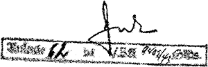 |
|
| |
|
|
|
|
|

