U-38 - 1st War Patrol
Translation by Jerry Mason with the help of Ken Dunn and Andi Forster
Departed |
Date |
Arrived |
Date |
Days at Sea |
Wilhelmshaven |
19 August 1939 |
Wilhelmshaven |
18 September 1939 |
31 |
| Click the icon to download a KMZ file displaying the U-boat track, significant events and locations for this patrol. You must have Google Earth loaded on your computer to view this file. Download Google Earth here |
Ships
Hit |
||||||
Date |
KTB
Time |
Position |
Ship |
Tons |
Nationality |
Convoy |
6 Sep 39 |
06.00 |
38°44'N,
10°15'W |
MANAAR |
7,242 |
British |
|
11 Sep 39 |
13.50 |
48°14'N,
11°48'W |
INVERLIFFEY |
9,456 |
British |
|
Total = 16,698 |
||||||
| Note: The positions in the table above and in the Google Earth patrol summary are derived from the KTB and in many cases do not match those set forth in authoritative references such as Jürgen Rohwer, Axis Submarine Successes of World War Two or the Uboat.net website. The goal here is to present the picture relative to the U-boat and not the absolute position that the ship was attacked or sank. | ||||||
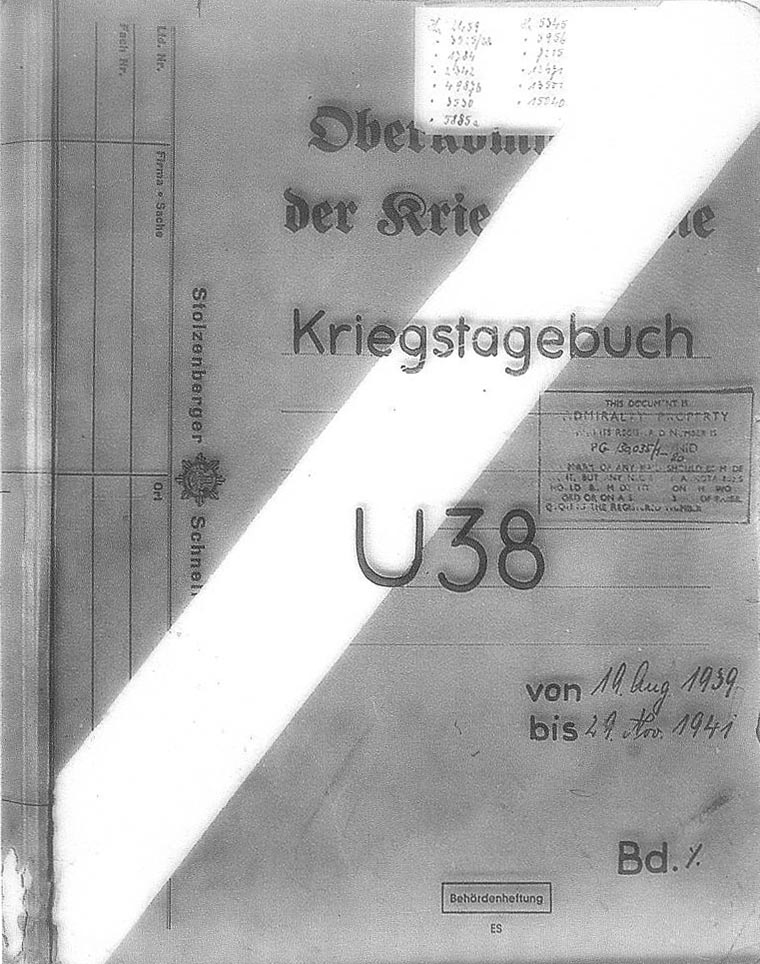
| K r i e g s t a g e b u c h " U 38 " . | |||||
| ================================== | |||||
| Beginning: 19.8.39. | |
||||
| Concluding: 18.9.39. | |||||
| Enclosures: 4 Prize reports. | |||||
 |
|||||
 |
|||||
| © U-boat Archive 2023 - all rights reserved | |||||
 |
Click the flag to view the above page from the original German KTB |
- 1 - |
|||||
| 19.08.39 | |||||
| 00.00 | Wilhelmshaven | Departed. | |||
| 13.30 | 55° 24' N, 7° 32' E | Course 320°, 10 knots. | |||
| NNE 2, Vis. good | Passed latitude of Esbjerg. | ||||
| 20.00 | 55° 50' N, 6° 41' E | Progress hindered by numerous fishing vessels and steamers. | |||
| 20.08.39 | |||||
| 08.00 | 57° 08.5' N, 5° 31' E | Own U-boat sighted to port about 8000 meters. | |||
| N 1-2, Vis. good | |||||
| 19.20 | 58° 09' N, 4° 36' E | U-boat, apparently an English boat of the L or Thetis Class (No. 181 on conning tower), in sight on southerly course. Boat drove with peacetime measures with open hatches. | |||
| Progress again hindered by numerous vessels. | |||||
| 21.08.39 | |||||
| 08.00 | 60° 00' N, 2° 58' E | Course 342°, 10 knots. | |||
| N 1-2, light Swell | |||||
| 13.45 | German U-boat, 5. U.-Flottille, in sight astern. Traffic density is already significantly less here. | ||||
| 22.08.39 | |||||
| 08.00 | 62° 46' N, 1° 37' W | Course 295°, 10 knots. No events. | |||
| 17.40 | SW 3-4, Swell, overcast | Boat of the 6. U-Flottille in sight to port. | |||
| No steamer traffic observed. | |||||
| 23.08.39 | |||||
| 00.00 | 63° 14' N, 6° 30' W | Course 270°, 10 knots. | |||
| WSW 3-4, Swell, Vis. medium | Except for fishing trawlers coming from Iceland no vessels sighted. | ||||
| 24.08.39 | |||||
| 00.00 | S 3-4, Sea 4, Vis. bad, rain | No events. | |||
| 25.08.39 | |||||
| 00.00 | 60° 06' N, 15° 50' W | 2 steamers sighted on the steamer route at the north tip of Scotland. | |||
| 18.20 | German U-boat sighted. | ||||
|
Sun and Moon Data 19.08.39 |
| Sun and Moon Data 20.08.39 | |
| Sun and Moon Data 21.08.39 | |
| Sun and Moon Data 22.08.39 | |
| Sun and Moon Data 23.08.39 | |
| Sun and Moon Data 24.08.39 | |
| Sun and Moon Data 25.08.39 |
- 2 - |
|||||
| 26.08.39 | |||||
| 00.00 | 57° 30' N, 17° 54' W | Course 180°, 10 knots. No events. | |||
| Very unsettled weather and changing Vis | |||||
| 27.08.39 | |||||
| 08.00 | 52° 29' N, 17° 54' W | No events. | |||
| 28.08.39 | |||||
| 08.00 | 49° 02' N, 17° 54' W | One steamer sighted. | |||
| 29.08.39 | |||||
| 00.00 | 47° 48' N, 17° 54' W | One steamer sighted. | |||
| 30.08.39 | |||||
| 00.00 | 44° 53' N, 18° 08' W | No events. | |||
| 31.08.29 | |||||
| 00.00 | 41° 44' N, 18° 08' W | In the course of the day arrived in the operations area. One steamer sighted. | |||
| SWbyS 5, Sea 4-5, Vis. good | |||||
| Intention: Head for the coast in the operations area at economical speed. Received Radio Message concerning invasion in Poland. | |||||
| 01.09.39 | |||||
| 00.00 | 39° 17' N, 16° 55' W | One steamer sighted. | |||
| WSW 2, Swell | |||||
| 02.09.39 | 37° 42' N, 13° 39' W | In the course of the day 4 steamers sighted, of these a dimmed one by night. | |||
| SSW 4, Sea 3 | |||||
| 03.09.39 | |||||
| 00.00 | 37° 50' N, 12° 18' W | At 12.00 hours received Radio Message concerning opening of hostilities against England. | |||
| Situation: Merchant warfare according to the Prize Regulations. Protecting neutrals especially important with regard to the Führer speech. French ships are to be treated especially carefully. Own range from the coast about 150 nm. This complicates merchant warfare because the crew can not be rescued. | |||||
| Decision: In accordance with operational orders wait on vessels, which can be sunk without warning. From observations of the previous days it seems this area is often traversed by steamers so there is the prospect that convoys will also choose this route. | |||||
|
Sun and Moon Data 26.08.39 |
| Sun and Moon Data 27.08.39 | |
| Sun and Moon Data 28.08.39 | |
| Sun and Moon Data 29.08.39 | |
| Sun and Moon Data 30.08.39 | |
| Sun and Moon Data 01.09.39 | |
| Sun and Moon Data 02.09.39 | |
| Sun and Moon Data 03.09.39 |
- 3 - |
|||||
| 04.09.39 | |||||
| 08.00 | 38° 10' N, 12° 30' W | From Radio Message reports on the Portuguese coast French warships and English U-boats may be expected. | |||
| NNE 3, Vis. good | |||||
| 16.30 | 37° 25' N, 12° 12' W | Boat was submerged. During an all around sweep before surfacing French mine cruiser "PLUTO" in sight. Cruiser ran at high speed and zigzaged heavily. For this reason attack would not have been successful. There is the impression that the periscope was sighted or that the boat was heard. | |||
| Decision changed. Intend go go under land to possibly pursue warships. Merchant ship warfare still does not seem as promising as the night before, however the possibility of carrying it out is more favorable in the vicinity of land. | |||||
| 05.09.39 | |||||
| 00.00 | 37° 40' N, 11° 22' W | Encountered a dimmed vessel at night. At first intended to sink the ship, however given the restriction against French ships this measure was given up. | |||
| 14.00 | Crash dive for aircraft. | ||||
| 16.07 | English passenger ship of the "HIGHLAND BRIGADE" Class in sight. Ship ran at high speed and zigzaged heavily. Remained submerged until the steamer was out of sight. | ||||
| 06.09.39 | |||||
| 06.00 | 38° 44' N, 10° 15' W | Steamer sighted abeam to port on southerly course. Came to intercept course on the surface. | |||
| N 2, low Sea State | |||||
| At a range of about 6000 meters set signal to stop and not use the Radio Message installation. Steamer gave a short tone with his siren and turned away. Shot across the bow. Steamer ran off at high speed and sent a Radio Message report. Thereupon shot for effect. Steamer returned fire from a cannon mounted on the stern. His salvos lay badly, rate of fire was low. After 4-5 hits the crew abandoned ship, which maintained slight speed astern. | |||||
|
Sun and Moon Data 04.09.39 |
| Sun and Moon Data 05.09.39 | |
| Sun and Moon Data 06.09.39 |
- 4 - |
|||||
| continued | |||||
| 06.09.39 | |||||
| It turned out to be the English steamer "MANAAR", 7200 tons. Dived and shot a G 7 a torpedo. Range amounted to about 1200 meters. By the stopwatch the torpedo detonated after about 400 meters. Water column lay directly in the direction of the ship so that it could not be determined if the ship was hit. After the 2nd shot, which hit under the bridge, the steamer was a little down by the bow but did not sink. After the 3rd shot, which also hit forward of the bridge sinking was not observed. | |||||
| 07.44 | 4th torpedo shot, which hit in the engine room. Steamer broke in the middle and sank. The bridge was protected with sandbags. The ship had no flag set and first stopped after hits were achieved. | ||||
| 07.09.39 | |||||
| 08.00 | 37° 18' N, 13° 33' W | In the course of the day 1 steamer sighted, however was in a hopeless position for stopping. | |||
| NE 1, light Swell | |||||
| 21.15 Radio Message Orders to return. | |||||
| 08.09.39 | |||||
| 08.00 | 39° 37' N, 13° 51' W | No events. | |||
| N 2, light Swell | |||||
| 09.09.39 | |||||
| 20.00 | 44° 55' N, 14° 09' W | No events. | |||
| 10.09.39 | |||||
| 06.00 | 46° 27' N, 14° 12' W | French fishing trawler "JUTLAND", cargo fish and salt, stopped and released after checking papers. | |||
| Incoming Radio Message concerning convoys departing from Gibraltar. | |||||
| Under the assumption that F.d.U. orders are expected and in accordance with orders that convoys, which are protected by England and France may only be attacked north of Brest, headed for Ouessant. | |||||
| 11.09.39 | |||||
| 12.35 | 48° 14' N, 11° 48' W | American tanker "STEWARD" stopped and released. | |||
| NNW 3, Sea 2 | |||||
| 13.50 | Irish steamer "INVERLIFFEY" stopped and | ||||
|
Sun and Moon Data 06.09.39 |
| Sun and Moon Data 07.09.39 | |
| Sun and Moon Data 08.09.39 | |
| Sun and Moon Data 09.09.39 | |
| Sun and Moon Data 10.09.39 | |
| Sun and Moon Data 11.09.39 |
- 5 - |
|||||
| continued | |||||
| 11.09.39 | sunk. Crew taken on boat the American ship. | ||||
| Captain had no cargo papers, stated when asked that he was destined for London. The ship was loaded with oil, was sunk by a torpedo shot. Continued return transit to the homeland, because no supplemental orders were received from F.d.U. in the last 24 hours. | |||||
| 12.09.39 | |||||
| 00.00 | 49° 11' N, 11° 59' W | No events. | |||
| 13.09.39 | |||||
| 00.00 | 52° 45' N, 13° 04' W | No events. | |||
| 14.09.39 | |||||
| 04.40 | 56° 55' N, 11° 40' W | Dived before 3 English destroyers. Attack initiated on one destroyer. Unsuccessful. Destroyer proceeded on a northerly course, very high speed and zigzagged continually, out of sight. It turned out to be a boat of the 4. Flottille. | |||
| 15.09.39 | |||||
| 00.00 | 59° 10' N, 9° 30' W | In the course of the day passed 3 steamers proceeding on a southwesterly course. One Swede, One Dane, destined for America and at the same time were passenger steamers. They were not stopped. | |||
| N 3, Sea 3 | |||||
| The third ship came in sight in an unfavorable location. | |||||
| 16.09.39 | 61° 22' N, 2° 45' W | Crash dived twice for aircraft. | |||
| SW 3, Sea 2, Vis. good | Between the Shetlands and Faroes no patrols at all were met. | ||||
| 17.09.39 | |||||
| 00.00 | 58° 54.5' N, 3° 24' E | In the course of the day 4 steamers were sighted. | |||
| Between Norway and the Shetlands and between Norway and the Orkneys English an patrol vessel line was suspected, however not encountered. Steamer traffic in the North Sea, especially in the Skagerrak was very lively. | |||||
| At 09.48 hours the Finish steamer "ODWAR II", 5700 tons, with coal from "Immisgham, England to Slemmestad, Norway stopped and released. | |||||
|
Sun and Moon Data 11.09.39 |
| Sun and Moon Data 12.09.39 | |
| Sun and Moon Data 13.09.39 | |
| Sun and Moon Data 14.09.39 | |
| Sun and Moon Data 15.09.39 | |
| Sun and Moon Data 16.09.39 | |
| Sun and Moon Data 17.09.39 |
- 6 - |
|||||
| continued | |||||
| 17.09.39 | |||||
| 11.08 | Danish steamer "ELISABETH", from Copenhagen, with wood for Holland, searched and released. | ||||
| In the course of the afternoon put the boat on the bottom off the passage east of the German mine warning area until the beginning of darkness. | |||||
| 18.30 | Met "U-40". | ||||
| Began transit to the south. | |||||
| No events. | |||||
| 18.09.39 | |||||
| 14.00 | Entered Wilhelmshaven. | ||||
| |
|||||
| Kapitänleutnant and | |||||
| Kommandant " U 38 ". | |||||
|
Sun and Moon Data 17.09.39 |
| Sun and Moon Data 18.09.39 |
Kriegstagebuch " U 38 " for the period from 19.9.-13.11.1939. |
|||||
| 19.09.39 | Wilhelmshaven | Torpedo offload. | |||
| 20.09.39 | Wilhelmshaven - down the Jade up the Weser - Bremen | Transfer cruise to Bremen. | |||
| 21.09. - 02.11.39 | Bremen A.G. Weser | Engine overhaul. | |||
| 03.11.39 | Bremen - down the Weser - up the Wesser- Wilhelmshaven | Sea trial. | |||
| 04.11.39 | Bremen A.G. Weser | Work service. | |||
| 05.11.39 | Bremen - down the Weser - up the Jade - Wilhelmshaven | Transfer cruise to Wilhelmshaven. | |||
| 06.11.39 | Wilhelmshaven | Outfitting of the boat. | |||
| to | |||||
| 13.11.39 | On board, 31 July 1040 | ||||
| |
|||||
| Kapitänleutnant and | |||||
| Kommandant. | |||||
|
| Enclosures to U-38's KTB - click on the text at left to proceed to the document | |
| Prize | Prize reports |
| Report | Report on torpedoes |
| Chart | Track chart |
Click the icons to view the associated records |
|||||
 |
Return to the U-boat KTB page | ||||