U-505 - 2nd War Patrol
Translation by Jerry Mason with help from Andi Forster
Departed |
Date |
Arrived |
Date |
Days at Sea |
Lorient |
11 February 1942 |
Lorient |
7 May 1942 |
86 |
| Click the icon to download a KMZ file displaying the U-boat track, significant events and locations for this patrol. You must have Google Earth loaded on your computer to view this file. Download Google Earth here |
Ships Attacked |
||||||
Date |
KTB Time |
Position |
Ship |
Tons |
Nationality |
Convoy |
5 Mar 42 |
23.07 - 23.47
|
6°09'N, 14°03'W
|
BENMOHR |
5,920 |
British |
|
6 Mar 42 |
11.31 |
4°57'N,
14°57'W |
SYDHAV |
7,587 |
Norwegian |
|
3 Apr 42 |
21.32 |
2°39'N,
6°03'W |
WEST IRMO |
5,775 |
American |
|
4 Apr 42 |
21.29 |
2°03'N, 8°03'W
|
ALPHACCA |
5,759 |
Netherlands |
|
Total = 25,041
|
||||||
| Note: The positions in the table above and in the Google Earth patrol summary are derived from the KTB and in many cases do not match those set forth in authoritative references such as Jürgen Rohwer, Axis Submarine Successes of World War Two or the Uboat.net website. The goal here is to present the picture relative to the U-boat and not the absolute position that the ship was attacked or sank. | ||||||
- 1 - |
|||||
 |
|||||
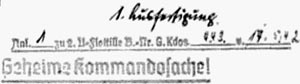
| K r i e g s t a g e b u c h | |||||
| U-505 | |||||
| 2nd War Patrol | |||||
| Kommandant: Kapitänleutnant L o e w e | |||||
| B e g a n : 04.02.42 | |||||
| C o n c l u d e d : 07.05.1942. | |||||
| Time: D.G.Z. | |||||
| All naval squares. | |||||
 |
|||||
| Distribution: | 2 x O.K.M. | ||||
| 1 x B.d.U. | |||||
| 1 x 2.A.d.Uboote. | |||||
| 1 x 2.U.-Flottille. | |||||
| |
|||||
| © U-boat Archive 2023 - all rights reserved | |||||
 |
Click the flag to view the above page from the original German KTB |
- 2 - |
|||||
| 04.02 - 08.02.42 | Lorient. Shipyard work. 15 tons ballast removed. | ||||
| 09.02 - 11.02.42 | Fitting out Lorient. | ||||
| 11.02.42 | |||||
| 13.00 | Trim test. | ||||
| 18.00 | Departed on 2nd war patrol, together with "U-68". | ||||
| Outbound orders read: | |||||
| "1. Depart Lorient 11 February, 18.00 hours. | |||||
| 2. Operations Order 52 in effect. In addition, take Operations Order 50 for information. | |||||
| 3. Proceed to the south. At 35° North proceed to the south on a straight course: U-505 between 22° and 24° West. Afterwards make for naval square Emil Toni 50. Attack area by Radio Message." | |||||
| In convoy to Lucie 2. | |||||
| 19.45 | Released from convoy. Proceeding via Point Ceder and Tanne. | ||||
| 20.00 and later | Anti-aircraft fire and aircraft parachute flares seen in the direction of Lorient. | ||||
| |
|||||
| 12.02.42 | |||||
| 00.00 | BF 6481 | ||||
| 04.00 | BF 5861 | ||||
| 08.00 | BF 5786 | ||||
| 09.40 | N 1-2, Sea 1, Vis. medium, few clouds, moonshine | Dived. Proceeding submerged. | |||
| 10.25 and 10.28 | A single distant detonation heard. | ||||
| 12.00 | BF 5759 | Day's run: |
|||
| 16.00 | BF 5758 | ||||
| 20.00 | BF 5781 | ||||
| 20.45 | Surfaced. | ||||
| |
|||||
| 13.02.42 | |||||
| 00.00 | BF 4994 | ||||
| N 1, Sea 0, isolated rain showers, Vis. medium to good | |||||
| 04.00 | BF 4899 | ||||
| 08.00 | BF 7226 | ||||
| 09.00 | Dived. Proceeding submerged. Discovred the port shaft makes a steady knocking at 90 RPM. Must be examined as soon as possible. | ||||
|
Sun and Moon Data 11.02.42 |
| Sun and Moon Data 12.02.42 | |
| Sun and Moon Data 13.02.42 |
- 3 - |
|||||
| 13.02.42 | |||||
| Must be examined as soon as possible. | |||||
| 12.00 | BF 7219 | Day's run: |
|||
| 13.04 | BF 7218 | Through the periscope an aircraft is sighted 8000 meters awasybearing 190°T on a westerly course, altitude 500 meters. Apparently a land-based aircraft. Aircraft out of sight in the west. | |||
| 16.00 | BF 7217 | ||||
| 20.00 | BF 7139 | ||||
| 21.25 | Surfaced. | ||||
| 23.00 | Short signal to B.d.U.: | ||||
| Position BF 71. | |||||
| 23.11 | Confirmed by B.d.U. | ||||
| For the outbound transit, decide to keep well clear of Finisterre because of U-boat danger and air surveillance and then to head for the point 35° North, 23° West by the shortest route. | |||||
|
|
|||||
| 14.02.42 | |||||
| 00.00 | BF 7151 | ||||
| 04.00 | BE 9358 | ||||
| 08.00 | BE 9267 | ||||
| SE 2-3, Sea 1-2, Vis. very good, 6/10 cloudy | |||||
| 09.20 | Test dive. | ||||
| 10.30 | Surfaced. | ||||
| 12.00 | BE 9277 | Day's run: |
|||
| 15.45 | BE 9450 | "Crash Dive" for aircraft (Sunderland), comes into sight bearing 160°T, course 0°, 8000 meters distant. Altitude 20 meters. Was not seen. | |||
| 16.30 | Surfaced. | ||||
| 18.45 | BE 9470 | "Crash dive" for aircraft (Sunderland), comes in to sight bearing 270°T, on course 120°, about 10000 meters distant. Low altitude. Was not seen. | |||
| 19.15 | Surfaced. | ||||
| 20.00 | BE 9470 | ||||
|
|
|||||
| 15.02.42 | |||||
| 00.00 | BE 9710 | ||||
| 04.00 | BE 8960 | ||||
|
Sun and Moon Data 13.02.42 |
| Sun and Moon Data 14.02.42 | |
| Sun and Moon Data 15.02.42 |
- 4 - |
|||||
| 15.02.42 | |||||
| 08.00 | BE 8980 | ||||
| SE 2, Sea 1, 10/10 overcast, Vis. good | |||||
| 09.25 | Test dive. | ||||
| 10.30 | Surfaced. | ||||
| 12.00 | CF 3210 | Day's run: |
|||
| 16.00 | CF 3240 | ||||
| S 3-4, Sea 2-3, Vis. very good, high closed cloud deck | |||||
| 20.00 | CF 3160 | ||||
| Light rain | |||||
| |
|||||
| 16.02.42 | |||||
| 00.00 | CF 3150 | ||||
| 04.00 | CF 3150 | ||||
| SSE 3, Sea 2-3, medium swell from the SW, Vis. good, low cloud deck, scattered rain | |||||
| 08.00 | CF 3170 | ||||
| 09.45 | Test dive. | ||||
| 10.40 | Surfaced. For 2 days the boat has had a heavy oil trace from starboard forward, after surfacing each time the over deck and bridge are full of oil, reason not yet found. | ||||
| 12.00 | CF 3180 | Day's run: |
|||
| 16.00 | CF 3420 | ||||
| 20.00 | CF 3450 | ||||
| |
|||||
| 17.02.42 | |||||
| 00.00 | CF 3480 | ||||
| 04.00 | CF 3720 | ||||
| 08.00 | CF 3750 | ||||
| 10.15 | Test dive. | ||||
| 10.45 | Surfaced. | ||||
|
Sun and Moon Data 15.02.42 |
| Sun and Moon Data 16.02.42 | |
| Sun and Moon Data 17.02.42 |
- 5 - |
|||||
| 17.02.42 | |||||
| 12.00 | CF 3780 | Day's run: |
|||
| SSE 3-4, drizzle, Vis. 1-1/2 nm, overcast, low rain clouds, medium swells from the SW | |||||
| 16.00 | CF 3770 | ||||
| 20.00 | CF 3770 | ||||
|
|
|||||
| 18.02.42 | |||||
| 00.00 | |||||
| S 1-2, Sea 1, Vis. 3-5 nm, partial overcast, light SW swell | |||||
| 04.00 | CF 5320 | ||||
| 08.00 | CF 5310 | ||||
| Rain | |||||
| 10.00 | Test dive. Completion of necessary work on the high pressure air installation. | ||||
| 12.00 | CF 5340 | Day's run: |
|||
| 12.30 | Surfaced. | ||||
| 16.00 | CF 5290 | ||||
| 20.00 | CF 5530 | ||||
|
|
|||||
| 19.02.42 | |||||
| 00.00 | CF 5550 | ||||
| S 4, Sea 3-4, overcast, medium swell from the SW | |||||
| 04.00 | CF 5550 | ||||
| 08.00 | CF 5550 | ||||
| 10.10 | S 2-3, Sea 2, medium SW swell | Test dive. | |||
| 10.40 | Surfaced. Oil trace has become weaker. | ||||
| 12.00 | CF 5810 | Day's run: |
|||
| SE 2-3, cloud deck breaking up | |||||
| 16.00 | CF 5810 | ||||
| 20.00 | CF 8120 | ||||
| SW 1-2, Sea 0, flat SW swell | |||||
|
|
|||||
|
Sun and Moon Data 17.02.42 |
| Sun and Moon Data 18.02.42 | |
| Sun and Moon Data 19.02.42 |
- 6 - |
|||||
| 20.02.42 | |||||
| 00.00 | CF 7390 | ||||
| 04.00 | CF 7630 | ||||
| 08.00 | CF 7660 | ||||
| 10.10 | Test dive. | ||||
| 10.40 | Surfaced. | ||||
| 12.00 | CF 7680 | Day's run: |
|||
| WSW 4, Sea 3-4, Vis. medium | |||||
|
|
|||||
| 16.00 | CF 7920 | ||||
| 20.00 | CF 7950 | ||||
|
|
|||||
| 21.02.42 | |||||
| 00.00 | CF 7980 | ||||
| 04.00 | DH 1120 | ||||
| 08.00 | DH 1150 | ||||
| WNW 5-6, Sea 5, Vis. medium, 6/10 high cloudiness | |||||
| 10.35 | Test dive. | ||||
| 11.40 | Surfaced. | ||||
| 12.00 | DH 1180 | Day's run: |
|||
| 16.00 | DH 1450 | ||||
| WNW 3-4, high swell | |||||
| 20.00 | DH 1480 | ||||
|
|
|||||
| 22.02.42 | |||||
| 00.00 | DH 1480 | ||||
| WNW 1-2, flat swell from the NW, Vis. 3 nm, high hazy cloudiness, moon shining through | |||||
| 04.00 | DH 1720 | ||||
| 08.00 | DH 1780 | ||||
| 10.50 - 11.35 | Test dive. | ||||
| 12.00 | DH 4150 | Day's run: |
|||
| 16.00 | DH 4180 | ||||
|
|
|||||
|
Sun and Moon Data 20.02.42 |
| Sun and Moon Data 21.02.42 | |
| Sun and Moon Data 22.02.42 |
- 7 - |
|||||
| 22.02.42 | |||||
| 20.00 | DH 4450 | ||||
| W 2-3, Sea 2, flat swell, 10/10 overcast, Vis. 3-4 nm | |||||
| |
|||||
| 23.02.42 | Canary Islands Sea Area | ||||
| 00.00 | DH 4480 | ||||
| 04.00 | DH 4750 | ||||
| 08.00 | DH 7120 | ||||
| 12.00 | DH 7150 | Day's run: |
|||
| WNW 2, Sea 1, flat NW swells, Vis. 5 nm, 2/10 overcast | |||||
| 14.40 - 15.20 | Test dive. | ||||
| 16.00 | DH 7190 | ||||
| 20.00 | DH 7430 | ||||
| 20.25 | Dived to correct oil trace. | ||||
| 20.50 | Surfaced. | ||||
| |
|||||
| 24.02.42 | West of the Canary Islands | ||||
| 00.00 | DH 7490 | ||||
| 04.00 | DH 7730 | ||||
| 08.00 | DH 7760 | ||||
| 12.00 | DT 2330 | Day's run: |
|||
| 16.00 | DT 2360 | ||||
| 16.30 | DT 3170 | Smoke trail in sight to port. Far off. Held on to it. Quickly shifts to the right. While approaching recognized 4-6 smoke trails. Convoy. | |||
| 9/10 overcast, NNE 1-2, Sea 0-1, old flat NW swells, Vis. very good | |||||
| 17.25 | Crash dive for aircraft (likely a Sunderland) which circles around the convoy and suddenly persistently flies in our direction. Evidently, has not seen us. | ||||
| Submerged rear diving planes get stuck in position hard up because of failure of the limit switch. Surfacing delayed because of depth control difficulties. | |||||
|
Sun and Moon Data 22.02.42 |
| Sun and Moon Data 23.02.42 | |
| Sun and Moon Data 24.02.42 |
- 8 - |
|||||
| 24.02.42 | |||||
| 18.13 | Surfaced. Convoy has shifted greatly, now positioned at 115°T. Went to GF, then 2 x GF to maneuver ahead. Contact by smoke clouds, because aircraft are seen again and again. Probably escort by 2 or 3 Sunderlands. Convoy is located about 20 nm away. | ||||
| 20.23 | Evaded before an aircraft approaching suddenly from the west, went to LF. | ||||
| 21.10 | Out maneuvered an aircraft approaching from the convoy. | ||||
| That always costs ground. The stern diving plane is again in service. | |||||
| 21.30 | At 16 knots, the boat can not go faster, have not gotten any further ahead. The bearing to the convoy has not shifted. He runs for sure at 15 knots. | ||||
| I wanted to report contact first when further details were determined and steamers were sighted. However, I decide to report by radio message, because I suppose "U-68" is in the path of the convoy and I fear contact will be broken in the relatively short twilight under the given circumstances. | |||||
| "Radio Message 21.40: From Loewe: Convoy several fast steamers DT 3480, southerly course, 15 knots. Aircraft escort. Contact only by smoke clouds. Forced off multiple times." | |||||
| I send a radio message deliberately in view of my later task and the enemy intercept service, because I believe it is more harmless than a radio signal. | |||||
| 22.00 | Smoke clouds out of sight. Chased after at highest speed on the last bearing. Given his speed it is possible he will slow down for fire cleaning [boiler cleaning/blowing tubes]. Otherwise I can not get him. | ||||
| 23.25 | DT 3750 | Ahead initially clouds of smoke, then a great number of shadows in sight. | |||
| 24.02.42 | Apparently he has just finished with fire cleaning, smoke quickly stops and he runs at his old speed. Unfortunately, I am positioned exactly behind him. Try at highest speed to maneuver ahead. I come ahead quite slowly. I maintain a distance of 4-5 nm. Should have been closer. | ||||
|
|
|||||
| 25.02.42 | Southwest of the Canary Islands | ||||
| 01.00 | DT 3780 | The convoy is suddenly out of sight. Had sidestepped to port. Chasing after gets nothing. | |||
| 10/10 overcast, NNE 2-3, Sea 2, moonshine, bright night, Vis. good | |||||
|
Sun and Moon Data 24.02.42 |
| Sun and Moon Data 25.02.42 |
- 9 - |
|||||
| 25.02.42 | |||||
| 01.20 | Stopped to listen. No results. | ||||
I consider: |
If I steer searching courses now at high speed, I will never catch him with a one knot speed advantage. Perhaps he zigzags in the course of the night again on or around his old general course 170° back. | ||||
| Therefore, decide to steer 160°, until dawn, in the hope of regaining contact. At slightly less speed, because highest speed costs a lot of fuel and in this case success is very much in doubt. | |||||
| Radio Message 02.04: | |||||
| From Loewe: Contact lost. Last observed enemy position 01.00 hours DT 3790, southeasterly course, 15 knots speed. In pursuit. If by dawn no contact, continue transit. Position DT 6132. 190 cbm. | |||||
03.31 to |
Dived to listen. Sound bearing in 120°T. Unfortunately far forward. | ||||
| 04.00 | DT 6160 | Surfaced. Continued on. | |||
| 08.00 | DT 6510 | ||||
| 08.15 | Cruising speed, course 190°. | ||||
| Conclusion: a one knot speed advantage given the circumstances was not enough. | |||||
| It was my mistake by to lose contact from 01.00 hours. | |||||
| 12.00 | DT 6640 | Day's run: |
|||
| 16.00 | DT 6810 | ||||
| 20.00 | DT 6760 | ||||
| |
|||||
| 26.02.42 | Northeast of the Cape Verde Islands | ||||
| 00.00 | DT 9130 | ||||
| NNE 2-3, Sea 2, clouds breaking up, moon shine, Vis. very good | |||||
| 04.00 | DT 9160 | ||||
| 08.00 | DT 9420 | ||||
| 12.00 | DT 9450 | Day's run: |
|||
| 16.00 | DT 9720 | ||||
| 20.00 | DT 9750 | ||||
|
Sun and Moon Data 25.02.42 |
| Sun and Moon Data 26.02.42 |
- 10 - |
|||||
| 26.02.42 | |||||
| 21.55 | Incoming Radio Message 2044/26 from B.d.U.: | ||||
| "To Loewe and Merten: | |||||
| Attack area in accordance with Operational Order 52 paragraph 20 first line and southeast there from. | |||||
| Amendment to paragraph 19a) in accordance with Radio Message Order from 15 February is to be understood as follows: border is a connecting line between naval square ER 3159 and square FD 3969. | |||||
| |
|||||
| 27.02.42 | Northeast of the Cape Verde Islands | ||||
| 00.00 | EJ 3120 | ||||
| 04.00 | EJ 3150 | ||||
| 08.00 | EJ 3180 | ||||
| NNE 4, Sea 3-4, NE swell, Vis. very good, 10/10 overcast | |||||
| 10.15 | Test dive, depth control and fire control training. Repairs. | ||||
| 12.00 | EJ 3420 | Surfaced. Day's run: |
|||
| Now the source of the continuing oil trace is found to be main ballast and reserve fuel oil tank 7 starboard, from which the oil is probably leaking through the emergency shut off valve and shut off valve in the vent line through the vent drain and vent itself. | |||||
| Total loss of fuel oil 9.5 cbm. | |||||
| Oil trace has vanished. | |||||
| 16.00 | EJ 3480 | ||||
| 20.00 | EJ 3720 | ||||
| |
|||||
| 28.02.42 | East of the Cape Verde Islands | ||||
| 00.00 | EJ 3750 | ||||
| 04.00 | EJ 6120 | ||||
| 08.00 | EJ 6150 | ||||
| NNE 4-5, Sea 3-4, Vis. good, cumulous clouds | |||||
| 12.00 | EJ 6190 | Day's run: |
|||
| 16.00 | EJ 6460 | ||||
| 20.00 | EJ 6570 | ||||
| |
|||||
|
Sun and Moon Data 26.02.42 |
| Sun and Moon Data 27.02.42 | |
| Sun and Moon Data 28.02.42 |
- 11 - |
|||||
| 01.03.42 | West Coast of Africa | ||||
| 00.00 | EJ 6810 | ||||
| 04.00 | EJ 6880 | ||||
| 08.00 | EJ 9220 | ||||
| 12.00 | EJ 9250 | Day's run: |
|||
| NNE 4, Sea 3-4, Vis. good, isolated high clouds | |||||
| 16.00 | EJ 9290 | The boat is positioned close to the ordered operations area. | |||
| Decision, initially to operate in the most favorable area from Operations Order 52 south and southeast of Freetown on courses across the suspected steamer courses to Cape Town, or the Ivory Coast - North America. On the way there I'll make an advance to the east off the coast to the north of Freetown and steer a southerly course from there in the intended operations area. | |||||
| 20.00 | EJ 9610 | ||||
| NNE 2-3, Sea 1-2, Vis. good, cloudless | |||||
| |
|||||
| 02.03.42 | |||||
| 00.00 | EJ 9650 | ||||
| Moon shine | |||||
| 04.00 | EJ 9690 | ||||
| 08.00 | EK 7470 | ||||
| 11.10 - 12.10 | Test dive. | ||||
| 12.00 | EK 7480 | Surfaced. Day's run: |
|||
| 16.00 | EK 7490 | ||||
| 20.00 | EK 7820 | ||||
| 20.25 | Crash dive for aircraft astern 8000 meters distant on a northerly course. Was unseen. | ||||
| 21.20 | Surfaced. | ||||
| |
|||||
| 03.03.42 | |||||
| 00.00 | EK 7830 | From 01.00 to 05.00 hours observed a toal eclipse of the moon. | |||
| 04.00 | EK 7950 | ||||
| 08.00 | EK 7950 | ||||
| N 1-2, Sea 0, flat N swells, Vis. good, Alto stratus clouds | |||||
|
Sun and Moon Data 01.03.42 |
| Sun and Moon Data 02.03.42 | |
| Sun and Moon Data 03.03.42 |
- 12 - |
|||||
| 03.03.42 | Northwest of Freetown | ||||
| 10.15 - 11.20 | Test dive. | ||||
| 12.00 | EK 7980 | Day's run: |
|||
| 16.00 | ET 1350 | ||||
| 20.00 | ET 1620 | ||||
|
|
|||||
| 04.03.42 | |||||
| 00.00 | ET 1680 | ||||
| 04.00 | ET 1920 | ||||
| 08.00 | ET 1950 | ||||
| NW 1, Sea 0, flat N swell, Vis. 8-10 nm, Alto stratus clouds | |||||
| 12.00 | ET 4330 | Day's run: |
|||
| 16.00 | ET 5140 | ||||
| 20.00 | ET 5180 | ||||
|
|
|||||
| 05.03.42 | West of Sierra Leone | ||||
| 00.00 | ET 5540 | ||||
| 04.00 | ET 5580 | ||||
| 08.00 | ET 5830 | ||||
| NW 1-2, Sea 0, confused swell, Vis. 8-10 nm, Alto stratus clouds 8/10 | |||||
| 10.05 - 10.40 | Test dive. | ||||
| 12.00 | ET 5940 | Day's run: |
|||
| 16.00 | ET 5950 | ||||
| 18.36 | ET 5990 | Steamer in sight in the extended periscope bearing 115°T. General course to Freetown (about 15) zig-zagging heavily. Running at 12 knots. Fully loaded. Maneuvered ahead for day attack, does not succeed, therefore initiated surface night attack. | |||
| 20.00 | ET 6740 | ||||
| 22.52 | NW 2, Sea 1, flat NW swell, Vis. very good, 9/10 overcast, high clouds | Steamer runs dimmed. Matched speed. | |||
| Double shot from tubes I and IV (Etos) depth 3 meters. | |||||
| Both were unexplained misses. Range = 600 meters. Matched speed again at 800 meters abeam steamer ran at 16 knots. Marine phosphoresence. | |||||
|
Sun and Moon Data 03.03.42 |
| Sun and Moon Data 04.03.42 | |
| Sun and Moon Data 05.03.42 |
- 13 - |
|||||
| 05.03.42 | |||||
| 23.07 | Shot from tube II (Eto). Range = 400 meters, depth 3 meters. | ||||
| Hit amidships. Steamer stopped, sets out boats and throws a large night rescue buoy. Radioed wildly "SSS, torpedoed, position and name." | |||||
| "BENMOHR" 5920 GRT. Settled very slowly deeper. | |||||
| 23.24 | Ato from tube III as a coup de grace, depth 4 meters, range = 300 meters. Hit at the bridge. Steamer settles deeper. | ||||
| 23.47 | ET 6480 | Breaks in the middle, masts bend together, quickly sinks. | |||
| When there was nothing else to see, ran off on opposite general course. Shortly after the night becomes moonlit. | |||||
|
|
|||||
| 06.03.42 | Southwest of Sierra Leone | ||||
| 00.00 | ET 6480 | ||||
| 03.00 | ET 6740 | "Crash dive" for a "Sunderland" flying out of the moon. | |||
| Bright night | |||||
| 04.25 | ET 6740 | Surfaced. | |||
| 08.00 | ET 5990 | ||||
| 09.30 | ET 8320 | From ahead out of a rain squall 8-10 nm distant a tanker comes into sight. Zig-zagging heavily. The bridge is completely above the horizon. I quickly recognize I am positioned aheadon his base course line. He heads for Freetown just like the previous steamer. Speed 10 knots. Tanker is full. | |||
| Rain showers, Vis. good | |||||
| 10.22 | ET 8320 | Dove for |
|||
| Tanker had no flag, no neutrality markings. Type "BRITISH CONFIDENCE", apparently oil burning., estimated at 8000 GRT. | |||||
| 11.31 | ET 8320 | Double shot from tube V and VI at 170 meters. | |||
| The second shot takes place from target angle 130°. Set depth 4 meters. Tanker fills only a third of the periscope at small enlargement. 2 detonations heard. Nothing observed because the periscope untercut. When I look out after 2 minutes, the tanker has disappeared, an enormous, white cloud of smoke stands 4-500 meters high which remains for a long time. In the sound locator detonations are heard for several minutes. Evidently loaded with gasoline. | |||||
| 12.18 | ET 8320 | Surfaced. Prior to that minor work on port diesel clutch. I approach the wreck location. A very large lake of heating oil, in it wreckage, 2 rafts and a lifeboat | |||
|
Sun and Moon Data 05.03.42 |
| Sun and Moon Data 06.03.42 |
- 14 - |
|||||
| 06.03.42 | |||||
| with approximately 20 men, some burned, all thickly covered in oil. When I approach them to help them as much as possible with provisions, water and bandages, and to ask for the name of the tanker, in the east, 8000 meters distant, a "Sunderland" comes into view. Therefore, I rush off, showing a narrow silhouette, at high speed, to the southwest. The flying boat apparently saw neither us nor the oilslick with the survivors. | |||||
| Day's run: |
|||||
| Decision, a few days on the recognized route to Freetown, also to operate in ET 80. | |||||
| 16.00 | ET 8350 | ||||
| 19.30 | ET 8610 | Crash dive for aircraft ahead 8000 meters distant. | |||
| 20.45 | Surfaced. | ||||
| 23.00 | Heavy rain showers, thunderstorms | ||||
|
|
|||||
| 07.03.42 | |||||
| 00.00 | ET 8550 | ||||
| 04.00 | ET 8580 | ||||
| 08.00 | ET 8730 | ||||
| ESE 2, Sea 0, flat swells, Vis. excellent, 9/10 overcast, altostratus, altocumulous | |||||
| 12.00 | ET 8810 | Day's run: |
|||
| Isolated heavy rain showers, a water spout | |||||
| 16.00 | ET 8860 | ||||
| 20.00 | ET 8980 | ||||
| 23.00 | E 2-3, Sea 2, E-swell, heavy rain squalls, Vis. changing, 10/10 overcast | Began removal of over deck torpedoes from canisters 9 and 10 for transfer to the bow room. For this purpose the boat is headed into the sea and swell with E-motors at KF. | |||
|
|
|||||
| 08.03.42 | |||||
| 00.00 | ET 8990 | ||||
| Several hours of steady rain | |||||
| 03.45 | ET 8980 | Transfer ended. Time required was very high, due to interruptions in rain squalls and new upper deck plates from the Lorient shipyard which hindered torpedo transportation | |||
|
Sun and Moon Data 06.03.42 |
| Sun and Moon Data 07.03.42 | |
| Sun and Moon Data 08.03.42 |
- 15 - |
|||||||||||||||||||||||||
| 08.03.42 | |||||||||||||||||||||||||
| and after much difficulty work had to be broken off after 2 hours. | |||||||||||||||||||||||||
| 08.00 | ET 8980 | ||||||||||||||||||||||||
| 09.30 - 10.05 | Test dive. | ||||||||||||||||||||||||
| 12.00 | ET 8970 | Day's run: |
|||||||||||||||||||||||
| 9/10 high cloudiness, Vis. very good, E 1-2, Sea 0 | |||||||||||||||||||||||||
| 16.00 | ET 8840 | ||||||||||||||||||||||||
| 20.00 | ET 8850 | ||||||||||||||||||||||||
| 20.14 | Incoming Radio Message 1900: | ||||||||||||||||||||||||
| To Merten and Loewe | |||||||||||||||||||||||||
| 1.) As soon as presence is noticed, report situation. | |||||||||||||||||||||||||
| 2.) Gunboat "LA SURPRISE" with 4 steamers on 9 March from naval square EK 46 via ET 42, ET 94, EU 76 for EU 83. Do not attack. | |||||||||||||||||||||||||
| I will not tranmit until 9 March at beginning of darkness, because then I want to leave the previous area. Presence is noticed by transmission of "BENMOHR". | |||||||||||||||||||||||||
|
|
|||||||||||||||||||||||||
| 09.03.42 | South of Freetown | ||||||||||||||||||||||||
| 00.00 | ET 8830 | ||||||||||||||||||||||||
| Wind calm, confused swell, 2/10 overcast, Vis. good | |||||||||||||||||||||||||
| 04.00 | ET 8910 | ||||||||||||||||||||||||
| 08.00 | ET 8670 | ||||||||||||||||||||||||
| 12.00 | ET 8590 | Day's run: |
|||||||||||||||||||||||
| Temperature conditions at 12.00 hours at sun culmination: | |||||||||||||||||||||||||
|
|||||||||||||||||||||||||
| Diesel-electric drive 7 knots, diesel ventilation. Living and working conditions well tolerable, crew at full efficiently. Temperatures in the boat 1-2 degrees higher with sun illumination, 1 degree lower at night . | |||||||||||||||||||||||||
| 16.00 | ET 8860 | ||||||||||||||||||||||||
| 20.00 | ET 8890 | ||||||||||||||||||||||||
| Decision, further operations in ET 90, because there is no traffic in ET 80. | |||||||||||||||||||||||||
| 22.30 and | Radio Message 21.30 and 21.50 hours to B.d.U. concerning situation, success, weather, fuel and torpedo situation, radio reception, position and intentions. | ||||||||||||||||||||||||
| 23.10 | |||||||||||||||||||||||||
|
Sun and Moon Data 08.03.42 |
| Sun and Moon Data 09.03.42 |
- 16 - |
|||||
| 09.03.42 | |||||
| (for plain text see Summary of "Own Radio Messages") | |||||
|
|
|||||
| 10.03.42 | |||||
| 00.00 | ET 8850 | ||||
| 04.00 | ET 8940 | ||||
| 08.00 | ET 8950 | ||||
| 10.00 - 10.30 | Test dive. | ||||
| 12.00 | ET 9710 | Day's run: |
|||
| 16.00 | ET 9480 | ||||
| 20.00 | ET 9570 | ||||
|
|
|||||
| 11.03.42 | |||||
| 00.00 | ET 9550 | ||||
| 04.00 | ET 9640 | ||||
| 08.00 | ET 9620 | ||||
| 12.00 | ET 9620 | Day's run: |
|||
| Heavily shifting wind, short swell, heavily changing cloudiness, cumulous and nimbus, isolated rain showers, Vis. very good | |||||
| 16.00 | ET 9560 | ||||
| 20.00 | ET 9550 | ||||
|
|
|||||
| 12.03.42 | South of Freetown | ||||
| 00.00 | ET 9810 | ||||
| 04.00 | ET 9730 | ||||
| 08.00 | ET 9740 | ||||
| 09.30 - 10.00 | Test dive. | ||||
| 12.00 | ET 9730 | Day's run: |
|||
| 16.00 | ET 9820 | ||||
| 20.00 | ET 9590 | ||||
|
|
|||||
|
Sun and Moon Data 09.03.42 |
| Sun and Moon Data 10.03.42 | |
| Sun and Moon Data 11.03.42 | |
| Sun and Moon Data 12.03.42 |
- 17 - |
|||||
| 13.03.42 | |||||
| 00.00 | ET 9690 | ||||
| 04.00 | EU 7470 | ||||
| 08.00 | EU 7460 | ||||
| Weather as for 11 March | |||||
| 12.00 | EU 7470 | Day's run: |
|||
| 16.00 | ET 9690 | ||||
| 20.00 | ET 9920 | ||||
|
|
|||||
| 14.03.42 | |||||
| 00.00 | ET 9910 | ||||
| 04.00 | ET 9830 | ||||
| 08.00 | ET 9850 | ||||
| 09.45 - 10.20 | Test dive. | ||||
| 12.00 | ET 9860 | Day's run: |
|||
| 16.00 | ET 9920 | ||||
| 20.00 | ET 9930 | Heard a special report concerning promotion of the Commander in Chief to Admiral on the occasion of sinking more than 1 million GRT during the last 2 months. | |||
| Because there is no traffic in ET 80 and ET 90, I decide now to go to EU 70 and EU 80 under the coast. | |||||
| 22.15 | Incoming Radio Message 2013 from "U-68": | ||||
| No traffic for one week, apparently completely stopped. Request FC 70 and 80, still possible because of fuel conservation. 135 cbm, EU 8514. Merten. | |||||
| 23.21 | Incoming Radio Message 2208 from B.d.U.: | ||||
| At suggestion of the Supreme Commander in Chief, the Führer has promoted me to Admiral. In this promotion I see thanks to and appreciation for you, my U-boat men. | |||||
| Commander in Chief. | |||||
| 24.00 | EU 7470 | ||||
|
|
|||||
| 15.03.42 | Southwest of Liberia | ||||
| 00.37 | Incoming Radio Message 1239: | ||||
| To Loewe and Merten. | |||||
| Gunboat "COMMANDANT DE LAGE" with 4 steamers 13 March from EU 8340 via 8470 via ET 9410, 1580 to 4630. Do not detain. | |||||
| 03.00 | EU 7480 | Several lights bearing 300°T. Closed. It is the French reported by Radio Message on 8 March. | |||
|
Sun and Moon Data 13.03.42 |
| Sun and Moon Data 14.03.42 | |
| Sun and Moon Data 15.03.42 |
- 18 - |
|||||
| 15.03.42 | |||||
| French convoy, ADVISO and 5 steamers, as per regulations. | |||||
| 04.00 | EU 7490 | ||||
| 04.58 | Incoming Radio Message 2319 from B.d.U.: | ||||
| Immediately report operations area and situation up to now. | |||||
| 06.00 | Radio Message 0531 to B.d.U.: | ||||
| On 7 March 4 days in ET 80, 4 days in ET 90. No traffic no air. | |||||
| 10 + 4, 146 cbm, EU 7450. | |||||
| 07.20 | French convoy out of sight. | ||||
| 08.00 | EU 7550 | ||||
| 09.30 | French convoy on southern course in sight. | ||||
| 10.56 | Incoming Radio Message 0947 from B.d.U. (excerpt) | ||||
| To Loewe: | |||||
| 1) No change of operations area to FC for fuel and traffic reasons. | |||||
| 2) Merten to search along the coast to the east. | |||||
| 2) Loewe remain off ET 38. Search for traffic. Close up. | |||||
| I planned for the latter anyway. | |||||
| 12.00 | EU 7560 | Day's run: |
|||
| 16.00 | EU 7290 | ||||
| 20.00 | EU 7310 | ||||
|
|
|||||
| 16.03.42 | |||||
| 00.00 | EU 4974 | ||||
| 04.00 | EU 4859 | ||||
| 08.00 | EU 4841 | ||||
| Vis. very good | |||||
| 08.05 | A steamer emerges from a rain squall astern. Dimmed. Course Freetown. Unfortunately, it is already too bright to attack successfully on the surface. Manruvered ahead. | ||||
| 08.43 | A smoke cloud is seen bearing 70°T, 10 nm distant. | ||||
| 12.00 | EU 4475 | Day's run: |
|||
| 13.27 | ET 6695 | Dived to attack |
|||
| 14.52 | Shortly before favorable shooting position the steamer turns off 40-50°. Range was very large. Double shot from tube II and I from range = 1500 meters, depth 5 meters missed. The sea is like a mirror. | ||||
| 16.34 | Surfaced. In a short time the steamer is in sight again. Renewed maneuver ahead is | ||||
|
Sun and Moon Data 15.03.42 |
| Sun and Moon Data 16.03.42 |
- 19 - |
|||||
| 16.03.42 | |||||
| 18.40 | thwatred by an aircraft before which a crash dive must be done at 18.40 hours. Probably not seen. | ||||
| 19.20 | Surfaced. Ran behind the steamer for 1-1/2 hours, no further sightings. | ||||
| 20.00 | ET 6647 | In the twilight operated on the course of the smoke cloud sighted previously. Nothing found up to darkness. | |||
|
|
|||||
| 17.03.42 | |||||
| 00.00 | ET 6654 | ||||
| 04.00 | ET 6692 | ||||
| 08.0 | EU 4479 | ||||
| Weather like 11 March | |||||
| 12.00 | EU 4733 | Day's run: |
|||
| 16.00 | EU 4739 | ||||
| 16.30 | Crash dive for aircraft, 5000 meters distant flying from 270°T. | ||||
| 17.30 | EU 4739 | Surfaced. | |||
| While blowing two patrol vessels come into sight bearing 340°T (1 steam trawler, 1 corvette type with one mast) at about 10000 meters distance, southeast course, I avoid on the surface. | |||||
| 18.15 | Patrol vessel out of sight bearing 40°T. Evidence of the presence of further merchant traffic. | ||||
| 20.00 | EU 4765 | ||||
|
|
|||||
| 18.03.42 | |||||
| 00.00 | EU 4749 | ||||
| 04.00 | ET 6965 | ||||
| 08.00 | ET 6954 | ||||
| 12.00 | ET 6925 | Day's run: |
|||
| 16.00 | ET 6691 | ||||
| 20.00 | ET 6639 | ||||
| 20.30 | African coast Cape Mount in sight. | ||||
|
|
|||||
|
Sun and Moon Data 16.03.42 |
| Sun and Moon Data 17.03.42 | |
| Sun and Moon Data 18.03.42 |
- 20 - |
|||||
| 19.03.42 | South of Freetown | ||||
| 00.00 | ET 6639 | ||||
| 04.00 | ET 6622 | ||||
| 08.00 | ET 6533 | ||||
| Low clouds breaking up, rain showers | |||||
| 09.00 - 10.10 | Test dive. | ||||
| Unfortunately, regular night "air" - surprise weather. Therefore, I run at higher than economical speed (9 knots) to be able to dive quickly. | |||||
| 12.00 | ET 6521 | Day's run: |
|||
| 16.00 | ET 6432 | ||||
| 20.00 | ET 6184 | ||||
|
|
|||||
| 20.03.42 | |||||
| 00.00 | ET 6184 | ||||
| 04.00 | ET 6184 | ||||
| 08.00 | ET 5366 | ||||
| 12.00 | ET 5328 | Day's run: |
|||
| 16.00 | ET 2979 | ||||
| 20.00 | ET 2943 | ||||
|
|
|||||
| 21.03.42 | |||||
| 00.00 | ET 2678 | ||||
| 04.00 | ET 2642 | ||||
| 08.00 | ET 2538 | ||||
| 09.25 - 10.00 | Test dive. | ||||
| 12.00 | ET 2647 | Day's run: |
|||
| 16.00 | ET 2921 | ||||
| 20.00 | ET 2957 | ||||
|
|
|||||
|
Sun and Moon Data 19.03.42 |
| Sun and Moon Data 20.03.42 | |
| Sun and Moon Data 21.03.42 |
- 21 - |
|||||
| 22.03.42 | Off Freetown | ||||
| 00.00 | ET 5321 | ||||
| 04.00 | ET 5315 | ||||
| 08.00 | ET 2893 | ||||
| 12.00 | ET 2826 | Day's run: |
|||
| 16.00 | ET 2581 | ||||
| 19.20 | Incoming Radio Message 1851 from B.d.U.: | ||||
| Loewe free to maneuver including in Merten's attack area. | |||||
| Initially I intend to go to the area of ET 21 to find out whether northbound traffic passes through, then I will go again to the area south of Freetown. | |||||
| 20.00 | ET 2542 | ||||
|
|
|||||
| 23.03.42 | |||||
| 00.00 | ET 2197 | ||||
| 04.00 | ET 2156 | ||||
| 08.00 | EK 8788 | ||||
| 09.20 - 10.00 | Test dive. | ||||
| 12.00 | ET 2143 | Day's run: |
|||
| 16.00 | ET 1396 | ||||
| 20.00 | ET 2149 | ||||
|
|
|||||
| 24.03.42 | |||||
| 00.00 | ET 1368 | ||||
| 02.30 | Transferred over deck torpedoes from canisters 3 and 4 to reserve storage in the bow room. Boat at 7 knots into the swell and sea. | ||||
| 04.00 | ET 1367 | ||||
| 05.00 | Transfer ended. | ||||
| 08.00 | ET 1369 | ||||
| 09.40 - 10.20 | Test dive. | ||||
| 12.00 | ET 1336 | Day's run: |
|||
| 16.00 | EK 8775 | ||||
| 16.40 | EK 8779 | Steamer on northwesterly course in sight bearing 80°T. Not zigzagging. 12 knots. Maneuvered ahead. | |||
| NW 3, Sea 2, Vis. 10 nm | |||||
|
Sun and Moon Data 22.03.42 |
| Sun and Moon Data 23.03.42 | |
| Sun and Moon Data 24.03.42 |
- 22 - |
|||||
| 24.03.42 | |||||
| 20.15 | EK 8711 | Dived to attack |
|||
| Unfortunately, it is a Portuguese Liner, "QUANZA" from Lisbon. | |||||
| 22.20 | Surfaced after work on the high pressure installation. Course south. | ||||
|
|
|||||
| 25.03.42 | |||||
| 00.00 | EK 8741 | ||||
| 04.00 | EK 8772 | ||||
| 08.00 | ET 2126 | ||||
| 12.00 | ET 2127 | Day's run: |
|||
| 16.00 | ET 2183 | ||||
| 20.00 | ET 2511 | ||||
|
|
|||||
| 26.03.42 | |||||
| 00.00 | ET 2554 | ||||
| 04.00 | ET 2594 | ||||
| 08.00 | ET 2917 | ||||
| 09.00 | ET 2942 | Steamer in sight bearing 200°T. Not zigzagging. Maneuvered ahead. He steers 120°. | |||
| 12.00 | ET 5323 | Day's run: |
|||
| 12.50 | ET 5326 | Dived to attack. | |||
| Portuguese "PUNGUE". Again nothing. | |||||
| 15.00 | Surfaced. | ||||
| 16.00 | ET 5338 | ||||
| 20.00 | ET 6172 | ||||
|
|
|||||
| 27.03.42 | South of Freetown | ||||
| 00.00 | ET 6422 | ||||
| 04.00 | ET 6446 | ||||
| 08.00 | ET 5696 | ||||
| 12.00 | ET 5963 | Day's run: |
|||
| 15.40 | ET 6771 | Crash dive for Sunderland astern 8000 meters distant. Westerly course. | |||
|
Sun and Moon Data 24.03.42 |
| Sun and Moon Data 25.03.42 | |
| Sun and Moon Data 26.03.42 | |
| Sun and Moon Data 27.03.42 |
- 23 - |
|||||
| 27.03.42 | |||||
| 16.00 | ET 6771 | Surfaced. | |||
| 20.00 | ET 8335 | ||||
| 23.38 | Incoming Radio Message 1543/27 from B.d.U.: | ||||
| To Loewe: Report situation tonight. | |||||
|
|
|||||
| 28.03.42 | |||||
| 00.00 | ET 8338 | ||||
| 01.49 | Reported situation to B.d.U. with Radio Message 0031/28 (See enclosure for text.) | ||||
| Radio message must be sent again at 05.21 hours because headquarters did not understand. | |||||
| 03.53 | Incoming Radio Message 0333/28 from B.d.U.: | ||||
| English landing at St. Nazaire. | |||||
| 03.56 | Incoming Radio Message 0331/28 from B.d.U.: | ||||
| To all boats east of 29° West: Head for BF 6510 at highest speed. | |||||
| 04.00 | ET 8338 | By the book, this unequivocal order also applies to me. Nevertheless, I decide on a further inquiry, because: | |||
| a) at best it will take 10 days to arrive at the location, | |||||
| b) can not oversee the situation from here, | |||||
| c) suppose analogus interpretation is necessary, | |||||
| d) because I must conserve every drop of fuel and above all must not proceed needlessly. | |||||
| 05.44 | Further inquiry transmitted in connection with the repetition of the situation Radio Message. | ||||
| 06.26 | This resulted in B.d. U.'s answer: | ||||
| To Loewe: Remain in operations area. | |||||
| After this "transmission exchange" the "game" I expected at this location might be completey "upset". | |||||
| 07.45 | Incoming Radio Message: 0745/28 | ||||
| English attack on Nazaire, conducted by destroyers and fast boats, defeated. | |||||
| 08.00 | ET 8338 | ||||
| 12.00 | ET 8337 | Day's run: |
|||
| 16.00 | ET 9151 | ||||
| 16.44 | ET 9152 | Aircraft in sight on southerly course distance 8000 meters bearing 300°T. | |||
| Vis. very good, isolated cumulous clouds | |||||
| I try to avoid on the surface, however, I am sighted. | |||||
| 16.48 | "Crash dive". | ||||
| 16.50 | At depth 40 meters 2 mild, located above the boat, not specifically targeted aircraft bombs. | ||||
|
Sun and Moon Data 27.03.42 |
| Sun and Moon Data 28.03.42 |
- 24 - |
|||||
| 28.03.42 | |||||
| Went to depth 80 meters. No significant damage. Aircraft was a two-engine coastal reconnaisance (type Anson?). | |||||
| 19.00 | Surfaced. | ||||
| It appears useless to me to remain in this area where I have been detected by direction finding and sighting. | |||||
| 20.00 | ET 9153 | ||||
| 20.30 | "Crash dive" for aircraft bearing 0°T, 8000 meters, flying towards, doubtful whether we were noticed. | ||||
| 21.05 | Surfaced. | ||||
| 21.16 | "Crash dive" for aircraft bearing 180°T, passenger aircraft. | ||||
| 21.56 | Surfaced. | ||||
| Clear moonlit night, very bright | Shadow on the horizon bearing 90°T. Triangular silhouette, perhaps a destroyer. While maneuvering on it 2000 meters astern again an aircraft. | ||||
| 22.46 | "Crash dive". In listening gear fast running machinery is heard. Uncertain bearing. | ||||
| 23.45 | Surfaced. Nothing more in sight. Ran off to the south. | ||||
|
|
|||||
| 29.03.42 | |||||
| 01.30 | ET 9198 | Shadow in sight bearing 180°T. Under the cover
of a weak rain squall a somewhat odd-looking freighter is identified.
It is light as day. Maneuvered ahead for |
|||
| Dived. However, I do not shoot because of too strong zigzagging and late sighting through the periscope. He runs at 7 knots. Ran along submerged for 4 1/2 hours. In the boat the humid heat is unbearable. | |||||
| 04.00 | ET 9165 | ||||
| 05.50 | Surfaced, to attack after moonset (06.20 hours) on the surface. However, evidently he has seen me, and called for help, ahead an aircraft floodlight emerges, a little later an aircraft with set navigation lights passes 300 meters to starboard, signals with the steamer which maintains target angle zero always behind, and approaches me. | ||||
| I "Crash dive". Attempt to torpedo the steamer submerged, however, it is getting too dark. I go to depth 20 meters so as not to be rammed. | |||||
| Suddenly "Asdic" sounds and sound locating which causes me to go to depth 100 meters. | |||||
|
Sun and Moon Data 28.03.42 |
| Sun and Moon Data 29.03.42 |
- 25 - |
|||||
| 29.03.42 | Impulses all 3 seconds, then 1.5 seconds. | ||||
| 06.48 | At depth 40 meters four depth charges or aircraft bombs. Medium distance, no damage. | ||||
| Supposition, detection either from an aircraft set down on the water or from the steamer which had probably been a naval auxiliary vessel, or perhaps a U-boat trap. | |||||
| Asdic stops after 10 minutes, sounds become quieter. | |||||
| Ran off. | |||||
| 08.00 | ET 9162 | Surfaced. Set off to charge battery and pump up air. | |||
| Crew and boat passed its baptism of fire with good behavior. It's a pitty, the effort deserved success. I want to continue operating further south on the known steamer route. Here, for now, I have brought substantial defense on my neck. | |||||
| 12.00 | ET 9531 | Day's run: |
|||
| 16.00 | ET 9567 | ||||
| 20.00 | ET 9834 | ||||
|
|
|||||
| 30.03.42 | |||||
| 00.00 | ET 9866 | ||||
| 04.00 | ET 9894 | ||||
| 08.00 | ET 9887 | ||||
| 12.00 | FE 3136 | Day's run: |
|||
| 16.00 | FE 3159 | ||||
| 20.00 | FE 3199 | ||||
|
|
|||||
| 31.03.42 | South of Freetown | ||||
| 00.00 | FE 3426 | ||||
| 04.00 | FE 3469 | ||||
| 08.00 | FE 3579 | Briefly operated on the scattered convoy reported by "U-68". | |||
| SE trade wind weather, Vis. medium | |||||
| 09.30 - 10.00 | Test dive. | ||||
| 12.00 | FE 3818 | Day's run: |
|||
| 16.00 | FE 3857 | ||||
| 16.40 | Passed south of the Equator. | ||||
| 17.40 | Passed north of the Equator. | ||||
| Further intention, to head for Cape Palmas and thereby intersect as many N-S courses as possible. | |||||
|
Sun and Moon Data 29.03.42 |
| Sun and Moon Data 30.03.42 | |
| Sun and Moon Data 31.03.42 |
- 26 - |
|||||||||||||||||
| 31.03.42 | |||||||||||||||||
| 20.00 | FE 3864 | ||||||||||||||||
| 23.52 | Incoming Radio Message 1445/31 from B.d.U.: | ||||||||||||||||
| Contents: Radio Intercept Service report about a convoy departing for the USA from Freetown between 1st and 3rd April. | |||||||||||||||||
| Unfortunately, I am currently 500 nm from Freetown. In addition the port diesel will be out of service for about 6 hours due to repair of the cylinder heads. | |||||||||||||||||
| Decide not to operate on this convoy, but to continue heading for Cape Palmas. | |||||||||||||||||
|
|||||||||||||||||
|
|
|||||||||||||||||
| 01.04.42 | |||||||||||||||||
| 00.00 | FE 3835 | ||||||||||||||||
| 04.00 | FE 3679 | ||||||||||||||||
| 08.00 | FE 3659 | ||||||||||||||||
| 12.00 | FF 1442 | Day's run: |
|||||||||||||||
| 16.00 | FF 1418 | Conducted a Line crossing ceremony appropriate for combat conditions. | |||||||||||||||
| 20.00 | FF 1425 | ||||||||||||||||
|
|
|||||||||||||||||
| 02.04.42 | |||||||||||||||||
| 00.00 | FF 1190 | ||||||||||||||||
| 04.00 | FF 1272 | ||||||||||||||||
| 08.00 | FF 1256 | ||||||||||||||||
| 09.30 - 11.45 | Test dive. | ||||||||||||||||
| 11.57 | FF 1262 | Crash dive for Sunderland (northerly course) 10000 meters distant in the west. | |||||||||||||||
| Day's run: |
|||||||||||||||||
| 12.10 | Surfaced. | ||||||||||||||||
| 16.00 | FF 1316 | ||||||||||||||||
| 16.22 | FF 1318 | Steamer on southerly course in sight bearing 300°T. Maneuvered ahead. | |||||||||||||||
| Vis. very good, 10/10 overcast | |||||||||||||||||
|
Sun and Moon Data 31.03.42 |
| Sun and Moon Data 01.04.42 | |
| Sun and Moon Data 02.04.42 |
- 27 - |
|||||
| 02.04.42 | Maneuvered ahead. | ||||
| When the boat is positioned ahead on his general course line (general course 150°), steamer comes to course 90°, smokes noticeably and remains lying nearly stopped for approximately 1 hour. To his left a cloud of smoke is in sight, am unable to distinguish anything with the periscope. | |||||
| 18.20 | Steamboat starts on course 90-100° again. | ||||
| Slowly maneuvered ahead again. | |||||
| Assume that this is a false course and that he will return to a southerly course after nightfall. | |||||
| 20.50 | Sunset. Approached for |
||||
| While approaching mext to the steamer an escort vessel is distinguished. Evidently he had stopped and waited for it. | |||||
| 21.50 | FF 1337 | Double shot from tube II and IV (Etos) | |||
| Depth 4 meters, range about 1000 meters. The escort vessel is positioned ahead of the steamer, still steering 90°. Speed 9 knots plotted. Both shots miss. Immediately afterwards the moon rises, full moon, it is getting very bright. | |||||
| Maneuvered ahead for |
|||||
| 24.00 | FF 2110 | ||||
|
|
|||||
| 03.04.42 | |||||
| 02.20 | I am positioned ahead of him, for half an hour he steers 110°. Visibilty is very good. Ahead a dark bank of clouds quickly draws closer. Now one rain squall follows another for two hours. Visibility sometimes only 100 meters. I run on, however, lose contact. | ||||
| 04.00 | FF 2160 | ||||
| 08.00 | FF 2282 | ||||
| 08.20 | It has become day. I turn back. | ||||
| 09.01 | My steamer in sight again bearing 345°T. | ||||
| Maneuvered ahead. | |||||
| 12.00 | FF 2340 | Day's run: |
|||
| 13.30 | The boat is positioned ahead. | ||||
| Very carefully match speed and general course. | |||||
| 16.00 | FF 2360 | ||||
| 17.00 | Just when we were going to dive to attack, the steamer stopped, afterwards came to course 60° (steering for Cape Three Points). | ||||
| At the same moment another steamer on a reciprocal heading comes into sight in the north. | |||||
| Renewed maneuvering ahead, to attack in the first dark hour of the night on the surface. | |||||
|
Sun and Moon Data 02.04.42 |
| Sun and Moon Data 03.04.42 |
- 28 - |
|||||
| 03.04.42 | |||||
| 20.00 | EU 9788 | ||||
| 21.00 | Initiated |
||||
| 8/10 overcast, dark night | Steamer is now protected by 2 escort vessels. Dimmed. | ||||
| 21.32 | EU 9781 | Shots from tubes I (depth 3 meters) and III (depth 4 meters) both Atos. Range = 800 meters. I am positioned 400 meters ahead the bow of one escort, turned hard to starboard, then shot from tube V (Eto) depth 3 meters, Range = 700 meters. One hit forward of the bridge observed. Steamer settles immediately heavily by the bow. | |||
| In the boat, at the time interval for both Atos, 2 detonations are heard, reliably in the sound locator. Steamer transmits SOS "SSS" position and name "WEST IRMO" 5775 GRT (American). | |||||
| I run off before the escorts and because of moonrise. The steamer has quickly disappeared in the darkness. | |||||
| I believe a quick sinking is probable. In the boat a total of 4 strong dull explosions were heard in irregular intels (2-5 minutes) after the 2nd torpedo detonation, perhaps boiler explosions. (No depth charges). | |||||
|
|
|||||
| 04.04.42 | |||||
| I am going on this route, which rounds Cape Palmas at a distance of 150 nm, one more time to the west. | |||||
| 00.00 | EU 9797 | ||||
| 04.00 | FF 3121 | ||||
| 08.00 | FF 2355 | ||||
| 10.00 - 11.30 | Test dive. | ||||
| 12.00 | FF 2325 | Day's run: |
|||
| 14.07 | FF 2319 | Smoke cloud to the south. Closed for 13 nm. | |||
| Vis. excellent | |||||
| 15.00 | Steamer in sight on a westerly course. So we saw him at 25 nm. | ||||
| Maneuvered ahead. Very heavy zigzags and general course alterations. | |||||
16.00 |
FF 2264 | It is getting late so I decide on a night attack on the surface. | |||
| 20.00 | FF 2242 | ||||
| 21.00 | Twilight, getitng dark quickly | Initiated. | |||
| 21.29 | FF 2242 | Shot with Ato from tube I, depth 4 meters, range = 800 meters. Hit aft 40 meters. Steamer settles aft quickly deeper and sank with the bow up vertically. Apart from hurried tuning lines he had not transmitted. Afterwards I approached the lifeboats. It was the Dutch "ALPHACCA" 5759 GRT. | |||
|
Sun and Moon Data 03.04.42 |
| Sun and Moon Data 04.04.42 |
- 29 - |
|||||
| 04.04.42 | Dutch "ALPHACCA". | ||||
| Cargo wool from Cape Town to Freetown. | |||||
| The people thank us for help, apparently they made it to the boats without casualties. Boats are well equipped. At first conversation in English, then German! At parting we mutually wish "good journey". Irony of fate. We fight against those that speak our own language. Ran off, at first on a false course. | |||||
|
|
|||||
| 05.04.42 | South of Liberia | ||||
| 00.00 | FF 2219 | Because "ALPHACCA" did not transmit, my operation on this east-west running steamer route is not detected. I will remain for some days on this route. | |||
| 04.00 | FF 2129 | ||||
| 08.00 | FF 2119 | ||||
| 12.00 | FF 2117 | Day's run: |
|||
| 16.00 | FF 1329 | ||||
| 20.00 | FF 1316 | ||||
| 22.00 - 24.00 | Over deck torpedoes from canisters 7 and 8 are transferred to the bow room. | ||||
|
|
|||||
| 06.04.42 | |||||
| 00.00 | FF 1311 | ||||
| 01.50 | Own Radio Message 0006 and 0056/6 sent concerning situation. | ||||
| (for clear text see enclosure). | |||||
| 04.00 | FF 1311 | ||||
| 08.00 | FF 1321 | ||||
| 09.31 | FF 1326 | Crash dive for Sunderland approaching from ahead, 8000 meters away. | |||
| While diving vent "one" did not open, the boat was quickly 40° down by the bow, I had to stop, blow and remain lying stopped, bridge and stern out of the water for 5 minutes, until it succeeds in flooding "one". A horrible situation. Thank God the aircraft saw nothing. | |||||
| 12.00 | FF 1334 | Day's run: |
|||
| 14.30 | After repairing vent 1 surfaced. | ||||
| 16.00 | FF 1336 | ||||
| 20.00 | FF 2127 | ||||
|
|
|||||
|
Sun and Moon Data 04.04.42 |
| Sun and Moon Data 05.04.42 | |
| Sun and Moon Data 06.04.42 |
- 30 - |
|||||
| 07.04.42 | South of Liberia | ||||
| 00.00 - 08.00 | FF 2153 | Back and forth on a line across the determined steamer route. | |||
| 09.00 - 10.00 | Test dive. | ||||
| 12.00 | FF 2166 | Day's run: |
|||
| 16.00 | FF 2249 | ||||
| 20.00 | FF 2265 | ||||
|
|
|||||
| 08.04.42 | Ivory Coast | ||||
| 00.00 | FF 2344 | I now steer for Cape Palmas. | |||
| 04.00 | FF 2233 | ||||
| 08.00 | EU 8892 | ||||
| 09.00 - 09.40 | Test dive. | ||||
| 12.00 | EU 8826 | Day's run: |
|||
| 16.00 | EU 8584 | ||||
| 20.00 | EU 8553 | A Spanish freighter on a westerly course passed. | |||
|
|
|||||
| 09.04.42 | |||||
| 00.00 | EU 8611 | ||||
| 04.00 | EU 8384 | ||||
| 08.00 | EU 8395 | ||||
| 09.00 - 09.45 | Test dive. | ||||
| 12.00 | EU 8355 | Day's run: |
|||
| 16.00 | EU 8377 | During the day the coast east of Cape Palmas in sight. | |||
| 20.00 | EU 8526 | Incoming Radio Message 1902/9 from B.d.U.: | |||
| French gunboat"ANNAMITO" to depart Dakar with 4 steamers 10 April via EK 72, ET 42, 91, EU 76 for Tabou. Do not detain. | |||||
|
|
|||||
| 10.04.42 | |||||
| 00.00 | EU 8542 | ||||
| 04.00 | EU 8465 | ||||
| 08.00 | EU 8458 | ||||
| 09.00 - 09.45 | Test dive. | ||||
|
Sun and Moon Data 07.04.42 |
| Sun and Moon Data 08.04.42 | |
| Sun and Moon Data 09.04.42 | |
| Sun and Moon Data 10.04.42 |
- 31 - |
|||||
| 10.04.42 | |||||
| 12.00 | EU 8472 | Day's run: |
|||
| 16.00 | EU 7694 | ||||
| 20.00 | EU 7913 | ||||
|
|
|||||
| 11.04.42 | |||||
| 00.00 | EU 7835 | ||||
| 04.00 | EU 7828 | ||||
| 08.00 | EU 7842 | ||||
| 09.00 - 09.45 | Test dive. | ||||
| 12.00 | EU 7821 | Day's run: |
|||
| 16.00 | EU 7559 | ||||
| 20.00 | EU 7536 | ||||
|
|
|||||
| 12.04.42 | |||||
| 00.00 | EU 7352 | ||||
| 04.00 | EU 7321 | ||||
| 08.00 | EU 4975 | ||||
| 09.00 - 09.30 | Test dive. | ||||
| 12.00 | EU 4892 | Day's run: |
|||
| 16.00 | EU 4853 | ||||
| 20.00 | EU 4841 | ||||
|
|
|||||
| 13.04.42 | Off Freetown | ||||
| 00.00 | EU 4756 | ||||
| 01.36 | Incoming Radio Message 1205/12 from B.d.U. concerning 2 groups of Italian East Africa traffic. | ||||
| 04.00 | EU 4749 | ||||
| 08.00 | ET 6969 | ||||
| 09.00 - 09.30 | Test dive. | ||||
| 12.00 | ET 6982 | Day's run: |
|||
| 16.00 | ET 6974 | ||||
| Persistant heavy rain (4 hours), Vis. slight | |||||
| 20.00 | ET 6885 | ||||
| 10/10 overcast, Vis. good | |||||
|
|
|||||
|
Sun and Moon Data 10.04.42 |
| Sun and Moon Data 11.04.42 | |
| Sun and Moon Data 12.04.42 | |
| Sun and Moon Data 13.04.42 |
- 32 - |
|||||
| 14.04.42 | |||||
| 00.00 | ET 6878 | ||||
| 04.00 | ET 9131 | ||||
| 08.00 | ET 9121 | ||||
08.03
10.30 |
ET 9152 |
Shadows in sight bearing 25°T. Southerly course. Sea is mirror flat. Ran off, to maneuver ahead, because it is too bright to attack on the surface. Target is positioned against the pitch-black horizon (as a result of thunderclouds), moves off quickly. I am positioned very unfavorably on the bright clear horizon. Target on the horizon is probably identified as a destroyer or gunboat, triangular superstructure forward long flat aftership. A similar vessel was previously observed here on 29 March. Runs at 12-14 knots. Goes out of sight. In the end, pursuit for 1 hour on the observed bearing produces nothing. The enemy must have zigzagged off around 80°. Pursuit broken off, due to fuel, no longer possibe. | |||
| I draw myself gradually to the north to start the return transit. | |||||
| 12.00 | ET 9127 | Day's run: |
|||
| 16.00 | ET 9117 | ||||
| 20.00 | ET 8313 | ||||
| 20.32 | Incoming Radio Message 1844/14 from B.d.U.: | ||||
| To Loewe. | |||||
| Report brief situation and return transit intentions. | |||||
| 22.44 | Reported by Radio Message 2157. | ||||
| (for clear text see enclosure). | |||||
|
|
|||||
| 15.04.42 | |||||
| 00.00 | ET 8315 | ||||
| 04.00 | ET 8232 | ||||
| 08.00 | ET 8222 | ||||
| 09.15 - 09.45 | Test dive. | ||||
| 12.00 | ET 5875 | Day's run: |
|||
| 16.00 | ET 5791 | ||||
| 20.00 | ET 5749 | ||||
|
|
|||||
| 16.04.42 | |||||
| 00.00 | ET 4961 | ||||
| 04.00 | ET 4927 | ||||
| 08.00 | ET 4911 | ||||
|
Sun and Moon Data 14.04.42 |
| Sun and Moon Data 15.04.42 | |
| Sun and Moon Data 16.04.42 |
- 33 - |
|||||
| 16.04.42 | |||||
| 09.30 - 10.00 | Test dive. | ||||
| 12.00 | ET 4825 | Day's run: |
|||
| 16.00 | ET 4582 | ||||
| 20.00 | ET 4525 | ||||
|
|
|||||
| 17.04.42 | |||||
| 00.00 | ET 4282 | ||||
| 04.00 | ET 4252 | ||||
| 08.00 | ET 4222 | ||||
| 12.00 | ET 1855 | Day's run: |
|||
| NNW 3, Sea 1, medium-swell, Vis. medium, iolated low clouds | |||||
| 16.00 | ET 1588 | ||||
| 20.00 | ET 1555 | ||||
| 20.36 | Incoming Radio Message 1936/17 from B.d.U.: To Loewe: | ||||
| If fuel situation allows, return in legs at 25° West. | |||||
|
|
|||||
| 18.04.42 | Guinea Coast | ||||
| 00.00 | ET 1522 | ||||
| 04.00 | ET 1258 | ||||
| 08.00 | ET 1222 | ||||
| 09.00 | ET 1222 | Crash dive for flying boat (Sunderland or Lerwik) from directly ahead (from 0°T) at 2500 meters approaching directly. Boat gets away against the swell very slowly. Peculiarly no bombs. Possibliy French reconnaissance? | |||
| 10.30 | Surfaced. | ||||
| 11.23 | EK 7884 | Crash dive for flying boat approaching from astern (from 179°T) at 6000 meters distant. At depth 40 meters three well placed aircraft bombs of medium calibre. No significant damage. | |||
| NNW 3-4, Sea 2, hazy horizon, Vis. 6-8 nm, cloudless | |||||
| 12.00 | EK 7884 | Day's run: |
|||
| 15.00 | Tried to surface. Through the periscope 2000 meters abeam a flying boat is sighted. | ||||
| Now I will remain submerged until darkness. | |||||
| 16.05 | EK 7875 | 3 detonations (distant aircraft bombs) | |||
| 16.16 | 6 detonations (distant aircraft bombs) | ||||
| They seem to be meant for us. | |||||
|
Sun and Moon Data 16.04.42 |
| Sun and Moon Data 17.04.42 | |
| Sun and Moon Data 18.04.42 |
- 34 - |
|||||
| 18.04.42 | |||||
| 20.00 | EK 7874 | ||||
| 21.30 | Again a flying boat in sight the periscope. Now I will wait until the moon has disappeared, and surface only then. The sky is cloudless, a bright clear night. | ||||
|
|
|||||
| 19.04.42 | |||||
| 00.10 | EK 7795 | Surfaced. Set off to the west to charge the battery. | |||
| 04.00 | EJ 9996 | ||||
| 08.00 | EJ 9896 | ||||
| 08.45 - 10.45 | Test dive. | ||||
| 12.00 | EJ 9881 | Day's run: |
|||
| NNW 3, Sea 2, Vis. 10 nm, isolated clouds, variable cloudiness | |||||
| 16.00 | EJ 9769 | ||||
| 20.00 | EJ 9752 | ||||
|
|
|||||
| 20.04.42 | South of the Cape Verde Islands | ||||
| 00.00 | EJ 9486 | ||||
| 04.00 | EJ 9461 | ||||
| 08.00 | EJ 9198 | ||||
| 08.50 - 10.45 | Test dive. | ||||
| 12.00 | EJ 9186 | Day's run: |
|||
| N 3-4, Sea 2, Vis. 8 nm, hazy horizon, isolated clouds | |||||
| 16.00 | EJ 9151 | ||||
| 20.00 | EK 9112 | ||||
| 20.16 | Incoming Radio Message 1635/20 from B.d.U.: | ||||
| Return harbor for Loewe is Lorient. | |||||
|
|
|||||
| 21.04.42 | Cape Verde Sea Area | ||||
| 00.00 | EJ 5993 | ||||
| 04.00 | EJ 5936 | ||||
|
Sun and Moon Data 18.04.42 |
| Sun and Moon Data 19.04.42 | |
| Sun and Moon Data 20.04.42 | |
| Sun and Moon Data 21.04.42 |
- 35 - |
|||||
| 21.04.42 | Cape Verde Sea Area | ||||
| 08.00 | EJ 5669 | ||||
| 12.00 | EJ 5635 | Day's run: |
|||
| NNE 4, Sea 3, Vis. 8 nm, isplated clouds | |||||
| 16.00 | EJ 5393 | ||||
| 20.00 | EJ 5336 | ||||
| 20.10 | EJ 5335 | Boa Vista Island of the Cape Verdes in sight. Closest point of approach 7 nm at 22.30 hours. Light house off Point Carreto is lit. | |||
|
|
|||||
| 22.04.42 | |||||
| 00.00 | EJ 3775 | ||||
| 03.30 | Passed Swedish steamer "FINN" on southerly course. | ||||
| 04.00 | EJ 3743 | ||||
| 08.00 | EJ 3479 | ||||
| It is now recognized that the transit back in legs about 25°W is not possible due to fuel reasons. I must transit on the shortest possible route. The NE-trade wind consumes more fuel than expected. | |||||
| 09.00 - 10.15 | Test dive. | ||||
| 12.00 | EJ 3454 | Day's run: |
|||
| NNE 4, Sea 3-4, Vis. good, low cloudiness breaking up | |||||
| 16.00 | EJ 3412 | ||||
| 20.00 | EJ 3145 | ||||
|
|
|||||
| 23.04.42 | North of the Cape Verde Islands | ||||
| 00.00 | EJ 3111 | ||||
| 04.00 | DT 9744 | ||||
| 08.00 | DT 9711 | ||||
| 12.00 | DT 9444 | Day's run: |
|||
| NNE 3-4, Sea 2-3, Vis. good | |||||
| 16.00 | DT 8633 | ||||
| 20.00 | DT 8366 | ||||
|
|
|||||
| 24.04.42 | |||||
|
Sun and Moon Data 21.04.42 |
| Sun and Moon Data 22.04.42 | |
| Sun and Moon Data 23.04.42 |
- 36 - |
|||||
| 24.04.42 | |||||
| 00.00 | DT 8332 | ||||
| 04.00 | DT 5968 | ||||
| 08.00 | DT 5983 | ||||
| 09.30 - 10.30 | Test dive. | ||||
| 12.00 | DT 5692 | Day's run: |
|||
| NNE 2-3, Sea 1-2, Vis. good, 10/10 overcast, rain showers | |||||
| 16.00 | DT 5638 | ||||
| 20.00 | DT 5395 | ||||
|
|
|||||
| 25.04.42 | North of the Cape Verde Islands | ||||
| 00.00 | DT 5337 | ||||
| 04.00 | DT 2994 | ||||
| 08.00 | DT 2961 | ||||
| 12.00 | DT 2697 | Day's run: |
|||
| N 2, Sea 1, NW-swell, Vis. excellent, 6/10 overcast | |||||
| 16.00 | DT 2664 | ||||
| 20.00 | DT 2397 | ||||
|
|
|||||
| 26.04.42 | |||||
| 00.00 | DT 2368 | ||||
| 04.00 | DT 3114 | ||||
| 08.00 | DH 7793 | ||||
| 09.20 - 10.45 | Test dive | ||||
| 12.00 | DH 7845 | Day's run: |
|||
| WNW 3-4, NW-swell, 1/10 cumulus, Vis. 12 nm | |||||
| 16.00 | DH 7813 | ||||
| 20.00 | DH 7558 | ||||
|
|
|||||
| 27.04.42 | Canary Island Sea Area | ||||
| 00.00 | DH 7534 | ||||
| 04.00 | DH 7292 | ||||
|
Sun and Moon Data 24.04.42 |
| Sun and Moon Data 25.04.42 | |
| Sun and Moon Data 26.04.42 | |
| Sun and Moon Data 27.04.42 |
- 37 - |
|||||
| 27.04.42 | |||||
| 08.00 | DH 7317 | ||||
| WNW 3-4, medium-high NW-swell, 10/10 overcast, Vis. good, isolated rain showers | |||||
| 12.00 | DH 4975 | Day's run: |
|||
| 16.00 | DH 4951 | ||||
| 20.00 | DH 4689 | ||||
|
|
|||||
| 28.04.42 | |||||
| 00.00 | DH 4691 | ||||
| 04.00 | DH 4638 | ||||
| 08.00 | DH 4399 | ||||
| 10.10 - 10.40 | Test dive. | ||||
| 12.00 | DH 5148 | Day's run: |
|||
| NNW 3-4, medium-high NW-Swell, Vis. medium, isolated cumulous clouds | |||||
| 16.00 | DH 5127 | ||||
| 20.00 | DH 2788 | ||||
|
|
|||||
| 29.04.42 | Madeira Sea Area | ||||
| 00.00 | DH 2767 | ||||
| 04.00 | DH 2735 | ||||
| 08.00 | DH 2574 | ||||
| 10.30 | Incoming Radio Message 1002/29 from B.d.U.: To Loewe: | ||||
| Report expected date of arrival by short signal. | |||||
| 11.15 | Report by short signal: 8 May and position. | ||||
| 12.00 | DH 2542 | Day's run: |
|||
| SW 3-4. flat NW-swell, 10/10 overcast, Vis. medium | |||||
| 16.00 | DH 2513 | In the course of the afternoon deteriorating visibility alternating between 2-4 nm. | |||
| 20.00 | DH 2258 | ||||
|
|
|||||
|
Sun and Moon Data 27.04.42 |
| Sun and Moon Data 28.04.42 | |
| Sun and Moon Data 29.04.42 |
- 38 - |
|||||
| 30.04.42 | Madeira Sea Area | ||||
| 00.00 | DH 2226 | ||||
| 04.00 | CF 9792 | ||||
| 08.00 | CF 9841 | ||||
| 09.00 - 11.00 | Test dive. | ||||
| 12.00 | CF 9812 | Day's run: |
|||
| W 1-2, Sea 1, short-swell, 10/10 overcast, heavy haze, Vis. 1 nm | |||||
| 16.00 | CF 9559 | Visibility changing 3-6 nm. | |||
| 20.00 | CF 9535 | ||||
|
|
|||||
| 01.05.42 | |||||
| 00.00 | CF 9371 | ||||
| 04.00 | CF 9315 | ||||
| 08.00 | CF 6984 | ||||
| 12.00 | CF 6956 | Day's run: |
|||
| N 4, Sea 3-4, low clouds breaking up, Vis. good | |||||
| 16.00 | CF 6926 | ||||
| 20.00 | CF 6695 | ||||
|
|
|||||
| 02.05.42 | Sea Area West of Portugal | ||||
| 00.00 | CF 6638 | ||||
| 04.00 | CF 6399 | ||||
| 08.00 | CG 4147 | ||||
| 09.00 - 13.45 | Test dive. Work on the high pressure air installation. | ||||
| 12.00 | CG 4118 | Day's run: |
|||
| 15.30 | CG 4112 | Crash dive for aircraft approaching from 340°T, 8000 meters. | |||
| 16.20 | Surfaced. | ||||
| 18.20 | CG 1775 | Suddenly as a result of the swell, there is a warship bearing 340°T, target angle 50°, high out. Distance approximately 6 nm. The Watch Officer properly crash dives. Went to periscope depth. Vesel quickly shifts and soon has target angle 90°. In the periscope with magnification 6 is made our clearly as a fast English escort vessel type "ATHERSTONE" slight zigzags. Course approximately 120°, speed estimated at 15-18 knots. Closest point of approach 6-7000 meters. | |||
| N 2-3, medium-high NW-Swell, Vis. good, isolated clouds | |||||
|
Sun and Moon Data 30.04.42 |
| Sun and Moon Data 01.05.42 | |
| Sun and Moon Data 02.05.42 |
- 39 - |
|||||
| 02.05.42 | |||||
| 19.15 | Out of sight in the periscope. | ||||
| 20.30 | CG 1775 | Surfaced. | |||
|
|
|||||
| 03.05.42 | West of Finisterre | ||||
| 00.00 | CG 1742 | ||||
| 04.00 | CG 1478 | ||||
| 04.55 | Short weather report sent in accordance with orders. | ||||
| 41°N, 15°W, 1028 mb falling, N 1-2, low NW-Swell, fair weather cumulous clouds, +16°, Vis, over 10 nm. | |||||
| 08.00 | CG 1445 | ||||
| 09.30 - 12.15 | Test dive. | ||||
| 12.00 | CG 1418 | Day's run: |
|||
| 16.00 | CG 1175 | ||||
| 20.00 | CG 1142 | ||||
| NE 2, 10/10 overcast, Vis. very good | |||||
|
|
|||||
| 04.05.42 | |||||
| 00.00 | BE 9897 | ||||
| 04.00 | BE 9871 | ||||
| 08.00 | BE 9851 | ||||
| 09.00 - 12.00 | Test dive. | ||||
| 12.00 | BE 9829 | Day's run: |
|||
| 16.00 | BE 9675 | ||||
| ENE 4, Sea 3, Vis. medium, cloudless | |||||
| 19.20 | BE 9665 | Fishing vessel under sail. Evaded. | |||
| 20.00 | BE 9661 | ||||
|
|
|||||
| 05.05.42 | Bay of Biscay | ||||
| 00.00 | BF 7184 | ||||
| 04.00 | BF 7246 | ||||
| 06.25 | Radio Message 0557/5 to B.d.U.: | ||||
| Position 7 May at 07.00 hours Luci two. Proceeding via Bogenlampe. [Bogenlampe = arclamp = a return route] | |||||
| Loewe. | |||||
| 06.35 | Dived to proceed submerged. | ||||
|
Sun and Moon Data 02.05.42 |
| Sun and Moon Data 03.05.42 | |
| Sun and Moon Data 04.05.42 | |
| Sun and Moon Data 05.05.42 |
- 40 - |
|||||
| 05.05.42 | |||||
| 12.00 | BF 7239 | Day's run: |
|||
| 15.00 | BF 7317 | Surfaced, without blowing, to air the boat and measure the altitude of the sun. | |||
| 15.04 | ESE 4, Sea 3, cloudless, hazy horizon, Vis. medium to moderate | Crash dive for 2-engined land-based aircraft, which was quickly close with the medium to moderate visibility. 9 badly placed aircraft bombs, small caliber. A fragment was later found on the conning tower. | |||
| 16.00 | BF 7314 | ||||
| 17.53 | Incoming Radio Message 1659/5 from B.d.U. on longwave. | ||||
| To Loewe: Enemy aircraft positioned at 15.25 hours over returning German U-boat naval square BF 7293. | |||||
| Really prompt work. | |||||
| 19.15 | Incoming Radio Message 1418/5 from B.d.U. (Very Low Frequency) | ||||
| Return route for Loewe is Bogenlampe. | |||||
| 19.20 | Incoming Radio Message 1251/5 from 2.U.-Flottille (Very Low Frequency) | ||||
| Escort for U-505 positioned 7 May 07.00 hour Luci 2. | |||||
| 20.00 | BF 7316 | ||||
| 22.40 | Surfaced. | ||||
|
|
|||||
| 06.05.42 | Bay of Biscay | ||||
| 00.00 | BF 4978 | ||||
| 04.00 | BF 4963 | ||||
| 05.50 | Short signal: Request Lorient bearing transmitter. | ||||
| 06.05 | Dived for |
||||
| 08.00 | BF 5725 | ||||
| 12.00 | BF 5722 | Day's run: |
|||
| 13.05 | Several distant detonations. | ||||
| 16.30 | BF 5497 | 5 distant detonations heard, nothing seen. | |||
| 20.00 | BF 5495 | ||||
| 22.30 | E 1-2, Sea 0, Vis. 6 nm, hazy horizon, cloudless | Surfaced. Returning via Route Bogenlampe. | |||
|
|
|||||
| 07.05.42 | |||||
| 00.00 | BF 5573 | ||||
| 03.30 | BF 5535 | Dimmed vessel on southwest course. | |||
| 04.00 | BF 5533 | ||||
| 05.21 | BF 6175 | Crash dive for 2 aircraft flying out of the moon. | |||
| Ahead Ile de Croix in sight. | |||||
| 06.41 | Surfaced. | ||||
| 06.50 | Taken in convoy at Point "Luci two". | ||||
| 08.50 | Made fast at Lorient. Day's run: |
||||
|
|
|||||
|
Sun and Moon Data 05.05.42 |
| Sun and Moon Data 06.05.42 | |
| Sun and Moon Data 07.05.42 |
- 41 - |
|||||||||||||||||||||||||||||||||||||||||||||||||||||||||||||||||||||||||||||||||||||||||||||||||||||
|
|||||||||||||||||||||||||||||||||||||||||||||||||||||||||||||||||||||||||||||||||||||||||||||||||||||
|
- 42 - |
|||||||||||||||||||||||||||||||||||||||||||||||||||||||||||||||||||||||||||||||||||||||||||||||||
|
|||||||||||||||||||||||||||||||||||||||||||||||||||||||||||||||||||||||||||||||||||||||||||||||||
|
| Enclosures to U-505's KTB - click on the text at left to proceed to the document | |
| Chart A | Track chart covering entire war patrol 11 February to 5 May 1942 |
| Chart B | Track chart covering the period 3 March to 18 April 1942 |
| Comments of the Befehlshabers der Unterseeboote | ||||
on the war diary of U-505 from 04.02.42 - 07.05.42. |
||||
|
||||
|
||||
For the Befehlshaber der Unterseeboote |
||||
| - The Chief of Operations Department
- |
||||
|
||||
|
Click the icons to view the associated records |
|||||
 |
Return to the U-boat KTB page | ||||