U-505 - 3rd War Patrol
Translation by Jerry Mason with help from Andi Forster
Departed |
Date |
Arrived |
Date |
Days at Sea |
Lorient |
7 June 1942 |
Lorient |
25 August 1942 |
80 |
| Click the icon to download a KMZ file displaying the U-boat track, significant events and locations for this patrol. You must have Google Earth loaded on your computer to view this file. Download Google Earth here |
Ships Attacked |
||||||
Date |
KTB Time |
Position |
Ship |
Tons |
Nationality |
Convoy |
28 Jun 42 |
18.55 - 20.00 |
22°39'N,
61°03'W |
SEA THRUSH |
5,447 |
American |
|
29 Jun 42 |
13.55 - 15.22 |
22°33'N,
61°03'W |
THOMAS MCKEAN |
7,191 |
American |
|
22 Jul 42 |
13.35
- 15.00 |
12°15'N,
81°15'W |
URIOUS |
153 |
Columbian |
|
Total = 12,791 |
||||||
| Note: The positions in the table above and in the Google Earth patrol summary are derived from the KTB and in many cases do not match those set forth in authoritative references such as Jürgen Rohwer, Axis Submarine Successes of World War Two or the Uboat.net website. The goal here is to present the picture relative to the U-boat and not the absolute position that the ship was attacked or sank. | ||||||
- 1 - |
|||||
 |
|||||
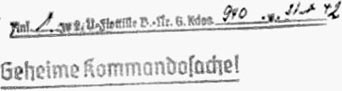
| K r i e g s t a g e b u c h | |||||
| " U-505 " 3rd War Patrol. | |||||
| Kommandant: Korvettenkapitän L o e w e | |||||
| Beginning: 7.5.42 | |||||
| Ending: 25.8.42. | |||||
| Patrol under Operations Order 50. | |||||
| Time: D.G.Z. | |||||
| All naval squares. | |||||

|
|||||
 |
|||||
| Distribution: | 2 x O.K.M. | ||||
| 1 x B.d.U. | |||||
| 1 x 2.A.d.Uboote. | |||||
| 1 x U-505. | |||||

|
|||||
| © U-boat Archive 2023 - all rights reserved | |||||
 |
Click the flag to view the above page from the original German KTB |
- 2 - |
|||||
| 07.05. - 08.05.42 | Idle period Lorient. Packing out. | ||||
| 09.05. - 03.06.42 | Overhaul at Kriegsmarine Shipyard Lorient. | ||||
| 04.06. - 07.06.42 | Fitting out in Lorient. | ||||
|
|
|||||
| 07.06.42 | |||||
| 20.30 | Put to sea on 3rd war patrol. | ||||
| 22.30 | N 4, Sea 3, cloudless, Vis. 6 nm | Released by escort at Point Luci 2. | |||
| Transit via Route Bogenlampe. | |||||
| Outbound orders: Head for square DD 50. | |||||
|
|
|||||
| 08.06.42 | Bay of Biscay | ||||
| 00.00 | BF 6177 | ||||
| 04.00 | BF 5549 | ||||
| 05.25 | Dived to proceed submerged. | ||||
| 08.00 | BF 5574 | ||||
| 12.00 | BF 5577 | Day's run: |
|||
| 16.00 | BF 5733 | ||||
| 20.00 | BF 5735 | Test dive to depth A +40 meters. | |||
| 23.20 | Surfaced. | ||||
|
|
|||||
| 09.06.42 | |||||
| 00.00 | BF 5729 | ||||
| NNE 6-7, Sea 6, 6/10, high clouds, Vis. 6 nm | |||||
| 04.00 | BF 4968 | ||||
| 06.00 | Dived to proceed submerged. | ||||
| 08.00 | BF 4984 | ||||
| 12.00 | BF 4976 | Day's run: |
|||
| 16.00 | BF 4975 | ||||
| 20.00 | BF 4977 | ||||
| 23.45 | Surfaced. | ||||
|
|
|||||
|
Sun and Moon Data 07.06.42 |
| Sun and Moon Data 08.06.42 | |
| Sun and Moon Data 09.06.42 |
- 3 - |
|||||
| 10.06.42 | Bay of Biscay | ||||
| 00.00 | BF 4899 | ||||
| 04.00 | BF 7227 | ||||
| NE 5-6, Sea 5, 8/10, Vis. good | |||||
| 06.20 | Dived to proceed submerged. | ||||
| 08.00 | BF 7164 | ||||
| 12.00 | BF 7159 | Day's run: |
|||
| 16.00 | BF 7157 | ||||
| 20.00 | BF 7173 | ||||
| 23.45 | Surfaced. | ||||
|
|
|||||
| 11.06.42 | Western Bay of Biscay | ||||
| 00.00 | BE 9396 | ||||
| NE 3-4, Sea 4 | |||||
| 02.28 | Short Signal: My position is BE 93 | ||||
| 04.00 | BE 9613 | ||||
| 08.00 | BE 9561 | ||||
| 12.00 | BE 9547 | Day's run: |
|||
| 12.05 | Several incoming messages from "U-105" (Schuch) concerning inability to dive, water intake, aircraft attack. | ||||
| Likewise Radio Message from B.d.U.: | |||||
| "Loewe, Piening, Würdemann go to Schuch at highest speed." | |||||
| Came to course 110°, GF. | |||||
| 16.00 | BE 9586 | ||||
| 20.00 | BE 9925 | ||||
| 21.30 | W 3-4, Sea 3, rain clouds | Because nothing more is heard from Schuch since 12.10 hours, headed for his 12.30 hours position. | |||
| 21.45 | BE 9961 | Crash dive for land-based aircraft. Was not detected. | |||
| 22.25 | Surfaced. | ||||
|
|
|||||
| 12.06.42 | West of Cape Finisterre | ||||
| 00.00 | BE 9958 | ||||
| 02.37 | Reported position BE 99 by Short Signal. | ||||
|
Sun and Moon Data 10.06.42 |
| Sun and Moon Data 11.06.42 | |
| Sun and Moon Data 12.06.42 |
- 4 - |
|||||
| continued | |||||
| 12.06.42 | |||||
| 02.40 | Incoming Radio Message 0146 from B.d.U.: | ||||
| Head for square BE 9945. | |||||
| 04.00 | BE 9982 | ||||
| 04.12 | Incoming Radio Message 0331 from B.d.U.: | ||||
| Loewe continue outbound transit. | |||||
| 07.10 | Dived. Proceeding submerged. | ||||
| 08.00 | BE 9974 | ||||
| 12.00 | CG 1223 | Day's run: |
|||
| 15.00 | N 3, Sea 2, Vis. 6 nm | Surfaced. | |||
| 16.00 | CG 1216 | ||||
| 20.00 | CG 1149 | ||||
|
|
|||||
| 13.06.42 | West of Portugal | ||||
| 00.00 | CF 3625 | ||||
| 04.00 | CF 3563 | ||||
| SSE 3, Sea 2, S-swell, dust rain | |||||
| 08.00 | CF 3558 | ||||
| Vis. changing 400-4000 meters | |||||
| 12.00 | CF 3574 | Day's run: |
|||
| 16.00 | CF 3723 | ||||
| 20.00 | CF 3716 | ||||
| Vis. 7 nm | |||||
|
|
|||||
| 14.06.42 | Northeast of the Azores | ||||
| 00.00 | CF 2962 | ||||
| 04.00 | CF 3957 | ||||
| 08.00 | CF 2974 | ||||
| 10.40 - 11.10 | Test dive. | ||||
| 12.00 | CF 5222 | Day's run: |
|||
| 16.00 | CF 5217 | ||||
| 20.00 | CF 5164 | ||||
| 22.15 | CF 5157 | Steamer in sight momentarily in the haze. Target angle not recognized. Contact immediately lost again in a rain squall. Pursuit is ineffective. Later in sight again with set lights. Neutral, course west. | |||
| Persistent rain, Vis. changing 1000-5000 meters | |||||
|
|
|||||
|
Sun and Moon Data 12.06.42 |
| Sun and Moon Data 13.06.42 | |
| Sun and Moon Data 14.06.42 |
- 5 - |
|||||
| 15.06.42 | |||||
| 00.00 | CF 5172 | ||||
| 04.00 | CF 4394 | ||||
| 08.00 | CF 4616 | ||||
| 12.00 | CF 4562 | Day's run: |
|||
| SSW 5, Sea 4, high fog, Vis. 6-7 nm | |||||
| 16.00 | CF 4555 | ||||
| 20.00 | CF 4547 | ||||
|
|
|||||
| 16.06.42 | Azores Sea Area | ||||
| 00.00 | CE 6683 | ||||
| 04.00 | CE 6679 | ||||
| 08.00 | CE 6835 | ||||
| 12.00 | CE 6828 | Day's run: |
|||
| 16.00 | CE 6845 | ||||
| 20.00 | CE 6791 | ||||
|
|
|||||
| 17.06.42 | |||||
| 00.00 | CE 9122 | ||||
| 04.00 | CE 9115 | ||||
| 08.00 | CE 8337 | ||||
| 10.30 - 11.00 | Test dive. | ||||
| 12.00 | CE 8343 | Day's run: |
|||
| WSW 3, Sea 2, SW-swell, Vis. good | |||||
| 16.00 | CE 8265 | ||||
| 20.00 | CE 8257 | ||||
|
|
|||||
| 18.06.42 | Southwest of the Azores | ||||
| 00.00 | CE 8193 | ||||
| 04.00 | CE 8185 | ||||
| 08.00 | CE 8177 | ||||
|
Sun and Moon Data 15.06.42 |
| Sun and Moon Data 16.06.42 | |
| Sun and Moon Data 17.06.42 | |
| Sun and Moon Data 18.06.42 |
- 6 - |
|||||
| continued | |||||
| 18.06.42 | |||||
| 12.00 | CE 7623 | Day's run: |
|||
| WSW 3-4, medium swell, high clouds, Vis. good | |||||
| 16.00 | CE 7616 | ||||
| 20.00 | CE 7562 | ||||
| Isolated rain showers | |||||
|
|
|||||
| 19.06.42 | |||||
| 00.00 | CE 7564 | ||||
| 04.00 | CE 7549 | ||||
| 08.00 | CE 7492 | ||||
| 12.00 | CE 7487 | Day's run: |
|||
| WSW 2, Sea 1, westerly flat swell, Vis. good, cumulus | |||||
| 16.00 | CE 9932 | ||||
| 20.00 | CE 9924 | ||||
|
|
|||||
| 20.06.42 | Southwest of the Azores | ||||
| 00.00 | CD 9862 | ||||
| 04.00 | CD 9854 | ||||
| 08.00 | CD 7793 [typo 9793] | ||||
| 10.00 - 11.15 | Test dive. | ||||
| 12.00 | CD 9785 | Day's run: |
|||
| 16.00 | CD 9777 | ||||
| 20.00 | DF 2223 | ||||
| Calm, changing cloudiness, Vis. very good | |||||
|
|
|||||
| 21.06.42 | |||||
| 00.00 | DF 2217 | ||||
| 04.00 | DF 2153 | ||||
| 08.00 | DF 2145 | ||||
| 12.00 | DF 1383 | Day's run: |
|||
| S 2, Sea 0, Vis. good, isolated cumulus | |||||
|
Sun and Moon Data 18.06.42 |
| Sun and Moon Data 19.06.42 | |
| Sun and Moon Data 20.06.42 | |
| Sun and Moon Data 21.06.42 |
- 7 - |
|||||
| continued | |||||
| 21.06.42 | |||||
| 16.00 | DF 1296 | ||||
| 20.00 | DF 1288 | ||||
|
|
|||||
| 22.06.42 | Southwest of the Azores | ||||
| 00.00 | DF 1436 | ||||
| 04.00 | DF 1428 | ||||
| 08.00 | DF 1441 | ||||
| 10.10 - 11.30 | Test dive. | ||||
| 12.00 | DE 3644 | Day's run: |
|||
| S 3, Sea 2, Vis. good, 10/10 | |||||
| 15.20 | Incoming Radio Message 1016/22 from B.d.U.: | ||||
| To Loewe: New objective is ED 11. | |||||
| 16.00 | DF 3673 | ||||
| 20.00 | DF 3833 | ||||
|
|
|||||
| 23.06.42 | North Atlantic | ||||
| 00.00 | DE 3852 | ||||
| 04.00 | DE 3872 | ||||
| 08.00 | DE 6131 | ||||
| 12.00 | DE 6143 | Day's run: |
|||
| 16.00 | DE 5393 | ||||
| 20.00 | DE 5622 | ||||
|
|
|||||
| 24.06.42 | |||||
| 00.00 | DE 5642 | ||||
| 00.56 | Short Signal to B.d.U.: "Position DE 55, 178 cbm." | ||||
| (In accordance with Operations Order on passing 50°W.) | |||||
| Sent for the second time at 03.32 hours, because it was not confirmed by Control. | |||||
| 04.00 | DE 5591 | ||||
| 08.00 | DE 5821 | ||||
| 12.00 | DE 7291 [typo DE 5492] | Day's run: |
|||
| SW 2, Sea 1, high haze, Vis. good | |||||
|
Sun and Moon Data 21.06.42 |
| Sun and Moon Data 22.06.42 | |
| Sun and Moon Data 23.06.42 | |
| Sun and Moon Data 24.06.42 |
- 8 - |
|||||
| continued | |||||
| 24.06.42 | |||||
| 16.00 | DE 5489 | Test dive. | |||
| 17.00 | Surfaced. | ||||
| 20.00 | DE 5718 | ||||
|
|
|||||
| 25.06.42 | |||||
| 00.00 | DE 4992 | ||||
| 04.00 | DE 7322 | ||||
| 08.00 | DE 7341 | ||||
| 12.00 | DE 7391 [typo DE 7291] | Day's run: |
|||
| NE 2, Vis. good, isolated clouds | |||||
| 16.00 | DE 7524 | Test dive. | |||
| 16.30 | Surfaced. | ||||
| 20.00 | DE 7435 | ||||
|
|
|||||
| 26.06.42 | North Atlantic | ||||
| 00.00 | DE 7457 | ||||
| 04.00 | DE 7711 | ||||
| 08.00 | DD 9961 | ||||
| 12.00 | DD 9978 | Day's run: |
|||
| E 3-4, Sea 2, cumulus, Vis. changing good | |||||
| 16.00 | DP 2151 | ||||
| 20.00 | DP 1393 | ||||
|
|
|||||
| 27.06.42 | |||||
| 00.00 | DP 1625 | For several days the gyro compass has had an error of 0-10°. | |||
| 04.00 | DP 1691 | ||||
| 08.00 | DP 1913 | ||||
| 12.00 | DP 1864 | Day's run: |
|||
| Trade wind weather | |||||
|
Sun and Moon Data 24.06.42 |
| Sun and Moon Data 25.06.42 | |
| Sun and Moon Data 25.06.42 | |
| Sun and Moon Data 27.06.42 |
- 9 - |
|||||
| continued | |||||
| 27.06.42 | |||||
| 16.00 | DP 1877 | ||||
| 16.30 | Test dive. Work on the high-pressure air and gyro-compass installation. | ||||
| 20.00 | DP 4133 | ||||
| 20.50 | Surfaced. | ||||
|
|
|||||
| 28.06.42 | |||||
| 00.00 | DP 4152 | ||||
| 04.00 | DO 6393 | ||||
| 08.00 | DO 6622 | ||||
| 12.00 | DO 6373 | Day's run: |
|||
| 15.32 | DO 6532 | Steamer in sight on course 120°. No zig zags. | |||
| Submerged attack. | |||||
| 18.00 | Dived. | ||||
| 18.55 | DO 6646 | Double shot from tube I and II, depth 3 meters, range = 800 meters, Etos. Hit at the forward edge of the bridge and bridge. Steamer settles forward. Crew is very disciplined, mans the cannons and gets the boats ready. | |||
| Gives the impression of navy personnel. | |||||
| Anti-aircraft platforms forward, bridge and aft. | |||||
| A 10.5 cm cannon forward and aft. | |||||
| Deck cargo about 15 2-engined aircraft, unpacked. | |||||
| 20.00 | DO 6646 | Coup de grace from tube III, Eto, depth 4 meters. | |||
| Hit forward edge of the bridge. | |||||
| Crew of about 100 men had previously abandoned ship. Subsequently surfaced. | |||||
| Steamer sinks quickly over the bow with flag waving. Heavy wreckage, car tires, aircraft, timber. | |||||
| Steamer is American, Type "Robin Hood", estimated length 140 meters. Tonnage 6900 GRT. | |||||
| Subsequently ran off. | |||||
| To check my gyrocompass I still want to remain 1 day in the broad sea area and only then approach the Antilles. | |||||
| Additionally, perhaps something will run into my hands. | |||||
|
|
|||||
|
Sun and Moon Data 27.06.42 |
| Sun and Moon Data 28.06.42 |
- 10 - |
|||||
| 29.06.42 | |||||
| 00.00 | DO 6621 | ||||
| 02.30 - 03.30 | Downloaded over deck torpedoes from canisters 3 and 4 to the bow room. | ||||
| 04.00 | DO 6358 | Reported success to B.d.U. by Radio Message 0302. | |||
| (Clear text see Enclosure) | |||||
| 05.50 | DO 6364 | In full moonshine a large steamer shadow on a southeasterly course in sight. | |||
| Very heavily irregular 5-minute zig zags. | |||||
| Maneuver ahead lasts a long time. Course 160°. | |||||
| 08.00 | DO 6399 | ||||
| 12.00 | DP 4446 | Day's run: |
|||
| Calm Trade wind weather | |||||
| 12.48 | Dived for submerged attack. | ||||
| 13.55 | DP 4457 | Double shot from tube I and II, depth 4 meters, range = 1200 meters. | |||
| One hit aft 60 meters. Heavy impact. Steamer stops, sets out boats. | |||||
| 14.19 | Surfaced. | ||||
| Steamer sunk with 72 shots of artillery (10.5 cm). Incendiary ammunition very effective. | |||||
| 15.22 | It is sunk. | ||||
| A new large motor ship with 3 masts of the C1 - Type, 7400 GRT. Deck cargo about 15 aircraft. On the way from New York for Trinidad determined from lifeboats. | |||||
| Boats are well equipped. By appearance and condition of equipment the ship is on its first journey. Name "THOMAS MCKEAN", weapons 1 10.5 cm forward, several anti-aircraft weapons. | |||||
| 16.00 | DP 4482 | ||||
| 20.00 | DP 4438 | ||||
|
|
|||||
| 30.06.42 | Northeast of the Antilles | ||||
| 00.00 | DP 4272 | ||||
| 01.30 - 02.30 | Over deck torpedoes from canisters 9 and 10 downloaded to the bow room. | ||||
| 03.15 | Reported success by Radio Message. | ||||
| 04.00 | DP 4163 | Far astern to starboard several times redish flashes. | |||
|
Sun and Moon Data 29.06.42 |
| Sun and Moon Data 30.06.42 |
- 11 - |
|||||
| continued | |||||
| 30.06.42 | |||||
| 08.00 | DP 4173 | Incoming Radio Message 0738/30 from B.d.U.: | |||
| To Loewe: Operations area lower third of EB and south there from. | |||||
| 12.00 | DO 6631 | Day's run: |
|||
| 16.00 - 16.30 | Test dive. | ||||
| 20.00 | DO 6567 | ||||
| 23.30 | DO 6575 | Vessel in sight ahead to port, 1 mast, 1 smokestack, quickly rises out. Probably a gun boat or coastal patrol vessel, speed 14 knots, course 50°. Suspect searching for survivors of the steamers I sank. Nothing else nearby. | |||
| I get away at high speed. In the course of this the starboard diesel is out of service. | |||||
|
|
|||||
| 01.07.42 | Northeast of the Antilles | ||||
| 00.20 | DO 6549 | Vessel out of sight. | |||
| 04.00 | DO 6495 | ||||
| 08.00 | DO 6716 | Starboard diesel back in service. | |||
| 12.00 | DO 5953 | Day's run: |
|||
| 16.00 | DO 5947 | ||||
| 20.00 | DO 5884 | ||||
|
|
|||||
| 02.07.42 | North of Puerto Rico | ||||
| 00.00 | DO 5798 | ||||
| 04.00 | DO 8116 | ||||
| 08.00 | DO 7361 | ||||
| 12.00 | DO 7376 | Day's run: |
|||
| E 4, Sea 4, 10/10, stratus | |||||
| 16.00 | DO 7539 | ||||
| 20.00 | DO 7585 | ||||
|
|
|||||
|
Sun and Moon Data 30.06.42 |
| Sun and Moon Data 01.07.42 | |
| Sun and Moon Data 02.07.42 |
- 12 - |
|||||
| 03.07.42 | Mona Passage | ||||
| 00.00 | DO 7844 | ||||
| 6/10, Vis. moderate | |||||
| 01.12 | Sun set. | ||||
| 01.30 - 02.00 | Test dive. | ||||
| 04.00 | ED 1139 | ||||
| 04.59 | Moonrise. | ||||
| 08.00 | ED 1426 | Passed through the Mona Passage. Nothing sighted. Only the smell of land from windward. | |||
| 11.49 | Sunrise. | ||||
| 12.00 | ED 1472 | Day's run: |
|||
| ESE 5-6, Sea 5, thunderstorms, Vis. moderate | |||||
| 16.00 | EC 3932 | ||||
| 20.00 | EC 3919 | ||||
|
|
|||||
| 04.07.42 | Caribbean Sea | ||||
| 00.00 | EC 3819 | ||||
| 04.00 | EC 3764 | ||||
| 08.00 | EC 3748 | ||||
| 12.00 | EC 2999 | Day's run: |
|||
| E 5, Sea 5, 10/10, Vis. moderate | |||||
| 16.00 | EC 5328 | ||||
| 20.00 | EC 5266 | ||||
|
|
|||||
| 05.07.42 | |||||
| 00.00 | EC 5285 | ||||
| 04.00 | EC 5199 | ||||
| 08.00 | EC 5184 | ||||
| 12.00 | EC 4392 | Day's run: |
|||
| ENE 5-6, Sea 5, cumulus, Vis. 8 nm | |||||
| 16.00 | EC 4266 | Test dive. At depth A +0 meters water temperature is always as above = 29°. | |||
| 20.00 | EC 4251 | ||||
|
|
|||||
|
Sun and Moon Data 03.07.42 |
| Sun and Moon Data 04.07.42 | |
| Sun and Moon Data 05.07.42 |
- 13 - |
|||||
| 06.07.42 | Western Caribbean Sea | ||||
| 00.00 | EC 4139 | ||||
| 04.00 | EC 4158 | ||||
| 08.00 | EC 4177 | ||||
| 12.00 | EB 6653 | Day's run: |
|||
| 16.00 | EB 6678 | ||||
| 20.00 | EB 6834 | ||||
| E 5-6, Sea 6, 4/10, low cumulus, Vis. 6 nm | |||||
|
|
|||||
| 07.07.42 | |||||
| 00.00 | EB 6854 | ||||
| 04.00 | EB 6796 | ||||
| 08.00 | EB 9125 | ||||
| 12.00 | EB 9147 | Day's run: |
|||
| ENE 6, Sea 6, low cumulus, rain squalls, Vis. medium | |||||
| From situation reports I have the impression that north-south traffic in the Gulf of Mexico, Yucatan Strait and Caribbean Sea is heavily throttled and is mostly led around outside via the Atlantic. Likewise from Colon to the north since no traffic has been observed for 14 days, however there is strong east west traffic to Trinidad. | |||||
| I suppose that the North America-Panama Canal traffic and vice versa runs via the Atlantic-Trinidad. | |||||
| Therefore, I go first to the area northeast of Colon where the traffic route would have to run to Trinidad. | |||||
| 16.00 | EB 9179 | ||||
| 16.05 - 17.10 | Test dive. | ||||
| 20.00 | EB 9425 | ||||
| 20.50 | EB 9428 | "Crash dive" for flying boat, 8000 meters off. | |||
| 21.45 | Surfaced. | ||||
| 22.30 | EB 9453 | "Crash dive" for flying boat, 8000 meters off. | |||
| 22.55 | Surfaced. | ||||
|
|
|||||
| 08.07.42 | |||||
| 00.00 | EB 9464 | ||||
|
Sun and Moon Data 06.07.42 |
| Sun and Moon Data 07.07.42 | |
| Sun and Moon Data 08.07.42 |
- 14 - |
|||||
| continued | |||||
| 08.07.42 | |||||
| 04.00 | EB 9574 | ||||
| 08.00 | EB 9824 | ||||
| 12.00 | EB 9859 | Day's run: |
|||
| 14.25 | EB 9843 | "Crash dive" for 2 flying boats, 10000 meters off. | |||
| 15.05 | ENE 4-5, Sea 4, Vis. good, cumulus | Surfaced. | |||
| 16.00 | EB 9854 | ||||
| 20.00 | EB 9849 | ||||
|
|
|||||
| 09.07.42 | Western Caribbean Sea | ||||
| 00.00 | EL 3223 | ||||
| 04.00 | EL 3263 | ||||
| 08.00 | EL 3373 | ||||
| 12.00 | EL 3637 | Day's run: |
|||
| 13.00 | EL 3662 | Land in sight ahead. Colombian coast. | |||
| 16.00 | EM 1411 | ||||
| 17.10 | EM 1412 | "Crash dive" for 3 aircraft, 10000 meters off. | |||
| 17.30 | Surfaced. | ||||
| 19.20 | EM 1174 | "Crash dive" for 2 aircraft, 8000 meters off. | |||
| 19.45 | Surfaced. A smoke feather bearing 180°T, above it an aircraft, about 10000 meters off. | ||||
| 19.50 | EM 1174 | "Crash dive". | |||
| 20.50 | Vis. very good | Surfaced. Operating on the smoke feather. A small freighter close offshore. | |||
| 22.20 | EM 1174 | "Crash dive" for flying boat astern. | |||
| 23.15 | Surfaced. In the northwest an extensive storm front. | ||||
| 23.30 | EM 1428 | A patrol vessel. | |||
| Close offshore another smoke cloud on a southwest course. | |||||
|
|
|||||
| 10.07.42 | |||||
| 00.00 | EM 1188 | In the east a large storm front. Rain. Freighter enters the Gulf of Morrosquillo and is lost from sight in rain. | |||
|
Sun and Moon Data 08.07.42 |
| Sun and Moon Data 09.07.42 | |
| Sun and Moon Data 10.07.42 |
- 15 - |
|||||
| continued | |||||
| 10.07.42 | lost from sight in rain. | ||||
| I break off the pursuit for navigational reasons, bad weather and inaccurate ship's position. Will make an advance the following night under the coast southwest there from where it is more precise. | |||||
| 04.00 | EM 1418 | ||||
| 08.00 | EL 3693 | ||||
| 12.00 | EL 3655 | Day's run: |
|||
| Calm, lightening, water spouts, 8/10, Vis. good, during the day cumulus, light trade winds, NE-swell | |||||
| 16.00 | EL 3617 | ||||
| 20.00 | EL 3283 | ||||
| 23.03 | EL 3246 | "Crash dive" for aircraft (course 90°). | |||
| 23.34 | Surfaced. | ||||
|
|
|||||
| 11.07.42 | |||||
| 00.00 | EL 3245 | ||||
| 04.00 | EL 3137 | ||||
| 08.00 | EL 3112 | ||||
| 12.00 | EL 8989 | Day's run: |
|||
| Trade wind 3, Sea 3, Vis. moderate, rain cloud | |||||
| 16.00 | EL 8946 | ||||
| 20.00 | EL 8866 | Radio Message from B.d.U. (Contents: Assumption of complete traffic stoppage, orders fuel conservation, waiting on opportunities.) | |||
|
|
|||||
| 12.07.42 | North of the Panama Canal | ||||
| 00.00 | EB 8883 | ||||
| Continuous heavy thunderstorms, very heavy summer lightening | |||||
| 04.00 | EL 2318 | Lighthouse off Point Manzanillo burns as in peacetime. | |||
| 07.40 | EL 2267 | Aircraft parachute flare bearing 160°T. | |||
| 08.00 | EL 2259 | ||||
| 10.55 | EL 2249 | "Crash dive" for aircraft. Passes at 800 meters, throws parachute flare. At depth 25 meters 5 aircraft bombs small caliber. No damage. | |||
| Dark night, 6/10, Vis. good, marine phosphorescence | |||||
|
Sun and Moon Data 10.07.42 |
| Sun and Moon Data 11.07.42 | |
| Sun and Moon Data 12.07.42 |
- 16 - |
|||||
| continued | |||||
| 12.07.42 | |||||
| 12.00 | EL 2217 | Day's run: |
|||
| 13.12 | Sunrise. | ||||
| 15.15 | Vis. very good | Surfaced. | |||
| 16.00 | EL 2336 | ||||
| 16.55 | EL 2131 | "Crash dive" for aircraft (course 0°). | |||
| 19.15 | Heavy lightening, Vis. greatly changing | Surfaced. | |||
| 20.00 | EB 8783 | ||||
|
|
|||||
| 13.07.42 | |||||
| 00.00 | EB 8723 | ||||
| 04.00 | EB 8481 | Sent situation report in accordance with orders (for clear text see Enclosure Radio Message 0245/13). | |||
| 08.00 | EB 7691 | ||||
| 12.00 | EB 7672 | Day's run: |
|||
| 16.00 | EB 7698 | ||||
| 20.00 | EB 8478 | ||||
|
|
|||||
| 14.07.42 | |||||
| 00.00 | EB 8497 | ||||
| 04.00 | EB 8587 | ||||
| 08.00 | EB 8598 | ||||
| 12.00 | EB 8687 | Day's run: |
|||
| Light trade wind, isolated rain squalls, low clouds | |||||
| 14.10 | EB 8924 | "Crash dive" for 2-engined land-based aircraft out of a rain squall flying 2000 meters off. At the same time a second aircraft passed astern. I must therefore assume that I have been sighted, although no bombs fell. | |||
| 15.00 | 3 separate thuds, distant detonations heard. | ||||
| 15.09 | |||||
| 16.00 | EB 8925 | ||||
| 16.50 | Surfaced. | ||||
| 20.00 | EB 8685 | ||||
| 20.10 | "Crash dive" for aircraft (course 170°). | ||||
| 21.10 | Surfaced. | ||||
|
Sun and Moon Data 12.07.42 |
| Sun and Moon Data 13.07.42 | |
| Sun and Moon Data 14.07.42 |
- 17 - |
|||||
| continued | |||||
| 14.07.42 | |||||
| 21.40 | EB 8682 | "Crash dive" for flying boat (course 90°) (Type "Consolidated"). | |||
| 22.20 | Surfaced. | ||||
| 23.55 | EB 8652 | "Crash dive" for aircraft 8000 meters off (course 180°). | |||
|
|
|||||
| 15.07.42 | North of the Panama Canal | ||||
| 01.40 | Surfaced. Previous surfacing attempt failed due to aircraft. | ||||
| 01.56 | EB 8652 | "Crash dive" for aircraft approaching from astern. | |||
| 02.54 | Surfaced. | ||||
| 04.00 | EB 8625 | ||||
| 08.00 | EB 8399 | ||||
| 12.00 | EB 9421 | Day's run: |
|||
| Trade wind 3-4, Sea 3, Vis. medium | |||||
| 16.00 | EB 9189 | ||||
| 20.00 | EB 9436 | ||||
| 21.15 | EB 9418 | "Crash dive" for aircraft (course 50°). | |||
| 22.30 | Surfaced. | ||||
|
|
|||||
| 16.07.42 | |||||
| 00.10 | EB 9519 | Short Signal: "No traffic" sent at the request of "U-129". | |||
| The B.d.U. order to only report new observations since the situation report of 13 July, arrived only after the short signal was sent. | |||||
| 04.00 | EB 9567 | ||||
| 08.00 | EB 9675 | ||||
| 12.00 | EB 9675 | Day's run: |
|||
| 16.00 | EB 9922 | ||||
| 16.10 | "Crash dive" for aircraft (course 180°). | ||||
| 17.00 | Surfaced. | ||||
| 20.00 | EB 9939 | ||||
|
|
|||||
|
Sun and Moon Data 14.07.42 |
| Sun and Moon Data 15.07.42 | |
| Sun and Moon Data 16.07.42 |
- 18 - |
|||||
| 17.07.42 | |||||
| 00.00 | EB 9962 | ||||
| 04.00 | EB 9916 | ||||
| 08.00 | EB 9597 | ||||
| 12.00 | EB 9572 | Day's run: |
|||
| 15.05 | EB 9464 | "Crash dive" for aircraft (course 0°). | |||
| 15.55 | EB 9456 | Surfaced. | |||
| 20.00 | EB 9417 | ||||
| Stiff trade wind, swell, Vis. medium, rain squalls | |||||
|
|
|||||
| 18.07.42 | |||||
| 00.00 | EB 8626 | ||||
| 04.00 | EB 8625 | ||||
| 08.00 | EB 8536 | ||||
| 12.00 | EB 8516 | Day's run: |
|||
| 16.00 | EB 8424 | ||||
| 20.00 | EB 8492 | ||||
|
|
|||||
| 19.07.42 | |||||
| 00.10 | EB 8813 | ||||
| 01.55 | Sunset. | ||||
| 04.00 | EB 8837 | Unpleasantly bright night. | |||
| 05.45 | Moonset. | ||||
| 08.00 | EB 8943 | ||||
| 12.00 | EB 8952 | Day's run: |
|||
| 16.00 | EB 8969 | ||||
| 16.15 | "Crash dive" for approaching aircraft (course 210°). | ||||
| 17.15 | Surfaced. | ||||
| 20.00 | EB 9773 | ||||
|
|
|||||
| 20.07.42 | |||||
| 00.00 | EL 3122 | ||||
|
Sun and Moon Data 17.07.42 |
| Sun and Moon Data 18.07.42 | |
| Sun and Moon Data 19.07.42 | |
| Sun and Moon Data 20.07.42 |
- 19 - |
|||||
| continued | |||||
| 20.07.42 | |||||
| 04.00 | EL 3159 | ||||
| 08.00 | EL 3199 | ||||
| 12.00 | EL 3522 | Day's run: |
|||
| 16.00 | EL 3294 | ||||
| Extensive rain front, Vis. moderate | Radio Message order: Report situation. | ||||
| 20.00 | EL 3257 | ||||
|
|
|||||
| 21.07.42 | Off the Panama Canal | ||||
| 00.00 | EL 3156 | ||||
| 04.00 | EL 3141 | ||||
| 08.00 | EL 2352 | ||||
| 12.00 | EL 2238 | Day's run: |
|||
| 12.30 | Dived, for a time to listen and watch for northbound [ships]. | ||||
| 16.00 | EL 2239 | Nothing heard or observed. | |||
| 19.55 | Surfaced. | ||||
| 20.20 | EL 2236 | "Crash dive" for aircraft (flying very high, about 2000 meters, course 180°). May have been detected. | |||
| 22.46 | Surfaced. | ||||
| 22.30 | "Crash dive" for aircraft (course 180°). | ||||
|
|
|||||
| 22.07.42 | |||||
| 00.00 | EL 2231 | ||||
| 00.30 | Surfaced. | ||||
| 04.00 | EB 8855 | ||||
| 05.30 | Sent situation report. (see Enclosure for text). | ||||
| 08.00 | EB 8814 | ||||
| 12.00 | EB 8482 | Day's run: |
|||
| 13.25 | Land in sight ahead (small island Courtown Cays). | ||||
| 13.35 | EB 8432 | A sailing vessel in sight bearing 30°T. Course west. Three-masted schooner "ROMAR" from Cartagena with a Columbian flag. | |||
| Clear weather, calm trade wind, Vis. very good | |||||
| Because the [vessel] did not stop at the challenge (several warning shots), I sank him with 10.5 cm (22 shots). Size about 400 GRT. | |||||
| 15.00 | Is sunk. | ||||
|
Sun and Moon Data 20.07.42 |
| Sun and Moon Data 21.07.42 | |
| Sun and Moon Data 22.07.42 |
- 20 - |
|||||
| continued | |||||
| 22.07.42 | |||||
| 16.00 | EB 8196 | ||||
| 20.00 | EB 8243 | ||||
| 23.30 | Incoming Radio Message Order from B.d.U.: To Loewe: | ||||
| Operate close offshore from naval square EL 25 to the east to square ED 90. In square EC 70 and 80 presumably there is heavy traffic along the coast. Supply anticipated. | |||||
| Due to bright nights and air off Colon I will initially move further to the east then towards the coast. | |||||
|
|
|||||
| 23.07.42 | |||||
| 00.00 | EB 8222 | ||||
| 04.00 | EB 8263 | ||||
| 08.00 | EB 8381 | ||||
| 09.00 | EB 8378 | Neutral passenger steamer, prescribed lighting, course 0°. | |||
| 12.00 | EB 8536 | Day's run: |
|||
| 16.00 | EB 8534 | ||||
| 20.00 | EB 8641 | ||||
| 22.13 | EB 8649 | "Crash dive" for aircraft (course 180°). | |||
| 22.55 | Surfaced. | ||||
|
|
|||||
| 24.07.42 | |||||
| 00.00 | EB 8682 | ||||
| Very heavy lightening, continued for 1 hour, Vis. sometimes only 100 meters. | |||||
| 04.00 | EB 8932 | ||||
| Very bright moonlit night. | |||||
| 08.00 | EB 9743 | ||||
| 12.00 | EB 9783 | Day's run: |
|||
| 9/10, rain, Vis. medium to good | |||||
| 13.25 | EB 9795 | "Crash dive" for approaching aircraft (course 310°). | |||
| 16.10 | EB 9798 | Surfaced. | |||
| 20.00 | EL 3214 | ||||
| 23.10 | EL 3248 | "Crash dive" for aircraft (course 270°). | |||
| 23.35 | Surfaced. | ||||
|
|
|||||
|
Sun and Moon Data 22.07.42 |
| Sun and Moon Data 23.07.42 | |
| Sun and Moon Data 24.07.42 |
- 21 - |
|||||
| 25.07.42 | |||||
| 00.00 | EL 3272 | Panama coast in sight. | |||
| 02.00 | EL 3212 | Small aircraft, probably a patrol. | |||
| Very bright night. | |||||
| 04.00 | EL 3279 | ||||
| 08.00 | EL 3522 | ||||
| Heavy lightening, summer lightening | |||||
| 11.30 | EL 3539 | Shadow in sight bearing 50°T, in the shine of the lightening, which continually illuminates the entire area bright as day to a great distance, a dimmed large freighter at approximately 6 nm. Course about 290°, zigzagging, 13-14 knots. | |||
| Surface attack hopeless due to lightening and approaching dawn. To maneuver ahead for a day attack I must get around behind him to the north, because otherwise he forces me, into the shallows of the Panama coast. | |||||
| 12.45 | Steamer is lost from sight in a rain squall. | ||||
| After considering maneuvering ahead before Colon, there is not enough room given the circumstances. Therefore, decided to break off pursuit. | |||||
| I will operate tomorrow night on the recognized route. The main thing is not to be detected. | |||||
| 12.00 | Day's run: |
||||
| 14.30 | Heavy rain squalls, Vis. very limited | Dived, to wait for better visibility. | |||
| 17.20 | Surfaced, immediately thereafter "crash dive" for aircraft (course 270°). | ||||
| 17.50 | EL 3293 | Surfaced. | |||
| 20.00 | EL 3266 | ||||
|
|
|||||
| 26.07.42 | |||||
| 00.00 | EL 3532 | Coast of Panama in sight. | |||
| 04.00 | EL 3537 | ||||
| Summer lightening, very bright night | |||||
| 08.00 | EL 3643 | ||||
| 12.00 | EL 3668 | Day's run: |
|||
| 16.00 | EM 1412 | Coast of Columbia in sight. | |||
| 20.00 | EM 1153 | ||||
| 23.10 | EC 7789 | "Crash dive" for flying boat (course 270°). | |||
| Cartagena is probably used as an air base. | |||||
|
|
|||||
|
Sun and Moon Data 25.07.42 |
| Sun and Moon Data 26.07.42 |
- 22 - |
|||||
| 27.07.42 | |||||
| 00.00 | EC 7789 | Surfaced. | |||
| 04.00 | EC 7764 | ||||
| 08.00 | EC 7819 | ||||
| 09.00 | ENE 6-8, Sea 6, Vis. medium, full moon | While draining the bow torpedo tubes tube I can not be drained. Currently, all tubes are flooded via torpedo compensating tank III. Additionally, is has freshened strongly. I give up my intention to stay submerged off Brranquilla by day, and set off to sea first of all to examine the damage. | |||
| 12.00 | EC 7821 | Day's run: |
|||
| Outer door of tube I is leaking. Metallic knocking on closing. | |||||
| Use of weapons greatly limited or even impossible due to weather. | |||||
| 16.00 | EC 7557 | ||||
| 20.00 | EC 7529 | I head for the coast again. | |||
| Abating somewhat | |||||
|
|
|||||
| 28.07.42 | |||||
| 00.00 | EC 7569 | ||||
| 04.00 | EC 7593 | ||||
| 08.00 | EC 7688 | ||||
| ENE 6-7, Sea 6, misty horizon, cloudless, full moon | |||||
| 12.00 | EC 7673 | Day's run: |
|||
| 16.00 | EC 7697 | Ahead the coast of Santa Marta in sight. | |||
| 20.00 | EC 8474 | ||||
| 21.10 | EC 8474 | ||||
| 21.10 | EC 8478 | Crash dive for flying boat (course 270°). | |||
| 21.50 | Surfaced. | ||||
|
|
|||||
| 29.07.42 | |||||
| 00.00 | EC 8488 | Intend to remain in EC 70 and 80 for 3 days. | |||
| 04.00 | EC 8493 | ||||
| 05.00 | In accordance with orders sent situation report (clear text see Enclosure.) | ||||
|
Sun and Moon Data 27.07.42 |
| Sun and Moon Data 28.07.42 | |
| Sun and Moon Data 29.07.42 |
- 23 - |
|||||
| continued | |||||
| 29.07.42 | |||||
| 08.00 | EC 8554 | ||||
| 10.20 | Incoming Radio Message from B.d.U.: Continue transit to ED 90 without delay. | ||||
| 11.08 | Incoming Radio Message from B.d.U. concerning handling of ETO in torpedo tube I. | ||||
| 12.00 | EC 8526 | Day's run: |
|||
| Calm trade wind weather | |||||
| 15.30 | ETO ejected from torpedo tube I. | ||||
| 16.00 | EC 8595 | ||||
| 20.00 | EC 8372 | Coast of the Guajira Peninsula in sight all day. | |||
| E 6-7, Sea 6, Vis. moderate, heavy ground swells on calm seas | Nothing sighted. | ||||
|
|
|||||
| 30.07.42 | |||||
| 00.00 | EC 8381 | ||||
| 04.00 | EC 8368 | ||||
| 08.00 | EC 9145 | ||||
| E 6-7, Vis. moderate | |||||
| 12.00 | EC 9154 | Day's run: |
|||
| Heavily misty horizon | |||||
| 10.42 | Incoming Radio Message from B.d.U.: To U-505: Go to naval square EO 10, 20, 50. | ||||
| 16.00 | EC 9161 | ||||
| 20.00 | EC 9214 | ||||
|
|
|||||
| 31.07.42 | |||||
| 00.00 | EC 9215 | Tonight I will pass between Aruba and Curacao and then off the coast of Venezuela. | |||
| 04.00 | EC 9264 | ||||
| Moonlit | |||||
| 06.30 | EC 9377 | North end of Curacao 8 nm distant. Lighthouses are extinguished. | |||
| 08.00 | EC 9614 | ||||
| 12.00 | EC 9682 | Day's run: |
|||
| Dived due to low clouds and moderate visibility. | |||||
| 16.00 | EC 9683 | ||||
| 20.00 | EC 9691 | ||||
|
|
|||||
|
Sun and Moon Data 29.07.42 |
| Sun and Moon Data 30.07.42 | |
| Sun and Moon Data 31.07.42 |
- 24 - |
|||||
| 01.08.42 | North coast of Venezuela | ||||
| 00.00 | EC 9691 | ||||
| 01.45 | E 3, Sea 2, Vis. medium, misty | Surfaced. Over the day nothing heard and nothing seen except for fishing vehicles. | |||
| 03.00 | Radio Message to B.d.U. with request to return due to the state of health of the Kommandant. | ||||
| 04.00 | ED 7473 | Lacre Point lighthouse (Bonaire) as in peacetime. | |||
| 08.00 | ED 7571 | ||||
| 12.00 | ED 7591 | Day's run: |
|||
| Radio Message from B.d.U. with return transit orders. | |||||
| 16.00 | ED 7673 | ||||
| 20.00 | ED 7654 | ||||
| 22.20 | Crash dive for flying boat (course 0°). | ||||
| 23.10 | ED 7629 | Surfaced. Before surfacing aircraft in sight in the periscope. | |||
|
|
|||||
| 02.08.42 | |||||
| 00.00 | ED 7635 | ||||
| 04.00 | ED 8179 | ||||
| 08.00 | ED 8191 | ||||
| 12.00 | ED 8244 | Day's run: |
|||
| 16.00 | ED 8228 | ||||
| 20.00 | ED 5883 | ||||
|
|
|||||
| 03.08.42 | |||||
| 00.00 | ED 5866 | ||||
| 04.00 | ED 5927 | ||||
| 05.30 | ED 5926 | Hospital ship - course 130° - passed. | |||
| Prescribed markings lighted. Row of green lights along the entire ship. Red cross. Name not determined, because it is too fast, 16-18 knots. | |||||
| 08.00 | ED 5932 | ||||
|
Sun and Moon Data 01.08.42 |
| Sun and Moon Data 02.08.42 | |
| Sun and Moon Data 03.08.42 |
- 25 - |
|||||
| continued | |||||
| 03.08.42 | |||||
| 12.00 | ED 6476 | Day's run: |
|||
| 16.00 | ED 6464 | ||||
| 17.00 | ED 6465 | "Crash dive" for aircraft. Boat completely surprised. Aircraft turned off 200 meters from the boat. Apparently American markings. No bombs. | |||
| E 2-3, Sea 2, Vis. good, cumulus | |||||
| 18.30 | Surfaced. | ||||
| 20.00 | ED 6542 | ||||
| 21.00 | Mountains of Dominica and Martinique in sight ahead. | ||||
| 21.10 | Dived. | ||||
|
|
|||||
| 04.08.42 | Dominica Channel | ||||
| 00.00 | ED 6523 | ||||
| 01.20 | Surfaced. Headed through the Dominica Channel to the east. Lighthouses on Martinique as in peacetime. | ||||
| 04.00 | ED 6612 | Northern tip of Martinique 6 nm abeam to starboard. | |||
| 08.00 | ED 6395 | ||||
| 12.00 | EE 4156 | Day's run: |
|||
| Calm trade wind weather, Vis. good | |||||
| 16.00 | EE 4133 | ||||
| 20.00 | EE 1766 | ||||
|
|
|||||
| 05.08.42 | Atlantic east of the Antilles | ||||
| 00.00 | EE 1498 | ||||
| 04.00 | EE 1462 | Radio Message to B.d.U. concerning situation, supply, patient transfer, (Clear text see Enclosure). | |||
| 08.00 | BE 1198 | ||||
| 12.00 | EE 1162 | Day's run: |
|||
| Calm trade wind weather, Vis. good | |||||
| 16.00 | DP 7793 | ||||
| 20.00 | DP 7736 | ||||
|
|
|||||
|
Sun and Moon Data 03.08.42 |
| Sun and Moon Data 04.08.42 | |
| Sun and Moon Data 05.08.42 |
- 26 - |
|||||
| 06.08.42 | |||||
| 00.00 | DP 7469 | ||||
| 04.00 | DP 7433 | ||||
| 08.00 | DP 7166 | ||||
| 12.00 | DP 4799 | Day's run: |
|||
| 16.00 - 16.30 | DP 4764 | Test dive. | |||
| 19.03 | Short Signal: Will be at meeting point on 8 August at 20.00 hours. U-505. | ||||
| 20.00 | DP 4732 | ||||
| Calm trade wind weather, Vis. very good | |||||
|
|
|||||
| 07.08.42 | |||||
| 00.00 | DP 4468 | ||||
| 04.00 | DP 4433 | ||||
| 08.00 | DP 4166 | ||||
| 12.00 | DP 1877 | Day's run: |
|||
| E 1-2, Sea 0, Vis. good | |||||
| 16.00 | DP 1578 | ||||
| 20.00 | DP 1543 | ||||
|
|
|||||
| 08.08.42 | |||||
| 00.00 | DP 1284 | ||||
| 04.00 | DP 1224 | ||||
| 08.00 | DD 9757 | ||||
| 12.00 | DD 9721 | Day's run: |
|||
| 16.00 | DD 9459 | ||||
| 16.30 | At meeting point with Wolfbauer. | ||||
| 20.00 | DD 9455 | ||||
| 20.05 | E 1-2, Sea 0, medium NW-swell | "U-463" in sight. | |||
| Establishing the towing connection goes smoothly. | |||||
| 21.34 - 23.20 | 25 cbm fuel oil taken over. | ||||
| 23.55 | Connection disengaged. | ||||
|
|
|||||
|
Sun and Moon Data 06.08.42 |
| Sun and Moon Data 07.08.42 | |
| Sun and Moon Data 08.08.42 |
- 27 - |
|||||
| 09.08.42 | |||||
| 00.00 | DD 9456 | ||||
| 00.40 | "U-463" out of sight. | ||||
| 04.00 | DD 9439 | ||||
| 08.00 | DD 9522 | ||||
| 12.00 | DD 9296 | Day's run: |
|||
| 16.00 - 16.45 | DD 9357 | Test dive. | |||
| 20.00 | DD 9356 | ||||
|
|
|||||
| 10.08.42 | |||||
| 00.00 | DE 7114 | ||||
| 04.00 | DE 4787 | ||||
| 08.00 | DE 4792 | ||||
| 12.00 | DE 4851 | Day's run: |
|||
| 16.00 | DE 4833 | ||||
| 20.00 | DE 4679 | ||||
|
|
|||||
| 11.08.42 | |||||
| 00.00 | DE 4667 | ||||
| 04.00 | DE 5442 | ||||
| 08.00 | DE 5426 | ||||
| 12.00 | DE 5275 | Day's run: |
|||
| 16.00 - 16.30 | DE 5259 | Test dive. | |||
| 20.00 | DE 5317 | ||||
| NE 3, Sea 3, Vis. good, cumulus | |||||
|
|
|||||
| 12.08.42 | |||||
| 00.00 | DE 5323 | ||||
| 04.00 | DE 3774 | ||||
| 08.00 | DE 3758 | ||||
|
Sun and Moon Data 09.08.42 |
| Sun and Moon Data 10.08.42 | |
| Sun and Moon Data 11.08.42 | |
| Sun and Moon Data 12.08.42 |
- 28 - |
|||||
| continued | |||||
| 12.08.42 | |||||
| 10.00 | ED 3764 | Swiss "ST. GOTTHARD" passed, course 270°. In so doing dived briefly. | |||
| 10.30 | Surfaced. | ||||
| 12.00 | ED 3739 | Day's run: |
|||
| 16.00 | ED 3821 | ||||
| 18.30 | ED 3589 | Passenger freighter in sight, course north. | |||
| One-hour pursuit at AK produces nothing. Bearing shifts quickly ahead. By plotting 18-19 knots. | |||||
| 19.30 | Pursuit broken off. | ||||
| 20.00 | ED 3591 | ||||
|
|
|||||
| 13.08.42 | |||||
| 00.00 | DE 3645 | ||||
| 02.30 | In accordance with orders reported weather by Short Signal. | ||||
| 04.00 | DE 3629 | ||||
| 08.00 | DE 3633 | ||||
| 12.00 | DF 1184 | Day's run: |
|||
| 16.00 | DF 1168 | ||||
| 20.00 | DF 1243 | ||||
|
|
|||||
| 14.08.42 | |||||
| 00.00 | DF 1234 | ||||
| 04.00 | CD 8775 | ||||
| 08.00 | CD 8759 | ||||
| 12.00 | CD 8818 | Day's run: |
|||
| 16.00 | CD 8854 | ||||
| 20.00 | CD 8838 | ||||
| NE 2-3, Sea 3, NE-swell, Vis. good | |||||
|
|
|||||
| 15.08.42 | Southwest of the Azores | ||||
| 00.00 | CD 8913 | ||||
|
Sun and Moon Data 12.08.42 |
| Sun and Moon Data 13.08.42 | |
| Sun and Moon Data 14.08.42 | |
| Sun and Moon Data 15.08.42 |
- 29 - |
|||||
| continued | |||||
| 15.08.42 | |||||
| 02.25 | In accordance with orders sent weather by Short Signal. | ||||
| 04.00 | CD 8694 | ||||
| 08.00 | CD 9445 | ||||
| SW 3, Sea 1, Vis. good | |||||
| 12.00 | CD 9437 | Day's run: |
|||
| 13.00 - 13.30 | Test dive. | ||||
| 16.00 | CD 9512 | ||||
| 20.00 | CD 9294 | ||||
|
|
|||||
| 16.08.42 | |||||
| 00.00 | CD 9349 | ||||
| 04.00 | CD 9338 | ||||
| 08.00 | CE 7121 | On the Swedish route several lights course south. | |||
| 12.00 | CE 4793 | Day's run: |
|||
| 13.00 | CE 4821 | An independent course north. No zig zags, let go, because of Route Anton and Swedish route. | |||
| Calm, Vis. good | |||||
| 16.00 | CE 4855 | ||||
| 20.00 | CE 4839 | ||||
|
|
|||||
| 17.08.42 | Azores sea area | ||||
| 00.00 | CE 4688 | ||||
| 04.00 | CE 5471 | ||||
| 08.00 | CE 5455 | ||||
| 12.00 | CE 5511 | Day's run: |
|||
| 16.00 | CE 5525 | ||||
| 20.00 | CE 5299 | ||||
| WSW 4, Sea 3, Vis. good, cumulus | |||||
|
|
|||||
| 18.08.42 | Azores sea area | ||||
| 00.00 | CE 5382 | ||||
|
Sun and Moon Data 15.08.42 |
| Sun and Moon Data 16.08.42 | |
| Sun and Moon Data 17.08.42 | |
| Sun and Moon Data 18.08.42 |
- 30 - |
|||||
| continued | |||||
| 18.08.42 | |||||
| 04.00 | CE 6141 | No operation on Group "Blücher"-convoy due to fuel inventory and condition of the Kommandant. | |||
| 08.00 | CE 6126 | ||||
| 10.20 | Dived to work on the high-pressure air installation. | ||||
| 12.00 | CE 3877 | Day's run: |
|||
| 14.00 | Surfaced. | ||||
| 16.00 | CE 3876 | ||||
| 20.00 | CE 3893 | ||||
|
|
|||||
| 19.08.42 | Azores sea area | ||||
| 00.00 | CE 3958 | ||||
| 04.00 | CF 1841 | ||||
| 08.00 | CF 1837 | ||||
| 12.00 | CF 1926 | Day's run: |
|||
| 16.00 | CF 2741 | ||||
| 20.00 | CF 2729 | ||||
|
|
|||||
| 20.08.42 | |||||
| 00.00 | CF 2815 | ||||
| 04.00 | CF 2832 | ||||
| 08.00 | CF 2687 | ||||
| 12.00 | CF 2696 | Day's run: |
|||
| NNW 1-2, medium swell, 1/10, Vis. very good | |||||
| 12.15 | CF 2696 | U-boat on southerly course in sight. Visual recognition signals exchanged. "U-214" (Reeder). 2 cans of tea delivered. | |||
| 13.15 | "U-214" out of sight. | ||||
| 16.00 | CF 3488 | ||||
| 20.00 | CF 3574 | ||||
|
|
|||||
| 21.08.42 | |||||
| 00.00 | CF 3562 | ||||
| 04.00 | CF 3384 | ||||
|
Sun and Moon Data 18.08.42 |
| Sun and Moon Data 19.08.42 | |
| Sun and Moon Data 20.08.42 | |
| Sun and Moon Data 21.08.42 |
- 31 - |
|||||
| continued | |||||
| 21.08.42 | |||||
| 08.00 | CF 3363 | ||||
| SW 3, SW-swell, 10/10, Vis. medium | |||||
| 07.20 | Dived. | ||||
| 12.30 | CG 1118 | Surfaced. Day's run: |
|||
| 16.00 | BE 9872 | ||||
| 20.00 | BE 9835 | ||||
| 21.10 | W 4, Sea 4, medium swell, low clouds, rain | Reached 13°W. Dived. Proceeding submerged. | |||
|
|
|||||
| 22.08.42 | |||||
| 00.00 | BE 9677 | ||||
| 04.00 | BE 9675 | Surfaced. Charging transit. | |||
| 07.00 | Dived to proceed submerged. | ||||
| 08.00 | BE 9662 | ||||
| 12.00 | BE 9639 | Surfaced. Day's run: |
|||
| Between 14.00 and 17.30 hours several distant detonations heard. | |||||
| 16.00 | BF 7417 | ||||
| 18.18 | 10/10 high clouds, Vis. good | Surfaced. Charging transit. | |||
| 20.00 | BF 7188 | ||||
| 21.35 | Dived. While submerged determined that gyro compass indication is completely wrong. | ||||
|
|
|||||
| 23.08.42 | |||||
| 00.00 | BF 7193 | Steered by magnetic compass. Hardly usable due to greatly changing deviation. | |||
| 04.00 | BF 7247 | ||||
| 04.15 | Surfaced. Charging transit. | ||||
| 06.55 | Dived. | ||||
| 08.00 | BF 7253 | ||||
| 10.16 | Several detonations heard. | ||||
| 12.00 | BF 7237 | Surfaced. Day's run: |
|||
| 16.00 | BF 7236 | ||||
|
Sun and Moon Data 21.08.42 |
| Sun and Moon Data 22.08.42 | |
| Sun and Moon Data 23.08.42 |
- 32 - |
|||||
| continued | |||||
| 23.08.42 | |||||
| 20.00 | BF 7311 | ||||
| 22.40 | Very misty, bright moonlit night, sometimes foggy | Surfaced. Charging transit. | |||
| Gyro-compass temporarily in service. Error 3-5°. Course continually improved by moon azimuth. | |||||
|
|
|||||
| 24.08.42 | |||||
| 00.00 | BF 4972 | ||||
| 03.45 | Radio Message: 25 August 15.00 hours Point Luci 2, request Lorient bearing transmitter. | ||||
| 04.00 | BF 4961 | ||||
| 06.30 | Dived. Proceeding submerged. In the vicinity of sailing fishing vessels. Prescribed lighting. | ||||
| 08.00 | BF 5721 | ||||
| 12.00 | BF 5726 | Surfaced. Day's run: |
|||
| 13.13 | SW 3, Sea 2, low clouds, Vis. changing | Surfaced briefly to measure sun elevation. | |||
| 16.00 | BF 5765 | ||||
| 20.00 | BF 5816 | ||||
| 22.48 | Surfaced. Charging transit. | ||||
|
|
|||||
| 25.08.42 | |||||
| 00.00 | BF 5585 | ||||
| 01.15 | Dived. | ||||
| 04.00 | BF 5565 | ||||
| 08.00 | BF 5563 | ||||
| 10.23 | Surfaced. Ran in. | ||||
| 12.00 | Surfaced. Day's run: |
||||
| 13.30 | Point Luci 2. Taken under escort. | ||||
| 15.00 | Made fast Lorient. | ||||
| Results: | |||||
| 1.) Sunk | 2 freighters 14 300 GRT | ||||
| 1 sailing vessel 400 GRT | |||||
|
2.) Total distance covered
|
|||||
|
|
|||||
| 13 340 nm | |||||
| No special experiences. | |||||
|
|
|||||
|
Sun and Moon Data 23.08.42 |
| Sun and Moon Data 24.08.42 | |
| Sun and Moon Data 25.08.42 |
| Enclosures to U-505's KTB - click on the text at left to proceed to the document | |
| Chart | Track chart covering entire war patrol 7 June to 25 August 1942 |
Comments of the Befehlshabers der Unterseeboote |
|||
on the K.T.B. of "U-505"
from 7.5 - 25.8.1942. |
|||
|
|||
| Due to the illness of the Kommandant the war patrol was broken off prematurely. The few attack opportunities offered in a time of traffic stoppage were used. | |||
| The sinking of the Colombian sailing vessel would have been better left undone. | |||
| Nothing to note. | |||
For the Befehlshaber der Unterseeboote |
|||
| - The Chief of the Operations Department
- |
|||
 |
|||
|
|
Click the icons to view the associated records |
|||||
 |
Return to the U-boat KTB page | ||||