U-87 - 3rd War Patrol
Translation by Jerry Mason with help from Andi Forster
Departed |
Date |
Arrived |
Date |
Days at Sea |
St. Nazaire |
19 May 1942 |
St. Nazaire |
8 July 1942 |
51 |
| Click the icon to download a KMZ file displaying the U-boat track, significant events and locations for this patrol. You must have Google Earth loaded on your computer to view this file. Download Google Earth here |
Ships Hit |
||||||
Date |
KTB Time |
Position |
Ship |
Tons |
Nationality |
Convoy |
16
Jun 42 |
04.17
- 04.18 |
42°21'N,
69°18'W |
PORT
NICHOLSON |
8,402 |
British |
XB-25 |
16
Jun 42 |
04.21 |
42°21'N,
69°18'W |
CHEROKEE |
5,896 |
American |
XB-25 |
Total = 14,298 |
||||||
| Note: The positions in the table above and in the Google Earth patrol summary are derived from the KTB and in many cases do not match those set forth in authoritative references such as Jürgen Rohwer, Axis Submarine Successes of World War Two or the Uboat.net website. The goal here is to present the picture relative to the U-boat and not the absolute position that the ship was attacked or sank. | ||||||
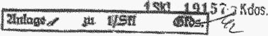
| III. War Patrol | Copy No. . . . 4. . . . . | ||||||||||||||||||||||||||||||||||||||||||||||||||||||||||||||||||||
| K r i e g s t a g e b u c h | |||||||||||||||||||||||||||||||||||||||||||||||||||||||||||||||||||||
| " U-87 " | |||||||||||||||||||||||||||||||||||||||||||||||||||||||||||||||||||||
|
|||||||||||||||||||||||||||||||||||||||||||||||||||||||||||||||||||||
 |
|||||||||||||||||||||||||||||||||||||||||||||||||||||||||||||||||||||
| © U-boat Archive 2023 - all rights reserved | |||||||||||||||||||||||||||||||||||||||||||||||||||||||||||||||||||||
 |
Click the flag to view the above page from the original German KTB |
- 1 - |
|||||
| 28.03.42 - | Shipyard period St. Nazaire. Diesel overhaul. | ||||
| 22.04.42 | |||||
| 11.04.42 | Fuel oil in the forward battery bilge. | ||||
| 19.04.42 | Again oil in the same bilge. Both times the welds were rither welded from the outside or sealed provisionally. | ||||
| 22.04.42 | Oil in the battery bilge for the third time. | ||||
| 23.04.42 - | Additional shipyard period. Now, at last, the fault locations can be welded from both sides. Therefore removal of the forward battery. | ||||
| 18.05.42 | |||||
 |
|||||
| 3rd War patrol. | |||||
| 19.05.42 | |||||
| 19.12 | Departed Atlantic Pier. 1/2 hour delay because "Löser" has a rope end in his propeller. | ||||
| 19.55 | Departed the St. Nazaire Lock. | ||||
| 20.00 | Taken under escort together with "Löser". | ||||
| 22.08 | SW 1, 2/10, 1009 mb, faint moonshine | Escort released. Proceed on Route "Uhunest". | |||
| 23.24 | Patrol boat group abeam to starboard 4000 meters not identified. | ||||
| 24.00 | Vis. good | On Route "Uhunest". | |||
|
|
|||||
| 20.05.42 | Bay of Biscay | ||||
| 02.00 | German U-boat on opposite course 3000 meters off on the starboard side. Did not answer recognition signal call with signal light. Positioned off lighted fishing trawler. 1-1/2 hours long heavy anti-aircraft fire over St. Nazaire. | ||||
| "Löser" overhauled me slowly zig zagging in long legs. | |||||
| 04.00 | BF 6755 | ||||
| SW 1, 4/10, light swell | |||||
| 05.30 | Large fishing trawler gathering on the 150-meter line. | ||||
| 06.05 | Dived to proceed submerged. | ||||
| Deep diving test depth A +60 meters. All watertight. | |||||
| 08.00 | BF 6774 | ||||
| 12.00 | BF 5895 | Day's run surfaced 106 nm | |||
| submerged 24 nm | |||||
| Total 130 nm. | |||||
| 13.15 | WNW 4, Sea 2-3, 7/10 | Surfaced. | |||
| 13.39 | Dived. | ||||
| 16.00 | BF 5894 | ||||
| 20.00 | BF 5885 | ||||
| 21.48 | Surfaced. | ||||
| 24.00 | BF 5874 | ||||
|
|
|||||
|
Sun and Moon Data 20.05.42 |
- 2 - |
|||||
| 21.05.42 | |||||
| 04.00 | BF 5785 | ||||
| SSW 4, Sea 3, 2-8/10 | |||||
| 05.57 | Dived to proceed submerged. | ||||
| 08.00 | BF 5774 | ||||
| 12.00 | BF 4996 | Day's run surfaced 72 nm | |||
| submerged 48 nm | |||||
| Total 120 nm. | |||||
| 16.00 | BF 4994 | ||||
| 20.00 | BF 4985 | ||||
| 21.43 | Surfaced. | ||||
| 24.00 | BF 4975 | ||||
| W 2, Sea 2, 6/10, rain showers | |||||
|
|
|||||
| 22.05.42 | |||||
| 04.00 | BF 4894 | ||||
| WbyS 3, Sea 2, Vis. medium, rain showers | |||||
| 08.00 | BF 4876 | ||||
| 12.00 | BF 4874 | Day's run surfaced 91 nm | |||
| W 1, Sea 2, 1/10 | submerged 24 nm | ||||
| Total 115 nm. | |||||
| 16.00 | BF 4786 | ||||
| SSW 2, Sea 1 | |||||
| 20.00 | BF 4775 | ||||
| 24.00 | BE 6995 | ||||
| SSW 3, Sea 2, overcast | |||||
|
|
|||||
| 23.05.42 | |||||
| 04.00 | BE 6985 | ||||
| SW 4, Sea 3, Vis. moderate | |||||
| 06.52 | Test dive | ||||
| 07.55 | Surfaced. | ||||
| 08.00 | BE 6975 | ||||
| WbyN 4, Sea 3, 4/10 | |||||
| 12.00 | BE 6895 | Day's run surfaced 137 nm | |||
| submerged 3 nm | |||||
| Total 140 nm. | |||||
| 15.50 | Dived to proceed submerged. The boat pitches strongly in the short sea and makes headway submerged at HF faster and more economically. | ||||
| 16.00 | BE 6886 | ||||
| 20.00 | BE 6875 | ||||
| 22.13 | Vis. medium | Surfaced. | |||
| 22.51 | Sent position report. | ||||
| 23.25 | Acknowledgement message from B.d.U. | ||||
| 24.00 | BE 6796 | ||||
| NW 2-3, Sea 3, 7/10 | |||||
|
|
|||||
|
Sun and Moon Data 21.05.42 |
| Sun and Moon Data 22.05.42 | |
| Sun and Moon Data 23.05.42 |
- 3 - |
|||||
| 24.05.42 | Eastern North Atlantic | ||||
| 04.00 | BE 6785 | ||||
| NW 1, Sea 2, 6/10 | |||||
| 08.00 | BE 6774 | ||||
| NW 2, long swells | |||||
| 11.25 | Switched to Ireland Circuit. | ||||
| 12.00 | BE 5986 | Day's run surfaced 95 nm | |||
| W 3, Sea 3, 2/10 | submerged 43 nm | ||||
| Total 138 nm. | |||||
| Difference between actual and dead reckoning Position 201°T, 18.2 nm | |||||
| 16.00 | BE 8316 | ||||
| W 4, Sea 3, 9/10 | |||||
| 20.00 | BE 8236 | ||||
| 24.00 | BE 8226 | ||||
|
|
|||||
| 25.05.42 | |||||
| 04.00 | BE 8216 | ||||
| SW 4, Sea 4, overcast | |||||
| 08.00 | BE 8136 | ||||
| Rain showers | |||||
| 12.00 | BE 8126 | Day's run surfaced 125 nm | |||
| submerged 0 nm | |||||
| Total 125 nm. | |||||
| 12.13 | Test dive. | ||||
| 15.04 | Surfaced. Submerged heavy knocking sounds at the position of the port forward diving plane. | ||||
| 16.00 | BE 8116 | ||||
| W 4-5, Sea 4, rain | |||||
| 20.00 | BE 7336 | ||||
| 24.00 | BE 7326 | ||||
|
|
|||||
| 26.05.42 | |||||
| 02.20 | Radio Message 01.52 hours from B.d.U.: "Report weather." | ||||
| 03.22 | Short Weather Signal sent: "45°N, 21°W, 1002 mb, falling, 14°C, W 3-4, cumulous clouds, light rain showers, Vis. 5 nm, medium-high swells from the west." | ||||
| 02.30 | Radio Message 01.55 hours from B.d.U.: "Via buoy off New York at 40°13.5'N and 73°47'W." | ||||
| 04.00 | BE 7324 | ||||
| 08.00 | BE 7314 | ||||
| 09.55 | Dived to proceed submerged. | ||||
| 12.00 | BE 7235 | Day's run surfaced 103 nm | |||
| submerged 13 nm | |||||
| Total 116 nm. | |||||
| 16.00 | BE 7225 | ||||
| 20.00 | BE 7215 | ||||
| W 5, Sea 4-5, 0/10 | |||||
| 22.40 | Surfaced. | ||||
| 24.00 | BE 7136 | ||||
|
|
|||||
|
Sun and Moon Data 24.05.42 |
| Sun and Moon Data 25.05.42 | |
| Sun and Moon Data 26.05.42 |
- 4 - |
|||||
| 27.05.42 | |||||
| 04.00 | BE 7126 | ||||
| Vis, medium, 999 mb, WNW 5, Sea 5 | |||||
| 08.00 | BE 7116 | ||||
| 10.01 | Dived to proceed submerged. | ||||
| 12.00 | BE 7114 | Day's run surfaced 57.6 nm | |||
| submerged 54.4 nm | |||||
| Total 112.0 nm. | |||||
| 14.15 | WbyN 6-7, Sea 5, 5/10, high swell | Surfaced. | |||
| 16.00 | BD 9334 | ||||
| 20.00 | BD 9324 | ||||
| WNW 4-5, Sea 4, 7/10 | |||||
| 24.00 | BD 9314 | ||||
|
|
|||||
| 28.05.42 | |||||
| 04.00 | BD 9235 | ||||
| W 3, Sea 2, 7/10, WNW-swell 3, Vis. medium, rain | |||||
| 08.00 | BD 9225 | ||||
| 12.00 | BD 9215 | Day's run surfaced 94 nm | |||
| submerged 19 nm | |||||
| Total 113 nm. | |||||
| 16.00 | BD 9126 | Difference between actual and dead reckoning position 211°T, 35.5 nm. | |||
| W 2, Sea 2, medium SW-swell 2-3, 8/10, Vis. good | |||||
| 20.00 | BD 9147 | ||||
| SW 2-3, 8/10, Vis. good | |||||
| 24.00 | BD 8359 | ||||
|
|
|||||
| 29.05.42 | |||||
| 00.00 | BD 8348 | ||||
| SSW 3, rain | |||||
| 08.00 | BD 8267 | ||||
| 12.00 | BD 8257 | Day's run surfaced 154 nm | |||
| Vis. medium | submerged 0 nm | ||||
| Total 154 nm. | |||||
| Western North Atlantic | |||||
| 13.45 | Test dive. | ||||
| 14.27 | Surfaced. | ||||
| 16.00 | BD 8196 | Difference between actual and dead reckoning position 202°T, 9 nm. | |||
| SW 2, Sea 1, fog, Vis. 300 meters | |||||
| 20.00 | BD 8185 | ||||
| Fog, rain | |||||
| 24.00 | BD 8174 | ||||
| SW 1, Vis. bad | |||||
|
|
|||||
|
Sun and Moon Data 27.05.42 |
| Sun and Moon Data 28.05.42 | |
| Sun and Moon Data 29.05.42 |
- 5 - |
|||||
| 30.05.42 | |||||
| 04.00 | BD 7386 | ||||
| SSW 3, Sea 2, fog | |||||
| 08.00 | BD 7376 | ||||
| Fog bank | |||||
| 12.00 | BD 7296 | Day's run surfaced 148 nm | |||
| submerged 2 nm | |||||
| Total 150 nm. | |||||
| 15.40 | Test dive. | ||||
| 16.00 | BD 7285 | ||||
| SW 3, 6/10, 996 mb | |||||
| 16.42 | Surfaced. | ||||
| 20.00 | BD 7277 | ||||
| WSW 4, Sea 3, 7/10 | |||||
| 22.12 | Radio Message 21.45 hours from B.d.U.: "Between 01.00 and 05.00 hours report weather. 08.00 hours switch to Greenland Circuit. | ||||
| 24.00 | BD 7431 | ||||
| W 4, Vis. good, rain | |||||
|
|
|||||
| 31.05.42 | |||||
| 01.09 | Short Weather Signal sent: "45°N, 37°W, 996 mb, rising, 12°C, W 4, squall weather with rain showers, Vis. 5 nm, medium-high swells from the west." | ||||
| 04.00 | BD 7422 | ||||
| WbyS 4, Sea 4, overcast, | |||||
| 07.35 | Dived to proceed submerged. | ||||
| 08.00 | BD 7415 | ||||
| 12.00 | BC 9636 | Day's run surfaced 67.5 nm | |||
| submerged 23.2 nm | |||||
| Total 90.7 nm. | |||||
| 16.00 | BC 9634 | ||||
| 18.10 | Surfaced. | ||||
| 20.00 | BC 9627 | ||||
| W 5, Sea 4-5, 5/10, 995 mb, long swells, Vis. medium | |||||
| 24.00 | BC 9641 | ||||
|
|
|||||
| 01.06.42 | |||||
| 04.00 | BC 9661 | ||||
| W 4, Sea 3 | |||||
| 08.00 | BC 9555 | ||||
| 09.00 | Radio Message 07.11 hours from Müller-Edzards: "Convoy in sight square BC 8257." | ||||
| Shortly thereafter B.d.U. prohibits me from operating on it. | |||||
| I am positioned 200 nm behind the convoy. | |||||
| 12.00 | BC 9545 | Day's run surfaced 58 nm | |||
| WbyS 4-5, Sea 3-4, 8/10 | submerged 36 nm | ||||
| Total 94 nm. | |||||
| 16.00 | BC 9468 | ||||
| 20.00 | BC 9728 | Difference between actual and dead reckoning position 201°T, 19 nm. | |||
| 20.30 | Test dive. | ||||
| 22.26 | Surfaced. | ||||
| 24.00 | BC 9718 | ||||
| WbyS 5, Sea 4-5, overcast | |||||
|
|
|||||
|
Sun and Moon Data 30.05.42 |
| Sun and Moon Data 31.05.42 | |
| Sun and Moon Data 01.06.42 |
- 6 - |
|||||
| 02.06.42 | |||||
| 04.00 | BC 8959 | ||||
| WbyS 6, Sea 5, overcast | |||||
| 08.00 | BC 8929 | ||||
| W 3-4, Sea 4, overcast | |||||
| 12.00 | BC 8918 | Day's run surfaced 107 nm | |||
| WbyS 1, long high swells | submerged 9 nm | ||||
| Total 116 nm. | |||||
| 18.00 | BC 8829 | ||||
| Vis. good | |||||
| 19.20 | Test dive. | ||||
| 20.00 | BC 8816 | Surfaced. | |||
| W 3, Sea 2, 8/10 | |||||
| 20.15 | Dived. | ||||
| 22.55 | Surfaced. | ||||
| 24.00 | BC 8736 | Difference between actual and dead reckoning position 20°T, 12 nm. | |||
| NNW 2-3 | |||||
|
|
|||||
| 03.06.42 | |||||
| 04.00 | BC 8726 | ||||
| WbyS 1, Sea 1, 8/10 | |||||
| 08.00 | BC 8715 | ||||
| 12.00 | BC 7956 | Difference between actual and dead reckoning position 109°T, 6 nm. | |||
| Vis. medium | |||||
| Day's run surfaced 144 nm | |||||
| submerged 4 nm | |||||
| Total 148 nm. | |||||
| 15.55 | Drifting rescue raft. Markings: HANS EGEDE, Greenland [translator's note: sunk by U-587 on 6 March] | ||||
| 16.00 | BC 7925 | ||||
| NNE 2-3, Sea 2, 7/10 | |||||
| 19.12 | Test dive. | ||||
| 20.00 | BC 7914 | ||||
| N 3, Sea 2, fog, Vis. 200 meters | |||||
| 2x.x5 | Surfaced. | ||||
| 23.00 | Reached the eastern limit of the Newfoundland Bank according to soundings. | ||||
| 24.00 | BC 7826 | ||||
| Fog, no visibility | |||||
|
|
|||||
| 04.06.42 | |||||
| 04.00 | BC 7818 | ||||
| Fog | |||||
| 08.00 | BC 7755 | ||||
| Fog | |||||
| 09.56 | Reached the western limit of the Newfoundland bank according to soundings. | ||||
| 12.00 | BC 7745 | Day's run surfaced 154 nm | |||
| E 1, overcast, 1022 mb | submerged 4 nm | ||||
| Total 158 nm. | |||||
| West of the Newfoundland Bank | |||||
| 16.00 | BB 9987 | ||||
| ENE 2, Vis. good | |||||
| 18.25 | Test dive. | ||||
| 19.00 | Surfaced. | ||||
| 20.00 | BB 9976 | ||||
| 24.00 | BB 9698 | ||||
| Vis. moderate | |||||
|
Sun and Moon Data 02.06.42 |
| Sun and Moon Data 03.06.42 | |
| Sun and Moon Data 04.06.42 |
- 7 - |
|||||
| 05.06.42 | |||||
| 04.00 | CC 1312 | ||||
| SE 2-3, overcast | |||||
| 08.00 | CC 1226 | ||||
| 12.00 | CC 1217 | Day's run surfaced 179 nm | |||
| Vis. changing greatly | submerged 5 nm | ||||
| Total 184 nm. | |||||
| 16.00 | CC 1153 | ||||
| ESE 4, Sea 3-4, overcast, rain | |||||
| 18.55 | Test dive. | ||||
| 20.00 | CC 1146 | ||||
| Vis. bad | |||||
| 20.45 | Surfaced. | ||||
| 21.12 | Dived. | ||||
| 21.50 | Surfaced. | ||||
| 24.00 | CB 3368 | ||||
| SE 3, fog, long swells | |||||
|
|
|||||
| 06.06.42 | |||||
| 04.00 | CB 3357 | ||||
| Fog 100 meters | |||||
| 08.00 | CB 3292 | ||||
| Wind calm, 990 mb | |||||
| 12.00 | CB 3276 | Day's run surfaced 141 nm | |||
| NW 3, Sea 2, fog | submerged 7 nm | ||||
| Total 148 nm. | |||||
| 16.00 | CB 3198 | ||||
| NW 4, Vis. moderate | |||||
| 20.00 | CB 3421 | Test dive. | |||
| 21.05 | Surfaced. | ||||
| 24.00 | CB 3414 | ||||
| NW 3, Sea 3, Vis. good | |||||
|
|
|||||
| 07.06.42 | |||||
| 04.00 | CB 2655 | Difference between actual and dead reckoning position 137°T, 15 nm. | |||
| 08.00 | CB 2568 | ||||
| 12.00 | CB 2581 | Day's run surfaced 156 nm | |||
| submerged 3 nm | |||||
| Total 159 nm. | |||||
| 16.00 | CB 2495 | Difference between actual and dead reckoning position 173°T, 11.5 nm. | |||
| Wind still, Vis. good | |||||
| 18.30 | Test dive. | ||||
| 19.30 | Surfaced. | ||||
| 20.00 | CB 2728 | ||||
| 20.40 | Smoke clouds bearing 230°T, later recognized as clouds of haze. | ||||
| 24.00 | CB 1963 | A soldier suspected of syphilis. Still in the initial stage. Isolation measures implemented. | |||
| SW 2, Sea 1, light swell | |||||
|
|
|||||
|
Sun and Moon Data 05.06.42 |
| Sun and Moon Data 06.06.42 | |
| Sun and Moon Data 07.06.42 |
- 8 - |
|||||
| 08.06.42 | |||||
| 02.42 | Stopped to outboard work. The source of trouble for the knocking sounds at the bow is not found. The sounds can be heard loudly in the bow room, interferes with the GHG very heavily. | ||||
| 04.00 | CB 1953 | ||||
| 08.00 | CB 1945 | ||||
| SW 3, Sea 1, 5/10 | |||||
| 12.00 | CB 1864 | Day's run surfaced 155 nm | |||
| submerged 3 nm | |||||
| Total 158 nm. | |||||
| 13.50 | Radio Message from B.d.U.: "Berger and Löser report position." | ||||
| 14.57 | Short Signal sent: "My position is square CB 18." | ||||
| Was not acknowledged. | |||||
| 16.00 | CB 1849 | ||||
| SW 1, Vis. good | Test dive. | ||||
| 17.05 | Surfaced. | ||||
| 17.20 | Drifting automobile inner tubes. | ||||
| 19.29 | Received Position Short Signal: "CB 18, signed NQ." Probably radio repeater for me. | ||||
| 20.00 | CB 1791 | False acknowledgement from B.d.U. for Short Signal: "U-87 reports with 2 Short Signals 19.29 hours with volume 2: My position is CB 1145." | |||
| 21.47 | Radio Message from B.d.U." "Berger, Degen, Löser Execute task at the earliest in after 11 June, further details follow on 9 June." | ||||
| 23.05 | Short Signal sent: "My position is CB 17." | ||||
| 24.00 | CB 1775 | ||||
| WNW 1, fog | |||||
|
|
|||||
| 09.06.42 | At Nantucket Island | ||||
| 02.46 | Mines loaded on the surface. | ||||
| False acknowledgement from B.d.U. for Short Signal: "U-87 reports by Short Signal at 17.42 hours with volume 2: My position is square CB 1318. | |||||
| It was not sent by me. | |||||
| 04.00 | CA 3995 | ||||
| Fog | |||||
| 08.00 | CA 3987 | ||||
| Fog, wind calm | |||||
| 08.48 | Content confirmation of my second Position Short Signal. | ||||
| 10.39 | Shadow in sight nearly abeam bearing 340°T. Destroyer of the "DEVEY" class in opposite course of about 90°. High speed. At most 5000 meters off. | ||||
| 10.40 | Crash dive. Destroyer came out of the thick haze. I stood before the clear, bright horizon in a glassy calm sea. Have a blessed sleep! | ||||
| 11.02 | Surfaced. Destroyer out of sight. | ||||
| 11.04 | Crash dive, Destroyer ran directly out of the rising sun. | ||||
|
Sun and Moon Data 08.06.42 |
| Sun and Moon Data 09.06.42 |
- 9 - |
|||||
| continued | |||||
| 09.06.42 | |||||
| 11.16 | Surfaced. | ||||
| 12.11 | CA 6226 | Difference between actual and dead reckoning position 78°T, 34 nm. | |||
| Wind calm, Vis. very good | |||||
| Day's run surfaced 159 nm | |||||
| submerged 5 nm | |||||
| Total 164 nm. | |||||
| 16.00 | CA 6224 | Drifting rescue framework with red flag. | |||
| E 1, Sea 0, 1/10 | |||||
| 20.00 | CA 6216 | ||||
| 21.50 | Drifting wreckage and rescue rafts. | ||||
| 24.00 | CA 6138 | ||||
|
|
|||||
| 10.06.42 | |||||
| 00.36 | Officer-Only Radio Message from B.d.U.: "To Berger. | ||||
| 01.45 | 1.) Do not execute Mining Order New York, but foul area off Boston. Observe traffic beforehand. The area NW and SW of the peacetime position of the Boston light ship appears favorable. See Kriegsmarine Standing War Order 492. Deploy in 20-30 meters water depth. | ||||
| 2.) If fouling off Boston is not possible, carry out wide range fouling at the Barnegat Lightship between 39°30N and 39°50N up to 20 nm off the coast. Light ship positioned as in peacetime from U-boat observations. | |||||
| 3.) Report execution from more than 50 nm distance as soon as possible by Officer-Only Message. | |||||
| 03.50 | Came to opposite course in the direction of Boston. A special chart of Boston is not on board. A chart is drawn based on the Sailing Instructions and Light List. | ||||
| 04.00 | CA 6143 | ||||
| 08.00 | CA 6132 | ||||
| 12.00 | CA 3879 | Day's run surfaced 180 nm | |||
| Wind calm, mirror-flat sea, very heavy distortion on the horizon | submerged 0 nm | ||||
| Total 180 nm. | |||||
| 13.26 | Crash dive for aircraft bearing 330°T, course 45°, aircraft altitude 200 meters. Distance 7000 meters, land-based aircraft. | ||||
| 13.58 | Surfaced. | ||||
| 14.15 | Passed Nantucket Whistle Buoy (Lightship substitute) at 60 meters. Red position buoy is located there. | ||||
| 14.37 | Crash dive for aircraft bearing 0°T, course 250°, altitude 200 meters, distance 6000 meters. Land-based aircraft. | ||||
| 14.57 | Surfaced. | ||||
| 15.57 | Several fishing vessels ahead. Dived. | ||||
| 16.00 | CA 3839 | There are always new fishing vessels. | |||
| 19.45 | Wind calm | Surfaced. | |||
| 20.00 | CA 3914 | ||||
| 24.00 | CA 3677 | ||||
| WSW 1, Vis. good | |||||
|
|
|||||
|
Sun and Moon Data 09.06.42 |
| Sun and Moon Data 10.06.42 |
- 10 - |
|||||
| 11.06.42 | |||||
| 01.06 | Small cargo sailing vessel bearing 320°T, course 60°. | ||||
| 01.17 | Crash dive for aircraft bearing 115°T, course 270°, altitude 300 meters, distance 5000 meters. Land-based aircraft. | ||||
| The sailing vessel crosses my course. | |||||
| 02.40 | Surfaced. | ||||
| 04.00 | CA 3562 | ||||
| W 1, 1/10 | |||||
| 04.29 | Fishing vessel bearing 270°T. | ||||
| 04.58 | Cape Cod and Nauset Beach lighthouses burning as in peacetime. | ||||
| 04.59 | Fishing vessel bearing 300°T. | ||||
| 08.00 | CA 3249 | ||||
| Hazy, Vis. moderate | |||||
| 09.10 | Patrol vessel with faintly set fishing lights in sight ahead. Comes closer quickly. | ||||
| 09.15 | Dived. | ||||
| Patrol vessel searches with listening gear. High whistling sound 96 times/minute. | |||||
| 12.00 | CA 3163 | Day's run surfaced 150 nm | |||
| submerged 21 nm | |||||
| Total 171 nm. | |||||
| Off Boston | |||||
| 12.30 | Patrol vessel comes very close. Put the boat on the bottom (depth A -10 meters), because my self noise is very loud. Patrol vessel stops for a short time and listens with search gear. | ||||
| Runs off slowly after 30 minutes. | |||||
| 13.23 | Raised the boat from the bottom. Entered Boston Bay [Massachusetts Bay]. | ||||
| 16.00 | CA 3162 | ||||
| Wind calm, Vis. medium | |||||
| 17.00 | Fast three masted motor sailing vessel runs over the boat course 115°. | ||||
| 17.25 | 3 fast boats, probably U-boat hunters leaving. Same course as the sailing vessels. | ||||
| 18.00 | Fast motor launch sounds on opposite course. Remains close by for 1/2 hour and throws explosive devices. It sounds as if gravel were thrown against the hull. | ||||
| 18.15 | Put the boat on the bottom (depth A -40 meters). | ||||
| Boat lies close to the peacetime position of the Boston Lightship. | |||||
| Made all around periscope sweeps several times. | |||||
| Heavy traffic runs past on both sides of the boat on course 310° from Cape Cod running to the north along the 40-meter line. | |||||
| Medium traffic traveling north on course 240° from Cape Ann also heading north along a series of buoys. There is no traffic in the middle of the bay. The outer bay is protected by a series of patrol vessels at the level of Cape Ann - Cape Cod and south therefrom, at night with faint set fishing lights. At least some with listening gear (bright whistling sound 96 times/minute). | |||||
|
Sun and Moon Data 11.06.42 |
- 11 - |
|||||
| continued | |||||
| 11-06.42 | |||||
| Only light traffic goes through the southeast entrance of the harbor, small vessels and fishermen. | |||||
| 19.10 | A fast boat comes back. Throws explosives again. Mostly 3-4 in quick succession. | ||||
| 20.00 | CA 3156 | ||||
| SW 1, Sea 0, hazy | |||||
| 23.15 | Aircraft, course 240° at low altitude over the boat probably a civilian aircraft. | ||||
| 24.00 | CA 3156 | ||||
|
|
|||||
| 12.06.42 | |||||
| 01.30 | The sailing vessel returns in the company of 3 fast boats. Probably a U-boat hunting group. The 3 masted schooner gives an outward appearance of being very neglected. | ||||
| Speed about 15 knots. | |||||
| 02.15 | Last of twilight, bright afterwards, cloudless shy, Vis. good | Surfaced. | |||
| The city of Boston is hardly darkened. The lighthouses burn as in peacetime. The buoys are mostly changed in their identification and position. In place of the Boston Lightship there is an unlighted bell buoy. | |||||
| I intend, to lay 4 mines off the north part of the northeast entrance, 2 mines off the east part. | |||||
| 04.00 | Wind calm, the sky darkens gradually | Waited until 04.00 hours for full darkness. Then preflooded underway on E-motors at HF. Light inbound and outbound traffic at night. | |||
| 04.55 | 1st mine deployed. | ||||
| 05.15 | Shadow of an anchored fast boat in sight ahead. | ||||
| 05.20 | Dived. | ||||
| 05.50 | 2nd mine deployed submerged. | ||||
| 06.09 | 3rd and 4th mine deployed shortly after one another. | ||||
| Due to failure of the mine top stop in tube III deployed the 4th mine together. | |||||
| 06.11 | Surfaced. | ||||
| 06.15 | Dived, because a pilot vessel approaches from behind a rock directly towards me. | ||||
| 06.42 | Surfaced. | ||||
| 06.49 | 5th mine deployed. | ||||
| 07.10 | Wind calm | 6th mine deployed. | |||
| Set off to the east. | |||||
| 08.00 | CA 3156 | Avoided several patrol vessels. | |||
| 10.50 | SW 2-3, Sea 2, Vis. bad, ground fog | Dived to proceed submerged. | |||
| 11.53 | Surfaced. Still thick fog. | ||||
| 11.58 | Dived. | ||||
| 12.00 | CA 3249 | Day's run surfaced 41 nm | |||
| submerged 29 nm | |||||
| Total 70 nm. | |||||
|
Sun and Moon Data 11.06.42 |
| Sun and Moon Data 12.06.42 |
- 12 - |
|||||
| continued | |||||
| 12.06.42 | |||||
| 15.55 | SW 1, Sea 1, Vis. good | Surfaced. Cape Cod is still in sight. | |||
| 15.57 | Dived. | ||||
| 16.00 | CA 3285 | ||||
| 17.30 | Listening device in the direction of Cape Cod. | ||||
| 18.30 | The same. | ||||
| 18.48 | CA 3286 | Convoy in sight bearing 45°T, target angle 100°, low speed, 6-7000 meters distant. 15 steamers, 4 destroyers. Due the strong self noise the convoy was not heard. I can use only the air search periscope, because the attack periscope has fogged up inside. Unfortunately, the enemy has already passed by. No attack can be made with the air search periscope in the glassy sea. | |||
| Wind calm, flat sea | |||||
| Went deep for a short time (depth A +60 meters), because the flank destroyer seems to have seen me. Convoy runs lightly zig zagging course of 300° in the direction of Boston. | |||||
| 20.00 | CA 3283 | ||||
| 20.54 | Convoy is still in sight. | ||||
| 23.00 | CA 3295 | Surfaced. Battery is nearly empty. | |||
| S 1, Sea 1, 7/10, fog, Vis, changing heavily | |||||
|
|
|||||
| 13.06.42 | Gulf of Maine | ||||
| 04.00 | CA 3265 | I intend to go on the Cape Ann - Cape Sable convoy route. | |||
| SbyE 1-2, fog, Vis. 100 meters | |||||
| 04.28 | Officer-Only Radio Message sent: "Fouling northeast approach to Boston early on 12 June. 74 cbm. Request important Serial Numbers from 11 June." | ||||
| 08.00 | CA 3235 | ||||
| Fog, Vis. 100 meters | |||||
| 10.46 | Dived to listen. | ||||
| 12.00 | BA 9794 | Day's run surfaced 77 nm | |||
| submerged 34 nm | |||||
| Total 111 nm. | |||||
| 13.06 | Fog, Vis. 100 meters | Surfaced. | |||
| 14.15 | Radio Message from B.d.U.: "Well done. Attack area north of the Latitude and west of the Longitude of CB 25." | ||||
| 16.00 | BA 9792 | ||||
| Fog, Vis. 100 meters | |||||
| 19.14 | Dived to listen. | ||||
| 19.32 | Surfaced. | ||||
| 20.00 | BA 9876 | ||||
| Fog, Vis. 100 meters | |||||
| 20.48 | Dived to listen. | ||||
| 21.02 | Surfaced. | ||||
| 24.00 | BA 9887 | ||||
| Fog, Vis. 100 meters | |||||
|
|
|||||
|
Sun and Moon Data 12.06.42 |
| Sun and Moon Data 13.06.42 |
- 13 - |
|||||
| 14.06.42 | |||||
| There seems to be permanent fog here. Intend to go towards Cap Cod and observe traffic off the coast there, until visibility improves. | |||||
| 02.04 | Dived to listen. | ||||
| 02.15 | Surfaced. | ||||
| 02.20 | Forward torpedo transferred from the overdeck, duration 2 hours. At the same time diver examines the forward diving plane. I suspect a knocking zinc protection plate, all are firmly in place. | ||||
| 04.00 | CA 3332 | ||||
| Fog, Vis. 50 meters. | |||||
| 08.00 | CA 3353 | ||||
| Fog, Vis. 100 meters, S 2 | |||||
| 12.00 | CA 3376 | Day's run surfaced 101 nm | |||
| Fog, Vis 100 meters | submerged 3 nm | ||||
| Total 104 nm. | |||||
| 15.13 | Dived to listen. Sounds of listening devices at Cape Cod. | ||||
| 15.54 | Surfaced. | ||||
| 16.00 | CA 3536 | ||||
| Fog, Vis. 100 meters | |||||
| 20.00 | CA 3528 | ||||
| Fog, Vis. 100 meters | |||||
| 21.00 | Dived. Put the boat on the bottom (depth A +0 meters). | ||||
| 24.00 | CA 3527 | ||||
| Fog, Vis. 100 meters | |||||
|
|
|||||
| 15.06.42 | |||||
| 01.20 | Surfaced. Still foggy. | ||||
| 01.35 | Dived. Put the boat on the bottom (depth A -10 meters). | ||||
| 04.00 | CA 3527 | ||||
| 08.00 | CA 3527 | ||||
| Fog, summer lightening | |||||
| 08.05 | Surfaced. Remained lying stopped. | ||||
| 12.00 | CA 3528 | Day's run surfaced 58 nm | |||
| Fog, E 1, Sea 1, 995 mb | submerged 2 nm | ||||
| Total 60 nm. | |||||
| 14.55 | Dived. Put the boat on the bottom (depth A -20 meters). | ||||
| 15.40 | NbyW 3, Sea 2, 9/10, Vis. medium | Sound bearing off shore, visibility has gotten better. A small fisherman just off shore. | |||
| Set off from land submerged. | |||||
| 16.00 | CA 3526 | ||||
| 18.25 | 2-engined land-based aircraft (double tail) flies long legs from land out over the sea. Altitude 50 meters, distance 3500 meters. | ||||
| 18.33 | Surfaced. Aircraft is still in sight. | ||||
| 18.35 | Dived. | ||||
| 19.40 | Surfaced. Avoided a fishing vessel. | ||||
| 20.00 | CA 3526 | ||||
| Vis. good, 7/10 | |||||
| 22.51 | Crash dive for aircraft bearing 90°T, course 120°. Altitude 500 meters, distance 9000 meters. | ||||
| 23.55 | Surfaced. | ||||
| 24.00 | CA 3297 | ||||
| Overcast | |||||
|
|
|||||
|
Sun and Moon Data 14.06.42 |
| Sun and Moon Data 15.06.42 |
- 14 - |
|||||
| 16.06.42 | |||||
| 01.14 | Mast heads in sight. Approached, destroyer of the GLEAVES Class. High speed. Course 80°. | ||||
| 02.10 | Destroyer out of sight. | ||||
| 03.35 | CA 3268 | Convoy in sight bearing 90°T, course 300°, speed 8 knots, light zig zags. 6 large freighters and 4 destroyers. | |||
| I wait until complete darkness, because I am positioned on the bright horizon. The sky darkens quickly. Cape Cod Lighthouse in sight. | |||||
| 04.10 | Run in the gap between the forward sweeper and the foremost ship. Steamers proceed quite disorderly in 2 rows. I am positioned in the convoy | ||||
| 04.17 | Shoot tube I, depth 4 meters, target angle bow right 80°, speed 8 knots, range 1100 meters, hit in the center after 100 seconds. | ||||
| Target deeply laden 7000 GRT freighter. | |||||
| Shoot tube II, depth 4 meters, target angle right 80°, speed 8 knots, range 800 meters, hit aft 40 meters after 110 seconds. | |||||
| Target: Lightly loaded 4500 GRT freighter, passes at 300 meters. Miss, likely past behind due to shifting too quickly. However, hits the first steamer after 110 seconds. After few seconds after ship floods. Then is no longer seen. Sinking certain. | |||||
| 04.21 | Shoot tube III and tube IV. Multiple shot. Depth 4 meters, target angle left 80°, speed 8 knots, range 600 meters. Hit center, 2nd hit aft 50 meters after 50 and 90 seconds respectively. Shortly thereafter an internal explosion in the steamer. | ||||
| Target: Deeply laden 7000 GRT freighter with high deck cargo. It began to turn away at the shots because of the first hits. After 2 minutes with heavy list lightly burning when last seen. Sinking is certain. Forward and flank escorts shoot heavily with star shells blocking both sides. I run the rear of the convoy, because I suppose there is no escort there. | |||||
| Brief blinking ahead. Probably a flashlight. Shortly after artillery fire at 1000 meters range. | |||||
| 04.30 | Crash dive. Boat settles 2 times with a heavy down angle. Caught with blowing. Forward they had let the water run into the bilge in order to reload, the destroyer drives closely past the boat. Once the boat settled to depth (A +104 meters). | ||||
| 05.25 | Surfaced. Ran off, because the convoy entered Boston. | ||||
| 06.10 | Rain, Vis. bad | A faint light bearing 220°T. On approaching very dazzling white light across the entire horizon. Fishing vessels. | |||
|
Sun and Moon Data 16.06.42 |
- 15 - |
|||||
| continued | |||||
| 16.06.42 | |||||
| 08.00 | CA 3371 | ||||
| NbyW 2-3, Sea 2, overcast | |||||
| 10.45 | Drifting net buoy. | ||||
| 12.00 | CA 3319 | Day's run surfaced 108 nm | |||
| NE 1, Sea 1, Vis. bad | submerged 11 nm | ||||
| Total 119 nm. | |||||
| 12.05 | Test dive after reloading. | ||||
| 12.50 | Surfaced. With E-motors at KF into the sea. | ||||
| 16.00 | CA 3327 | ||||
| NEbyE, Sea 2 | |||||
| 20.00 | CA 3327 | ||||
| 24.00 | CA 3316 | ||||
| E 4, Sea 3-4 | |||||
|
|
|||||
| 17.06.42 | |||||
| 04.00 | CA 3234 | ||||
| 08.00 | CA 3246 | ||||
| E 1, long swells, | Standing in position. | ||||
| 12.00 | CA 3246 | Day's run surfaced 71 nm | |||
| E 2-3, rain | submerged 2 nm | ||||
| Total 73 nm. | |||||
| 13.26 | Vis. bad | Three masted schooner under sail bearing 20°T. It is the same as seen on 12 June off Boston. Turned away. | |||
| 13.48 | Destroyer bearing 90°T, course 200°. Quickly comes closer out of the haze. | ||||
| Crash dive, by sound bearings the destroyer runs close by ahead of the boat, however, has not seen us. | |||||
| The sailing vessel runs at quite low RPM ahead. In addition, wild searches often hear several destroyers at the same time. Frequent stops in order to listen or work with locating gear. Like a startled wasps' nest. | |||||
| 15.52 | Surfaced. Going to the east in the direction of Cape Sable. | ||||
| 16.00 | CA 3246 | ||||
| E 2-3, swell, Vis. 1000 meters | |||||
| 16.50 | Radio Message 10.56 hours B.d.U.: "For boats in the area of the North American coast no supply possible . . . . " | ||||
| 19.20 | Radio Message situation report sent: | ||||
| Since 12 June fog except for a few hours. Square CA 3513 to CA 3519 no traffic. Convoy course 300° 12 June square CA 3286, 16 June square CA 3268 from the latter two steamers each 7000 GRT sunk. From today strong sea defense off the main harbor. Position CA 3246. Going to the east. A squares CA. Fuel inventory 67 cbm. 4 + 2 torpedoes. E 3, 1008 mb rising, rain, Vis. up to 1000 meters." | |||||
| 20.00 | CA 3256 | By examination identified 5 men with crab lice. | |||
| EbyN 2, Vis. bad | |||||
| 24.00 | CA 3266 | ||||
| EbyS 3-4, Sea 3, fog | |||||
|
|
|||||
|
Sun and Moon Data 16.06.42 |
| Sun and Moon Data 17.06.42 |
- 16 - |
|||||
| 18.06.42 | |||||
| 01.05 | Small fishing vessels bearing 0°T. | ||||
| 04.00 | CA 3349 | Dived to proceed submerged. | |||
| Rain fog, Vis. 100 meters | |||||
| 08.00 | CA 3355 | ||||
| 12.00 | CA 3364 | Day's run surfaced 78 nm | |||
| submerged 14 nm | |||||
| Total 92 nm. | |||||
| 12.45 | ESE 1, long swells | Surfaced. | |||
| 16.00 | CB 1151 | ||||
| Vis. medium | |||||
| 16.40 | Steamer in sight bearing 100°T, target angle left 90°, course 0°, speed 15 knots, zig zagging. | ||||
| The horizon is very hazy. | |||||
| 17.35 | Suddenly thick fog, visibility 400 meters. | ||||
| Steering collision course. | |||||
| 18.39 | Dived to listen. Propeller sounds bearing 80°T. | ||||
| 18.45 | Surfaced. | ||||
| 18.56 | Wind calm, fog | Steamer in sight ahead to starboard, 500 meters off. | |||
| 18.57 | Shot from tube V. Depth 4 meters, target angle left 60°, speed 8 knots, range 600 meters, missed. | ||||
| Steamer goes to AK reverse at the moment of the shot. Apparently had a good fog lookout. Probably undershot, because the steamer was estimated in the haze to be 6000 GRT. Actual size about 3000 GRT. | |||||
| New approach for a bow shot. Immediately after coming in sight the steamer begins artillery fire from a stern cannon of approximately 7.5 cm which was camouflaged before. | |||||
| 19.04 | Crash dive. No sound bearings. | ||||
| Steamer lies stopped somewhere. | |||||
| 19.32 | Surfaced. Enemy not found again in the fog. | ||||
| 20.00 | CB 1123 | Wind calm, fog, Vis. 300 meters. | |||
| 21.00 | Destroyer bearing 135°T on opposite course. Crash dive. | ||||
| 21.18 | Surfaced. | ||||
| 24.00 | CB 1213 | Difference between actual and dead reckoning position by sounding 0°T, 8 nm. | |||
| Fog, rain | |||||
|
|
|||||
| 19.06.42 | |||||
| 04.00 | CB 1213 | ||||
| Wind calm, fog | |||||
| 04.35 | Dived to proceed submerged. | ||||
| 08.00 | CB 1216 | ||||
| 08.35 | Put the boat on the bottom (depth A +0 meters). | ||||
| 10.39 | Surfaced to ventilate. | ||||
| 10.57 | Dived and put the boat on the bottom (depth A -10 meters). | ||||
| 12.00 | CB 1216 | Day's run surfaced 98 nm | |||
| submerged 10 nm | |||||
| Total 108 nm. | |||||
| 14.25 | Vis. clear, hazy horizon | Surfaced. | |||
| 14.31 | Crash dive for aircraft bearing 320°T, course 120°, altitude 600 meters, distance 3000 meters. Flying boat, 2 engines. | ||||
|
Sun and Moon Data 18.06.42 |
| Sun and Moon Data 19.06.42 |
- 17 - |
|||||
| continued | |||||
| 19.06.42 | |||||
| 14.58 | Fog, SW 1-2 | Surfaced. | |||
| 16.00 | CB 1218 | ||||
| Fog, Vis. 200 meters | |||||
| 18.07 | Fog, Vis. 1000 meters | Dived to listen. Sound bearing 30°T. | |||
| 18.44 | Surfaced. | ||||
| 18.50 | Vis. good, to the horizon, wind calm, glassy flat Sea | Destroyer ahead to port, course 270°, low speed, distance 5000 meters, target angle 110° (one-stack destroyer). | |||
| Crash dive. | |||||
| Destroyer increases speed. I can not attack in the glassy flat sea with the air search periscope. | |||||
| 19.45 | Surface. | ||||
| 20.00 | CB 1241 | ||||
| SW 1, Sea 0, 4/10, Vis. 5-6000 meters | |||||
| 24.00 | CB 1217 | ||||
| Vis. moderate | |||||
|
|
|||||
| 20.06.42 | |||||
| 02.15 | Dived to listen. | ||||
| 02.39 | Surfaced. | ||||
| 03.12 | Light swell | Stern torpedo transferred from the overdeck, work duration 2 hours. | |||
| 04.00 | CB 1211 | ||||
| 06.10 | Test dive. | ||||
| 06.23 | Surfaced. | ||||
| 08.00 | BA 9973 | ||||
| SbyE 1, fog, 999 mb | |||||
| 12.00 | BA 9973 | Day's run surfaced 88 nm | |||
| Fog, rain | submerged 5 nm | ||||
| Total 93 nm. | |||||
| 16.00 | CB 1214 | ||||
| Vis. heavily changing | |||||
| 18.07 | Vis. between 100 and 4000 meters | Dived to listen. | |||
| 18.20 | Surfaced. | ||||
| 20.00 | BA 9973 | ||||
| Bands of haze to the horizon | |||||
| 21.46 | Crash dive for aircraft bearing 260°T, course 300°, altitude 500 meters, distance 3000 meters. Land-based aircraft. | ||||
| 22.13 | Surfaced. | ||||
| 23.32 | Crash dive for aircraft bearing 220°T, course 240°, altitude 200 meters, distance 3000 meters. Flying boat. | ||||
| 24.00 | BA 9979 | ||||
| W 1, Vis. good | |||||
|
|
|||||
| 21.06.42 | |||||
| 00.20 | Surfaced. | ||||
| Exceptionally strong mirage. Mostly three to four horizons on top of each other. As a result, the rocks and beacons (also the lighted buoys) off Seal Island and Cap Sable come | |||||
|
Sun and Moon Data 19.06.42 |
| Sun and Moon Data 20.06.42 | |
| Sun and Moon Data 21.06.42 |
- 18 - |
|||||
| continued | |||||
| 21.06.42 | |||||
| in sight at 35 nm. Can see the brightly-illuminated coast at 30 nm, lighthouses burn as in peacetime | |||||
| 04.00 | BA 9998 | ||||
| W 1, overcast, Vis. good | |||||
| 08.15 | Patrol vessel with fishing lights ahead in sight. Quickly comes closer. Avoided. | ||||
| 08.00 | CB 1312 | ||||
| 08.40 | Ran away from the rising star. Because of the heavy layer of dust it looked enlarged like a strong reddish floodlight which quickly got closer. | ||||
| 08.59 | Crash dive. 2 star shells were fired at a range of about 2000 meters. Sound bearings not possible due to self noise. | ||||
| 10.00 | Surfaced. | ||||
| 11.50 | A vessel in sight bearing 30°T. Looks like a German U-boat conning tower. Approached submerged. It is recognized as a fishing boat. | ||||
| 12.00 | CB 1351 | Day's run surfaced 143 nm | |||
| WSW 1, 3/10, Vis. good | submerged 6 nm | ||||
| Total 149 nm. | |||||
| South of Nova Scotia | |||||
| 13.57 | Surfaced. | ||||
| 15.57 | Crash dive for aircraft bearing 280°T, course 180°, altitude 200 meters, distance 4000 meters. Land-based aircraft. | ||||
| 16.00 | CB 1337 | ||||
| S 1, Sea 1, 3/10 | |||||
| 16.30 | Surfaced. | ||||
| 20.00 | CB 2115 | ||||
| 20.45 | Sailing fishing vessel bearing 130°T. | ||||
| 21.10 | Dived, for a closer look. | ||||
| 21.56 | Ran off. Boat is a fast boat with two short completely unexplicably placed masts. On the forward mast a small sail (triangular). The boat turns constantly in a large curve at the position. Water depth here of 180 meters. Boat looked like a fishing boat from afar. | ||||
| 23.05 | Surfaced. | ||||
| 23.50 | Crash dive for aircraft bearing 100°T, course 290°, altitude 1000 meters, distance 6000 meters. Land-based aircraft. | ||||
| 24.00 | BB 7878 | ||||
| Wind calm, Vis. medium | |||||
|
|
|||||
| 22.06.42 | |||||
| 00.25 | Surfaced | ||||
| 00.45 | Crash dive for aircraft bearing 295°T, course 0°, altitude 1000 meters, distance 4000 meters. Flying boat. | ||||
| 02.20 | Surfaced. | ||||
| Main ballast and reserve fuel oil tanks 2 and 4 converted. Dived several times. | |||||
| 04.00 | BB 7872 | ||||
| 05.10 | Patrol vessel 240°T, course 100° with a masthead light. Set a second light later. | ||||
|
Sun and Moon Data 21.06.42 |
| Sun and Moon Data 22.06.42 |
- 19 - |
|||||
| continued | |||||
| 22.06.42 | |||||
| 08.00 | BB 7855 | ||||
| W 1, Sea 0, overcast | |||||
| 11.20 | Crash dive for aircraft bearing 210°T, course 135°, altitude 500 meters, distance 4000 meters. Lockheed Hudson. | ||||
| 12.00 | BB 7827 | Day's run surfaced 128 nm | |||
| SW 1, Sea 1, 5/10 | submerged 14 nm | ||||
| Total 142 nm. | |||||
| 12.49 | Surfaced. | ||||
| 14.09 | Drifting net marker. | ||||
| 16.00 | BB 7733 | ||||
| Vis. moderate | |||||
| 16.55 | Crash dive for aircraft bearing 280°T, course 110°, altitude 200 meters, distance 2000 meters. Lockheed Hudson. | ||||
| Aircraft came directly out of the clouds. 3 well-placed aircraft bombs at depth A -30 meters. Bombs fall relatively late. Probably the 2nd approach of the aircraft. No significant damage. | |||||
| 18.55 | Heavy haze layer on the horizon, wind calm | Surfaced. | |||
| 19.25 | Crash dive for aircraft bearing 60°T, course 330°, altitude 100 meters, distance 2000 meters. Land-based aircraft. | ||||
| 20.00 | BB 7736 | ||||
| Wind calm, fog | |||||
| 20.05 | Surfaced. | ||||
| 24.00 | BB 7827 | ||||
|
|
|||||
| 23.06.42 | |||||
| 03.03 | Dived to proceed submerged. | ||||
| 04.00 | BB 7822 | ||||
| 08.00 | BD 7588 | ||||
| 12.00 | BB 7588 | Surfaced. | |||
| Wind calm, flat glassy Sea, Vis. 2500 meters, heavy haze layer on the horizon | Day's run surfaced 96 nm | ||||
| submerged 17 nm | |||||
| Total 113 nm. | |||||
| 12.02 | Crash dive for aircraft bearing 100°T, course 270°, altitude 100 meters, distance 1000 meters. Lockheed Hudson. | ||||
| Aircraft came directly out of the sun, which at the moment comes exactly over the haze layer and is very dazzling. | |||||
| Dived, because the diesel is not yet ready. | |||||
| After 25 seconds three well-placed aircraft bombs at depth A -70 meters. Bombs lie aft beneath the boat. | |||||
| Damage: Entire electrical system, E-motors, order and reporting system, lighting, water level glass, pressure gauges, all rudders, 200-meter depth meter remains operable. Boat settles quickly with a large down angle. Is held by blowing main ballast tank 3. Boat rises up to depth A -65 meters. The E-motors will not run, because, as we later determined there were several spare parts and tools which had fallen from their mountings into the E-motors. Due to the down angle the boat is | |||||
|
Sun and Moon Data 22.06.42 |
| Sun and Moon Data 23.06.42 |
- 20 - |
|||||
| continued | |||||
| 23.06.42 | |||||
| taken deep. Went to depth A +0 meters and malfunctions are removed. Boat remains fairly water tight. | |||||
| Further malfunctions and damage: | |||||
| Both compressor foundations torn; port compressor bearing plate torn; torpedo tube V leaks; torpedo tube V warped; in the electric torpedo which lay in the tube, the battery shifted aft; bolts in the thrust bearings cracked or loosened; most of the port diesel foundation bolts cracked; engine moved laterally; E-motors foundation bolts loosened; shaft flange port bolt heads partially torn; 5 cells of the after battery leaked; most spare parts on the ceiling jumped out of their brackets (danger to the crew). | |||||
| Injuries: Masch.Mt. Haferbier, bruise on the foot. Fell in the diesel room with the torn out door between the E-motor room and the diesel room. | |||||
| Proceeding submerged. | |||||
| 16.00 | BB 7832 | ||||
| 10°C in the boat | |||||
| 17.11 | 3 aircraft bombs far off. | ||||
| 20.00 | BB 7836 | ||||
| 22.30 | Boat put on the bottom depth A +10 meters. | ||||
| 24.00 | BB 7839 | ||||
|
|
|||||
| 24.06.42 | |||||
| 02.41 | SSE 1, Sea 2, Vis. medium | Surfaced. Port engine remains out of service. | |||
| 03.20 | Searchlight blinking in several locations 180°T. Nearby suddenly a quickly shifting white sight. Nothing seen. | ||||
| 03.27 | Dived to listen. Faint slow propeller sounds. | ||||
| 03.56 | Surfaced. | ||||
| 04.00 | BB 7839 | ||||
| SSE 3, fog | |||||
| 08.00 | BB 7976 | ||||
| Thick fog, Vis. 50 meters | |||||
| 12.00 | CB 2263 | Day's run surfaced 72 nm | |||
| [ganze Nach?] thunderstorms | submerged 16 nm | ||||
| Total 88 nm. | |||||
| 16.00 | CB 2293 | ||||
| S 1-2, rain, fog, thunderstorms | |||||
| 18.24 | Test dive. | ||||
| 19.44 | Surfaced. | ||||
| 20.00 | CB 2616 | ||||
| Fog | |||||
| 20.07 | Radio Message to B.d.U.: "Greatly changing visibility, a lot of fog. 18 June square CB 1123 single miss in fog on a small fast freighter course 0°. Otherwise nothing seen. Square BB 75, 77, 78 heavy air, medium sea surveillance. Yesterday aircraft bombs at depth A -70 meters. One engine out of service. | ||||
|
Sun and Moon Data 23.06.42 |
| Sun and Moon Data 24.06.42 |
- 21 - |
|||||
| continued | |||||
| 24.06.42 | |||||
| Foundation bolts cracked. Engine moved laterally. Both compressor foundations torn. A compressor out of service. Stern tube out of service. 2 stern torpedoes out of service. 2 E and 1 A torpedo. 49 cbm, 1006 mb, thunderstorms, fog, S 2, Position square CB 22. Request delayed return transit. Missing Serial Numbers 275, 276 from 21 June." | |||||
| 21.32 | Radio Message 21.06 hours from B.d.U.: The missing Serial Numbers are completed." | ||||
| 21.50 | Radio Message 21.18 hours from B.d.U.: Begin return transit." | ||||
| 18.07 | Radio Message from B.d.U.: "To Berger, Degen, Löser: All three harbors are open only with special precautionary measures of the USA for traffic. Everywhere success is probable. For . . . . . . . ." | ||||
| 24.00 | CB 2635 | ||||
| Rain, fog, Vis. 100 meters | |||||
|
|
|||||
| 25.06.42 | |||||
| 01.13 | Test dive. | ||||
| 13.30 | Surfaced. | ||||
| 04.00 | CB 3414 | ||||
| 08.00 | CB 3426 | ||||
| SSW 2, rain, Sea 1-2, fog | |||||
| 12.00 | CB 3515 | Day's run surfaced 131 nm | |||
| submerged 7 nm | |||||
| Total 138 nm. | |||||
| Western North Atlantic | |||||
| 16.00 | CB 3535 | ||||
| W 2, Vis. heavily changing, rain | |||||
| 20.00 | CB 3624 | ||||
| 21.35 | Radio Message 20.37 hours from B.d.U.: ". . . . Berger report weather." | ||||
| 24.00 | CB 3636 | ||||
| NE 1, Sea 1, rain showers | |||||
|
|
|||||
| 26.06.42 | |||||
| 02.31 | Short Weather Signal sent: "42°N, 57°W, 1010 mb steady, +20°C, NE 1-2, 10/10 overcast cloud layer, mist, Vis. 10 nm, low SW-swells." | ||||
| 04.00 | CC 1452 | ||||
| Continuous thunderstorms | |||||
| 08.00 | CC 1542 | ||||
| Heavy rain | |||||
| 12.00 | CC 1561 | Day's run surfaced 192 nm | |||
| NW 3, Sea 2, Vis. good | submerged 0 nm | ||||
| Total 192 nm. | |||||
| 12.52 | Test dive. | ||||
| 13.23 | Surfaced. | ||||
| 16.00 | CC 1627 | ||||
| NW 1, Sea 1 | |||||
| 20.00 | CC 2414 | ||||
| 24.00 | CC 2432 |
|
|||
|
Sun and Moon Data 24.06.42 |
| Sun and Moon Data 25.06.42 | |
| Sun and Moon Data 26.06.42 |
- 22 - |
|||||
| 27.06.42 | |||||
| 04.00 | CC 2288 | ||||
| 08.00 | CC 2378 | ||||
| W 2, Vis. medium | |||||
| 12.00 | CC 2395 | Day's run surfaced 217 nm | |||
| Hazy horizon | submerged 1 nm | ||||
| Total 218 nm. | |||||
| 16.00 | CC 3182 | ||||
| W 1, foggy, 1023 mb | |||||
| 20.00 | CC 3249 | ||||
| 24.00 | CC 3266 | ||||
| Rain, fog | |||||
|
|
|||||
| 28.06.42 | |||||
| 04.00 | CC 3353 | ||||
| 08.00 | CD 1143 | ||||
| E 1, Vis. medium | |||||
| 12.00 | CD 1139 | Day's run surfaced 224 nm | |||
| N 1, Vis. good | submerged 0 nm | ||||
| Total 224 nm. | |||||
| 16.00 | CD 1236 | ||||
| 19.10 | Test dive. Work on the diesel. | ||||
| 20.00 | CD 1321 | ||||
| E 1 | |||||
| 20.34 | Surfaced. | ||||
| 24.00 | BC 9779 | ||||
|
|
|||||
| 29.06.42 | |||||
| 04.00 | BC 9795 | ||||
| Rain, fog, wind calm | |||||
| 08.00 | BC 9881 | ||||
| 12.00 | BC 9869 | Day's run surfaced 221 nm | |||
| submerged 3 nm | |||||
| Total 224 nm. | |||||
| 16.00 | BC 9955 | ||||
| E 1, Vis. good | |||||
| 20.00 | BD 7742 | ||||
| S 1 | |||||
| 24.00 | BD 7495 | ||||
| SSW 2, Sea 1-2 | Difference between actual and dead reckoning position 325°T, 25 nm. | ||||
|
|
|||||
| 30.06.42 | |||||
| 04.00 | BD 7581 | ||||
| 08.00 | BD 7569 | ||||
| 12.00 | BD 7656 | Day's run surfaced 216 nm | |||
| SSW 3, Sea 2 | submerged 0 nm | ||||
| Total 216 nm. | |||||
| 16.00 | BD 8441 | ||||
| 20.00 | BD 8429 | ||||
| WbyN 2-3, Sea 2, Vis. good | |||||
| 24.00 | BD 8517 | ||||
|
|
|||||
|
Sun and Moon Data 27.06.42 |
| Sun and Moon Data 28.06.42 | |
| Sun and Moon Data 29.06.42 | |
| Sun and Moon Data 30.06.42 |
- 23 - |
|||||
| 01.07.42 | Eastern North Atlantic | ||||
| 04.00 | BD 8526 | ||||
| 08.00 | BD 8611 | ||||
| W 1, Sea 1 | |||||
| 12.00 | BD 8389 | Day's run surfaced 192 nm | |||
| WSW 2, 7/10 | submerged 0 nm | ||||
| Total 192 nm. | |||||
| 12.28 | Test dive. | ||||
| 13.06 | Surfaced. | ||||
| 16.00 | BD 9174 | ||||
| Vis. medium | Difference between actual and dead reckoning position 33°T, 17 nm | ||||
| 20.00 | BD 9166 | ||||
| WSW 4, Sea 3, 9/10 | |||||
| 22.45 | Radio Message 21.23 hours from B.d.U.: "Berger report weather. On 2 July at 08.00 hours switch to Ireland Circuit . . . . . . . . " | ||||
| 24.00 | BD 9255 | ||||
| WSW 5, Sea 4, overcast | |||||
|
|
|||||
| 02.07.42 | |||||
| 01.07 | Short Weather Signal sent: "45°N, 27°W, 1007 mb falling, +18C, W 3-4, altostratus 10/10 overcast, Vis. 5 nm, medium-high W-swell." | ||||
| Due to receiver interference the confirmation was not received. | |||||
| 04.00 | BD 9341 | ||||
| Long swells | |||||
| 04.04 | Short Weather Signal repeated. | ||||
| 08.00 | BD 9329 | Switched to Ireland Circuit. | |||
| 12.00 | BE 7114 | Day's run surfaced 224 nm | |||
| Rain showers | submerged 1 nm | ||||
| Total 225 nm. | |||||
| 16.00 | BE 7126 | ||||
| 20.00 | BE 7215 | ||||
| 24.00 | BE 7235 | ||||
| W 3, Sea 3, overcast | |||||
|
|
|||||
| 03.07.42 | |||||
| 04.00 | BE 7324 | ||||
| W 1, Vis, medium | |||||
| 08.00 | BE 7336 | ||||
| 12.00 | BE 8126 | Day's run surfaced 223 nm | |||
| Light swell | submerged 0 nm | ||||
| Total 223 nm. | |||||
| 12.05 | Test dive. | ||||
| 14.23 | Surfaced. | ||||
| 16.00 | BE 5876 | Difference between actual and dead reckoning position 10°T, 17 nm. | |||
| 20.00 | BE 5895 | ||||
| W 2, Vis. changing | |||||
| 24.00 | BE 5984 | ||||
|
|
|||||
| 04.07.42 | |||||
| 04.00 | BE 5996 | ||||
| W 3, Sea 2, 7/10 | |||||
| 08.00 | BE 6785 | ||||
|
Sun and Moon Data 01.07.42 |
| Sun and Moon Data 02.07.42 | |
| Sun and Moon Data 03.07.42 | |
| Sun and Moon Data 04.07.42 |
- 24 - |
|||||
| continued | |||||
| 04.07.42 | |||||
| 12.00 | BE 6874 | Day's run surfaced 199 nm | |||
| Vis. good, 4/10 | submerged 11 nm | ||||
| Total 210 nm. | |||||
| Bay of Biscay | |||||
| 16.00 | BE 6886 | ||||
| 20.00 | BE 9313 | Difference between actual and dead reckoning position 140°T, 6 nm. | |||
| WbyS 2-3, rain showers | |||||
| 23.00 | Sailing vessel (fisherman) bearing 90°T, course NE. | ||||
| 24.00 | BE 9332 | ||||
|
|
|||||
| 05.07.42 | |||||
| 04.00 | BF 7122 | ||||
| 06.10 | Dived to proceed submerged. | ||||
| 08.00 | BF 7212 | ||||
| W 1, 7/10, Vis. good | |||||
| 12.00 | BF 7222 | Day's run surfaced 183 nm | |||
| submerged 12 nm | |||||
| Total 195 nm. | |||||
| 16.00 | BF 7231 | ||||
| 20.00 | BF 7233 | ||||
| 23.15 | Surfaced. | ||||
| 24.00 | BF 7312 | ||||
| W 1, Sea 1, 5/10 | |||||
|
|
|||||
| 06.07.42 | |||||
| 04.00 | BF 7353 | Up to now no return harbor has come for me. Apparently they do not suppose I am so far along. Therefore, send a position report. | |||
| WSW 2, 1020 mb | |||||
| 04.31 | Short Signal sent: "My position is BF 81." | ||||
| 06.22 | Dived to proceed submerged. | ||||
| 08.00 | BF 8111 | ||||
| 12.00 | BF 8113 | Day's run surfaced 41 nm | |||
| submerged 54 nm | |||||
| Total 95 nm. | |||||
| 14.20 | Surfaced. | ||||
| 14.55 | Dived. | ||||
| 16.00 | BF 8126 | ||||
| W 3, Sea 2, 7/10, swells | |||||
| 18.45 | My sent Short Signal is understood incorrectly. Received Radio Message 12.15 hours from B.d.U.: Concerning position report in the Bay of Biscay." | ||||
| 19.30 | For that reason went to Coastal Circuit. | ||||
| 20.00 | BF 8132 | ||||
| 20.53 | Received Radio Message 10.36 and 11.57 hours from B.d.U.: Entrance route is Morgennebel." | ||||
| 22.46 | Surfaced. | ||||
| 23.37 | Sent Radio Message: "Position 8 July 07.00 hours Nanni 1." | ||||
| 24.00 | BF 8223 | ||||
|
|
|||||
|
Sun and Moon Data 04.07.42 |
| Sun and Moon Data 05.07.42 | |
| Sun and Moon Data 06.07.42 |
- 25 - |
|||||
| 07.07.42 | |||||
| 00.40 | Rain showers | Fishing sailing vessel bearing 90°T. | |||
| 00.58 | Radio Message 00.24 hours from 6th U-Flottille: "Escort positioned on 8 July 06.00 hours Nanni 1." | ||||
| 01.45 | 2 fishing trawlers avoided. | ||||
| 03.05 | Bright glow astern. Searchlight from aircraft. | ||||
| 04.00 | BF 5884 | ||||
| W 2, Sea 2-3, 5/10 | Several times flashes bearing 0°T. | ||||
| 05.10 | Dived to proceed submerged. | ||||
| 08.00 | BF 5894 | ||||
| 12.00 | BF 5895 | Day's run surfaced 55 nm | |||
| submerged 53 nm | |||||
| Total 108 nm. | |||||
| 13.36 | Surfaced. | ||||
| 13.42 | Dived. Difference between actual and dead reckoning position 285°T, 19 nm. | ||||
| 16.00 | BF 5894 | Surfaced. | |||
| 16.18 | Dived. | ||||
| 17.06 | Surfaced. | ||||
| 20.00 | BF 6775 | ||||
| WbyS 3, Sea 2, Vis. good | |||||
| 22.35 | Reached Point "Morgen". | ||||
| 24.00 | Route "Morgennebel". | ||||
|
|
|||||
| 08.07.42 | |||||
| 04.00 | Route "Morgennebel". | ||||
| 05.32 | Sperrbrecher at N 1 in sight. Exchanged recognition signals. | ||||
| 06.08 | Taken under escort. | ||||
| Made fast St. Nazaire Lock. | |||||
| Day's run surfaced 143 nm | |||||
| submerged 31 nm | |||||
| Total 174 nm. | |||||
Final Observations. |
|||||
| After completing the mine task off Boston 2 freighters with a total of 14000 GRT were sunk in subsequent merchant warfare. Because of damage by aircraft bombs the patrol was broken off early. The operations area is particularly unfavorable especially during the summer months because prevailing fog or bad visibility. | |||||
| 6 mines (TMC) were laid and 5 torpedoes shot. There were 2 out of service torpedoes on board. An Eto due to aircraft bombs, an Ato due to leaking overdeck container. | |||||
| Nautical miles covered 6934 sm, of these 6263 sm surfaced and 671 sm submerged. | |||||
| The morale of the crew was good. The work of the engine personnel during the removal of failures caused by aircraft bombs is especially noteworthy. | |||||
| The state of health was quite good. All cases could be cured with on board means except for a suspected case of syphilis. | |||||
|
|
|||||
|
Sun and Moon Data 07.07.42 |
| Sun and Moon Data 08.07.42 |
| Enclosures to U-87's KTB - click on the text at left to proceed to the document | |
| Chart | Track chart covering entire war patrol 23 December 1941 to 8 February 1942 |
| Radio | Excerpt of the Radio Log |
Comments of the Befehlshabers
der Unterseeboote |
||||
on the Kriegstagebuch of "U-87" from 27.3, to 8.7.1942. |
||||
|
||||
|
||||
Signed in draft: Dönitz |
||||
| Validized: | ||||
 |
 |
|||
| Leutnant z.S. and Adjutant | ||||
|
Click the icons to view the associated records |
|||||
 |
Return to the U-boat KTB page | ||||