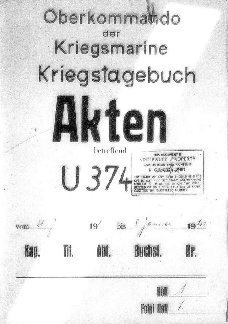
U-374 - 1st War Patrol
Translation by Jerry Mason with help from Andi Forster
Departed |
Date |
Arrived |
Date |
Days at Sea |
Kiel |
29 September 1941 |
Brest |
11 November 1941 |
44 |
| Click the icon to download a KMZ file displaying the U-boat track, significant events and locations for this patrol. You must have Google Earth loaded on your computer to view this file. Download Google Earth here |
Ships Hit |
||||||
Date |
KTB Time |
Position |
Ship |
Tons |
Nationality |
Convoy |
31 Oct 41 |
09.03 |
47°57'N,
50°35'W |
ROSE SCHIAFFINO |
3,349 |
British |
|
Total = 3,349 |
||||||
| Note: The positions in the table above and in the Google Earth patrol summary are derived from the KTB and in many cases do not match those set forth in authoritative references such as Jürgen Rohwer, Axis Submarine Successes of World War Two or the Uboat.net website. The goal here is to present the picture relative to the U-boat and not the absolute position that the ship was attacked or sank. | ||||||
| This KTB uses the depth notation "depth T = xx meters" Under this scheme, the actual depth was twice the depth given after T = so for example, if the KTB entry read "depth T = 50 meters, the actual depth was 100 meters. This was intended to hide the actual depth for security purposes. This notation was used from about January 1940 to December 1941. In these KTBs, depths written without using "T =", for example "dived to depth 35 meters" were not so disguised. |
|
||||||||||||||||
| Kommandant: | Oblt.z.S. v. F i s c h e l | |||||||||||||||
| Beginning: | 29.9.1941 | |||||||||||||||
| Concluding: | 11.11.1941 | |||||||||||||||
 |
||||||||||||||||
| © U-boat Archive 2025 - all rights reserved | ||||||||||||||||
 |
Click the flag to view the above page from the original German KTB |
- 1 - |
|||||
| 29.09.41 | |||||
| 06.00 | Kiel Wik, Tirpitz Mole |
Ready for sea. | |||
| SE 4, 9/10, Stratocumulus, Sea 4, Vis. 7-10 nm | Transit into the operational area through the western Baltic, Great Belt, Kattegat. Escorted by Sperrbrecher in the Great Belt, from the Kattegat escorted by 2 Vorpostenboote. | ||||
 |
|||||
| 30.09.41 | |||||
| 08.45 | S 3, later SSW 1, changing Stratus, Sea 3, abating to 1, Vis. 5-10 nm | Transit through the Kattegat and Skagerrak with escort. Dived to balance the boat. | |||
| 09.30 | Surfaced. | ||||
| 18.15 | Kristiansand | Made fast. | |||
| |
|||||
| 01.10.41 | |||||
| 06.00 | Kristiansand | Ready for sea. | |||
| Transit through the Skagerrak, SW coast of Norway, northern North Sea. | |||||
| 19.03 | Skudesnaeshaven | Starboard abeam. Released escort. Set off from the coast at HF. | |||
| 24.00 | AN 2869 | ||||
| W-1-3, 0-3/10 Cumulus, Sea 0-3, Vis. 10-20 nm | |
||||
| 02.10.41 | |||||
| 04.00 | AN 2391 | Transit through the northern North Sea. | |||
| NW 3, 6/10 | |||||
| 06.46 | AN 2334 | Dived, balanced the boat, afterwards continued submerged. | |||
| 08.00 | AN 2331 | ||||
| 11.45 | AF 8776 | Surfaced to ventilate the boat. | |||
| 12.00 | Day's run: since Skudesnaeshaven 149 nm | ||||
| 1x.43 | Dived. | ||||
|
Sun and Moon Data 29.09.41 |
| Sun and Moon Data 30.09.41 | |
| Sun and Moon Data 01.10.41 | |
| Sun and Moon Data 02.10.41 |
- 2 - |
|||||
| continued | |||||
| 02.10.41 | |||||
| 16.00 | AF 8772 | ||||
| 17.17 | SW 5, 10/10 Cumulonimbus, rain, Sea 5 | Surfaced, continued transit on the surface, LF. | |||
| 18.05 | Crash dive. Dived for aircraft, probably Ju 88. | ||||
| 19.05 | Surfaced, continued transit on the surface. | ||||
| 20.00 | AF 7963 | ||||
| 24.00 | AF 7689 | ||||
| |
|||||
| 03.10.41 | |||||
| 04.00 | AF 7646 | ||||
| W 3, rain showers | |||||
| 07.55 | AF 7299 | Dived, continued transit submerged. | |||
| 12.00 | AF 7295 | Day's run: 145 nm | |||
| 13.00 | Surfaced, continued transit on the surface. | ||||
| 16.00 | AF 7227 | ||||
| W 2-3, 2-3/10, Sea 2-3, heavy Swell, Vis. 20 nm | |||||
| 20.00 | AF 4796 | ||||
| 24.00 | AF 4757 | ||||
| |
|||||
| 04.10.41 | |||||
| 01.15 | AF 4745 | Drifting mine sighted. | |||
| 04.00 | AE 6961 | ||||
| 07.48 | Dived, continued transit submerged. Proceeding submerged was used to give each seaman instruction at a diving plane. | ||||
| 08.00 | AE 6911 | ||||
| SW 2, 5/10, Sea 2 | |||||
| 12.00 | AE 6835 | Day's run: 208 nm Faroe Islands area. | |||
| SW 2, heavy fog | |||||
| 13.10 | Surfaced, ventilated the boat. | ||||
| 14.01 | Dived, continued transit submerged. | ||||
| 16.00 | AE 6829 | ||||
| 17.12 | Surfaced, continued transit on the surface. | ||||
| 19.03 | AE 6842 | Drifting mine sighted. | |||
| 20.00 | AE 6841 | ||||
| 24.00 | AE 6785 | ||||
| |
|||||
|
Sun and Moon Data 02.10.41 |
| Sun and Moon Data 33.10.41 | |
| Sun and Moon Data 04.10.41 |
- 3 - |
|||||
| 05.10.41 | |||||
| 02.45 | AE 9112 | Drifting mine sighted. | |||
| 04.00 | AE 9114 | The sighting of 3 drifting mines confirms the Rosenstiel-report. | |||
| 08.00 | AE 8356 | ||||
| 08.25 | Dived, continued transit submerged. | ||||
| Cooling water pump port diesel out of service. | |||||
| 12.00 | AE 8357 | Day's run: 166 nm | |||
| The following position reports were sent without being acknowledged by the Control Station. | |||||
| 2 October 22.39 hours: Have passed 62°N. | |||||
| 3 October 13.30 hours: Have passed 62°N. | |||||
| 4 October 00.36 hours: Position report. | |||||
| 4 October 07.07 hours: Position report. | |||||
| 4 October 23.45 hours: Position report. | |||||
| 13.33 | SW 2-3, 4-8/10, Vis. 5-8 nm, Sea 2 | Surfaced, port diesel is in service again. | |||
| 16.00 | AE 8377 | ||||
| Fog, Vis. at times only 1-2 nm | |||||
| 20.00 | AE 8525 | ||||
| 24.00 | AE 8545 | ||||
| |
|||||
| 06.10.41 | |||||
| 04.00 | AE 8494 | ||||
| 08.00 | AE 8716 | ||||
| 08.40 | Dived, continued transit submerged. | ||||
| 10.15 | Wind 3, fog | Underwater Telegraph signal heard, no sound bearing, surfaced. | |||
| 11.18 | Dived, listened, no results. | ||||
| 12.00 | AE 7939 | Day's run: 183 nm South of Iceland. | |||
| 13.41 | Surfaced, continued transit on the surface. | ||||
| 16.00 | AE 7953 | ||||
| SW 2, fog, Sea 0-1, Vis. changing 100-2000 meters | |||||
| 20.00 | AE 7971 | ||||
| 24.00 | AE 7888 | ||||
| |
|||||
| 07.10.41 | |||||
| 04.00 | AL 2129 | ||||
| 08.00 | AL 1266 | ||||
| 09.25 | Dived, balanced the boat. | ||||
|
Sun and Moon Data 05.10.41 |
| Sun and Moon Data 06.10.41 | |
| Sun and Moon Data 07.10.41 |
- 4 - |
|||||
| continued | |||||
| 07.10.41 | |||||
| 10.55 | Surfaced, continued transit on the surface. | ||||
| 12.00 | AL 1282 | Day's run: 226 nm | |||
| 16.00 | AL 1277 | ||||
| SE 4, 10/10, Sea 3-4, Vis. 10 nm, isolated rain showers | |||||
| 18.51 | Radio Message 1816/7/227: English whale ship "SVENDFOYN" torpedoed at 16.30 hours naval square AL 2129. U-boats in the vicinity operate on it. | ||||
| 20.24 | Radio Message: 1942/7/228: The torpedoed whale ship "SVENDFOYN" received Short Wave-Orders at 17.30 hours to make for Iceland. | ||||
| 21.00 | AL 1319 | Want to try and catch "SVENDFOYN" off Reykjvik. Came to course 10°, GF. | |||
| SE 6-7, 10/10, Sea 5 | |||||
| 24.00 | AL 1191 | ||||
| |
|||||
| 08.10.41 | |||||
| 02.00 | AL 1137 | ||||
| 06.00 | AD 8964 | ||||
| 08.30 | AD 8695 | Boat can only be held on this course at LF. Broke off northern transit. Continued into operations area at KF. | |||
| E 9, 10/10, Sea 8, Vis. 5-7 nm | |||||
| 12.00 | AD 8942 | Day's run: 246 nm | |||
| 16.00 | AD 8942 | ||||
| 20.00 | AD 8894 | ||||
| 24.00 | AK 3136 | ||||
| SE 2, 10/10, heavy Swell | |||||
| |
|||||
| 09.10.41 | |||||
| 06.00 | AK 3172 | ||||
| 09.40 | Dived, balanced the boat. | ||||
| 10.00 | AK 2298 | ||||
| 11.05 | Surfaced. | ||||
| 12.00 | AK 2413 | Day's run: 211 nm | |||
| SE 1-2, 10/10, fog, Vis. greatly changing, heavy Swell | |||||
| 16.00 | AK 2352 | Transit speed: 1 diesel 2 x KF (=240 RPM). Waiting for Orders from B.d.U. | |||
|
Sun and Moon Data 07.10.41 |
| Sun and Moon Data 08.10.41 | |
| Sun and Moon Data 09.10.41 |
- 5 - |
|||||
| continued | |||||
| 09.10.41 | |||||
| 20.00 | AK 2372 | ||||
| 24.00 | AK 1499 | ||||
| NE 2, 10/10, Sea 1 | |||||
| |
|||||
| 10.10.41 | |||||
| 04.00 | AK 1629 | ||||
| 08.00 | AK 1645 | ||||
| 12.00 | AK 1674 | Day's run: 157 nm | |||
| ENE 3-4, 10/10, Sea 2-3, Vis. 10 nm | |||||
| 12.47 | Radio Message 1041/10/132/292: From B.d.U. 1) Occupy as attack areas with depth of 120 nm the squares: | ||||
| U-573 GZ 9655 | |||||
| U-374 AT 3255 [AJ 3255] | |||||
| U-208 AT 3655 | |||||
| 2) etc. | |||||
| 16.00 | AK 1597 | ||||
| 20.00 | AK 1579 | ||||
| NE 5, 10/10, Stratocumulus, Sea 4-5, Vis. 5-7 nm | |||||
| 24.00 | AJ 3399 | ||||
| |
|||||
| 11.10.41 | |||||
| 04.00 | AJ 3389 | ||||
| NE 2, 10/10, Sea 2-3, heavy Swell | |||||
| 08.00 | AJ 3379 | ||||
| 11.00 | AJ 3377 | Dived to balance the boat. | |||
| 12.00 | AJ 3299 | Day's run: 114 nm Boat reached the operations area. 120 nm from the S-tip of Greenland. | |||
| 12.56 | Propeller sound bearing 240°T. Surfaced. Suspect vessel on NE-course, bearing shifted to the right. Ran off on course 290° at 2 x HF until 13.30 hours. | ||||
| 13.30 | Dived, listened, nothing heard. | ||||
| 15.06 | Surfaced. | ||||
| 16.00 | WNW 3-4, 10/10, at times fog, otherwise Vis. 3-5 nm, Sea 2, heavy Swell | ||||
|
Sun and Moon Data 09.10.41 |
| Sun and Moon Data 10.10.41 | |
| Sun and Moon Data 11.10.41 |
- 6 - |
|||||
| continued | |||||
| 12.10.41 | |||||
| 10.43 | Dived to balance the boat. | ||||
| 11.29 | Surfaced. | ||||
| 12.00 | AJ 3200 | ||||
| SE 8, 10/10, Sea 6, Vis. 3-5 nm | |||||
| 22.00 | AJ 3200 | ||||
| SSE 3, cloudless, Sea 2, Vis. 20 nm | |||||
| |
|||||
| 13.10.41 | |||||
| 10.02 | AJ 3200 | Dived to balance the boat. | |||
| SW 5, 8/10, Stratocumulus, Sea 4 | Main ballast and reserve fuel oil tank 4 converted to a ballast tank. | ||||
| 12.22 | Surfaced. | ||||
| 20.00 | SW 7-8, 8/10, Sea 7, Vis. 5 nm | ||||
| |
|||||
| 14.10.41 | |||||
| 10.27 | AJ 3200 | Dived to balance the boat. | |||
| 11.31 | SW 6, 7/10 Cumulus, Sea 6, Vis. 8-10 nm | Surfaced. | |||
| 22.00 | SW 7, 5/10 Cumulus, Sea 7 | ||||
| |
|||||
| 15.10.41 | |||||
| 09.58 | AK 3200 | Dived to balance the boat. | |||
| 11.28 | WSW 4-5, Sea 4, 7/10, isolated showers, Vis. outside of showers 10 nm | Surfaced. | |||
| 22.00 | W 5, 8/10, Sea 4, Vis. 5 nm | ||||
| |
|||||
| 16.10.41 | |||||
| 10.25 | AJ 3200 | Dived to balance the boat. | |||
| 11.30 | Surfaced. | ||||
| 12.00 | SW 1, 8/10, Sea 1, Vis. 10 nm | ||||
| 16.24 | Radio Message 1538/16/247: U-374, U-573 and U-208 report fuel inventory by Naval Short Signal. | ||||
|
Sun and Moon Data 12.10.41 |
| Sun and Moon Data 13.10.41 | |
| Sun and Moon Data 14.10.41 | |
| Sun and Moon Data 15.10.41 | |
| Sun and Moon Data 16.10.41 |
- 7 - |
|||||
| continued | |||||
| 16.10.41 | |||||
| 18.07 | Radio Message to B.d.U.: Still have 2/3 of my fuel inventory. | ||||
| 19.26 | Radio Message 1852/16/258: Heinsohn, Fischel, Schlieper and Bleichrodt head for square UP 71 [AJ 71], day's run about 120 nm. Permission to attack, as is general outside the blockade area. | ||||
| 19.55 | AJ 3318 | Began transit into new operations area 2 diesels 2 x KF (=240 RPM). | |||
| NE 2, 3/10, Sea 1-2, Vis. 15 nm | |||||
| 24.00 | AJ 3259 | ||||
| |
|||||
| 17.10.41 | |||||
| 04.00 | AJ 3513 | ||||
| 08.00 | AJ 3464 | ||||
| 12.00 | AJ 3479 | Day's run: 134 nm | |||
| SW 1, 4/10, Sea 1. Vis. 10 nm | |||||
| 16.00 | AJ 2939 | ||||
| 18.00 | WNW 3, 7/10 Cumulus, rain showers, Sea 2, Vis. 15-20 nm | ||||
| 20.00 | AJ 2958 | ||||
| 24.00 | AJ 6112 | ||||
| |
|||||
| 18.10.41 | |||||
| 04.00 | AJ 5365 | ||||
| 08.00 | AJ 5388 | ||||
| 11.03 | Dived to balance the boat. | ||||
| 11.35 | Surfaced. | ||||
| 12.00 | AJ 5618 | Day's run: 177 nm | |||
| NW 3, 4-6/10 Cumulus, isolated rain showers, Sea 2, Vis. outside of the showers over 20 nm | |||||
| 16.00 | AJ 5591 | ||||
| 19.45 | AJ 5813 | Crash dive. Dived for aircraft. Aircraft was over 10 nm away and the type was not distinguished. | |||
| 20.45 | NW 2, 5/10 Cumulus, isolated rain showers, Vis. 15-20 nm | Surfaced. | |||
| 24.00 | AJ 5738 | ||||
| |
|||||
|
Sun and Moon Data 16.10.41 |
| Sun and Moon Data 17.10.41 | |
| Sun and Moon Data 18.10.41 |
- 8 - |
|||||
| 19.10.41 | |||||
| 04.00 | AJ 5773 | ||||
| 08.00 | AJ 7331 | ||||
| 12.00 | AJ 7342 | Day's run: 197 nm | |||
| N 1, 7/10 Cumulus, isolated rain showers, Sea 2, Vis. 5-10 nm | |||||
| 16.00 | AJ 7283 | ||||
| 20.00 | AJ 7511 | ||||
| NE 3-4, 9-10/10, Sea 3, Vis. 5 nm | |||||
| 20.29 | Stopped. | ||||
| |
|||||
| 20.10.41 | |||||
| 01.35 | Radio Message 0040/20/107/252: Occupy at economical transit speed: 1.) As Group Mordbrenner attack areas depth 40 nm: | ||||
| U-374 square 9595 | |||||
| U-573 square 9615 | |||||
| U-208 square 9697 | |||||
| U-109 square 9636 | |||||
| of the large square that lies west of WS. [AH] | |||||
| 2.) As Group Schlagetot . . . . etc. | |||||
| Radio Message was first received at 15.45 hours. | |||||
| 06.00 | AJ 7459 | ||||
| 06.15 | Began transit into ordered area at KF. | ||||
| 08.00 | AJ 7473 | ||||
| 12.00 | AH 9688 | Day's run: 172 nm | |||
| NW 3, 4/10, Sea 2, Vis. 5-10 nm | |||||
| 12.56 | Dived at lightness because running further on the surface is no longer possible. | ||||
| 22.00 | AH 9595 | Surfaced. Reached the operations area. Back and forth in position 1 diesel 2 x KF (=240 RPM). Beacon on Belle Isle burns. | |||
| NWbyW 1-2, Sea 2-3/10, Sea 1, Vis. over 20 nm | |||||
| Initially intend to observe 25-30 nm away by day, 10 nm away by night, and go closer later. | |||||
| Sea area off Belle Isle. | |||||
| |
|||||
| 21.10.41 | |||||
| 00.10 | 4000 GRT coal burning steamer sighted. Steered for the Bell Isle lighthouse. Matched speed of the steamer. | ||||
| 01.32 | Steamer proceeds at 10 knots with set lights. Fan from tubes II and III. Settings: | ||||
| Enemy speed: 10 knots | |||||
|
Sun and Moon Data 19.10.41 |
| Sun and Moon Data 20.10.41 | |
| Sun and Moon Data 21.10.41 |
- 9 - |
|||||
| continued | |||||
| 21.10.41 | Enemy target angle: bow right 80°, range: 1000 meters, Shooting angle: 7°, spread angle: 6°. Miss. | ||||
| Apparently the steamer reduced speed to take a bearing on Belle Isle. 1 torpedo was a ground detonator after 6 minutes. Apparently the steamer did not notice the attack, because he continued on with set lights, but with N-course along the coast. Detonation of the torpedo was apparently not noticed by other places because the next evening the beacons continued to burn. | |||||
| 11.48 | Dived due to fliers weather. | ||||
| 13.58 | NWbyW 5-6, 7/1, Sea 5, Vis. 20 nm | Surfaced. | |||
| 22.18 | With increased darkness headed for Belle Isle. | ||||
| |
|||||
| 22.10.41 | |||||
| 00.31 | Stopped in a dead angle of the Belle Isle lighthouse 3 nm from the center of the island. The south channel is easily overseen from here. Listening gear manned to monitor the north channel. | ||||
| 10.58 | SW 2, cloudless, Sea 1 | Dived. Back and forth in position at depth 20 meters at the north edge of the south channel. Hourly periscope observations. Good listening weather. | |||
| 23.27 | Surfaced. Driving back and forth seems too conspicuous to me (listening danger), therefore stopped to charge about 8 nm from Belle Isle. Listening gear manned continuously. With complete flooding of main ballast tank 5 interference in the G.H.G. was slight. | ||||
| |
|||||
| 23.10.41 | |||||
| 11.15 | AH 9595 | Dived, Back and forth in position. | |||
| W 3, 9/10, Sea 1-2, Vis. 15-20 nm | |||||
| 23.37 | Surfaced. Main ballast and reserve fuel oil tank 2 converted for use as a ballast tank. | ||||
| |
|||||
| 24.10.41 | |||||
| 01.30 | Sighted several lights in the north channel off Belle Isle. Apparently 2 vessels. No sound bearings. Ran behind at AK on course 230°. Reached the vessels. 2 small vessels of about 600 tons, apparently M-Boote or similar naval vessels. Drove in line ahead completely undimmed. Not valuable targets, turned away, went to the old position. | ||||
| 08.00 | AH 9595 | ||||
| S 3-4, 6-8/10, Sea 2, Vis. 5-10 nm | |||||
|
Sun and Moon Data 21.10.41 |
| Sun and Moon Data 22.10.41 | |
| Sun and Moon Data 23.10.41 | |
| Sun and Moon Data 24.10.41 |
- 10 - |
|||||
| continued | |||||
| 24.10.41 | |||||
| 11.31 | Dived, back and forth in position. | ||||
| 23.42 | Surfaced. | ||||
| |
|||||
| 25.10.41 | |||||
| 08.00 | AH 9595 | ||||
| SbyW 5-6, cloudless, Sea 5 | |||||
| 11.54 | Dived, back and forth in position. | ||||
| 23.43 | NNW 1/20, Sea 1 | Surfaced. | |||
| |
|||||
| 26.10.41 | |||||
| 08.00 | AH 9595 | ||||
| SSE 3-4, 10/10, Sea 3-4 | |||||
| 11.50 | Dived, back and forth in position. | ||||
| 23.13 | S 1, 10/10, Sea 0, heavy mist/fog | Surfaced. | |||
| |
|||||
| 27.10.41 | |||||
| 08.00 | AH 9595 | ||||
| SSW 5, 8/10, Sea 3-4, at times light fog | |||||
| 11.36 | Dived, back and forth in position. | ||||
| 23.31 | SSW 1-2, 5/10, Sea 1 | Surfaced. | |||
| |
|||||
| 28.10.41 | |||||
| 08.00 | AH 9595 | ||||
| SSW 4, 10/10, Sea 3 | |||||
| 12.02 | S 2-3, 10/10, Sea 2, Vis. 5-4 nm | Dived, back and forth in position. | |||
| 23.16 | Surfaced. | ||||
| Results at Belle Isle: No patrols, north entrance without barrier. U-boat were not suspected close under the coast. | |||||
| |
|||||
|
Sun and Moon Data 24.10.41 |
| Sun and Moon Data 25.10.41 | |
| Sun and Moon Data 26.10.41 | |
| Sun and Moon Data 27.10.41 | |
| Sun and Moon Data 28.10.41 |
- 11 - |
|||||
| 29.10.41 | |||||
| 01.43 | Radio Message 1936/28/180/280: | ||||
| 1.) Fischel, Schauenberg, Kentrat, Schultze on 29 October between 01.00 and 05.00 hours send weather by Short Signal. | |||||
| 2.) etc. | |||||
| 02.27 | Radio Message 1012/28/281: To Mordbrenner. Head for square EM 47. Attack permission there as before. | ||||
| 03.17 | AH 9911 | Headed for new operations area on course 135° both diesels 2 x KF (=240 RPM). | |||
| 04.00 | AH 9915 | ||||
| 04.55 | Radio Message to B.d.U.: | ||||
| N52, W55, 1016 mb, +6°C, S 3-4, drizzle, Vis. 1 nm. UC. | |||||
| 08.00 | AH 9951 | ||||
| 11.34 | Radio Message 1001/29/300: To Mordbrenner. Occupy as attack areas: | ||||
| 1.) Heinsohn square EM 4485. | |||||
| 2.) Schlieper square 6685 | |||||
| Fischel square 6368 | |||||
| Bleichrodt square 6955 | |||||
| of the large square west of square EM. [BB] | |||||
| 3) Depth for all 80 nm. | |||||
| 4) Fischel in square 6382 drop by where a focal point is suspected. | |||||
| 5) The western limit of the entire area for Group "Mordbrenner" at the moment is the longitude of square 9875 of the square (continued) | |||||
| 12.00 | AH 9991 | Day's run: 53 nm The sea area east of Newfoundland. | |||
| SSE 1-2, 10/10, rain, Sea 1, Vis. 3 nm | |||||
|
Sun and Moon Data 29.10.41 |
- 12 - |
|||||
| continued | |||||
| 29.10.41 | |||||
| 12.31 | Radio Message 1046/29/204: that lies west of square EM (continuation of 1001). The southern limit is the latitude of the same square. Attack action west of this longitude or south of this longitude may only be made while pursuing an enemy out of the operations area. | ||||
| 16.00 | BB 3311 | ||||
| 20.00 | BB 3355 | ||||
| NNW 4, 10/10, Sea 3, Vis. 3-5 nm | |||||
| 24.00 | BB 3395 | ||||
| |
|||||
| 30.10.41 | |||||
| 04.00 | BB 3668 | ||||
| 08.00 | BB 3938 | ||||
| 09.02 | Dived to balance the boat. | ||||
| 10.25 | Surfaced. | ||||
| 12.00 | BB 3968 | Day's run: 184 nm Grand Bank of Newfoundland, St. Johns. | |||
| NW 4, 7/10 Cumulus, Sea 3-4, Vis. over 20 nm | |||||
| 16.00 | BB 6335 | Close observation intended in the vicinity. | |||
| 18.30 | Dived, to approach the coast submerged until darkness. | ||||
| 23.38 | BB 6382 | Surfaced. Lighthouses burn. In the harbor strong smoke development. Whether it is from vessels cannot be distinguished. | |||
| Distance from the coast 10 nm. | |||||
| |
|||||
| 31.10.41 | |||||
| 00.51 | Radio Message 2123/30/269: Mordbrenner operate on Kentrat-convoy. Boats from Reißwolf report successes. Bravo for Rasch. | ||||
| 02.21 | Radio Message 0207/31/276: Group Mordbrenner do not operate on Kentrat-convoy, instead take up ordered attack areas. | ||||
| 04.00 | BB 6382 | Broke off, began southern transit. | |||
| NW 1, 0-2/10, Sea 1, Vis. 15 nm, very bright moonshine | |||||
| 04.35 | Steamer with set lights left St. Johns and ran towards the boat. Initially ran to the moon lee, matched speed and maneuvered ahead for submerged attack. Steamer was made out as a 6000 GRT freighter, loaded. | ||||
| 06.12 | Crash dive for submerged attack with the stern tube. | ||||
|
Sun and Moon Data 29.10.41 |
| Sun and Moon Data 30.10.41 | |
| Sun and Moon Data 31.10.41 |
- 13 - |
|||||
| continued | |||||
| 31.10.41 | The increasing darkness and the undimmed side lights of the steamer lead in the beginning to an underestimation of range. Shooting range was too great, broke off submerged attack. | ||||
| 07.00 | Surfaced. Matched speed again, initiated surface attack. | ||||
| 08.00 | NW 1, 8/10, Sea 0, dark | Distance from the coast now about 40 nm. | |||
| 09.03 | BC 4163 | Fan from Tube II and III. | |||
| Settings: | |||||
| Bearing = 1.2° | |||||
| Enemy target angle = 62.0° | |||||
| Enemy speed = 9 knots | |||||
| Torpedo speed = 30 knots | |||||
| Range = 800 meters | |||||
| Enemy length = 100 meters | |||||
| Shooting angle = 345.4° | |||||
| Spread angle = 7.3° | |||||
| After 70 seconds (=1020 meters) hit aft 30 meters. | |||||
| Explosion column about 100 meters high. Steamer sinks over the stern post in about 1/2 minute. | |||||
| After about 7 minutes 2nd torpedo is a bottom detonator. | |||||
| Steamer steered course 85°. Assume that he ran to a convoy meeting point. Attempted to find the meeting point on the course of the steamer. | |||||
| 09.15-10.15 160° 1 diesel 2 x KF. | |||||
| 12.00 - 13.00 50° both diesels LF. | |||||
| 13.00 85° " " " | |||||
| 13.25 " " " HF | |||||
| 13.30 0° " " " | |||||
| 14.45 110° " " LF. | |||||
| 12.00 | NW 1, 7/10, Sea 0, Vis. 20 nm | ||||
| 12.55 | Radio Message 1214/31/296: Bleichrodt, Heinsohn, Schlieper and Fischel by 1 November 11.00 hours take up patrol line from CA 7555 to MB 4885. Operation against Kentrat-convoy intended. [BC 7555 to BC 4885] | ||||
| 15.45 | Search for convoy broken off. | ||||
| Began torpedo download from forward over deck canister. | |||||
| 16.00 | BC 4256 | ||||
| 16.19 | Crash dive. Dived before 2 aircraft, type not distinguished. | ||||
| 16.45 | Surfaced. | ||||
| 17.30 | Torpedo download ended, gear stowed. Duration minus the crash dive of 1 hour 19 minutes. In buoyancy condition A and preflooded main ballast tank 1 the forward torpedo loading hatch is well clear. Torpedo loading hatch opened 30°. | ||||
| 17.35 | [illegible 5 words] | ||||
|
Sun and Moon Data 31.10.41 |
- 14 - |
|||||
| continued | |||||
| 31.10.41 | |||||
| 20.00 | BC 4564 | ||||
| SSW 3, 10/10 Stratus, Sea 2, Vis. over 20 nm | |||||
| 21.28 | Vessel bearing 260°T, target angle 0°, type not distinguished. Crash dive for submerged attack because seen very late. Through the periscope thought to be a patrol boat. Boat prepared for an artillery attack. | ||||
| 22.34 | Surfaced. Due to increasing darkness artillery attack was not carried out. | ||||
| Enemy passed out of sight. | |||||
| 22.45 | Radio Message 2159/31/217: 1.) All Mordbrenner operate on Kentrat-convoy. 2.) All Mordbrenner and Rasch and Rosenbaum report immediately if in contact with the enemy and attacks. | ||||
| 22.50 | Radio Message 2212/31/218: 1.) Rasch immediately report position with Naval Short Signal. 2.) All Mordbrenner report by Short Signal "No" if enemy contact is unlikely to happen later tonight. 3.) Rosenbaum return transit. | ||||
| I do not expect an approach opportunity in the next night, therefore broke off operation on the Kentrat-convoy. Initially stopped, to await further orders. | |||||
| 23.44 | Radio Message to B.d.U.: No. | ||||
| 24.00 | BC 4598 | ||||
| |
|||||
| 01.11.41 | |||||
| 04.00 | BC 4515 | ||||
| 04.22 | Radio Message was not heard by Control Station, new Radio Message sent. | ||||
| Radio Message to B.d.U.: 0350/1: From Fischel to 1: No. 2. One steamer 6000 GRT. 9 1 torpedoes. 47 cbm. Position square 1515 request return in 6382. | |||||
| 05.10 | Radio Message 0330/1/233: Mordbrenner and Kentrat first continue to operate on convoy general course 250°. Enemy speed 10.5-12 knots. If unsuccessful, continue search in sectors between 240° and 260° based on position for 19.00 hours in 8212. Order from the south Bleichrodt, Heinsohn, Schlieper and Fischel. | ||||
| Kentrat free to maneuver. Rasch break off search head for NL 9982. | |||||
| 06.52 | Transit to St. John, [illegible 2 words] catch a new steamer. | ||||
|
Sun and Moon Data 31.10.41 |
| Sun and Moon Data 01.11.41 |
- 15 - |
|||||
| continued | |||||
| 01.11.41 | |||||
| 07.57 | BC 4542 | 8000 GRT steamer sighted. Steamer proceeded dimmed, half loaded. Matched speed, 11-12 knots. | |||
| 09.08 | BC 4544 | Fan from tubes II and IV | |||
| Settings: | |||||
| Bearing = 6° | |||||
| Enemy target angle = 66.0° | |||||
| Enemy speed = 11.5 knots | |||||
| Torpedo speed = 30 knots | |||||
| Range = 1000 meters | |||||
| Enemy length = 110 meters | |||||
| Shooting angle = 345.5° | |||||
| Spread angle = 6.8° | |||||
| Depth = 3 meters | |||||
| Unexplained miss. Steamer held course until the torpedo would have hit and afterwards. Initiated a new attack. | |||||
| 09.28 | BC 4466 | Fan from tube V | |||
| Settings: | |||||
| Bearing = 231° | |||||
| Enemy target angle = 107° | |||||
| Enemy speed = 11 knots | |||||
| Torpedo speed = 30 knots | |||||
| Range = 1200 meters | |||||
| Shooting angle = 212.8° | |||||
| Spread angle = 6.8° | |||||
| Depth = 4 meters | |||||
| Miss, pursued. Initiated a new attack. | |||||
| 10.29 | BC 4464 | 2 multiple shot from tubes I and III. | |||
| Settings: | |||||
| Bearing = 9.8° | |||||
| Enemy target angle = 90° | |||||
| Enemy speed = 12 knots | |||||
| Torpedo speed = 30 knots | |||||
| Range = 800 meters | |||||
| Shooting angle = 346.2° | |||||
| Depth = 3 meters | |||||
| Unexplained miss. Speed was matched again, enemy target angle by plotting and observation. | |||||
| It is already too late for a new surface attack. | |||||
| 11.05 | Rudder failure. Boat had to stop for a long time because due to reloading of tube V the hand rudder could not be used immediately. | ||||
| Steamer got away. | |||||
| 11.40 | Dived to balance the boat. | ||||
| 12.00 | BC 4453 | Day's run: 217 nm | |||
| E 1, 3/10, Sea 0, Vis. over 20 nm | |||||
|
Sun and Moon Data 01.11.41 |
- 16 - |
|||||
| continued | |||||
| 01.11.41 | |||||
| 12.45 | Propeller sounds. 8000 GRT steamer with 2 smokestacks, one cannon on the stern. Steamer came from the right astern and so was heard very late. Estimated range therefore very great (3000 meters). | ||||
| 13.16 | BC 4453 | Shot from tube III | |||
| Settings: | |||||
| Bearing = 349.5° | |||||
| Enemy target angle = 99.5° (bow right) | |||||
| Enemy speed = 11 knots | |||||
| Torpedo speed = 30 knots | |||||
| Range = 3000 meters | |||||
| Shooting angle = 11.1° | |||||
| Depth = 3 meters | |||||
| miss. Probably speed overestimated. Torpedo was heard for 4 1/2 minutes (=4050 meters running track). | |||||
| Afterwards the boat was prepared for artillery attack. | |||||
| 13.52 | BC 4452 | Surfaced. Cannon ready. Range is still too great. Steamer transmitted on 600-meter wavelength was successfully interfered with. | |||
| 14.10 | NE 2, 3/10, Sea 1, Vis. over 20 nm | Several smoke clouds sighted bearing 280°T. [illegible word] Course 280° to run towards. | |||
| Smoke clouds were identified as a convoy. | |||||
| 15.13 | [position in error - 25 nm too far north] | Radio Message to B.d.U. 1500/1/247: Enemy convoy in sight square KC 4172, course 50°. U-374. | |||
| 16.00 | BC 4419 | ||||
| 16.35 | Radio Message 1544/1/252: U-374 do not attack. Hold contact. Immediately give Short Signal weather report. Group "Schlagetot" operate on this convoy. Hardegen requests bearing signals. | ||||
| 18.52 | [position in error - 20 nm too far northeast] | Radio Message to B.d.U. 1852/1: From Fischel: Square 4168, 15 ships, course 50°, 8 knots. Wind NE 2, Vis. 25 nm, cloudless. | |||
| 20.14 | Crash dive. Dived before aircraft at great range (Sunderland?). | ||||
| 20.52 | Surfaced. | ||||
| 21.00 | Radio Message 2035/1/264: Fischel, Lehmann, Topp, Rasch on 2 November between 01.00 and 05.00 hours report weather by Short Signal. | ||||
| 21.37 | [position error corrected] | Radio Message to B.d.U.: 2000/1/267: From Fischel: correct position is SE 4191, course 50°, 9 knots. Aircraft. 45 cbm. | |||
| 22.35 | [based on incorrect position but probably not carried out due to contact keeper reports] | Radio Message 2047/1/266: 1.) Operating on Fischel-convoy: Hardegen, Hinsch, Schuch, Rollmann, Linder, Uphoff, Mützelburg, Elfe and Greger. In this order carry out search in sector 20-70°. Starting from 15.00 hour position in square KC 4172. On 2 November 12.00 hours, in assigned sub-sectors be on circular arc that the enemy | |||
|
Sun and Moon Data 01.11.41 |
- 17 - |
|||||
| continued | |||||
| 01.11.41 | could reach at speed 11 knots, then run against the convoy searching obliquely in assigned sectors. Fischel free to maneuver. | ||||
| 2) Kentrat free to maneuver on Fischel-convoy or Rasch. Report intentions. | |||||
| 3.) Boats operating on the Fischel-convoy carry the designation "Raubritter". | |||||
| Contact keeping was influenced by the fuel shortage. As a result, initially it was at a very great distance while running with (about 25 nm, so the inexact number of vessels). Likewise, the intention to maneuver ahead by day was foregone. In increasing darkness operated on the end of the convoy at higher speed. Could not avoid the boat being positioned in the moon lee of the convoy. | |||||
| 23.08 | Crash dived a short distance from the convoy (about 2500 meters), to prevent premature discovery. | ||||
| |
|||||
| 02.11.41 | |||||
| 00.28 | BC 4137 | Surfaced, after all of the sound bearings had shifted ahead. Distance on surfacing about 6000 meters. | |||
| 00.45 | Radio Message 0031/2/272: From Fischel: Stand by for bearing signals. | ||||
| Sent bearing signals. | |||||
| Because it is expected to get dark [when the moon set] at 09.00 hours, I want to try to get in a favorable position until then to close with a small speed advantage. Initially I closed up. Obviously, the two sweepers were also getting closer, they come in sight from time to time astern. There is still bright moonlight. By day the convoy proceeded in about 4-5 lines abreast, now the formation is 1-2 very broad lines abreast. | |||||
| 02.10 | Began to set out to port. With the excellent visibility the flank screen is very far out. As a result the distance from the core of the convoy was very great. | ||||
| 02.47 | Convoy zigzagged temporarily to the NNW, as a result, the distance gained was lost. | ||||
| 03.10 | The convoy zigzagged to a NE-course. | ||||
| 04.10 | Radio Message U-374 to B.d.U.: 0300/2/123/276: Square 4133, course 20°. | ||||
| Due to the last zigzags the boat is again positioned behind the convoy. In the meantime the moon shifted to the SSW, so that I must change over to the starboard side of the convoy. | |||||
|
Sun and Moon Data 01.11.41 |
| Sun and Moon Data 02.11.41 |
- 18 - |
|||||
| continued | |||||
| 02.11.41 | |||||
| The distance of the two aft sweepers is now 6 nm. Want to try to pass through between the convoy and the aft sweepers because otherwise I cannot make up the resulting distance loss with my low fuel supply. Initially is goes well in this position. The clouds increase and they don't expect anyone here. About 04.57 hours the moon breaks through again. In the meantime the aft screen has closed up. Avoiding is not possible because we are hemmed in ahead and behind. | |||||
| 05.07 | Corvette ahead, target angle 10°. | ||||
| 05.10 | BC 1874 [Despite being writte in T = notation, this is probably a typo. Water depth was actually 93.5 meters] |
Crash dive. At depth T = 40 meters [actual depth 80 meters] six depth charges, distance about 300 meters. Minor failures. Boat put on the bottom depth T = 93.5 meters, all sound sources shot off. Apparently both sweepers are involved in the search. The boat was often overrun at low distance, however not detected by S-gear. | |||
| 08.10 | Except for the convoy no other sound bearings. | ||||
| 08.37 | Surfaced after an all around sweep through the periscope. | ||||
| 09.32 | Radio Message to B.d.U.: 0500/2/124: From Fischel: Contact lost, depth charges, compass failure, pursuit still not possible, 42 cbm. | ||||
| 11.46 | BC 1874 | Radio Message to B.d.U.: 1107/2/280: From Fischel: Position square 1877. Last sound bearing 08.00 hours in 10°T, 27 nm away. 33 ships, 3 destroyers, 3 escort vessels. Return transit. 31 October independent 6000 GRT sunk. Several torpedo failures. 3 and 1 torpedoes. | |||
| Began return transit. | |||||
| 12.00 | BC 1875 | Day's run: 114 nm Grand Bank of Newfoundland. | |||
| NE 1-2, 8/10, Sea 1, Vis. 10 nm | |||||
| 16.00 | BC 1879 | ||||
| 20.00 | BC 1859 | ||||
| 24.00 | BC 1948 | ||||
| |
|||||
| 03.11.41 | |||||
| 04.00 | BC 1955 | ||||
| 08.00 | BC 1968 | ||||
| 12.00 | BC 2742 | Day's run: 127 nm | |||
| NNE 2, cloudless, Sea 2, Vis. 15-20 nm | |||||
| 16.00 | BC 2761 | ||||
| 20.00 | BC 2817 | ||||
| 24.00 | BC 2855 | ||||
|
Sun and Moon Data 02.11.41 |
| Sun and Moon Data 03.11.41 |
- 19 - |
|||||
| 04.11.41 | |||||
| 04.00 | BC 2869 | ||||
| 08.00 | BC 2985 | ||||
| 12.00 | BC 3777 | Day's run: 174 nm Western Atlantic. | |||
| ESE 3, 10/10, Sea 2-3, Vis. 3-5 nm | |||||
| 14.30 | Dived to balance the boat. | ||||
| 15.23 | Surfaced. | ||||
| 16.00 | BC 3788 | ||||
| 20.00 | BC 3878 | ||||
| 24.00 | BC 3886 | ||||
| |
|||||
| 05.11.41 | |||||
| 04.00 | BC 3974 | ||||
| 08.00 | BC 3983 | ||||
| 12.00 | BD 1772 | Day's run: 184 nm Central Atlantic. | |||
| SEbyS 4, 7/10, Sea 3-4 | |||||
| 16.00 | BD 1845 | ||||
| 20.00 | BD 1838 | ||||
| 24.00 | BD 1927 | ||||
| |
|||||
| 06.11.41 | |||||
| 04.00 | BD 1939 | ||||
| 08.00 | BD 2728 | ||||
| 12.00 | BD 2819 | Day's run: 221 nm Central Atlantic. | |||
| SbyE 3-4, 6/10, Sea 2-3, Vis. 15 nm | |||||
| 13.30 | Dived to balance the boat. | ||||
| 14.01 | Surfaced. | ||||
| 16.00 | BD 2836 | ||||
| 20.00 | BD 2926 | ||||
| 24.00 | BD 3716 | ||||
| |
|||||
| 07.11.41 | |||||
| 04.00 | BD 3735 | ||||
| 08.00 | BD 3828 | ||||
| 12.00 | BD 3918 | Day's run: 234 nm Central Atlantic. | |||
|
Sun and Moon Data 04.11.41 |
| Sun and Moon Data 05.11.41 | |
| Sun and Moon Data 06.11.41 | |
| Sun and Moon Data 07.11.41 |
- 20 - |
|||||
| continued | |||||
| 07.11.41 | |||||
| 16.00 | BD 3939 | ||||
| SSE 3, 10/10, Sea 2, Vis. over 20 nm | |||||
| 20.00 | BE 1737 | ||||
| 24.00 | BE 1828 | ||||
| |
|||||
| 08.11.41 | |||||
| 04.00 | BE 1951 | ||||
| 08.00 | BE 2745 | ||||
| 10.00 | Dived to balance the boat. | ||||
| 10.18 | Surfaced. | ||||
| 12.00 | BE 2755 | Day's run: 261 nm Eastern Atlantic. | |||
| SEbyE 5, 10/10, rain, Sea 4, Vis. 3-5 nm | |||||
| 16.00 | BE 2969 | ||||
| 20.00 | BE 2855 | ||||
| 24.00 | BE 2869 | ||||
| |
|||||
| 09.11.41 | |||||
| 04.00 | BE 2959 | ||||
| 08.00 | BE 3773 | ||||
| 12.00 | BE 3768 | Day's run: 196 nm Eastern Atlantic. | |||
| NW 1, 5/10, Sea 1-2, Vis. 10-15 nm | |||||
| 16.00 | BE 3885 | ||||
| 20.00 | BE 3977 | ||||
| 24.00 | BE 3994 | ||||
| |
|||||
| 10.11.41 | |||||
| 04.00 | BF 1779 | ||||
| 08.00 | BF 1798 | ||||
| 12.00 | BF 4216 | Day's run: 213 nm Sea area off Brest. | |||
| NW 2-3, 10/10, rain, Sea 3, Vis. 4 nm | |||||
| 16.00 | BF 4311 | ||||
| WNW 6-7, 10/10, rain, Sea 6, Vis. 2-5 nm | |||||
| 16.30 | Dived to balance the boat. | ||||
| 18.26 | Surfaced. | ||||
| 20.00 | BF 1989 | ||||
| 24.00 | BF 2774 | |
|||
|
Sun and Moon Data 07.11.41 |
| Sun and Moon Data 08.11.41 | |
| Sun and Moon Data 09.11.41 | |
| Sun and Moon Data 10.11.41 |
- 21 - |
|||||
| 11.11.41 | |||||
| 04.00 | BF 2792 | ||||
| 05.30 | Escorted by 2 Vorpostenboote | ||||
| 06.00 | BF 2875 | Day's run: 178 | |||
| SbyE 2, cloudless, Sea 1, Vis. 10 nm | |||||
| 08.10 | Escort by Sperrbrecher. | ||||
| 10.46 | Boat made fast in Brest. | ||||
| |
|||||
| G e n e r a l . | |||||
1.) |
Fuel saving: | ||||
| As soon as possible, even when the weather was not ideal, external bunkers were converted for use as ballast tanks. Even 4 alone brings increased seaworthiness, fuel savings and more speed. | |||||
| As most economical transit speed the speed setting 2 x KF at 240 RPM was implemented. Advantage of KF: Engines do not flood in seas, run smoother, mufflers were significantly less smoky. Compared to LF: one or both engines 2 x KF is as economical as LF, even more economical than diesel-electric. | |||||
| In the operations area one can also stop by day even in calm weather. Flood main ballast tank 5 substantially, self noise in the listening gear is then tolerable. In certain circumstances stopping and listening is safer than creeping through the area at 5 knots. Up to a considerable Sea State, you can put the boat before the wind with stopped engines. 1-2 nm of drift already produces a rudder effect that makes tackling with the engines unnecessary. Bridge then sealed with a tarpaulin aft. | |||||
| With the lengthening of the patrol, the amount of fuel used for the secondary consumers increases considerably. (Lights, galley, heating, ventilation, compressed air are also needed when the boat is stopped so cost twice as much fuel in 50 days as in 25 days.) So must be conserved: | |||||
| Lights: 25 watt instead of 40 watt bulbs, switch off unnecessary lighting fixtures | |||||
| Heating: is in generally superfluous. (Dry things in the E-motor room.) | |||||
| Compressed air: Express negative buoyancy tanks early on test dives, on long transits in a clear visibility conditions carry in whole or partly expressed. | |||||
|
Sun and Moon Data 11.11.41 |
- 22 - |
|||||
| In good weather do not blow excessively. | |||||
| Always think: For most patrols, the secondary consumers cost more fuel than the E-motors. | |||||
2.) |
Bridge: | ||||
| The bridge has become considerably drier after the wave deflector was removed from the cannon. Nevertheless, the forward lookouts are still quite damp because they can not get close enough to the bridge cladding. Therefore, an oblique plate was used to cover the foremost part of the bridge. Its trailing edge terminates at the trailing edge of the forward periscope at the level of the upper edge of the bridge cladding. Slope forward 35°. Drainage through pipes in the tower cladding. The forward lookout now has protection for the binoculars and can even take cover in overcoming seas. The arrangement has proven itself. | |||||
| |
|||||
3.) |
Intermittent smoke development: | ||||
| Several vessels (as noted with fishing groups) were also observed on the convoy. Apparently they fire [presumably meaning blow tubes] at the same time so that steamers do not constantly smoke and betray the convoy. | |||||
|
|
| Enclosures to U-374's KTB - click on the text at left to proceed to the document | |
| Radio | Excerpt of the radio log |
| Chart | Track chart covering the entire patrol |
| Sketches | Combat sketches |
Comments of the Befehlshabers der Unterseeboote |
|||||||||||||
on the Kriegstagebuch of "U-374" from 29.9. - 11.11.1941 |
|||||||||||||
|
|||||||||||||
|
|||||||||||||
For the Befehlshaber der Unterseeboote |
|||||||||||||
The Chief of the Operations Department |
|||||||||||||
|
|
|||||||||||||
|
Click the icons to view the associated records |
|||||
 |
Return to the U-boat KTB page | ||||