U-377 - 7th War Patrol
Translation by Jerry Mason with the help of Robert Derencin and Andi Forster
Departed |
Date |
Arrived |
Date |
Days at Sea |
Skjomenfjord |
7 October 1942 |
Narvik |
24 October 1942 |
18 |
Narvik |
27 October 1942 |
Narvik |
13 November 1942 |
18 |
| Click the icon to download a KMZ file displaying the U-boat track, significant events and locations for this patrol. You must have Google Earth loaded on your computer to view this file. Download Google Earth here |
Ships Attacked |
None |
| |
|||||
| K R I E G S T A G E B U C H | |||||
| " U - 377 " | |||||
| Kommandant: Kapitänleutnant K ö h l e r | |||||
| Beginning: 25 September 1942 | |||||
| Ending: 25 November 1942 | |||||
 |
|||||
| © U-boat Archive 2025 - all rights reserved | |||||
 |
Click the flag to view the above page from the original German KTB |
- 1 - |
|||||
| 25.09.42 to | |||||
| 06.10.42 | Skjomenfjord | Rest and outfitting. | |||
 |
|||||
| 07.10.42 | |||||
| 07.13 | Skjomenfjord | Put to sea. Transit to Narvik. | |||
| 08.40 | Narvik | Made fast alongside "Grille". | |||
| Took over equipment for weather station "Nussbaum". | |||||
| Took aboard: Regierungsrat Dr. Nusser | |||||
| Matrose Krüger | |||||
| 12.47 | Put to sea in accordance with outbound orders Admiral Nordmeer. | ||||
| 17.23 | Harstadt | Made fast provisions warehouse. Provisions loading. | |||
| |
|||||
| 08.10.42 | |||||
| 04.55 | Harstad | Put to sea. Transit to Tromsø. | |||
| 11.35 | Tromsø | Made fast alongside C.A. LAARSEN. Continued taking over weather station outfitting. | |||
| Took aboard: Naut. Insp. Knöspel | |||||
| Fkmt. Erichs | |||||
| 12.00 | Total distance covered: | ||||
| 7./8.10. |
|||||
| ====== | |||||
| 17.28 | Tromsø | Cast off C.A. LAARSEN for main trim test. | |||
| 18.40 | Made fast C.A. LAARSEN. | ||||
| 21.07 | Cast off C.A. LAARSEN. Under escort by 3 M-Boote of the 22. Minensuchfflottille with gear transit through Grøtsundet, Helgøyfjord, Skagøysund, Røssholmdypet | ||||
| |
|||||
| 09.10.42 | |||||
| 06.36 | Exit Røssholmdypet | Released from convoy. | |||
| (Point Schwarz 10) | Course 270°, GF. | ||||
| SE 3-4, Sea 2-3, Vis. good, few clouds, 996 mb | |||||
| 08.00 | AB 9835 | Course 322°, 2 x HF. | |||
| SE 3-4, Sea 2-3, Vis. good, few clouds, 996 mb | |||||
|
Sun and Moon Data 07.10.42 |
| Sun and Moon Data 08.10.42 | |
| Sun and Moon Data 09.10.42 |
- 2 - |
|||||
| continued | |||||
| 09.10.42 | |||||
| 10.00 | Course 322°, HF. | ||||
| 12.00 | AB 9551 | Distance traveled: | |||
| SE 3, Sea 3, Vis. good, completely overcast, 994 mb | 8./9.10. |
||||
| Up to 8.10. |
|||||
| |
|||||
| ===== | |||||
| 14.22 | Incoming Radio Message 1359/800 | ||||
| Köhler for "Nussbaum". In no case disable W.F. gear. | |||||
| Nordmeerchef | |||||
| 16.00 | AB 9193 | ||||
| SE 2, Swell 3, Vis. good, overcast, 992 mb | |||||
| 20.00 | AB 9122 | ||||
| SE 4, Sea 3, Vis. good, overcast, 991 mb | |||||
| |
|||||
| 10.10.42 | |||||
| 00.00 | AB 6744 | ||||
| SSE 3, Sea 3, Vis. medium, overcast, 990 mb | |||||
| 04.00 | AB 5685 | ||||
| Weather unchanged | |||||
| 08.00 | AB 5614 | ||||
| SE 4, Sea 3-4, Vis. medium, (rain) overcast, 992 mb | |||||
| 09.58 | AB 5295 | Test dive. | |||
| 10.29 | Surfaced. | ||||
| 12.00 | AB 5258 | Total distance covered: | |||
| SE 4-5, Sea 4, Vis. bad, (rain) overcast, 994 mb | 9./10.10. |
||||
| Up to 9.10. |
|||||
| |
|||||
| ===== | |||||
| 13.00 | AB 5254 | Course 357°. | |||
| 16.00 | AB 2887 | ||||
| ENE 5, Sea 3, Vis. moderate, overcast | |||||
| 20.00 | AB 2824 | ||||
| E 6, Sea 4-5, Vis. bad, overcast, 997 mb | |||||
| |
|||||
|
Sun and Moon Data 09.10.42 |
| Sun and Moon Data 10.10.42 |
- 3 - |
|||||
| 11.10.42 | |||||
| 00.00 | AB 2543 | ||||
| ESE 6, Sea 4-5, Vis. bad, overcast, 998 mb | |||||
| 04.00 | AB 2273 | ||||
| EbyN 5, Sea 4, Vis. bad, (rain) overcast, 1006 mb | |||||
| 08.00 | ÄC 7778 [typo ÄG 7778] | Course 30°. | |||
| NE 4, Sea 3-4, Vis. bad, (rain) overcast, 1011 mb | |||||
| 12.00 | ÄC 7751 [typo ÄG 7751] | Total distance covered: | |||
| E 6, Sea 4-5, Vis. medium, nearly completely overcast, 1015 mb | 10./11.10. |
||||
| Up to 10.10. |
|||||
| |
|||||
| ===== | |||||
| 17.07 | Fuglehuken beacon | Bearing 145°T, distance 3 nm. | |||
| Ran into Ny-Ålesund in the evening twilight. | |||||
| 19.30 | Ny-Ålesund | Rubber boat with 1 Officer and 2 men to land to investigate the settlement. Exploration showed nothing out of the ordinary. Anchored depth 21 meters, 60 meters chain. | |||
| E 5, Sea 2, Vis. very good, few clouds, 1020 mb | |||||
| Brandalph marker 141°T | |||||
| Pier 173°T | |||||
| 20.45 | Search party back on board. In so doing rubber boat drifted away. Recovery is impossible in bad weather. Because the dinghy was handed over for repairs, the drifting rubber boat must be retrieved, | ||||
| |
|||||
| 12.10.42 | Ny-Ålesund | ||||
| 08.36 | EbyS 6-7, Sea 2, overcast, 1019 mb | Weighed anchor and . . . | |||
| 08.55 | Ny-Ålesund jetty | made fast. (At low water 1 meter under the keel). | |||
| Head of the jetty (the "Vega" Nordenskjölds) is intact. There is only 1 dolphin of lower railroad entrance blown up. | |||||
| Rubber boat was taken aboard. | |||||
| 12.00 | EbyS 7-8, Sea 2 | Total distance covered: | |||
| 11./12.10. |
|||||
| Up to 11.10. |
|||||
| |
|||||
| ===== | |||||
|
Sun and Moon Data 11.10.42 |
| Sun and Moon Data 12.10.42 |
- 4 - |
|||||
| continued | |||||
| 12.10.42 | With the weather conditions anchoring in Signehamna is not possible due to ice. Therefore remained lying and transfered supplies from the storehouse to supplement outfitting Nussbaum. Additionally bagged coal standing on the pier and 2 boats for transport in Signehamna. | ||||
| |
|||||
| 13.10.42 | |||||
| 07.00 | Ny-Ålesund pier | Cast off and proceeded to Krossfjord. | |||
| EbyS 2-3, Sea 1, overcast, Vis. good, 1018 mb | Very favorable ice conditions in Krossfjord. | ||||
| 09.16 | Signehamna | Anchored, 10 meters water, 30 meters chain. | |||
| Fridtjovneset 53°T | |||||
| Nilspynten 120°T | |||||
| Total distance covered: | |||||
| 13.10. |
|||||
| Up to 13.10. |
|||||
| |
|||||
| ===== | |||||
| 13. to 18.10.42 | Signehamna | Landed the gear and set up Weather Station Nussbaum. | |||
[W.F.L. = Wetterfunkgerät = automatic land weather station] |
Goal, make it so that the participants can endure and the station can work if under certain circumstances no further replenishment was possible. Transport was significantly hampered by mud and coastal ice and could not be carried out without the two boats from Ny-Ålesund. Further transport to the hut was also a significant job. The men labored tirelessly, fully and joyfully, so that despite all the difficulties the goal was reached on 18 October. With the W.F.L. equipment it was found that the gear canister had fallen over so that wind direction and strength could no longer be detected. The holder of the canister in the anchor frame is so inadequate that getting blown over could be expected. | ||||
|
Sun and Moon Data 12.10.42 |
| Sun and Moon Data 13.10.42 |
- 5 - |
|||||
| continued | |||||
| 13.10. | |||||
| 13.31 Incoming Radio Message 1047/739 | |||||
| Köhler. | |||||
| By air report from 12 October ice limit shifts about from square ÄH 3822 to square 9389. | |||||
| Adm. Nordmeer | |||||
| 13.22 Incoming Radio Message 1128/740 | |||||
| Köhler. | |||||
| With task completion report give operational readiness of radio station Nussbaum. | |||||
| Nordmeerchef | |||||
| 14.10. | |||||
| 13.24 Incoming Radio Message 1050/751 | |||||
| With completion report give evaluation of ice conditions Krossfjord. | |||||
| 17.10. | |||||
| 20.15 Incoming Radio Message 1956/738 | |||||
| Köhler. Report situation. | |||||
| Adm. Nordmeer | |||||
| 17.10. | |||||
| 21.25 Outgoing Short Signal: Will complete task on 18th day of the current month. | |||||
| Köhler | |||||
| 19.10.42 | |||||
| 10.00 | Krossfjord | Commissioning of Station Nussbaum. | |||
| Dr. Nusser, Fkmt. Erichs, Matrose Krüger disembarked. | |||||
| 10.25 | Weighed anchor. | ||||
| 12.01 | Krossfjord | Trim test. | |||
| 12.25 | S 1-2, Sea 0, completely overcast, Vis. greatly changing, at times snow showers, 1025 mb | ||||
| 14.25 | Fuglehuken beacon | Abeam bearing 145°T, distance 4 nm, course 210°. | |||
| 20.00 | ÄC 7719 [typo ÄG 7719] | Course 180°. | |||
| SSW 3, Sea 2-3, overcast, Vis. changing, driving snow, 1022 mb | |||||
|
Sun and Moon Data 19.10.42 |
- 6 - |
|||||
| continued | |||||
| 19.10.42 | |||||
| 20.59 | Outgoing Radio Message 1856/725 | ||||
| Executed. Radio Station Nusbaum in operation from now. Ice condition Krossfjord favorable. "Knöspel" on board. Square ÄC 7722 [typo ÄG 7722]. | |||||
| Köhler | |||||
| 23.25 | ÄC 7779 [typo ÄG 7779] | Incoming Radio Message 1645/719 | |||
| SW 4, Sea 3, overcast, Vis. changing, snow showers, 1021 mb | All | ||||
| 1150 in 17E 1820 1 cruiser and 2 destroyers course for Isfjorden. | |||||
| Flieger Führer Nord Ost | |||||
| |
|||||
| 20.10.42 | |||||
| 01.54 | AB 2227 | Incoming Radio Message 0046/727 | |||
| Köhler. Go to Isfjorden. Consider air report Radio Message 1645/719. Observe Grønfjord. Supply ship possible there or reported cruiser. Only brief delay then accelerated return transit. New air reconnaissance tomorrow. | |||||
| Admiral Nordmeer | |||||
| Headed for Isfjorden. | |||||
| 04.00 | AB 2234 | ||||
| 08.00 | ÄC 7767 [typo ÄG 7767] | ||||
| Weather unchanged, 1018 mb | |||||
| 10.35 | ÄC 7738 [typo ÄG 7738] | Southern tip Prinz Karl Foreland and mountain with Cape Linné in sight. Ran off to the west. Intend to run in to Isfjorden with twilight and moonlight and after moonset to be in Grønfjord. Expect patrol vessels off Grønfjord. | |||
| W 4, Sea 2-3, overcast, Vis. good, 1018 mb | |||||
| 12.00 | ÄC 7737 [typo ÄG 7737] | Total distance covered: | |||
| Weather unchanged | 19./20.10. |
||||
| Up to 19.10. |
|||||
| |
|||||
| ======= | |||||
| 13.35 | ÄC 7728 [typo ÄG 7728] | Headed for the coast on course 74.5°. | |||
| 16.00 | ÄC 7735 [typo ÄG 7735] | ||||
| NW 4, Sea 3, overcast, Vis. changing, snow showers, 1018 mb | |||||
|
Sun and Moon Data 19.10.42 |
| Sun and Moon Data 20.10.42 |
- 7 - |
|||||
| continued | |||||
| 20.10.42 | |||||
| 18.20 | ÄC 7812 [typo ÄG 7812] | Course change to 90°. | |||
| 20.00 | NW 4, Sea 2-3, few clouds, Vis. very good, bright moonshine | Ahead to port southern tip of Prins Karl Foreland with Sattelberg, Isfjord directly ahead, Cape Linné to starboard. | |||
| 21.23 | ÄC 7557 [typo ÄG 7557] | Ahead of me land and cliffs, turned away to the west, sounding series shows that I have mistaken the Kaldneset peninsula as the southern tip of Prins Karl Foreland. Additinally the flat land between the peninsula and the southern tip was not distinguished due to ground fog. | |||
| 22.08 | ÄC 7549 [typo ÄG 7549] | Course change to 180°. | |||
| Perfect position by sounding series. | |||||
| 23.20 | ÄC 7576 [typo ÄG 7576] | Course 90°. | |||
| |
|||||
| 21.10.42 | |||||
| 01.05 | ÄC 7594 [typo ÄG 7594] | Ahead to starboard a strong white light. Was made out as a fishing lugger, at the top has a very strong white light. On the bow and stern each a faint white light and lies in the middle of Isfjord. Because he slowly approaches us I must initially move off. In so doing it is reported to me that 4 cylinder heads of the port diesel are cracked and the engine can fail at any time. While moving off I observe the lugger Morse with a station to the north at the entrance to Isfjord. Suppose that there is another patrol vessel without lights. In these very good visibility conditions a breakthrough on the surface is not possible. Under favorable conditions further observation would take another day to complete. Because in Radio Message 1645/719 only a brief delay and accelerated return transit is ordered, and in addition, the port diesel is not operable, I decide on return transit. | |||
| NW 2, Sea 1-2, few clouds, Vis. very good, bright moonshine, Northern Lights, 1020 mb | |||||
| 02.00 | ÄC 7594 [typo ÄG 7594] | ||||
| 04.41 | ÄC 7816 [typo ÄG 7816] | Outgoing Radio Message 0313/738 | |||
|
Sun and Moon Data 20.10.42 |
| Sun and Moon Data 21.10.42 |
- 8 - |
|||||
| continued | |||||
| 21.10.42 | |||||
| 04.41 | ÄC 7816 [typo ÄG 7816] | Outgoing Radio Message 0313/738 | |||
| Weather unchanged | Entrance "Isfjord" patrol vessels. In center a fishing lugger with strong white light. Port diesel out of service. On return transit. | ||||
| Köhler | |||||
| 08.00 | ÄC 7767 [typo ÄG 7767] | ||||
| NW 1-2, Sea 0-1, overcast, Vis. changing, 1020 mb | |||||
| 11.17 - 11.57 | AB 2226 | Dived to balance the boat. | |||
| SW 1, light Swell, overcast, Vis. very good, 1020 mb | |||||
| 12.00 | Total distance covered: | ||||
| 20./21.10. |
|||||
| Up to 20.10. |
|||||
| |
|||||
| ======= | |||||
| 16.00 | AB 2522 | ||||
| SW 1, Sea 0, overcast, Vis. very good, 1020 mb | |||||
| 20.24 | AB 2599 | Incoming Radio Message 1920/744 | |||
| SW 0-1, Sea 0, overcast, Vis. good, 1019 mb | Köhler | ||||
| Report : 1) How long will provisions last for the full group Nussbaum. | |||||
| 2) How much fuel, what equipment is required. | |||||
| 3) Which radio and weather instruments. | |||||
| 4) Intend to carry out remaining transport only with Brodda after Köhler arrival. | |||||
| The following damage exists in the diesel system: | |||||
| 1) 4 cylinder heads in the port diesel cracked. | |||||
| 2) Port supercharger conduit leaks (supercharger pressure only 0.15) | |||||
| 3) Both bearing bolts of the port diesel cracked, support base heavily cracked. Damage can only be provisionally repaired with on board means. | |||||
| 4) Exhaust manifolds of both diesels cracked, cooling water entry into the exhaust gas space. Despite this damage I believe that the completion of the remaining | |||||
|
Sun and Moon Data 21.10.42 |
- 9 - |
|||||
| continued | |||||
| 21.10.42 | transport by me is possible and send appropriate Radio Message, because | ||||
| a) it was indented, as is apparent from Radio Messages, | |||||
| b) the loss of a fully ready boat for another operation is avoided, | |||||
| c) the crew took much joy in the work of constructing the station, the completion of this task by the boat is desirable. | |||||
| 22.29 | Outgoing Radio Message 2113/745 | ||||
| To 1) 6 months. | |||||
| To 2) each 1500 liters benzine and petroleum. Clothing entire specialized equipment other than skis, sleds, oven, mattresses. Not coal. | |||||
| To 3) Radio outfitting entire excluding generator. Meteorology as far as possible | |||||
| To 4) Remaining transport by Köhler possible, then shipyard required. | |||||
| Arrival Point Schwarz 7 on 23 October 09.00 hours. | |||||
| |
|||||
| 22.10.42 | |||||
| 00.00 | AB 2949 | ||||
| SE 1, Sea 1, half overcast, Vis. good, 1018 mb | |||||
| 04.00 | AB 5353 | ||||
| E 1-2, Sea 1, completely overcast, Vis. very good, 1015 mb | |||||
| 08.00 | AB 5399 | ||||
| E 2-3, Sea 2, completely overcast, Vis. changing, 1011 mb | |||||
| 10.38 - 11.00 | Dived to balance the boat. | ||||
| 11.53 | Incoming Radio Message 1129/750 | ||||
| Radio Beacons "Ingøy", "Tromso" each transmit on 23 October from 06.20 - 10.30 hours every half hour for 5 minutes. | |||||
|
Sun and Moon Data 21.10.42 |
| Sun and Moon Data 22.10.42 |
- 10 - |
|||||
| continued | |||||
| 22.10.42 | |||||
| Identifier for Ingøy 453 Ludwig, Cäsar, Friedrich, Alli. | |||||
| Admiral Nordmeer | |||||
| 12.00 | AB 6449 | Total distance covered: | |||
| ESE 4-5, Sea 3, overcast, Vis. medium, (rain showers), 1004 mb | 21./22.10. |
||||
| Up to 21.10. |
|||||
| |
|||||
| ======== | |||||
| 16.00 | AB 6755 | ||||
| E 5-6, Sea 3-4, overcast, Vis. medium, 1006 mb | |||||
| 20.00 | AB 9163 | ||||
| SE 4-5, Sea 3-4, overcast, Vis. changing, rain showers, 1004 mb | |||||
| |
|||||
| 23.10.42 | |||||
| 00.00 | AB 9278 | ||||
| Weather unchanged | |||||
| 04.00 | AB 9581 | ||||
| 06.00 | [actually the boat was about 130 nm from Tromso and 250 nm from Ingøy, this is probably why bearing was inexact and jumped heavily] | Land in sight directly ahead and to port. | |||
| 06.30 | Ingøy gives no bearing signals. Radio beacon employed too late because bearings within a distance of 50 nm are inexact and jumped heavily. | ||||
| 07.30 | Must be north of Andenes. Course 200°. | ||||
| Believe recognize in south Andfjorden. | |||||
| 08.00 | Recognition signals exchanged with He 115 | ||||
| 08.22 | Recognition signals exchanged with He 115 | ||||
| 10.25 | Recognised Mösdalme Moutain bearing 120°T, so in the morning I am too far to the south of Andenes. Despite the fact that I have already approached Andenes 5 times, one can hardly see where you are located from the image of the coast if you do not get the Andenes lighthouse directly. | ||||
| 10.52 | AB 3262 [typo AF 3262] | Outgoing Radio Message 1037/757 | |||
| Running in delayed because Andenes not found. | |||||
| Köhler | |||||
| 12.09 | AB 3314 [typo AF 3314] | Incoming Radio Message 1135/758 | |||
| Köhler | |||||
|
Sun and Moon Data 22.10.42 |
| Sun and Moon Data 23.10.42 |
- 11 - |
|||||
| continued | |||||
| 23.10.42 | |||||
| 12.09 | AB 3314 [typo AF 3314] | Incoming Radio Message 1135/758 | |||
| Köhler | |||||
| Andenes 69°19'N and 16°08'E transmits from now to 14.30 hours 265 kHz, Luci. | |||||
| Nordmeerchef | |||||
| Total distance covered: | |||||
| 22./23.10. |
|||||
| Up to 22.10. |
|||||
| |
|||||
| ======= | |||||
| 13.05 | Recognition signals exchanged with He 115. | ||||
| 15.50 | Andenes Lighthouse | Bearing 180°, distance 7 nm. | |||
| The transmitter of the bearing signals from Andenes proved to be very good. | |||||
| Transit through Andfjorden, Toppsundet | |||||
| 19.14 | Harstad | Made fast alongside LAUGEN to take over the pilot. | |||
| 20.40 | Cast off. Transit through Tjeldsund, Ofotenfjorden. During this transit I noticed when steering in the route sectors, that the gyro compass was not operable. For example, in the white sector from Barøy instead of course 65° I needed to steer 55°, to hold the beacon off Narvik directly ahead in 90° I had to steer 65° for quite some time and later 115°, so that by the chart I would have driven over land. | ||||
| |
|||||
| 24.10.42 | |||||
| 02.45 | Narvik | Made fast alongside GRILLE. | |||
| 08.10 | Cast off GRILLE. Transit to Skjomenfjord | ||||
| 09.50 | Skjomenfjord | Made fast alongside "KÄRNTEN". Gave over the reserve torpedoes, took over fuel, and repaired the gyro compass. | |||
| 16.21 | Skjomenfjord | Cast off "KÄRNTEN". | |||
| 17.53 | Narvik | Made fast alongside GRILLE. | |||
| Prepared to take over remaining "Nussbaum" transport. | |||||
| Total distance covered: | |||||
| 23./24.10 |
|||||
|
Sun and Moon Data 23.10.42 |
| Sun and Moon Data 24.10.42 |
- 12 - |
|||||
| Total distance covered: | |||||
| 23./24.10. |
|||||
| Up to 23.10. |
|||||
| |
|||||
| ======= | |||||
| 25.10.42 | Narvik | Took over the equipment of Station Nussbaum, total about 10 tons. | |||
| 26.10.42 | " | ||||
| 27.10.42 | Narvik | ||||
| 10.20 | Cast off GRILLE in accordance with Outbound Orders Admiral Nordmeer. Additionally on board: | ||||
| Naut.Insp. Köhler | |||||
| Naut.Assistent Gabaty | |||||
| Funkobergefreiter Müller | |||||
| 11.15 - 11.54 | Ofotenfjorden | Main trim test. | |||
| Afterwards transit through Tjeldsund, Toppsundet, Andfjorden | |||||
| 19.41 | Andenes Lighthouse | Course 330°. | |||
| NNE 3, Sea 2, overcast, Vis. medium, 1003 mb | |||||
| |
|||||
| 28.10.42 | |||||
| 00.00 | AB 9581 | ||||
| NE 2, Sea 1-2, overcast, Vis. good, 1001 mb | |||||
| 04.00 | AB 9433 | ||||
| 08.00 | AB 9128 | ||||
| N 4, Sea 2-3, 8/10, Vis. medium, hail, 1004 mb | |||||
| 10.50 - 11.24 | AB 6776 | Dived to balance the boat. | |||
| 12.00 | AB 6772 | Total distance covered: | |||
| N 5-6, Sea 4, completely overcast, Vis. changing, 1006 mb | 27./28.10. |
||||
| Up to 27.10. |
|||||
| |
|||||
| ======= | |||||
| 16.00 | AB 6715 | ||||
| NNW 3-4, Sea 3, overcast, Vis. changing, (snow showers), 1006 mb | |||||
| 20.00 | AB 6448 | ||||
| NNW 5, Sea 3-4, nearly completely overcast, Vis. medium (hail), 1007 mb | |
||||
| [Note: there is an error in the Total distance covered entry for 27./28.10. | |||||
| It should read as follows: | Total distance covered: | ||||
| 27./28.10. |
|||||
| Up to 27.10. |
|||||
| |
|||||
| ======= | |||||
| The |
|||||
|
Sun and Moon Data 27.10.42 |
| Sun and Moon Data 28.10.42 |
- 13 - |
|||||
| continued | |||||
| 29.10.42 | |||||
| 00.00 | AB 6412 | ||||
| NNE 6, Sea 5, overcast, Vis. changing, (snow showers), 1011 mb | |||||
| 04.00 | N 5, Sea 4, half overcast, Vis. changing, hail, 1018 mb | ||||
| 08.00 | NNE 3, Sea 3, 3/4 overcast, Vis. changing, hail, 1021 mb | ||||
| 10.38 - 11.05 | AB 3745 | Dived to balance the boat. | |||
| 12.00 | AB 3742 | Total distance covered: | |||
| NE 3, Sea 3, 3/4 overcast, Vis. very good, 1021 mb | 28./29.10. |
||||
| Up to 28.10. |
|||||
| |
|||||
| ======== | |||||
| 16.00 | AB 2668 | ||||
| NNW 2-3, Sea 2, overcast, Vis. changing, snow sleet, 1021 mb | |||||
| 20.00 | AB 2386 | ||||
| Weather unchanged | |||||
| |
|||||
| 30.10.42 | |||||
| 00.00 | AB 7798 | ||||
| NW 2, Sea 1-2, overcast, Vis. very good, 1021 mb | |||||
| 04.00 | AB 7722 | ||||
| NW 0-1, Sea 0, overcast, Vis. medium, 1020 mb | |||||
| 08.00 | AB 7514 | ||||
| Weather unchanged | |||||
| 10.10 | Land bearing 90°T. | ||||
| 10.37 | The land is Amsterdamøya! Despite the strong northeasterly wind the last days against and approximate 1 knots current by plotting, surprisingly a navigation offset of 32 nm to the northwest. | ||||
| By the northeast winds the East Greenland Current will have grown in strength, so that in the north there is a vacuum and thus a stronger Gulf Stream on the west coast of Spitsbergen counter to the wind direction. | |||||
|
Sun and Moon Data 29.10.42 |
| Sun and Moon Data 30.10.42 |
- 14 - |
|||||
| continued | |||||
| 30.10.42 | |||||
| 12.00 | AB 7242 | Total distance covered: | |||
| NE 1-2, Sea 0, overcast, Vis. moderate, 1019 mb | 29./30.10. |
||||
| Up to 29.10. |
|||||
| |
|||||
| ======== | |||||
| 15.38 | Signehamna | At low speed drove in the shallow coastal ice sheet of the bay. Boat lies fixed. | |||
| Bearings: | |||||
| Nilspynten 134°T | |||||
| Fridtjovneset 30°T | |||||
| Total distance covered: | |||||
| 29./30.10. |
|||||
| Up to 29.10. |
|||||
| |
|||||
| ======== | |||||
| |
|||||
| 31.10. - 07.11.42 | Signehamna | Unloaded and transported the rest of the equipment. | |||
| Until 3 November the work was carried out relatively smoothly, then it was made considerably more difficult by the thaw and heavy floating ice. Light and weather-wise, it was the latest date to carry out such a task. The men exerted themselves fully and joyfully in this difficult work. | |||||
| 4.11.42 00.29 hours Incoming Radio Message 2344/730 | |||||
| Köhler due to strong armed reconnaissance on 4 November south of 78°30'N report immediately if south of this line by tomorrow. | |||||
| Admiral Nordmeer | |||||
| |
|||||
| 08.11.42 | |||||
| 09.37 | Signehamna | Weighed anchor. Due to ice conditions and weather main trim test could not be carried out in the fjord system. | |||
| 12.06 | Ny-Ålesund | Made fast at the pier. | |||
| SE 7-8, overcast, rain and snow showers | Total distance covered: | ||||
| 8.11 |
|||||
| Up to 8.11. |
|||||
| |
|||||
| ======== | |||||
|
Sun and Moon Data 30.10.42 |
| Sun and Moon Data 31.10.42 | |
| Sun and Moon Data 08.11.42 |
- 15 - |
|||||
| continued | |||||
| 08.11.42 | |||||
| Now it can be positively determined from lack of tracks in the snow that no one is in this area. | |||||
| |
|||||
| 09.11.42 | |||||
| 11.45 | Ny-Ålesund | Cast off. | |||
| SW 3, Sea 0-1, overcast, (rain), 994 mb | |||||
| 12.07 - 12.27 | Trim test. | ||||
| 14.05 | Fuglehuken beacon | Bearing 180°, distance 5 nm. | |||
| SW 1-2, Sea 1-2, overcast, Vis. bad, 993 mb | |||||
| 20.00 | ÄC 7458 [typo ÄG 7458] | ||||
| Sea 2, S 2, overcast, Vis. medium, 989 mb | |||||
| 21.35 | ÄC 7722 [typo ÄG 7722] | Outgoing Short Signal: | |||
| Have completed task. | |||||
| Köhler | |||||
| 22.24 | Incoming Radio Message 2204/710 | ||||
| Köhler has crossed 78°N on return transit after completing task. | |||||
| Nordmeerchef | |||||
| |
|||||
| 10.11.42 | |||||
| 00.00 | ÄC 7752 [typo ÄG 7752] | ||||
| SSE 3, Sea 2, overcast, Vis. good, 982 mb | |||||
| 04.00 | AB 2234 | ||||
| SE 3-4, Sea 3, nearly completely overcast, Vis. bad, 980 mb | |||||
| 08.00 | AB 2291 | ||||
| S 6, Sea 4, nearly completely overcast, Vis. bad, 981 mb | |||||
| 08.46 - 09.52 | AB 2295 | Vent piping of the cooling water tubing of the starboard diesel torn. Dived for repairs and to balance the boat. | |||
| 12.00 | AB 2535 | Total distance covered: | |||
|
Sun and Moon Data 08.11.42 |
| Sun and Moon Data 09.11.42 | |
| Sun and Moon Data 10.11.42 |
- 16 - |
|||||
| continued | |||||
| 10.11.42 | |||||
| 12.00 | AB 2535 | Total distance covered: | |||
| SSW 5, Sea 4, overcast, Vis. bad, 983 mb | 9./10.11. |
||||
| Up to 9.11. |
|||||
| |
|||||
| ======== | |||||
| 16.00 | AB 2593 | ||||
| SW 6, Sea 5, overcast, Vis. bad, 985 mb | |||||
| 20.00 | AB 2914 | ||||
| SW 8, Sea 6-7, overcast, Vis. bad, 989 mb | |||||
| |
|||||
| 11.11.42 | |||||
| 00.00 | AB 2972 | ||||
| WSW 5-6, Sea 5, overcast, Vis. changing, 996 mb | |||||
| 04.39 | AB 5343 | Outgoing Short Signal. | |||
| SW 4-5, Sea 5, overcast, Vis. changing, 1000 mb | Position 36 hours off meeting point with escort. | ||||
| Köhler | |||||
| 08.00 | AB 5387 | ||||
| SW 5-6, Sea 5, overcast, Vis. medium, 1007 mb | |||||
| 12.00 | AB 5655 | Total distance covered: | |||
| W 3-4, Sea 3, half overcast, Vis. good, 1012 mb | 10./11.11. |
||||
| Up to 10.11. |
|||||
| |
|||||
| ======== | |||||
| 16.00 | AB 5926 | ||||
| WNW 5, Sea 3-4, overcast, Vis. good, 1017 mb | |||||
| 20.00 | AB 5994 | ||||
| NNW 5, Sea 4, 3/4 overcast, Vis. medium, 1023 mb | |||||
| |
|||||
| 12.11.42 | |||||
| 00.00 | AB 9144 | ||||
| WNW 3, Sea 2-3, overcast, Vis. good, 1027 mb | |||||
|
Sun and Moon Data 10.11.42 |
| Sun and Moon Data 11.11.42 | |
| Sun and Moon Data 12.11.42 |
- 17 - |
|||||
| continued | |||||
| 12.11.42 | |||||
| 02.14 | AB 9186 | U-boat abeam to port on northwesterly course. German U-boat. Recognition Signal requested. Was only answred correctly on the second answer letter. Also departure of Hopmann and Mäder announced by Radio Message. | |||
| 07.03 | Outgoing Short Signal | ||||
| Position 6 hours earlier at meeting point. | |||||
| Köhler | |||||
| 08.12 | Incoming Radio Message 0749/737 | ||||
| Short Signal 07.00 hours not solved, send again. | |||||
| Admiral Nordmeer | |||||
| 08.32 | Sent newly encoded Short Signal. | ||||
| Position 6 hours earlier at meeting point. | |||||
| 08.47 | Recognition Signal exchanged with Ship 4. [WANDRAHM?] | ||||
| 09.39 | Incoming Radio Message 0919/738 | ||||
| Köhler positioned 10.30 at Point Schwarz 7. No escort. | |||||
| Admiral Nordmeer | |||||
| 12.49 | Harstad | Made fast alongside LAUGEN. | |||
| Provisions supply. | |||||
| Total distance covered: | |||||
| 11./12.11. |
|||||
| Up to 11.11. |
|||||
| |
|||||
| ======== | |||||
| |
|||||
| 13.11.42 | |||||
| 10.10 | Harstad | Cast off LAUGEN. Transit through Tjeldsund, Ofotenfjorden. | |||
| 16.22 | Narvik | Made fast alongside GRILLE. | |||
| Total distance covered: | |||||
| 13.11. |
|||||
| Up to 13.11. |
|||||
| |
|||||
| ======== | |||||
| |
|||||
| 14.11.42 | Narvik | ||||
| 15.11.42 | Narvik | ||||
| 04.05 | Cast off from GRILLE. Transit through Ofotenfjorden, Vestfjorden. | ||||
|
Sun and Moon Data 12.11.42 |
| Sun and Moon Data 13.11.42 |
- 18 - |
|||||
| continued | |||||
| 15.11.42 | |||||
| 09.00 | Bremneset | Taken in convoy. Transit through archipelago to Bodø. | |||
| SW 10, Sea 5, overcast, Vis. changing, (rain), 985 mb | |||||
| 20.50 | Bodø | Made fast alongside "KARPFINGER". | |||
| 23.00 | Cast off. With escort patrol boat Roter Adler continued on archipelago route to Rørvik. | ||||
| |
|||||
| 16.11.42 | |||||
| 18.55 | Rørvik | Made fast alongside minelayer "PARIS". | |||
| Initially further escort by "R 64" cannot be carried out due to storm (NW 10), | |||||
| |
|||||
| 17.11.42 | Rørvik | ||||
| 18.11.42 | |||||
| 08.59 | Rørvik | Continued transit in convoy by "R 64". | |||
| WNW 5, overcast, Vis. good, 1016 mb | |||||
| 17.34 | Trondheim | Made fast shipyard harbor. | |||
| Total distance covered: | |||||
| 15./18.11. |
|||||
| Up to 15.11. |
|||||
| |
|||||
| ======== | |||||
| |
|||||
| 19.11.42 | Trondheim | ||||
| |
|||||
| 20.11.42 | |||||
| 08.05 | Trondheim | Cast off. | |||
| WNW 10-11, squalls, overcast, Vis. bad, 1004 mb | Transit in under escort by patrol vessel WARTHEGAU further to the south. | ||||
| 20.38 | Kristiansund | Made fast. | |||
| |
|||||
| 21.11.42 | Kristiansund | NW storm 10-11. Further escort must be interrupted. | |||
| |
|||||
|
- 19 - |
|||||
| continued | |||||
| 22.11.42 | |||||
| 07.22 | Kristiansund | Cast off. | |||
| 16.15 | Ålesund | Made fast. | |||
| |
|||||
| 23.11.42 | |||||
| 07.36 | Ålesund | Cast off. Escort by U-boat hunters 1703 and 1704. | |||
| 13.40 | Måloy | U-boat hunters released, continued escort by "Ship 139" and orders to go to Daviken Bay due to U-boat hunt in Sognefjorden. | |||
| 16.04 | Daviken Bay | Made fast alongside Ship 139. | |||
| |
|||||
| 24.11.42 | |||||
| 12.55 | Daviken Bay | Departed with Ship 139. | |||
| 19.47 | Askevold | Made fast alongside Ship 139. | |||
| |
|||||
| 25.11.42 | |||||
| 07.52 | Askevold | Departed with Ship 139. | |||
| 18.04 | Bergen | ||||
| Marineholm | Made fast. | ||||
| Total distance covered: | |||||
| 19./25.11. |
|||||
| Up to 19.11. |
|||||
| |
|||||
| ======== | |||||
| |
|||||
|
| Enclosures to U-377's KTB - click on the text at left to proceed to the document | |
| ChartA | Track chart of period 9 October to 23 October 1942 |
| ChartB | Track Chart of period from 27 October to 12 November 1942 |
Comments |
|||
Admiral Nordmeer on the K.T.B. "U 377" |
|||
from 25.9. - 25.11.42 |
|||
|
|||
| |
|||
| |
|||
|
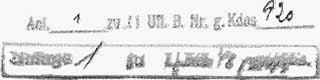
| Admiral Nordmeer | ||
| B.Nr.Gkdos 1964 AU 14 January 1943. | ||
| To | ||
the Marine-Gruppenkomando Nord. |
||
| Concerning: K.T.B. "U 377". | ||
| Forwarded are the enclosed is the K.T.B. of "U-377" for the period from 25.9. - 25.11.42 (2-copies) with comments by Admiral Nordmeer and two track charts. | ||
| signed in draft K l ü b e r | ||
 |
||
|
| Comments of the Befehlshabers der Unterseeboote | |||
on the KTB of "U 377" from 25.9. - 25.11.1942 |
|||
There is nothing to note. |
|||
For the Befehlshaber der Unterseeboote |
|||
| - The Chief of the Operations Department - | |||
 |
|||
|
Click the icons to view the associated records |
|||||
 |
Return to the U-boat KTB page | ||||